Article

Enhancement of Small Towns in Inland Areas. A Novel Indicators Dataset to Evaluate Sustainable Plans

by
Antonio Nesticò
*,
Pierfrancesco Fiore
and
Emanuela D’Andria
Department of Civil Engineering, University of Salerno, Via Giovanni Paolo II, 132-84084 Fisciano, Italy
*
Author to whom correspondence should be addressed.
Sustainability 2020, 12(16), 6359; https://doi.org/10.3390/su12166359
Submission received: 25 June 2020 / Revised: 1 August 2020 / Accepted: 4 August 2020 / Published: 7 August 2020

Abstract

:
In response to the abandonment and depopulation of small towns in inland areas, it is necessary to provide analysis and technical-economic evaluation tools with the aim of selecting effective recovery and valorization strategies. In the light of what criteria and indicators should this selection be carried out? The principles of sustainability guide us to a new definition of social, economic, environmental, and historical-architectural criteria. The intention is to outline a new way of classifying the judgment criteria, exclusively referring to the peculiarities of small towns. In turn, the criteria are specifically defined in sixteen sub-criteria, again able to represent the salient features of small municipalities: Local traditions, genius loci, urbanization levels, but also prevailing economy, environmental (flora and fauna, water, soil, air, etc.), and historical-architectural components (relations between the small town and the immediate context, formal relationship between building and urban core, etc.). This is followed by the drafting of a novel dataset of evaluation indicators, capable of expressing the project actions’ capacity to pursue the objectives expressed by the criteria. These are datasets that give back 24 indicators for the social sub-criteria, 42 for the economic sub-criteria, 34 for the environmental ones, and 38 for the historical-architectural ones. The goal-criteria-subcriteria-indicators structure outlined in this paper opens up research perspectives on the characterization of a hierarchical model of multi-criteria analysis.

1. Introduction

The depopulation of small towns is a current problem that affects many European and non-European Countries. The exodus to the cities intensified at the beginning of the 20th century, when industrial development and the systematic drainage of the plains encouraged strong migration of workers from the hilly areas to the valley floors. With the industrial progress of the post-war period, this phenomenon is increasing together with the rapid expansion of urban areas. The results of growth are the fragmentation of the countryside, the uncontrolled consumption of land, and the abandonment of small towns: The places that previously ensured subsistence are no longer considered suitable for ‘contemporary living’. Thus, new housing and work needs lead residents to prefer the metropolis rather than the rural areas. In addition, the little or no employment opportunities, the considerable distance from major service centres, and the inadequacy of infrastructure contribute to the shrinkage of small settlements. The direct consequences are their cultural, social, and economic isolation, together with the degradation of the built heritage and the impoverishment of the productive fabric [1].
However, the interest in these realities is attested by the gradual awareness of their potential.
Small municipalities are models of ‘slow living’, witnesses of national and identity consciences: «Emotional territories, they are a kaleidoscope of historical and collective memories, full of cultural and environmental heritage, of historical and folk traditions, of flavours, colours and perfumes» [2] (p. 47). At the time of metropolitan and environmental crisis, small towns are also seen as a real opportunity for the sustainable development of nations. Moreover, «the city [...] needs to create a balanced relationship with the surrounding territory because it shares with it the environmental resources on which the most important challenges for the future of metropolitan areas depend. It is for this reason that the debate around small towns is also involving large urban centres» [3] (p. 12).
Therefore, valorizing and protecting small territorial realities is a moral and essential duty. Nevertheless, any project cannot consider the simple conservation of architectural artefacts, but must also involve the social, anthropological, environmental, cultural, and economic components: «It seems clear that the recovery of villages should not be understood only and necessarily as an operation of maintenance and restoration of the historical heritage for cultural and tourist purposes, but means returning to inhabit the territory in order to re-establish a broken relationship with nature, different case by case. From this point of view, the buildings and people’s memory is essential in not losing a knowledge and culture heritage inextricably linked to the natural and artificial places built over the centuries» [3] (p. 13).
With these premises, the work faces the valorization of small towns in inland areas according to the sustainable development axioms. The several tangible and intangible factors that characterize small municipalities, as well as the need for organic programmatic actions, require the definition of operational tools useful to select effective intervention strategies. This must be done in the light of multiple evaluation criteria—social, economic, environmental, historical-architectural—which can be organised in a multi-criteria economic analysis model.
Multiple-criteria decision analysis (MCDA) allows us to express convenience judgements on investment options based on several criteria. The MCDA supports the decision-maker in solving complex problems, which raise heterogeneous and conflicting issues. This determines compromise solutions capable of balancing the pursuit of pre-established objectives with a view to maximising the collective well-being [4,5].
The efficacy of multi-criteria techniques is demonstrated in literature. In fact, many sectors make use of these techniques [6,7,8,9,10,11,12,13,14,15]. The list is long: Tourism menagement, production management, safety and risk management, manufacturing systems, information technology management, operation research and soft computing, strategic menagement, energy-environmental and sustainability, supply chain management, material, quality management, GIS, urban and territorial management, construction and project management, and knowledge management [16].
Whatever the field of reference is, and whatever the specific topic investigated is, it is always essential to have panels of criteria and corresponding indicators in order to correctly implement the pre-established model of analysis. In the present work, the characterization of a new scheme of criteria and indexes is proposed, outlining an innovative interpretative framework of the project actions’ capacity to effectively valorize small towns.

2. Aim of the Paper

The aim of the research is to define criteria and corresponding indicators for the economic evaluation of projects specifically aimed at valorizing small towns in inland areas. This is done by reference to the sustainable development principles.
The study starts from the recognition of the social, economic, environmental, and historical-architectural components that are crucial in the process of selecting projects for the small towns’ recovery and valorization. These elements lead to establishing the analysis criteria, which are then divided into sub-criteria according to the Analytic Hierarchy Process structure (AHP).
The criteria schematization in accordance to the social, economic, environmental, and historical-architectural factors that characterize villages, the set of sub-criteria, as well as the determination of corresponding evaluation indicators, is the novelty of the paper, which intends to provide operators an information dataset useful to concretely use multi-criteria models for the selection of the most successful project options for small municipalities. This makes it possible to fill a literature gap, i.e., the lack of criteria, sub-criteria, and indicators precisely built for the technical-economic evaluation of investments in small towns.
From the beginning (Section 3), the literature review on the ‘small town’ definition is presented.
In Section 4, the importance of concrete actions for the recovery and enhancement of marginal territorial realities is attested to, from which it is clear the need to define an AHP model that includes social, economic, environmental, and historical-architectural parameters (Section 5). Following that, in Section 6, the sub-criteria and indicators for each of the above-mentioned four criteria are set out in a tabular form.
Finally, Section 7 illustrates the results achieved through a brief discussion. The conclusions (Section 8) summarize what has been exposed, highlighting its originality and the research perspectives.

3. Literary Excursus on the ‘Small Town’ Definition

Although it is difficult and complex to delineate concisely the definition of ‘small town’, it is equally useful to trace a semantic path on its meaning. To this end, it is appropriate to start from the broader concept of historic centre. With regard to Italy, even if the Gubbio Charter (1960) does not give a precise expression to the term, it is instead clear that there is an urgent need to safeguard «the whole historical city, the whole urban structure, as it has been slowly coming together over the centuries». It is only four years later that, in Declaration XL, the Commission of Inquiry for the Protection and Valorization of the Historical, Artistic and Landscape Heritage offers a first interpretation, enucleating historical centres as «those urban settlement structures that constitute cultural unity or the original and authentic part of settlements, and testify the features of a living urban culture». Moreover, of great importance is the consideration made by Di Gioia in 1975: «The notion of historical centre today tends to expand further, in order to cover all settlement contexts with historical relevance, whatever period they belong to […]. Historical centre is not only the ancient centre of a city […]. The expression ‘historical centre’ is taken to mean all those urban planning values, of architectural environment and art, which are intended to be protected today: including therefore every value that, in their history, critical and recent, the city, the small town, or even the most isolated and modest settlement, have been able to express» [17] (p. 25).
In this context, the first, although vague, reference to the small town concept can be traced back to 1964, the year of Declaration XL. In fact, with the Venice Charter, and in particular with art. 1, the ‘monument’ is no longer understood as a single valuable building, but as an «urban or landscape environment» that testifies a particular culture or an important historical event. In this wider meaning are also included the historical centres and the small towns, considered typical realities of the territory for their «spontaneous and vernacular expressions».
Seven years later (1971), Alberto Predieri at the VI Conference of the National Association of Historic-Artistic Centres distinguishes:
  • The centres of big metropolitan areas;
  • the small towns as urban nuclei included in fast or stationary development cities, originally key nodes of the territory as important places for economic and political-cultural activities; and
  • abandoned small towns.
Moreover, in making the definition of small town, Predieri underlines its historical-artistic and environmental value together with the tourist-cultural one [18].
Interesting is the Roberto Di Stefano’s thought that relates «the small urbanized towns» to a low number of inhabitants [19] (p. 51). Giuseppe Rocchi also highlights the relationship between small towns and population, talking about «urban agglomerations characterized by a few thousand inhabitants», usually located in marginal areas, rural or mountainous, subject to a significant demographic decrease [20] (p. 306).
Thus, a quantitative identification approach begins to be outlined. In this regard, Edoardo Detti’s observation is significant: «The distinction that can be made is only of situation, environment and quantity; I would not say of value even if the city differs for a more durable and formally evolved building, and the small towns for a more rustic building» [18] (p. 20). Enrico Guidoni also refers to the functionality of a numerical definition, necessary «to delimit in first approximation the field of research» [21] (p. 5).
Moreover, it is interesting to underline that even in the European panorama, and more precisely during the Symposium on the conservation of smaller historic towns in 1975, M.A., Chastel assigned to the petites villes a range of inhabitants between 2000 and 20,000.
The expedience of adopting a maximum population threshold is also a prerogative of many Italian laws. The references are to No 11/1997 of Marche, No 37/1999 of Veneto, and the recent No 158/2017. The latter, extending to the entire national territory, allocates European funds to municipalities with a population of less than 5000 inhabitants. The aims are the recovery and valorization of these realities through the promotion of social, economic, cultural, and environmental development.
Hence, the urgency to have a dimensional-quantitative limit in view of possible application interventions. However, in order to have a more precise idea of the small town, it is equally essential to deepen the relationship between small municipalities and landscape. In this regard, it is good to remember that the word ‘landscape’ was coined in painting field during the late Middle Ages to describe «images that portrayed distant countries, trees, mountains, hills, scenes of countryside life […] descriptions of open spaces, where fields, tree-lined rows and architecture are in harmony with the natural setting». Furthermore, the most frequent expression to qualify the artistic genre to which it referred is «‘painting of villages’ which used a word derived from the Latin pagus [...] with a reference to the border sign planted in the ground, and it indicated an administrative district, a rural territory, or, more broadly, a vast inhabited region» [22] (pp. 15–22).
The link between the built and the surrounding natural space is further highlighted in the German word Landshaft, adopted in the 9th century to indicate a limited territorial area, a district, or a village [22].
In addition to these considerations, there is the European Landscape Convention (2000) in which ‘landscape’ value is given to the built heritage harmoniously inserted in the environment. Here the landscape is understood as «a specific part of the territory, as perceived by the populations, whose character derives from the action of natural and/or human factors and their interrelationships». After all, the genius loci of a place springs from the balance between the aesthetics of the built-nature relationship and social, cultural, economic, and historical issues.
It is therefore plausible to recognize the small towns as a «‘landscape within the landscape’, as the action of man who, spontaneously, has modified the territory using local materials and resources, adapting to soil trends, climate and morphological structures. Places where intangible goods, localism, specificities and shared values are preserved» [23] (p. 1399).

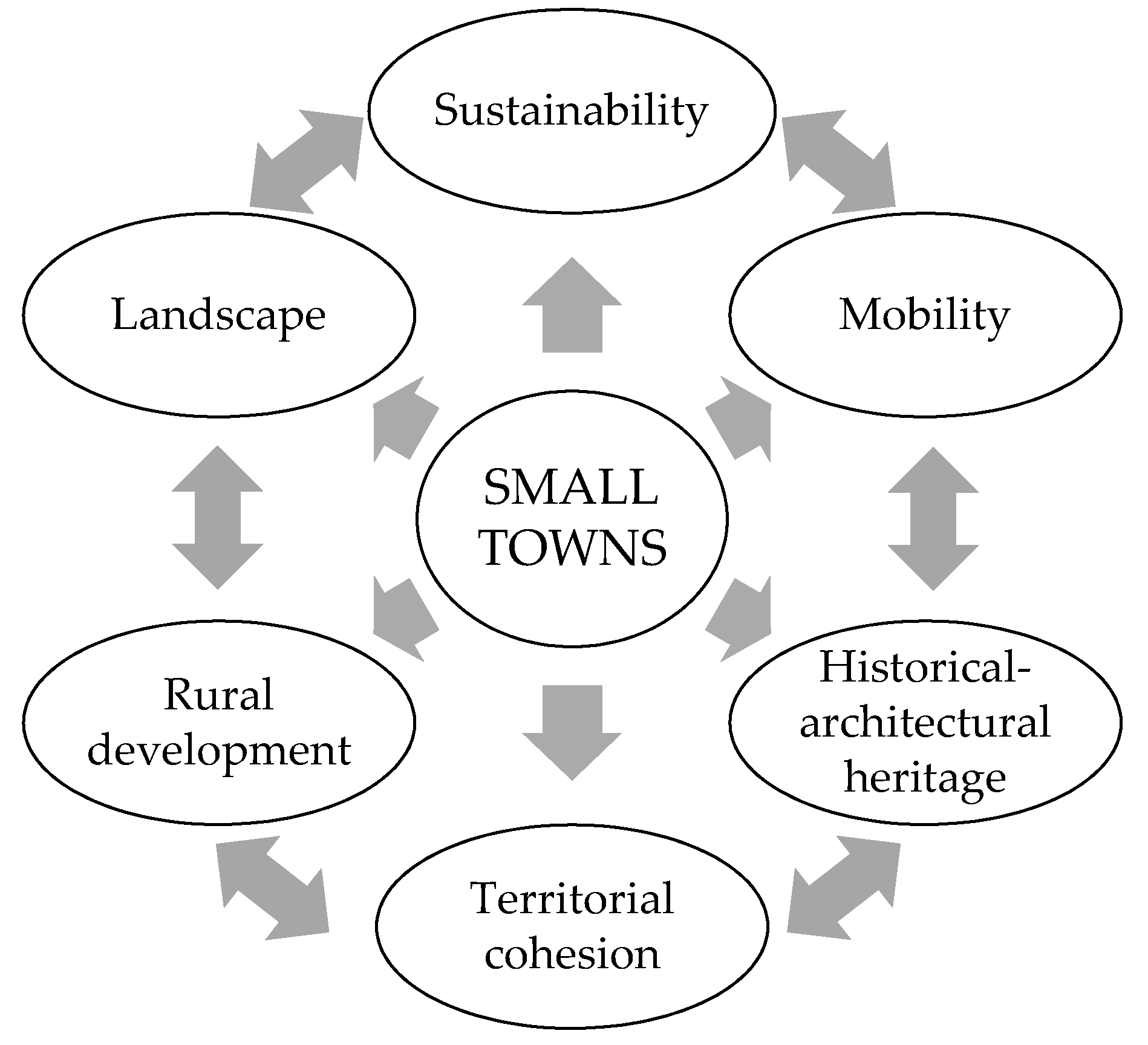
4. Small Towns and Valorization Actions

As places of ‘contraction’, small towns are victims of depopulation and abandonment phenomena. The marginalization they suffer from, on the one hand has caused their cultural, social, and economic isolation, and on the other hand has allowed them to preserve intact a vast material and immaterial heritage «in an autonomy that, although not devoid of contemporaneity, represents an object of great interest not only in terms of memory conservation but also in terms of potential for composing qualitative social and settlement models» [2] (p. 15).
The latent interest in small realities can already be traced back to the 19th century, when William Morris praised the high quality of the traditional built heritage [24]. The following century is characterized by many cultural events focused on the small settlements topic. Among these, Architecture without architects (1964), an exhibition organized at the MoMa by Bernard Rudofsky, which highlighted the indispensability of vernacular architecture, mostly unknown.
In 1979, Norman F. Carver Jr. lauded the small towns’ human dimension, stressing the relevance of these places and the imminent risk of their disappearance. In fact, in the preface of his book Italian Hilltowns he writes: «Italians have built some of the most human scale cities in the world. The archetypes of these cities are the villages and the small towns where, free from conceptual and stylistic influences, the admirable harmony between Italian life and landscape has developed. The aim of this book is to document these villages and small towns, partly because their uniqueness is in danger of disappearing, and partly because the solutions they have given to universal problems deserve to be emulated from many points of view» [25] (p. 6).
Actually, however, a real interest in small settlements has only occurred in the last decade. The metropolis crisis, combined with the environmental one, makes it necessary to consider the marginal realities as a possible solution to mend the city-countryside relationship.
Indeed, rehousing small towns encourages healthy lifestyles and the setting up of community and identity links; it limits soil consumption and helps to reduce urban decongestion. In addition, «popular shapes are instructive, because they are a direct response to urgent common demands, to individual or collective needs and to the climatic characteristics of places. Their freedom from artificial constraints of taste or style gives us the possibility to understand more immediately how fundamental forces shape the built world» [25] (p. 7). It is, therefore, substantial to proceed with effective valorization interventions that aim at safeguarding the large small heritage: «It is a matter [...] of giving life to complex evaluations that allow to highlight problems and resources in order to elaborate strategies, in an integrated planning perspective» [18] (p. 77). So, actions directed not only to the building reuse, but also to the environmental and landscape protection, together with the infrastructural rehabilitation and social cohesion.
More specifically, the valorization of these realities includes: The recovery of material and immaterial potential; the re-proposal of productive vocations; the insertion of local values in a knowledge and promotion positive circuit. The revitalization of small towns is, therefore, possible in view of a sustainable development of the territories, since it is evident the need to consider social, economic, environmental, and cultural aspects. So, every project must inevitably be based on sustainability principles.

5. Materials and Methods. A New Panel of Evaluation Criteria and Sub-Criteria

In the light of the issues referred to in the previous paragraph, it is clear that there is a need to set up operational tools aimed at selecting suitable strategies for the valorization of small towns. The complexity of the actions to be performed and the multitude of factors to be considered in small towns orient towards the use of multi-criteria analysis models [26,27]. Among these, the Analytic Hierarchy Process [28,29] is chosen, as it allows us to disaggregate the decision-making problem through a multi-level structure, which identifies in sequence:
  • General goal (Level I);
  • criteria by which to reach the goal (Level II);
  • sub-criteria (Level III); and
  • possible alternatives (Level IV).
The AHP requires the comparison in pairs among the elements of a same hierarchical level with each of the elements at the higher level. In this way the criteria are compared with the goal, the sub-criteria with the superordinate criterion, and the alternatives with the sub-criteria. The comparisons can be made using Saaty’s fundamental scale, which makes verbal judgments in a range from ‘equal’ to ‘extreme’.
As is well known, comparisons in pairs aij return square, symmetrical, and reciprocal matrixes such as:
A = | a 11 a 12 a 1 n a 21 a 22 a 2 n a n 1 a n 2 a n n |
Once the evaluation matrixes are established, it is possible to calculate the eigenvector and consequently the components of the priorities vector. Thus, the priorities of the elements are expressed and the alternative that best pursues the overall goal is selected. The main eigenvector determines the matrixes’ reliability [30].
With regard to the aims of the research, the definition of the criteria is carried out taking into account the different components of sustainable development. Therefore, the proposed criteria for the evaluation of small towns’ valorization projects are: Social, economic, environmental, and cultural. The cultural component specifically evaluates the historical-architectural aspects of small towns.
Having decided the criteria, they are then characterised in sub-criteria. To this purpose, a study is conducted on the strengths and weaknesses of the generic small town, with the aim of identifying its constant characteristics. The ‘invariants’ so detected are:
  • Presence of local traditions and identities;
  • lack of services;
  • typical production activities;
  • distance from major cities;
  • lack of adequate infrastructure;
  • environmental quality;
  • insertion in a natural context;
  • limited and compact extension of the built fabric;
  • ‘human scale’ dimension of the built;
  • quality of the built heritage; and
  • site-specific typological-constructive characters.
These recurrent characteristics are organized according to social, economic, environmental, and historical-architectural criteria and ‘translated’ into 16 sub-criteria. Table 1 shows the division of the ‘invariants’ into the 4 criteria and their declination into sub-criteria.
In addition, the sub-criterion ‘Bioclimatic quality’ is chosen to be included in the environmental criterion with reference to the building system. Indeed, this sub-criterion is considered extremely significant within a possible valorisation project.
Thus, after obtaining the sub-criteria, Table 2 shows the hierarchical organization of all the elements.
For the environmental sub-criterion and the historical-architectural sub-criterion, it is proposed a detailed analysis referring to three different layers:
  • Territory;
  • urban core;
  • building.
Social sub-criteria combine local traditions and identities with essential services. Among these, very important are the secondary urbanization works, which include schools of all levels, health facilities, churches, markets, etc.
Fundamental to the small towns’ rebirth are also the productive vocations, i.e., the activities linked to agriculture, handicrafts, and industry. These, together with primary urbanization works (electricity, water, telephone and gas networks, but also roads and public lighting), promote the growth of the local economy
The environmental sub-criteria collect on a territorial scale the native fauna and plant elements, as well as other natural components such as water, air, and soil.
At the urban core level, the consistency and composition of green spaces is investigated.
Importance is also given to the bioclimatic characteristics of existing buildings.
The three layers’ territory, urban core and building, already used for the organization of the environmental sub-criteria, are reproposed for the historical-architectural sub-criteria. With regard to the territorial dimension, attention is paid to landscape issues, linked to the formal relationship between the small town and its context. At the scale of the village, it is important to consider the visual image that it gives back, rendered through the correlations between buildings and empty spaces (squares, streets, alleys, stairways), and between the urban fabric and surrounding areas. Finally, the architectural artefact is studied not only in its formal relationship with the entire small town, but also in the typological characters that distinguish it.

6. Novel Indicators Datasets for the Multi-Criteria Analysis of Small Towns Enhancement Plans

At this point, evaluation indicators should be defined for each of the sub-criteria proposed in the previous paragraph. To this end, the reference literature is analysed in detail. More specifically, the small towns valorization topic requires the consideration of issues concerning: Urban sustainability, sustainable urban mobility, valorization of the historical-cultural heritage, territorial cohesion, rural development, and landscape. Figure 1 outlines the macro areas of research.
As a result of the investigation carried out on several datasets of indicators related to the macro areas of Figure 1, there is the selection of 15 international studies shown in Table 3. The parameters used for their choice are: Suitability to the main research goal, pertinence to the small towns’ reality, setting clarity, easily available data, possibility of application to different city sizes. Thus, from the 15 studies, as many as 470 evaluation indicators are collated.
From the set of 470 indicators, those that best describe each of the 16 sub-criteria already set out in Table 2 are chosen. As Table 4 explains, this operation is conducted through six principles: 1. Focus; 2. Relevance; 3. Accessibility; 4. Clarity; 5. Cost; 6. Frequency [31,32]. The preference of one indicator over another is therefore made through questions: Does the indicator in exam measure more accurately than another what is desired to be measured? Is the indicator more consistent to the research object than another? Is the indicator clearer in its definition than another? In doing so, all 470 indicators are compared with each other and evaluated on the basis of objective parameters.
At this point, it is possible to draw up four novel datasets of indicators to which operators can refer for the multi-criteria evaluation of plans and projects aimed at the sustainable development of small towns in inland areas. These are the four datasets in Table 5, Table 6, Table 7 and Table 8, which respectively concern the social, economic, environmental, and historical-architectural criteria.
For each indicator, the unit of measurement is specified, useful for the concrete application of the same indices in case studies. In this way, local administrations or designers can choose for each dataset one or more indicators suitable to evaluate the related sub-criteria. The choice is also made on the basis of the data that each expert has available for a project. So, the operator who wants to select an effective valorization strategy can choose the most relevant indexes for the specific case he is evaluating.
It should be noted that Table 5, Table 6, Table 7 and Table 8 contain not only indicators chosen from those 470 that the literature proposes, but also completely new indices, specifically defined for the analysis of plans and projects regarding small towns.

6.1. Evaluation Indicators of the Small Towns’ Social Components

Table 5 sets out the novel characterization of the social criterion in the three sub-criteria:
  • Local traditions and identities;
  • secondary urbanization works; and
  • social assistance services.
Several evaluation indicators are proposed for each sub-criterion, accompanied by a brief description.
Great importance is given to the place’s identity, as the result of a community’s identification process with its environment. This natural ‘context empathy’, closely linked to emotional, cultural, and subjective issues, is essential in delineating the soul of a territory, its ‘sense of being’, and its immaterial richness [47,48].
Attention is also paid to more concrete aspects, such as the presence of secondary urbanization works (education, health, commerce, leisure) and social assistance services.

6.2. Economic Indicators

For the economic criterion, Table 6 shows the division into two sub-criteria proposed in this research:
  • Productive vocations, and
  • primary urbanization works.
Both sub-criteria are considered essential for the development of small realities since, in addition to increasing their employment opportunities, they also promote tourism. The evaluation indicators focus on efficient land use, considering both agricultural and livestock areas. In addition, the industrial and hotel sectors are also taken into account.
Obviously, productive vocations cannot be increased without suitable primary urbanization works. Among these, the road system, public transport, electricity, gas, water, and internet networks are fundamental. The strengthening of this infrastructure means raising the quality of life and encouraging settlement in small towns.

6.3. Environmental Indicators

The environmental sub-criteria are organised into three distinct levels (Table 7) relating to:
  • Territory;
  • urban core; and
  • building.
Thus, it is possible to proceed from the analysis on a territorial scale to that of the settlement and of the building system.
The aspects addressed concern the vegetative cover, the climatic and environmental characteristics of the place, the presence of natural elements such as rivers, lakes, etc. In addition, there are the bioclimatic parameters of the single architectural building: Thermal insulation, indoor ventilation, room lighting.
In general, the environmental quality in small towns is high, and any project must take this pre-requisite into account, respect it, and enhance it. This means: Containing emissions of pollutants into soil, water and air; increasing wooded areas, preserving local biodiversity; and using renewable sources for sustainable land development.

6.4. Historical-Architectural Indicators

Like the environmental criterion, the historical-architectural one is also divided by levels: Territory; urban core; building.
The first layer (territory) is closely related to the landscape. It refers, in fact, to the fragility of environmental contexts, but also to their exceptionality and uniqueness. The integration of the small town with the environment is a complex concept, which is characterized by multiple indicators: Settlement dispersion; perceived value of the landscape skyline; injured landscape; etc.
The urban core scale is crucial because it is the link between the built heritage and its context.
This relationship must necessarily be preserved because, in addition to composing ‘the soul of places’, it is a determining factor for the small town’s ‘beauty’. To this end, it is opportune to conserve unaltered the harmonious image of the village, both in relation to its volumetry and its spatiality.
Referring then to the building system, issues related to the use of architectural artefacts, their protection, and conservation level are considered.
It is evident that the proposed characterization of the historical-architectural sub-criteria is mostly based on subjective judgements, dictated by the operator’s sensibility. Translating ‘emotional feelings’ arising from the suggestion of small towns into quantitative data could be a forced operation, which would hardly respect the small settlement’s nature.
Thus, in the light of the above, Table 8 shows the proposed historical-architectural sub-criteria and the corresponding indicators.

7. Results and Discussion

The research proposes novel datasets of criteria, sub-criteria, and corresponding indicators specifically defined for the multi-criteria evaluation of projects aimed at the recovery and valorization of small municipalities.
Based on the sustainable development principles, the four criteria are recognised: Social, economic, environmental, and historical-architectural.
This is followed by the characterization of the sub-criteria, in light of extensive analysis conducted on the recurrent characteristics of the small town type, i.e., its ‘invariants’.
Therefore, each sub-criterion is associated with several evaluation indicators, some taken from the articulated sector literature (see Table 3), others proposed. From a corpus of 470 indicators, they are then selected. This is done according to the methodological principles: Focus, relevance, accessibility, clarity, cost, frequency. Thus, it is possible to collect: 24 indicators for the social sub-criteria; 42 for the economic sub-criteria; 34 for the environmental ones; and 38 for the historical-architectural ones.
Table 5, Table 6, Table 7 and Table 8 detail the study results, which are proposed as a methodological aid and a new operational tool for the effective selection of intervention initiatives in favour of small towns.
It becomes clear how important the work can be, since for the first time it indicates the complex components and parameters to be considered in the implementation of a multi-criteria models.
An hierchical model structured on the basis of the proposed criteria, sub-criteria, and indicators can be an important decision support system if local administrations intend to evaluate one or more valorization actions to be carried out or implemented. In fact, by comparing two or more project alternatives through the criteria and sub-criteria identified, it is possible to intervene concretely to propose improvements from a social, economic, environmental, or historical-architectural point of view. An AHP tool, thanks to the indicators that quantify the sub-criteria, is suitable to assess design weaknesses in order to strengthen them through strategic guidelines. The extensive dataset provided allows the designer/administrator to choose among multiple evaluation indicators, those most relevant to the specific case and whose necessary data can be more easily available.
Compared to the 17 Sustainable Development Goals (SDGs), the collapsed indicators have a specific and new focus on issues related to the social, economic, environmental, and historical-architectural aspects of small towns only. This means concentrating on the topics that affect these places in order to give a concrete and operational response to their valorization. In fact, enhancing these places means taking a first step towards the sustainable development of the territories. Moreover, starting from the problems of the individual small realities is the fundamental step to solve wider matters, such as those addressed by SDGs worldwide.

8. Conclusions

Valorizing the small towns is essential for the sustainable development of countries. There are several advantages: Greater healthiness of the air, possibility to reduce urban decongestion, opportunity to patch up the city–countryside relationship, redefinition of social and identity values, recovery of the built heritage, and reinstatement of local productive activities.
However, in the face of these multiple opportunities, the actions to be taken are complex. In fact, the widespread distance from big cities, the lack of adequate infrastructure, the insufficient basic services determine the absence of concrete job and housing possibilities, encouraging the population and especially the youngest to prefer the metropolitan life. Moreover, the multiple factors that characterize small towns are often different and conflicting, generating a frequent inability of local authorities to meet the site’s needs. In this regard, the projects aimed only at the recovery of architectural artefacts are unsuitable to heal the numerous ‘lacerations’ of small realities: Interventions ‘dropped from above’, not consistent with the real necessities of the inhabitants and the territory, should be avoided.
Therefore, reasoned and organic actions are required, able to capture both social (local traditions, genius loci, schools, health facilities, markets, etc.), economic (productive activities, roads, parking, etc.), and environmental (flora and fauna, water, soil, air, etc.) aspects as well as the historical-architectural components of the village (visual-infrastructural-landscape relationship between the small town and the immediate context, formal relationship between building and urban core, etc.). It is imperative to extend the field of action, looking to the soul of places, respecting the traces that history has given to the present.
In light of the above, the novelty of the research immediately emerges. The proposed datasets, in fact, allow the effective use of analysis tools able to support public administrations in the selection of valid strategies for the recovery and valorization of small municipalities.
Research perspectives concern the characterization of a hierarchical model of multi-criteria analysis, which can certainly be based on the criteria-subcriteria-indicators structure outlined in this work.

Author Contributions

Conceptualization, A.N. and P.F.; Data curation, A.N. and E.D.; Formal analysis, A.N., P.F. and E.D.; Investigation, A.N., P.F. and E.D.; Methodology, A.N., P.F. and E.D.; Project administration, A.N. and P.F.; Resources, E.D.; Software A.N., P.F. and E.D.; Supervision, A.N. and P.F.; Validation, A.N., P.F. and E.D.; Visualization, A.N., P.F. and E.D.; Writing—original draft, A.N. and E.D.; Writing—review & editing, A.N., P.F. and E.D. All authors have read and agreed to the published version of the manuscript.

Funding

This research received no external funding.

Conflicts of Interest

The authors declare no conflict of interest.

References

  1. Sau, A. La Rivitalizzazione Dei Borghi e Dei Centri Storici Minori Come Strumento per il Rilancio Delle Aree Interne. Federalismi.it. Rivista di Diritto Pubblico Italiano, Comparator, Europeo, n. 3, 31.01.2018. Available online: www.federalismi.it (accessed on 1 March 2020).
  2. Paolella, A. Il Riuso Dei Borghi Abbandonati. Esperienze Di Comunità, 1st ed.; Pellegrini Editore: Cosenza, Italy, 2019. [Google Scholar]
  3. Berizzi, C.; Rocchelli, L. Borghi Rinati. Paesaggi Abbandonati e Interventi di Rigenerazione, 1st ed.; Il Poligrafo: Padua, Italy, 2019. [Google Scholar]
  4. Figueira, J.; Greco, S.; Ehrgott, M. Multiple Criteria Decision Analysis: State of the Art Surveys, 2nd ed.; Springer: New York, NY, USA, 2016. [Google Scholar]
  5. Ribera, F.; Nesticò, A.; Cucco, P.; Maselli, G. A multicriteria approach to identify the Highest and Best Use for historical buildings. J. Cult. Herit. 2020, 41, 166–177. [Google Scholar] [CrossRef]
  6. Ishizaka, A.; Nemery, P. Multi-Criteria Decision Analysis: Methods and Software, 1st ed.; John Wiley & Sons: Chichester, UK, 2013. [Google Scholar]
  7. Roy, B. Méthodologie Multicritére d’Aide à la Décision, 1st ed.; Economica: Paris, France, 1985. [Google Scholar]
  8. Guitoni, A.; Martel, J.M. Tentative guidelines to help choosing an appropriate MCDA method. Eur. J. Oper. Res. 1998, 109, 501–521. [Google Scholar] [CrossRef]
  9. Vincke, P. L’aide Multicritère à la Décision, 1st ed.; Université de Bruxelles: Bruxelles, Belgium, 1989. [Google Scholar]
  10. Colson, G.; De Bruyn, C. Models and Methods in Multiple Criteria Decision Making, 1st ed.; Pergamon Press: Oxford, UK, 1989; Volume 23. [Google Scholar]
  11. Fishburn, P.C. A survey of multiattribute/multicriterion evaluation theories. In Multiple Criteria Problem Solving, 1st ed.; Zionts, S., Ed.; Springer: Heidelberg, Germany, 1978; pp. 181–224. [Google Scholar]
  12. Roy, B.; Bouyssou, D. Aide Multicritère à la Décision: Methodes et Cas, 1st ed.; Economica: Paris, France, 1993. [Google Scholar]
  13. Keeney, R.L.; Raiffa, H. Decisions with Multiple Objectives: Preferences and Value Trade-Offs, 1st ed.; Cambridge University Press: Cambridge, UK, 1993. [Google Scholar]
  14. De Montis, A. Analisi Multicriteri e Valutazione per la Pianificazione Territoriale, 1st ed.; CUEC Editrice: Cagliari, Italy, 2001. [Google Scholar]
  15. Nesticò, A.; Somma, P. Comparative Analysis of Multi-Criteria Methods for the Enhancement of Historical Buildings. Sustainability 2019, 11, 4526. [Google Scholar] [CrossRef] [Green Version]
  16. Mardani, A.; Jusoh, A.; Nor, K.; Khalifah, Z.; Zakwan, N.; Valipour, A. Multiple criteria decision-making techniques and their applications—A review of the literature from 2000 to 2014. Econ. Res. Ekonomska Istraživanja 2015, 28, 516–571. [Google Scholar] [CrossRef]
  17. Di Gioia, V. Criteri di definizione dei centri storici. Civ. Delle Macch. 1975, 1–2, 25. [Google Scholar]
  18. Coletta, T. I Centri Storici Minori Abbandonati della Campania. Conservazione, Recupero e Valorizzazione, 1st ed.; Edizioni Scientifiche Italiane: Naples, Italy, 2010. [Google Scholar]
  19. Di Stefano, R. Il Recupero Dei Valori. Centri Storici e Monumenti. Limiti Della Conservazione e del Restauro, 1st ed.; Edizioni Scientifiche Italiane: Naples, Italy, 1979. [Google Scholar]
  20. Rocchi, G. Istituzioni di Restauro Dei Beni Architettonici e Ambientali, 1st ed.; Hoepli Editore: Milan, Italy, 1985. [Google Scholar]
  21. Aa, V.V. Storia Dell’arte Italiana. Inchieste Su Centri Minori, 1st ed.; Giulio Einaudi Editore: Turin, Italy, 1980; Volume 1. [Google Scholar]
  22. Tosco, C. Il Paesaggio Come Storia, 1st ed.; Il Mulino: Bologna, Italy, 2007. [Google Scholar]
  23. Nesticò, A.; D’Andria, E.; Fiore, P. Centri Minori E Strategie Di Valorizzazione. In I Centri Minori… Da Problema a Risorsa. Strategie Sostenibili per la Valorizzazione del Patrimonio Edilizio, Paesaggistico e Culturale Nelle Aree Interne, 1st ed.; Fiore, P., D’Andria, E., Eds.; FrancoAngeli: Milan, Italy, 2019; pp. 1397–1404. [Google Scholar]
  24. Morris, M. Paure e Speranze Sul Futuro Dell’arte. Le Prospettive Dell’architettura Nella Civiltà, 1st ed.; Nuova Editrice Berti: Parma, Italy, 2012. [Google Scholar]
  25. Carver, N.F. Borghi Collinari Italiani, 1st ed.; CLEAN Edizioni: Naples, Italy, 2017. [Google Scholar]
  26. Nesticò, A.; He, S.; De Mare, G.; Benintendi, R.; Maselli, G. The ALARP Principle in the Cost-Benefit Analysis for the Acceptability of Investment Risk. Sustainability 2018, 10, 4668. [Google Scholar] [CrossRef] [Green Version]
  27. Nesticò, A.; Guarini, M.R.; Morano, P.; Sica, F. An Economic Analysis Algorithm for Urban Forestry Projects. Sustainability 2019, 11, 314. [Google Scholar] [CrossRef] [Green Version]
  28. Saaty, T.L. The Analytic Hierarchy Process; McGraw Hill: New York, NY, USA, 1980. [Google Scholar]
  29. Saaty, T.L. Decision Making for Leaders: The Analytic Hierarchy Process for Decisions in a Complex World; RWS Publications: Pittsburgh, PA, USA, 1990. [Google Scholar]
  30. Fusco Girard, L.; Nijkamp, P. Le Valutazioni per lo Sviluppo Sostenibile della Città e del Territorio, 3rd ed.; FrancoAngeli: Milan, Italy, 2000. [Google Scholar]
  31. Neely, A.; Adams, C.; Kennerley, M. The Performance Prism; Financial Times/Prentice Hall: Upper Saddle River, NJ, USA, 2002. [Google Scholar]
  32. Nesticò, A.; Maselli, G. Sustainability indicators for the economic evaluation of tourism investments on islands. J. Clean. Prod. 2020, 248, 119217. [Google Scholar] [CrossRef]
  33. Mega, V.; Pedersen, J. Urban Sustainability Indicators, 1st ed.; Office for Official Publications of the European Communities: Luxembourg, 1998. [Google Scholar]
  34. Mameli, F.; Marletto, G. A selection of indicators for monitoring sustainable urban mobility policies. In Trasporti, Ambiente e Territorio. La Ricerca di Un Nuovo Equlibrio, 1st ed.; Marletto, G., Musso, E., Eds.; FrancoAngeli: Milan, Italy, 2010; pp. 167–174. [Google Scholar]
  35. Vallega, A. Indicatori per il Paesaggio, 1st ed.; FrancoAngeli: Milan, Italy, 2009. [Google Scholar]
  36. Minx, J.; Creutzig, F.; Ziegler, T.; Owen, A. Developing a Pragmatic Approach to Assess Urban Metabolism in Europe. A report to the European Environment Agency, 1st ed.; Technische Universität Berlin and Stockholm Environment Institute, Climatecon: Berlin, Germany, 2011. [Google Scholar]
  37. European Commission. Science for Environment Policy. In In-Depth Report: Indicators for Sustainable Cities; EEA Urban Metabolism Framework; Directorate-General Environment: Brussels, Belgium, 2018; p. 13. [Google Scholar]
  38. United Nations Economic Commission for Europe. Transport for Sustainable Development in the ECE Region, 1st ed.; UNECE Transport Division: Geneva, Switzerland, 2011. [Google Scholar]
  39. Volpiano, M. Indicators for the Assessment of Historic Landscape Features. In Landscape Indicators, 1st ed.; Cassatella, C., Peano, A., Eds.; Springer: Heidelberg, Germany, 2011; pp. 77–104. [Google Scholar]
  40. Directorate-General for Agriculture and Rural Development. Rural Development in the European Union Statistical and Economic Information Report 2013, 1st ed.; European Union: Brussels, Belgium, 2013. [Google Scholar]
  41. European Spatial Planning Observation Network (ESPON). Key Indicators for Territorial Cohesion and Spatial Planning, Part A, Executive Summary, 1st ed.; European Union: Brussels, Belgium, 2013. [Google Scholar]
  42. Phillips, R.G.; Stein, J.M. An Indicator Framework for Linking Historic Preservation and Community Economic Development. Soc. Indic. Res. 2013, 113, 1–15. [Google Scholar] [CrossRef]
  43. Valtenbergs, V.; González, A.; Piziks, R. Selecting Indicators for Sustainable Development of Small Towns: The Case of Valmiera Municipality. Procedia Comput. Sci. Spec. IssueIcte Reg. Dev. 2013, 26, 21–32. [Google Scholar]
  44. European Environment Agency (EEA). Core Set of Indicators (CSI). In Digest of EEA Indicators 2014, 1st ed.; Aa, V.V., Ed.; European Environment Agency: Luxembourg, 2014; pp. 28–31. [Google Scholar]
  45. UN-Habitat. Measurement of City Prosperity. Methodology and Metadata, 1st ed.; UN-Habitat: Nairobi, Kenya, 2016. [Google Scholar]
  46. Bosch, P.; Jongeneel, S.; Rovers, V.; Neumann, H.-M.; Airaksinen, M.; Huovila, A. CITYkeys LIst of City Indicators, 1st ed.; CITYkeys: Brussels, Belgium, 2017. [Google Scholar]
  47. Troisi, R.; Alfano, G. Towns as Safety Organizational Fields: An Institutional Framework in Times of Emergency. Sustainability 2019, 11, 7025. [Google Scholar] [CrossRef] [Green Version]
  48. Nesticò, A. L’Analisi Economica del Rischio di Progetto. Criteri e Tecniche. LaborEst 2019, 18, 41–48. [Google Scholar] [CrossRef]
Figure 1. Macro thematic areas related to the valorization of small towns.
Sustainability 12 06359 g001
Table 1. Correspondence between invariants and sub-criteria.
CriterionInvariantSub-Criterion
SocialPresence of local traditions and identitiesLocal traditions and identities
Lack of servicesSecondary urbanization works
Social assistance services
EconomicTypical production activitiesProductive vocations
Distance from major citiesPrimary urbanization works
Lack of adequate infrastructurePrimary urbanization works
EnvironmentalEnvironmental qualityFlora and fauna
Environmental quality of water, air and soil
Green areas
Historical-architecturalInsertion in a natural contextIntegration with the environment
Visual image
Limited and compact extension of the built fabricDialogue between the urban fabric and its context
‘Human scale’ dimension of the builtEmpty/Full relationship and green space system
Quality of the built heritageFormal relationship between the building and the characteristics of the urban core
Site-specific typological-constructive charactersTypological-distributive and typological-formal characteristics of the building
Table 2. Hierarchical organization of the elements.
Valorization of small townsSocial criterionLocal traditions and identities
Secondary urbanization works (kindergartens, schools, health facilities, neighborhood markets, municipal delegations, churches and religious buildings, sports facilities)
Social assistance services (services for the elderly, for people with disabilities, for immigrants)
Economic criterionProductive vocations (agriculture, crafts, industry, trade, tourism)
Primary urbanization works (roads serving the settlements, conduits suitable for collecting and draining sewage, car parks, electricity network, telephone network, gas network, public lighting, water network)
Environmental criterionTerritory
Flora and fauna
Environmental quality (water, air, soil)
Urban core
Green areas
Building
Bioclimatic quality
Historical-architectural criterionTerritory
Integration with the environment
Urban core
Visual image
Dialogue between the urban fabric and its context
Empty/Full relationship and green space system
Building
Formal relationship between the building and the characteristics of the urban core
Typological-distributive and typological-formal characteristics of the building
Table 3. Main bibliographical references and number of indicators.
Reference StudyN. Indicators
Mega V., Pedersen J. (1998), Urban Sustainability Indicators [33]16
European Commission (2008), European Green Capital Award12
Mameli F., Marletto G. (2009). A selection of indicators for monitoring sustainable urban mobility policies [34]14
Vallega A. (2009), Indicatori per il paesaggio [35]37
European Environment Agency (2010), EEA Urban Metabolism Framework [36,37]15
United Nations Economic Commission for Europe (UNECE) (2011), Transport for sustainable development in the ECE region [38]17
Volpiano M. (2011), Indicators for the Assessment of Historic Landscape Features [39]12
Swiss Confederation (2012), Ufficio Federale dell’Ambiente UFAM – Paesaggio: Indicatori11
EU Commission, Directorate-General for Agriculture and Rural Development (2013), Rural Development in the European Union - Statistical and Economic Information, Report 2013 [40]59
European Spatial Planning Observation Network (2013), KITCASP - Key Indicators for Territorial Cohesion and Spatial Planning [41]20
Phillips R. G., Stein J. M. (2013), An Indicator Framework for Linking Historic Preservation and Community Economic Development [42]29
Valtenbergs V., González A., Piziks R. (2013), Selecting indicators for sustainable development of small towns: the case of Valmiera municipality [43]73
European Environment Agency (2014), Digest of EEA Indicators 2014 - Core Set of Indicators (CSI) [44]42
UN-Habitat - United Nations Human Settlements Programme (2016), MEASUREMENT OF CITY PROSPERITY - Methodology and Metadata [45]39
Bosch P., Jongeneel S., Rovers V., Neumann H-M., Airaksinen M., Huovila A. (2017), CITYkeys list of city indicators [46]74
TOTAL470
Table 4. Criteria for the evaluation indices selection.
Selective criteria of the evaluation indicesFocusIt is necessary to select indicators that measure only what you want to measure
RelevanceIt is appropriate to choose the indicators most consistent with the current study
AccessibilityIt is meant to provide an easy way to find the required data
ClarityClear and unambiguous interpretation indicators are taken into account
CostPreference is given to indicators whose data collection requires little cost
FrequencyThat means choosing the indicators that repeatedly present themselves
Table 5. Social sub-criteria and indicators.
Social Criterion
Sub-CriterionIndicatorDescription
Local traditions and identitiesIndicated by literature
Sense of place/identification with place/attachement to placeThe way people perceive the resources and historical environment of their community. There is an identity linked to the place that evokes a special sense of place. This indicator requires a direct survey among the inhabitants of the historical sites
The number of cultural eventsn. of cultural events
The number of visitors in cultural eventsn. visitors in cultural events
Taste’s placesIt is evaluated by the level at which the “taste’s places” enter into landscape valorization policies
I = G c G t × 100
Gc expresses the number of “taste’s places” subject to interventions and measures included in the territorial plans, aimed at enhancing their value in relation to the landscape.
Gt expresses the total number of “taste’s places” existing in the considered territory.
Event placesIt is assessed by the degree to which “event places” are included in the perception of the landscape and are enhanced through ad hoc measures
I = E c E t × 100
Ec expresses the number of “event places” subject to interventions and measures included in the territorial plans, aimed at enhancing their value in relation to the landscape.
Et expresses the total number of “event places” existing in the considered territory.
Proposed
Number of oral traditions (fables, historical events, music)/religious traditions/gastronomic traditions/festivals, exhibitions, and marketsn. of oral, religious, gastronomic traditions, festivals, fairs, and markets
Secondary
urbanization works
Land Use MixLand use diversity per square kilometre, within a city or urban area (residential, commercial, and services, industrial, public facilities, and public spaces)
Land use change% of total (building, roads, domestic, green space, agricultural, woodland, water, etc.)
Access to services (hospitals and schools)Travel time (minutes) to hospitals/schools
Access to basic health care services% of people
Access to local/neighbourhood services within a short distanceNot specified in the bibliographical reference. It is proposed the distance in km to reach the nearest services
Unemployment structureNot specified in the bibliographical reference. It is proposed the % of unemployed residents
Social Justice IndicatorPercentage of the population affected by poverty, unemployment, lack of access to education, information, training, and leisure
Development of service sectorThis indicator measures the share of gross value added (GVA) in the services sector in a region
Access to public amenities% of people
Access to commercial amenities% of people
Access to educational resourcesLikert’s scale. Wherever possible, the use of the percentage of the population accessing educational resources is suggested
Number of public librariesNumber of public libraries per 100,000 people (n./100,000 people)
Social assistance
services
Indicated by literature
The number of assistance centersn. of assistance centers
Net migrationIt’s the ratio of net migration during the year to the average population in that year.
It is also possible to use: n./1000
Average number of assistance hours per yearAverage number of assistance hours per year
Percentage difference between the offered services level and the standard services levelPercentage difference between the offered services level and the standard services level
Quantitative level of benefitsTo be estimated on the most appropriate evaluation scale, depending on the available information framework
Proposed
Percentage of those who benefit from social assistance services on the resident population% population benefiting from social assistance services/total resident population
Table 6. Economic sub-criteria and indicators.
Economic Criterion
Sub-CriterionIndicatorDescription
Productive vocationsIndicated by literature
Forest areas extensively exploitedNot specified in the bibliographical reference. It is proposed the surface in m2 of extensively exploited forest areas
Agricultural areasNot specified in the bibliographical reference. It is proposed the surface in km2 of agricultural areas
Economic specializationShows the level (high or low) through which a city focuses its economic activities on certain goods and services
H = i = 1 N S i 2
S i 2 is the employment share in the city’s industry. S i 2 share is expressed with a number and not a percentage.
N is the total number of industries.
H varies from 1/N to 1. A value of H greater than 0.25 indicates a high concentration
Structure of the economy% GVA by branch (primary/secondary/tertiary sector)
Land use efficiencyNot specified in the bibliographical reference. It is proposed to make use of expert judgements, from which a quantitative evaluation algorithm can be deduced
Distribution of businesses and employed by industriesNot specified in the bibliographical reference. It is proposed the number of employees in the industrial sector
The number of touristsNot specified in the bibliographical reference. It is proposed the number of tourists compared to the resident population
Foreign Direct InvestmentsCapital/Earnings
Accomodation loadNot specified in the bibliographical reference. It is proposed the accommodation capacity of the structures (hotels, hostels, b&b etc.) as number of beds
Dynamics of foundation and dissolution of local businessesNot specified in the bibliographical reference. An economic indicator is proposed, depending on the level of information available
The number of guest nightsNumber of guest nights
Economic enhancement of historical-cultural heritage networkingIt is proposed to evaluate this parameter according to the specificities of the case study
Agricultural land use% of Utilised agricultural area (UAA) in arable land/permanent pasture/permanent crops
Economic development of non-agricultural sectorGVA (million EUR) in secondary and tertiary sectors
Tourism infrastructure in rural areasTotal number of bed places in tourist accommodations (%)
Tourism intensityn./100.000
Local food production% of tonnes
Green jobs% of jobs
Land use change% of total (building, roads, domestic, green space, agricultural, woodland, water, etc.)
Proposed
Prevailing cultivation% of cultivations
Primary urbanization
works
Length of mass transport networkKm/1,000,000 people
Length of bike route network% in km
Public transport network lengthNot specified in the bibliographical reference. It is proposed the route length in km (tram, trolleybus, bus)
Street intersection densityNumber of street intersections per one square kilometer of urban area (n./km2)
Street densityNumber of kilometers of urban streets per square kilometer of land (km/km2)
Infrastructure densitykm of roads per 1,000 inhabitants
Infrastructure qualityNot specified in the bibliographical reference. It is proposed the % of asphalted road surface on the total existing road surface
Percentage of houses with communications (including electricity, water, sewage, gas, heating, internet, phone lines)% of houses equipped with electrical system, water system, purification system, gas, heating, internet, telephone line
The number of public Wi-Fi placesNumber of public spaces equipped with Wi-Fi
Public and private services accessibile via telephone and computerNot specified in the bibliographical reference. The indicator should be chosen according to the data availability
Transportation mode split (percentage of each mode of transportation, i.e., private, public, bicycles, pedestrians)% of each transport mode (public, private, cycle, walking)
Internet accessIt is the ratio between the total number of Internet users in a city and the total population of the same city (%)
Home computer accessPercentage of families owning household computers compared to the total number of families in the city (%)
Internet infrastructureFamilies with DSL coverage (%)
Internet take-up in rural areasFamilies with a broadband connection contract (% of families with at least one member aged between 16 and 74 years)
Access to electricityPercentage of families connected to the national network
Access to public transport% of people
Access to high speed internet% of people
Access to public free WiFi% of m2
Public transport usen./cap/year
Land occupied by transport infrastructuresNot specified in the bibliographical reference. A percentage evaluation is proposed
Quality of the street and sidewalks coverNot specified in the bibliographical reference. It is proposed the use of expert judgements
Table 7. Environmental sub-criteria and indicators.
Sub-CriterionIndicatorDescription
Territory
Flora and faunaLand cover% area in agricultural/forest/natural/artificial classes
Protected forestNot specified in the bibliographical reference. It is proposed an evaluation based on the extension in m2
The number of protected animal and plant speciesn. of protected animal and plant species
Percentage of preserved area/reservoirs/waterways/parks in relation to total land area% areas, reserves, rivers, protected parks in relation to the total territorial area
Species and habitats of European interestNot specified in the bibliographical reference. It is proposed the use of a numerical or percentage data
Number and status of protected European habitats and speciesNumber and Conservation Status (EU defined status of Natura 2000 sites—SACs and SPAs and Annexed species)
Designated areaskm2, %, number of species and habitats listed by the Habitats Directive
Land takehectares or km2
Urban land take% of land that is converted from natural and semi-natural areas (including wooded and agricultural areas) to artificial land used for urban and economic purposes
Proportion of protected areasNot specified in the bibliographical reference. It is proposed the % of protected natural areas on the total number of existing natural areas
Biodiversity: Tree species compositionArea of forest classified by number of tree species occurring and by forest type (%)
Biodiversity: Protected forest_share of FOWL protected under MCPFE classes (%)
_ change of FOWL area protected under MCPFE classes (ha)
Forest ecosystem health% of sampled trees in defoliation classes 2–4 (all trees/conifers/broadleaves)
Protected areas and elementsSurface extension. Level of environmental protection. Number of protected elements. Other specific indicators
Ecologically protected areas% of surface area subject to ecological protection measures in relation to the total surface area
I = S p S t × 100
Sp is the area in hectares (ha) subject to protection measures.
St is the total area, expressed in hectares (ha), of the considered territory.
Protected species% of protected plant and/or animal species in relation to all existing plant and/or animal species
I = S p S t × 100
Sp is the number of species, belonging to the wild vegetation, subject to protective measures.
St is the number of species, belonging to spontaneous vegetation, existing at the time the survey is carried out
Environmental
quality
Renewable energy production (wind, hydro, biomass, etc.)Megawatts and % by renewable energy type
Greenhouse gas emissionsTonnes CO₂ eq. per individual
Water qualitySpecific quality indicator
Water quality statusAbsolute values on the actual status or objective met/failed (as per WFD for groundwater, rivers, lakes, estauarine, coastal)
Air qualitySpecific quality indicator
Emissions of main air pollutantsSpecific indicator
Exposure of ecosystems to acidification, eutrophication and ozoneSpecific indicator
Exceedance of air quality limit values in urban areasSpecific indicator
Atmospheric greenhouse gas concentrationsSpecific indicator
Green growth and eco-innovationSpecific indicator
Global Climate Indicator (GCI)Emitted total CO₂, CH₄, N₂O and CFCs and halons
CO₂ emissionsSpecific indicator
Emission of greenhouse gases and local pollutantsSpecific indicator
Urban core
Green areasGreen area per capitaGreen surface per capita
Green spaceHectares/100,000
Building
Bioclimatic qualityProposed
Shape and orientationType of shape. Building orientation
Ventilation qualityPresence/absence of internal ventilation. Ventilation level
Energy classLevel
Table 8. Historical-architectural sub-criteria and indicators.
Historical-Architectural Criterion
Sub-CriterionIndicatorDescription
Territory
Integration with the environmentIndicated by literature
Exceptionality of the historical-cultural characteristics of the landscapeScore scale
Fragility of the historical-cultural characteristics of the landscapeScore scale
Designation of rural areas«[…] If more than 50% of the total population lives in rural grid cells, the region is classified as predominantly rural. Regions where between 20% and 50% of the population lives in rural grid cells are considered intermediate, while those with less than 20% in rural grid cells are predominantly urban»
Importance of rural areasThis indicator consists in 4 sub-indicators:
% territory in rural areas
% population in rural areas
% Gross Value Added in rural areas
% employment in rural areas
Protected areas and elementsSurface extension. Level of environmental protection. Number of protected elements. Other specific indicators
Settlement dispersionUrban penetration units per km2 of landscape (DSE/km2)
Alternatively, it can be replaced with an urban sprawl index
IS i = [ urb i , t + n ( urb i , t × ( pop i , t + n pop i , t ) ) ] urb i , t × 100
i refers to an urban area.
t to the initial year of investigation and t+n to the final year.
urb refers to the built area (in terms of land consumed) expressed in km2 within administrative boundaries.
pop is the total population of the municipality
Landscape value of skylineVisual and aesthetic impact produced by human presence and activities on the skyline (linear/areal impact coefficient)
I = L i L b
I = S i S c
Li expresses the overall length of the lines drawn by human works (roads, railways, and so on) engraved on the skyline, measured on the outline of the territory that appears from the photographic vision and/or cartographic representation.
Lb expresses the baseline length delimited by that portion of the skyline.
Si expresses the total surface area of the area engravings produced by human communities on the outline delimited by the skyline.
Sc expresses the surface area limited by the skyline
Injured landscapeRepresentative indices of human impact on the landscape
I = A f A t × 100
Af represents the sum of the surface area, measured in hectares (ha), of areas occupied by landfills and quarries, as well as areas degraded due to hydrogeological instability.
At represents the total suburban area of the considered territory
Proposed
Landscape infrastructures (religious itineraries, transhumance routes, protoindustrial architecture paths)km of paths and trails recovered and/or valorized
Urban core
Visual imageIndicated by literature
Historic preservation element/plan and integration with community planningIt is important to note whether or not the local government has a historical conservation plan as part of its overall plan (the community masterplan)
Fragility of the historical-cultural characteristics of the landscapeScore scale
Significance/Typicality of the historical-cultural characteristics of the landscapeScore scale
Landscape perceived beautyAverage score given through questionnaires on the beauty of the landscape in a specific municipality (1 = not corresponding at all; 5 = corresponding in full)
Landscape value of skylineVisual and aesthetic impact produced by human presence and activities on the skyline (linear/areal impact coefficient)
I = L i L b
I = S i S c
Li expresses the overall length of the lines drawn by human works (roads, railways, and so on) engraved on the skyline, measured on the outline of the territory that appears from the photographic vision and/or cartographic representation.
Lb expresses the baseline length delimited by that portion of the skyline.
Si expresses the total surface area of the area engravings produced by human communities on the outline delimited by the skyline.
Sc expresses the surface area limited by the skyline
Panoramic sitesRelevance of panoramic sites in the perception of the landscape and in the preservation of its quality
I = P d P b + P d × 100
Pb indicates the number of panoramic sites that can offer views of the surrounding landscape.
Pd indicates the number of panoramic sites that have deteriorated as a result of improper interventions on the territory
Parking pressureVisual impact dimension of car parks on the landscape
I = L p L c × 100
I = S p S c × 100
Lp expresses the length, calculated in km, of linear developments which, at times of maximum frequency, are assumed by vehicles aligned along lines relevant from the landscape point of view.
Lc expresses the length, calculated in km, of the relevant country lines developing in the territory concerned.
Sp expresses the surface area, calculated in hectares (ha) of the spaces that, at times of maximum frequency, are car parks within the territory considered.
Sc expresses the surface area, calculated in hectares (ha), of the territory characterized by the landscape to be safeguarded
Proposed
Visual interference
(or the presence of illegal building and/or architectural artefacts out of scale with respect to the pre-existing built fabric)
m3 of illegal building and/or architectural artefacts out of scale with respect to the pre-existing built fabric
Hydrographic pondsN. of existing or designed hydrographic elements (natural or artificial)
Dialogue between the urban fabric and its contextIndicated by literature
Perceived quality of the landscape around the own homeShare of interviewees who were “not at all satisfied” (0) to “very satisfied” (10) with the quality of the landscape around their home
Panoramic sitesRelevance of panoramic sites in the perception of the landscape and in the preservation of its quality
I = P d P b + P d × 100
Pb indicates the number of panoramic sites that can offer views of the surrounding landscape.
Pd indicates the number of panoramic sites that have deteriorated as a result of improper interventions on the territory
Proposed
Urban morphology
(intended as the aggregation mode of settlements that define their form. The elements that structure an urban core are considered: Streets, buildings, open spaces, green areas)
How much the project proposal alters the way the settlement is aggregated (score scale)
Level of the relationship between the small town and its contextScore scale
Empty/Full relationship and green space systemPreservation of relation systems between assetsScore scale
Accessibility to open public areasPercentage (%) of urban area that is located less than 400 m away from an open public space
Accessibility to open public areas = 100 · population less than   400   m   away open public area city population
Accessibility to open public areas = 100 · urban area less than   400   m   away open public area total urban area
Green, Public space and Heritage Indicator (GPI)Percentage of green or public spaces and local heritage in need of improvement
Public outdoor recreation spacem2/cap
Green space accessibility% of total population within 500 metres of public managed green areas (active and passive)
The number of green space reconstruction projectsN.
Urban pedestrian areasUrban surface area pedestrianized in relation to the quality of the landscape
I = P e S × 100
Pe indicates the extension, measured in hectares (ha), of existing pedestrian spaces.
S indicates the extension, measured in hectares (ha), of the total urban area.
Valuing of urban public parks and gardensIt provides an evaluation of the green spaces’ function within the urban landscape
I = S a + S n S a × 100
Sa indicates the area, measured in hectares (ha), of existing green spaces in the urban environment at the present time.
Sn indicates the area, measured in hectares (ha), of the green spaces that should be realised.
Revitalisation of historical urban spacesRelationship between the urban spaces that have benefited, or are benefiting, from architectural recovery and cultural valorization in a single city, or in a complex of cities, and the complex of historical urban spaces existing in the urban context considered.
I = S R + S r S t × 100
SR expresses the surface area, measured in hectares (ha), of the city’s historical spaces that have benefited from architectural restoration and cultural heritage valorization.
Sr expresses the surface area, measured in hectares (ha), of historical spaces which, at the time the indicator is calculated, are subject to architectural restoration and cultural valorization.
St expresses the total area, measured in hectares (ha), of the city’s historical spaces taken into account.
Building
Formal relationship between the building and the characteristics of the urban coreState of preservation of built heritage with reference to characterizing elementsScore scale
Historic preservation element/plan and integration with community planningIt is important to note whether or not the local government has a historical conservation plan as part of its overall plan (the community masterplan)
Historic fabricMeasures the amount (%) of historical fabric in a specific community. This is done by dating the structures from the foundation of the settlement to the present day
Typological-distributive and typological-formal characteristics of the buildingPreservation of the assetsIt is proposed to evaluate this parameter according to the specificities of the case study
Use of historical-cultural heritagePercentage of buildings in use
Preservation of cultural heritageLikert’s scale
Ground floor usage% of m2

