Topic Editors

Department of Physical Geography and Ecosystem Science, Lund University, S-22362 Lund, Sweden
Department of Physical Geography and Ecosystem Science, Lund University, Sölvegatan 12, SE-223 62 Lund, Sweden

Recent Advances in Hydroinformatics: Focusing on Machine Learning and Remote Sensing in Hydrology

Abstract submission deadline
closed (14 February 2022)
Manuscript submission deadline
closed (30 April 2022)
Viewed by
605698

Topic Information

Dear Colleagues,

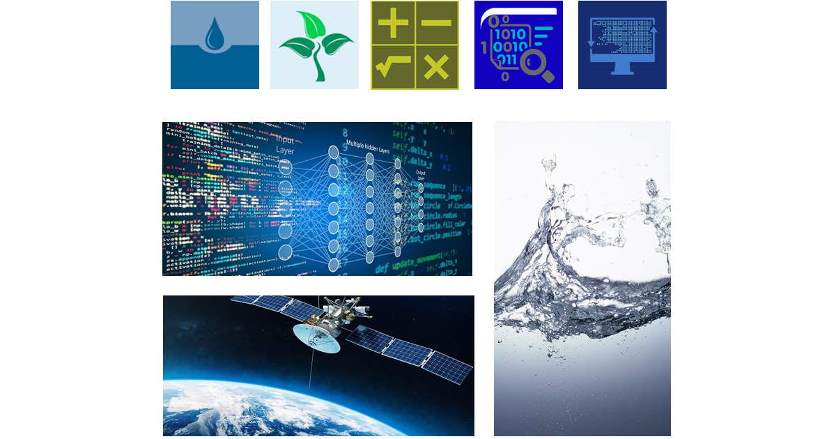
Water-related issues are becoming one of the greatest problems facing humankind in the world. We need a good understanding of the water cycle and related processes for water planning, developing, and managing water resources, in terms of both water quantity and quality, across all water uses. The complex processes in the water cycle and water-related problems call for new approaches. Researchers have introduced “Hydroinformatics” as a subject to focus on the application of information techniques to improve our understanding of the water cycle and address water-related problems. Broadly, Hydroinformatics uses information theory, simulating, data processing, artificial intelligence, systems analysis, remote sensing, and soft computing technologies to ensure better management of water-based systems under global environmental and climate change. This knowledge changes how hydrology, hydraulics, and water resource studies are generally applied in society. Recent decades in particular have witnessed the increasing application of machine learning and remote sensing in various fields, and considerable progress has been achieved. In this topic, we would like to invite researchers to focus on the application of machine learning and remote sensing in hydrology and water sciences. Suitable research papers for this topic can include but not be limited to the following:

  • Machine learning and deep learning in water sciences;
  • Data mining in hydrology, hydraulic, and water-based systems;
  • Application of remote sensing in hydrology and water resource management;
  • Decision support system in water science;
  • Uncertainty in modeling of water resources;
  • Optimization algorithms for solving water problems issues;
  • Time series analysis in water resource management;
  • Monitoring and forecasting water cycle variables with new technologies.

Dr. Zheng Duan
Mr. Babak Mohammadi
Topic Editor

Keywords

  • hydrology
  • artificial intelligence
  • soft-computing-based solution
  • remote sensing
  • water cycle
  • water–soil–atmosphere
  • data science
  • information theory

Participating Journals

Journal Name Impact Factor CiteScore Launched Year First Decision (median) APC
Water
water
3.4 5.5 2009 16.5 Days CHF 2600
Sustainability
sustainability
3.9 5.8 2009 18.8 Days CHF 2400
Digital
digital
- - 2021 22.7 Days CHF 1000
Computation
computation
2.2 3.3 2013 18 Days CHF 1800
Informatics
informatics
3.1 4.8 2014 30.3 Days CHF 1800

Preprints.org is a multidiscipline platform providing preprint service that is dedicated to sharing your research from the start and empowering your research journey.

MDPI Topics is cooperating with Preprints.org and has built a direct connection between MDPI journals and Preprints.org. Authors are encouraged to enjoy the benefits by posting a preprint at Preprints.org prior to publication:

  1. Immediately share your ideas ahead of publication and establish your research priority;
  2. Protect your idea from being stolen with this time-stamped preprint article;
  3. Enhance the exposure and impact of your research;
  4. Receive feedback from your peers in advance;
  5. Have it indexed in Web of Science (Preprint Citation Index), Google Scholar, Crossref, SHARE, PrePubMed, Scilit and Europe PMC.

Published Papers (40 papers)

Order results
Result details
Journals
Select all
Export citation of selected articles as:
13 pages, 3841 KiB  
Article
The Future Change in Evaporation Based on the CMIP6 Merged Data Generated by Deep-Learning Method in China
by Xianghua Niu, Xikun Wei, Wei Tian, Guojie Wang and Wenhui Zhu
Water 2022, 14(18), 2800; https://doi.org/10.3390/w14182800 - 08 Sep 2022
Viewed by 1920
Abstract
Land evaporation (LET) is an important variable in climate change, water cycle and water resources management. Mastering the projected changes in LET is significant for crop water requirements and the energy cycle. The global climate model (GCM) is a vital tool for future [...] Read more.
Land evaporation (LET) is an important variable in climate change, water cycle and water resources management. Mastering the projected changes in LET is significant for crop water requirements and the energy cycle. The global climate model (GCM) is a vital tool for future climate change research. However, the GCMs have low spatial resolution and relatively high errors. We use a deep learning (DL)-based model to deal with this problem. The DL approach can downscale the model data and merge simultaneously. We applied the DL approach to a suit of models from the Coupled Model Intercomparison Project 6th edition (CMIP6) LET data. From the result of all the evaluation metrics, the DL merged data greatly improved in both spatial and time dimensions. The mean RMSE is 5.85 mm and the correlation is 0.95 between the DL merged data and reference data (historical reliable evaporation data). The future LET evidently increases in four scenarios (SSP1–2.6, SSP2–4.5, SSP3–7.0, and SSP5–8.5), and the upward intensity rises from the low to high emission scenarios. The highest increasing regions are in the Tibet Plateau and the south of China and the trend is larger than 10 mm/decade in the high scenarios. From the seasonal point of view, the increasing trend in spring and summer is far larger than for autumn and winter. The Tibet Plateau and the northeast of China have the largest upward trend in the spring of SSP5–8.5, higher than 1.6 mm/decade. Full article
Show Figures

Figure 1

22 pages, 911 KiB  
Article
Feasibility of Adding Twitter Data to Aid Drought Depiction: Case Study in Colorado
by Sarbajit Mukherjee, Simon Wang, Daniella Hirschfeld, Joel Lisonbee and Robert Gillies
Water 2022, 14(18), 2773; https://doi.org/10.3390/w14182773 - 06 Sep 2022
Cited by 1 | Viewed by 1896
Abstract
The use of social media, such as Twitter, has changed the information landscape for citizens’ participation in crisis response and recovery activities. Given that drought progression is slow and also spatially extensive, an interesting set of questions arise, such as how the usage [...] Read more.
The use of social media, such as Twitter, has changed the information landscape for citizens’ participation in crisis response and recovery activities. Given that drought progression is slow and also spatially extensive, an interesting set of questions arise, such as how the usage of Twitter by a large population may change during the development of a major drought alongside how the changing usage facilitates drought detection. For this reason, contemporary analysis of how social media data, in conjunction with meteorological records, was conducted towards improvement in the detection of drought and its progression. The research utilized machine learning techniques applied over satellite-derived drought conditions in Colorado. Three different machine learning techniques were examined: the generalized linear model, support vector machines and deep learning, each applied to test the integration of Twitter data with meteorological records as a predictor of drought development. It is found that the integration of data resources is viable given that the Twitter-based model outperformed the control run which did not include social media input. Eight of the ten models tested showed quantifiable improvements in the performance over the control run model, suggesting that the Twitter-based model was superior in predicting drought severity. Future work lies in expanding this method to depict drought in the western U.S. Full article
Show Figures

Graphical abstract

2 pages, 172 KiB  
Editorial
Application of Machine Learning and Remote Sensing in Hydrology
by Babak Mohammadi
Sustainability 2022, 14(13), 7586; https://doi.org/10.3390/su14137586 - 22 Jun 2022
Cited by 6 | Viewed by 1766
Abstract
Water is vital to all life on earth, but its management is becoming more difficult owing to the behavior of water in nature such as water dynamics, water movements, and different forms of water in nature [...] Full article
21 pages, 4454 KiB  
Article
Mid- to Long-Term Runoff Prediction Based on Deep Learning at Different Time Scales in the Upper Yangtze River Basin
by Yuanxin Ren, Sidong Zeng, Jianwei Liu, Zhengyang Tang, Xiaojun Hua, Zhenghao Li, Jinxi Song and Jun Xia
Water 2022, 14(11), 1692; https://doi.org/10.3390/w14111692 - 25 May 2022
Cited by 8 | Viewed by 2408
Abstract
Deep learning models are essential tools for mid- to long-term runoff prediction. However, the influence of the input time lag and output lead time on the prediction results in deep learning models has been less studied. Based on 290 schemas, this study specified [...] Read more.
Deep learning models are essential tools for mid- to long-term runoff prediction. However, the influence of the input time lag and output lead time on the prediction results in deep learning models has been less studied. Based on 290 schemas, this study specified different time lags by sliding windows and predicted the runoff process by RNN (Recurrent Neural Network), LSTM (Long–short-term Memory), and GRU (Gated Recurrent Unit) models at five hydrological stations in the upper Yangtze River during 1980–2018 at daily, ten-day, and monthly scales. Different models have different optimal time lags; therefore, multiple time lags were analyzed in this paper to find out the relationship between the time intervals and the accuracy of different river runoff predictions. The results show that the optimal time-lag settings for the RNN, LSTM, and GRU models in the daily, ten-day, and monthly scales were 7 days, 24 ten days, 27 ten days, 24 ten days, 24 months, 27 months, and 21 months, respectively. Furthermore, with the increase of time lags, the simulation accuracy would stabilize after a specific time lag at multiple time scales of runoff prediction. Increased lead time was linearly related to decreased NSE at daily and ten-day runoff prediction. However, there was no significant linear relationship between NSE and lead time at monthly runoff prediction. Choosing the smallest lead time could have the best prediction results at different time scales. Further, the RMSE of the three models revealed that RNN was inferior to LSTM and GRU in runoff prediction. In addition, RNN, LSTM, and GRU models could not accurately predict extreme runoff events at different time scales. This study highlights the influence of time-lag setting and lead-time selection in the mid- to long-term runoff prediction results for the upper Yangtze River basin. It is recommended that researchers should evaluate the effect of time lag before using deep learning models for runoff prediction, and to obtain the best prediction, the shortest lead-time length can be chosen as the best output for different time scales. Full article
Show Figures

Figure 1

18 pages, 2419 KiB  
Article
A New Urban Waterlogging Simulation Method Based on Multi-Factor Correlation
by Yue Yang, Cuilin Pan, Guangwei Fan, Maochun Tian and Junshu Wang
Water 2022, 14(9), 1421; https://doi.org/10.3390/w14091421 - 29 Apr 2022
Cited by 5 | Viewed by 2450
Abstract
Waterlogging simulation is a key technology for solving urban waterlogging problems. The current waterlogging modeling process is relatively complex and requires high basic data, which is not conducive to rapid modeling and popularization. In this study, we evaluated the correlation between rainfall and [...] Read more.
Waterlogging simulation is a key technology for solving urban waterlogging problems. The current waterlogging modeling process is relatively complex and requires high basic data, which is not conducive to rapid modeling and popularization. In this study, we evaluated the correlation between rainfall and waterlogging water using the following factors: terrain, evaporation, infiltration, pipe drainage capacity, and river flood water level. By quantifying the influence value of each factor on rainfall, we established a simplified model for fast calculation of waterlogging depth through input rainfall. Waterlogging data was collected from Guangzhou, China to set up the multi-factor correlation model, and verify the simulation results of the model. After the original rainfall is added/deducted, the added/loss value, the relationship between net rainfall, and maximum water depth is better than that between original rainfall and maximum water depth. Establishing a stable multi-factor correlation model for a waterlogging point requires at least three historical waterlogging event data for parameter calibration by sensitivity analysis. Comparing the simulation of four waterlogging points, the multi-factor correlation model (error = −13%) presented the least error in simulating the maximum water volume, followed by the Mike Urban model (error = −19%), and finally the SWMM model (error = 20%). Furthermore, the multi-factor correlation model and SWMM model required the least calculation time (less than 1 s), followed by the Mike Urban model (About half a minute). By analyzing the waterlogging data of Guangzhou, 42 waterlogging points with modeling conditions were screened out to further validate the multi-factor correlation model. Each waterlogging point was modeled based on the historical field, and the last rainstorm was used for model verification. The mean error of the comparison between the simulated maximum waterlogging and the measured maximum waterlogging was 3%, and the R2 value was 0.718. In summary, the multi-factor correlation model requires fewer basic data, has a simple modeling process and wide applicability, and makes it easy to realize the intelligent parameter adjustment, which is more suitable for the urgent requirements of current urban waterlogging prediction. The model results may prove accurate and provide scientific decision support for the prevention and control of urban waterlogging. Full article
Show Figures

Figure 1

26 pages, 20142 KiB  
Article
Assessing the Impact of the Farakka Barrage on Hydrological Alteration in the Padma River with Future Insight
by Abu Reza Md. Towfiqul Islam, Swapan Talukdar, Shumona Akhter, Kutub Uddin Eibek, Md. Mostafizur Rahman, Swades Pal, Mohd Waseem Naikoo, Atiqur Rahman and Amir Mosavi
Sustainability 2022, 14(9), 5233; https://doi.org/10.3390/su14095233 - 26 Apr 2022
Cited by 15 | Viewed by 2494
Abstract
Climate change and human interventions (e.g., massive barrages, dams, sand mining, and sluice gates) in the Ganga–Padma River (India and Bangladesh) have escalated in recent decades, disrupting the natural flow regime and habitat. This study employed innovative trend analysis (ITA), range of variability [...] Read more.
Climate change and human interventions (e.g., massive barrages, dams, sand mining, and sluice gates) in the Ganga–Padma River (India and Bangladesh) have escalated in recent decades, disrupting the natural flow regime and habitat. This study employed innovative trend analysis (ITA), range of variability approach (RVA), and continuous wavelet analysis (CWA) to quantify the past to future hydrological change in the river because of the building of the Farakka Barrage (FB). We also forecast flow regimes using unique hybrid machine learning techniques based on particle swarm optimization (PSO). The ITA findings revealed that the average discharge trended substantially negatively throughout the dry season (January–May). However, the RVA analysis showed that average discharge was lower than environmental flows. The CWA indicated that the FB has a significant influence on the periodicity of the streamflow regime. PSO-Reduced Error Pruning Tree (REPTree) was the best fit for average discharge prediction (RMSE = 0.14), PSO-random forest (RF) was the best match for maximum discharge (RMSE = 0.3), and PSO-M5P (RMSE = 0.18) was better for the lowest discharge prediction. Furthermore, the basin’s discharge has reduced over time, concerning the riparian environment. This research describes the measurement of hydrological change and forecasts the discharge for upcoming days, which might be valuable in developing sustainable water resource management plans in this location. Full article
Show Figures

Figure 1

14 pages, 6430 KiB  
Article
Deep Learning-Based Algal Detection Model Development Considering Field Application
by Jungsu Park, Jiwon Baek, Jongrack Kim, Kwangtae You and Keugtae Kim
Water 2022, 14(8), 1275; https://doi.org/10.3390/w14081275 - 14 Apr 2022
Cited by 20 | Viewed by 2982
Abstract
Algal blooms have various effects on drinking water supply systems; thus, proper monitoring is essential. Traditional visual identification using a microscope is a time-consuming method and requires extensive labor. Recently, advanced machine learning algorithms have been increasingly applied for the development of object [...] Read more.
Algal blooms have various effects on drinking water supply systems; thus, proper monitoring is essential. Traditional visual identification using a microscope is a time-consuming method and requires extensive labor. Recently, advanced machine learning algorithms have been increasingly applied for the development of object detection models. The You-Only-Look-Once (YOLO) model is a novel machine learning algorithm used for object detection; it has been continuously improved in newer versions, and a tiny version of each standard model presented. The tiny versions applied a less complicated architecture using a smaller number of convolutional layers to enable faster object detection than the standard version. This study compared the applicability of the YOLO models for algal image detection from a practical aspect in terms of classification accuracy and inference time. Therefore, automated algal cell detection models were developed using YOLO v3 and YOLO v4, in which a tiny version of each model was also applied. The cell images of 30 algal genera were used for training and testing the models. The model performances were compared using the mean average precision (mAP). The mAP values of the four models were 40.9, 88.8, 84.4, and 89.8 for YOLO v3, YOLO v3-tiny, YOLO v4, and YOLO v4-tiny, respectively, demonstrating that YOLO v4 is more precise than YOLO v3. The tiny version models presented noticeably higher model accuracy than the standard models, allowing up to ten times faster object detection time. These results demonstrate the practical advantage of tiny version models for the application of object detection with a limited number of object classes. Full article
Show Figures

Graphical abstract

28 pages, 7645 KiB  
Article
On the Calibration of Spatially Distributed Hydrologic Models for Poorly Gauged Basins: Exploiting Information from Streamflow Signatures and Remote Sensing-Based Evapotranspiration Data
by Tadesse Alemayehu, Hoshin V. Gupta, Ann van Griensven and Willy Bauwens
Water 2022, 14(8), 1252; https://doi.org/10.3390/w14081252 - 13 Apr 2022
Cited by 4 | Viewed by 2198
Abstract
Spatially distributed hydrologic models are useful for understanding the water balance dynamics of catchments under changing conditions, thereby providing important information for water resource management and decision making. However, in poorly gauged basins, the absence of reliable and overlapping in situ hydro-meteorological data [...] Read more.
Spatially distributed hydrologic models are useful for understanding the water balance dynamics of catchments under changing conditions, thereby providing important information for water resource management and decision making. However, in poorly gauged basins, the absence of reliable and overlapping in situ hydro-meteorological data makes the calibration and evaluation of such models quite challenging. Here, we explored the potential of using streamflow signatures extracted from historical (not current) streamflow data, along with current remote sensing-based evapotranspiration data, to constrain the parameters of a spatially distributed Soil and Water Assessment Tool (SWAT) model of the Mara River Basin (Kenya/Tanzania) that is forced by satellite-based rainfall. The result is a reduced bias of the simulated estimates of streamflow and evapotranspiration. In addition, the simulated water balance dynamics better reflect underlying governing factors such as soil type, land cover and climate at both annual and seasonal time scales, indicating the structural and behavioral consistency of the calibrated model. This study demonstrates that the judicious use of available information can help to facilitate meaningful calibration and evaluation of hydrologic models to support decision making in poorly gauged river basins around the world. Full article
Show Figures

Figure 1

24 pages, 7284 KiB  
Article
Simple Prediction of an Ecosystem-Specific Water Quality Index and the Water Quality Classification of a Highly Polluted River through Supervised Machine Learning
by Alberto Fernández del Castillo, Carlos Yebra-Montes, Marycarmen Verduzco Garibay, José de Anda, Alejandro Garcia-Gonzalez and Misael Sebastián Gradilla-Hernández
Water 2022, 14(8), 1235; https://doi.org/10.3390/w14081235 - 12 Apr 2022
Cited by 8 | Viewed by 3191
Abstract
Water quality indices (WQIs) are used for the simple assessment and classification of the water quality of surface water sources. However, considerable time, financial resources, and effort are required to measure the parameters used for their calculation. Prediction of WQIs through supervised machine [...] Read more.
Water quality indices (WQIs) are used for the simple assessment and classification of the water quality of surface water sources. However, considerable time, financial resources, and effort are required to measure the parameters used for their calculation. Prediction of WQIs through supervised machine learning is a useful and simple approach to reduce the cost of the analysis through the development of predictive models with a reduced number of water quality parameters. In this study, regression and classification machine-learning models were developed to estimate the ecosystem-specific WQI previously developed for the Santiago-Guadalajara River (SGR-WQI), which involves the measurement of 17 water quality parameters. The best subset selection method was employed to reduce the number of significant parameters required for the SGR-WQI prediction. The multiple linear regression model using 12 parameters displayed a residual square error (RSE) of 3.262, similar to that of the multiple linear regression model using 17 parameters (RSE = 3.255), which translates into significant savings for WQI estimation. Additionally, the generalized additive model not only displayed an adjusted R2 of 0.9992, which is the best fit of all the models evaluated, but also fitted the rating curves of each parameter developed for the original algorithm for the SGR-WQI calculation with great accuracy. Regarding the classification models, an overall proportion of 93% and 86% of data were correctly classified using the logistic regression model with 17 and 12 parameters, respectively, while the linear discriminant functions using 12 parameters correctly classified an overall proportion of 84%. The models evaluated were found to be efficient in predicting the SGR-WQI with a reduced number of parameters as complementary tools to extend the current water quality monitoring program of the Santiago-Guadalajara River. Full article
Show Figures

Figure 1

19 pages, 20489 KiB  
Article
Water Information Extraction Based on Multi-Model RF Algorithm and Sentinel-2 Image Data
by Zhiqi Jiang, Yijun Wen, Gui Zhang and Xin Wu
Sustainability 2022, 14(7), 3797; https://doi.org/10.3390/su14073797 - 23 Mar 2022
Cited by 10 | Viewed by 2469
Abstract
For the Sentinel-2 multispectral satellite image remote sensing data, due to the rich spatial information, the traditional water body extraction methods cannot meet the needs of practical applications. In this study, a random forest-based RF_16 optimal combination model algorithm is proposed to extract [...] Read more.
For the Sentinel-2 multispectral satellite image remote sensing data, due to the rich spatial information, the traditional water body extraction methods cannot meet the needs of practical applications. In this study, a random forest-based RF_16 optimal combination model algorithm is proposed to extract water bodies. The research process uses Sentinel-2 multispectral satellite images and DEM data as the basic data, collected 24 characteristic variable indicators (B2, B3, B4, B8, B11, B12, NDVI, MSAVI, B5, B6, B7, B8A, NDI45, MCARI, REIP, S2REP, IRECI, PSSRa, NDWI, MNDWI, LSWI, DEM, SLOPE, SLOPE ASPECT), and constructed four combined models with different input variables. After analysis, it was determined that RF_16 was the optimal combination for extracting water body information in the study area. Model. The results show that: (1) The characteristic variables that have an important impact on the accuracy of the model are the improved normalized difference water index (MNDWI), band B2 (Blue), normalized water index (NDWI), B4 (Red), B3 (Green), and band B5 (Vegetation Red-Edge 1); (2) The water extraction accuracy of the optimal combined model RF_16 can reach 93.16%, and the Kappa coefficient is 0.8214. The overall accuracy is 0.12% better than the traditional Relief F algorithm. The RF_16 method based on the optimal combination model of random forest is an effective means to obtain high-precision water body information in the study area. It can effectively reduce the “salt and pepper effect” and the influence of mixed pixels such as water and shadows on the water extraction accuracy. Full article
Show Figures

Figure 1

19 pages, 4028 KiB  
Article
A Novel Intelligent Inversion Method of Hydrogeological Parameters Based on the Disturbance-Inspired Equilibrium Optimizer
by W. Y. Wang, J. T. Kang, Kai Li, Y. H. Fan and P. Lin
Sustainability 2022, 14(6), 3267; https://doi.org/10.3390/su14063267 - 10 Mar 2022
Cited by 6 | Viewed by 1834
Abstract
Accurate and quick acquisition of hydrogeological parameters is the critical issue for groundwater numerical simulation and sustainability of the water sources. A novel intelligent inversion method of hydrogeological parameter, based on the global optimization algorithm called the disturbance-inspired equilibrium optimizer (DIEO), is developed. [...] Read more.
Accurate and quick acquisition of hydrogeological parameters is the critical issue for groundwater numerical simulation and sustainability of the water sources. A novel intelligent inversion method of hydrogeological parameter, based on the global optimization algorithm called the disturbance-inspired equilibrium optimizer (DIEO), is developed. Firstly, the mathematical model and the framework of DIEO are reported. Several types of mathematical benchmark functions are used to test the performance of the DIEO. Furthermore, the intelligent inversion of hydrogeological parameters of pumping tests is transformed into the global optimization problem, which can be solved by meta-heuristic algorithms. The objective function for hydrogeological parameter inversion is constructed, and the novel inversion method based on DIEO is finally proposed. To further validate the competitiveness and efficiency of the proposed intelligent inversion method, three types of case studies are carried out. The results show that the proposed intelligent inversion method is reliable for obtaining the hydrogeological parameters accurately and quickly, providing a reference for the inversion of parameters in other fields. Full article
Show Figures

Figure 1

24 pages, 2874 KiB  
Article
Optimization of Water Distribution Networks Using Genetic Algorithm Based SOP–WDN Program
by Uchit Sangroula, Kuk-Heon Han, Kang-Min Koo, Kapil Gnawali and Kyung-Taek Yum
Water 2022, 14(6), 851; https://doi.org/10.3390/w14060851 - 09 Mar 2022
Cited by 21 | Viewed by 8296
Abstract
Water distribution networks are vital hydraulic infrastructures, essential for providing consumers with sufficient water of appropriate quality. The cost of construction, operation, and maintenance of such networks is extremely large. The problem of optimization of a water distribution network is governed by the [...] Read more.
Water distribution networks are vital hydraulic infrastructures, essential for providing consumers with sufficient water of appropriate quality. The cost of construction, operation, and maintenance of such networks is extremely large. The problem of optimization of a water distribution network is governed by the type of water distribution network and the size of pipelines placed in the distribution network. This problem of optimal diameter allocation of pipes in a distribution network has been heavily researched over the past few decades. This study describes the development of an algorithm, ‘Smart Optimization Program for Water Distribution Networks’ (SOP–WDN), which applies genetic algorithm to the problem of the least-cost design of water distribution networks. SOP–WDN demonstrates the application of an evolutionary optimization technique, i.e., genetic algorithm, linked with a hydraulic simulation solver EPANET, for the optimal design of water distribution networks. The developed algorithm was applied to three benchmark water distribution network optimization problems and produced consistently good results. SOP–WDN can be utilized as a tool for guiding engineers during the design and rehabilitation of water distribution pipelines. Full article
Show Figures

Figure 1

13 pages, 5139 KiB  
Article
Irrigation Mapping on Two Contrasted Climatic Contexts Using Sentinel-1 and Sentinel-2 Data
by Ehsan Elwan, Michel Le Page, Lionel Jarlan, Nicolas Baghdadi, Luca Brocca, Sara Modanesi, Jacopo Dari, Pere Quintana Seguí and Mehrez Zribi
Water 2022, 14(5), 804; https://doi.org/10.3390/w14050804 - 03 Mar 2022
Cited by 13 | Viewed by 3480
Abstract
This study aims to propose an operational approach to map irrigated areas based on the synergy of Sentinel-1 (S1) and Sentinel-2 (S2) data. An application is proposed at two study sites in Europe—in Spain and in Italy—with two climatic contexts (semiarid and humid, [...] Read more.
This study aims to propose an operational approach to map irrigated areas based on the synergy of Sentinel-1 (S1) and Sentinel-2 (S2) data. An application is proposed at two study sites in Europe—in Spain and in Italy—with two climatic contexts (semiarid and humid, respectively), with the objective of proving the essential role of multi-site training for a robust application of the proposed methodologies. Several classifiers are proposed to separate irrigated and rainfed areas. They are based on statistical variables from Sentinel-1 and Sentinel-2 time series data at the agricultural field scale, as well as on the contrasted behavior between the field scale and the 5 km surroundings. The support vector machine (SVM) classification approach was tested with different options to evaluate the robustness of the proposed methodologies. The optimal number of metrics found is five. These metrics illustrate the importance of optical/radar synergy and the consideration of multi-scale spatial information. The highest accuracy of the classifications, approximately equal to 85%, is based on training dataset with mixed reference fields from the two study sites. In addition, the accuracy is consistent at the two study sites. These results confirm the potential of the proposed approaches towards the most general use on sites with different climatic and agricultural contexts. Full article
Show Figures

Figure 1

25 pages, 2236 KiB  
Article
Modeling Reference Crop Evapotranspiration Using Support Vector Machine (SVM) and Extreme Learning Machine (ELM) in Region IV-A, Philippines
by Allan T. Tejada, Jr., Victor B. Ella, Rubenito M. Lampayan and Consorcia E. Reaño
Water 2022, 14(5), 754; https://doi.org/10.3390/w14050754 - 26 Feb 2022
Cited by 16 | Viewed by 3097
Abstract
The need for accurate estimates of reference crop evapotranspiration (ETo) is important in irrigation planning and design, irrigation scheduling, reservoir management among other applications. ETo can be accurately determined using the internationally accepted FAO Penman–Monteith (FAO-56 PM) equation. However, this requires numerous observed [...] Read more.
The need for accurate estimates of reference crop evapotranspiration (ETo) is important in irrigation planning and design, irrigation scheduling, reservoir management among other applications. ETo can be accurately determined using the internationally accepted FAO Penman–Monteith (FAO-56 PM) equation. However, this requires numerous observed data, including solar radiation, air temperature, relative humidity, and wind speed, which in most cases are unavailable, particularly in developing countries such as the Philippines. This study developed models based on Support Vector Machines (SVMs) and Extreme Learning Machines (ELMs) for the estimation of daily ETo using different input combinations of meteorological data in Region IV-A, Philippines. The performance of machine learning models was compared with the different established alternative empirical models for ETo. The results show that the SVM and ELM models, with at least Tmax, Tmin, and Rs as inputs, provide the best daily ETo estimates. The accuracy of machine learning models was also found to be superior compared to the empirical models given with same input requirements. In general, SVM and ELM models showed similar modeling performance, although the former showed lower run time than the latter. Full article
Show Figures

Figure 1

19 pages, 8638 KiB  
Article
A New Rainfall-Runoff Model Using Improved LSTM with Attentive Long and Short Lag-Time
by Xi Chen, Jiaxu Huang, Sheng Wang, Gongjian Zhou, Hongkai Gao, Min Liu, Ye Yuan, Laiwen Zheng, Qingli Li and Honggang Qi
Water 2022, 14(5), 697; https://doi.org/10.3390/w14050697 - 23 Feb 2022
Cited by 5 | Viewed by 2394
Abstract
It is important to improve the forecasting performance of rainfall-runoff models due to the high complexity of basin response and frequent data limitations. Recently, many studies have been carried out based on deep learning and have achieved significant performance improvements. However, their intrinsic [...] Read more.
It is important to improve the forecasting performance of rainfall-runoff models due to the high complexity of basin response and frequent data limitations. Recently, many studies have been carried out based on deep learning and have achieved significant performance improvements. However, their intrinsic characteristics remain unclear and have not been explored. In this paper, we pioneered the exploitation of short lag-times in rainfall-runoff modeling and measured its influence on model performance. The proposed model, long short-term memory with attentive long and short lag-time (LSTM-ALSL), simultaneously and explicitly uses new data structures, i.e., long and short lag-times, to enhance rainfall-runoff forecasting accuracy by jointly extracting better features. In addition, self-attention is employed to model the temporal dependencies within long and short lag-times to further enhance the model performance. The results indicate that LSTM-ALSL yielded superior performance at four mesoscale stations (1846~9208 km2) with humid climates (aridity index 0.77~1.16) in the U.S.A., for both peak flow and base flow, with respect to state-of-the-art counterparts. Full article
Show Figures

Figure 1

26 pages, 8059 KiB  
Article
Short-Term Hydrological Forecast Using Artificial Neural Network Models with Different Combinations and Spatial Representations of Hydrometeorological Inputs
by Renaud Jougla and Robert Leconte
Water 2022, 14(4), 552; https://doi.org/10.3390/w14040552 - 12 Feb 2022
Cited by 5 | Viewed by 2704
Abstract
In hydrological modelling, artificial neural network (ANN) models have been popular in the scientific community for at least two decades. The current paper focuses on short-term streamflow forecasting, 1 to 7 days ahead, using an ANN model in two northeastern American watersheds, the [...] Read more.
In hydrological modelling, artificial neural network (ANN) models have been popular in the scientific community for at least two decades. The current paper focuses on short-term streamflow forecasting, 1 to 7 days ahead, using an ANN model in two northeastern American watersheds, the Androscoggin and Susquehanna. A virtual modelling environment is implemented, where data used to train and validate the ANN model were generated using a deterministic distributed model over 16 summers (2000–2015). To examine how input variables affect forecast accuracy, we compared streamflow forecasts from the ANN model using four different sets of inputs characterizing the watershed state—surface soil moisture, deep soil moisture, observed streamflow the day before the forecast, and surface soil moisture along with antecedent observed streamflow. We found that the best choice of inputs consists of combining surface soil moisture with observed streamflow for the two watersheds under study. Moreover, to examine how the spatial distribution of input variables affects forecast accuracy, we compared streamflow forecasts from the ANN using surface soil moisture at three spatial distributions—global, fully distributed, and single pixel-based—for the Androscoggin watershed. We show that model performance was similar for both the global and fully distributed representation of soil moisture; however, both models surpass the single pixel-based models. Future work includes evaluating the developed ANN model with real observations, quantified in situ or remotely sensed. Full article
Show Figures

Figure 1

17 pages, 23626 KiB  
Article
Hydrological Drought Forecasting Using Machine Learning—Gidra River Case Study
by Wael Almikaeel, Lea Čubanová and Andrej Šoltész
Water 2022, 14(3), 387; https://doi.org/10.3390/w14030387 - 27 Jan 2022
Cited by 23 | Viewed by 3937
Abstract
Drought is one of many critical problems that could arise as a result of climate change as it has an impact on many aspects of the world, including water resources and water scarcity. In this study, an assessment of hydrological drought in the [...] Read more.
Drought is one of many critical problems that could arise as a result of climate change as it has an impact on many aspects of the world, including water resources and water scarcity. In this study, an assessment of hydrological drought in the Gidra River is carried out to characterize dry, normal, and wet hydrological situations by using the Slovak Hydrometeorological Institute (SHMI) methodology. The water bearing coefficient is used as the index of the hydrological drought. As machine and deep learning are increasingly being used in many areas of hydroinformatics, this study is utilized artificial neural networks (ANNs) and support vector machine (SVM) models to predict the hydrological drought in the Gidra River based on daily average discharges in January, February, March, and April of the corresponding year. The study utilized in total 58 years of daily average discharge values containing 35 normal and wet years and 23 dry years. The results of the study show high accuracy of 100% in predicting hydrological drought in the Gidra River. The early classification of the hydrological situation in the Gidra River shows the potential of integrating water management with the deep and machine learning models in terms of irrigation planning and mitigation of drought effects. Full article
Show Figures

Figure 1

14 pages, 2251 KiB  
Article
A GA-BP Neural Network Regression Model for Predicting Soil Moisture in Slope Ecological Protection
by Dunwen Liu, Chao Liu, Yu Tang and Chun Gong
Sustainability 2022, 14(3), 1386; https://doi.org/10.3390/su14031386 - 26 Jan 2022
Cited by 19 | Viewed by 2407
Abstract
In this study, based on a highway project in Zhejiang, China, the meteorological factors and soil moisture of high side slopes were monitored in real time by a meteorological data monitoring system, and the correlation between soil moisture and meteorological factors was investigated [...] Read more.
In this study, based on a highway project in Zhejiang, China, the meteorological factors and soil moisture of high side slopes were monitored in real time by a meteorological data monitoring system, and the correlation between soil moisture and meteorological factors was investigated using the obtained data of soil moisture and total solar radiation, atmospheric temperature, soil temperature, relative humidity, and wind speed. Based on the correlation and the influence of meteorological factors on soil moisture lag, a back propagation (BP) neural network regression model optimized with genetic algorithm (GA) was proposed for the first time and applied to soil moisture prediction of high side slopes. The results showed that the BP neural network regression model and the GA-BP neural network regression model were used for soil moisture prediction in two cases without and with lags, respectively, and both prediction methods showed a more significant improvement in prediction accuracy considering their lags compared with those without lags; the GA-BP neural network regression model outperformed the BP neural network regression model in terms of accuracy. V-fold cross-validation eliminated the effect of random errors, indicating that the model can be applied to soil moisture prediction for ecological conservation. Using the soil moisture prediction results as the basis for screening ecological slope protection vegetation is of great significance to the safety and reliability of road construction. Full article
Show Figures

Figure 1

13 pages, 3044 KiB  
Article
Monitoring Water Quality of the Haihe River Based on Ground-Based Hyperspectral Remote Sensing
by Qi Cao, Gongliang Yu, Shengjie Sun, Yong Dou, Hua Li and Zhiyi Qiao
Water 2022, 14(1), 22; https://doi.org/10.3390/w14010022 - 22 Dec 2021
Cited by 27 | Viewed by 5052
Abstract
The Haihe River is a typical sluice-controlled river in the north of China. The construction and operation of sluice dams change the flow and other hydrological factors of rivers, which have adverse effects on water, making it difficult to study the characteristics of [...] Read more.
The Haihe River is a typical sluice-controlled river in the north of China. The construction and operation of sluice dams change the flow and other hydrological factors of rivers, which have adverse effects on water, making it difficult to study the characteristics of water quality change and water environment control in northern rivers. In recent years, remote sensing has been widely used in water quality monitoring. However, due to the low signal-to-noise ratio (SNR) and the limitation of instrument resolution, satellite remote sensing is still a challenge to inland water quality monitoring. Ground-based hyperspectral remote sensing has a high temporal-spatial resolution and can be simply fixed in the water edge to achieve real-time continuous detection. A combination of hyperspectral remote sensing devices and BP neural networks is used in the current research to invert water quality parameters. The measured values and remote sensing reflectance of eight water quality parameters (chlorophyll-a (Chl-a), phycocyanin (PC), total suspended sediments (TSS), total nitrogen (TN), total phosphorus (TP), ammonia nitrogen (NH4-N), nitrate-nitrogen (NO3-N), and pH) were modeled and verified. The results show that the performance R2 of the training model is above 80%, and the performance R2 of the verification model is above 70%. In the training model, the highest fitting degree is TN (R2 = 1, RMSE = 0.0012 mg/L), and the lowest fitting degree is PC (R2 = 0.87, RMSE = 0.0011 mg/L). Therefore, the application of hyperspectral remote sensing technology to water quality detection in the Haihe River is a feasible method. The model built in the hyperspectral remote sensing equipment can help decision-makers to easily understand the real-time changes of water quality parameters. Full article
Show Figures

Figure 1

17 pages, 5182 KiB  
Article
Landsat Observations of Two Decades of Wetland Changes in the Estuary of Poyang Lake during 2000–2019
by Xi Jiang, Jiasheng Wang, Xiaoguang Liu and Juan Dai
Water 2022, 14(1), 8; https://doi.org/10.3390/w14010008 - 21 Dec 2021
Cited by 4 | Viewed by 2956
Abstract
The stability of wetlands is threatened by the combined effects of global climate change and human activity. In particular, the vegetation cover status of lake wetlands has changed. Here, the change in vegetation cover at the estuary of Poyang Lake was monitored, and [...] Read more.
The stability of wetlands is threatened by the combined effects of global climate change and human activity. In particular, the vegetation cover status of lake wetlands has changed. Here, the change in vegetation cover at the estuary of Poyang Lake was monitored, and its influencing factors are studied to elucidate the dynamic change characteristics of vegetation at the inlet of this lake. Flood and water level changes are two of the main factors affecting the evolution of wetland vegetation at the estuary of Poyang Lake. Therefore, Landsat data from 2000 to 2019 were used to study the spatial and temporal variation in the Normalized Difference Vegetation Index (NDVI) in the vegetation cover area. Theil–Sen Median trend analysis and Mann–Kendall tests were used to study the long-term trend characteristics of NDVI. The response between NDVI and the explanatory variables at the estuary of Poyang Lake was quantified using regression tree analysis to study the regional climate, water level, and flood inundation duration. Results showed the following: (1) Vegetation in a large area of the study area improved significantly from 2000 to 2010 and only slightly from 2010 to 2019, and few areas with slight degradation of vegetation were found. In most of these areas, the vegetation from 2000 to 2010 exhibited a gradual change, from nothing to something, which started around 2004; (2) The main variable that separated the NDVI values was the mean water level in October. When the mean October water level was greater than 14.467 m, the study area was still flooded in October. Thus, the regional value of BestNDVI was approximately 0.3, indicating poor vegetation growth. When the mean water level in October was less than 14.467 m, the elevation of the study area was higher than the water level value, and after the water receded in October, the wetland vegetation exhibited autumn growth in that year. Thus, the vegetation in the study area grew more abundantly. These results could help manage and protect the degraded wetland ecology. Full article
Show Figures

Figure 1

20 pages, 4074 KiB  
Article
A Physics-Informed, Machine Learning Emulator of a 2D Surface Water Model: What Temporal Networks and Simulation-Based Inference Can Help Us Learn about Hydrologic Processes
by Reed M. Maxwell, Laura E. Condon and Peter Melchior
Water 2021, 13(24), 3633; https://doi.org/10.3390/w13243633 - 17 Dec 2021
Cited by 13 | Viewed by 4848
Abstract
While machine learning approaches are rapidly being applied to hydrologic problems, physics-informed approaches are still relatively rare. Many successful deep-learning applications have focused on point estimates of streamflow trained on stream gauge observations over time. While these approaches show promise for some applications, [...] Read more.
While machine learning approaches are rapidly being applied to hydrologic problems, physics-informed approaches are still relatively rare. Many successful deep-learning applications have focused on point estimates of streamflow trained on stream gauge observations over time. While these approaches show promise for some applications, there is a need for distributed approaches that can produce accurate two-dimensional results of model states, such as ponded water depth. Here, we demonstrate a 2D emulator of the Tilted V catchment benchmark problem with solutions provided by the integrated hydrology model ParFlow. This emulator model can use 2D Convolution Neural Network (CNN), 3D CNN, and U-Net machine learning architectures and produces time-dependent spatial maps of ponded water depth from which hydrographs and other hydrologic quantities of interest may be derived. A comparison of different deep learning architectures and hyperparameters is presented with particular focus on approaches such as 3D CNN (that have a time-dependent learning component) and 2D CNN and U-Net approaches (that use only the current model state to predict the next state in time). In addition to testing model performance, we also use a simplified simulation based inference approach to evaluate the ability to calibrate the emulator to randomly selected simulations and the match between ML calibrated input parameters and underlying physics-based simulation. Full article
Show Figures

Figure 1

21 pages, 6212 KiB  
Article
Development of Boosted Machine Learning Models for Estimating Daily Reference Evapotranspiration and Comparison with Empirical Approaches
by Saeid Mehdizadeh, Babak Mohammadi, Quoc Bao Pham and Zheng Duan
Water 2021, 13(24), 3489; https://doi.org/10.3390/w13243489 - 07 Dec 2021
Cited by 20 | Viewed by 3013
Abstract
Proper irrigation scheduling and agricultural water management require a precise estimation of crop water requirement. In practice, reference evapotranspiration (ETo) is firstly estimated, and used further to calculate the evapotranspiration of each crop. In this study, two new coupled models were developed for [...] Read more.
Proper irrigation scheduling and agricultural water management require a precise estimation of crop water requirement. In practice, reference evapotranspiration (ETo) is firstly estimated, and used further to calculate the evapotranspiration of each crop. In this study, two new coupled models were developed for estimating daily ETo. Two optimization algorithms, the shuffled frog-leaping algorithm (SFLA) and invasive weed optimization (IWO), were coupled on an adaptive neuro-fuzzy inference system (ANFIS) to develop and implement the two novel hybrid models (ANFIS-SFLA and ANFIS-IWO). Additionally, four empirical models with varying complexities, including Hargreaves–Samani, Romanenko, Priestley–Taylor, and Valiantzas, were used and compared with the developed hybrid models. The performance of all investigated models was evaluated using the ETo estimates with the FAO-56 recommended method as a benchmark, as well as multiple statistical indicators including root-mean-square error (RMSE), relative RMSE (RRMSE), mean absolute error (MAE), coefficient of determination (R2), and Nash–Sutcliffe efficiency (NSE). All models were tested in Tabriz and Shiraz, Iran as the two studied sites. Evaluation results showed that the developed coupled models yielded better results than the classic ANFIS, with the ANFIS-SFLA outperforming the ANFIS-IWO. Among empirical models, generally the Valiantzas model in its original and calibrated versions presented the best performance. In terms of model complexity (the number of predictors), the model performance was obviously enhanced by an increasing number of predictors. The most accurate estimates of the daily ETo for the study sites were achieved via the hybrid ANFIS-SFLA models using full predictors, with RMSE within 0.15 mm day−1, RRMSE within 4%, MAE within 0.11 mm day−1, and both a high R2 and NSE of 0.99 in the test phase at the two studied sites. Full article
Show Figures

Figure 1

28 pages, 34027 KiB  
Article
Short-Term River Flood Forecasting Using Composite Models and Automated Machine Learning: The Case Study of Lena River
by Mikhail Sarafanov, Yulia Borisova, Mikhail Maslyaev, Ilia Revin, Gleb Maximov and Nikolay O. Nikitin
Water 2021, 13(24), 3482; https://doi.org/10.3390/w13243482 - 07 Dec 2021
Cited by 7 | Viewed by 4637
Abstract
The paper presents a hybrid approach for short-term river flood forecasting. It is based on multi-modal data fusion from different sources (weather stations, water height sensors, remote sensing data). To improve the forecasting efficiency, the machine learning methods and the Snowmelt-Runoff physical model [...] Read more.
The paper presents a hybrid approach for short-term river flood forecasting. It is based on multi-modal data fusion from different sources (weather stations, water height sensors, remote sensing data). To improve the forecasting efficiency, the machine learning methods and the Snowmelt-Runoff physical model are combined in a composite modeling pipeline using automated machine learning techniques. The novelty of the study is based on the application of automated machine learning to identify the individual blocks of a composite pipeline without involving an expert. It makes it possible to adapt the approach to various river basins and different types of floods. Lena River basin was used as a case study since its modeling during spring high water is complicated by the high probability of ice-jam flooding events. Experimental comparison with the existing methods confirms that the proposed approach reduces the error at each analyzed level gauging station. The value of Nash–Sutcliffe model efficiency coefficient for the ten stations chosen for comparison is 0.80. The other approaches based on statistical and physical models could not surpass the threshold of 0.74. Validation for a high-water period also confirms that a composite pipeline designed using automated machine learning is much more efficient than stand-alone models. Full article
Show Figures

Graphical abstract

15 pages, 5336 KiB  
Article
GPU-Accelerated Laplace Equation Model Development Based on CUDA Fortran
by Boram Kim, Kwang Seok Yoon and Hyung-Jun Kim
Water 2021, 13(23), 3435; https://doi.org/10.3390/w13233435 - 04 Dec 2021
Cited by 1 | Viewed by 1898
Abstract
In this study, a CUDA Fortran-based GPU-accelerated Laplace equation model was developed and applied to several cases. The Laplace equation is one of the equations that can physically analyze the groundwater flows, and is an equation that can provide analytical solutions. Such a [...] Read more.
In this study, a CUDA Fortran-based GPU-accelerated Laplace equation model was developed and applied to several cases. The Laplace equation is one of the equations that can physically analyze the groundwater flows, and is an equation that can provide analytical solutions. Such a numerical model requires a large amount of data to physically regenerate the flow with high accuracy, and requires computational time. These numerical models require a large amount of data to physically reproduce the flow with high accuracy and require computational time. As a way to shorten the computation time by applying CUDA technology, large-scale parallel computations were performed on the GPU, and a program was written to reduce the number of data transfers between the CPU and GPU. A GPU consists of many ALUs specialized in graphic processing, and can perform more concurrent computations than a CPU using multiple ALUs. The computation results of the GPU-accelerated model were compared with the analytical solution of the Laplace equation to verify the accuracy. The computation results of the GPU-accelerated Laplace equation model were in good agreement with the analytical solution. As the number of grids increased, the computational time of the GPU-accelerated model gradually reduced compared to the computational time of the CPU-based Laplace equation model. As a result, the computational time of the GPU-accelerated Laplace equation model was reduced by up to about 50 times. Full article
Show Figures

Figure 1

17 pages, 3116 KiB  
Article
Assessment of Water Quality for Aquaculture in Hau River, Mekong Delta, Vietnam Using Multivariate Statistical Analysis
by Fridah Gacheri Mutea, Howard Kasigwa Nelson, Hoa Van Au, Truong Giang Huynh and Ut Ngoc Vu
Water 2021, 13(22), 3307; https://doi.org/10.3390/w13223307 - 22 Nov 2021
Cited by 17 | Viewed by 4977
Abstract
The deterioration signs of water quality in the Hau River are apparent. The present study analyzed the surface water quality of the Hau River using multivariate statistical techniques, including principal component analysis (PCA) and Cluster Analysis (CA). Eleven water quality parameters were analyzed [...] Read more.
The deterioration signs of water quality in the Hau River are apparent. The present study analyzed the surface water quality of the Hau River using multivariate statistical techniques, including principal component analysis (PCA) and Cluster Analysis (CA). Eleven water quality parameters were analyzed at 19 different sites in An Giang and Can Tho Provinces for 12 months from January to December 2019. The findings show high levels of Biological Oxygen Demand (BOD), Total Soluble Solids (TSS), and total coliform, all year round. The PCA revealed that all the water quality parameters influenced the water quality of the Hau River, hence the relevance for water sample scrutiny. The dendrogram of similarity between sampling sites showed a maximum similarity of 95.6%. The Accumulation Factor (AF) trend showed that the concentrations/values of TSS, BOD, and phosphate (PO43−) in the downstream were 1.29, 1.53, and 1.52 times, respectively, greater than the upstream levels. Despite most of the parameters analyzed supporting aquaculture production, caution is needed in the regulation of pollution point sources to undertake sustainable aquaculture production. Full article
Show Figures

Figure 1

19 pages, 9478 KiB  
Article
Soil Moisture Retrieval Using Microwave Remote Sensing Data and a Deep Belief Network in the Naqu Region of the Tibetan Plateau
by Zhihui Yang, Jun Zhao, Jialiang Liu, Yuanyuan Wen and Yanqiang Wang
Sustainability 2021, 13(22), 12635; https://doi.org/10.3390/su132212635 - 16 Nov 2021
Cited by 10 | Viewed by 2357
Abstract
Soil moisture plays an important role in the land surface model. In this paper, a method of using VV polarization Sentinel-1 SAR and Landsat optical data to retrieve soil moisture data was proposed by combining the water cloud model (WCM) and the deep [...] Read more.
Soil moisture plays an important role in the land surface model. In this paper, a method of using VV polarization Sentinel-1 SAR and Landsat optical data to retrieve soil moisture data was proposed by combining the water cloud model (WCM) and the deep belief network (DBN). Since the simple combination of training data in the neural network cannot effectively improve the accuracy of the soil moisture inversion results, a WCM physical model was used to eliminate the effect of vegetation cover on the ground backscatter, in order to obtain the bare soil backscatter coefficient. This improved the correlation of ground soil backscatter characteristics with soil moisture. A DBN soil moisture inversion model based on the bare soil backscatter coefficients as the foundation training data combined with radar incidence angle and terrain factors obtained good inversion results. Studies in the Naqu area of the Tibetan Plateau showed that vegetation cover had a significant effect on the soil moisture, and the goodness of fit (R2) between the backscatter coefficient and soil moisture before and after the elimination of vegetation cover was 0.38 and 0.50, respectively. The correlation between the backscatter coefficient and the soil moisture was improved after eliminating the vegetation cover. The inversion results of the DBN soil moisture model were further improved through iterative parameters. The model prediction reached its highest level of accuracy when the restricted Boltzmann machine (RBM) was set to seven layers, the bias and R were 0.007 and 0.88, respectively. Ten-fold cross-validation showed that the DBN soil moisture model performed stably with different data. The prediction was further improved when the bare soil backscatter coefficient was used as the training data. The mean values of the root mean square error (RMSE), the inequality coefficient (TIC), and the mean absolute percent error (MAPE) were 0.023, 0.09, and 11.13, respectively. Full article
Show Figures

Figure 1

25 pages, 4448 KiB  
Article
Flood Risk Mapping by Remote Sensing Data and Random Forest Technique
by Hadi Farhadi and Mohammad Najafzadeh
Water 2021, 13(21), 3115; https://doi.org/10.3390/w13213115 - 04 Nov 2021
Cited by 54 | Viewed by 9645
Abstract
Detecting effective parameters in flood occurrence is one of the most important issues that has drawn more attention in recent years. Remote Sensing (RS) and Geographical Information System (GIS) are two efficient ways to spatially predict Flood Risk Mapping (FRM). In this study, [...] Read more.
Detecting effective parameters in flood occurrence is one of the most important issues that has drawn more attention in recent years. Remote Sensing (RS) and Geographical Information System (GIS) are two efficient ways to spatially predict Flood Risk Mapping (FRM). In this study, a web-based platform called the Google Earth Engine (GEE) (Google Company, Mountain View, CA, USA) was used to obtain flood risk indices for the Galikesh River basin, Northern Iran. With the aid of Landsat 8 satellite imagery and the Shuttle Radar Topography Mission (SRTM) Digital Elevation Model (DEM), 11 risk indices (Elevation (El), Slope (Sl), Slope Aspect (SA), Land Use (LU), Normalized Difference Vegetation Index (NDVI), Normalized Difference Water Index (NDWI), Topographic Wetness Index (TWI), River Distance (RD), Waterway and River Density (WRD), Soil Texture (ST]), and Maximum One-Day Precipitation (M1DP)) were provided. In the next step, all of these indices were imported into ArcMap 10.8 (Esri, West Redlands, CA, USA) software for index normalization and to better visualize the graphical output. Afterward, an intelligent learning machine (Random Forest (RF)), which is a robust data mining technique, was used to compute the importance degree of each index and to obtain the flood hazard map. According to the results, the indices of WRD, RD, M1DP, and El accounted for about 68.27 percent of the total flood risk. Among these indices, the WRD index containing about 23.8 percent of the total risk has the greatest impact on floods. According to FRM mapping, about 21 and 18 percent of the total areas stood at the higher and highest risk areas, respectively. Full article
Show Figures

Figure 1

23 pages, 33016 KiB  
Article
Parsimonious Models of Precipitation Phase Derived from Random Forest Knowledge: Intercomparing Logistic Models, Neural Networks, and Random Forest Models
by Lenin Campozano, Leandro Robaina, Luis Felipe Gualco, Luis Maisincho, Marcos Villacís, Thomas Condom, Daniela Ballari and Carlos Páez
Water 2021, 13(21), 3022; https://doi.org/10.3390/w13213022 - 28 Oct 2021
Cited by 1 | Viewed by 2205
Abstract
The precipitation phase (PP) affects the hydrologic cycle which in turn affects the climate system. A lower ratio of snow to rain due to climate change affects timing and duration of the stream flow. Thus, more knowledge about the PP occurrence and drivers [...] Read more.
The precipitation phase (PP) affects the hydrologic cycle which in turn affects the climate system. A lower ratio of snow to rain due to climate change affects timing and duration of the stream flow. Thus, more knowledge about the PP occurrence and drivers is necessary and especially important in cities dependent on water coming from glaciers, such as Quito, the capital of Ecuador (2.5 million inhabitants), depending in part on the Antisana glacier. The logistic models (LM) of PP rely only on air temperature and relative humidity to predict PP. However, the processes related to PP are far more complex. The aims of this study were threefold: (i) to compare the performance of random forest (RF) and artificial neural networks (ANN) to derive PP in relation to LM; (ii) to identify the main drivers of PP occurrence using RF; and (iii) to develop LM using meteorological drivers derived from RF. The results show that RF and ANN outperformed LM in predicting PP in 8 out of 10 metrics. RF indicated that temperature, dew point temperature, and specific humidity are more important than wind or radiation for PP occurrence. With these predictors, parsimonious and efficient models were developed showing that data mining may help in understanding complex processes and complements expert knowledge. Full article
Show Figures

Figure 1

21 pages, 36044 KiB  
Article
Identification of the Dominant Factors in Groundwater Recharge Process, Using Multivariate Statistical Approaches in a Semi-Arid Region
by José Luis Uc Castillo, José Alfredo Ramos Leal, Diego Armando Martínez Cruz, Adrián Cervantes Martínez and Ana Elizabeth Marín Celestino
Sustainability 2021, 13(20), 11543; https://doi.org/10.3390/su132011543 - 19 Oct 2021
Cited by 12 | Viewed by 3171
Abstract
Identifying contributing factors of potential recharge zones is essential for sustainable groundwater resources management in arid regions. In this study, a data matrix with 66 observations of climatic, hydrogeological, morphological, and land use variables was analyzed. The dominant factors in groundwater recharge process [...] Read more.
Identifying contributing factors of potential recharge zones is essential for sustainable groundwater resources management in arid regions. In this study, a data matrix with 66 observations of climatic, hydrogeological, morphological, and land use variables was analyzed. The dominant factors in groundwater recharge process and potential recharge zones were evaluated using K-means clustering, principal component analysis (PCA), and geostatistical analysis. The study highlights the importance of multivariate methods coupled with geospatial analysis to identify the main factors contributing to recharge processes and delineate potential groundwater recharge areas. Potential recharge zones were defined into cluster 1 and cluster 3; these were classified as low potential for recharge. Cluster 2 was classified with high potential for groundwater recharge. Cluster 1 is located on a flat land surface with nearby faults and it is mostly composed of ignimbrites and volcanic rocks of low hydraulic conductivity (K). Cluster 2 is located on a flat lowland agricultural area, and it is mainly composed of alluvium that contributes to a higher hydraulic conductivity. Cluster 3 is located on steep slopes with nearby faults and is formed of rhyolite and ignimbrite with interbedded layers of volcanic rocks of low hydraulic conductivity. PCA disclosed that groundwater recharge processes are controlled by geology, K, temperature, precipitation, potential evapotranspiration (PET), humidity, and land use. Infiltration processes are restricted by low hydraulic conductivity, as well as ignimbrites and volcanic rocks of low porosity. This study demonstrates that given the climatic and geological conditions found in the Sierra de San Miguelito Volcanic Complex (SSMVC), this region is not working optimally as a water recharge zone towards the deep aquifer of the San Luis Potosí Valley (SLPV). This methodology will be useful for water resource managers to develop strategies to identify and define priority recharge areas with greater certainty. Full article
Show Figures

Figure 1

21 pages, 6729 KiB  
Article
Evaluation of the RF-Based Downscaled SMAP and SMOS Products Using Multi-Source Data over an Alpine Mountains Basin, Northwest China
by Yuanyuan Wen, Jun Zhao, Guofeng Zhu, Ri Xu and Jianxia Yang
Water 2021, 13(20), 2875; https://doi.org/10.3390/w13202875 - 14 Oct 2021
Cited by 5 | Viewed by 2095
Abstract
Passive microwave surface soil moisture (SSM) products tend to have very low resolution, which massively limits their application and validation in regional or local-scale areas. Many climate and hydrological studies are urgently needed to evaluate the suitability of satellite SSM products, especially in [...] Read more.
Passive microwave surface soil moisture (SSM) products tend to have very low resolution, which massively limits their application and validation in regional or local-scale areas. Many climate and hydrological studies are urgently needed to evaluate the suitability of satellite SSM products, especially in alpine mountain areas where soil moisture plays a key role in terrestrial atmospheric exchanges. Aiming to overcome this limitation, a downscaling method based on random forest (RF) was proposed to disaggregate satellite SSM products. We compared the ability of the downscaled soil moisture active passive (SMAP) SSM and soil moisture and ocean salinity satellite (SMOS) SSM products to capture soil moisture information in upstream of the Heihe River Basin by using in situ measurements, the triple collocation (TC) method and temperature vegetation dryness index (TVDI). The results showed that the RF downscaling method has strong applicability in the study area, and the downscaled results of the two products after residual correction have more details, which can better represent the spatial distribution of soil moisture. The validation with the in situ SSM measurements indicates that the correlation between downscaled SMAP and in situ SSM is better than downscaled SMOS at both point and watershed scales in the Babaohe River Basin. From the TC method, the root mean square error (RMSE) of the CLDAS (CMA land data assimilation system), downscaled SMAP and downscaled SMOS were 0.0265, 0.0255 and 0.0317, respectively, indicating that the downscaled SMAP has smaller errors in the study area than others. However, the soil moisture distribution in the study area shown by the SMOS downscaled results is closer than the downscaled SMAP to the degree of drought reflected by TVDI. Overall, this study suggests that the proposed RF-based downscaling method can capture the variation of SSM well, and the downscaled SMAP products perform significantly better than the downscaled SMOS products after the accuracy verification and error analysis of the downscaled results, and it should be helpful to facilitate applications for satellite SSM products at small scales. Full article
Show Figures

Figure 1

17 pages, 7860 KiB  
Article
Combining Spectral Water Indices and Mathematical Morphology to Evaluate Surface Water Extraction in Taiwan
by Fang-Shii Ning and Yu-Chan Lee
Water 2021, 13(19), 2774; https://doi.org/10.3390/w13192774 - 06 Oct 2021
Cited by 9 | Viewed by 2123
Abstract
Rivers in Taiwan are characterised by steep slopes and high sediment concentrations. Moreover, with global climate change, the dynamics of channel meandering have become complicated and frequent. The primary task of river governance and disaster prevention is to analyse river changes. Spectral water [...] Read more.
Rivers in Taiwan are characterised by steep slopes and high sediment concentrations. Moreover, with global climate change, the dynamics of channel meandering have become complicated and frequent. The primary task of river governance and disaster prevention is to analyse river changes. Spectral water indices are mostly used for surface water estimation, which separates the water from the background based on a threshold value, but it can be challenging in the case of environmental noise. Edge detection uses a canny edge detector and mathematical morphology for extracting geometrical features from the image and effective edge detection. This study combined spectral water indices and mathematical morphology to capture water bodies based on downloaded remote sensing images. From the findings, this study summarised the applicability of various spectral water body indices to the surface water extraction of different river channel patterns in Taiwan. The normalised difference water index and the modified normalised difference water index are suitable for braided rivers, whereas the automated water extraction index is ideal for meandering rivers. Full article
Show Figures

Figure 1

20 pages, 7467 KiB  
Article
Prediction of Aquatic Ecosystem Health Indices through Machine Learning Models Using the WGAN-Based Data Augmentation Method
by Seoro Lee, Jonggun Kim, Gwanjae Lee, Jiyeong Hong, Joo Hyun Bae and Kyoung Jae Lim
Sustainability 2021, 13(18), 10435; https://doi.org/10.3390/su131810435 - 18 Sep 2021
Cited by 13 | Viewed by 3357
Abstract
Changes in hydrological characteristics and increases in various pollutant loadings due to rapid climate change and urbanization have a significant impact on the deterioration of aquatic ecosystem health (AEH). Therefore, it is important to effectively evaluate the AEH in advance and establish appropriate [...] Read more.
Changes in hydrological characteristics and increases in various pollutant loadings due to rapid climate change and urbanization have a significant impact on the deterioration of aquatic ecosystem health (AEH). Therefore, it is important to effectively evaluate the AEH in advance and establish appropriate strategic plans. Recently, machine learning (ML) models have been widely used to solve hydrological and environmental problems in various fields. However, in general, collecting sufficient data for ML training is time-consuming and labor-intensive. Especially in classification problems, data imbalance can lead to erroneous prediction results of ML models. In this study, we proposed a method to solve the data imbalance problem through data augmentation based on Wasserstein Generative Adversarial Network (WGAN) and to efficiently predict the grades (from A to E grades) of AEH indices (i.e., Benthic Macroinvertebrate Index (BMI), Trophic Diatom Index (TDI), Fish Assessment Index (FAI)) through the ML models. Raw datasets for the AEH indices composed of various physicochemical factors (i.e., WT, DO, BOD5, SS, TN, TP, and Flow) and AEH grades were built and augmented through the WGAN. The performance of each ML model was evaluated through a 10-fold cross-validation (CV), and the performances of the ML models trained on the raw and WGAN-based training sets were compared and analyzed through AEH grade prediction on the test sets. The results showed that the ML models trained on the WGAN-based training set had an average F1-score for grades of each AEH index of 0.9 or greater for the test set, which was superior to the models trained on the raw training set (fewer data compared to other datasets) only. Through the above results, it was confirmed that by using the dataset augmented through WGAN, the ML model can yield better AEH grade predictive performance compared to the model trained on limited datasets; this approach reduces the effort needed for actual data collection from rivers which requires enormous time and cost. In the future, the results of this study can be used as basic data to construct big data of aquatic ecosystems, needed to efficiently evaluate and predict AEH in rivers based on the ML models. Full article
Show Figures

Figure 1

28 pages, 11638 KiB  
Article
Deep Learning-Based Predictive Framework for Groundwater Level Forecast in Arid Irrigated Areas
by Wei Liu, Haijiao Yu, Linshan Yang, Zhenliang Yin, Meng Zhu and Xiaohu Wen
Water 2021, 13(18), 2558; https://doi.org/10.3390/w13182558 - 17 Sep 2021
Cited by 14 | Viewed by 2742
Abstract
An accurate groundwater level (GWL) forecast at multi timescales is vital for agricultural management and water resource scheduling in arid irrigated areas such as the Hexi Corridor, China. However, the forecast of GWL in these areas remains a challenging task owing to the [...] Read more.
An accurate groundwater level (GWL) forecast at multi timescales is vital for agricultural management and water resource scheduling in arid irrigated areas such as the Hexi Corridor, China. However, the forecast of GWL in these areas remains a challenging task owing to the deficient hydrogeological data and the highly nonlinear, non-stationary and complex groundwater system. The development of reliable groundwater level simulation models is necessary and profound. In this study, a novel ensemble deep learning GWL predictive framework integrating data pro-processing, feature selection, deep learning and uncertainty analysis was constructed. Under this framework, a hybrid model equipped with currently the most effective algorithms, including the complete ensemble empirical mode decomposition with adaptive noise (CEEMDAN) for data decomposition, the genetic algorithm (GA) for feature selection, the deep belief network (DBN) model, and the quantile regression (QR) for uncertainty evaluation, denoted as CEEMDAN-GA-DBN, was proposed for the 1-, 2-, and 3-month ahead GWL forecast at three GWL observation wells in the Jiuquan basin, northwest China. The capability of the CEEMDAN-GA-DBN model was compared with the hybrid CEEMDAN-DBN and the standalone DBN model in terms of the performance metrics including R, MAE, RMSE, NSE, RSR, AIC and the Legates and McCabe’s Index as well as the uncertainty criterion including MPI and PICP. The results demonstrated the higher degree of accuracy and better performance of the objective CEEMDAN-GA-DBN model than the CEEMDAN-DBN and DBN models at all lead times and all the wells. Overall, the CEEMDAN-GA-DBN reduced the RMSE of the CEEMDAN-DBN and DBN models in the testing period by about 9.16 and 17.63%, while it improved their NSE by about 6.38 and 15.32%, respectively. The uncertainty analysis results also affirmed the slightly better reliability of the CEEMDAN-GA-DBN method than the CEEMDAN-DBN and DBN models at the 1-, 2- and 3-month forecast horizons. The derived results proved the ability of the proposed ensemble deep learning model in multi time steps ahead of GWL forecasting, and thus, can be used as an effective tool for GWL forecasting in arid irrigated areas. Full article
Show Figures

Figure 1

23 pages, 15506 KiB  
Article
Estimating Organic and Inorganic Part of Suspended Solids from Sentinel 2 in Different Inland Waters
by Bárbara Alvado, Xavier Sòria-Perpinyà, Eduardo Vicente, Jesús Delegido, Patricia Urrego, Antonio Ruíz-Verdú, Juan Miguel Soria and José Moreno
Water 2021, 13(18), 2453; https://doi.org/10.3390/w13182453 - 07 Sep 2021
Cited by 8 | Viewed by 3772
Abstract
Inland waters are very sensitive ecosystems that are mainly affected by pressures and impacts within their watersheds. One of water’s dominant constituents is the suspended particulate matter that affects the optical properties of water bodies and can be detected from remote sensors. It [...] Read more.
Inland waters are very sensitive ecosystems that are mainly affected by pressures and impacts within their watersheds. One of water’s dominant constituents is the suspended particulate matter that affects the optical properties of water bodies and can be detected from remote sensors. It is important to know their composition since the ecological role they play in water bodies depends on whether they are mostly organic compounds (phytoplankton, decomposition of plant matter, etc.) or inorganic compounds (silt, clay, etc.). Nowadays, the European Space Agency Sentinel-2 mission has outstanding characteristics for measuring inland waters’ biophysical variables. This work developed algorithms that can estimate the total concentration of suspended matter (TSM), differentiating organic from inorganic fractions, through the combined use of Sentinel-2 images with an extensive database obtained from reservoirs, lakes and marshes within eastern zones of the Iberian Peninsula. For this, information from 121 georeferenced samples collected throughout 40 field campaigns over a 4-year period was used. All possible two-band combinations were obtained and correlated with the biophysical variables by fitting linear regression between the field data and bands combination. The results determined that only using bands 705 or 783 lead to the obtaining the amount of total suspended matter and their organic and inorganic fractions, with errors of 10.3%, 14.8% and 12.2%, respectively. Therefore, remote sensing provides information about total suspended matter dynamics and characteristics as well as its spatial and temporal variation, which would help to study its causes. Full article
Show Figures

Figure 1

20 pages, 89840 KiB  
Article
Hydrogeophysical Study of Sub-Basaltic Alluvial Aquifer in the Southern Part of Al-Madinah Al-Munawarah, Saudi Arabia
by Mohamed Metwaly, Fathy Abdalla and Ayman I. Taha
Sustainability 2021, 13(17), 9841; https://doi.org/10.3390/su13179841 - 01 Sep 2021
Cited by 6 | Viewed by 2690
Abstract
Groundwater is extremely important in a water-scarce country such as Saudi Arabia, where permanent surface water resources are absent. Sustainable and future developments plans are essentially relying on the clear understanding of water resources. To evaluate the water resources in arid countries, the [...] Read more.
Groundwater is extremely important in a water-scarce country such as Saudi Arabia, where permanent surface water resources are absent. Sustainable and future developments plans are essentially relying on the clear understanding of water resources. To evaluate the water resources in arid countries, the groundwater should be quantified through either traditional or scientifically advanced techniques. Aquifer characteristics, particularly the hydraulic conductivity and transmissivity, are essential for the evaluation the aquifer properties as well as the management and development of groundwater modelling for specific aquifers. The present study aims to evaluate the sub-basaltic alluvial aquifer in the northern part of Harrat Rahat, south of Al-Madinah city, and then estimates the principal aquifer’s hydraulic parameters based on the interpreted 1D resistivity-depth models along the study area. For that, 49 Vertical Electrical Soundings (VES’s) utilizing a Schlumberger electrode array were performed along the southern part of Al-Madinah city. The resistivity of the water-bearing formation, thickness, porosity, hydraulic conductivity, and transmissivity parameters were calculated along the measured longitudinal profile from the interpreted VES data. The estimated porosity, hydraulic conductivity, and transmissivity were achieved along the whole profile with average values of 0.2, 3.5 m/day, and 369.6 m2/day, respectively. The resulting transmissivity values from the VES models were compared with those of previous pumping test measurements carried out in the area and a reasonable correlation between the two data sets was observed. These results indicate that surface geoelectrical resistivity techniques may provide an alternative, rapid, and cost-effective method of estimating the aquifer hydraulic parameters where pumping data is rare or unavailable. Full article
Show Figures

Figure 1

19 pages, 6200 KiB  
Article
Climate and Land Use Change Effects on Sediment Production in a Dry Tropical Forest Catchment
by Juan Pablo García Montoya, Juan Vicente Giraldez Cervera and Tom Vanwalleghem
Water 2021, 13(16), 2233; https://doi.org/10.3390/w13162233 - 17 Aug 2021
Cited by 5 | Viewed by 3174
Abstract
Understanding the natural and anthropogenic drivers that influence erosion and sediment transport is a key prerequisite for adequate management of river basins, where, especially in tropical catchments, there are few direct measurements or modeling studies. Therefore, this study analyzed the effect of human-induced [...] Read more.
Understanding the natural and anthropogenic drivers that influence erosion and sediment transport is a key prerequisite for adequate management of river basins, where, especially in tropical catchments, there are few direct measurements or modeling studies. Therefore, this study analyzed the effect of human-induced land-use changes and natural ENSO (El Niño-Southern Oscillation) related changes in rainfall patterns on soil erosion and catchment-scale sediment dynamics with the SEDD (Sediment Delivery Distributed) model. In the 393 km2 Tonusco river basin, representative of tropical, mountainous conditions, daily rainfall data were used to quantify changes in rainfall erosivity and satellite images for the evaluation of cover factor changes between 1977 and 2015. The final model combined soil loss, calculated by RUSLE, with a sediment routing-based delivery ratio, that was calibrated and validated with data from the sediment load recorded at the basin outlet. The results detected a great reduction of the vegetation cover in the catchment during the last decade of from 79.5 to 29.5%, and the influence of important runoff and erosion events linked to La Niña episodes. Soil erosion rates were locally very high, of over 120 Mg ha−1yr−1, and sediment yields were estimated at the range of 6.17–8.23 Mg ha−1yr−1. Full article
Show Figures

Figure 1

17 pages, 2401 KiB  
Article
Multi-Step Sequence Flood Forecasting Based on MSBP Model
by Yue Zhang, Juanhui Ren, Rui Wang, Feiteng Fang and Wen Zheng
Water 2021, 13(15), 2095; https://doi.org/10.3390/w13152095 - 30 Jul 2021
Cited by 7 | Viewed by 2334
Abstract
Establishing a model predicting river flow can effectively reduce huge losses caused by floods. This paper proposes a multi-step time series forecasting model based on multiple input and multiple output strategies, and this model is applied to the flood forecasting process of a [...] Read more.
Establishing a model predicting river flow can effectively reduce huge losses caused by floods. This paper proposes a multi-step time series forecasting model based on multiple input and multiple output strategies, and this model is applied to the flood forecasting process of a river basin in Shanxi, which effectively improves the engineering application value of the flood forecasting model based on deep learning. The experimental results show that after considering the seasonal characteristics of the river channel and screening the influencing factors, a simple neural network model can accurately predict the peak value, the peak time and flood trends. On this basis, we proposed the MSBP (Multi-step Back Propagation) model, which can accurately predict the flow trend of the river basin 20 h in advance, and the NSE (Nash Efficiency) is 0.89. The MSBP model can improve the reliability of flood forecasting and increase the internal interpretability of the model, which is of great significance for effectively improving the effect of flood forecasting. Full article
Show Figures

Figure 1

17 pages, 5512 KiB  
Article
Sensitivity and Performance Analyses of the Distributed Hydrology–Soil–Vegetation Model Using Geomorphons for Landform Mapping
by Pâmela A. Melo, Lívia A. Alvarenga, Javier Tomasella, Carlos R. Mello, Minella A. Martins and Gilberto Coelho
Water 2021, 13(15), 2032; https://doi.org/10.3390/w13152032 - 25 Jul 2021
Cited by 4 | Viewed by 2481
Abstract
Landform classification is important for representing soil physical properties varying continuously across the landscape and for understanding many hydrological processes in watersheds. Considering it, this study aims to use a geomorphology map (Geomorphons) as an input to a physically based hydrological model (Distributed [...] Read more.
Landform classification is important for representing soil physical properties varying continuously across the landscape and for understanding many hydrological processes in watersheds. Considering it, this study aims to use a geomorphology map (Geomorphons) as an input to a physically based hydrological model (Distributed Hydrology Soil Vegetation Model (DHSVM)) in a mountainous headwater watershed. A sensitivity analysis of five soil parameters was evaluated for streamflow simulation in each Geomorphons feature. As infiltration and saturation excess overland flow are important mechanisms for streamflow generation in complex terrain watersheds, the model’s input soil parameters were most sensitive in the “slope”, “hollow”, and “valley” features. Thus, the simulated streamflow was compared with observed data for calibration and validation. The model performance was satisfactory and equivalent to previous simulations in the same watershed using pedological survey and moisture zone maps. Therefore, the results from this study indicate that a geomorphologically based map is applicable and representative for spatially distributing hydrological parameters in the DHSVM. Full article
Show Figures

Figure 1

14 pages, 3788 KiB  
Article
How Well Can Machine Learning Models Perform without Hydrologists? Application of Rational Feature Selection to Improve Hydrological Forecasting
by Vsevolod Moreido, Boris Gartsman, Dimitri P. Solomatine and Zoya Suchilina
Water 2021, 13(12), 1696; https://doi.org/10.3390/w13121696 - 19 Jun 2021
Cited by 18 | Viewed by 2684
Abstract
With more machine learning methods being involved in social and environmental research activities, we are addressing the role of available information for model training in model performance. We tested the abilities of several machine learning models for short-term hydrological forecasting by inferring linkages [...] Read more.
With more machine learning methods being involved in social and environmental research activities, we are addressing the role of available information for model training in model performance. We tested the abilities of several machine learning models for short-term hydrological forecasting by inferring linkages with all available predictors or only with those pre-selected by a hydrologist. The models used in this study were multivariate linear regression, the M5 model tree, multilayer perceptron (MLP) artificial neural network, and the long short-term memory (LSTM) model. We used two river catchments in contrasting runoff generation conditions to try to infer the ability of different model structures to automatically select the best predictor set from all those available in the dataset and compared models’ performance with that of a model operating on predictors prescribed by a hydrologist. Additionally, we tested how shuffling of the initial dataset improved model performance. We can conclude that in rainfall-driven catchments, the models performed generally better on a dataset prescribed by a hydrologist, while in mixed-snowmelt and baseflow-driven catchments, the automatic selection of predictors was preferable. Full article
Show Figures

Figure 1

19 pages, 7167 KiB  
Article
Graph Convolutional Networks: Application to Database Completion of Wastewater Networks
by Yassine Belghaddar, Nanee Chahinian, Abderrahmane Seriai, Ahlame Begdouri, Reda Abdou and Carole Delenne
Water 2021, 13(12), 1681; https://doi.org/10.3390/w13121681 - 17 Jun 2021
Cited by 6 | Viewed by 475117
Abstract
Wastewater networks are mandatory for urbanisation. Their management, including the prediction and planning of repairs and expansion operations, requires precise information on their underground components (manhole covers, equipment, nodes, and pipes). However, due to their years of service and to the increasing number [...] Read more.
Wastewater networks are mandatory for urbanisation. Their management, including the prediction and planning of repairs and expansion operations, requires precise information on their underground components (manhole covers, equipment, nodes, and pipes). However, due to their years of service and to the increasing number of maintenance operations they may have undergone over time, the attributes and characteristics associated with the various objects constituting a network are not all available at a given time. This is partly because (i) the multiple actors that carry out repairs and extensions are not necessarily the operators who ensure the continuous functioning of the network, and (ii) the undertaken changes are not properly tracked and reported. Therefore, databases related to wastewater networks may suffer from missing data. To overcome this problem, we aim to exploit the structure of wastewater networks in the learning process of machine learning approaches, using topology and the relationship between components, to complete the missing values of pipes. Our results show that Graph Convolutional Network (GCN) models yield better results than classical methods and represent a useful tool for missing data completion. Full article
Show Figures

Figure 1

Back to TopTop