


Sustainability 2023, 15(24), 16929; https://doi.org/10.3390/su152416929 - 18 Dec 2023
Viewed by 669
Abstract
►
Show Figures
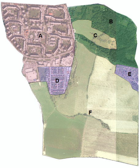
Site museums, focusing on immovable relics, are crucial for preserving unearthed artifacts by controlling their microenvironment. Artifacts are typically found in air–soil coupled environments. Current environmental control standards, designed for artifacts preserved in air, lead to diseases in soil artifacts due to inappropriate
[...] Read more.
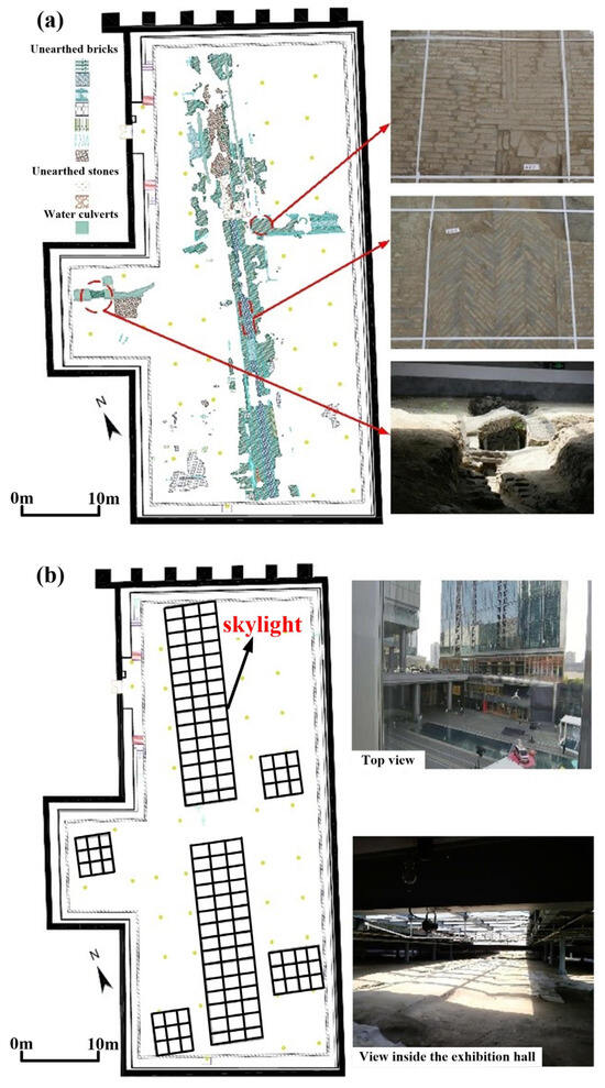
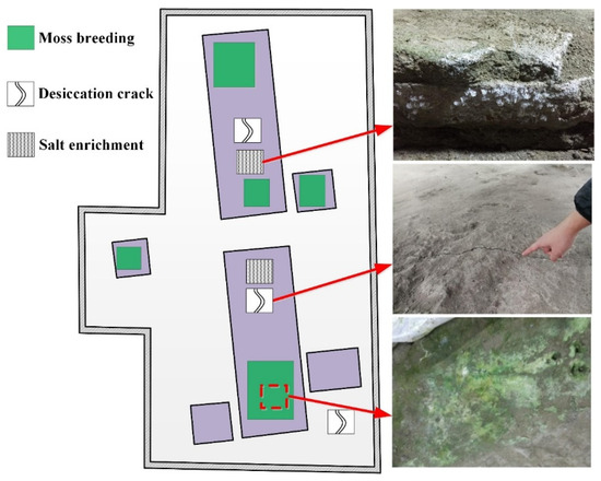
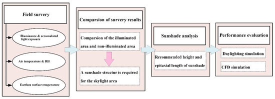
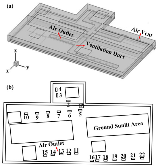
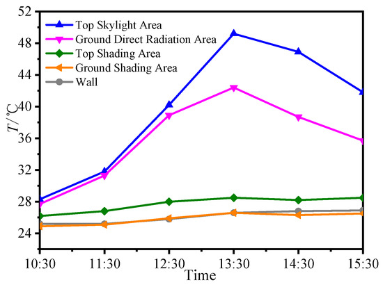
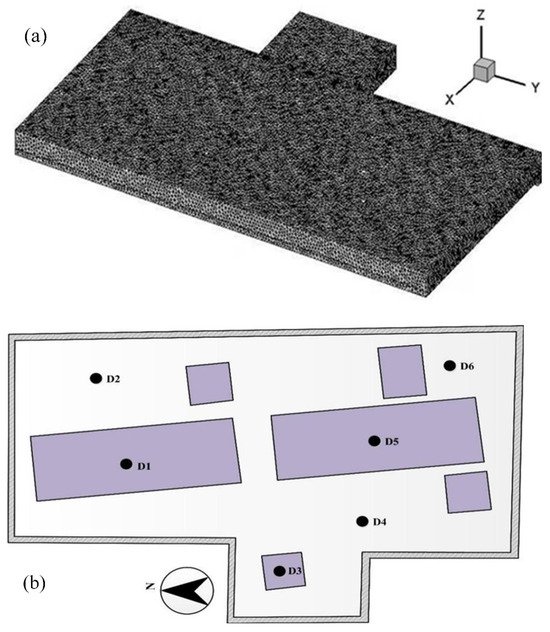
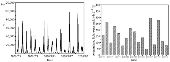
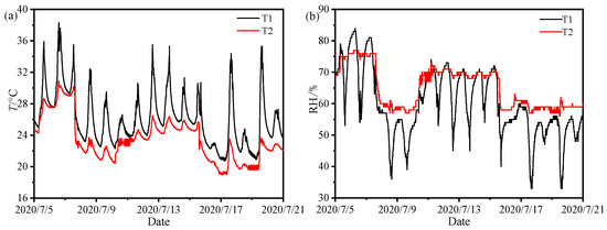
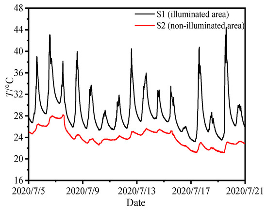
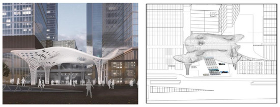
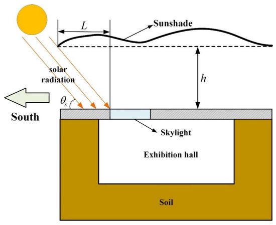
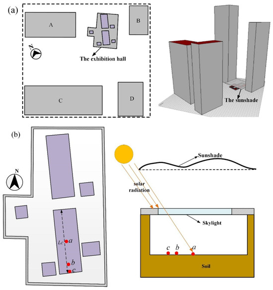
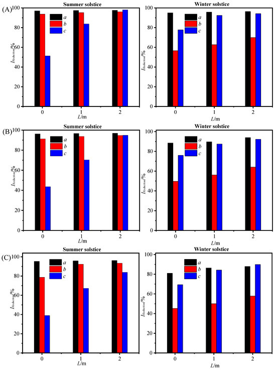
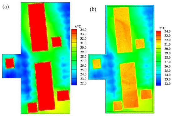
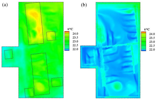
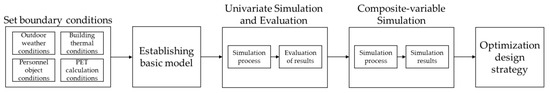
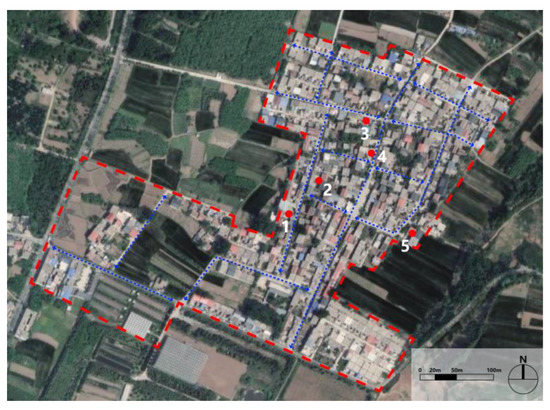
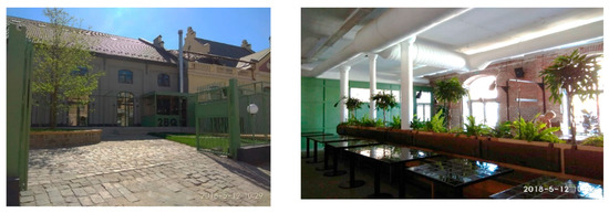
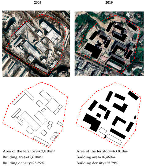
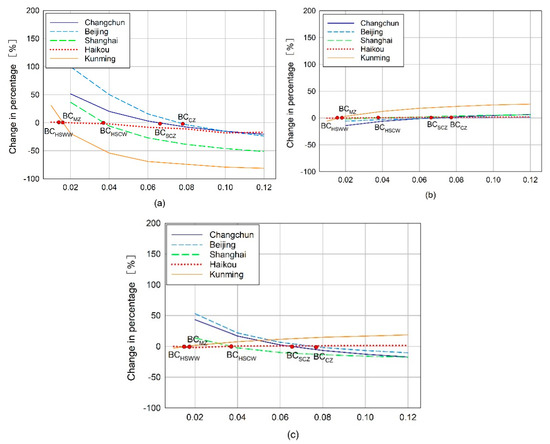
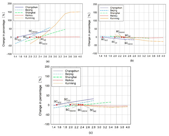
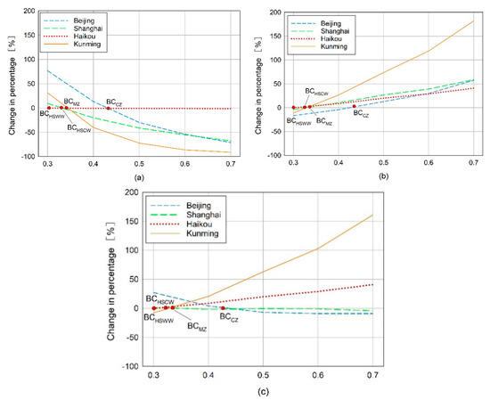
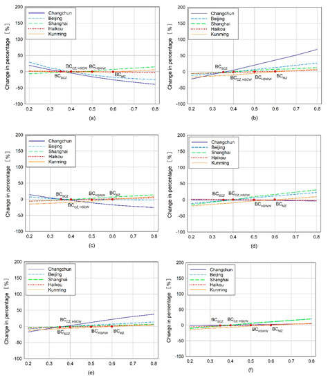
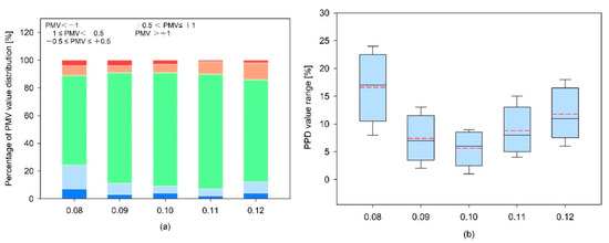
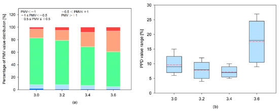
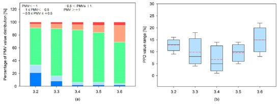
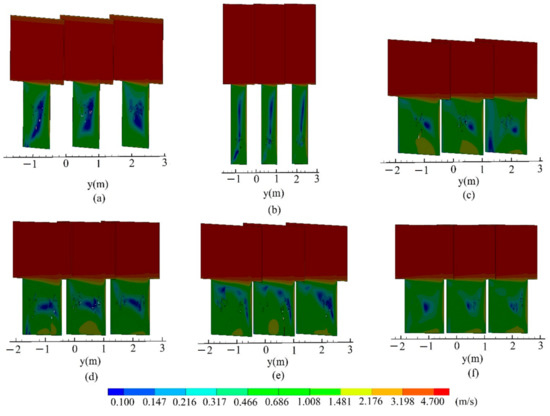
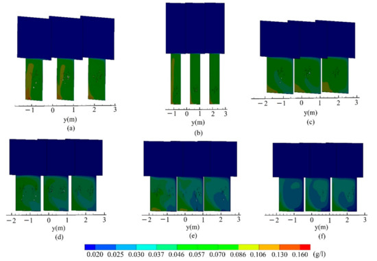
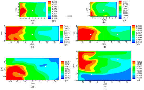
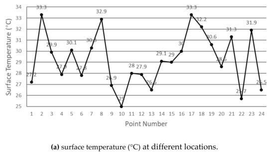
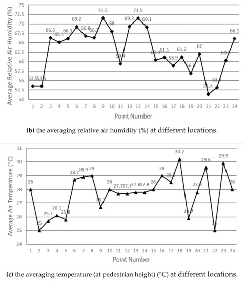
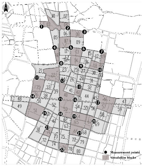
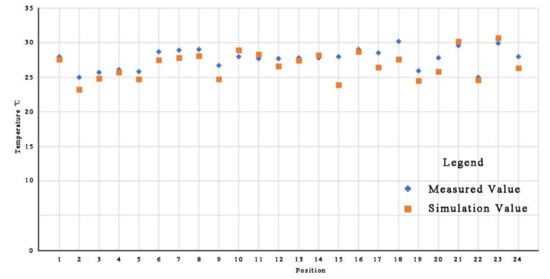
Site museums, focusing on immovable relics, are crucial for preserving unearthed artifacts by controlling their microenvironment. Artifacts are typically found in air–soil coupled environments. Current environmental control standards, designed for artifacts preserved in air, lead to diseases in soil artifacts due to inappropriate storage conditions. Taking Chengdu’s Jiangnan Guan Street as a case study, this research, through monitoring the on-site artifact environment and analyzing the correlation between diseases and the environment, proposes a tensioned membrane sunshade for the protection of artifacts under exposed roofs. Utilizing computational fluid dynamics and lighting simulations, we compared the environmental changes before and after the implementation of the plan. The results indicate: (1) direct sunlight from the exposed roof is the main cause of instability and disease in the soil–air coupled environment of the artifacts; (2) the sunshade significantly improves the storage environment of the artifacts, reducing the temperature difference at various locations from 12.8 °C to 0.3 °C and decreasing direct solar exposure by over 90%. Our proposed solution effectively improves the preservation environment of unearthed artifacts, offering new insights for the protection of the Chengdu Jiangnan Pavilion Street site.
Full article
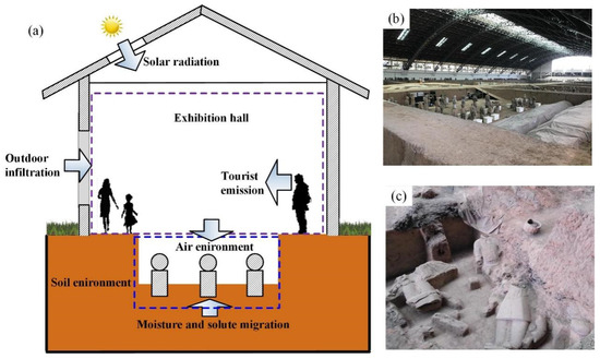
Figure 1