


Sustainability 2023, 15(3), 2269; https://doi.org/10.3390/su15032269 - 26 Jan 2023
Cited by 3 | Viewed by 1339
Abstract
►
Show Figures
Proper estimation of sediment movement is very critical for the management of alluvial rivers. Computing the sediment transport with single particle size is possible. However, particles on the river bed and in transport have a size distribution. It is very important to estimate
[...] Read more.
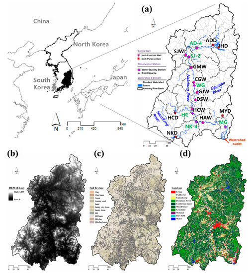
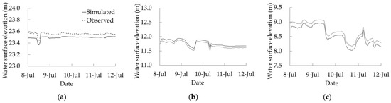
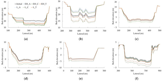
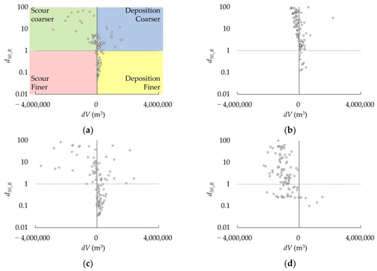
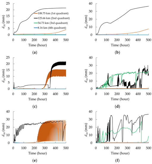
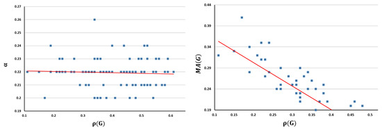
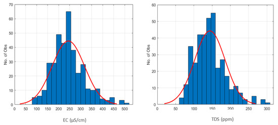
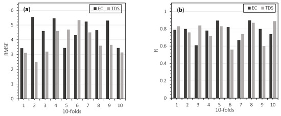
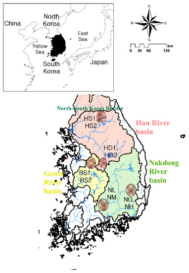
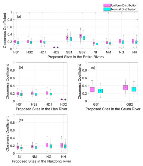
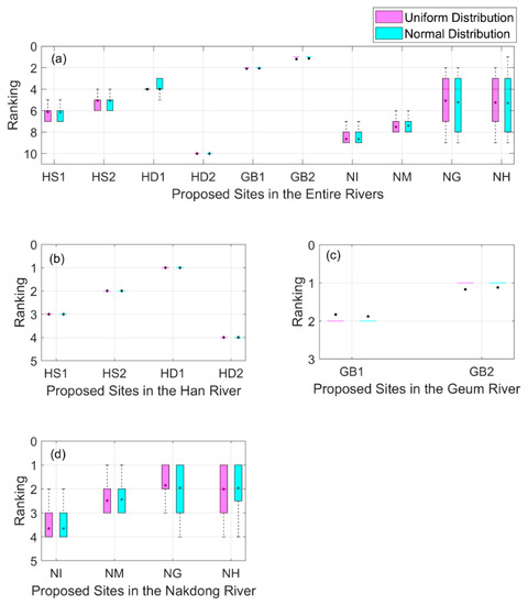
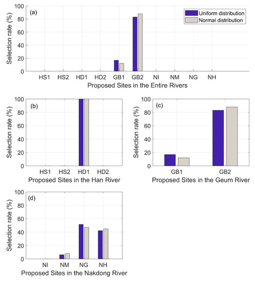
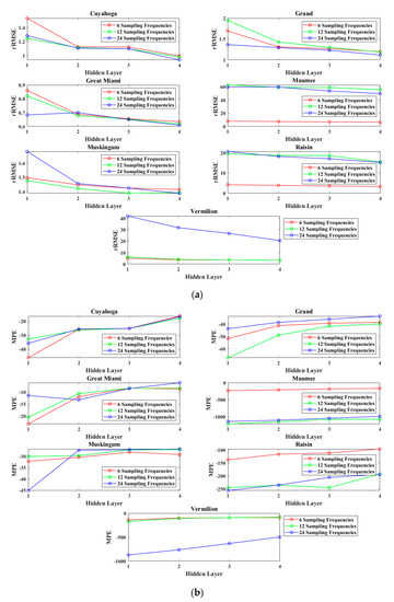
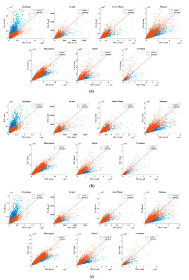
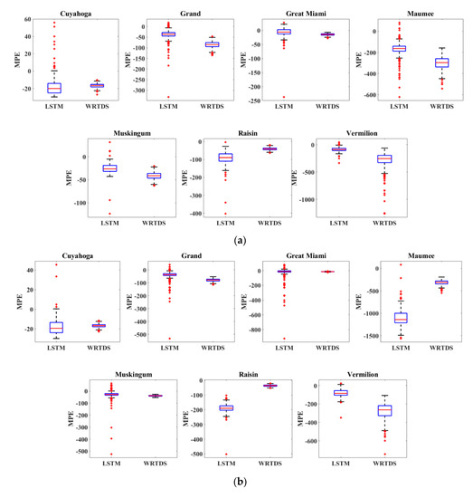
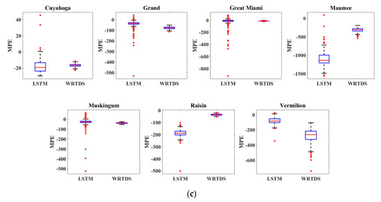
Proper estimation of sediment movement is very critical for the management of alluvial rivers. Computing the sediment transport with single particle size is possible. However, particles on the river bed and in transport have a size distribution. It is very important to estimate bed material size change, such as bed armoring, in case of scour. In this study, the applicability of the bed sorting method, which is available with HEC-RAS, was analyzed. Bed sorting methods divide the bed into two or three layers. Numerical simulations were conducted in the Geum River, Korea. The performance of the simulation with respect to bed sorting methods was evaluated by considering the temporal change of bed material size during the scour and armoring process. Three layer methods are not applicable for a natural river and had oscillatory temporal bed material size variation. The two layer method has stable temporal bed material size changes and predicts the armoring of the bed properly even with limited field data. Consequently, the active layer method is reliable for natural rivers to simulate the bed material size change while applications of three layer methods require sufficient investigation.
Full article
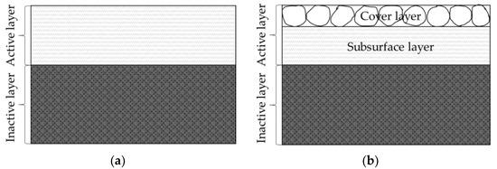
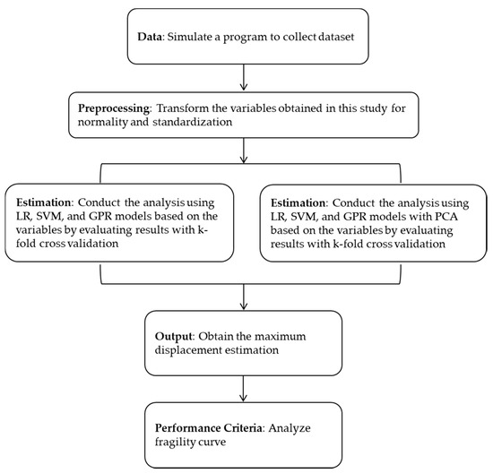
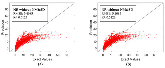
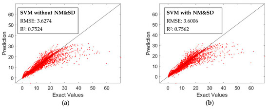
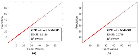
Figure 1


