


Remote Sens. 2023, 15(13), 3337; https://doi.org/10.3390/rs15133337 - 29 Jun 2023
Cited by 1 | Viewed by 1697
Abstract
►
Show Figures
The kinetic energy transfer between the atmosphere and oceans, called wind work, affects ocean dynamics, including near-inertial oscillations and internal gravity waves, mesoscale eddies, and large-scale zonal jets. For the most part, the recent numerical estimates of global wind work amplitude are almost
[...] Read more.
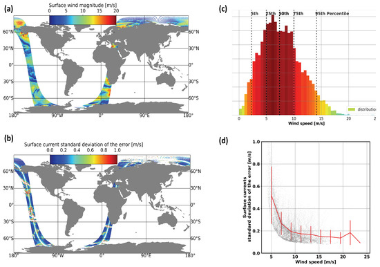
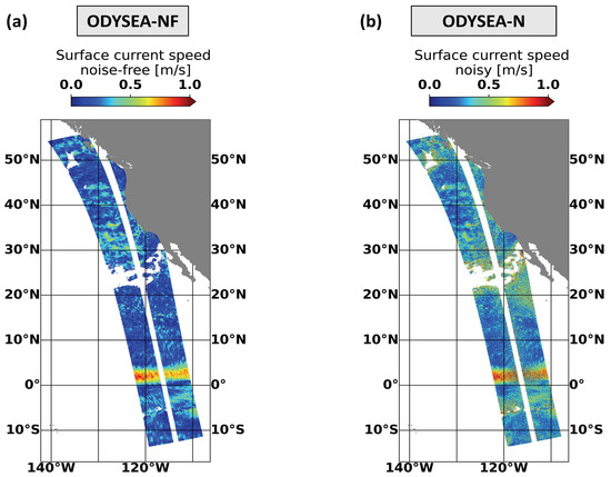
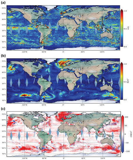
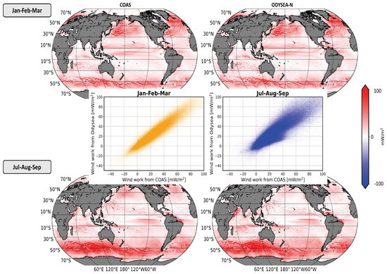
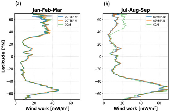
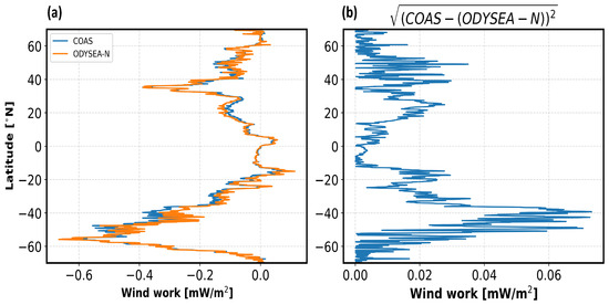
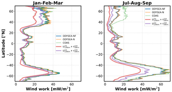
The kinetic energy transfer between the atmosphere and oceans, called wind work, affects ocean dynamics, including near-inertial oscillations and internal gravity waves, mesoscale eddies, and large-scale zonal jets. For the most part, the recent numerical estimates of global wind work amplitude are almost five times larger than those reported 10 years ago. This large increase is explained by the impact of the broad range of spatial and temporal scales covered by winds and currents, the smallest of which has only recently been uncovered by increasingly high-resolution modeling efforts. However, existing satellite observations do not fully sample this broad range of scales. The present study assesses the capabilities of ODYSEA, a conceptual satellite mission to estimate the amplitude of wind work in the global ocean. To this end, we use an ODYSEA measurement simulator fed by the outputs of a km scale coupled ocean–atmosphere model to estimate wind work globally. The results indicate that compared with numerical truth estimates, the ODYSEA instrument performs well globally, except for latitudes north of 40
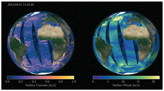
Figure 1