


Land 2023, 12(1), 217; https://doi.org/10.3390/land12010217 - 09 Jan 2023
Cited by 8 | Viewed by 3003
Abstract
►
Show Figures
Peri-urbanization is a global phenomenon strongly linked to socio-demographic and settlement dynamics. Although peri-urbanization is a topic widely debated in academic literature, especially in the field of urban and regional planning, there is no universal definition, and different types and interpretations of peri-urban
[...] Read more.
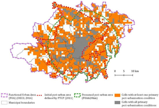
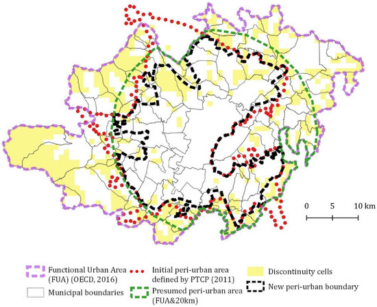
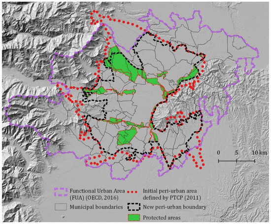
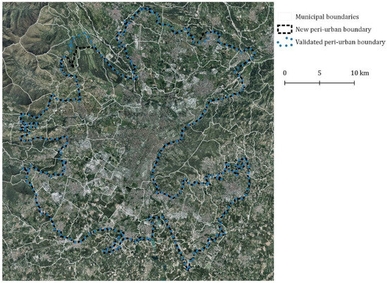
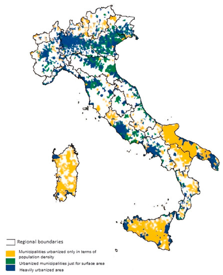
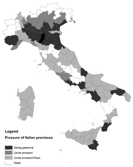
Peri-urbanization is a global phenomenon strongly linked to socio-demographic and settlement dynamics. Although peri-urbanization is a topic widely debated in academic literature, especially in the field of urban and regional planning, there is no universal definition, and different types and interpretations of peri-urban areas can be found in the literature. Identifying physical limits and boundaries, as well as defining what is peri-urban and what is not, are important issues for planning these spaces at city and metropolitan levels but are not easy to solve due to their heterogeneity. Establishing land use rules for peri-urban areas is a crucial issue for maintaining and fostering primary and vital ecosystem services, especially in terms of functions provided to urban core areas. Developing a replicable method to identify and regulate peri-urban areas, exportable to other European countries, is the aim of this study. In this paper, the authors propose a method applied to the case study of Turin (Italy), based on a collaborative and place-based approach, the identification of certain peri-urbanization conditions, and the definition of rules and guidelines for peri-urban areas, in order to support decision-makers at different levels. These planning tools were adopted by the recent General Territorial Plan of the Turin Metropolitan Area (TMA). In conclusion, the authors highlighted not only the strengths and possible limitations of this method but also the role of the landscape planning approach in terms of the protection and management of peri-urban areas, considering some of the new challenges that will likely involve future peri-urban research and planning practices.
Full article
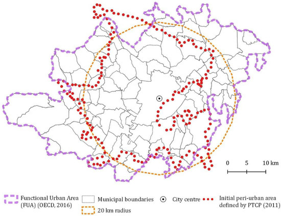
Figure 1