Advanced Technologies for Maritime and Underwater Archaeology

A special issue of Journal of Marine Science and Engineering (ISSN 2077-1312). This special issue belongs to the section "Geological Oceanography".

Deadline for manuscript submissions: closed (15 September 2021) | Viewed by 23862

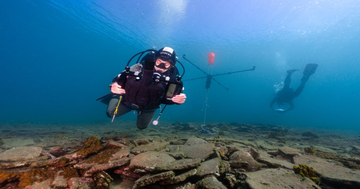
Image courtesy of Fabio Bruno

Special Issue Editors


E-Mail Website
Guest Editor
3DResearch s.r.l., Rende, 87036 Cosenza, Italy
Interests: computer vision; underwater technologies; 3D recording; AR/VR technologies
Special Issues, Collections and Topics in MDPI journals

E-Mail Website
Guest Editor
Department of Biology, Ecology and Earth Sciences, University of Calabria, Rende, 87036 Cosenza, Italy
Interests: cultural heritage; characterization and diagnostics of stone building materials and their decay processes; experimentation of innovative protective products for materials; archaeometry; underwater archaeology
Special Issues, Collections and Topics in MDPI journals

E-Mail Website
Guest Editor
BISITE Research Group, University of Salamanca, 37007 Salamanca, Spain
Interests: artificial intelligence; blockchain; deep learning; satellite systems; robot vision; cognitive robotics; sensor fusion; data fusion; mobile robotics; wireless networks; robotics; security; Internet of Things
Special Issues, Collections and Topics in MDPI journals

E-Mail Website
Guest Editor

E-Mail Website
Guest Editor
Oceanus-Lab, Laboratory of Marine Geology and Physical Oceanography, Department of Geology, University of Patras, 26504 Patras, Greece
Interests: marine geology; environmental oceanography; archaeological oceanography; marine remote sensing
Special Issues, Collections and Topics in MDPI journals

E-Mail Website
Guest Editor
Faculty of Electrical Engineering and Computing, University of Zagreb, Zagreb, Croatia
Interests: marine robotics (underwater and surface); autonomous systems; guidance, control and navigation; automatic control; nonlinear systems; identification
Special Issues, Collections and Topics in MDPI journals

Special Issue Information

Dear Colleagues,

Underwater cultural heritage (UCH) is a crucial asset for the knowledge of humankind’s history and traditions. It is tangible evidence of past human life that has to be protected for ensuring its accessibility to present and future generations.

The documentation, preservation, and dissemination of UCH is an open challenge that is strongly interdisciplinary because it involves collaboration among various experts from different sectors like archaeology, geology, biology, marine science, engineering, robotics, computer science, and numerous other disciplines.

This Special Issue intends to collect original and high-quality research articles and technical notes devoted to the knowledge of underwater materials and promote innovative methodologies, applications, and emerging technological solutions on the subject of materials that lie underwater.

Submissions are welcome that contribute to providing a multidisciplinary forum for cutting-edge scientific and technological issues in materials science, underwater archaeology, archaeometry, cultural heritage, alteration and aging, climate impact, case studies, and other related fields involving the large and varied community of experts from around the globe working in the underwater cultural heritage field.

Contributions are invited on the following topics:

  • 3D imaging technologies for the documentation of underwater sites;
  • Sensing, diagnostic, and monitoring technologies for UCH;
  • Advanced data processing technologies applied to the conservation and monitoring of UCH;
  • Characterization and diagnostics of underwater materials;
  • Conservation state assessment and conservation-restoration technologies for underwater archaeological sites and objects;
  • Case studies dealing with conservation and valorization of UCH;
  • Digital technologies for the exploitation of UCH.


Prof. Dr. Fabio Bruno
Dr. Antonio Lagudi
Dr. Michela Ricca
Dr. Javier Prieto
Prof. Dr. Mauro Francesco La Russa
Prof. Dr. George Papatheodorou
Prof. Dr. Nikola Mišković
Guest Editors

Manuscript Submission Information

Manuscripts should be submitted online at www.mdpi.com by registering and logging in to this website. Once you are registered, click here to go to the submission form. Manuscripts can be submitted until the deadline. All submissions that pass pre-check are peer-reviewed. Accepted papers will be published continuously in the journal (as soon as accepted) and will be listed together on the special issue website. Research articles, review articles as well as short communications are invited. For planned papers, a title and short abstract (about 100 words) can be sent to the Editorial Office for announcement on this website.

Submitted manuscripts should not have been published previously, nor be under consideration for publication elsewhere (except conference proceedings papers). All manuscripts are thoroughly refereed through a single-blind peer-review process. A guide for authors and other relevant information for submission of manuscripts is available on the Instructions for Authors page. Journal of Marine Science and Engineering is an international peer-reviewed open access monthly journal published by MDPI.

Please visit the Instructions for Authors page before submitting a manuscript. The Article Processing Charge (APC) for publication in this open access journal is 2600 CHF (Swiss Francs). Submitted papers should be well formatted and use good English. Authors may use MDPI's English editing service prior to publication or during author revisions.

Keywords

  • underwater cultural heritage
  • virtual and augmented reality
  • marine robotics
  • artificial intelligence
  • underwater 3D imaging
  • conservation
  • diagnostics

Published Papers (6 papers)

Order results
Result details
Select all
Export citation of selected articles as:

Editorial

Jump to: Research

2 pages, 163 KiB  
Editorial
Advanced Technologies for Maritime and Underwater Archaeology
by Javier Prieto, Fabio Bruno, Antonio Lagudi, Michela Ricca, Mauro Francesco La Russa, George Papatheodorou and Nikola Mišković
J. Mar. Sci. Eng. 2023, 11(3), 593; https://doi.org/10.3390/jmse11030593 - 10 Mar 2023
Cited by 1 | Viewed by 1587
Abstract
Underwater cultural heritage (UCH) is a crucial asset for our knowledge of human history and traditions [...] Full article
(This article belongs to the Special Issue Advanced Technologies for Maritime and Underwater Archaeology)

Research

Jump to: Editorial

21 pages, 21769 KiB  
Article
The Benefits of 3D and 4D Synthesis of Marine Geophysical Datasets for Analysis and Visualisation of Shipwrecks, and for Interpretation of Physical Processes over Shipwreck Sites: A Case Study off Methoni, Greece
by Panagiotis Gkionis, George Papatheodorou and Maria Geraga
J. Mar. Sci. Eng. 2021, 9(11), 1255; https://doi.org/10.3390/jmse9111255 - 12 Nov 2021
Cited by 3 | Viewed by 2897
Abstract
Through the study of three wreck sites over the Methoni Bay (Greece), this article presents the benefits of spatio-temporal integration and correlation of marine geophysical data in a common three-dimensional (3D) geographical platform for analysis, and visualisation of shipwreck ruins and for interpretation [...] Read more.
Through the study of three wreck sites over the Methoni Bay (Greece), this article presents the benefits of spatio-temporal integration and correlation of marine geophysical data in a common three-dimensional (3D) geographical platform for analysis, and visualisation of shipwreck ruins and for interpretation of physical processes over wreck sites. The integration of 3D datasets has been proven to support identification of archaeological features over and under the seafloor, evaluation of the wreck structure state, and assessment on the wrecking event and the wreck site arrangement at that time, due to interactive cross-examination of datasets acquired in separate planes. Data synthesis is fundamental for 3D digital reconstruction of scattered and partially buried shipwreck ruins in complex geology as every dataset acts as interpretive and complimentary to each other. It is also shown that data synthesis highlights the signatures of physical processes over the wreck sites, and the interaction between the processes and the shipwrecks. The analysis of spatio-temporal, four-dimensional (4D) integrated datasets has proved to provide knowledge on the wreck site evolution through time, and highlights the disturbance of underwater archaeological resources due to human activities. The study has also shown that the creation of a shoalest depth true position bathymetric surface supports the realistic 3D wreck representation over the seafloor. Full article
(This article belongs to the Special Issue Advanced Technologies for Maritime and Underwater Archaeology)
Show Figures

Figure 1

14 pages, 3973 KiB  
Article
Underwater Power Tools for In Situ Preservation, Cleaning and Consolidation of Submerged Archaeological Remains
by Emiliano Scalercio, Francesco Sangiovanni, Alessandro Gallo and Loris Barbieri
J. Mar. Sci. Eng. 2021, 9(6), 676; https://doi.org/10.3390/jmse9060676 - 19 Jun 2021
Cited by 3 | Viewed by 5084
Abstract
In situ protection and conservation of the Underwater Cultural Heritage are now considered a primary choice by the scientific community to be preferred, when possible, over the practice of recovery. The conservation of the artefacts within their environmental context is essential in fact [...] Read more.
In situ protection and conservation of the Underwater Cultural Heritage are now considered a primary choice by the scientific community to be preferred, when possible, over the practice of recovery. The conservation of the artefacts within their environmental context is essential in fact for a correct interpretation of archaeological presences and to preserve their true value intact for future generations. However, this is not an easy task because modern technological equipment is necessary to make the work carried out by underwater restorers and archaeologists faster and more efficient. To this end, the paper presents three innovative underwater power tools for the cleaning, conservation, and consolidation activities to be performed in submerged archaeological sites. The first one is an underwater cleaning brush tool for a soft cleaning of the underwater archaeological structures and artefacts; the second one is a multifunctional underwater hammer drill suitable to be used as a corer sampler, chisel, or drill; the last one is an injection tool specifically designed to dispense mortar underwater for consolidation techniques of submerged structures. Full article
(This article belongs to the Special Issue Advanced Technologies for Maritime and Underwater Archaeology)
Show Figures

Figure 1

12 pages, 34725 KiB  
Article
Innovation Concept Model and Prototype Validation of Robotic Fish with a Spatial Oscillating Rigid Caudal Fin
by Shuyan Wang, Yu Han and Shiteng Mao
J. Mar. Sci. Eng. 2021, 9(4), 435; https://doi.org/10.3390/jmse9040435 - 17 Apr 2021
Cited by 7 | Viewed by 2153
Abstract
Inspired by carangiform fish with a high-aspect ratio of the caudal fin’s up-down swing, but also by dolphins with a similar caudal fin’s left-right swing, a robotic fish with a spatial oscillating rigid caudal fin is implemented to optimize propulsion and maneuverability, whose [...] Read more.
Inspired by carangiform fish with a high-aspect ratio of the caudal fin’s up-down swing, but also by dolphins with a similar caudal fin’s left-right swing, a robotic fish with a spatial oscillating rigid caudal fin is implemented to optimize propulsion and maneuverability, whose orientation could be transformed to any position of a taper domain. First, three steering-engines were adopted to make the conceptual prototype, and an experimental apparatus for measuring thrust, lift forces, lateral forces and torque was developed. Then, three comparison experiments, respectively corresponding to the three modes of cruise, diving and maneuvering in random space, were conducted to imitate bionic fish’s hydrodynamics. The comparison results of the experiments proved that propelling and maneuvering in any direction could be realized through changing the orientation of the spatial oscillating rigid caudal fin. Full article
(This article belongs to the Special Issue Advanced Technologies for Maritime and Underwater Archaeology)
Show Figures

Figure 1

25 pages, 10468 KiB  
Article
Digital Technologies for the Sustainable Development of the Accessible Underwater Cultural Heritage Sites
by Fabio Bruno, Michela Ricca, Antonio Lagudi, Pari Kalamara, Angelos Manglis, Anastasia Fourkiotou, Dimitra Papadopoulou and Aggeliki Veneti
J. Mar. Sci. Eng. 2020, 8(11), 955; https://doi.org/10.3390/jmse8110955 - 23 Nov 2020
Cited by 16 | Viewed by 4786
Abstract
In recent years, the development in digital technologies such as Augmented Reality (AR) and Virtual Reality (VR) has evolved rapidly. These technologies are currently in the process of creating driving change in the Cultural and Creative Industries (CCIs), representing innovative means to share [...] Read more.
In recent years, the development in digital technologies such as Augmented Reality (AR) and Virtual Reality (VR) has evolved rapidly. These technologies are currently in the process of creating driving change in the Cultural and Creative Industries (CCIs), representing innovative means to share information, facilitating access and increasing the value and public awareness on Cultural and Natural Heritage. This is particularly relevant for underwater environments, where the most interesting cultural and naturalistic sites are accessible only to scuba divers, or not accessible at all, due to depth and/or environmental constraints. In addition, in underwater sites, guided diving tours are carried out by professionals that usually describe the area to be visited during the predive briefings; such step is needed due to the impossibility of underwater verbal communication without dedicated equipment, a practice very rarely adopted for recreational diving. So, these difficulties make it almost impossible to replicate under the sea, the guided tour approach that is usually offered in on-land museums. Considering such limitations, several technological applications are emerging to increase the accessibility underwater and enrich users’ experience both for divers and nondivers. This work aims to identify the potential of underwater sites (either cultural or natural) to support the development of sustainable tourism (economic, environmental, cultural and social) in the Mediterranean. Moreover, it focuses on supplying local/regional authorities and stakeholders with a multidisciplinary plan for managing Underwater Museums and Knowledge Centres, by promoting innovation in the diving industry and improving users’/tourists’ experience through value-added services and cutting-edge technologies. Full article
(This article belongs to the Special Issue Advanced Technologies for Maritime and Underwater Archaeology)
Show Figures

Figure 1

20 pages, 6651 KiB  
Article
Assessing the Accuracy of Underwater Photogrammetry for Archaeology: A Comparison of Structure from Motion Photogrammetry and Real Time Kinematic Survey at the East Key Construction Wreck
by Anne E. Wright, David L. Conlin and Steven M. Shope
J. Mar. Sci. Eng. 2020, 8(11), 849; https://doi.org/10.3390/jmse8110849 - 28 Oct 2020
Cited by 13 | Viewed by 4373
Abstract
The National Park Service (NPS) Submerged Resources Center (SRC) documented the East Key Construction Wreck in Dry Tortugas National Park using Structure from Motion photogrammetry, traditional archaeological hand mapping, and real time kinematic GPS (Global Positioning System) survey to test the accuracy of [...] Read more.
The National Park Service (NPS) Submerged Resources Center (SRC) documented the East Key Construction Wreck in Dry Tortugas National Park using Structure from Motion photogrammetry, traditional archaeological hand mapping, and real time kinematic GPS (Global Positioning System) survey to test the accuracy of and establish a baseline “worst case scenario” for 3D models created with NPS SRC’s tri-camera photogrammetry system, SeaArray. The data sets were compared using statistical analysis to determine accuracy and precision. Additionally, the team evaluated the amount of time and resources necessary to produce an acceptably accurate photogrammetry model that can be used for a variety of archaeological functions, including site monitoring and interpretation. Through statistical analysis, the team determined that, in the worst case scenario, in its current iteration, photogrammetry models created with SeaArray have a margin of error of 5.29 cm at a site over 84 m in length and 65 m in width. This paper discusses the design of the survey, acquisition and processing of data, analysis, issues encountered, and plans to improve the accuracy of the SeaArray photogrammetry system. Full article
(This article belongs to the Special Issue Advanced Technologies for Maritime and Underwater Archaeology)
Show Figures

Figure 1

Back to TopTop