


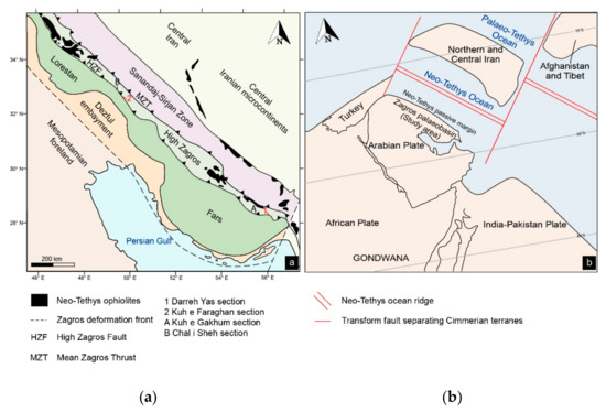
Geosciences 2023, 13(5), 130; https://doi.org/10.3390/geosciences13050130 - 30 Apr 2023
Cited by 1 | Viewed by 1362
Abstract
►
Show Figures
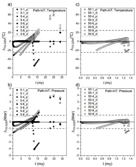
Antigorite dehydration is a process able to release, in comparison with other minerals, the highest amount of H2O from a subducting slab. The released fluid delivers critical elements (e.g., S, Cu, and REE) to the overlying subarc mantle, modifying the mantle
[...] Read more.
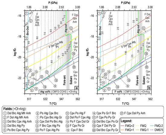
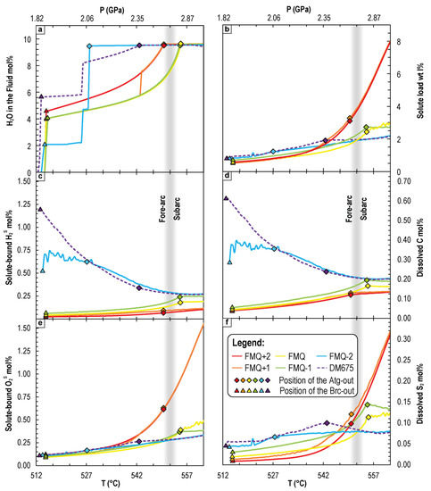
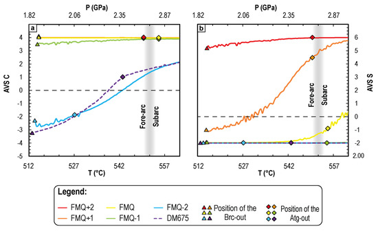
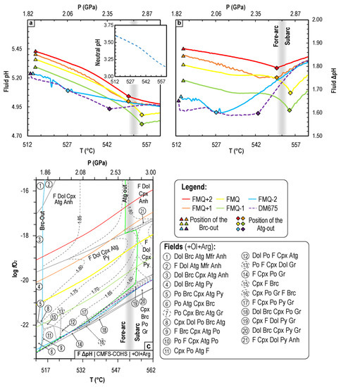
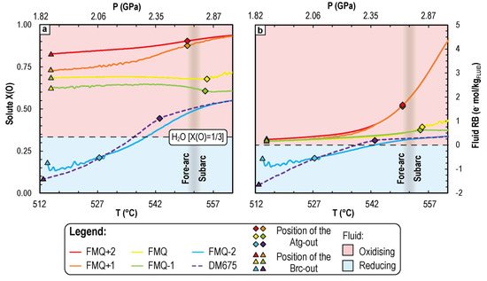
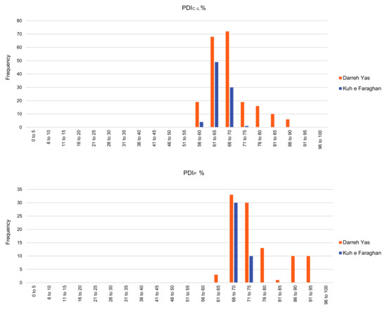
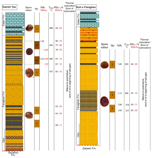
Antigorite dehydration is a process able to release, in comparison with other minerals, the highest amount of H2O from a subducting slab. The released fluid delivers critical elements (e.g., S, Cu, and REE) to the overlying subarc mantle, modifying the mantle source of arc magmas and related ore deposits. Whether antigorite breakdown produces oxidising or reducing fluids is debated. Whereas previous studies have investigated antigorite dehydration in serpentinites (i.e., in a (C)AMFS-H2O system), this contribution is devoted to the CMFS-COHS carbonate system, which is representative of the metacarbonate sediments (or carbonate-dominated ophicarbonate rocks) that sit atop the slab. Thermodynamic modelling is used to investigate the redox effect of the carbonate-buffered antigorite dehydration reactions (i.e., brucite breakdown and antigorite breakdown) on electrolytic fluid geochemistry as a function of P-T-fO2. The influence of P-T-fO2 conditions on the solubility of C and S, solute-bound H2 and O2, fluid pH, the average valence states of dissolved C and S, and the fluid redox budget indicates that, in metacarbonate sediments, the CaCO3+antigorite reaction tends to produce reducing fluids. However, the redox state of such fluids is buffered not only by the redox state of the system but also, most importantly, by concomitantly dissolving redox-sensitive minerals (i.e., carbonates, graphite, pyrite, and anhydrite). A qualitative correlation between the redox state of the system and the possible depth of fluid release into the mantle wedge is also derived.
Full article
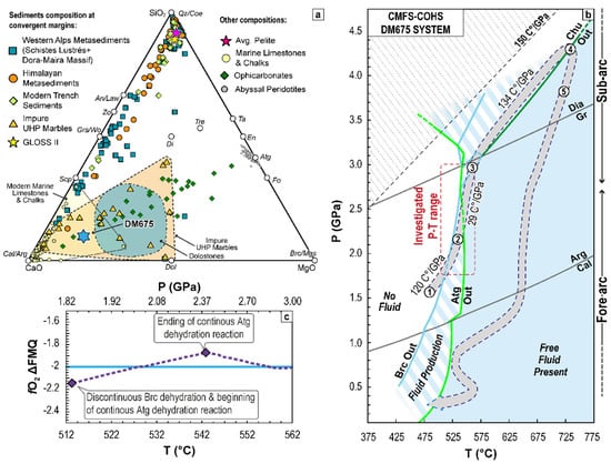
Figure 1
