Geoheritage and Geotourism Resources: Education, Recreation, Sustainability

A special issue of Geosciences (ISSN 2076-3263). This special issue belongs to the section "Geoheritage, Geoparks and Geotourism".

Deadline for manuscript submissions: closed (31 January 2022) | Viewed by 51130

Printed Edition Available!
A printed edition of this Special Issue is available here.

Special Issue Editors


E-Mail Website1 Website2
Guest Editor
Department of Geology and Geoenvironment, National and Kapodistrian University of Athens, 15772 Athens, Greece
Interests: palaeoecology; sedimentology; palaeoenvironment; geoheritage; geotourism; geoconservation; geoeducation
Special Issues, Collections and Topics in MDPI journals

E-Mail Website
Guest Editor
Faculty of Geology and Geoenvironment, National and Kapodistrian University of Athens, University Campus-Zografou, 15784 Athens, Greece
Interests: ore minerals; critical metals; magmatic-hydrothermal ore deposits; mineralogy of hydrothermal alterations in porphyry-epithermal systems; mineralogy and genesis of gemstones
Special Issues, Collections and Topics in MDPI journals

E-Mail Website
Guest Editor
Department of Historical Geology and Palaeontology, Faculty of Geology and Geo-Environment, National and Kapodistrian University of Athens, Panepistimioupolis, 15784 Athens, Greece
Interests: paleoclimatology; paleoceanographic proxies; micropaleontology; integrated stratigraphy; marine geology; ocean dynamics; sea-level changes; marginal seas; astronomical frequencies in paleoclimates; extreme geological events
Special Issues, Collections and Topics in MDPI journals

Special Issue Information

Dear Colleagues,

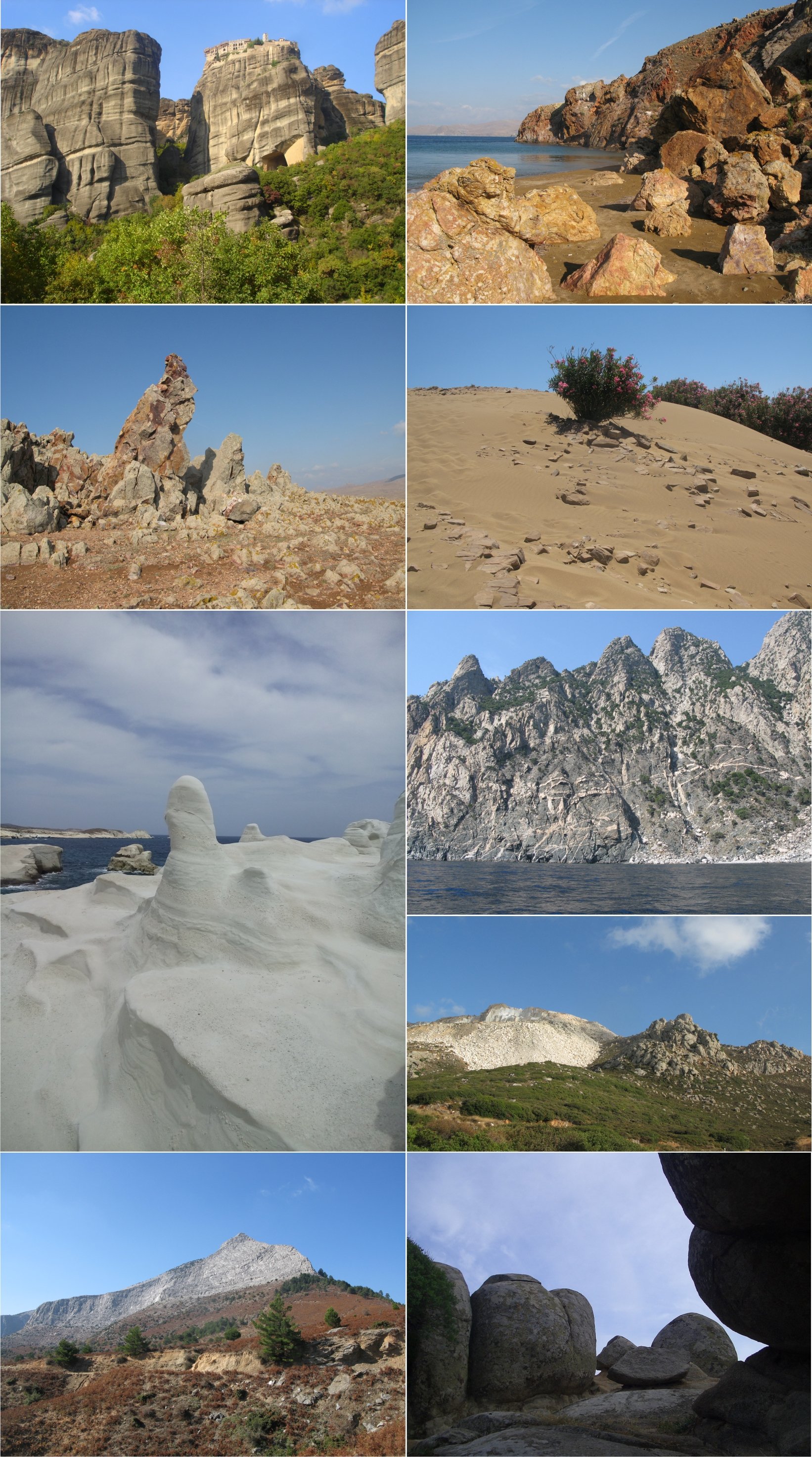
In recent years, the interest of society in the geoenvironment has been constantly increasing. Concepts such as "geosites", "geoparks", and “geodiversity” are linked to new local economic and cultural growth of the areas. Significant geosites are recognized worldwide through the activity of geoparks and benefit from the exchange of information, skills, experience and staff between geoparks. Geotourism is a form of tourism that allows the discovery of the geological peculiarities of the visited territories, combined with other natural and human resources. Geo-Education is at the core of the interest and operation of Geoparks, which are considered as ideal destinations for educational activities

The aim of the present Special Issue is to highlight ways in which geoheritage can be a very promising geotourism product that will lead to the sustainable development of society and will contribute to geo-information, education, knowledge and public awareness on issues concerning geoconservation and protection.

Among other topics, this Special Issue aims to highlight, review and evaluate the usefulness of geo-cultural features in didactics in terms of geoparks and other geotouristic attractions. Innovative methods of geo-education in geoparks are more than welcome, as well as development of research combining the geosciences with social science and humanities. The essential role of geoheritage in popularization of knowledge should be emphasized.

Original research articles and reviews are welcome. Research areas may include (but not limited to) the following:

  • Scientific studies of geoheritage presenting geosites occurring in different geological and geomorphological contexts;
  • Techniques for the enhancement of geoheritage;
  • Significance of geoheritage in human life;
  • Geosciences education for sustainability;
  • Educational programmes;
  • Sustainable geotourism, which highlight problems connected with the management of geological heritage;
  • Sustainable use of natural and cultural heritage and resources;
  • Valorisation of geo-heritage for sustainable and innovative tourism development.

text

Prof. Dr. Hara Drinia
Prof. Dr. Panagiotis Voudouris
Prof. Dr. Assimina Antonarakou
Guest Editors

Manuscript Submission Information

Manuscripts should be submitted online at www.mdpi.com by registering and logging in to this website. Once you are registered, click here to go to the submission form. Manuscripts can be submitted until the deadline. All submissions that pass pre-check are peer-reviewed. Accepted papers will be published continuously in the journal (as soon as accepted) and will be listed together on the special issue website. Research articles, review articles as well as short communications are invited. For planned papers, a title and short abstract (about 100 words) can be sent to the Editorial Office for announcement on this website.

Submitted manuscripts should not have been published previously, nor be under consideration for publication elsewhere (except conference proceedings papers). All manuscripts are thoroughly refereed through a single-blind peer-review process. A guide for authors and other relevant information for submission of manuscripts is available on the Instructions for Authors page. Geosciences is an international peer-reviewed open access monthly journal published by MDPI.

Please visit the Instructions for Authors page before submitting a manuscript. The Article Processing Charge (APC) for publication in this open access journal is 1800 CHF (Swiss Francs). Submitted papers should be well formatted and use good English. Authors may use MDPI's English editing service prior to publication or during author revisions.

Keywords

  • Geoheritage
  • Geoconservation
  • Geosite
  • Geotope
  • Geoeducation
  • Geotoursim
  • Sustainability
  • Geopark
  • Public awareness

Published Papers (15 papers)

Order results
Result details
Select all
Export citation of selected articles as:

Editorial

Jump to: Research, Review

4 pages, 179 KiB  
Editorial
Editorial of Special Issue—“Geoheritage and Geotourism Resources: Education, Recreation, Sustainability”
by Hara Drinia, Panagiotis Voudouris and Assimina Antonarakou
Geosciences 2022, 12(6), 251; https://doi.org/10.3390/geosciences12060251 - 16 Jun 2022
Cited by 4 | Viewed by 1411
Abstract
In recent years, the interest of society in the geoenvironment is constantly increasing [...] Full article

Research

Jump to: Editorial, Review

23 pages, 3683 KiB  
Article
How Greek Students Perceive Concepts Related to Geoenvironment: A Semiotics Content Analysis
by Efthymios Georgousis, Maria Savelidi, Socrates Savelides, Spyros Mosios, Maximos-Vasileios Holokolos and Hara Drinia
Geosciences 2022, 12(4), 172; https://doi.org/10.3390/geosciences12040172 - 14 Apr 2022
Cited by 5 | Viewed by 2223
Abstract
In order to design a geoeducation program in the context of the possibilities given to the Experimental Schools of Greece of Lower Secondary Education, teachers identified the need for diagnostically assess students’ understanding of basic concepts of the geoenvironment and particularly the concepts [...] Read more.
In order to design a geoeducation program in the context of the possibilities given to the Experimental Schools of Greece of Lower Secondary Education, teachers identified the need for diagnostically assess students’ understanding of basic concepts of the geoenvironment and particularly the concepts of geodiversity, geoheritage, geoethics and geotourism. In addition, there was a need to apply the educational technique of creating cognitive conflicts in order to promote the scientific perceptions of these concepts. Thus, research questions were identified which led the research to assess the current latent state of students’ perceptions regarding the thematic areas of the concepts and to identify concepts whose perceptions can be used in the educational process in order to achieve effective cognitive conflicts in order to promote scientific perceptions of them. The students briefly answered a four-question questionnaire, wherein each question examined their perceptions regarding the four concepts of geoenvironment: geodiversity, geoheritage, geoethics and geotourism. All 45 students of the geoeducation program that took part in the survey were aged between 12 and 15 years old. The qualitative research strategy approach was selected and specifically the hybrid technique of semiotics content analysis in combination with thematic analysis. This technique was selected due to the need to identify, code, categorize and count both obvious and latent meanings in the students’ written answers; these meanings were related to the four concepts under examination. The results of the research show that the current latent state of students’ perceptions regarding the thematic fields of the four concepts of the geoenvironment can be considered as particularly confused since the majority of students did not understand the concepts as they are employed in the international literature. The research also highlighted concepts that can be used by teachers in their efforts to develop students’ clear or even scientifically acceptable perceptions for the concepts of geodiversity, geoheritage, geoethics and geotourism in the thematic field of the geoenvironment. Full article
Show Figures

Figure 1

22 pages, 5322 KiB  
Article
Salinas and “Saltscape” as a Geological Heritage with a Strong Potential for Tourism and Geoeducation
by Katia Hueso-Kortekaas and Emilio Iranzo-García
Geosciences 2022, 12(3), 141; https://doi.org/10.3390/geosciences12030141 - 21 Mar 2022
Cited by 8 | Viewed by 3293
Abstract
Salinas and saltscapes are relevant geoheritage sites with important implications on socioeconomic activities beyond the production of salt, particularly tourism and education. As cultural landscapes, they also have implications related to the identity of their communities. This work presents the study of the [...] Read more.
Salinas and saltscapes are relevant geoheritage sites with important implications on socioeconomic activities beyond the production of salt, particularly tourism and education. As cultural landscapes, they also have implications related to the identity of their communities. This work presents the study of the patrimonialization processes of four sites in Europe (Añana in Spain, Guérande in France, Læsø in Denmark, and Sečovlje in Slovenia). Lessons obtained from these processes may contribute to the recovery and valuation of similar saltscapes and other forms of geoheritage. The study is based on interviews with relevant stakeholders, a survey of the related grey and scientific literature, and a simplified SWOT analysis. Despite their differences in historical background and current management, all four sites share features that have contributed to the success of their patrimonialization processes, such as having a dedicated entity for this purpose or being protected in some way. They also share common threats that need to be addressed, such as the banalization of the heritage discourse. Other saltscapes and geoheritage sites in general may benefit from these common features, which should serve as an inspiration and not as a template. In the end, shifting from a little-known productive, (proto-)industrial activity toward a sustainable, multifunctional landscape in which geoeducation and tourism are paramount contributes to a more resilient and educated society. Full article
Show Figures

Figure 1

27 pages, 8462 KiB  
Article
Preservation of the Geoheritage and Mining Heritage of Serifos Island, Greece: Geotourism Perspectives in a Potential New Global Unesco Geopark
by Nikolaos Vlachopoulos and Panagiotis Voudouris
Geosciences 2022, 12(3), 127; https://doi.org/10.3390/geosciences12030127 - 10 Mar 2022
Cited by 9 | Viewed by 3203
Abstract
Serifos island is characterized by rich geodiversity, industrial and cultural heritage. The present paper focuses on the geological and mining heritage of Serifos, with the aim of integrating the island in the international environment of Geoparks, in the near future. In this geopark, [...] Read more.
Serifos island is characterized by rich geodiversity, industrial and cultural heritage. The present paper focuses on the geological and mining heritage of Serifos, with the aim of integrating the island in the international environment of Geoparks, in the near future. In this geopark, Serifos can highlight the rich geological heritage of the island combined with the rich industrial heritage as expressed by mining activities since prehistoric times and the mining facilities of iron and copper mines. During the present study, six geotrails have been developed to link these cultural and ecological sites with the geological heritage. Along the routes, the geodiversity is explained, including its relationship with the surrounding biodiversity, and the historical and cultural aspects of the region. In the proposed geocultural routes (geotrails), the dialectic relationship between Humans and Nature is determined by historical conditions and by the record of the process that transforms space into a landscape. The geological-mining heritage of Serifos will attract people from all over the world with different kind of interests and will make it known to alternative tourists. The results of this paper are intended to constitute a valuable tool for enhancing and raising awareness of the geological heritage of the island of Serifos. Full article
Show Figures

Figure 1

27 pages, 12347 KiB  
Article
A Step towards a Sustainable Tourism in Apennine Mountain Areas: A Proposal of Geoitinerary across the Matese Mountains (Central-Southern Italy)
by Francesca Filocamo, Carmen Maria Rosskopf, Vincenzo Amato and Massimo Cesarano
Geosciences 2022, 12(2), 100; https://doi.org/10.3390/geosciences12020100 - 21 Feb 2022
Cited by 4 | Viewed by 2764
Abstract
The Apennine mountain areas suffer progressive abandonment and marginality, although being characterized by an extraordinary richness in natural and cultural resources, and landscapes of great beauty. Therefore, their natural heritage, and especially their geoheritage, tranformed into geotourism initiatives, can represent an essential resource [...] Read more.
The Apennine mountain areas suffer progressive abandonment and marginality, although being characterized by an extraordinary richness in natural and cultural resources, and landscapes of great beauty. Therefore, their natural heritage, and especially their geoheritage, tranformed into geotourism initiatives, can represent an essential resource to support local economy andsustainable development. The present study illustrates the case of Matese Mountains (Southern Apennines), particularly rich in protected areas, including the Matese National Park currently taking off, which is characterized by a rich geoheritage, based on 59 geosites. Among these geosites, examining the specially built geosite GIS database, 16 geosites were selected to construct a geoitinerary crossing the Matese Mountains. The geoitinerary was delineated to optimally represent the major geomorphological and geological (especially geohistorical) features of the Matese area. The selected geosites were associated to a new procedure to assess their Scientific Value (SV) and Potential Tourism Use (PTU), and to confirm their suitability for the purpose. To illustrate the geoitinerary, a geoitinerary map, and illustration material such as descriptive cards were produced. As an overall result, the proposed geoitinerary represents a valuable contribution for the geotourism promotion of the Matese Mountains on which to base future studies and initiatives in this perspective. Full article
Show Figures

Figure 1

21 pages, 3793 KiB  
Article
Comparative Analysis of Two Assessment Methods for the Geoeducational Values of Geosites: A Case Study from the Volcanic Island of Nisyros, SE Aegean Sea, Greece
by George Zafeiropoulos and Hara Drinia
Geosciences 2022, 12(2), 82; https://doi.org/10.3390/geosciences12020082 - 10 Feb 2022
Cited by 17 | Viewed by 2875
Abstract
In this study, the geoeducational value of five geosites, located in the aspiring geopark of the volcanic island of Nisyros, SE Aegean Sea, was assessed by means of two methods: the G-P method of Brilha (2016) and the M-GAM method. The first method [...] Read more.
In this study, the geoeducational value of five geosites, located in the aspiring geopark of the volcanic island of Nisyros, SE Aegean Sea, was assessed by means of two methods: the G-P method of Brilha (2016) and the M-GAM method. The first method takes into account 12 criteria belonging to the educational potential. The M-GAM method, on the other hand, takes into account the opinions of visitors who, as non-experts, express a different point of view that is rarely calculated or evaluated in different geosite assessment methods. For the better and more objective comparison of the two methods of evaluation of the educational potential of the study areas, the results were converted to a percentage scale (%). The first G-P method clearly highlights the high geological value of the studied geosites, which have a relatively high score and can be used for geotourism and geoeducation. The second method, on the other hand, yields a moderate score in areas with objectively high geological value. This is clearly evident, as this method considers the opinions of visitors who lack the necessary cognitive geological background, thereby underestimating the significance and potential of certain geological features due to lack of formal training. Full article
Show Figures

Figure 1

22 pages, 55976 KiB  
Article
Digital Tools to Serve Geotourism and Sustainable Development at Psiloritis UNESCO Global Geopark in COVID Times and Beyond
by Charalampos Fassoulas, Emmanouel Nikolakakis and Spiridon Staridas
Geosciences 2022, 12(2), 78; https://doi.org/10.3390/geosciences12020078 - 07 Feb 2022
Cited by 15 | Viewed by 3664
Abstract
Digital tools that aid geolocation, geointerpretation and geomodelling are increasingly used in the promotion of geoheritage and geoconservation. UNESCO Global Geoparks (UGGps) are complex regions that require a variety of approaches to advance geoconservation and public awareness, holistic heritage management and sustainable development. [...] Read more.
Digital tools that aid geolocation, geointerpretation and geomodelling are increasingly used in the promotion of geoheritage and geoconservation. UNESCO Global Geoparks (UGGps) are complex regions that require a variety of approaches to advance geoconservation and public awareness, holistic heritage management and sustainable development. UGGps need more diversified and applied digital tools to address these subjects. Additional efforts are made through their commitment to achieving sustainable development goals (SDGs) in the changing and challenging world of the COVID-19 pandemic and the exacerbation of climate change. In this study, we present three new digital applications developed for the Psiloritis UGGp in Southern Greece. These digital tools were developed under the implementation of the “Enhancement Plan” of the geopark via the RURITAGE, a project that supports rural regeneration through conservation, with a focus on local heritage. Digital tools developed in the project include an interactive digital map that demonstrates all properties of local heritage, products and services, two story maps focusing on historic churches and monasteries of the Amari district and on the natural and cultural values of Nida plateau, and a business-listing map with the affiliated geopark enterprises. These digital tools combine multiple applications and methods such as Wordpress webpages, web maps, spherical panoramas, multimedia, site interpretation, geolocation and virtual reality to aid the interpretation of natural and cultural heritage, promote important sites, demonstrate overlaps between nature and human society and support local productivity. Digital tools offer online access to interested parties in any area and are also used for in situ information sites. They are user-friendly, device-adjusted and available for sharing on social media and webpages. The applicability and effectiveness of these digital tools are proven to advance geotourism and the SDGs, in line with the provisions of the “World After roadmap” of UGGps. During the COVID-19 pandemic, the “visibility” of the Psiloritis UGGp was doubled via the use of these digital tools, as they have become popular among the general public. Full article
Show Figures

Figure 1

13 pages, 16223 KiB  
Article
Geological and Mining Heritage as a Driver of Development: The NE Sector of the Linares-La Carolina District (Southeastern Spain)
by Rosendo Mendoza, Javier Rey, Julián Martínez and Maria Carmen Hidalgo
Geosciences 2022, 12(2), 76; https://doi.org/10.3390/geosciences12020076 - 06 Feb 2022
Cited by 3 | Viewed by 2091
Abstract
Conservation, rehabilitation and post-valuation of the facilities of old mining districts is considered a valid strategy to revitalize these areas. In this study, the northeastern sector of the Linares-La Carolina mining district was analyzed, integrating geological information with mining to assess its value. [...] Read more.
Conservation, rehabilitation and post-valuation of the facilities of old mining districts is considered a valid strategy to revitalize these areas. In this study, the northeastern sector of the Linares-La Carolina mining district was analyzed, integrating geological information with mining to assess its value. The characteristics of the three most emblematic veins (consisting of galena, sphalerite, chalcopyrite, pyrite, quartz, ankerite and calcite) were analyzed, namely El Guindo, Federico and El Sinapismo. In this study, each mining exploitation was evaluated according to their geological context. Currently, old mining operations can only be visited from drainage galleries or from some exploration galleries. However, some of the old mining shafts could be adapted for visitation. On the surface, the remains of the most important extraction shafts and part of the associated facilities are still visible. One can also visit old tailings dumps with a high contents of heavy metals associated with ore concentration plants. The contaminating potential of these wastes is being monitored thanks to control piezometers and sensors installed at different depths within the tailings ponds, which assist in controlling evolution in the latter years. Different localities of special interest from geological, mining and mineralogical points of view are indicated. Therefore, the guided tour described in this work is attractive for tourism and educational purposes. Full article
Show Figures

Figure 1

27 pages, 3950 KiB  
Article
Quantitative Assessment of the Geosites of Chelmos-Vouraikos UNESCO Global Geopark (Greece)
by Vasilis Golfinopoulos, Penelope Papadopoulou, Eleni Koumoutsou, Nickolas Zouros, Charalampos Fassoulas, Avraam Zelilidis and George Iliopoulos
Geosciences 2022, 12(2), 63; https://doi.org/10.3390/geosciences12020063 - 29 Jan 2022
Cited by 12 | Viewed by 3276
Abstract
The assessment of the geosites of Chelmos-Vouraikos UNESCO Global Geopark (UGGp) was carried out based on an established methodology for the evaluation of geoparks’ geosites. Such assessments should be used for sustainable development and geoconservation in geoparks. The selected methodology is based on [...] Read more.
The assessment of the geosites of Chelmos-Vouraikos UNESCO Global Geopark (UGGp) was carried out based on an established methodology for the evaluation of geoparks’ geosites. Such assessments should be used for sustainable development and geoconservation in geoparks. The selected methodology is based on a wider range of criteria concerning the overall value of each geosite, compared to other locations. Each criterion was scored and then three indices, Vedu, Vprot and Vedu were estimated for each geosite. The application of this methodology at Chelmos-Vouraikos UGGp has produced results which not only highlight the value of each geosite, but also provide ways for their utilization. The assessment of the 40 geosites of the geopark, identified geosites with high educational and touristic value (such as Portes–Triklia and the Cave of the Lakes), while geosites with increased protection-need value (the Tectonic Graben of Kalavryta) were also highlighted. Therefore, the assessment results will be used by the geopark to plan the effective management of the geosites based on their strengths and weaknesses, and which thus will promote the geopark and will contribute to the sustainable development of the local communities. The proposed methodology uses all possible criteria for its impartial application and despite a few minor problems that have been identified, it is considered appropriate for the assessment of geosites in Geoparks. The application of such evaluation methodologies is considered crucial for the development, protection and touristic promotion of geoparks. Full article
Show Figures

Figure 1

31 pages, 16217 KiB  
Article
Assessment of Geological Heritage Sites and Their Significance for Geotouristic Exploitation: The Case of Lefkas, Meganisi, Kefalonia and Ithaki Islands, Ionian Sea, Greece
by Evangelos Spyrou, Maria V. Triantaphyllou, Theodora Tsourou, Emmanuel Vassilakis, Christos Asimakopoulos, Aliki Konsolaki, Dimitris Markakis, Dimitra Marketou-Galari and Athanasios Skentos
Geosciences 2022, 12(2), 55; https://doi.org/10.3390/geosciences12020055 - 24 Jan 2022
Cited by 13 | Viewed by 4781
Abstract
Geological heritage or geoheritage refers to the total of geosites, i.e., areas of high geological interest in a given area. Geosites have a high potential of attracting geotourists, thus contributing to the development of the local economy. Assessing sites of geological interest can [...] Read more.
Geological heritage or geoheritage refers to the total of geosites, i.e., areas of high geological interest in a given area. Geosites have a high potential of attracting geotourists, thus contributing to the development of the local economy. Assessing sites of geological interest can contribute to their promotion, as well as their preservation and protection. Greece’s geotectonic position in the convergent zone between the African and Eurasian plates has contributed to the existence of a considerable wealth of geosites, with the particularly active geotectonic region of the Ionian Sea characterized as a geoheritage hotspot. The purpose of this study is the selection of several such sites from the islands of Lefkas, Meganisi, Kefalonia and Ithaki and their assessment regarding their scientific, environmental, cultural, economic and aesthetic value. The most representative sites for the individual disciplines of geology (e.g., geomorphology, tectonics, stratigraphy and palaeontology) have been chosen, mapped and assessed, while indicative georoutes are proposed, which could aid the island’s geotouristic promotion to geologist and non-geologist future visitors. Full article
Show Figures

Figure 1

22 pages, 6694 KiB  
Article
How Academics and the Public Experienced Immersive Virtual Reality for Geo-Education
by Fabio L. Bonali, Elena Russo, Fabio Vitello, Varvara Antoniou, Fabio Marchese, Luca Fallati, Valentina Bracchi, Noemi Corti, Alessandra Savini, Malcolm Whitworth, Kyriaki Drymoni, Federico Pasquaré Mariotto, Paraskevi Nomikou, Eva Sciacca, Sofia Bressan, Susanna Falsaperla, Danilo Reitano, Benjamin van Wyk de Vries, Mel Krokos, Giuliana Panieri, Mathew Alexander Stiller-Reeve, Giuseppe Vizzari, Ugo Becciani and Alessandro Tibaldiadd Show full author list remove Hide full author list
Geosciences 2022, 12(1), 9; https://doi.org/10.3390/geosciences12010009 - 24 Dec 2021
Cited by 18 | Viewed by 3929
Abstract
Immersive virtual reality can potentially open up interesting geological sites to students, academics and others who may not have had the opportunity to visit such sites previously. We study how users perceive the usefulness of an immersive virtual reality approach applied to Earth [...] Read more.
Immersive virtual reality can potentially open up interesting geological sites to students, academics and others who may not have had the opportunity to visit such sites previously. We study how users perceive the usefulness of an immersive virtual reality approach applied to Earth Sciences teaching and communication. During nine immersive virtual reality-based events held in 2018 and 2019 in various locations (Vienna in Austria, Milan and Catania in Italy, Santorini in Greece), a large number of visitors had the opportunity to navigate, in immersive mode, across geological landscapes reconstructed by cutting-edge, unmanned aerial system-based photogrammetry techniques. The reconstructed virtual geological environments are specifically chosen virtual geosites, from Santorini (Greece), the North Volcanic Zone (Iceland), and Mt. Etna (Italy). Following the user experiences, we collected 459 questionnaires, with a large spread in participant age and cultural background. We find that the majority of respondents would be willing to repeat the immersive virtual reality experience, and importantly, most of the students and Earth Science academics who took part in the navigation confirmed the usefulness of this approach for geo-education purposes. Full article
Show Figures

Figure 1

28 pages, 30766 KiB  
Article
Inventory and Assessment of the Geomorphosites in Central Cyclades, Greece: The Case of Paros and Naxos Islands
by Niki Evelpidou, Anna Karkani, Maria Tzouxanioti, Evangelos Spyrou, Alexandros Petropoulos and Lida Lakidi
Geosciences 2021, 11(12), 512; https://doi.org/10.3390/geosciences11120512 - 14 Dec 2021
Cited by 6 | Viewed by 2545
Abstract
The Cycladic landscape is characterized by landforms of natural beauty and rarity. Landforms resulting from differential erosion, weathering, tectonics, drainage network, sea level changes, and depositional processes can contribute to the development of geotourism in the area. This can be achieved by supporting [...] Read more.
The Cycladic landscape is characterized by landforms of natural beauty and rarity. Landforms resulting from differential erosion, weathering, tectonics, drainage network, sea level changes, and depositional processes can contribute to the development of geotourism in the area. This can be achieved by supporting conservation, protection and promotion of the geo-environment and nature, educating students, residents, and visitors. The aim of this work is to develop an inventory of the main geomorphosites of Paros and Naxos islands by assessing their scientific and additional values, using qualitative and quantitative criteria. Our results show that, besides the high scientific interest of the 75 geomorphosites, most are also characterized by a high ecological value and can potentially lead to a significant increase in the islands’ tourism. The results of this work aim at raise awareness on the geomorphological heritage of central Cyclades and provide a basis for their promotion, protection, and management. Full article
Show Figures

Figure 1

13 pages, 1066 KiB  
Article
Bridges as Geoheritage Viewpoints in the Western Caucasus
by Anna V. Mikhailenko, Vladimir A. Ermolaev and Dmitry A. Ruban
Geosciences 2021, 11(9), 377; https://doi.org/10.3390/geosciences11090377 - 07 Sep 2021
Cited by 4 | Viewed by 1667
Abstract
Distant observation of unique geological and geomorphological features facilitates comprehension and tourism of these important resources. Bridges offer an opportunity for such observation, and the idea of bridge-based geoheritage viewpoints is proposed. In the geologically-rich area of the Western Caucasus (southwestern Russia), eleven [...] Read more.
Distant observation of unique geological and geomorphological features facilitates comprehension and tourism of these important resources. Bridges offer an opportunity for such observation, and the idea of bridge-based geoheritage viewpoints is proposed. In the geologically-rich area of the Western Caucasus (southwestern Russia), eleven bridges were assessed semiquantitatively with the newly proposed approach. The results indicated their different but moderate utility as geoheritage viewpoints. The utility of two bridges is high. Bridges differ not only by the quality of the views they offer but also by their accessibility. Mandatory permissions and entrance fees reduce this property in several cases. Although the study area is somewhat specific due to the relatively large number of bridges and their utility, similar situations can be found in other geographical localities. Bridge-based geoheritage viewpoints are important to geotourism development, and, particularly, they contribute to establishing optimal and comfortable routes. Full article
Show Figures

Figure 1

Review

Jump to: Editorial, Research

28 pages, 7127 KiB  
Review
Geoheritage and Cultural Heritage—A Review of Recurrent and Interlinked Themes
by Edyta Pijet-Migoń and Piotr Migoń
Geosciences 2022, 12(2), 98; https://doi.org/10.3390/geosciences12020098 - 21 Feb 2022
Cited by 52 | Viewed by 6190
Abstract
Relationships between geoheritage and cultural heritage are being increasingly explored and have become one of the mainstreams within studies of geoheritage and geodiversity. In this review paper, we identify the main and secondary themes at the geoheritage—cultural heritage interface and provide examples of [...] Read more.
Relationships between geoheritage and cultural heritage are being increasingly explored and have become one of the mainstreams within studies of geoheritage and geodiversity. In this review paper, we identify the main and secondary themes at the geoheritage—cultural heritage interface and provide examples of specific topics and approaches. These themes include added cultural value to geoheritage sites, geoheritage in urban spaces, cultural landscapes, and the contribution of geoheritage to their identity, mining and quarrying heritage, linkages with natural disasters, history of science, and art. Intangible cultural heritage is also reviewed in the geoheritage context. In the closing part of the paper, various classifications of geoheritage—cultural heritage linkages are proposed, although it is concluded that themes and fields of inquiry are overlapping and interlinked, rendering one classification system not very feasible. Instead, a mind map to show these diverse connections is offered. The paper closes with recommendations for future studies, arising from this review and the identification of research gaps and under-researched areas. Full article
Show Figures

Figure 1

20 pages, 2926 KiB  
Review
From Geoheritage to Geoeducation, Geoethics and Geotourism: A Critical Evaluation of the Greek Region
by George Zafeiropoulos, Hara Drinia, Assimina Antonarakou and Nikolaos Zouros
Geosciences 2021, 11(9), 381; https://doi.org/10.3390/geosciences11090381 - 09 Sep 2021
Cited by 49 | Viewed by 4153
Abstract
The purpose of this review is, initially, to emphasize the importance of geoenvironmental education for the promotion and preservation of geological heritage and geoethical values, and based on these, to present the current situation in Greece. Geoeducation is a broader component of environmental [...] Read more.
The purpose of this review is, initially, to emphasize the importance of geoenvironmental education for the promotion and preservation of geological heritage and geoethical values, and based on these, to present the current situation in Greece. Geoeducation is a broader component of environmental education which aims to promote the geological heritage of a place and its geoconservation. It is a key integral tool for tackling environmental issues and therefore further assisting in sustainable development. Greece is known for its exceptional and rare natural beauty, as well as for the abundance of natural resources and its remarkable geological features. For this reason, six global geoparks have already been established in this country. However, its nature protection is mainly considered as the protection of biodiversity, while the term “geodiversity” is almost absent in Greek law. The importance of establishing a legal framework for the protection of geotopes is underlined by the fact that their promotion and rational management create opportunities for sustainable development, as well as to become quality tourist destinations (geotourism) through nature protection and education. Geodiversity can gain public attention and have a positive impact on geotopes protection. Such initiatives can not only improve the protection of geological sites, but also play an important role in their sustainable development. Full article
Show Figures

Graphical abstract

Back to TopTop