


Aerospace 2024, 11(4), 307; https://doi.org/10.3390/aerospace11040307 - 14 Apr 2024
Viewed by 416
Abstract
►
Show Figures
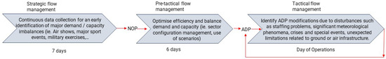
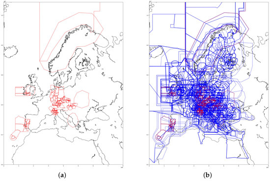
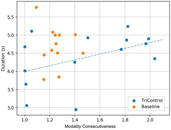
The aviation industry has proposed multiple solutions to reduce fuel consumption, air pollution, and noise at airports, one of which involves deploying electric trucks for aircraft towing between the stand and the runway. However, the introduction of tow trucks results in increased surface
[...] Read more.
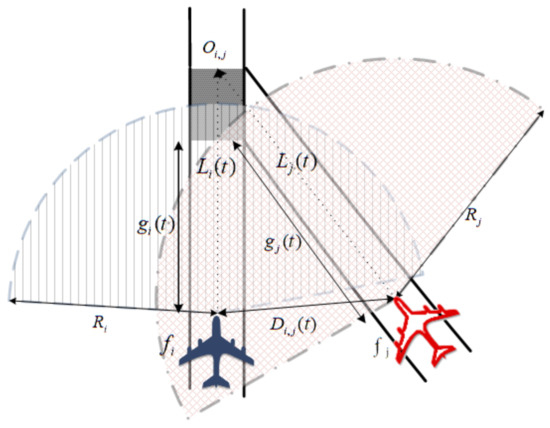
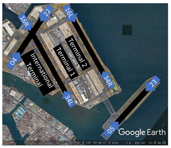
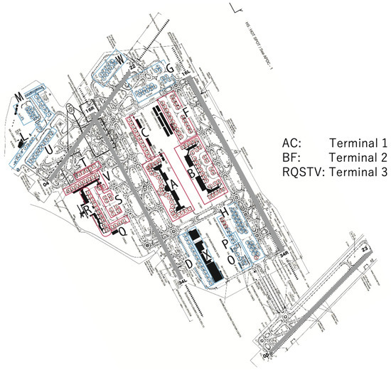
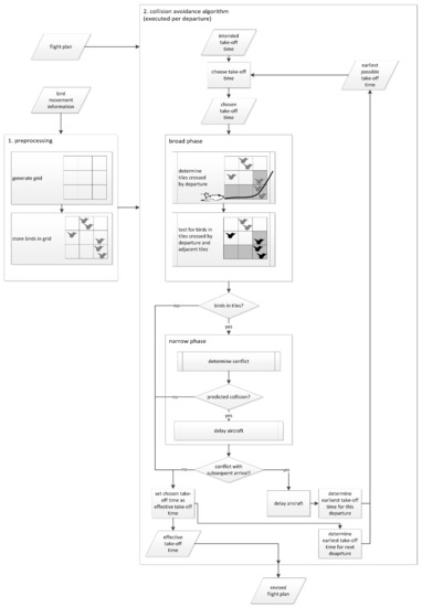
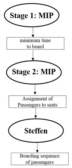
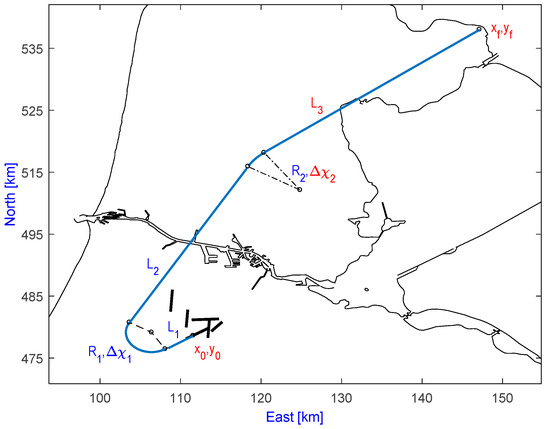
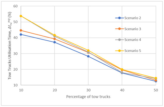
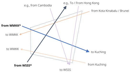
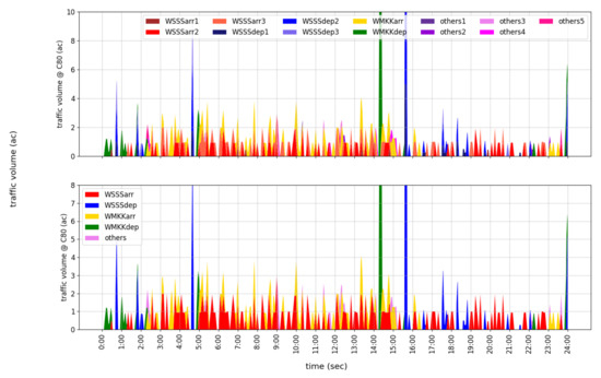
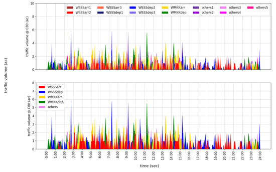
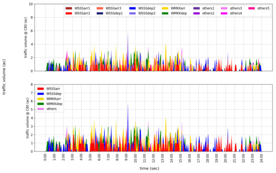
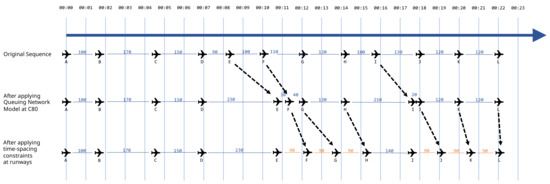
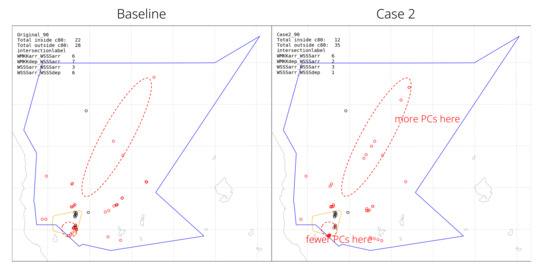
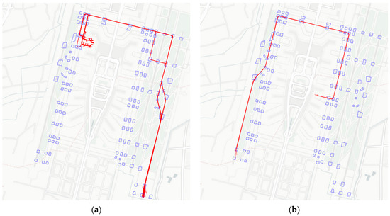
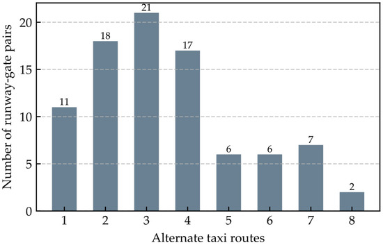
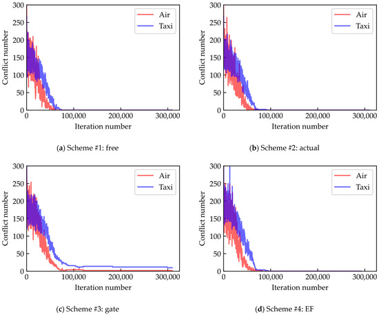
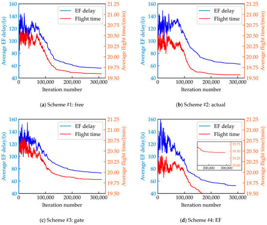
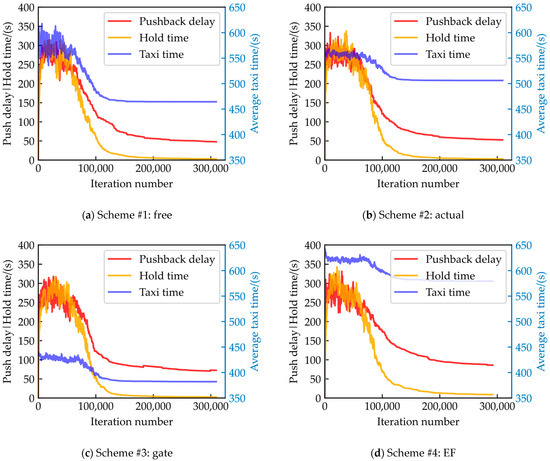
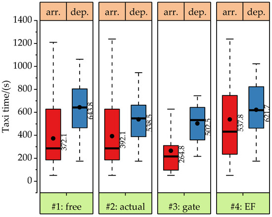
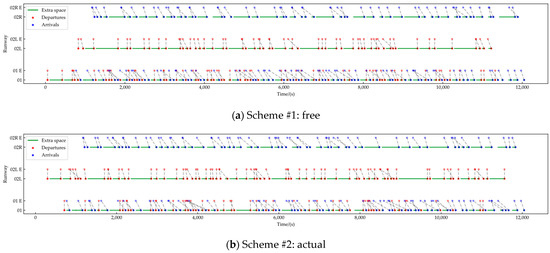
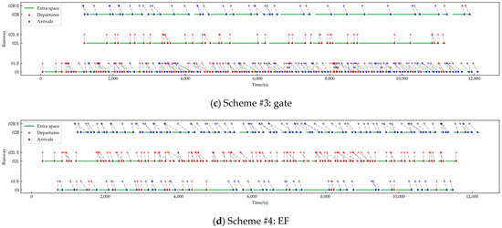
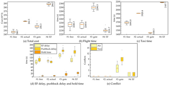
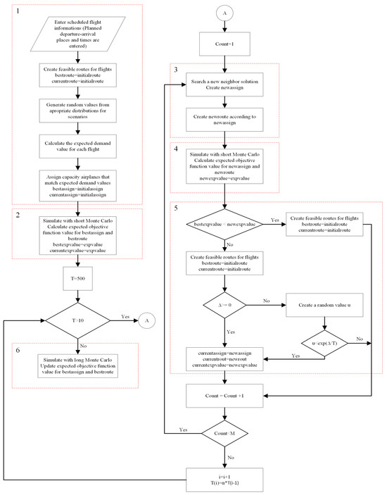
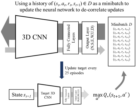
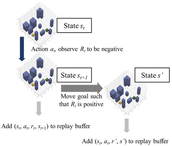
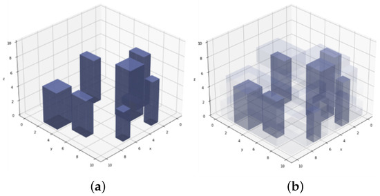
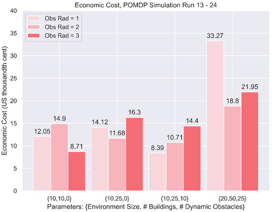
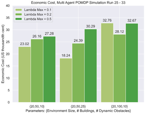
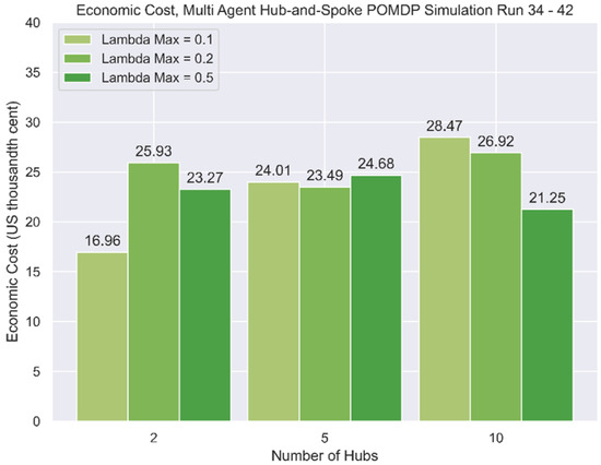
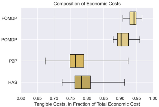
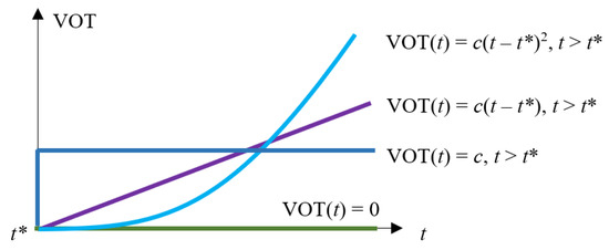
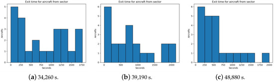
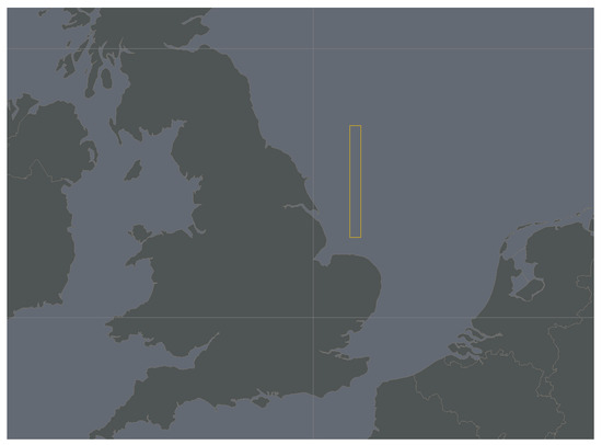
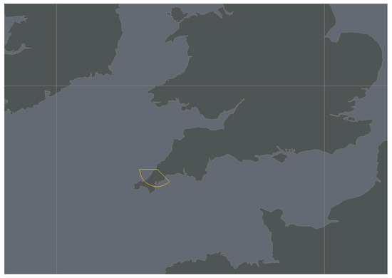
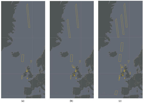
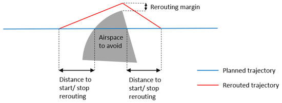
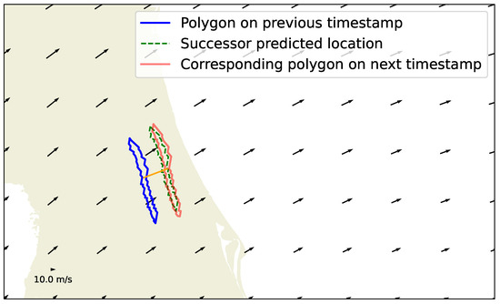
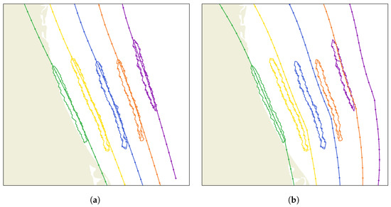
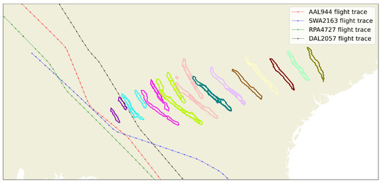
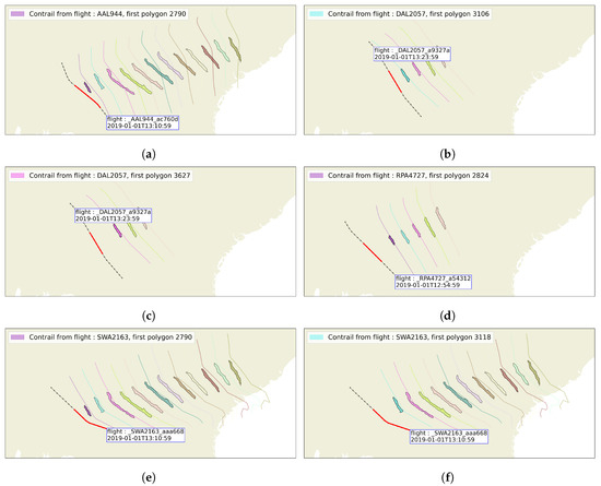
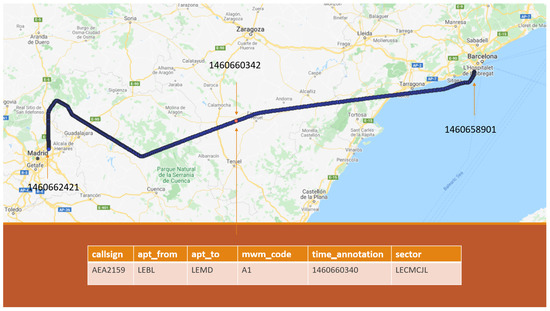
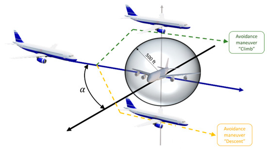
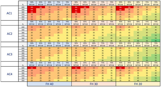
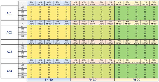
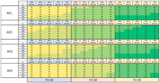
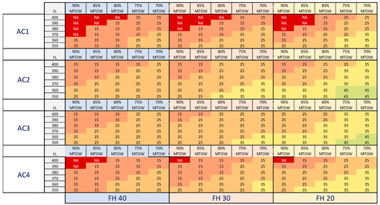
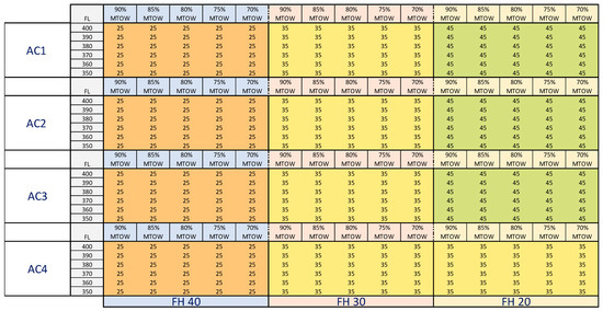
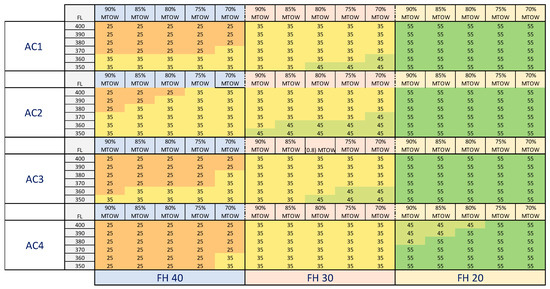
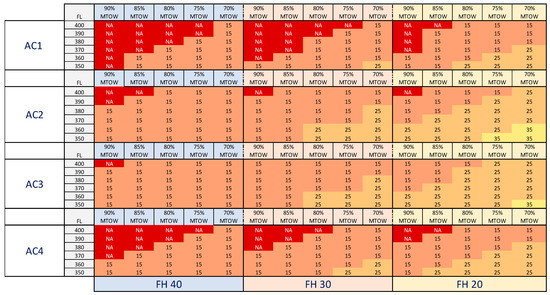
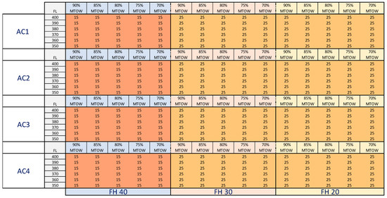
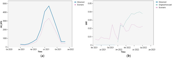
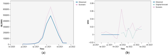
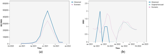
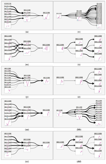
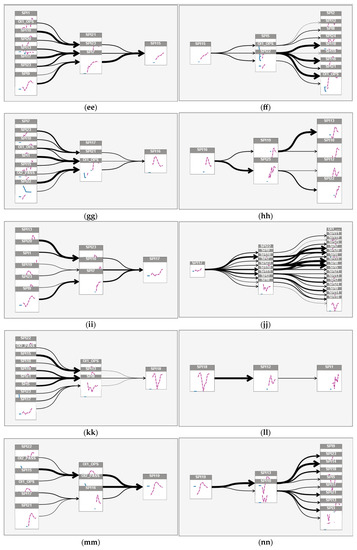
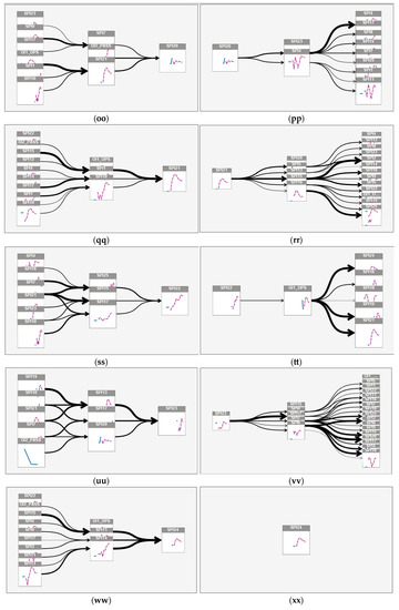
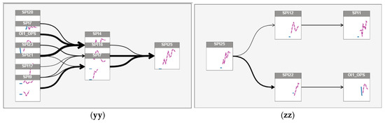
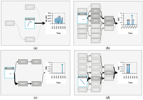
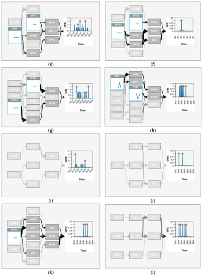
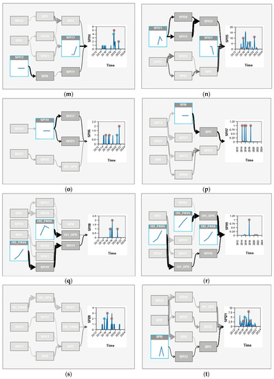
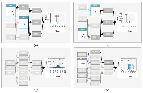
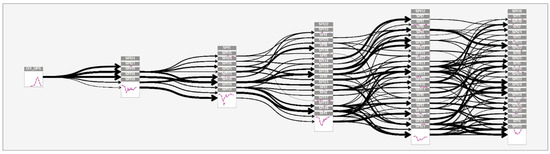
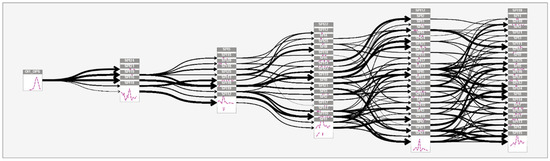
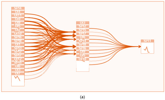
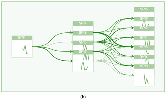
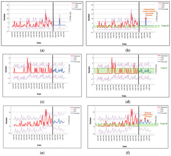
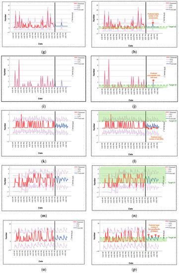
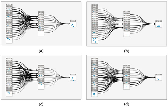
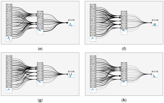
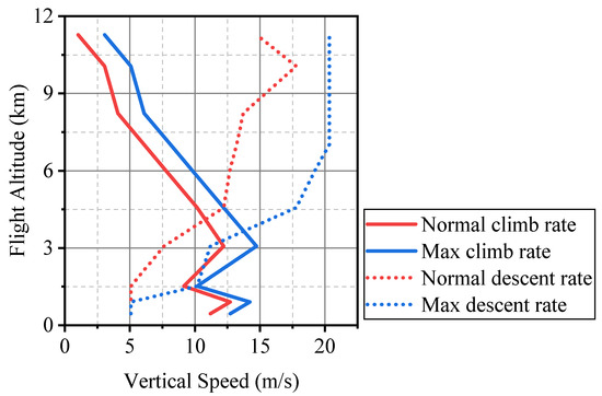
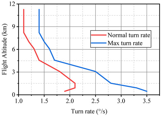
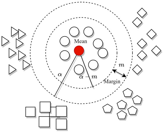
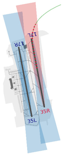
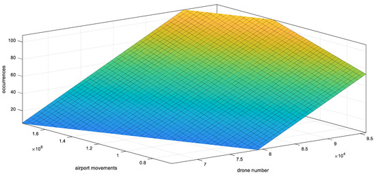
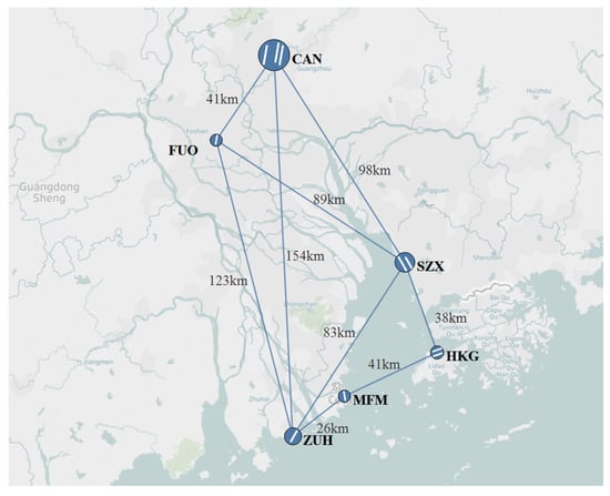
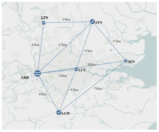
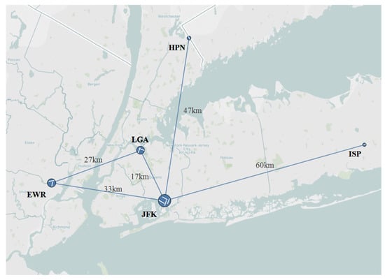
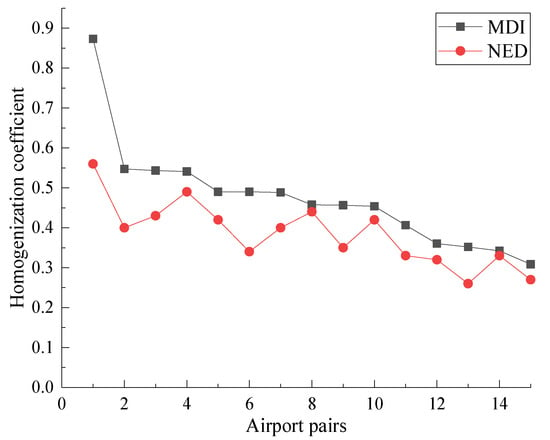
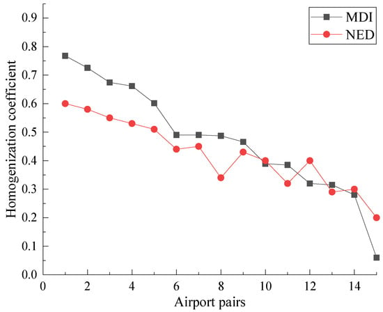
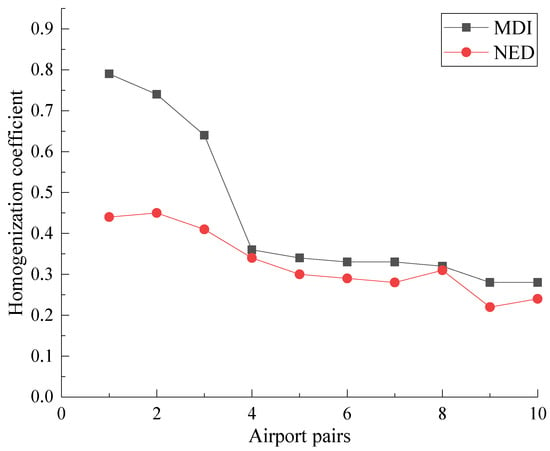
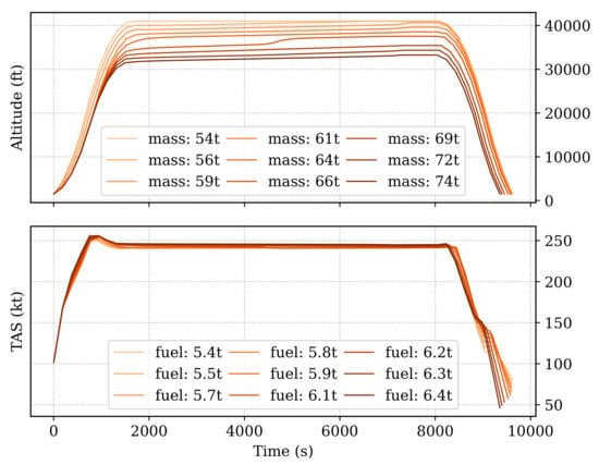
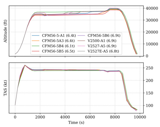
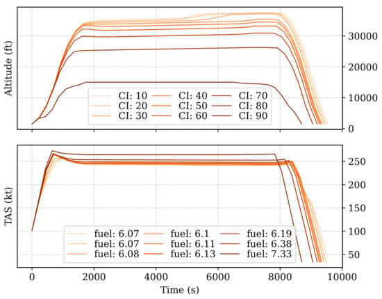
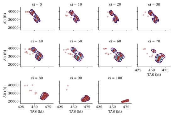
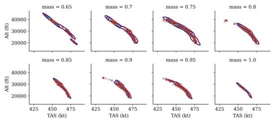
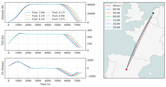
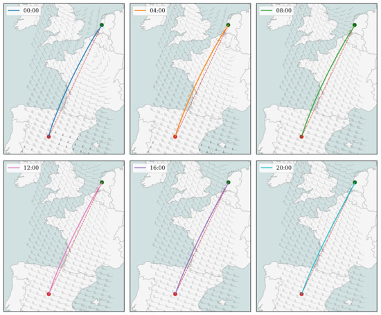
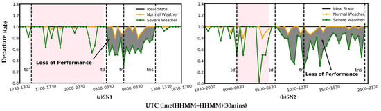
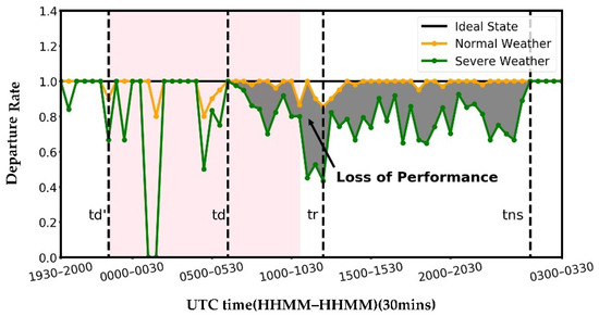
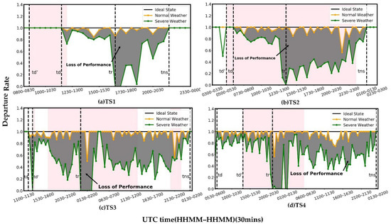
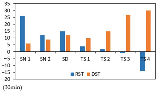
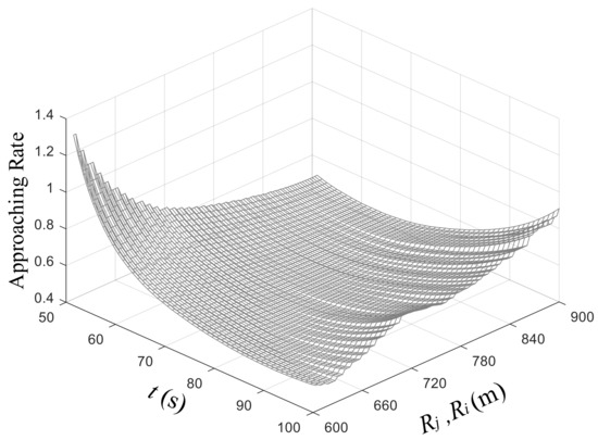
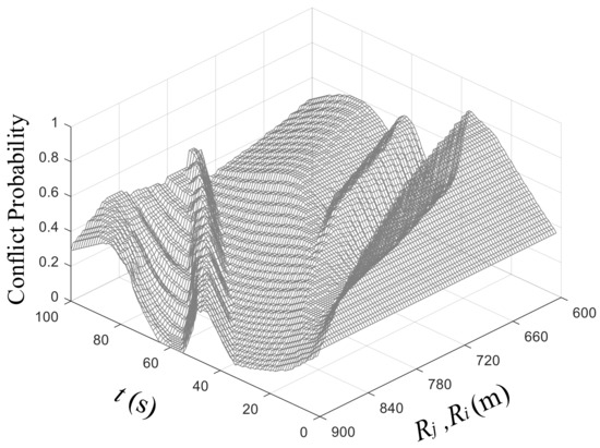
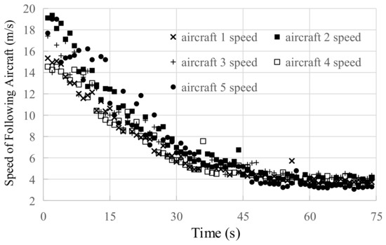
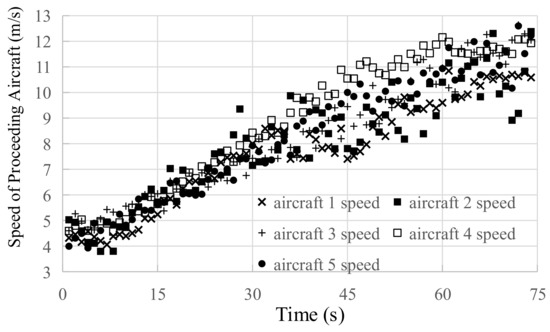
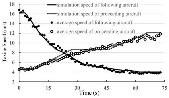
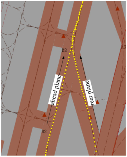
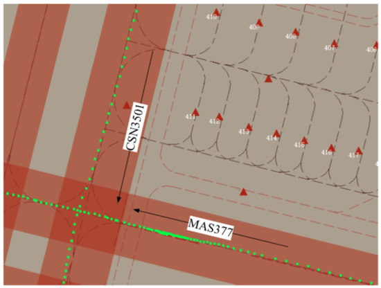
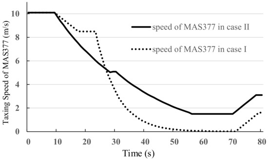
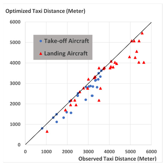
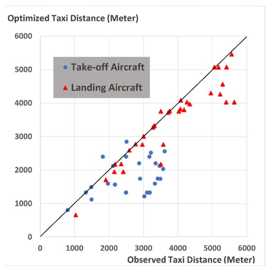
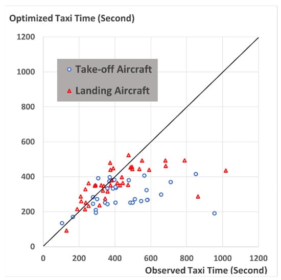
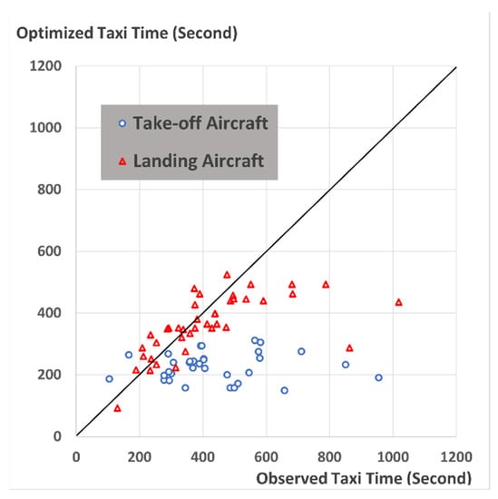
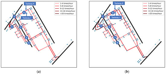
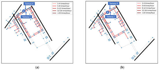
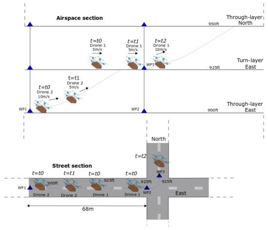
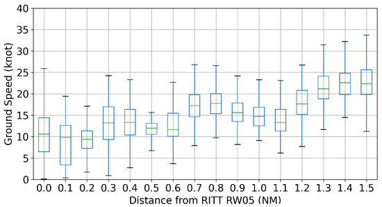
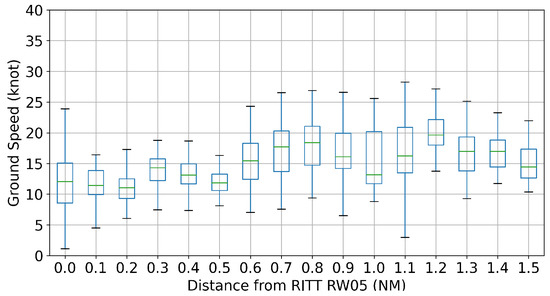
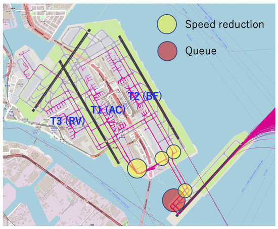
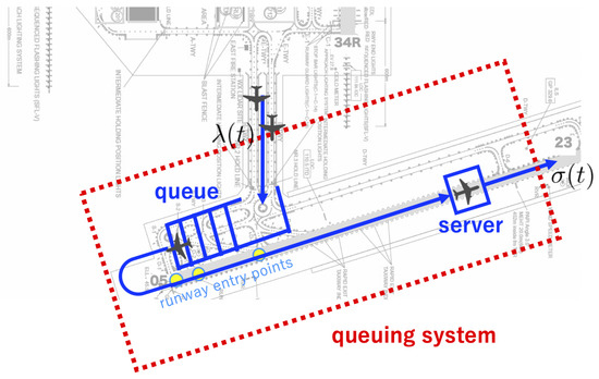
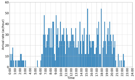
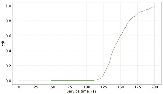
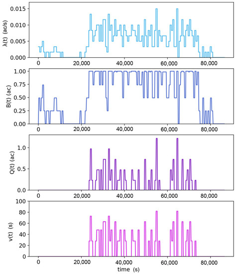
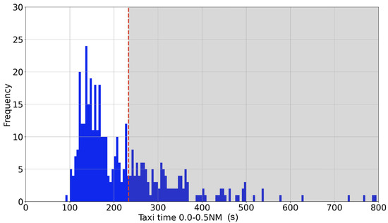
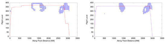
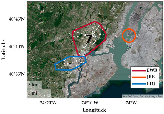
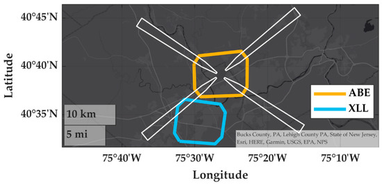
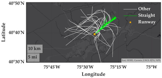
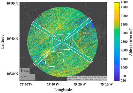
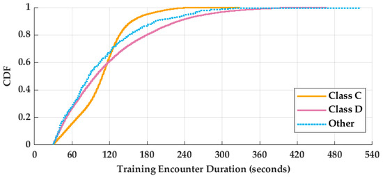
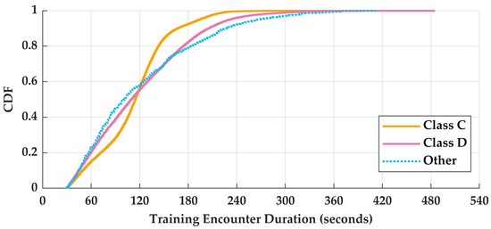
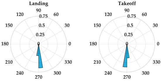
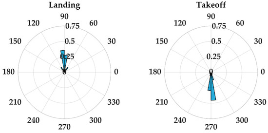
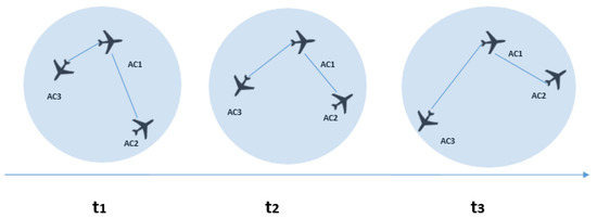
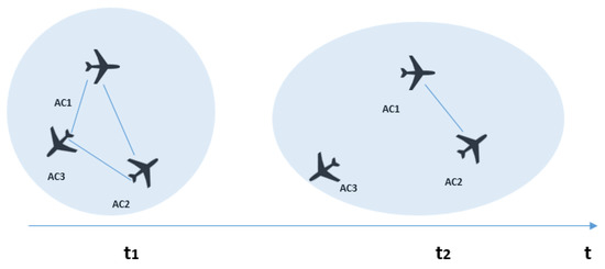
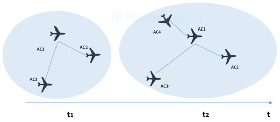
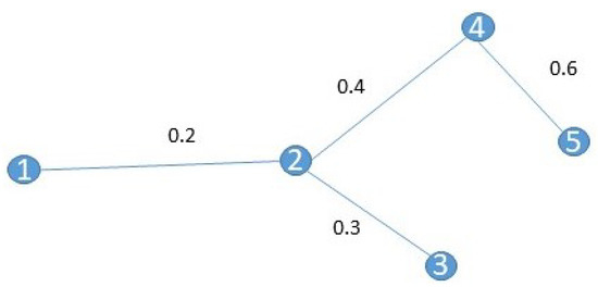
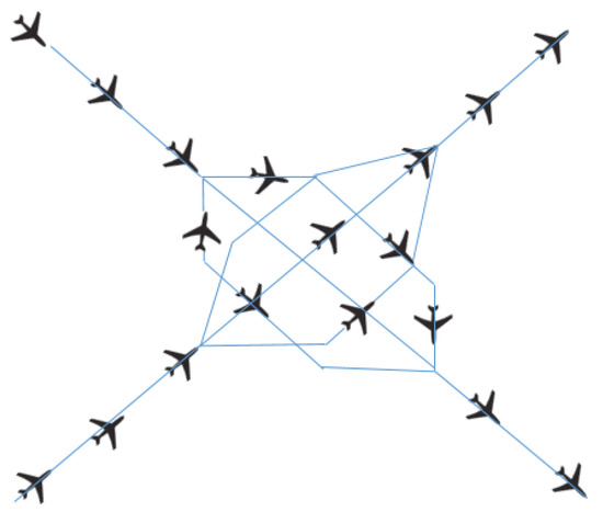
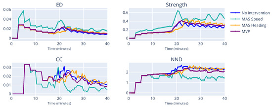
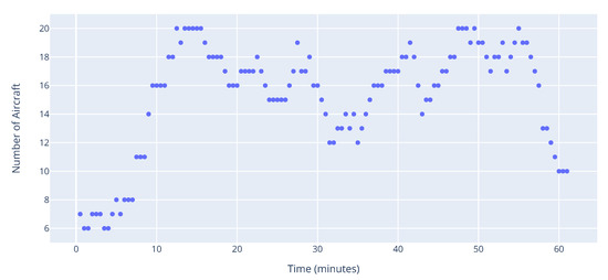
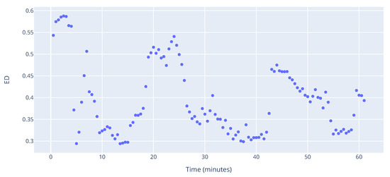
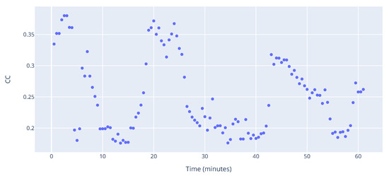
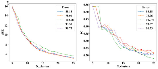
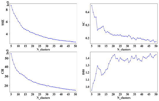
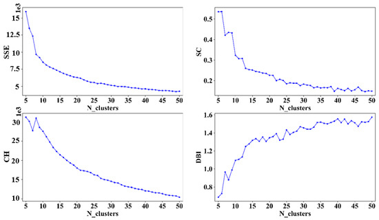
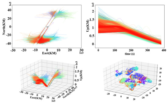
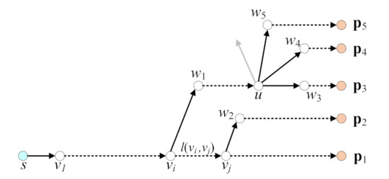
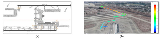
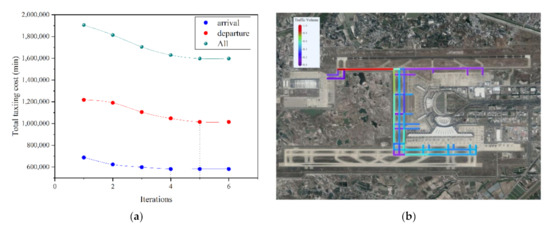
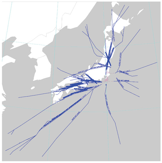
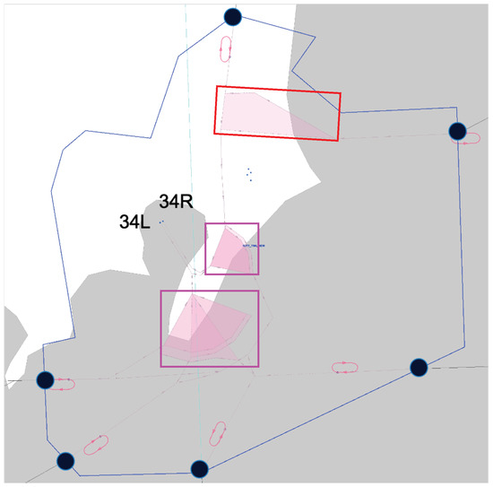
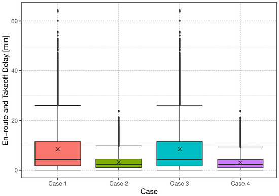
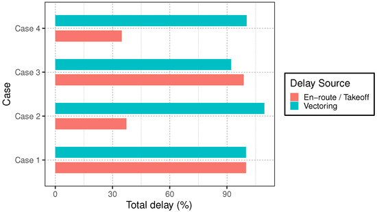
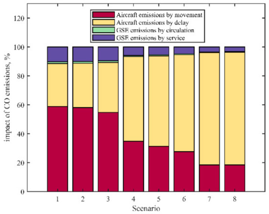
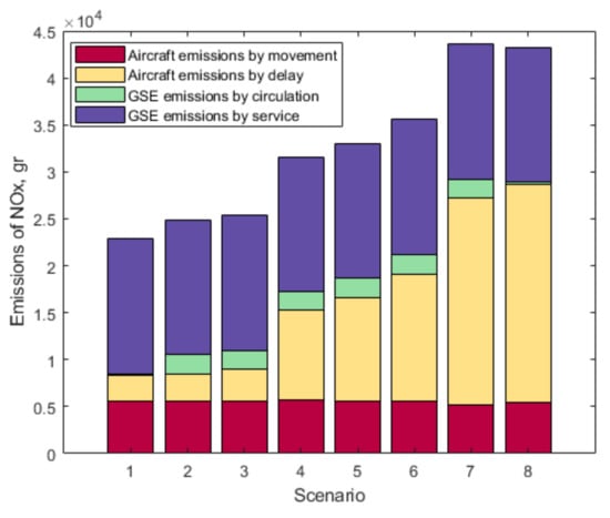
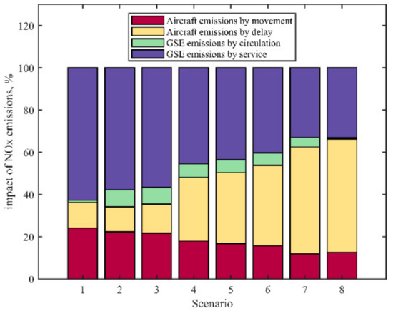
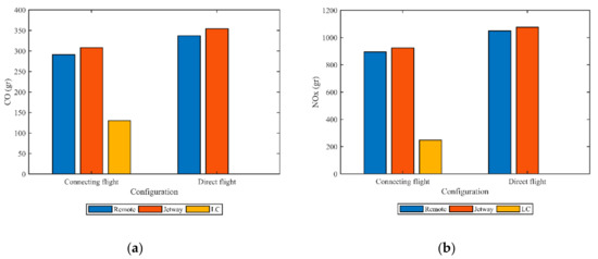
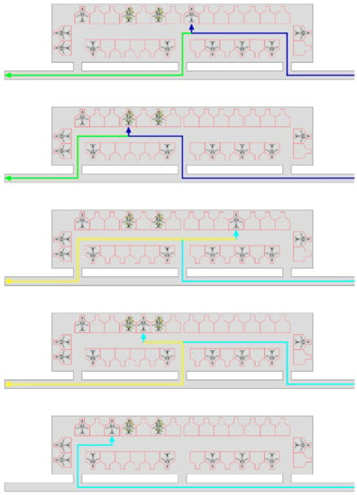
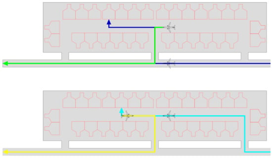
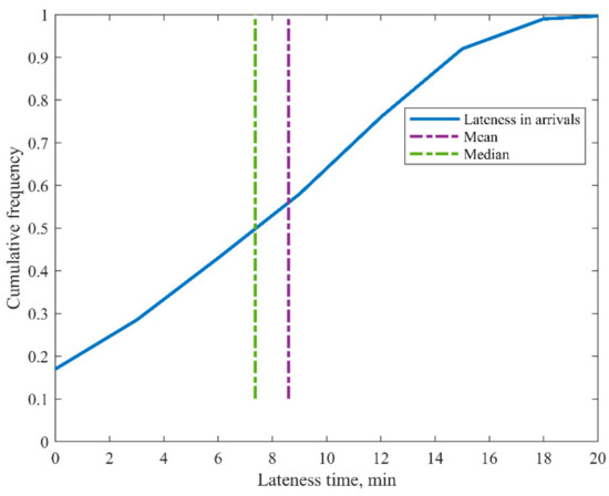
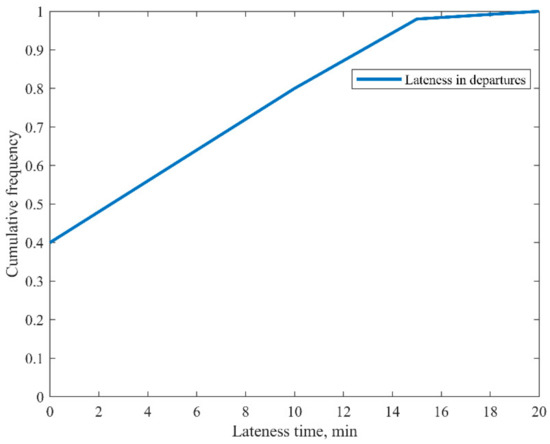
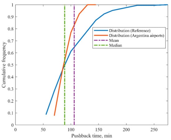
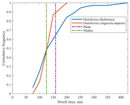
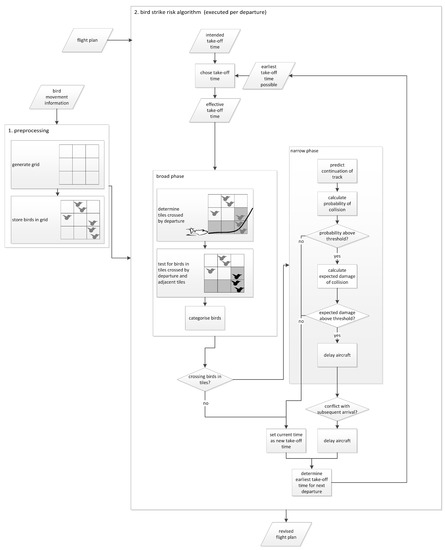
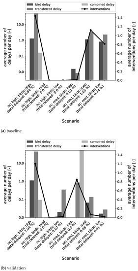
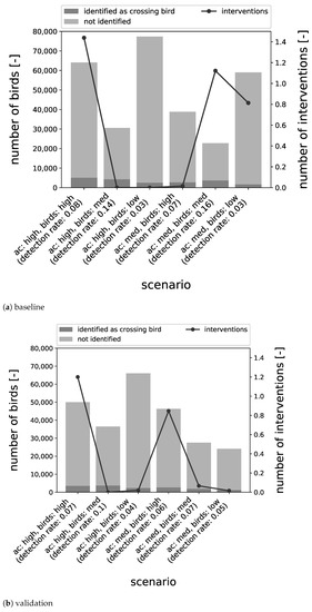
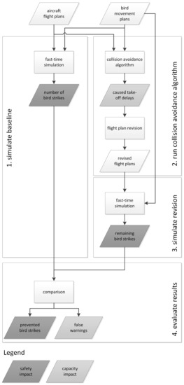
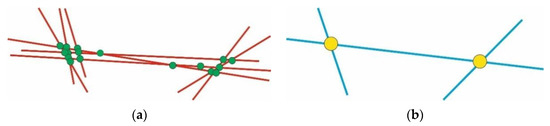
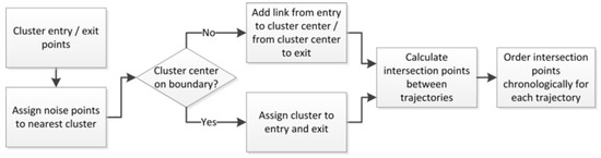
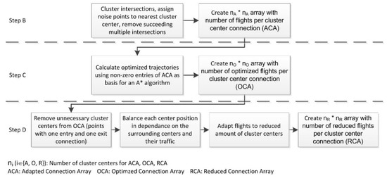
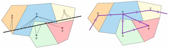
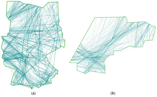
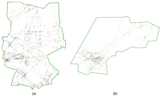
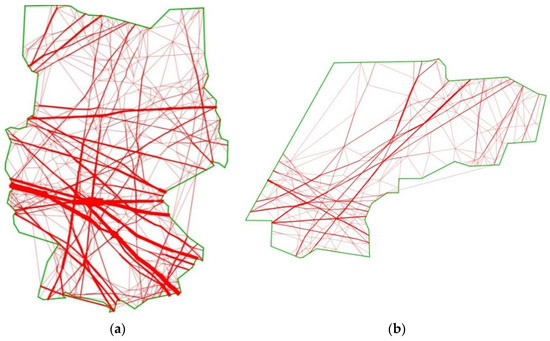
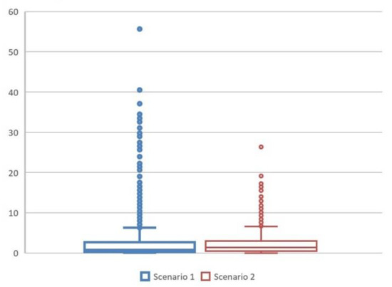
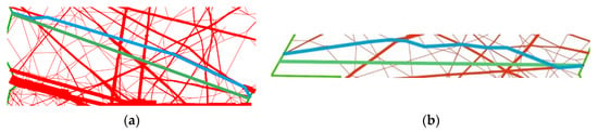
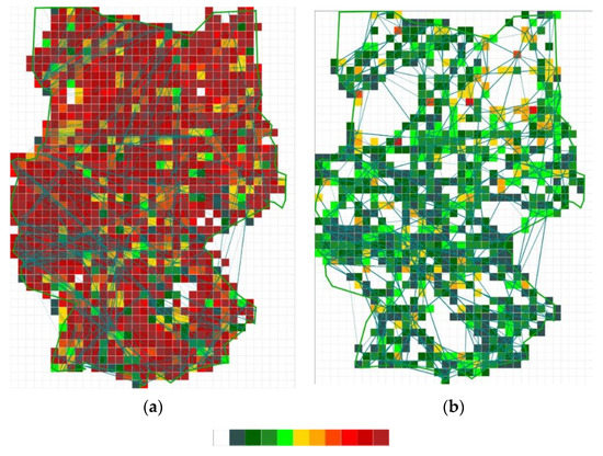
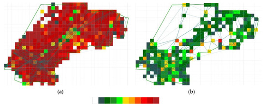
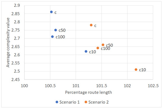
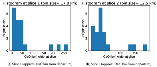
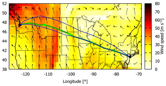
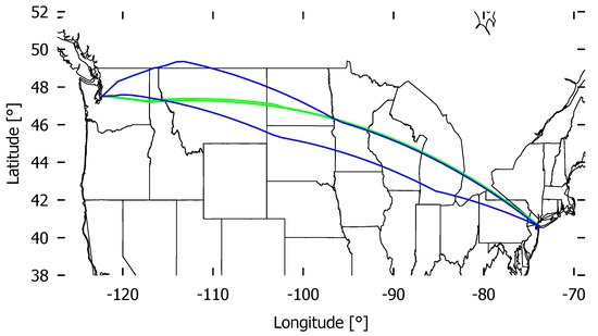
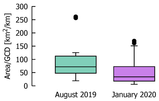
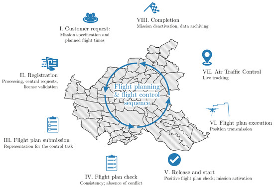
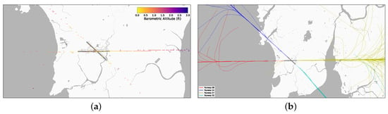
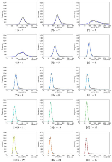
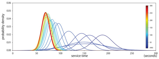
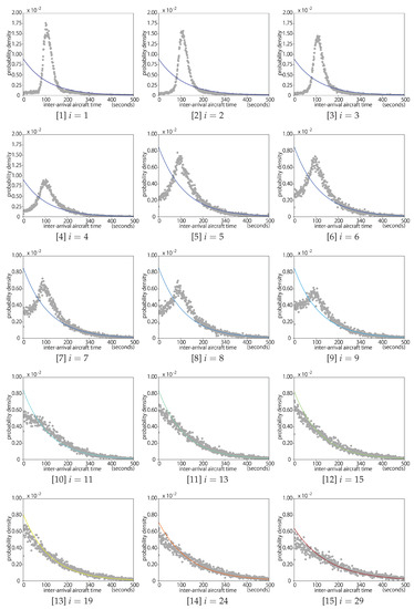
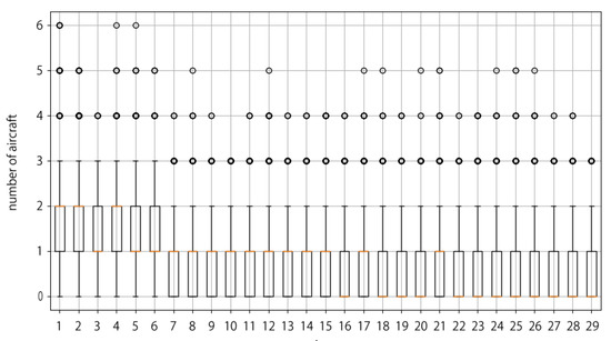
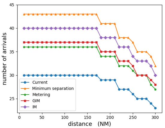
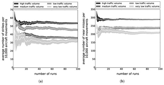
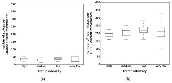
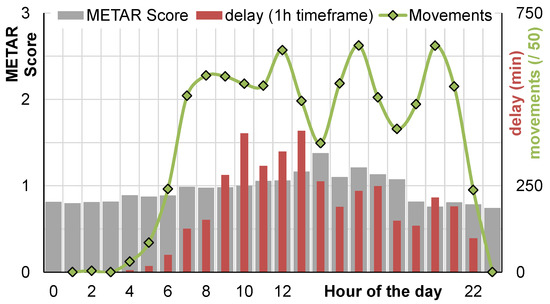
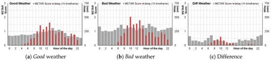
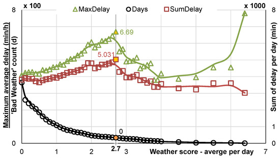
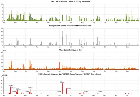
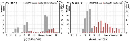
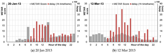
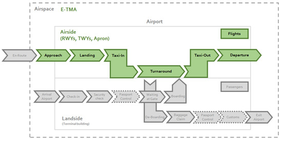
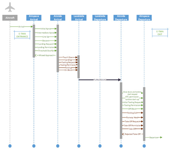
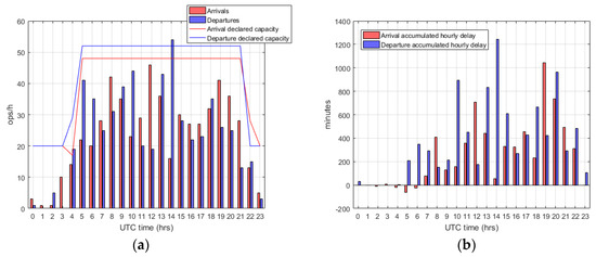
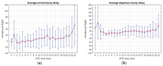
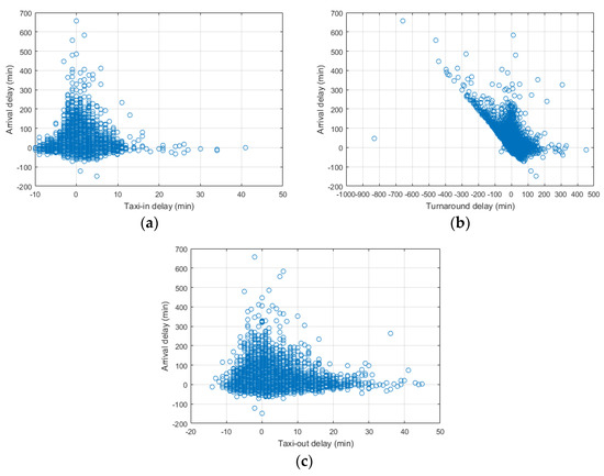
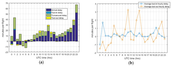
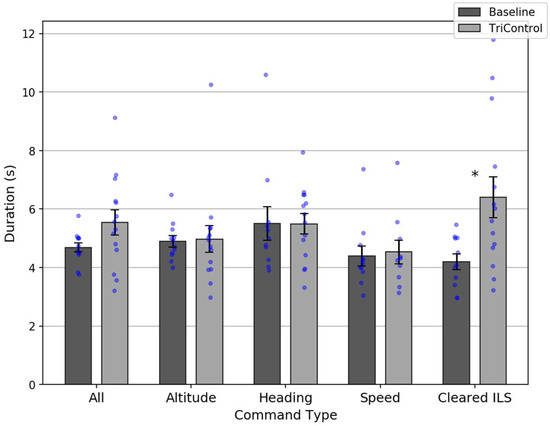
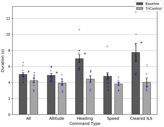
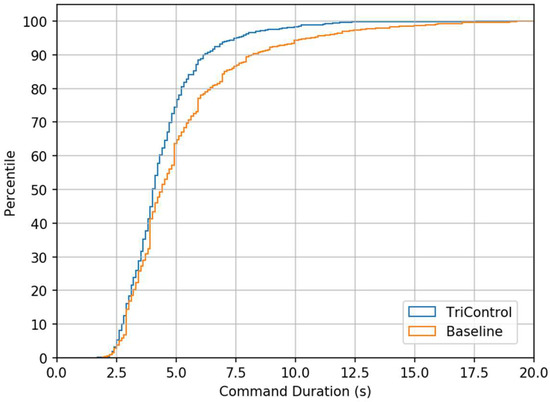
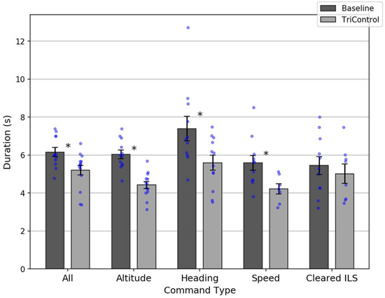
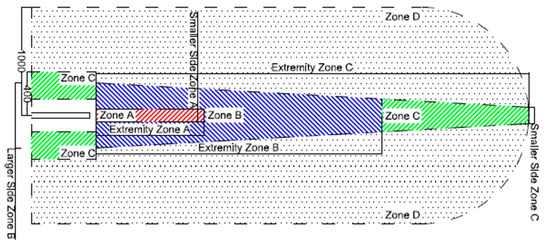
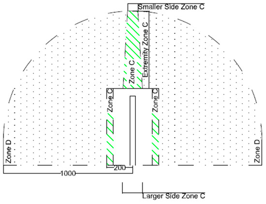
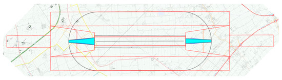
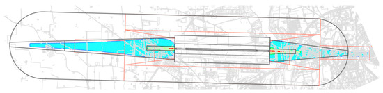
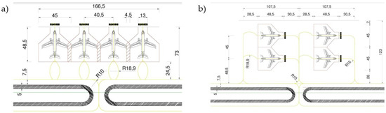
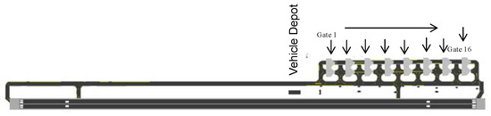
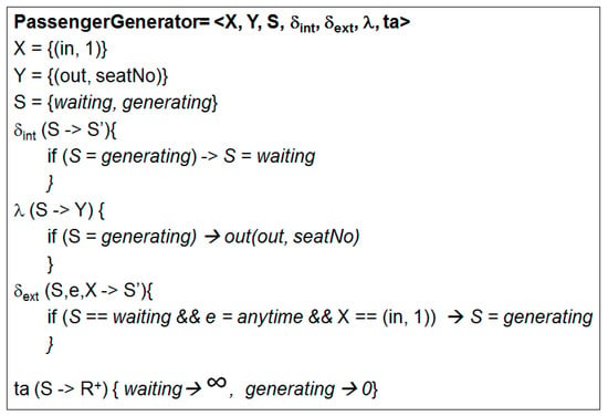
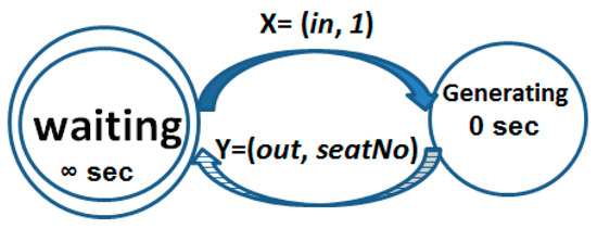
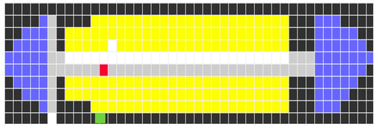
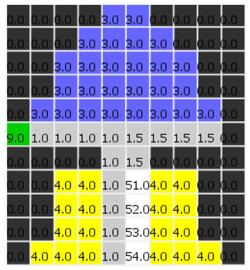
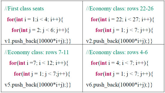
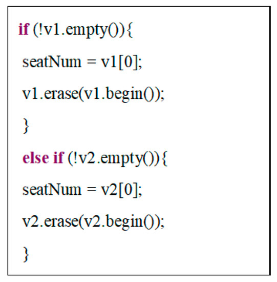
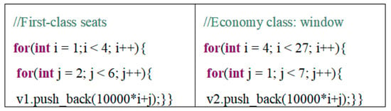
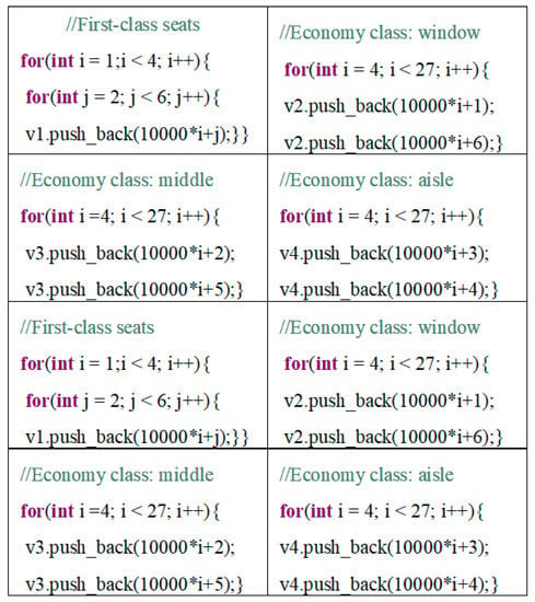
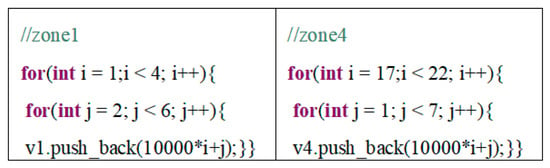
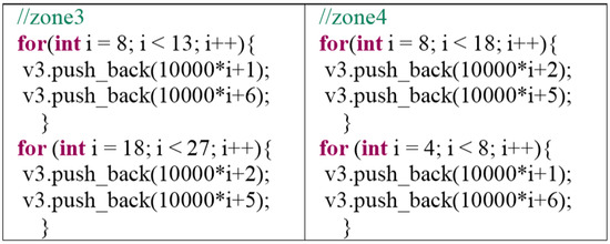
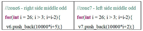
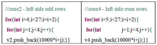
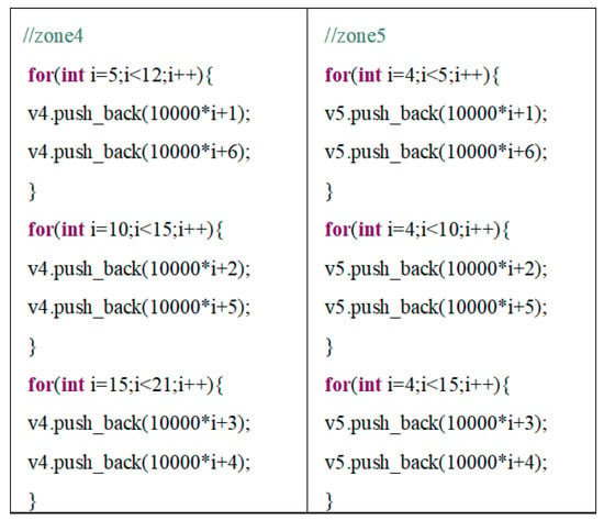
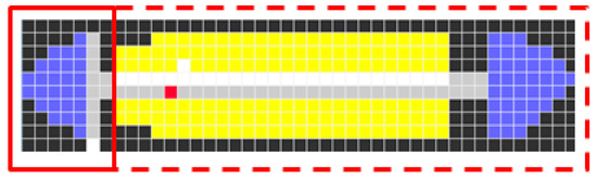
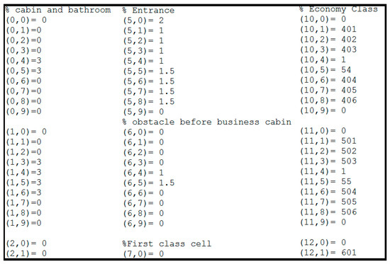
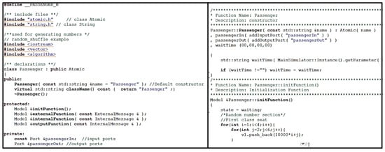
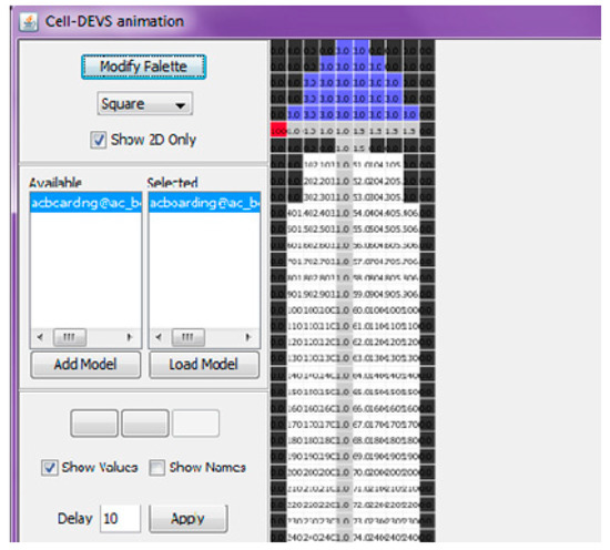
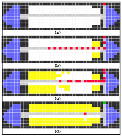
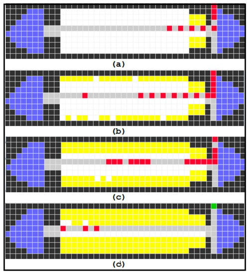
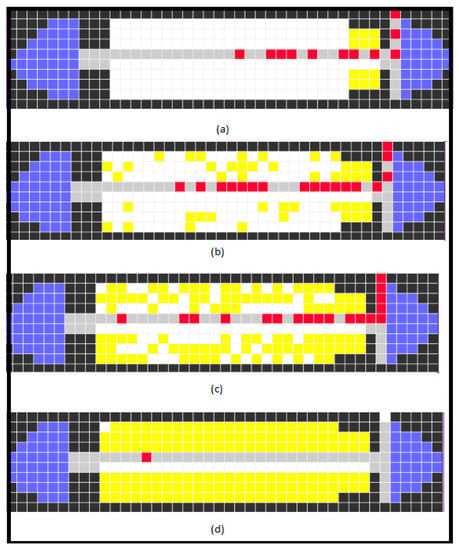
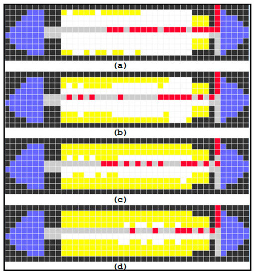
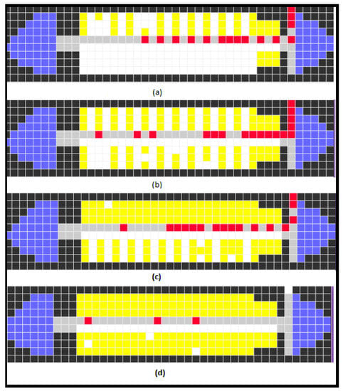
The aviation industry has proposed multiple solutions to reduce fuel consumption, air pollution, and noise at airports, one of which involves deploying electric trucks for aircraft towing between the stand and the runway. However, the introduction of tow trucks results in increased surface traffic, posing challenges from the perspective of air traffic controllers (ATCOs). Various solutions involving automated planning and execution have been proposed, but many are constrained by their inability to manage multiple active runways simultaneously, and their failure to account for the tow truck battery state of charge during assignments. This paper presents a novel system for taxi operations that employs autonomous tow trucks to enhance ground operations and address deficiencies in existing approaches. The system focuses on identifying conflict-free solutions that minimise taxi-related delays and route length while maximising the efficient use of the tow trucks. The algorithm operates at a strategic level and uses a centralised approach. It has the capacity to cater for multiple active runways and considers factors such as the tow truck battery state of charge and availability of charging stations. Furthermore, the proposed algorithm is capable of scheduling and routing tow trucks for aircraft taxiing without generating traffic conflicts.
Full article

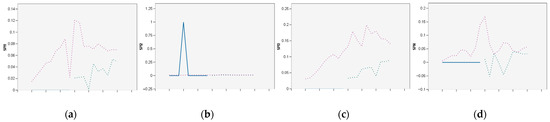
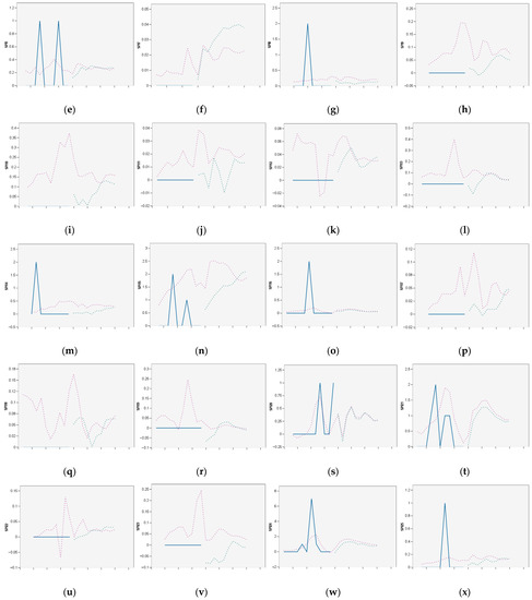
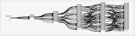
Figure 1


