Next Issue
Volume 29, ICCEIS 2022
Previous Issue
Volume 27, ECSA-9 2022
 
 
engproc-logo

Journal Browser

Journal Browser

Eng. Proc., 2022, OpenSky 2022

The 10th OpenSky Symposium

Delft, The Netherlands | 10–11 November 2022

Volume Editors:
Michael Schultz, Universität der Bundeswehr München, Germany
Junzi Sun, Delft University of Technology, The Netherlands
Xavier Olive, The French Aerospace Lab, France
Martin Strohmeier, OpenSky Network, Switzerland

Number of Papers: 19
  • Issues are regarded as officially published after their release is announced to the table of contents alert mailing list.
  • You may sign up for e-mail alerts to receive table of contents of newly released issues.
  • PDF is the official format for papers published in both, html and pdf forms. To view the papers in pdf format, click on the "PDF Full-text" link, and use the free Adobe Reader to open them.
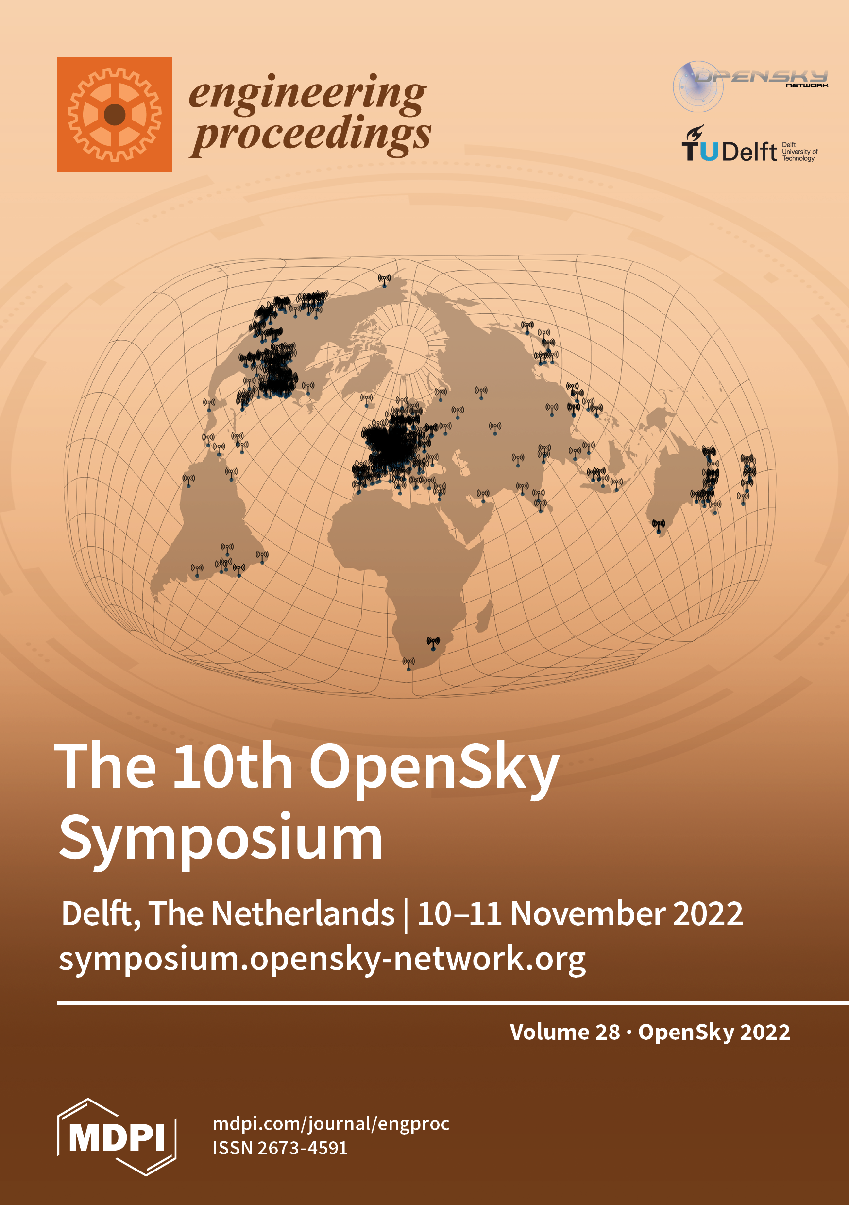
Cover Story (view full-size image): Since its launch in 2013, the OpenSky Network has quickly evolved to a large-scale air traffic control data collection and sharing platform. With more than 4500 sensors registered across the globe [...] Read more.
Order results
Result details
Select all
Export citation of selected articles as:

Editorial

Jump to: Other

1 pages, 174 KiB  
Editorial
Statement of Peer Review
by Michael Schultz, Junzi Sun, Xavier Olive and Martin Strohmeier
Eng. Proc. 2022, 28(1), 19; https://doi.org/10.3390/engproc2022028019 - 02 Feb 2023
Viewed by 719
Abstract
In submitting conference proceedings to Engineering Proceedings, the volume editors of the proceedings certify to the publisher that all papers published in this volume have been subjected to peer review administered by the volume editors [...] Full article
(This article belongs to the Proceedings of The 10th OpenSky Symposium)

Other

Jump to: Editorial

10 pages, 2134 KiB  
Proceeding Paper
A Quantitative Approach to Air Traffic Safety at Very Low Levels
by Xavier Olive and Patrick Le Blaye
Eng. Proc. 2022, 28(1), 1; https://doi.org/10.3390/engproc2022028001 - 13 Dec 2022
Cited by 1 | Viewed by 1180
Abstract
A safe integration of drone operations at very low levels, especially for beyond visual line-of-sight operations, must come with proper modeling of the mid-air collision risk at lower altitudes. In this paper, we present a state-of-the-art quantitative model for the air risk assessment [...] Read more.
A safe integration of drone operations at very low levels, especially for beyond visual line-of-sight operations, must come with proper modeling of the mid-air collision risk at lower altitudes. In this paper, we present a state-of-the-art quantitative model for the air risk assessment of unmanned aircraft system (UAS) operations and illustrate how cooperative technologies such ADS-B and FLARM, together with networks of compatible ground receivers, are crucial to provide the traffic data required to support this model. An application over an area of Southeastern France is presented. The results suggest that the collected traffic data allow accurate analyses of the spatial and temporal variation of traffic types and density at lower altitudes, and can thus support an objective assessment of the risk of collision of UAS with manned traffic. Full article
(This article belongs to the Proceedings of The 10th OpenSky Symposium)
Show Figures

Figure 1

10 pages, 910 KiB  
Proceeding Paper
Large Landing Trajectory Dataset for Go-Around Analysis
by Raphael Monstein, Benoit Figuet, Timothé Krauth, Manuel Waltert and Marcel Dettling
Eng. Proc. 2022, 28(1), 2; https://doi.org/10.3390/engproc2022028002 - 13 Dec 2022
Cited by 1 | Viewed by 1931
Abstract
The analysis and prediction of go-arounds, also referred to as missed approaches, is an active field of research due to the go-around’s impact on safety and the disruption of the traffic flow at airports. The advent of open-source aircraft trajectories available to researchers [...] Read more.
The analysis and prediction of go-arounds, also referred to as missed approaches, is an active field of research due to the go-around’s impact on safety and the disruption of the traffic flow at airports. The advent of open-source aircraft trajectories available to researchers has increased the level of interest in the field. This paper introduces a publicly available dataset containing metadata of almost 9 million landings and 33,000 go-arounds. The dataset is based on observations from the OpenSky Network and includes data from 176 airports in 44 countries observed in the year 2019. After downloading the data, a go-around classification was performed and the quality was assessed. The usefulness of the dataset is illustrated with two novel example applications. The first example shows how the go-around rate for a runway can be modeled by using a quasi-binomial generalized linear model, while the second example compares the go-around rates for a number of airport–airline pairs. The introduced dataset is significantly larger than the data used so far in the analysis of go-arounds and provides the opportunity to develop novel use cases. This dataset frees researchers from having to collect and process large amounts of data and instead lets them focus on the analysis. The authors are convinced that this large dataset will stoke the creativity of the research community and facilitate interesting and novel applications. Full article
(This article belongs to the Proceedings of The 10th OpenSky Symposium)
Show Figures

Figure 1

6 pages, 9709 KiB  
Proceeding Paper
Using OpenSky Data for Teaching Software Engineering to Undergraduates
by Kai Renz
Eng. Proc. 2022, 28(1), 3; https://doi.org/10.3390/engproc2022028003 - 14 Dec 2022
Viewed by 1157
Abstract
In the past year, the author has been using the OpenSky ressources for teaching purposes in the context of Software-Engineering courses for undergraduates at the Darmstadt University of Applied Sciences (Germany). Challenges in using the OpenSky-Online-API during hands-on sessions with groups of students [...] Read more.
In the past year, the author has been using the OpenSky ressources for teaching purposes in the context of Software-Engineering courses for undergraduates at the Darmstadt University of Applied Sciences (Germany). Challenges in using the OpenSky-Online-API during hands-on sessions with groups of students could be found in the following areas: restrictions on the update frequency for data-retrieval calls when using the same IP address from the university network; necessity to create logins for accessing data for a specific timestamp; and a lack of student understanding of basic flight-data terminology, including geographic location. The OpenSky-Network data was used to teach Software-Engineering topics with the focus on professional software tests including UI-Testing with an OpenLayer visualization, testing of network connectivity using a circuit breaker, and the usage of mocks and stubs to obtain independent integration tests. To overcome the technological limitations of the data retrieval, a simple flight-data proxy was implemented to be used instead of the actual OpenSky website. This paper gives some insights into the specific testing topics covered by the course and the usage of OpenSky flight data. Some future improvements are suggested so that undergraduate students can further get to know the interesting field of flight-data processing while learning essential techniques for professional software testing. Full article
(This article belongs to the Proceedings of The 10th OpenSky Symposium)
Show Figures

Figure 1

10 pages, 631 KiB  
Proceeding Paper
Construction of a Radar Cross-Section Database Using ADS-B Data from the OpenSky Network
by Milan Rozel, Nicolas Gonçalves, Alec Reygrobellet and Pierre Bruneel
Eng. Proc. 2022, 28(1), 4; https://doi.org/10.3390/engproc2022028004 - 15 Dec 2022
Cited by 2 | Viewed by 1627
Abstract
Building a labeled database usually requires extensive work when the labeling is not automated. This paper presents a methodology to build a labeled database of aircraft radar signature (specifically radar cross section) using the OpenSky Network data. This method relies on a radar [...] Read more.
Building a labeled database usually requires extensive work when the labeling is not automated. This paper presents a methodology to build a labeled database of aircraft radar signature (specifically radar cross section) using the OpenSky Network data. This method relies on a radar system steered by the live API to automatically select, track and measure target aircraft according to custom user rules. The OpenSky ADS-B database allows for an efficient processing of the radar data, as it provides ranging and speed information to locate the region of interest inside the radar data. In addition, the ADS-B and Mode-S databases give an estimate of the attitude of the aircraft, which is paramount for signature measurement. We also compare the ADS-B data with the radar data. Full article
(This article belongs to the Proceedings of The 10th OpenSky Symposium)
Show Figures

Figure 1

9 pages, 1351 KiB  
Proceeding Paper
Aircraft Go-Arounds Associated to Vessel Traffic: Hamburg Finkenwerder Case Study
by Emy Arts, Alexander Kamtsiuris, Florian Raddatz and Gerko Wende
Eng. Proc. 2022, 28(1), 5; https://doi.org/10.3390/engproc2022028005 - 15 Dec 2022
Viewed by 881
Abstract
An aircraft go-around is a costly yet safety critical procedure. While there are many reasons to decide that a go-around is necessary, at Hamburg Finkenwerder airport (EDHI) there is a rather peculiar one: vessel traffic crossing the approach path. As both vessels and [...] Read more.
An aircraft go-around is a costly yet safety critical procedure. While there are many reasons to decide that a go-around is necessary, at Hamburg Finkenwerder airport (EDHI) there is a rather peculiar one: vessel traffic crossing the approach path. As both vessels and aircraft transmit their position at regular intervals through the Automatic Identification System (AIS) and Automatic Dependent Surveillance Broadcast (ADS-B) protocols it is possible to identify vessels that can cause problems to the aircraft’s approach. In this work we identified a 10 time higher than average go-around incidence at Finkenwerder airport and were able to find evidence of its relation to large passing vessels. As vessel traffic has a mostly stable course and speed, we found it is possible to predict the passing vessels well ahead of time in order to determine the best approach and reduce the number of go-arounds, allowing to save both fuel and emissions. Full article
(This article belongs to the Proceedings of The 10th OpenSky Symposium)
Show Figures

Figure 1

10 pages, 3764 KiB  
Proceeding Paper
A Geometric Approach to Study Aircraft Trajectories: The Benefits of OpenSky Network ADS-B Data
by Rémi Perrichon, Xavier Gendre and Thierry Klein
Eng. Proc. 2022, 28(1), 6; https://doi.org/10.3390/engproc2022028006 - 15 Dec 2022
Viewed by 1823
Abstract
To date, statistical analyses of aircraft trajectories have been under-exploited in the Airspace Traffic Management (ATM) literature. One reason is the need for advanced methods to tackle the high sampling irregularities and temporal correlations that both characterize trajectories. Differential geometry provides a relevant [...] Read more.
To date, statistical analyses of aircraft trajectories have been under-exploited in the Airspace Traffic Management (ATM) literature. One reason is the need for advanced methods to tackle the high sampling irregularities and temporal correlations that both characterize trajectories. Differential geometry provides a relevant framework to study trajectories. By modeling trajectories as parameterized curves, shape analysis allows us to answer operational questions. This work presents a geodesic distance that rigorously defines and quantifies shape differences between aircraft trajectories. The key idea is to compare how the shape of a given trajectory changes from one popular data set (the Eurocontrol R&D data archive) to another one (OpenSky Network ADS-B data). Distances and geodesic paths are computed for a sample of flights that departed from Toulouse–Blagnac (LFBO) and landed at Paris–Orly (LFPO) in 2019. Its use for clustering purposes is illustrated and discussed. Full article
(This article belongs to the Proceedings of The 10th OpenSky Symposium)
Show Figures

Figure 1

10 pages, 370 KiB  
Proceeding Paper
Evading the Public Eye: On Astroturfing in Open Aviation Data
by Martin Strohmeier, Xavier Olive and Junzi Sun
Eng. Proc. 2022, 28(1), 7; https://doi.org/10.3390/engproc2022028007 - 15 Dec 2022
Cited by 1 | Viewed by 5990
Abstract
The usage of large private and business jets, from those owned by Elon Musk to Kylie Jenner and Bernard Arnault, has recently attracted considerable attention in many countries. Enabled by open and crowdsourced aircraft tracking systems based on the automatic dependent surveillance–broadcast protocol, [...] Read more.
The usage of large private and business jets, from those owned by Elon Musk to Kylie Jenner and Bernard Arnault, has recently attracted considerable attention in many countries. Enabled by open and crowdsourced aircraft tracking systems based on the automatic dependent surveillance–broadcast protocol, the aircraft and their owners have been scrutinized. While the underlying technology is not novel and its privacy issues have been discussed for years, the increased attention has led to the backlash against open tracking data and, consequently, a scramble to find possible solutions to hide private jets from the public eye. In this paper, we analyze two such methods, which have not yet been discussed previously in the literature: blocking requests to web tracking platforms and malicious editing of crowdsourced databases. We draw on data from the OpenSky Network and illustrate the futility of such approaches. Finally, we outline the type of stakeholders and aircraft deploying such methods, as well as demonstrate the level of environmental impact that might have otherwise been missed by the public. Full article
(This article belongs to the Proceedings of The 10th OpenSky Symposium)
Show Figures

Figure 1

9 pages, 945 KiB  
Proceeding Paper
Usage of Geometric Altitude for Radar Plot Position Improvements
by Helmut Puhr
Eng. Proc. 2022, 28(1), 8; https://doi.org/10.3390/engproc2022028008 - 15 Dec 2022
Viewed by 1376
Abstract
In ATC Tracking applications, the barometric altitude of measured aircraft is predominantly used as a substitute for the geometric altitude in slant range correction of Radar target reports, introducing position errors. With ADS-B being frequently available and of increasing quality, a reliable source [...] Read more.
In ATC Tracking applications, the barometric altitude of measured aircraft is predominantly used as a substitute for the geometric altitude in slant range correction of Radar target reports, introducing position errors. With ADS-B being frequently available and of increasing quality, a reliable source for geometric altitude information has become available, allowing for improvements in Radar plot position accuracy. In the presented work, the availability, quality, modeling and reconstruction of such geometric altitude information are reviewed and discussed in relation to current solutions based on barometric altitude. For a single Radar, options for accuracy improvement are described and assessed in comparison to reference data, i.e., ATC Tracker output and real-live meteorological measurements. The application of the discussed ADS-B-based methods can be used to improve Radar plot position accuracy, contributing to aircraft surveillance cost-efficiency and safety. Full article
(This article belongs to the Proceedings of The 10th OpenSky Symposium)
Show Figures

Figure 1

7 pages, 204 KiB  
Proceeding Paper
Open-Source Flight Data: Free, but at What Cost?
by James Norman
Eng. Proc. 2022, 28(1), 9; https://doi.org/10.3390/engproc2022028009 - 16 Dec 2022
Cited by 1 | Viewed by 2020
Abstract
The proliferation of open-source flight data has been heralded throughout the aviation industry, from air traffic service providers seeking efficiencies to the voyeuristic tracking of celebrity aircraft movements. However, the rise of open-source data presents challenges when juxtaposed against the traditional safety management [...] Read more.
The proliferation of open-source flight data has been heralded throughout the aviation industry, from air traffic service providers seeking efficiencies to the voyeuristic tracking of celebrity aircraft movements. However, the rise of open-source data presents challenges when juxtaposed against the traditional safety management systems that have sustained commercial aviation until now. Open-source data are not protected legally to the same extent as traditional flight data, and data from open-source platforms are not subject to the same validation standards as traditional flight data. Pilots are now able to interface with their own flight data, which diverges from the original aggregate intent of flight data monitoring programs. This paper addresses regulatory, legal, and ethical topics pertaining to the use of open-source data in U.S. commercial aviation, and offers recommendations to the industry in light of the new data landscape. Full article
(This article belongs to the Proceedings of The 10th OpenSky Symposium)
10 pages, 13961 KiB  
Proceeding Paper
Analysis of Helicopter Flights in Urban Environments for UAV Traffic Management
by David Hünemohr, Maximilian Bauer, Jan Kleikemper and Markus Peukert
Eng. Proc. 2022, 28(1), 10; https://doi.org/10.3390/engproc2022028010 - 20 Dec 2022
Cited by 1 | Viewed by 1502
Abstract
Future air mobility will consist of increased unmanned aerial vehicle (UAV) traffic operating in urban areas. Currently, the lower airspace in these environments is mainly used by traffic operating under visual flight rules, particularly helicopters in emergency medical services (HEMS). In the presented [...] Read more.
Future air mobility will consist of increased unmanned aerial vehicle (UAV) traffic operating in urban areas. Currently, the lower airspace in these environments is mainly used by traffic operating under visual flight rules, particularly helicopters in emergency medical services (HEMS). In the presented work, we analyze urban HEMS missions with automatic dependent surveillance-broadcast (ADS-B) data to identify the potential benefits to support UAV traffic management (UTM). In our methodology, we first restrict an existing HEMS ADS-B data set to a specific city and then further process it to extract the valid HEMS flights. Because no other mission information is available, we apply rule-based algorithms to define different helicopter flight segments and characterize specific HEMS mission segments. The resulting data set is analyzed to extract the characteristic information about the HEMS traffic within the city. The methodology is applied to the ADS-B HEMS flight data in the area of Berlin. The results show that the HEMS and flight segments can be identified robustly, and specific flight patterns are characteristic for them. Based on the results of this analysis, UAV traffic alert strategies are proposed to demonstrate the potential benefit of integrating ADS-B data statistics for UTM. Full article
(This article belongs to the Proceedings of The 10th OpenSky Symposium)
Show Figures

Figure 1

10 pages, 4447 KiB  
Proceeding Paper
Terminal Manoeuvre Area Effects on Aircraft Engine Dust Ingestion
by Daniel Rotherham, Nicholas Bojdo, Antonio Filippone and Ben Parkes
Eng. Proc. 2022, 28(1), 11; https://doi.org/10.3390/engproc2022028011 - 20 Dec 2022
Cited by 1 | Viewed by 1668
Abstract
Aircraft manufacturers and airlines invest large amounts of money into making air travel more sustainable to reduce the effects of global warming. Extending the in-service life of aeroengines through route optimisation is one method to contribute to the sustainability of aviation. Atmospheric dust [...] Read more.
Aircraft manufacturers and airlines invest large amounts of money into making air travel more sustainable to reduce the effects of global warming. Extending the in-service life of aeroengines through route optimisation is one method to contribute to the sustainability of aviation. Atmospheric dust ingestion leads to premature failure of engine components, increased fuel burn due to loss of efficiency, and shortened maintenance intervals. A methodology that takes a fleet-based approach to quantify the dust exposure experienced by aircraft, primarily operated within the Persian Gulf, has been developed to investigate opportunities for mitigating engine damage by atmospheric dust. The variations in dust loading experienced by a Middle Eastern Low-Cost Carrier’s (LCC) fleet were analysed by combining the Copernicus Atmospheric Monitoring Services (CAMS) dust reanalysis dataset with the OpenSky Network’s open-source trajectory data pool. It is found that runway orientation and patterns of traffic arrival have a direct bearing on the amount of dust encountered by aircraft engines. Full article
(This article belongs to the Proceedings of The 10th OpenSky Symposium)
Show Figures

Figure 1

10 pages, 2330 KiB  
Proceeding Paper
GNSS Jamming and Its Effect on Air Traffic in Eastern Europe
by Benoit Figuet, Manuel Waltert, Michael Felux and Xavier Olive
Eng. Proc. 2022, 28(1), 12; https://doi.org/10.3390/engproc2022028012 - 20 Dec 2022
Cited by 4 | Viewed by 1679
Abstract
Global navigation satellite systems technology is at the core of modern air traffic navigation. Aircraft use it to estimate their position, while air navigation service providers rely on services such as automatic dependent surveillance broadcast which have been enabled by this technology. Since [...] Read more.
Global navigation satellite systems technology is at the core of modern air traffic navigation. Aircraft use it to estimate their position, while air navigation service providers rely on services such as automatic dependent surveillance broadcast which have been enabled by this technology. Since satellite signals are very low in power, they are susceptible to radio frequency interference activities, which can have a significant impact on aviation. This paper illustrates how crowd-sourced automatic dependent surveillance data transmitted by aircraft can be used to gain situational awareness about radio frequency interference and how air traffic over Eastern Europe has been impacted by interference activities over a period spanning from February to August 2022. The results suggest that satellite navigation signals were subject to interference of varying strength and duration. We observed several days when more than 1000 flights were affected, representing 60% of the daily traffic in the analysed area. Furthermore, the extent of the interference impact on aviation depends on the altitude of the aircraft, as low-flying aircraft tend to be less affected by interference than the ones flying at higher altitudes. Consequently, this paper contributes to a better understanding of how civil aviation is affected by radio frequency interference and where such disturbances may occur. Full article
(This article belongs to the Proceedings of The 10th OpenSky Symposium)
Show Figures

Figure 1

10 pages, 1184 KiB  
Proceeding Paper
Environmental Footprint of Private and Business Jets
by Junzi Sun, Xavier Olive and Martin Strohmeier
Eng. Proc. 2022, 28(1), 13; https://doi.org/10.3390/engproc2022028013 - 21 Dec 2022
Cited by 3 | Viewed by 5455
Abstract
Civil aviation contributes to rising global greenhouse gas emissions. Flights carried out by private and business jets are only a very small fraction of commercial passenger flights. However, these private flights are extremely environmentally inefficient and account for the most emissions per passenger [...] Read more.
Civil aviation contributes to rising global greenhouse gas emissions. Flights carried out by private and business jets are only a very small fraction of commercial passenger flights. However, these private flights are extremely environmentally inefficient and account for the most emissions per passenger in the aviation sector. While the commercial aviation sector has been under increased scrutiny by environmentalists for years, the footprint of private and business jets has entered the public eye only very recently. Social media provides new ways for sharing individual private flights, but the large-scale analysis of private jet flights and their emissions has been lacking until now. To better inform this discussion, we use open and large-scale flight data collected by the OpenSky Network over fours years and apply the OpenAP model in order to estimate the emissions of around 250 private jets. The total carbon emissions is found to be between 0.45 and 0.5 megatonnes. The yearly emissions from these selected jets is equivalent to 40,000 global inhabitant emissions. In our analysis, we provide further insight into private jet emissions and raise awareness about the emission inequalities in the current aviation system. Full article
(This article belongs to the Proceedings of The 10th OpenSky Symposium)
Show Figures

Figure 1

9 pages, 2476 KiB  
Proceeding Paper
ATC Level Tactical Manoeuvring during Descent for Mitigating Impact of ADS-B Message Injection Cyber Attack
by Mohd Ruzeiny Kamaruzzaman, Mohammad Delwar Hossain, Yuzo Taenaka and Youki Kadobayashi
Eng. Proc. 2022, 28(1), 14; https://doi.org/10.3390/engproc2022028014 - 21 Dec 2022
Cited by 1 | Viewed by 1130
Abstract
To reduce delays caused by an ADS-B Message Injection attack, we propose an Air Traffic Control (ATC) level tactical manoeuvring framework for maintaining safe flight trajectories while reducing diversion from the original trajectory during the descent phase. This framework is formed based on [...] Read more.
To reduce delays caused by an ADS-B Message Injection attack, we propose an Air Traffic Control (ATC) level tactical manoeuvring framework for maintaining safe flight trajectories while reducing diversion from the original trajectory during the descent phase. This framework is formed based on three key elements: a high impact attack scenario, the consideration of the standard ATC incidence response, and safety manoeuvring with reduced diversion for the affected aircraft. Simulation results showed that the tactical manoeuvring records a faster time to return to the original path prior to the attack incident compared to a conventional simplified safe diversion instructed by the ATC. Full article
(This article belongs to the Proceedings of The 10th OpenSky Symposium)
Show Figures

Figure 1

9 pages, 3351 KiB  
Proceeding Paper
Evaluation of the Noise Benefits from Performing CDO in TMA Using OpenSky Data
by Henrik Hardell and Tatiana Polishchuk
Eng. Proc. 2022, 28(1), 15; https://doi.org/10.3390/engproc2022028015 - 26 Dec 2022
Viewed by 896
Abstract
Exposure to high levels of noise negatively affects human health. The noise produced by aircraft engines is strong enough to reach well beyond the limits suggested by the World Health Organisation (WHO) and it is estimated that the health and well-being of millions [...] Read more.
Exposure to high levels of noise negatively affects human health. The noise produced by aircraft engines is strong enough to reach well beyond the limits suggested by the World Health Organisation (WHO) and it is estimated that the health and well-being of millions of people in Europe is impaired by aircraft noise. In this work, we estimate the potential benefits from performing a continuous descent operation (CDO) in the terminal maneuvering area (TMA), by comparing the noise and emissions calculated for the actual aircraft trajectories, obtained from the OpenSky network database, to a more efficient descent, where the engines are running at idle thrust. To model the aircraft performance, we use the Base of Aircraft Data (BADA), while IMPACT is used for calculating noise and emissions. We consider three European airports (Stockholm-Arlanda, Vienna and Dublin) focusing on the busy periods in 2019 and the most used arrival runways at each airport. Even though the highest levels of noise are experienced during take-off and the the initial climb-phase, where aircraft engines are operating at a high thrust setting, as well as during the final approach segment, where aircraft are closer to the ground, the results of our study suggest that noise-related benefits may also be obtained for areas further away from an airport when arriving aircraft perform CDOs. Additionally, we observe that while most of the emissions decrease when aircraft perform CDOs, some components, such as carbon monoxide (CO) and hydrocarbon (HC) may also increase. Full article
(This article belongs to the Proceedings of The 10th OpenSky Symposium)
Show Figures

Figure 1

9 pages, 13763 KiB  
Proceeding Paper
Investigating the Occurrence of Aircraft Exhaust Plume Intersections Using Open-Source Air Traffic Data
by Kieran N. Tait, Stephen Roome and Joshua Hoole
Eng. Proc. 2022, 28(1), 16; https://doi.org/10.3390/engproc2022028016 - 27 Dec 2022
Viewed by 1065
Abstract
It is well established that the climate impact of aircraft non-CO2 emissions can be reduced by optimising flight routes to avoid climate-sensitive areas. Little research has been conducted, however, on the effect of residual emissions from nearby aircraft on local atmospheric chemistry [...] Read more.
It is well established that the climate impact of aircraft non-CO2 emissions can be reduced by optimising flight routes to avoid climate-sensitive areas. Little research has been conducted, however, on the effect of residual emissions from nearby aircraft on local atmospheric chemistry and how this may alter the route optimisation process. This paper aims to address these unknowns by observing air traffic data and identifying key hot-spot regions where aircraft plumes are likely to overlap. Providing real-world evidence of these occurrences will serve to justify future atmospheric modelling studies into these effects. Full article
(This article belongs to the Proceedings of The 10th OpenSky Symposium)
Show Figures

Figure 1

10 pages, 3793 KiB  
Proceeding Paper
Using MobilityDB and Grafana for Aviation Trajectory Analysis
by Adam Broniewski, Mohammad Ismail Tirmizi, Esteban Zimányi and Mahmoud Sakr
Eng. Proc. 2022, 28(1), 17; https://doi.org/10.3390/engproc2022028017 - 10 Jan 2023
Viewed by 1589
Abstract
Air traffic management (ATM) requires the handling big data of moving objects, such as flight trajectories. There is, however, a lack of specialized tools for trajectory-data management, where the spatiotemporal data are first class citizens. Instead, specialized algorithms for trajectory-data management are built [...] Read more.
Air traffic management (ATM) requires the handling big data of moving objects, such as flight trajectories. There is, however, a lack of specialized tools for trajectory-data management, where the spatiotemporal data are first class citizens. Instead, specialized algorithms for trajectory-data management are built on top of existing geospatial tools. In this paper, we showcase MobilityDB, which is an open-source database for moving objects. MobilityDB is developed as an extension to PostgreSQL and PostGIS that specializes in the storage and processing of trajectory data. Its data model integrates spatiotemporal and temporal types as first class citizens in the database. It thus allows one to perform complex spatial and spatiotemporal queries. This paper presents how to combine MobilityDB with Grafana, an open-source dashboard tool, to perform basic and advanced queries and interact with Grafana visualization. A use case for flight trajectories, based on the OpenSky Network data, is illustrated. Full article
(This article belongs to the Proceedings of The 10th OpenSky Symposium)
Show Figures

Figure 1

7 pages, 1722 KiB  
Proceeding Paper
Analysing the Actual Use of Controller–Pilot Data Link Communications
by Erwin Orye, Gabor Visky and Olaf Maennel
Eng. Proc. 2022, 28(1), 18; https://doi.org/10.3390/engproc2022028018 - 28 Jan 2023
Viewed by 1571
Abstract
Controller–pilot data link communications (CPDLC) is a digital protocol and part of air navigation systems where Air Traffic Control (ATC) can text an aircraft instead of engaging in voice communications. This research used a CPDLC receiver at the airport of a European capital [...] Read more.
Controller–pilot data link communications (CPDLC) is a digital protocol and part of air navigation systems where Air Traffic Control (ATC) can text an aircraft instead of engaging in voice communications. This research used a CPDLC receiver at the airport of a European capital -EETN and captured all the CPDLC messages for one year. The total number of messages, more than 4.7 million might not be directly relevant since the COVID-19 pandemic affected the number of flights during that period. Still, the classification of the captured messages reveals the usage of this communication channel. Some characterisation analysis of the data traffic shows that only 2% of the 4.7 million messages are Connection-Oriented Transport Protocol (COTP) messages. If we do not consider the messages necessary to connect and establish a connection (e.g., next data authority, release request), there were, in the downlink, from aircraft to ATC, 4626 “wilco” messages, 74 free text messages, and 225 other messages. We found 6357 instruction messages and 9991 free text messages in the uplink. Therefore, only 0.3% of all VDL-2 messages have an operational added value. This enormous overhead, the limited available bandwith and the predicted increase of users of CPDLC, such as unmanned aircraft and recreative flights will saturate this completely this communication channel. Full article
(This article belongs to the Proceedings of The 10th OpenSky Symposium)
Show Figures

Figure 1

Back to TopTop