Article

Obesity and Residents’ Perceptions of Their Neighborhood’s Urban Amenities and Ambient Environment

1
College of Liberal Arts and Sciences, Wayne State University, Detroit, MI 48201, USA
2
Department of Family Medicine, College of Human Medicine, Michigan State University, East Lansing, MI 48824, USA
*
Author to whom correspondence should be addressed.
Obesities 2023, 3(2), 165-179; https://doi.org/10.3390/obesities3020014
Submission received: 20 February 2023 / Revised: 27 March 2023 / Accepted: 14 April 2023 / Published: 18 May 2023

Abstract

:
There is a lack of research on how perceptions about urban spaces are associated with obesity. We surveyed 347 residents in a rapidly changing area of Detroit, Michigan about their perceptions of urban amenities and the ambient environment. We use principal component analysis to reduce the urban amenity and ambient environment variables to a manageable number. We use a spatial error model to account for spatial autocorrelation. We find that more urban amenities are associated with decreased obesity. A one-percent increase in residents’ perceptions of the availability of urban amenities is associated with a 0.13 percent decrease in obesity. Adverse ambient environments are associated with increased obesity. A one-percent increase in residents’ perceptions of adverse ambient environment quality is associated with a 0.12-percent increase in obesity. Addressing residents’ perceptions about urban spaces can provide planners with an additional tool to tackle obesity.

1. Introduction

Many researchers agree that obesity is a serious threat to public health worldwide [1,2,3]. In the United States, the problem is severe. Between 1960 and 1962, 13 percent of American adults were obese, a figure that rose steadily through 2009–2010 to almost 36 percent [4]. By 2015–2016, the figure was almost 40 percent [5]. Current linkages between obesity and COVID-19 underscore the importance of addressing the issue and the potential role that urban planning could play [6].
A growing number of publications within the literature have examined the relationship between urban spaces and obesity. One strand of the literature has generally focused on access to urban amenities, and has found that access to such amenities are associated with a lower body mass index (BMI; e.g., access to healthful foods [7]. A smaller section of the literature has examined how certain elements of the ambient environment, such as noise, are associated with obesity. Both strands of the literature generally rely only on publicly available, objective data. For clarity, we also avoid terms such as ‘physical environment’, ‘urban environment’, and ‘built environment’. ‘Urban amenities’ is intended to capture the everyday things that people can do when they live in urban areas, and ‘ambient environment’ is meant to capture the surroundings or conditions in which residents live.
However, there is less research examining whether perceptions of urban spaces are associated with obesity. In a review of 92 articles that address the relationship between urban spaces and obesity, Mackenbach et al. (2014) found that only eight used subjective measures, while an additional nine used a combination of objective and subjective measures. However, subjective measures are growing in importance as part of a larger body of the literature that takes a holistic view of health outcomes beyond objective measures of urban spaces or personal characteristics [8]. This article adds to our understanding of the role of perceptions by examining associations between obesity and residents’ perceptions of walkability to urban amenities “in their neighborhood” and the quality of the ambient environment “in their community.” The analyses control for several objective measures of urban spaces, socioeconomic characteristics, transportation usage, and length of residence.
In the case of urban amenities, we examine residents’ perceptions of walkability to these amenities because walkability has emerged as an attribute that is associated with positive health outcomes [9]. In the case of the ambient environment, we examine residents’ perceptions of factors such as dust, air quality, and blight because pollution can have consequences that are related to obesity [10].
Data for the analyses come from a survey of 347 residents in an approximately one-mile area surrounding a new light rail route in Detroit, Michigan. The results show that lower levels of obesity are associated with residents’ subjective perceptions about the availability of more urban amenities. The results show that higher levels of obesity are associated with residents’ subjective perceptions of adverse ambient environmental quality. The effects of perceptions about urban spaces on obesity are larger than the effects of direct measures to certain urban amenities. These results contribute to a body of research in environmental psychology that takes a broad approach to understanding public health outcomes [11]. The findings have implications for how planners can employ perceptions of urban spaces to promote good public health outcomes. This paper is part of a larger body of research that is attempting to understand the implications of gentrifying neighborhoods in Detroit for disadvantaged populations. The results are not intended to establish directions of causality between access to urban amenities or quality of the ambient environment and obesity.

2. Background

The literature on obesity and urban planning has grown in recent decades. One strand of the literature—which falls under the rubric of social ecology—builds on a much older scholarship on how geography and local circumstances shape health outcomes. A second strand examines how urban design shapes health outcomes. We will briefly describe these two strands and their merger under environmental psychology. We will also note urban planning’s emphasis on studying associations between obesity and objective measures of urban spaces.

2.1. Social Ecology, the Image of the City, and the Role of Perceptions

The earliest scholarship on understanding how spaces can affect health outcomes can be traced to the literature on the biological adaptation of organisms as a function of their locations and habitats [12]. Later on, social ecology, the study of human-environment relationships [13], also considered the social milieu as a contributing factor for understanding the effects of locations and habitats on biological outcomes. For example, Lewin (1951) added the role of social, economic, and legal environments, while Barker (1968) emphasized social settings. As the field of social ecology evolved in the 1970s, it focused on understanding how human-environment relations were mediated by cultural, institutional, and social contexts, while incorporating new lessons on geographic determinism and biological processes [13,14,15,16]. There are other theories of how people interact with their surroundings including, for example, learning by observing [17] and intentions [18].
In parallel with advances in social ecology, the urban design literature addressed how the design of urban spaces affects how people use them. This line of inquiry was spurred by The Image of the City [19], though it can be traced further back to Tolman (1948). A central issue in this strand of research is learning about urban spaces through the imageability of paths, edges, districts, nodes, and landmarks [19] or through the physical attributes of urban spaces, which, researchers argue, affect how people use them [20].
Social ecology and urban design merged under the umbrella of environmental psychology, which addresses, among other issues, how urban spaces affect human behavior. Central to the lens of environmental psychology are perceptions. In the interpretative mode [11,21], humans process perceptions about spatial form to better understand how to use and navigate urban spaces. In the evaluative mode, humans process perceptions about environmental quality to better understand potentially negative consequences to which they might be exposed or positive attributes that might be beneficial [11,22].
The interest in perceptions has led to articles on how people perceive the built environment and build mental maps [23], how perceptions lead to usage patterns, and how these perceptions can affect the use of urban spaces that, in turn, can influence health outcomes [24,25,26,27]. Much of this research centers on how these perceptions of urban spaces influence physical activity, whether for recreation or everyday use [28], and is based on the recognition that physical activity is mediated by perceptions about the built environment [29]. For example, Ball et al. (2007) examined the relation between perceptions of environmental aesthetics and leisure walking and found that higher measures of attractiveness were associated with more leisure walking [30].
Some of this research is directly related to BMI. For example, Boehmer et al. (2007) found that subjective measures of land use and aesthetic conditions exhibited similarly strong associations with obesity [25]. Tilt et al. (2007) found that BMI was lower as a result of the interaction between objective measures of vegetation and subjective measures of accessible destinations [31].
There could also be differences between the effects of objective characteristics and the effects of perceptions; for example, Ma and Dill (2015; 2017) found that objective characteristics and perceptions have different associations with the propensity to bike and the frequency of bike use [31,32,33,34,35]. Furthermore, the precise physiological mechanisms through which perceptions of urban spaces are formed and how they are related to obesity are not understood, but they likely include several mechanisms. These include urban designs that can affect stress as measured by cortisol or amylase [36,37], influence emotional responses as measured by electroencephalography [38], or activate certain genetic markers [39]. (We will not elaborate on these points, because this paper does not examine the mechanisms through which perceptions of urban spaces affect obesity; it only examines associations between the two. However, we will note in the conclusion that more studies are needed on how people form these perceptions).
Despite the long history of papers on the importance of how residents perceive urban spaces and despite the more recent research on the role of perceptions, most of the planning literature on obesity has examined objective measures of urban spaces as predictors of obesity. Of the 92 articles reviewed by Mackenbach et al. (2014), only eight studies used subjective measures, and only an additional nine used a combination of objective and subjective measures [40]. Furthermore, it is useful to account for both perceptions and objective measures of urban spaces because, as Orstad et al. (2017) observe in their review of the literature, perceived and objective measures of urban spaces are “related but distinct measures” (p. 905), and “they account for unique variance in physical activity behaviors” (920) [41].

2.2. Objective Measures of Urban Amenities and Obesity

A number of urban amenities have been found to be associated with obesity [9,42]. These measures are generally researched in the context of built form, where a favorable built form is interpreted as one that promotes walkability to amenities. Walkability is facilitated by higher densities, diversity in land uses, designs that encourage walking, and nearby destinations, generally referred to as D variables [9,43,44]. D variables are further characterized by mixed-use zoning, more intersections, multiple access points, and public transportation. Most evidence on D variables shows that characteristics that increase walkability reduce obesity, for example, as it relates to high street connectivity and the density of intersections [45,46], though, for simplicity, researchers frequently use simple measures of distance to urban amenities as proxies for walkability.
Results with regard to walkability are sometimes unexpected. For example, Ball et al. (2012) found that in Glasgow, improved walkability was not associated with lower BMIs; Lovasi et al. (2009) also found inconsistent relationships between walkability and BMI in New York City. Some researchers attribute these ambiguous results to the roles played by socioeconomic status and age: lower-income and younger populations are more likely to take advantage of increased walkability [47,48,49]. Furthermore, there may be scale effects: county-level measures of D variables were associated with reduced BMIs [50], but postal code measures showed smaller effects [51]. Taken together, these findings emphasize that the results regarding D variables can be ambiguous when researchers use different geographical scales or do not control for socioeconomic circumstances.
Researchers have also examined how the presence of supermarkets is associated with reduced BMIs [7,42]. However, on the flip side of access to supermarkets that offer healthful foods is access to low-cost fast or processed foods. The presence of more convenience stores or fast food restaurants has been found to be associated with higher obesity [9], including obesity among children [2]. In lower-income neighborhoods, their presence appears to exacerbate the association [52], although other authors warn researchers to take more care in how they define and measure access to food [53]. (For further evidence on how fast food restaurants are associated with obesity in lower income neighborhoods [1,49,54]).

2.3. Ambient Environment and Obesity

An emerging body of evidence argues that environmental stressors are associated with obesity. One concern is air pollution. However, because directly measuring this factor is difficult and expensive, scholars have used traffic as an indicator of air pollution. Jerret et al. (2014) found that by the time a child reaches age 10, traffic pollution can add 0.4 units to their BMI. Using the same data, McConnell et al. (2015) found that the effect is compounded by the presence of secondhand smoke [55,56].
Traffic noise from roads [57] and aircraft [58] is also associated with obesity. While the exact pathway is unclear, noise is believed to impair psychological, metabolic, and immunological functions [57]. Other research has found that traffic noise might lead to reduced physical activity [59] and reduced leisure time sports activities [60]. Other recent articles in the literature consider the ambient environment as a second-order effect of the built environment. For example, researchers have investigated how sprawl or the reliance on private vehicles can lead to climate change, which in turn can affect health outcomes.
However, there is little research on how local-level ambient environments, or residents’ perceptions of them, are associated with obesity.

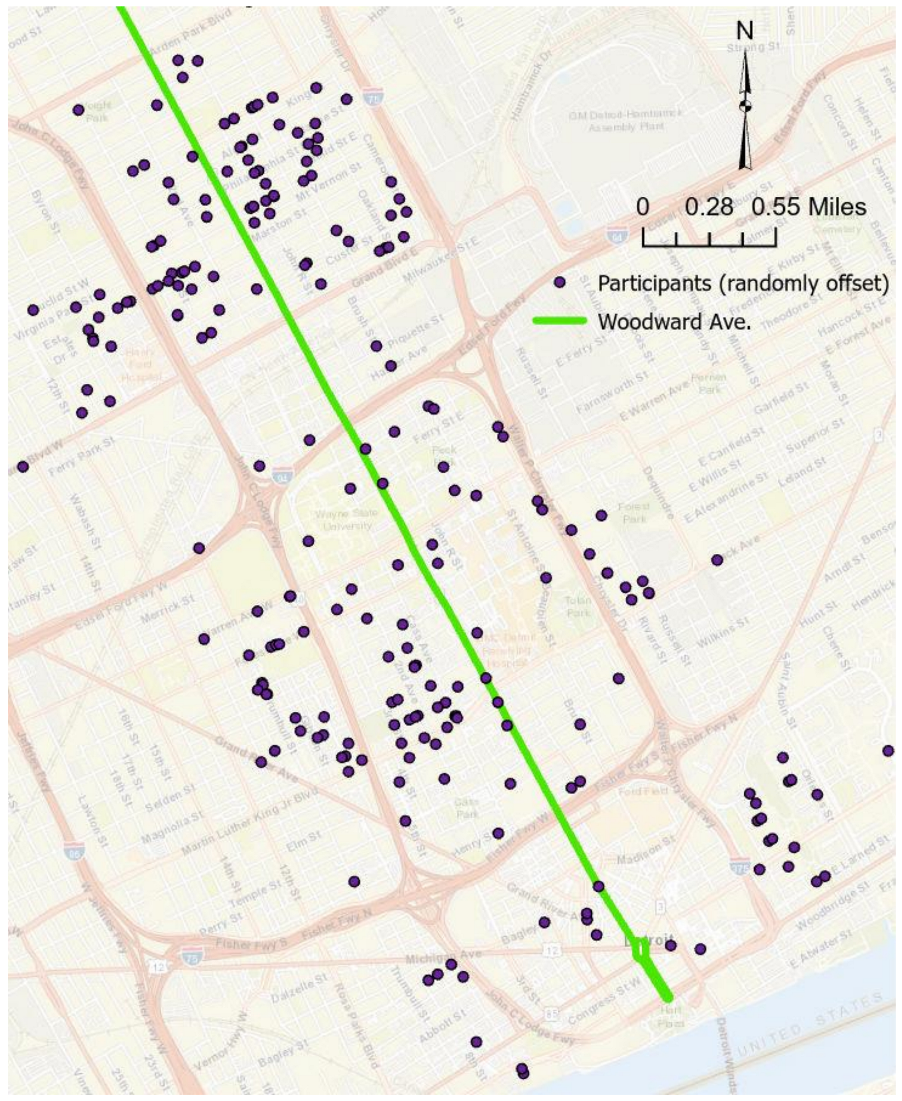
3. Materials and Methods

An area of one mile around a newly built streetcar on Woodward Avenue, the main thoroughfare in Detroit (see Figure 1), was selected for study. This area was selected because parts of it are rapidly gentrifying in a city that continues to experience population loss even as some neighborhoods become wealthier and attract younger, white residents [61]. This trend has implications for planning and policy in Detroit and other gentrifying cities that are faced with continuing inequities.
In broad terms, socioeconomic circumstances and access to amenities and ambient environmental quality vary in the study area. The study area contains a number of different areas along Woodward Avenue, from a buzzing downtown to a catching-up midtown to the nascent New Center to a considerably poorer North End neighborhood. The study also includes areas of extreme poverty just a few blocks removed on the east and west sides all along the north-south length of Woodward.
Participants were recruited by mailing notices to 2000 randomly selected residential addresses within the study area. Addresses were obtained from a local marketing company that maintains a database on occupied properties in Detroit. Interested residents called the phone number on the notice to make an in-person appointment to take the survey. Only one adult per household was permitted to take the survey. Participants were compensated for their time with USD 75 gift cards, and they were paid when they returned a log of their transportation usage after one week. Surveys were completed by 398 residents, which resulted in 347 useable observations. The response rate of about 20 percent compares well with rates in other published, planning-related research, for example, Chatman (2009, 20 percent), Lund (2006, 13.3 percent), Rodriguez et al. (2006, between 23.6 and 26.4 percent), etc. Data were collected between fall 2016 and spring 2017 [62,63,64]. The survey was approved by the Institutional Review Board of Wayne State University.
Because using self-reported heights and weights to determine BMIs has been identified as a shortcoming of prior research [7], we obtained these measures in person when the participants came in to take the survey.

3.1. Questions about Urban Amenities and the Ambient Environment

Because this paper focuses on residents’ perceptions of amenities and the ambient environment, we will elaborate on the treatment of these variables. Regarding urban amenities, residents were asked to indicate whether they disagreed or agreed with certain statements on a scale of 1 to 7, where 1 indicated strong disagreement and 7 indicated strong agreement. These statements allow respondents to define their own neighborhoods, which addresses a concern about the practice of defining neighborhoods based on the availability of data [65], even though those definitions may not reflect residents’ own perceptions of what defines their neighborhoods [66,67]. The statements, verbatim, were as follows:
There are plenty of places to shop within walking distance of my home.
There are enough places in my neighborhood where I can go for recreation or entertainment.
I can get most of my personal business (like banking, laundry, etc.) done within walking distance of my home.
There are good restaurants within walking distance of my home.
These questions were left open to the respondents’ interpretation. For example, some residents may count gas stations and liquor stores as among “plenty of places to shop.” Similarly, we cannot rule out the possibility that residents may perceive fast food restaurants as “good restaurants.”
Regarding ambient environmental quality, residents were asked to rank their level of concern with a series of statements on a scale of 1 to 7, where 1 represented “not concerned” and 7 represented “very concerned.” The questions, verbatim, were as follows:
How concerned are you about annoying odors due to air pollution in your community?
How concerned are you about black particles (black dust) falling from the air in your community?
How concerned are you about the health effects of air pollution in your community?
How concerned are you about dust in the community affecting your home or car (e.g., dust on window ledges, dust on vehicle, etc.)?
How concerned are you about litter in your community?
How concerned are you about blight in your community (e.g., abandoned buildings, broken windows, etc.)?

3.2. Other Control Variables in the Survey

The survey also included questions on socioeconomic characteristics that have been found to be associated with obesity (see Orstad et al., 2017 for a summary of this literature) [41]. Socioeconomic data from the survey are consistent with data from the American Community Survey (ACS). Because of high coefficients of variation in ACS data at the census block group level, we cannot make statistical comparisons between the data from this survey and ACS data at the block group level. We note, however, that except for age, all socioeconomic data obtained from the survey fall within the range of ACS data for all surrounding block groups. We chose to examine ACS data at the block group level because data at the next lower level of geography—the census block—are either missing or have even higher coefficients of variation. The next higher level of geography—the census tract—is much larger than the definition of neighbors of 500 m used in this article (see later on in the article for a discussion of how neighbors are defined). We note, however, that data from this survey also fall within the range of data for all census tracts within the study area.
The survey also enquired about transportation usage because transportation usage could be independent of spatial form in residents’ immediate surroundings. Residents may find their neighborhood walkable for one or the other amenity, but, for example, because residents in Detroit may travel far distances for work, whether by private or public transport or even walking [68,69], a reasonable expectation is that most residents’ decisions about transportation are independent of the immediate spatial form around them. This spatial mismatch between jobs and residences in Detroit has been well-known for a long time [70]. To be sure, the spatial mismatch hypothesis has been updated to the modal mismatch hypothesis, where having a car can help ensure that low-income workers have access to jobs in far-out suburbs [71]. Even so, the underlying situation remains the same: metropolitan travel patterns can be unrelated to characteristics at the neighborhood level. Thus, there is no reason to believe Detroiters’ choices about how they get to work is related to their neighborhood-built characteristics. Such transportation choices can be associated with obesity [72].
Because data were collected between fall (September 2016) and spring (May 2017), we used a dummy variable, fall/spring, to control for the fact that transportation habits might be different during the winter. Furthermore, we account for how long respondents lived in their homes because this factor may influence the effects of their neighborhoods on obesity. This variable was included based on feedback from other readers of this article.

3.3. Data on Other Neighborhood and Built Characteristics

Other data on neighborhood and built characteristics were obtained from the ACS (population), Detroit’s publicly available data portal (crime rates), and from publicly available information on built characteristics (the location of restaurants, dollar stores, supermarkets, and gas stations).
A point is warranted with regard to whether perceptions about urban amenities are derived purely from objective measures, such as the location of restaurants, and, thus, whether a model containing both sets of measures may over-control for these variables. However, recent papers that examine how objective and subjective measures influence the use of urban spaces argue that both sets of measures should be included in analyses. For example, Ma and Dill’s (2015) results show that—at least as it relates to bicycling—“the perceived environment and objective environment had different associations with bicycling. This suggests that future research should include both measures when possible … (248).” See also Ma and Dill (2017) for similar points [32,33]. Furthermore, Orstad et al. (2017) observe in their review of the literature that perceived and objective measures of urban spaces are “related but distinct measures” (p. 905) and that “they account for unique variance in physical activity behaviors” (920) [41]. Here, we discuss only the distinction between perceptions and objective measures as they related to urban amenities. We acknowledge that perceptions about the ambient environment can be associated with objective circumstances, but we do not have objective measures of the urban environment, and we do not consider the latter in this research.
Summary statistics for the data appearing in Table 1.

3.4. Principal Component Analysis

Because of the large number of questions regarding urban amenities and the ambient environment, we used principal component analysis (PCA) to reduce the answers to a smaller number of variables. We used a varimax rotation in the PCA because this minimizes the number of variables with high loadings, which in turn permits a more straightforward interpretation of the factors. We retained factors whose Eigenvalues were greater than one to use in the regression analysis. To corroborate the choice of the number of factors, we examined the scree plot from the PCA and the amount of variance explained.
Because one set of variables clearly refers to urban amenities and the second set refers to the ambient environment, we expected that the PCA would load the former on one factor and the latter on a second factor. In this sense, we used PCA as a data-reduction technique to reduce the number of questions on urban amenities and the ambient environment to one manageable variable each.

3.5. Approach to Regressions

We investigated the use of spatial regression models because of the possibility that obesity may be localized, in which case participants located close to each other may have similar levels of obesity. There is reason to believe that people living near each other may have similar levels of obesity because one person’s choices or circumstances may be related to the choices or circumstances of people living close by, for example, decisions to walk. If this is the case, the assumptions of independence of observations and uncorrelated error terms in OLS regressions are violated and regression coefficients will be biased and inconsistent. This violation could be accounted for by a spatial autoregressive (SAR) model in which neighbors are assigned spatial weights.
Another possibility is that spatially correlated covariates are not included in the model, in which case OLS regression coefficients will be inefficient. This violation could be accounted for by a spatial error model (SEM), which accounts for spatial dependence in the error term.
To select an appropriate model, we examined the log-likelihood, the Akaike info criterion (AIC), and the Schwarz criterion (SC) of an OLS regression, a SAR model, and a SEM. The SEM had the highest log-likelihood, the smallest AIC, and the smallest SC; thus, it was the best-fitting model. We will discuss the results of this model only. The spatial lag coefficient of the SAR was also not statistically significant, suggesting that neighboring observations do not influence each other. (However, OLS regression was used to assess whether there is multicollinearity in the data by examining the variance inflation factor (VIF). The highest VIF (1.91 for the natural log of distance to liquor stores) is below the commonly accepted threshold of 10 [73].
The SEM assumes that errors are spatially correlated in that errors in one observation are correlated with errors in nearby observations [74]. The SEM is defined as:
y = X β + u
u = λ Wu + ε
where ε is the uncorrelated error term that satisfies the normal regression assumptions, u is the spatially correlated error term, and λ is the strength of the spatial dependence. If λ ≠ 0, an OLS regression will produce unbiased coefficients, but they will not be efficient, and the estimated standard errors will be biased. The SEM treats spatial correlation as a nuisance to be controlled for, and it has the effect of reducing the magnitude of coefficients that would otherwise be obtained in an OLS model.
We used exploratory spatial correlation in ArcGIS to determine the first peak statistically significant level for Moran’s I of the natural log of BMI. This occurred at approximately one-third of a mile (550 m). We used this distance to define neighbors as being within 550 m of each other and to create a row-standardized weights matrix. Two of the observations were outside this distance and were removed from the sample.
The determination of neighbors via exploratory spatial correlations is distinct from the questions that implicitly asked participants to define their own neighborhoods. The former is a statistical construct that is used to identify an area that is experiencing clustered phenomena, whereas in the latter case, participants may have no information about the existence of spatial clustering. We used the natural log of BMI as the dependent variable.

4. Results

4.1. Principal Component Analysis

Following the rule of retaining factors whose Eigenvalues exceed 1, we retained the first two factors of the varimax-rotated PCA. The variation explained by these two factors totaled 70 percent—short of the recommended 80 percent for PCA. Still, the clear way in which the neighborhood amenity variables loaded on one factor and the ambient-environment variables loaded on a second factor (Table 2) suggested that it would work well to use these two loadings to interpret the data. A scree plot suggested using a third factor. However, only two variables (litter and blight) loaded strongly on the third factor. Because it is generally recommended that a factor contain at least four variables, we decided not to consider the third factor. Factor 1 shows high loadings for places to shop, places for recreation and entertainment, getting personal business done, and good restaurants in the neighborhood, which we collectively term urban amenities. Factor 2 shows high loadings for odors, black particles, the health effects of air pollution, dust, litter, and blight, which we collectively term the ambient environment. The natural logs of these two factors are the main variables of interest in the regressions.

4.2. Spatial Error Model

The SEM results appear in Table 3. Lambda is statistically significant at the five-percent level, which means that there is spatial dependence between the error terms. As noted earlier, the SEM can only reveal clustering in the error term; it does not reveal the reasons for the spatial effect. Nonetheless, using the SEM accounts for the nuisance effect of the spatial clustering that would otherwise produce incorrect standard errors in an OLS model.

4.3. Regression Results

Main variables of interest. The results for urban amenities and the ambient environment confirm the underlying research hypotheses. A one-percent increase in residents’ perceptions of the availability of urban amenities is associated with a 0.13-percent decrease in obesity. A one-percent increase in residents’ perceptions of adverse ambient environment quality is associated with a 0.12-percent increase in obesity. Because environmental quality was measured in terms of how “bad” it was, this result may also be interpreted as showing that a one-percent improvement in perceptions of environmental quality is associated with a 0.12 percent reduction in obesity. Both results are significant at the five-percent level.
To facilitate comparisons with other continuous variables below, we examine how changes in BMI are associated with a 10-percent change in the main independent variables. A 10-percent increase in perceptions about urban amenities is associated with a 1.26-percent reduction in obesity, while a 10-percent improvement in perceptions about environmental quality is associated with a 1.21-percent reduction in obesity.
Other control variables. Stand-alone measures of built characteristics: The results for the built environment provide evidence to support previous research. However, the substantive effects are smaller than those of the perceptions about urban amenities and the ambient environment. For example, a 10-percent increase in distance away from a fast-food restaurant reduces obesity by 0.42 percent (significant at the one-percent level). A 10-percent increase in distance from supermarkets increases obesity by 0.19 percent (significant at the five-percent level). The magnitudes of the results for fast food restaurants and supermarkets are about three and six times smaller, respectively, than the results for perceptions about either urban amenities or the ambient environment. These results point to the central finding of this paper: subjective perceptions of urban amenities can be more important than objective measures. (We cannot make similar comparisons between subjective perceptions and objective measures of the ambient environment because we do not have objective measures of the ambient environment).
Transportation choices: Of the transportation choice variables, only the number of automobile trips per week is statistically significant. Every additional automobile trip per week is associated with a 0.2-percent increase in obesity. A person who takes the mean number of automobile trips per week (12 trips) will reduce their obesity by 2.4 percent if they decide to stop using automobiles altogether (of course, this might be accompanied by increased walking).
Socioeconomic factors: The socioeconomic characteristics perform as expected, and their effects can be substantial. Obesity levels are about 6.2-percent higher for women and about 11.6-percent higher for African Americans. Both results are significant at the one percent level. Being married reduces obesity by about 7.8 percent, significant at the five-percent level. Having an associate’s degree or less increases obesity by 5.3 percent, though this result is significant at the ten-percent level. The length of time living at the current residence was not statistically significant. As noted earlier, based on other feedback the length of time living at the current residence was included as an independent variable. However, including this variable did not change the magnitude or direction of any of the other independent variables.

5. Discussion

The results of this research contribute to the growing literature on how perceptions about urban places are associated with health outcomes, in this case obesity. We acknowledge that this study might be limited by the fact that it was performed in a small area of Detroit, and more studies nationwide are needed to corroborate the results. Furthermore, we do not intend to suggest that the small effects of objective measures of distances to certain urban amenities mean that distances to these urban amenities are unimportant, that the number of supermarkets in neighborhoods is inconsequential, or that planners should be indifferent to the presence of more fast food restaurants, etc. However, encouraging a supermarket here or making it more difficult for a fast food restaurant to build there is not enough. Instead, addressing obesity requires that planners keep their eyes on the bigger picture: creating neighborhoods in which residents can accomplish a range of daily tasks, creating neighborhoods that are environmentally healthy, and working to ensure that residents’ perceptions about their neighborhoods are consistent with these improvements. Of course, changing perceptions may be difficult, but we suggest that it is probably easier to change perceptions than to encourage full-service supermarkets to locate within walking distance of residents’ homes, or to move fast food restaurants out of the neighborhood.
The underlying finding of this research is that perceptions about the availability of urban amenities and the quality of the urban environment are more important than the actual distances to amenities and, perhaps, the actual quality of the environment (as noted earlier, because we do not have objective measures of the ambient environment, we cannot say for certain that perceptions of the ambient environment are more important than objective measures of it).
Perceptions affect how people “obtain, code, save, recollect, and decode information” about locations in urban spaces [21]. In the case of urban amenities, perceptions that can lead to the creation of cognitive maps have been associated with legibility, the degree to which the location of and routes to these amenities are learned, remembered, and achievable [75]. Legibility, of course, has many implications for planning, particularly as it relates to residents’ knowledge of available urban amenities and the ability to easily locate and go to these amenities, preferably by walking. In this sense, the intelligibility of urban spaces—defined as the capacity of urban spaces to provide clues about the neighborhood as a whole [76]—is critical. Several authors have identified it as important in encouraging walking, and Long and Baran indeed found that in more intelligible neighborhoods, people are better able to identify paths to destinations.
How can urban spaces provide intelligibility to increase walking by improving perceptions about the availability of urban amenities and ambient environmental quality? Generally, the literature identifies four factors that lead to the development of spatial knowledge: individual characteristics, basic familiarity with the surrounding space, the urban space itself, and the means of acquiring knowledge [77]. The latter two are considered external to individuals and have spawned research on how they can be used to encourage walking.
When discussing how to encourage walking to urban amenities, researchers refer to the discrete and relational properties of urban space. The former refer to the five imageable elements of paths, edges, districts, nodes, and landmarks [19] and the characteristics that make them memorable, such as the width of paths or the color of pavements [77]. The latter refer to the organization between and within various elements of urban spaces, including destinations [78]. Of course, perceptions about distances to urban amenities might not be accurate. Krizek et al. (2012) found that businesses need to be within a five-minute walk for residents to perceive them as available [79]. The good news is that Krizek et al. found that urban residents consistently overestimated distances to destinations. Altering residents’ perceptions by making it clear to residents that they are closer to destinations than they realized might help increase walking to these destinations.
It is outside the scope of this article to discuss precisely how to design urban spaces to encourage walking by increasing perceptions that urban amenities are available. We simply reiterate the importance of design in doing so and refer readers to the many articles that address these aspects of urban design [23,80]. We also note the intriguing possibility that technology can be used to inform and influence perceptions of urban spaces and thereby encourage walking [20]. Further research into the physiological mechanisms that govern how perceptions of urban spaces are formed and how they are related to obesity could also be helpful.
In the case of the ambient environment, it could be that cleaner environments are simply more welcoming. In this case, addressing perceptions about the quality of the ambient environment may sometimes require concrete action—for example, removing blight and litter. In other instances, planners may have less control, as in the case of air pollution from other political jurisdictions.
Addressing residents’ perceptions about urban spaces provides planners with an additional tool to tackle obesity. Perception about urban spaces can have larger impacts on obesity than actual objective measures, at least in the case of urban amenities. As noted earlier, this paper establishes only associations between perceptions of urban spaces and obesity. In a subsequent paper, we will seek to establish directions of causality between urban spaces and obesity.

Author Contributions

Conceptualization, R.M. and B.A.; methodology, R.M. and B.A.; formal analysis, R.M.; writing—original draft preparation, R.M.; writing—review and editing, R.M. and B.A.; project administration, R.M. and B.A.; funding acquisition, R.M. and B.A. All authors have read and agreed to the published version of the manuscript. Additional thanks to Kiel Opperman for helping with the survey design and to Matthew Glaab for assisting with data collection.

Funding

This research was funded by the Office of the Vice President for Research, Wayne State University. The APC was funded by Wayne State University.

Institutional Review Board Statement

The study was approved by the Institutional Review Board of Wayne State University (protocol code 077515B3E, 1 June 2015).

Informed Consent Statement

Informed consent was obtained from all subjects involved in the study.

Data Availability Statement

The data presented in this study are available on request from the corresponding author. The data are not publicly available due to privacy restrictions.

Conflicts of Interest

The authors declare no conflict of interest.

References

  1. Dunton, G.F.; Kaplan, J.; Wolch, J.; Jerrett, M.; Reynolds, K.D. Physical environmental correlates of childhood obesity: A systematic review. Obes. Rev. 2009, 10, 393–402. [Google Scholar] [CrossRef] [PubMed]
  2. Ogden, C.L.; Carroll, M.D.; Kit, B.K.; Flegal, K.M. Prevalence of childhood and adult obesity in the United States, 2011–2012. JAMA 2014, 311, 806–814. [Google Scholar] [CrossRef] [PubMed]
  3. Timperio, A.; Salmon, J.; Telford, A.; Crawford, D. Perceptions of local neighbourhood environments and their relationship to childhood overweight and obesity. Int. J. Obes. 2005, 29, 170–175. [Google Scholar] [CrossRef] [PubMed]
  4. Fryar, C.D.; Carroll, M.D.; Ogden, C.L. Prevalence of Overweight, Obesity, and Extreme Obesity among Adults: United States, Trends 1960–1962 through 2009–2010; National Center for Health Statistics: Hyattsville, MD, USA, 2012.
  5. Hales, C.M.; Fryar, C.D.; Carroll, M.D.; Freedman, D.S.; Ogden, C.L. Trends in obesity and severe obesity prevalence in US youth and adults by sex and age, 2007–2008 to 2015–2016. JAMA 2018, 319, 1723–1725. [Google Scholar] [CrossRef] [PubMed]
  6. Hamidi, S.; Sabouri, S.; Ewing, R. Does density aggravate the COVID-19 pandemic? Early findings and lessons for planners. J. Am. Plan. Assoc. 2020, 86, 495–509. [Google Scholar] [CrossRef]
  7. Morland, K.B.; Evenson, K.R. Obesity prevalance and the local food environment. Health Place 2009, 15, 491–495. [Google Scholar] [CrossRef]
  8. Sallis, J.F.; Owen, N. Ecological Models of Health Behavior. In Health Behavior: Theory, Research, and Practice, 5th ed.; Jossey-Bass: San Francisco, CA, USA, 2015; pp. 43–64. [Google Scholar]
  9. Booth, K.M.; Pinkston, M.M.; Poston, W.S.C. Obesity and the built environment. J. Am. Diet. Assoc. 2005, 105, S110–S117. [Google Scholar] [CrossRef]
  10. An, R.; Ji, M.; Yan, H.; Guan, C. Impact of ambient air pollution on obesity: A systematic review. Int. J. Obes. 2018, 42, 1112–1126. [Google Scholar] [CrossRef]
  11. Stokols, D. Environmental Psychology. Annu. Rev. Psychol. 1978, 29, 253–295. [Google Scholar] [CrossRef]
  12. Darwin, C. The Origin of Species; PF Collier & Son: New York, NY, USA, 1909. [Google Scholar]
  13. Stokols, D.; Lejano, R.P.; Hipp, J. Enhancing the resilience of human–environment systems: A social ecological perspective. Ecol. Soc. 2013, 18, 1. [Google Scholar] [CrossRef]
  14. Lewin, K. Field Theory in Social Science: Selected Theoretical Papers (Edited by Dorwin Cartwright); Harpers: Oxford, UK, 1951; 346p. [Google Scholar]
  15. Barker, R.G. Ecological Psychology: Concepts and Methods for Studying the Environment of Human Behavior; Stanford University Press: Stanford, CA, USA, 1968; p. vi. 242p. [Google Scholar]
  16. Stokols, D. Establishing and maintaining healthy environments: Toward a social ecology of health promotion. Am. Psychol. 1992, 47, 6–22. [Google Scholar] [CrossRef] [PubMed]
  17. Bandura, A. Toward a psychology of human agency. Perspect. Psychol. Sci. 2006, 1, 164–180. [Google Scholar] [CrossRef] [PubMed]
  18. Searle, J.R. Rationality in Action; MIT Press: Cambridge, MA, USA, 2003. [Google Scholar]
  19. Lynch, K. The Image of the City; Technology Press: Cambridge, MA, USA, 1960; 194p. [Google Scholar]
  20. Wohl, S. Sensing the city: Legibility in the context of mediated spatial terrains. Space Cult. 2019, 22, 90–102. [Google Scholar] [CrossRef]
  21. Downs, R.; Stea, D. Cognitive Maps and Spatial Behavior: Image and Environment; Edward Arnold: London, UK, 1973. [Google Scholar]
  22. Craik, K.H. Environmental Psychology. Annu. Rev. Psychol. 1973, 24, 403–422. [Google Scholar] [CrossRef]
  23. Ewing, R.; Handy, S. Measuring the unmeasurable: Urban design qualities related to walkability. J. Urban Des. 2009, 14, 65–84. [Google Scholar] [CrossRef]
  24. Brownson, R.C.; Hoehner, C.M.; Day, K.; Forsyth, A.; Sallis, J.F. Measuring the built environment for physical activity: State of the science. Am. J. Prev. Med. 2009, 36, S99–S123. [Google Scholar] [CrossRef]
  25. Boehmer, T.K.; Hoehner, C.M.; Deshpande, A.D.; Brennan Ramirez, L.K.; Brownson, R.C. Perceived and observed neighborhood indicators of obesity among urban adults. Int. J. Obes. 2007, 31, 968–977. [Google Scholar] [CrossRef]
  26. Adams, M.A.; Ryan, S.; Kerr, J.; Sallis, J.F.; Patrick, K.; Frank, L.D.; Norman, G.J. Validation of the neighborhood environment walkability scale (NEWS) items using geographic information systems. J. Phys. Act. Health 2009, 6, S113–S123. [Google Scholar] [CrossRef]
  27. Duncan, M.J.; Winkler, E.; Sugiyama, T.; Cerin, E.; duToit, L.; Leslie, E.; Owen, N. Relationships of land use mix with walking for transport: Do land uses and geographical scale matter? J. Urban Health Bull. N. Y. Acad. Med. 2010, 87, 782–795. [Google Scholar] [CrossRef]
  28. Bauman, A.E.; Reis, R.S.; Sallis, J.F.; Wells, J.C.; Loos, R.J.F.; Martin, B.W. Physical Activity 2: Correlates of physical activity: Why are some people physically active and others not? Lancet 2012, 380, 258–271. [Google Scholar] [CrossRef]
  29. Rhodes, R.E.; Saelens, B.E.; Sauvage-Mar, C. Understanding physical activity through interactions between the built environment and social cognition: A systematic review. Sport. Med. 2018, 48, 1893–1912. [Google Scholar] [CrossRef] [PubMed]
  30. Ball, K.; Timperio, A.; Salmon, J.; Giles-Corti, B.; Roberts, R.; Crawford, D. Personal, social and environmental determinants of educational inequalities in walking: A multilevel study. J. Epidemiol. Community Health 2007, 61, 108–114. [Google Scholar] [CrossRef] [PubMed]
  31. Tilt, J.H.; Unfried, T.M.; Roca, B. Using objective and subjective measures of neighborhood greenness and accessible destinations for understanding walking trips and BMI in Seattle, Washington. Am. J. Health Promot. 2007, 21, 371–379. [Google Scholar] [CrossRef] [PubMed]
  32. Ma, L.; Dill, J. Associations between the objective and perceived built environment and bicycling for transportation. J. Transp. Health 2015, 2, 248–255. [Google Scholar] [CrossRef]
  33. Ma, L.; Dill, J. Do people’s perceptions of neighborhood bikeability match “reality”? J. Transp. Land Use 2017, 10, 291–308. [Google Scholar] [CrossRef]
  34. Gustafson, A.A.; Sharkey, J.; Samuel-Hodge, C.D.; Jones-Smith, J.; Folds, M.C.; Cai, J.W.; Ammerman, A.S. Perceived and objective measures of the food store environment and the association with weight and diet among low-income women in North Carolina. Public Health Nutr. 2011, 14, 1032–1038. [Google Scholar] [CrossRef]
  35. McGinn, A.P.; Evenson, K.R.; Herring, A.H.; Huston, S.L.; Rodriguez, D.A. Exploring associations between physical activity and perceived and objective measures of the built environment. J. Urban Health Bull. N. Y. Acad. Med. 2007, 84, 162–184. [Google Scholar] [CrossRef]
  36. Jiang, B.; Chang, C.-Y.; Sullivan, W.C. A dose of nature: Tree cover, stress reduction, and gender differences. Landsc. Urban Plan. 2014, 132, 26–36. [Google Scholar] [CrossRef]
  37. Beil, K.; Hanes, D. The influence of urban natural and built environments on physiological and psychological measures of stress—A pilot study. Int. J. Environ. Res. Public Health 2013, 10, 1250–1267. [Google Scholar] [CrossRef]
  38. Aspinall, P.; Mavros, P.; Coyne, R.; Roe, J. The urban brain: Analysing outdoor physical activity with mobile EEG. Br. J. Sport Med. 2015, 49, 272–276. [Google Scholar] [CrossRef]
  39. Fredrickson, B.L.; Grewen, K.M.; Coffey, K.A.; Algoe, S.B.; Firestine, A.M.; Arevalo, J.M.; Ma, J.; Cole, S.W. A functional genomic perspective on human well-being. Proc. Natl. Acad. Sci. USA 2013, 110, 13684–13689. [Google Scholar] [CrossRef] [PubMed]
  40. Mackenbach, J.D.; Rutter, H.; Compernolle, S.; Glonti, K.; Oppert, J.M.; Charreire, H.; De Bourdeaudhuij, I.; Brug, J.; Nijpels, G.; Lakerveld, J. Obesogenic environments: A systematic review of the association between the physical environment and adult weight status, the SPOTLIGHT project. BMC Public Health 2014, 14, 233. [Google Scholar] [CrossRef]
  41. Orstad, S.L.; McDonough, M.H.; Stapleton, S.; Altincekic, C.; Troped, P.J. A systematic review of agreement between perceived and objective neighborhood environment measures and associations with physical activity outcomes. Environ. Behav. 2017, 49, 904–932. [Google Scholar] [CrossRef]
  42. Papas, M.A.; Alberg, A.J.; Ewing, R.; Helzlsouer, K.J.; Gary, T.L.; Klassen, A.C. The built environment and obesity. Epidemiol. Rev. 2007, 29, 129–143. [Google Scholar] [CrossRef] [PubMed]
  43. Lovasi, G.S.; Hutson, M.A.; Guerra, M.; Neckerman, K.M. Built Environments and Obesity in Disadvantaged Populations. Epidemiol. Rev. 2009, 31, 7–20. [Google Scholar] [CrossRef] [PubMed]
  44. Handy, S.L.; Boarnet, M.G.; Ewing, R.; Killingsworth, R.E. How the built environment affects physical activity—Views from urban planning. Am. J. Prev. Med. 2002, 23, 64–73. [Google Scholar] [CrossRef]
  45. Wang, F.H.; Wen, M.; Xu, Y.Q. Population-adjusted street connectivity, urbanicity and risk of obesity in the US. Appl. Geogr. 2013, 41, 1–14. [Google Scholar] [CrossRef]
  46. Saelens, B.E.; Sallis, J.F.; Black, J.B.; Chen, D. Neighborhood-based differences in physical activity: An environment scale evaluation. Am. J. Public Health 2003, 93, 1552–1558. [Google Scholar] [CrossRef]
  47. Ball, K.; Lamb, K.; Travaglini, N.; Ellaway, A. Street connectivity and obesity in Glasgow, Scotland: Impact of age, sex and socioeconomic position. Health Place 2012, 18, 1307–1313. [Google Scholar] [CrossRef]
  48. Lovasi, G.S.; Neckerman, K.M.; Quinn, J.W.; Weiss, C.C.; Rundle, A. Effect of Individual or Neighborhood Disadvantage on the Association Between Neighborhood Walkability and Body Mass Index. Am. J. Public Health 2009, 99, 279–284. [Google Scholar] [CrossRef]
  49. McClaren, L. Socioeconomic Status and Obesity. Epidemol. Rev. 2007, 29, 29–48. [Google Scholar] [CrossRef] [PubMed]
  50. Doyle, S.; Kelly-Schwartz, A.; Schlossberg, M.; Stockard, J. Active community environments and health—The relationship of walkable and safe communities to individual health. J. Am. Plan. Assoc. 2006, 72, 19–31. [Google Scholar] [CrossRef]
  51. Spence, J.C.; Cutumisu, N.; Edwards, J.; Evans, J. Influence of neighbourhood design and access to facilities on overweight among preschool children. Int. J. Pediatr. Obes. 2008, 3, 109–116. [Google Scholar] [CrossRef]
  52. Cetateanu, A.; Jones, A. Understanding the relationship between food environments, deprivation and childhood overweight and obesity: Evidence from a cross sectional England-wide study. Health Place 2014, 27, 68–76. [Google Scholar] [CrossRef] [PubMed]
  53. Cobb, L.K.; Appel, L.J.; Franco, M.; Jones-Smith, J.C.; Nur, A.; Anderson, C.A.M. The relationship of the local food environment with obesity: A systematic reivew of methods, study quality, and results. Obesity 2015, 23, 1331–1344. [Google Scholar] [CrossRef] [PubMed]
  54. Vandevijvere, S.; Sushil, Z.; Exeter, D.J.; Swinburn, B. Obesogenic retail food environments around New Zealand Schools: A national study. Am. J. Prev. Med. 2016, 51, e57–e66. [Google Scholar] [CrossRef]
  55. McConnell, R.; Shen, E.; Gilliland, F.D.; Jerrett, M.; Wolch, J.; Chang, C.-C.; Lurmann, F.; Berhane, K. A longitudinal cohort study of body mass index and childhood exposure to secondhand tobacco smoke and air pollution: The Southern California Children’s Health Study. Environ. Health Perspect. 2015, 123, 360–366. [Google Scholar] [CrossRef]
  56. Jerret, M.; McConnell, R.; Wolch, J.; Chang, R.; Lam, C.; Dunton, G.; Gilliand, F.; Lurmann, F.; Islam, T.; Berhane, K. Traffic-related air pollution and obesity formation in children: A longitudinal, multilevel analysis. Environ. Health 2014, 13, 49. [Google Scholar] [CrossRef]
  57. Christensen, J.S.; Raasochou-Nielsen, O.; Tjonneland, A.; Nordsborg, R.B.; Jensen, S.S.; Sorensen, T.I.A.; Sorensen, M. Long-term exposure to residential traffic noise and changes in body weight and waist circumference: A cohort study. Environ. Res. 2015, 143, 154–161. [Google Scholar] [CrossRef]
  58. Eriksson, C.; Hilding, A.; Pyko, A.; Bluhm, G.; Pershagen, G.; Ostenson, C.-G. Long-term aircraft noise exposure and body mass index, waist circumference, and type 2 diabetes: A prospective study. Environ. Health Perspect. 2014, 122, 687–694. [Google Scholar] [CrossRef]
  59. Foraster, M.; Eze, I.C.; Vienneau, D.; Brink, M.; Cajochen, C.; Caviezel, S.; Heritier, H.; Schaffner, E.; Shindler, C.; Wanner, M.; et al. Long-term transportation annoyance is associated with subsequent lower levels of physical activity. Environ. Int. 2016, 91, 341–349. [Google Scholar] [CrossRef] [PubMed]
  60. Roswall, N.; Ammitzbøll, G.; Schultz Christensen, J.; Raaschou-Nielsen, O.; Solvang Jensen, S.; Tjønneland, A.; Sørensen, M. Residential exposure to traffic noise and leisure-time sports: A population-based study. Int. J. Hyg. Environ. Health 2017, 220, 1006–1013. [Google Scholar] [CrossRef] [PubMed]
  61. MacDonald, C.; Tanner, K. Detroit’s Population Decline Continues for 7th Straight Decade, 2020 Census Data Shows; Detroit Free Press: Detroit, MI, USA, 2021. [Google Scholar]
  62. Chatman, D.G. Residential Choice, the Built Environment, and Nonwork Travel: Evidence Using New Data and Methods. Environ. Plan. A Econ. Space 2009, 41, 1072–1089. [Google Scholar] [CrossRef]
  63. Lund, H. Reasons for living in a transit-oriented development, and associated transit use. J. Am. Plan. Assoc. 2006, 72, 357–366. [Google Scholar] [CrossRef]
  64. Rodríguez, D.A.; Khattak, A.J.; Evenson, K.R. Can new urbanism encourage physical activity?: Comparing a new urbanist neighborhood with conventional suburbs. J. Am. Plan. Assoc. 2006, 72, 43–54. [Google Scholar] [CrossRef]
  65. Messer, L.C. Invited commentary: Beyond the metrics for measuring neighborhood effects. Am. J. Epidemiol. 2007, 165, 868–871. [Google Scholar] [CrossRef]
  66. Diez Roux, A.V. Neighborhoods and health: Where are we and were do we go from here? Rev. D’epidemiologie Sante Publique 2007, 55, 13–21. [Google Scholar] [CrossRef]
  67. Oakes, J.M. The (mis)estimation of neighborhood effects: Causal inference for a practicable social epidemiology. Soc. Sci. Med. 2004, 58, 1929–1952. [Google Scholar] [CrossRef]
  68. Lee, J.; Vojnovic, I.; Grady, S.C. The ‘transportation disadvantaged’: Urban form, gender and automobile versus non-automobile travel in the Detroit region. Urban Stud. 2018, 55, 2470–2498. [Google Scholar] [CrossRef]
  69. Covington, K.L. Overcoming spatial mismatch: The opportunities and limits of transit mode in addressing the Black-White unemployment gap. City Community 2018, 17, 211–235. [Google Scholar] [CrossRef]
  70. Kain, J.F. Housing segregation, negro employment, and metropolitan decentralization. Q. J. Econ. 1968, 82, 175–197. [Google Scholar] [CrossRef]
  71. Blumenberg, E.; Manville, M. Beyond the spatial mismatch: Welfare recipients and transportation policy. J. Plan. Lit. 2004, 19, 182–205. [Google Scholar] [CrossRef]
  72. Jacobson, S.H.; King, D.M.; Yuan, R. A note on the relationship between obesity and driving. Transp. Policy 2011, 18, 772–776. [Google Scholar] [CrossRef]
  73. Gujarati, D.N. Basic Econometrics, 3rd ed.; McGraw-Hill: New York, NY, USA, 1995; p. xxiii. 838p. [Google Scholar]
  74. Ward, M.D.; Skrede Gleditsch, K. Spatial Regression Models; Sage Publications: Thousand Oaks, CA, USA, 2008. [Google Scholar]
  75. Bell, P.A.; Greene, T.C.; Fisher, J.D.; Baum, A. Environmental Psychology, 5th ed.; Harcourt College Publishers: Fort Worth, TX, USA, 2005; p. xvii. 634p. [Google Scholar]
  76. Long, Y.; Baran, P.K. Does intelligibility affect place legibility? Understanding the relationship between objective and subjective evaluations of the urban environment. Environ. Behav. 2012, 44, 616–640. [Google Scholar] [CrossRef]
  77. Ahmadpoor, N.; Shahab, S. Spatial knowledge acquisition in the process of navigation: A review. Curr. Urban Stud. 2019, 7, 1–19. [Google Scholar] [CrossRef]
  78. Peponis, J.; Bafna, S.; Zhang, Z. The connectivity of streets: Reach and directional distance. Environ. Plan. B Plan. Des. 2008, 35, 881–901. [Google Scholar] [CrossRef]
  79. Krizek, K.J.; Horning, J.; El-Geneidy, A. Perceptions of accessibility to neighbourhood retail and other public services. In Accessibility Analysis and Transport Planning; Edward Elgar Publishing: Cheltenham, UK, 2012. [Google Scholar]
  80. Forsyth, A.; Hearst, M.; Oakes, J.M.; Schmitz, K.H. Design and destinations: Factors influencing walking and total physical activity. Urban Stud. 2008, 45, 1973–1996. [Google Scholar] [CrossRef]
Figure 1. The location of participants, where the points are randomly offset to mask their exact location (Woodward Avenue is shown to provide context about the distribution of the sample around the main thoroughfare and new streetcar in Detroit).
Obesities 03 00014 g001
Table 1. Descriptive statistics for variables used in regressions.
MinimumMaximumMeanStandard Deviation
Natural log BMI2.793.933.340.21
Main variables of interest
 Urban amenities−2.101.480.000.94
 Ambient environment−2.071.090.000.94
Other built characteristics
 Natural log distance (meters) to fast food restaurants2.576.785.800.72
 Natural log distance (meters) to liquor stores3.186.795.580.76
 Natural log distance (meters) to supermarkets1.747.416.170.99
 Natural log distance (meters) to dollar stores and gas stations3.767.136.030.61
Transportation use
 Automobile trips per week05312.0711.41
 Bus trips per week0643.626.97
 Bicycle trips per week0200.832.65
 Walking trips per week0605.727.44
Socioeconomic factors
 Age178853.5415.24
 Female 0.570.496
 Black 0.820.386
 Married 0.140.343
 Live alone 0.650.476
 Household income0350,00026,26936,700
 Associate’s degree or less 0.750.436
 Census track population, thousands2.7229.9511.535.12
 Crime rate per 100 residents, Block Group1.8661.8010.059.63
Additional control variable
 Time in home, years0.160.98.48.6
 Fall/Spring010.430.50
Table 2. Varimax rotated factors.
VariablesUrban Amenities (Factor 1)Ambient Environment (Factor 2)
Plenty of places to shop within walking distance of home0.740
Enough places in their neighborhood for recreation and entertainment0.872
Can get most of their personal business (such as banking and laundry) done within walking distance of their home0.757
Good restaurants within walking distance of their home0.854
Annoying odors due to air pollution 0.832
Black particles (black dust) failing from the air 0.878
The health effects of air pollution in their neighborhood 0.925
Dust affecting their home or car 0.852
Litter 0.802
Blight 0.793
Table 3. Results of the spatial error model.
VariableCoefficientLevel of Significance
Constant1.434***
Main variables of interest
 Urban amenities−0.134***
 Ambient neighborhood environment0.116**
Other objective measures of urban amenities
 Natural log distance to fast food restaurants−0.044***
 Natural log distance to liquor stores0.026*
 Natural log distance to supermarkets0.020**
 Natural log distance to dollar stores and gas stations−0.006
Transportation use
 Automobile trips per week0.002**
 Bus trips per week−0.001
 Bicycle trips per week−0.001
 Walking trips per week0.000
Socioeconomic factors
 Age0.001*
 Female0.060***
 Black0.110***
 Married−0.082**
 Live alone−0.039
 Household income0.000
 Associate’s degree or less0.052*
 Census track population, thousands−0.001
 Crime rate per 100 residents, Block Group0.000
Additional control variable
 Time in home0.000
 Fall/Spring0.002
Lambda−0.363**
*** Significant at the one-percent level. ** Significant at the five-percent level. * Significant at the 10-percent level.
Disclaimer/Publisher’s Note: The statements, opinions and data contained in all publications are solely those of the individual author(s) and contributor(s) and not of MDPI and/or the editor(s). MDPI and/or the editor(s) disclaim responsibility for any injury to people or property resulting from any ideas, methods, instructions or products referred to in the content.

