Next Issue
Volume 9, November
Previous Issue
Volume 9, September


J. Mar. Sci. Eng., Volume 9, Issue 10 (October 2021) – 112 articles

Cover Story (view full-size image): 
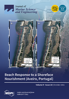
In Aveiro (NW coast of Portugal), a coastal monitoring programme was carried out in sequence of a shoreface nourishment intervention (over than 2 M m3) performed in 2020. In this programme, almost one year of biweekly subaerial topographies and quarterly bathymetric surveys were collected along a 10 km coastal stretch between June 2020 and June 2021. In this study, topographic and bathymetric surveys were analysed to assess the expectation that if the shoreface nourishment is located in sufficiently shallow water depths, its landward movement will feed adjacent beaches and, consequently, increase the subaerial beach volume. Results show that the subaerial beach volume is well correlated with the 1.05 m (above MSL) isoline displacement through time. View this paper
  • Issues are regarded as officially published after their release is announced to the table of contents alert mailing list.
  • You may sign up for e-mail alerts to receive table of contents of newly released issues.
  • PDF is the official format for papers published in both, html and pdf forms. To view the papers in pdf format, click on the "PDF Full-text" link, and use the free Adobe Reader to open them.
Order results
Result details
Section
Select all
Export citation of selected articles as:
23 pages, 6814 KiB  
Article
CFD Prediction of Ship Seakeeping and Slamming Behaviors of a Trimaran in Oblique Regular Waves
by Xiyu Liao, Zhanyang Chen, Hongbin Gui and Mengchao Du
J. Mar. Sci. Eng. 2021, 9(10), 1151; https://doi.org/10.3390/jmse9101151 - 19 Oct 2021
Cited by 12 | Viewed by 2085
Abstract
The main hull encounters waves at first and causes waves to break, when trimarans are subject to the slamming in head waves. At this moment, emergence phenomena of side hulls will not occur. Thus, the slamming study of trimarans in oblique waves presents [...] Read more.
The main hull encounters waves at first and causes waves to break, when trimarans are subject to the slamming in head waves. At this moment, emergence phenomena of side hulls will not occur. Thus, the slamming study of trimarans in oblique waves presents further practical significance. In this study, a CFD method is used for trimaran seakeeping and slamming analysis. An overset grid technique is adopted to simulate ship motions in waves. Firstly, to further verify the present method, a series of verification and validation studies is conducted. Then, the motion responses and slamming pressure with different control parameters, such as forward speed and ship heading angle, are calculated and discussed. The comparative results indicate that the seakeeping and slamming behaviors of trimarans differ significantly from those of conventional monohull ships. Finally, severe bow slamming and green water in oblique waves are also observed and investigated, which should be given enough attention during ship design and evaluation. Full article
(This article belongs to the Special Issue Ship Motions and Wave Loads)
Show Figures

Figure 1

16 pages, 2839 KiB  
Article
Sedimentary Environmental Evolution of the Western Taiwan Shoal Area since the Late Pleistocene
by Chipeng He, Longbin Sha, Dongbo Zhao, Lu Dai, Zheng Li, Jiabing Tang, Xianfu Li and Dongling Li
J. Mar. Sci. Eng. 2021, 9(10), 1150; https://doi.org/10.3390/jmse9101150 - 19 Oct 2021
Cited by 1 | Viewed by 1931
Abstract
A new pollen analysis and major and trace element contents were conducted on a 40 m long gravity core recovered from the Taiwan Shoal (sand ridges), south of the Taiwan Strait, beginning in the Late Pleistocene. The changes in the pollen assemblage and [...] Read more.
A new pollen analysis and major and trace element contents were conducted on a 40 m long gravity core recovered from the Taiwan Shoal (sand ridges), south of the Taiwan Strait, beginning in the Late Pleistocene. The changes in the pollen assemblage and concentration represent the climate change around the Taiwan Shoal and the strength of the Zhe-Min Coastal Current, whereas variations in major and trace element contents can imply the source of the sediments in the Taiwan Shoal, which are correlated with the rise or fall of the sea level with increased marine dinoflagellate cysts. The interval of 40–30 m was characterized by high pollen and spore concentrations, and evergreen Quercus was dominant taxon, which indicates a warm sedimentary environment, and the surrounding area of the Taiwan Shoal were covered by a tropical and subtropical broad-leaved forest. There were no pollen and spores from 30–24 m, which indicates a strong hydrodynamic sedimentary environment, and most of the Taiwan Shoal might have been experience subaerial exposure. The interval of 24–17 m was characterized by the reappearance of pollen and spores, as well as marine dinoflagellate cysts and foraminifera, suggesting the climate was warm and wet in the study area and an apparent marine sedimentary environment with relatively high sea level. Deciduous Quercus dominated the interval of 17–12 m, which indicated that the climate was relatively cool, corresponding to the end of Marine isotope stages3 (MIS3) to the Last Glacial Maximum accompanied by weathering and denudation. Above 12 m, the low pollen concentration with increased marine dinoflagellate cysts and foraminifera abundance suggested a marine sedimentary environment in the Taiwan Shoal. The high concentrations in Pinus corresponds to Holocene high sea level. Full article
(This article belongs to the Special Issue Advance in Sedimentology and Coastal and Marine Geology)
Show Figures

Figure 1

16 pages, 42794 KiB  
Article
Suppressed Thermocline Mixing in the Center of Anticyclonic Eddy in the North South China Sea
by Yongfeng Qi, Huabin Mao, Xia Wang, Linhui Yu, Shumin Lian, Xianpeng Li and Xiaodong Shang
J. Mar. Sci. Eng. 2021, 9(10), 1149; https://doi.org/10.3390/jmse9101149 - 19 Oct 2021
Cited by 4 | Viewed by 1698
Abstract
Direct microstructure observations and fine-scale measurements of an anticyclonic mesoscale eddy were conducted in the northern South China Sea in July 2020. An important finding was that suppressed turbulent mixing in the thermocline existed at the center of the eddy, with an averaged [...] Read more.
Direct microstructure observations and fine-scale measurements of an anticyclonic mesoscale eddy were conducted in the northern South China Sea in July 2020. An important finding was that suppressed turbulent mixing in the thermocline existed at the center of the eddy, with an averaged diapycnal diffusivity at least threefold smaller than the peripheral diffusivity. Despite the strong background shear and significant wave–mean flow interactions, the results indicated that the lack of internal wave energy in the corresponding neap tide period during measurement of the eddy’s center was the main reason for the suppressed turbulent mixing in the thermocline. The applicability of the fine-scale parameterization method in the presence of significant wave–mean flow interactions in a mesoscale eddy was evaluated. Overprediction via fine-scale parameterization occurred in the center of the eddy, where the internal waves were inactive; however, the parameterization results were consistent with microstructure observations along the eddy’s periphery, where active internal waves existed. This indicates that the strong background shear and wave–mean flow interactions affected by the mesoscale eddy were not the main contributing factors that affected the applicability of fine-scale parameterization in the northern South China Sea. Instead, our results showed that the activity of internal waves is the most important consideration. Full article
(This article belongs to the Section Physical Oceanography)
Show Figures

Figure 1

17 pages, 9023 KiB  
Article
The Making of a Gravel Beach (Cavo, Elba Island, Italy)
by Irene Cinelli, Giorgio Anfuso, Enrico Bartoletti, Lorenzo Rossi and Enzo Pranzini
J. Mar. Sci. Eng. 2021, 9(10), 1148; https://doi.org/10.3390/jmse9101148 - 19 Oct 2021
Cited by 3 | Viewed by 1643
Abstract
This paper presents the history and evolution of the different projects carried out from 1999 to 2008 at Cavo beach in the Elba Island, Italy. The village of Cavo almost completely lost its beach in the 1970s due to the reduction of sedimentary [...] Read more.
This paper presents the history and evolution of the different projects carried out from 1999 to 2008 at Cavo beach in the Elba Island, Italy. The village of Cavo almost completely lost its beach in the 1970s due to the reduction of sedimentary input, and the backing coastal road was defended by a revetment and two detached breakwaters. Such severe erosion processes continued in the following years and impeded any possibility of beach tourist development. In 1999, a project based on the removal of existing breakwaters and beach nourishment works based on the use of gravel as borrow sediment and the construction of two short groins to maintain nourished sediment, raised environmental concern and did not find the approval of the stakeholders. They were worried about the characteristics of the sediments, i.e., waste materials from iron mining rich in red silt and clay. Such sediment fractions made the sea red during the nourishment and deposited on the Posidonia oceanica meadow in front of the beach, with a potential environmental impact. Furthermore, they cemented the gravel fraction forming a beach rock. Between 2006 and 2008, these materials were covered with better quality gravel, extending and raising the beach profile, which required the elevation and lengthening of the two existing groins. Beach evolution monitoring following the second project, based on morphological and sedimentological data acquired before, during and after the works, demonstrated the great stability of the newly created beach. The wider beach has allowed the construction of a promenade and the positioning, in summer, of small structures useful for seaside tourism, increasing the appeal of this village. Data presented in this paper shows an interesting study case, since few examples exist in international literature regarding gravel nourishment projects monitoring and evolution. Full article
(This article belongs to the Special Issue Sediment Dynamics in Artificial Nourishments)
Show Figures

Figure 1

14 pages, 14842 KiB  
Article
Examination of Computational Performance and Potential Applications of a Global Numerical Weather Prediction Model MPAS Using KISTI Supercomputer NURION
by Ji-Sun Kang, Hunjoo Myung and Jin-Hee Yuk
J. Mar. Sci. Eng. 2021, 9(10), 1147; https://doi.org/10.3390/jmse9101147 - 19 Oct 2021
Cited by 6 | Viewed by 1787
Abstract
To predict extreme weather events, we conducted high-resolution global atmosphere modeling and simulation using high-performance computing. Using a new-generation global weather/climate prediction model called MPAS (Model for Prediction Across Scales) with variable resolution, we tested strong scalability on the KISTI (Korea Institute of [...] Read more.
To predict extreme weather events, we conducted high-resolution global atmosphere modeling and simulation using high-performance computing. Using a new-generation global weather/climate prediction model called MPAS (Model for Prediction Across Scales) with variable resolution, we tested strong scalability on the KISTI (Korea Institute of Science and Technology Information) supercomputer NURION. In addition to assessing computational performance, we simulated three typhoons that occurred in 2019 to analyze the forecast accuracy of MPAS. MPAS results were also applied to force an ADCIRC (The Advanced CIRCulation) + SWAN (Simulating Waves Nearshore) model to predict coastal flooding over southern Korea. The time-integration of MPAS showed excellent scalability up to 4096 cores of NURION KNL (KNight Landing) nodes, but a serious I/O bottleneck issue was still found after trying two additional I/O strategies (i.e., adjusting the stripe count and using a burst buffer). On the other hand, the forecast accuracy of MPAS showed very encouraging results for wind and pressure during typhoons. ADCIRC+SWAN also generated a good estimate of significant wave height for typhoon Mitag. The proposed variable-resolution MPAS model, under an efficient computational environment, could be utilized to predict and understand the highly nonlinear chaotic atmosphere and coastal flooding in typhoons. Full article
Show Figures

Figure 1

21 pages, 10612 KiB  
Article
Monitoring and Forecasting the Ocean State and Biogeochemical Processes in the Black Sea: Recent Developments in the Copernicus Marine Service
by Stefania A. Ciliberti, Marilaure Grégoire, Joanna Staneva, Atanas Palazov, Giovanni Coppini, Rita Lecci, Elisaveta Peneva, Marius Matreata, Veselka Marinova, Simona Masina, Nadia Pinardi, Eric Jansen, Leonardo Lima, Ali Aydoğdu, Sergio Creti’, Laura Stefanizzi, Diana Azevedo, Salvatore Causio, Luc Vandenbulcke, Arthur Capet, Catherine Meulders, Evgeny Ivanov, Arno Behrens, Marcel Ricker, Gerhard Gayer, Francesco Palermo, Mehmet Ilicak, Murat Gunduz, Nadezhda Valcheva and Paola Agostiniadd Show full author list remove Hide full author list
J. Mar. Sci. Eng. 2021, 9(10), 1146; https://doi.org/10.3390/jmse9101146 - 18 Oct 2021
Cited by 8 | Viewed by 2976
Abstract
The Black Sea Monitoring and Forecasting Center (BS-MFC) is the European reference service for the provision of ocean analyses, forecasts, and reanalyses in the Black Sea basin. It is part of the Copernicus Marine Environment and Monitoring Service (CMEMS) and ensures a high [...] Read more.
The Black Sea Monitoring and Forecasting Center (BS-MFC) is the European reference service for the provision of ocean analyses, forecasts, and reanalyses in the Black Sea basin. It is part of the Copernicus Marine Environment and Monitoring Service (CMEMS) and ensures a high level of efficiency in terms of operations, science, and technology for predictions and the monitoring of physical and biogeochemical processes in the Black Sea. The operational BS-MFC framework is based on state-of-the-art numerical models for hydrodynamics, biogeochemistry, and waves; analysis, forecast, and reanalysis are provided on a spatial grid with about 3 km of horizontal resolution that covers the whole Black Sea basin (the Azov Sea is not included). The scientific assessment of BS-MFC products is performed by implementing a product quality dashboard that provides pre-qualification and operational model skills according to GODAE/OceanPredict standards. Novel interfaces based on high-resolution models are part of the scientific development plan to ensure a strong connection with the nearest seas from a modelling point of view, in particular with the Mediterranean Sea. To improve forecasting skills, dedicated online coupled systems are being developed, which involve physics, biogeochemistry, and waves together with the atmosphere and, in the future, with ensemble forecasting methodologies and river-ocean interfaces. Full article
(This article belongs to the Special Issue Ocean Modelling in Support of Operational Ocean and Coastal Services)
Show Figures

Figure 1

15 pages, 4508 KiB  
Article
Influence of SST in Low Latitudes on the Arctic Warming and Sea Ice
by Genrikh V. Alekseev, Natalia I. Glok, Anastasia E. Vyazilova, Natalia E. Kharlanenkova and Mikhail Yu. Kulakov
J. Mar. Sci. Eng. 2021, 9(10), 1145; https://doi.org/10.3390/jmse9101145 - 18 Oct 2021
Cited by 7 | Viewed by 1858
Abstract
Global climate models, focused on projecting anthropogenic warming, have not detected an increase in sea surface temperature (SST) at low latitudes comparable to the observed one. This appears to be one reason for the discrepancy between the model estimates of warming and reduction [...] Read more.
Global climate models, focused on projecting anthropogenic warming, have not detected an increase in sea surface temperature (SST) at low latitudes comparable to the observed one. This appears to be one reason for the discrepancy between the model estimates of warming and reduction of the sea ice extent in the Arctic and the observed changes in the climate system. In previous studies, it was shown that short-term manifestations of the impact of low latitudes on the Arctic climate were identified in 2–3 weeks as a result of strengthening of atmospheric circulation patterns. In this paper, for the first time, a climatic relationship was established among an increase in SST, air temperature, and water vapor content at low latitudes, and a decrease in sea ice extent in the Arctic. ECMWF Re-Analysis data (ERA-Interim, ERA5), Hadley Centre Sea Ice and Sea Surface Temperature data set (HadISST), sea ice archives of the World Centers NSIDC (USA), and Arctic and Antarctic Research Institute (Russia), observations of water temperature in the Kola section (33°30’ E), calculated sea ice parameters using the Arctic and Antarctic Research Institute coupled ice-ocean circulation model (AARI–IOCM). Methods of multivariate correlation analysis, calculating spectra and coherence, and creating correlation graphs were used to obtain the results. For the first time, estimates of the effect of heat transport from low to high latitudes on climate change and sea ice extent in the Arctic over the past 40 years have been obtained, explaining a significant part of their variability. The increase in heat transport is affected by an increase in SST at low latitudes, where a significant part of the solar heat is accumulated. Due to the increase in SST, the amount of heat transported by the ocean and the atmosphere from low latitudes to the Arctic increases, leading to an increase in the air temperature, water vapor content, downward longwave radiation at high latitudes, and a decrease in the thickness and extent of winter sea ice. Potential topics include, but are not limited to: the role of heat and moisture transport in the Arctic warming, effect of SST at low latitudes on transports, linkage of warming in low latitudes and in shrinking of the Arctic sea ice. Full article
Show Figures

Figure 1

18 pages, 7236 KiB  
Article
Deformation Anomalies Accompanying Tsunami Origination
by Grigory Dolgikh and Stanislav Dolgikh
J. Mar. Sci. Eng. 2021, 9(10), 1144; https://doi.org/10.3390/jmse9101144 - 18 Oct 2021
Cited by 7 | Viewed by 1519
Abstract
Basing on the analysis of data on variations of deformations in the Earth’s crust, which were obtained with a laser strainmeter, we found that deformation anomalies (deformation jumps) occurred at the time of tsunami generation. Deformation jumps recorded by the laser strainmeter were [...] Read more.
Basing on the analysis of data on variations of deformations in the Earth’s crust, which were obtained with a laser strainmeter, we found that deformation anomalies (deformation jumps) occurred at the time of tsunami generation. Deformation jumps recorded by the laser strainmeter were apparently caused by bottom displacements, leading to tsunami formation. According to the data for the many recorded tsunamigenic earthquakes, we calculated the damping ratios of the identified deformation anomalies for three regions of the planet. We proved the obtained experimental results by applying the sine-Gordon equation, the one-kink and two-kink solutions of which allowed us to describe the observed deformation anomalies. We also formulated the direction of a theoretical deformation jump occurrence—a kink (bore)—during an underwater landslide causing a tsunami. Full article
(This article belongs to the Special Issue Sea Level Fluctuations)
Show Figures

Figure 1

17 pages, 7188 KiB  
Article
Collision Risk Assessment Support System for MASS RO and VTSO Support in Multi-Ship Environment of Vessel Traffic Service Area
by Yunja Yoo and Jin-Suk Lee
J. Mar. Sci. Eng. 2021, 9(10), 1143; https://doi.org/10.3390/jmse9101143 - 18 Oct 2021
Cited by 9 | Viewed by 2272
Abstract
The discussions by the International Maritime Organization for the introduction of a maritime autonomous surface ship (MASS) began in earnest. At the 27th ENAV meeting, the International Association of Marine Aids to Navigation and Lighthouse Authorities proposed the “sharing of a common operating [...] Read more.
The discussions by the International Maritime Organization for the introduction of a maritime autonomous surface ship (MASS) began in earnest. At the 27th ENAV meeting, the International Association of Marine Aids to Navigation and Lighthouse Authorities proposed the “sharing of a common operating picture for situational awareness of the waterway within vessel traffic service (VTS) environment” when developing a system to support MASS operation. Marine accidents caused by collisions on waterways still account for a high percentage of ship accidents that occur at sea, and many studies have investigated the risk of collision between ships. Collision risk assessment was primarily conducted in ship domain-based safety areas. This study evaluates the collision risk using the ship domain derived by the VTS operator (VTSO) and proposes a real-time collision risk assessment support system to improve the situational awareness of VTSOs and MASS remote operators (MASS ROs) regarding near-collision situations occurring in local waters. To evaluate the validity of the proposed system, a risk analysis was performed on near-collision scenarios at Busan Port. The results show that the distance to the closest point of approach (CPA), time to the CPA, and inter-ship distance converged within 0.5 nautical miles, 10 min, and 3 nautical miles, respectively. Full article
(This article belongs to the Section Ocean Engineering)
Show Figures

Figure 1

18 pages, 11337 KiB  
Article
Pipeline Pressure Loss in Deep-Sea Hydraulic Systems Considering Pressure-Dependent Viscosity Change of Hydraulic Oil
by Jia-Bin Wu and Li Li
J. Mar. Sci. Eng. 2021, 9(10), 1142; https://doi.org/10.3390/jmse9101142 - 18 Oct 2021
Cited by 7 | Viewed by 2401
Abstract
The high ambient pressure in deep-sea conditions greatly increases the viscosity of hydraulic oil and then the pipeline pressure loss in deep-sea hydraulic systems. Large pipeline pressure loss can lead to a further change of viscosity on the basis of the viscosity increase [...] Read more.
The high ambient pressure in deep-sea conditions greatly increases the viscosity of hydraulic oil and then the pipeline pressure loss in deep-sea hydraulic systems. Large pipeline pressure loss can lead to a further change of viscosity on the basis of the viscosity increase caused by the ambient pressure when the hydraulic oil flows through the pipeline. Therefore, the classic Poiseuille’s law can no longer accurately calculate the pipeline pressure loss in deep-sea conditions since it treats the viscosity as a constant. In this paper, based on laminar flow theory and the viscosity-pressure characteristics of hydraulic oil, a novel equation for pipeline pressure loss is proposed, in which the viscosity change when flowing through the pipeline is taken into account. A CFD (Computational Fluid Dynamics) model of a pipeline in the deep-sea hydraulic system has been established, and CFD simulations have been conducted to verify the correctness of the proposed equation for pipeline pressure loss. Theoretical analysis shows that the proposed novel equation for pipeline pressure loss is equivalent to the classic Poiseuille’s law when the pipeline pressure loss or the viscosity change is low. The research results in this paper can provide theoretical support for work efficiency optimization, load capacity improvement, and precise control of deep-sea operation equipment or deep-sea hydraulic systems. Full article
(This article belongs to the Section Ocean Engineering)
Show Figures

Figure 1

18 pages, 1961 KiB  
Article
Walleye Pollock Gadus chalcogrammus, a Species with Continuous Range from the Norwegian Sea to Korea, Japan, and California: New Records from the Siberian Arctic
by Alexei M. Orlov, Maxim O. Rybakov, Elena V. Vedishcheva, Alexander A. Volkov and Svetlana Yu. Orlova
J. Mar. Sci. Eng. 2021, 9(10), 1141; https://doi.org/10.3390/jmse9101141 - 17 Oct 2021
Cited by 17 | Viewed by 2974
Abstract
The first records of walleye pollock Gadus chalcogrammus Pallas, 1814 in the seas of the Siberian Arctic (the Laptev Sea, the Kara Sea, the southeastern Barents Sea), are documented. Information about the external morphology (morphometric and meristic characters), photos of sagittal otoliths and [...] Read more.
The first records of walleye pollock Gadus chalcogrammus Pallas, 1814 in the seas of the Siberian Arctic (the Laptev Sea, the Kara Sea, the southeastern Barents Sea), are documented. Information about the external morphology (morphometric and meristic characters), photos of sagittal otoliths and fish, and data on the sequences of the CO1 mtDNA gene are presented. The results of a comparative analysis indicate that walleye pollock caught in the Siberian Arctic do not differ in principle from North Pacific and North Atlantic individuals. Previous conclusions about the conspecificity of the walleye and Norwegian pollock Theragra finnmarchica are confirmed. New captures of walleye pollock in the Siberian Arctic allow us to formulate a hypothesis about its continuous species’ range from the coasts of Norway in the North Atlantic to the coasts of Korea, Japan, and California in the North Pacific. The few records of walleye pollock in the North Atlantic originate from the North Pacific due to the transport of early pelagic juveniles to the Arctic by currents through the Bering Strait and further active westward migrations of individuals which have switched to the bentho-pelagic mode of life. Full article
(This article belongs to the Special Issue Deepwater Fishes)
Show Figures

Figure 1

8 pages, 957 KiB  
Article
Specification of the Okadaic Acid Equivalent for Okadaic Acid, Dinophysistoxin-1, and Dinophysistoxin-2 Based on Protein Phosphatase 2A Inhibition and Cytotoxicity Assays Using Neuro 2A Cell Line
by Tsuyoshi Ikehara, Kazuya Chikanishi and Naomasa Oshiro
J. Mar. Sci. Eng. 2021, 9(10), 1140; https://doi.org/10.3390/jmse9101140 - 17 Oct 2021
Cited by 2 | Viewed by 2061
Abstract
Diarrhetic shellfish poisoning (DSP) is a globally occurring disease threatening public health and trade. The causative toxins, okadaic acid (OA), dinophysistoxin-1 (DTX1), and dinophysistoxin-2 (DTX2) are collectively called OAs, and are quantified using the LC-MS/MS method. The hazardous effect of total OAs is [...] Read more.
Diarrhetic shellfish poisoning (DSP) is a globally occurring disease threatening public health and trade. The causative toxins, okadaic acid (OA), dinophysistoxin-1 (DTX1), and dinophysistoxin-2 (DTX2) are collectively called OAs, and are quantified using the LC-MS/MS method. The hazardous effect of total OAs is expressed as the sum of OA equivalents defined for respective OAs based on mouse lethality, produced by either intraperitoneal (OAip) or oral administration (OAor). OAs are potent inhibitors of protein phosphatase 2A (PP2A) and are cytotoxic, necessitating expansion of the concept of OA equivalents to all relevant bioactivities. In this study, we determined OA equivalents for respective OA members in PP2A inhibition and cytotoxicity assays. To secure result credibility, we used certified OAs, reference materials, and PP2A produced using genetic engineering. The relative ratio of the OA equivalents determined by PP2A inhibition assays for OA, DTX1, and DTX2 were 1.0:1.6:0.3, while the ratio determined using the cytotoxicity assays indicated 1.0:1.5:0.5. OA equivalents showed a similar tendency in the PP2A inhibition and cytotoxicity assays, and matched better with oral toxicity data than intraperitoneal toxicity in mice. The PP2A inhibition assay, which measures the core activity of the OAs, suggested a higher OA equivalent for DTX1 than that currently used. Full article
(This article belongs to the Special Issue Chemistry, Toxicology and Etiology of Marine Biotoxins)
Show Figures

Figure 1

14 pages, 2648 KiB  
Article
Propagation Properties of an Off-Axis Hollow Gaussian-Schell Model Vortex Beam in Anisotropic Oceanic Turbulence
by Xinguang Wang, Le Wang and Shengmei Zhao
J. Mar. Sci. Eng. 2021, 9(10), 1139; https://doi.org/10.3390/jmse9101139 - 17 Oct 2021
Cited by 4 | Viewed by 1394
Abstract
Based on the extended Huygens–Fresnel principle and the power spectrum of anisotropic oceanic turbulence, the analytical expressions of the average intensity and coherence properties of an off-axis hollow Gaussian-Schell model (OAHGSM) vortex beam propagating through anisotropic oceanic turbulence were derived. The effects of [...] Read more.
Based on the extended Huygens–Fresnel principle and the power spectrum of anisotropic oceanic turbulence, the analytical expressions of the average intensity and coherence properties of an off-axis hollow Gaussian-Schell model (OAHGSM) vortex beam propagating through anisotropic oceanic turbulence were derived. The effects of turbulent ocean and beam characteristic parameters on the evolution properties of the OAHGSM vortex beam were analyzed in detail. Our numerical simulation results showed that the OAHGSM vortex beam with a larger position factor is more focusable. Meanwhile, the OAHGSM vortex beam eventually evolves into a Gaussian-like beam after propagating through the anisotropic oceanic turbulent channel. The speed of this process can be accelerated by the decrease of the hollow order, topological charge, beam width, and transverse coherence width of the beam. The results also indicated that the normalized average intensity spreads more greatly and the spectral degree of coherence decays more rapidly for the smaller dissipation rate of the kinetic energy per unit mass of fluid, the smaller anisotropic coefficient, the smaller inner scale factor, the larger dissipation rate of the mean-squared temperature, and the higher temperature–salinity contribution ratio. Full article
(This article belongs to the Section Physical Oceanography)
Show Figures

Figure 1

22 pages, 9560 KiB  
Article
Effects of Wavy Leading-Edge Protuberance on Hydrofoil Performance and Its Flow Mechanism
by Jing Li, Chunbao Liu and Xiaoying Li
J. Mar. Sci. Eng. 2021, 9(10), 1138; https://doi.org/10.3390/jmse9101138 - 17 Oct 2021
Cited by 4 | Viewed by 2598
Abstract
This paper examines the effects on a Clark-y three-dimensional hydrofoil of wavy leading-edge protuberances in a quantitative and qualitative way. The simulation is accompanied by a hybrid RANS-LES model in conjunction with Zwart-Gerber–Belamri model. Detailed discussions of the stable no-cavitating, unsteady cavitating flow [...] Read more.
This paper examines the effects on a Clark-y three-dimensional hydrofoil of wavy leading-edge protuberances in a quantitative and qualitative way. The simulation is accompanied by a hybrid RANS-LES model in conjunction with Zwart-Gerber–Belamri model. Detailed discussions of the stable no-cavitating, unsteady cavitating flow fields and the control mechanics are involved. The force characteristics, complicated flow behaviors, cavitation–streamwise vortex interactions, and the cavitating flow instability are all presented. The results demonstrate that protuberances acting as vortex generators produce a continuous influx of boundary-layer vorticity, significantly enhancing the momentum transfer of streamwise vortices and therefore improving the hydrodynamics of the hydrofoil. Significant interactions are described, including the encouragement impact of cavitation evolution on the fragmentation of streamwise vorticities as well as the compartmentation effect of streamwise vorticities binding the cavitation inception inside the troughs. The variations in cavitation pressure are mainly due to the acceleration in steam volume. In summary, it is vital for new hydrofoils or propeller designs to understand in depth the effects of leading-edge protuberances on flow control. Full article
(This article belongs to the Section Ocean Engineering)
Show Figures

Figure 1

13 pages, 2047 KiB  
Article
Stock Assessment of Exploited Sardine Populations from Northeastern Bay of Bengal Water, Bangladesh Using the Length-Based Bayesian Biomass (LBB) Method
by Partho Protim Barman, Qun Liu, Md. Abdullah Al-Mamun, Petra Schneider and Mohammad Mojibul Hoque Mozumder
J. Mar. Sci. Eng. 2021, 9(10), 1137; https://doi.org/10.3390/jmse9101137 - 16 Oct 2021
Cited by 9 | Viewed by 2843
Abstract
Stock assessment is necessary to understand the status of fishery stocks. However, for the data-poor fishery, it is very challenging to assess the stock status. The length-based Bayesian biomass (LBB) technique is one of the most powerful methods to assess the data-poor fisheries [...] Read more.
Stock assessment is necessary to understand the status of fishery stocks. However, for the data-poor fishery, it is very challenging to assess the stock status. The length-based Bayesian biomass (LBB) technique is one of the most powerful methods to assess the data-poor fisheries resources that need simple length frequency (LF) data. Addressing the present gap, this study aimed to assess the stock status of three sardines (Sardinella fimbriata, Dussumieria acuta, and D. elopsoides) in the Bay of Bengal (BoB), Bangladesh using the LBB method. The estimated relative biomass for S. fimbriata was B/B0 < BMSY/B0, indicating the overfished biomass, while the assessed B/B0 > BMSY/B0 for D. acuta and D. elopsoides indicates healthy biomass. Additionally, for S. fimbriata, the length at first landing was smaller than the optimum length at first landing (Lc < Lc_opt), indicating an overfishing status, but a safe fishing status was assessed for D. acuta and D. elopsoides (Lc > Lc_opt). Therefore, increasing the mesh size of fishing gears may help to ensure the long-term viability of sardine populations in the BoB, Bangladesh. Full article
(This article belongs to the Special Issue Marine Fisheries Management)
Show Figures

Figure 1

15 pages, 3947 KiB  
Article
Geometry Optimization of Heaving Axisymmetric Point Absorbers under Parametrical Constraints in Irregular Waves
by Jinming Wu
J. Mar. Sci. Eng. 2021, 9(10), 1136; https://doi.org/10.3390/jmse9101136 - 16 Oct 2021
Cited by 1 | Viewed by 1598
Abstract
The objective of this work is to identify the maximum absorbed power and optimal buoy geometry of a heaving axisymmetric point absorber for a given cost in different sea states. The cost of the wave energy converter is estimated as proportional to the [...] Read more.
The objective of this work is to identify the maximum absorbed power and optimal buoy geometry of a heaving axisymmetric point absorber for a given cost in different sea states. The cost of the wave energy converter is estimated as proportional to the displaced volume of the buoy, and the buoy geometry is described by the radius-to-draft ratio. A conservative wave-height-dependent motion constraint is introduced to prevent the buoy from jumping out of the free surface of waves. The constrained optimization problem is solved by a two-nested-loops method, within which a core fundamental optimization process employs the MATLAB function fmincon. Results show that the pretension of the mooring system should be as low as possible. Except for very small energy periods, the stiffness of both the power take-off and mooring system should also be as low as possible. A buoy with a small radius-to-draft ratio can absorb more power, but at the price of working in more energetic seas and oscillating at larger amplitudes. In addition, the method to choose the optimal buoy geometry at different sea states is provided. Full article
(This article belongs to the Section Ocean Engineering)
Show Figures

Figure 1

17 pages, 3365 KiB  
Article
Assimilation Research of Wind Stress Drag Coefficient Based on the Linear Expression
by Junli Xu, Yuling Nie, Kai Ma, Wenqi Shi and Xianqing Lv
J. Mar. Sci. Eng. 2021, 9(10), 1135; https://doi.org/10.3390/jmse9101135 - 15 Oct 2021
Cited by 1 | Viewed by 1292
Abstract
The wind stress drag coefficient plays an important role in storm surge models. This study reveals the influences of wind stress drag coefficients, which are given in form of formulas and inverted by the data assimilation method, on the storm surge levels in [...] Read more.
The wind stress drag coefficient plays an important role in storm surge models. This study reveals the influences of wind stress drag coefficients, which are given in form of formulas and inverted by the data assimilation method, on the storm surge levels in the Bohai Sea, Yellow Sea, and East China Sea during Typhoon 7008. In the process of data assimilation, the drag coefficient is based on the linear expression Cd = (a + b × U10) × 10−3 (generally speaking, a and b are empirical parameters determined by observed data). The results showed that the performance of the data assimilation method was far superior to those of drag coefficient formulas. Additionally, the simulated storm surge levels obviously changed in the neighborhood of typhoon eye. Furthermore, the effect of initial values of a and b in the Cd expression on the storm surge levels was also investigated when employing the data assimilation method. The results indicated that the simulation of storm surge level was the closest to the observation when a and b were simultaneously equal to zero, whereas the simulations had slight differences when the initial values of a and b were separately equal to the drag coefficients from the work of Smith, Wu, and Geernaert et al.. Therefore, we should choose appropriate initial values for a and b by using the data assimilation method. As a whole, the data assimilation method is much better than drag coefficient parameterization formulas in the simulation of storm surges. Full article
(This article belongs to the Special Issue Wind and Wave Climate)
Show Figures

Figure 1

24 pages, 87177 KiB  
Article
A Vector Wavenumber Integration Model of Underwater Acoustic Propagation Based on the Matched Interface and Boundary Method
by Wei Liu, Lilun Zhang, Yongxian Wang, Xinghua Cheng and Wenbin Xiao
J. Mar. Sci. Eng. 2021, 9(10), 1134; https://doi.org/10.3390/jmse9101134 - 15 Oct 2021
Cited by 3 | Viewed by 1829
Abstract
Acoustic particle velocities can provide additional energy flow information of the sound field; thus, the vector acoustic model is attracting increasing attention. In the current study, a vector wavenumber integration (VWI) model was established to provide benchmark solutions of ocean acoustic propagation. The [...] Read more.
Acoustic particle velocities can provide additional energy flow information of the sound field; thus, the vector acoustic model is attracting increasing attention. In the current study, a vector wavenumber integration (VWI) model was established to provide benchmark solutions of ocean acoustic propagation. The depth-separated wave equation was solved using finite difference (FD) methods with second- and fourth-order accuracy, and the sound source singularity in this equation was treated using the matched interface and boundary method. Moreover, the particle velocity was calculated using the wavenumber integration method, consistent with the calculation of the sound pressure. Furthermore, the VWI model was verified using acoustic test cases of the free acoustic field, the ideal fluid waveguide, the Bucker waveguide, and the Munk waveguide by comparing the solutions of the VWI model, the analytical formula, and the image method. In the free acoustic field case, the errors of the second- and fourth-order FD schemes for solving the depth-separated equation were calculated, and the actual orders of accuracy of the FD schemes were tested. Moreover, the time-averaged sound intensity (TASI) was calculated using the pressure and particle velocity, and the TASI streamlines were traced to visualize the time-independent energy flow in the acoustic field and better understand the distribution of the acoustic transmission loss. Full article
(This article belongs to the Special Issue Technological Oceanography)
Show Figures

Figure 1

20 pages, 9003 KiB  
Article
Facies Analysis and Sedimentary Architecture of Hybrid Event Beds in Submarine Lobes: Insights from the Crocker Fan, NW Borneo, Malaysia
by Muhammad Jamil, Numair Ahmed Siddiqui, Nisar Ahmed, Muhammad Usman, Muhammad Umar, Hamad ur Rahim and Qazi Sohail Imran
J. Mar. Sci. Eng. 2021, 9(10), 1133; https://doi.org/10.3390/jmse9101133 - 15 Oct 2021
Cited by 9 | Viewed by 2393
Abstract
Hybrid event beds represent the combined effect of multiple geological processes, which result in complex depositional geometries and distinct facies distribution in marine environments. Previous work on hybrid event beds highlights the classification, origin, and types of hybrid facies. However, in the present [...] Read more.
Hybrid event beds represent the combined effect of multiple geological processes, which result in complex depositional geometries and distinct facies distribution in marine environments. Previous work on hybrid event beds highlights the classification, origin, and types of hybrid facies. However, in the present study, we discuss the development of hybrid event beds in submarine lobes with an emphasis on the analysis of proximal to distal, frontal to lateral relationships and evolution during lobe progradation. Detailed geological fieldwork was carried out in the classical deep-marine Late Paleogene Crocker Fan to understand the relationship between the character of hybrid bed facies and lobe architecture. The results indicate that hybrid facies of massive or structureless sandstone with mud clasts, clean to muddy sand, and chaotic muddy sand with oversized sand patch alternations (H1–H3) are well developed in proximal to medial lobes, while distal lobes mainly contain parallel to cross-laminated clean to muddy hybrid facies (H3–H5). Furthermore, lateral lobes have less vertical thickness of hybrid beds than frontal lobes. The development of hybrid beds takes place in the lower part of the thickening upward sequence of lobe progradation, while lobe retrogradation contains hybrid facies intervals in the upper part of stratigraphy. Hence, the development of hybrid beds in submarine lobe systems has a significant impact on the characterization of heterogeneities in deep-marine petroleum reservoirs at sub-seismic levels. Full article
(This article belongs to the Special Issue Advance in Sedimentology and Coastal and Marine Geology)
Show Figures

Figure 1

26 pages, 5350 KiB  
Article
Identification of Shipyard Priorities in a Multi-Criteria Decision-Making Environment through a Transdisciplinary Energy Management Framework: A Real Case Study for a Turkish Shipyard
by Seyed Vahid Vakili, Aykut I. Ölçer and Alessandro Schönborn
J. Mar. Sci. Eng. 2021, 9(10), 1132; https://doi.org/10.3390/jmse9101132 - 15 Oct 2021
Cited by 16 | Viewed by 4737
Abstract
Ship building, as an energy-intensive sector, produces significant amounts of air emissions, including greenhouse gases. Most research in greenhouse gas reductions from shipping concentrates on the reduction in emissions during the operational phase. However, as emissions during ship operation are reduced, the construction [...] Read more.
Ship building, as an energy-intensive sector, produces significant amounts of air emissions, including greenhouse gases. Most research in greenhouse gas reductions from shipping concentrates on the reduction in emissions during the operational phase. However, as emissions during ship operation are reduced, the construction and dismantling phases of ships are becoming increasingly important in the assessment of the life-cycle impact of ships. In this study, priorities for a Turkish shipyard to become energy efficient were identified by means of a semi-structured questionnaire and an interview. This was undertaken using Fuzzy Multi-Criteria Decision-Making methods, including the Fuzzy Analytical Hierarchy Process and Fuzzy Order of Preference by Similarity to Ideal Solution, which are part of a proposed systematic and transdisciplinary Energy Management Framework and System. By applying Multi-Criteria Decision-Making methods, this framework supports the shipyard’s decision makers to make rational and optimized decisions regarding energy sectors within their activities. Applying the framework has significant potential to help achieve good product quality while reducing costs and environmental impacts, and can thereby enhance the sustainability of shipping. Moreover, the framework can boost both business and socio-economic perspectives for the shipyard, and improve its reputation and competitiveness, in alignment with achieving the Nationally Determined Contributions of States under the Paris Agreement. Full article
(This article belongs to the Special Issue Subsea System Design)
Show Figures

Figure 1

21 pages, 6762 KiB  
Article
Dynamics Simulation of Grasping Process of Underwater Vehicle-Manipulator System
by Zongyu Chang, Yang Zhang, Zhongqiang Zheng, Lin Zhao and Kunfan Shen
J. Mar. Sci. Eng. 2021, 9(10), 1131; https://doi.org/10.3390/jmse9101131 - 15 Oct 2021
Cited by 6 | Viewed by 2001
Abstract
Underwater vehicle-manipulator system (UVMS) can be applied to fulfill different complex underwater tasks such as grasping, drilling, sampling, etc. It is widely used in the field of oceanographic research, marine exploration, military, and commercial applications. In this paper, the dynamic simulation of UVMS [...] Read more.
Underwater vehicle-manipulator system (UVMS) can be applied to fulfill different complex underwater tasks such as grasping, drilling, sampling, etc. It is widely used in the field of oceanographic research, marine exploration, military, and commercial applications. In this paper, the dynamic simulation of UVMS is presented in the process of grasping an object. First, the dynamic model of UVMS, which considers the change of the load of manipulator when the end effector of manipulator grasps the object, is developed. To compare different conditions, numerical simulation of grasping processes without/with vehicle attitude control are carried out. The simulation results show that the coupling dynamics between the vehicle and the manipulator in the grasping process are clearly illustrated. It deteriorates the positioning accuracy of the end effector of the manipulator and is harmful to underwater precision operations. The tracking position error of end effector without vehicle control is large and UVMS cannot complete the grasping task under this condition. Vehicle control can compensate the motion of the vehicle due to the coupling effect caused by the motion of the manipulator. This study will contribute to underwater operation mission for UVMS with floating base. Full article
(This article belongs to the Section Ocean Engineering)
Show Figures

Figure 1

48 pages, 14945 KiB  
Article
Numerical Assessment on the Dynamic Behaviour of Submarine Hoses Attached to CALM Buoy Configured as Lazy-S under Water Waves
by Chiemela Victor Amaechi, Facheng Wang and Jianqiao Ye
J. Mar. Sci. Eng. 2021, 9(10), 1130; https://doi.org/10.3390/jmse9101130 - 15 Oct 2021
Cited by 24 | Viewed by 3329
Abstract
Recent design challenges in ocean observations, energy storage, offloading/discharging, and loading operations in both the offshore-renewable industry have led to advances in the application of catenary anchor leg moorings (CALM) buoys. Due to different seabed profiles, soil stiffness and environmental conditions, there is [...] Read more.
Recent design challenges in ocean observations, energy storage, offloading/discharging, and loading operations in both the offshore-renewable industry have led to advances in the application of catenary anchor leg moorings (CALM) buoys. Due to different seabed profiles, soil stiffness and environmental conditions, there is the need for numerical assessment to investigate the behaviour of the submarine hoses, based on the structural and hydrodynamic behaviour. In this study, experimental and numerical investigations are carried out on the dynamic behaviour of the submarine hoses attached to a CALM buoy in Lazy-S configuration. Six mooring lines are attached to the CALM buoy with a water depth of 100 m in the numerical model. A hydrodynamic model utilising ANSYS AQWA was developed then coupled unto the dynamic model in Orcina’s Orcaflex. The studies were carried out to study the effect of flow angles, wave height, soil stiffness and hydrodynamic loads on the structural behaviour of the submarine hoses. Waves at different angles to the submarine hose affected the effective tension more where the hose bends due to the floats attached. Parametric studies were carried out on both linear and nonlinear seabed models, and recommendations were made from the investigations on the submarine hose models. Full article
(This article belongs to the Special Issue Novel Techno-Economic Solutions for Offshore Renewable Energy Systems)
Show Figures

Graphical abstract

22 pages, 15296 KiB  
Article
Motion of Floating Caisson with Extended Bottom Slab under Regular and Irregular Waves
by Tomoaki Nakamura, Naoto Nagayama, Yong-Hwan Cho, Norimi Mizutani, Yoshinosuke Kurahara and Masahide Takeda
J. Mar. Sci. Eng. 2021, 9(10), 1129; https://doi.org/10.3390/jmse9101129 - 15 Oct 2021
Cited by 1 | Viewed by 1690
Abstract
Floating caissons may oscillate primarily due to ocean waves during towing operations. Reducing the oscillation based on the extension part (footing) of the bottom slab of the caissons can efficiently increase the safety of towing maneuvers. However, the influence of the footing length [...] Read more.
Floating caissons may oscillate primarily due to ocean waves during towing operations. Reducing the oscillation based on the extension part (footing) of the bottom slab of the caissons can efficiently increase the safety of towing maneuvers. However, the influence of the footing length on the motion of floating caissons has not been adequately studied. This study investigates this topic through hydraulic model experiments and numerical simulations. Experimental results for regular waves show that the rotational motion (pitch) of the caisson around the wave crest direction increases owing to resonance. This suggests that the pitch could be reduced by designing caissons, such that resonance may be prevented along the footing length. In the numerical simulations of irregular waves, the Fourier amplitudes of the heave and pitch show that the footings amplify their low-frequency components and reduce their high-frequency components. Furthermore, the significant total amplitudes of the heave and pitch show a different trend from that of the regular waves observed in the hydraulic model experiments. This suggests that it is essential to examine the motion of a caisson under irregular waves when assessing the effect of footings in an actual marine environment. Full article
(This article belongs to the Section Coastal Engineering)
Show Figures

Figure 1

19 pages, 1960 KiB  
Article
Applying Artificial Intelligence Methods to Detect and Classify Fish Calls from the Northern Gulf of Mexico
by Emily E. Waddell, Jeppe H. Rasmussen and Ana Širović
J. Mar. Sci. Eng. 2021, 9(10), 1128; https://doi.org/10.3390/jmse9101128 - 15 Oct 2021
Cited by 13 | Viewed by 2958
Abstract
Passive acoustic monitoring is a method that is commonly used to collect long-term data on soniferous animal presence and abundance. However, these large datasets require substantial effort for manual analysis; therefore, automatic methods are a more effective way to conduct these analyses and [...] Read more.
Passive acoustic monitoring is a method that is commonly used to collect long-term data on soniferous animal presence and abundance. However, these large datasets require substantial effort for manual analysis; therefore, automatic methods are a more effective way to conduct these analyses and extract points of interest. In this study, an energy detector and subsequent pre-trained neural network were used to detect and classify six fish call types from a long-term dataset collected in the northern Gulf of Mexico. The development of this two-step methodology and its performance are the focus of this paper. The energy detector by itself had a high recall rate (>84%), but very low precision; however, a subsequent neural network was used to classify detected signals and remove noise from the detections. Image augmentation and iterative training were used to optimize classification and compensate for the low number of training images for two call types. The classifier had a relatively high average overall accuracy (>87%), but classifier average recall and precision varied greatly for each fish call type (recall: 39–91%; precision: 26–94%). This coupled methodology expedites call extraction and classification and can be applied to other datasets that have multiple, highly variable calls. Full article
(This article belongs to the Special Issue Fish Acoustic Communities in a Conservation Perspective)
Show Figures

Figure 1

18 pages, 707 KiB  
Article
A Quantitative Evaluation Method for Obstacle Avoidance Performance of Unmanned Ship
by Guoquan Xiao, Bing Ren, Chao Tong and Xiaobin Hong
J. Mar. Sci. Eng. 2021, 9(10), 1127; https://doi.org/10.3390/jmse9101127 - 15 Oct 2021
Cited by 9 | Viewed by 1802
Abstract
In response to the urgent need for quantitative evaluation of the obstacle avoidance performance of an unmanned ship, a quantitative evaluation model is established to evaluate quantitatively the obstacle perception performance, static obstacle avoidance performance and dynamic obstacle avoidance performance of an unmanned [...] Read more.
In response to the urgent need for quantitative evaluation of the obstacle avoidance performance of an unmanned ship, a quantitative evaluation model is established to evaluate quantitatively the obstacle perception performance, static obstacle avoidance performance and dynamic obstacle avoidance performance of an unmanned ship. The base data for calculating are derived from the shore-based database; the evaluation factor layer is evaluated by the cost function method. Based on the established evaluation model, the quantitative evaluation score of the obstacle perception performance of the unmanned ship is obtained by data analysis for the 50 to 100 m buoy and 100 m island obstacle perception test. The quantitative evaluation score of the static obstacle avoidance performance obtained by testing the performance of a single obstacle, continuous obstacle and inflection obstacle is 68.8 points. For buoys as dynamic obstacles, the dynamic obstacle avoidance performance quantitative evaluation score of 64.13 points is obtained by testing the performance of obstacle avoidance in chasing, facing and crossing encounters. The analysis of the test data saved to the database verify the rationality of the quantitative evaluation model, which can provide reference for the quantitative evaluation and improvement of the unmanned ship’s obstacle avoidance performance. Full article
(This article belongs to the Section Ocean Engineering)
Show Figures

Figure 1

20 pages, 7698 KiB  
Article
Ship Motion Planning for MASS Based on a Multi-Objective Optimization HA* Algorithm in Complex Navigation Conditions
by Meiyi Wu, Anmin Zhang, Miao Gao and Jiali Zhang
J. Mar. Sci. Eng. 2021, 9(10), 1126; https://doi.org/10.3390/jmse9101126 - 14 Oct 2021
Cited by 5 | Viewed by 2203
Abstract
Ship motion planning constitutes the most critical part in the autonomous navigation systems of marine autonomous surface ships (MASS). Weather and ocean conditions can significantly affect their navigation, but there are relatively few studies on the influence of wind and current on motion [...] Read more.
Ship motion planning constitutes the most critical part in the autonomous navigation systems of marine autonomous surface ships (MASS). Weather and ocean conditions can significantly affect their navigation, but there are relatively few studies on the influence of wind and current on motion planning. This study investigates the motion planning problem for USV, wherein the goal is to obtain an optimal path under the interference of the navigation environment (wind and current), and control the USV in order to avoid obstacles and arrive at its destination without collision. In this process, the influences of search efficiency, navigation safety and energy consumption on motion planning are taken into consideration. Firstly, the navigation environment is constructed by integrating information, including the electronic navigational chart, wind and current field. Based on the environmental interference factors, the three-degree-of-freedom kinematic model of USVs is created, and the multi-objective optimization and complex constraints are reasonably expressed to establish the corresponding optimization model. A multi-objective optimization algorithm based on HA* is proposed after considering the constraints of motion and dynamic and optimization objectives. Simulation verifies the effectiveness of the algorithm, where an efficient, safe and economical path is obtained and is more in line with the needs of practical application. Full article
(This article belongs to the Special Issue Maritime Autonomous Vessels)
Show Figures

Figure 1

15 pages, 7761 KiB  
Article
Investigation on Resistance, Squat and Ship-Generated Waves of Inland Convoy Passing Bridge Piers in a Confined Waterway
by Peng Du, Abdellatif Ouahsine, Philippe Sergent, Yannick Hoarau and Haibao Hu
J. Mar. Sci. Eng. 2021, 9(10), 1125; https://doi.org/10.3390/jmse9101125 - 14 Oct 2021
Cited by 6 | Viewed by 1643
Abstract
The average and unsteady hydrodynamics of an inland convoy passing bridge piers in a confined waterway were investigated using both numerical and experimental approaches. The numerical simulations are realized by solving the RANS (Reynolds-averaged Navier–Stokes) equations accounting for the solid body motion using [...] Read more.
The average and unsteady hydrodynamics of an inland convoy passing bridge piers in a confined waterway were investigated using both numerical and experimental approaches. The numerical simulations are realized by solving the RANS (Reynolds-averaged Navier–Stokes) equations accounting for the solid body motion using the sliding mesh technique, while the experiments were carried out in the towing tank. The advancing resistance, trim, sinkage and ship-generated waves were analyzed as functions of the water depth, distance between bridge piers, draught and velocity. The existence of the piers is found to only influence the transient hydrodynamics of the convoy, but not the averaged properties. The ship-generated waves, especially the wave profiles at a specific lateral position, were characterized. Two wave crests exist at the pier position because of the additional reflections, creating a very complex wave pattern in the confined waterway. Full article
(This article belongs to the Special Issue Computational Fluid Mechanics)
Show Figures

Figure 1

18 pages, 15930 KiB  
Article
Long-Term Shoreline Evolution Using DSAS Technique: A Case Study of Quang Nam Province, Vietnam
by Dinh Nhat Quang, Vu Huong Ngan, Ho Sy Tam, Nguyen Trung Viet, Nguyen Xuan Tinh and Hitoshi Tanaka
J. Mar. Sci. Eng. 2021, 9(10), 1124; https://doi.org/10.3390/jmse9101124 - 14 Oct 2021
Cited by 30 | Viewed by 3119
Abstract
A Quang Nam coastline, located in the central of Vietnam, has been strongly affected by severe erosion and accretion due to climate change and human activities. Thus, understanding the causes and mechanisms of coastal morphology changes is essential to offer optimal coastal management [...] Read more.
A Quang Nam coastline, located in the central of Vietnam, has been strongly affected by severe erosion and accretion due to climate change and human activities. Thus, understanding the causes and mechanisms of coastal morphology changes is essential to offer optimal coastal management and protection solutions. In this research, the Digital Shoreline Analysis System (DSAS) technique developed by the United States Geological Survey was adopted to calculate rate-of-change statistics from multiple historical coastline positions of Quang Nam province extracted from satellite images, i.e., Landsat and Sentinel images from 1990 to 2019. The coastal dynamic was digitized, visualized, and compared by two statistical parameters provided in DSAS, namely End Point Rate (EPR) and Linear Regression Rate (LRR). The final results reveal that the Quang Nam coast experienced remarkable phenomena of erosion and accumulation over the past three decades. The total number of erosional and accretional transects obtained from the EPR results are 401 and 414, with annual change rates of −1.7 and 0.77 m/year, respectively. The LRR parameter was also considered and illustrated a significant correlation with the EPR, as the obtained R2 value of 0.96. The lowest value of EPR over the period 1990–2019 is −42.4 m/year, highlighting the most significant erosion at the north of Cua Dai estuary, whereas coastline advance is recorded in the south segment. As a result, this study’s outcomes provide helpful information for better and sustainable coastal management in Quang Nam province of Vietnam. Full article
(This article belongs to the Section Coastal Engineering)
Show Figures

Figure 1

19 pages, 3901 KiB  
Article
Seasonal Sources and Cycling of Nitrogen Revealed by Stable Isotopes in the Northeastern Beibu Gulf, China
by Qibin Lao, Guoqiang Liu, Jingsong Gao, Youli Shen, Qizhong Su, Chunqing Chen and Fajin Chen
J. Mar. Sci. Eng. 2021, 9(10), 1123; https://doi.org/10.3390/jmse9101123 - 14 Oct 2021
Cited by 3 | Viewed by 1662
Abstract
Isotope measurements were performed on dissolved nitrate (NO3) and ammonium (NH4+) in the coastal waters of the northeastern Beibu Gulf, China, to investigate the seasonal nitrate sources and their biogeochemical processes, which are due to the rapid [...] Read more.
Isotope measurements were performed on dissolved nitrate (NO3) and ammonium (NH4+) in the coastal waters of the northeastern Beibu Gulf, China, to investigate the seasonal nitrate sources and their biogeochemical processes, which are due to the rapid development of local industrialisation and urbanisation. The high N/P ratio observed in the coastal bay during both fall and spring suggests that P is a limiting nutrient, which in turn indicates that increasing P causes conditions favourable for algal blooms. Higher nutrient concentrations and δ15N-NO3 and δ15N-NH4+ values were found in the nearshore area in the fall, suggesting that nutrients originated mainly from land-based pollution. A Bayesian isotope mixing model was used to calculate the contribution of potential NO3 sources and the results showed that in the nearshore area, NO3 originated mainly from manure and sewage (58%). In the spring, however, in addition to the impact of urban sewage effluents, the exchange of sediment and water was another important factor causing higher nutrient concentrations and positive NO3 isotopes in the nearshore area. There were lower concentrations of nutrients and an increase in δ15N-NO3 and δ15N-NH4+ values in the offshore area in the fall, and the NO3 loss in the surface water was mainly caused by the process of assimilation. However, the exchange of sediment and water was the dominant factor causing higher nutrient concentrations (except for NO3) and positive dual nitrate isotopes but lower NO3 concentration in the offshore area during the spring. Overall, isotope analysis of NO3 and NH4+ helps to illustrate the major sources of the former and their biological transformation in the northeastern Beibu Gulf. Full article
(This article belongs to the Section Chemical Oceanography)
Show Figures

Figure 1

15 pages, 2081 KiB  
Article
Evaluating the Effects Related to Restocking and Stock Replenishment of Penaeus penicillatus in the Xiamen Bay, China
by Jia-Qiao Wang, Yi-Jia Shih, Liang-Ming Huang, Jun Li, Wei-Wen Li, Chun-Han Shih and Ta-Jen Chu
J. Mar. Sci. Eng. 2021, 9(10), 1122; https://doi.org/10.3390/jmse9101122 - 14 Oct 2021
Cited by 6 | Viewed by 1729
Abstract
The quantitative evaluation of restocking and stock replenishment is essential for providing operational feedback and implementing adaptive management for future restoration projects. Since 2010, approximately 700 million juvenile shrimp (Penaeus penicillatus) have been released into Xiamen Bay, Fujian Province, China, each [...] Read more.
The quantitative evaluation of restocking and stock replenishment is essential for providing operational feedback and implementing adaptive management for future restoration projects. Since 2010, approximately 700 million juvenile shrimp (Penaeus penicillatus) have been released into Xiamen Bay, Fujian Province, China, each year, through stock replenishment programs. The recruited shrimp were sampled through three-year bottom trawl surveys from 2014 to 2017. The biological characteristics and catch equation were used to evaluate the effect of restocking and stock replenishment. The analysis uses the FAO-ICLARM Stock Assessment Tool (FISAT II) program. In general, there are two sources of recruitments—one from spawning brood stock and the other from released juvenile shrimp. We constructed an evaluation model for an effect evaluation based on Baranov’s catch equation to separate the initial recruitment volume using survey data. The relationship between body weight and total length was W = 1.638 TL2.9307. There is no statistically significant difference between males and females. The von Bertalanffy growth parameters derived for prawns, using FiSAT II, were L = 209.6 mm and K = 0.51 per year. In spring 2014, the initial resource amount was 49,200, while the ratio of effective recruitment and parent amount was 3.92. The survival rate of the released shrimp larvae, 1.88‱, seems to be very unsatisfactory. The resource amount in summer and autumn is higher than in winter and spring. Obviously, the restocking effect is lower and the programs need to be improved. To improve the restocking effect, the replenishment performance should be adjusted to reduce the mortality rate and increase its release effectiveness. Therefore, corresponding implementations are recommended, including standard extensive culture, reduction in stress during transportation, and temporary culture. Full article
(This article belongs to the Special Issue Interannual Variation of Planktonic Species and Fish Populations)
Show Figures

Figure 1

Previous Issue
Next Issue
Back to TopTop