Next Issue
Volume 9, August
Previous Issue
Volume 9, June


Land, Volume 9, Issue 7 (July 2020) – 27 articles

Cover Story (view full-size image): 
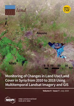
Since 2011, the Syrian civil war has caused a grave social and economic crisis in most of Syria. The conflict has destroyed the livelihoods of millions of people, triggered large-scale population displacements, and led to the large-scale abandonment of land. Demand for food and space at other sites, and other conflict-related human activities, have put enormous pressure on land systems. As the military conflict impedes the collection of information at ground level, multi-temporal Landsat imagery was applied to quantify changes in land cover between 2010 and 2018. Extensive changes for the six land cover categories cultivated areas, forests, urban areas, bare areas, rangelands, and water bodies, particularly between 2014 and 2018, were identified. Most of the change can be either directly or indirectly attributed to the serious implications of the conflict. View this paper
  • Issues are regarded as officially published after their release is announced to the table of contents alert mailing list.
  • You may sign up for e-mail alerts to receive table of contents of newly released issues.
  • PDF is the official format for papers published in both, html and pdf forms. To view the papers in pdf format, click on the "PDF Full-text" link, and use the free Adobe Reader to open them.
Order results
Result details
Section
Select all
Export citation of selected articles as:
24 pages, 2897 KiB  
Article
Transformation of Local People’s Property Rights Induced by New Town Development (Case Studies in Peri-Urban Areas in Indonesia)
by Rahmat Aris Pratomo, D. Ary A. Samsura and Erwin van der Krabben
Land 2020, 9(7), 236; https://doi.org/10.3390/land9070236 - 21 Jul 2020
Cited by 16 | Viewed by 5379
Abstract
New town development as a form of large-scale development is not a new phenomenon, particularly in developing countries. This development mainly takes place in peri-urban areas due to the high pressure caused by the growing population and the lack of facilities and infrastructure [...] Read more.
New town development as a form of large-scale development is not a new phenomenon, particularly in developing countries. This development mainly takes place in peri-urban areas due to the high pressure caused by the growing population and the lack of facilities and infrastructure in city centres. As an effect, local communities who originally occupied the land often lose their rights over the property their livelihood might have relied on. Property rights can be grouped differently, classified according to different bundles: appropriation, ownership, and formality of rights. This paper investigates to what extent new town development in Indonesia has affected the property rights of local communities, in terms of the transformation of rights and security level. Moreover, it examines to what extent this transformation has been affected by urbanisation pressure. Ample attention is paid to the transformation of various bundles of rights concerning different usage of property, both residential and cultivated land. A total of 252 questionnaires were distributed to three different locations of new towns in Indonesia. A before-after analysis was employed to identify the transformation of the property rights and their security level, followed by multiple linear regression analysis to observe the influence of the urbanisation pressure to the security level. The research reveals that the transformation of property rights of local residents mainly concerns the appropriation rights. The analysis also indicates that there is a tendency that the security level decreases. Statistically, this appears to be affected by urbanisation pressure variables: type of land, land use, and occupation. With this study, we offer on the one hand a conceptual framework for assessing property rights, while on the other hand, we provide empirical evidence regarding the effects of new town development on property rights transformation and its security level. Full article
(This article belongs to the Special Issue Responsible and Smart Land Management)
Show Figures

Figure 1

16 pages, 2329 KiB  
Article
Revisiting the Proximity Principle with Stakeholder Input: Investigating Property Values and Distance to Urban Green Space in Potchefstroom
by Zene Combrinck, Elizelle Juanee Cilliers, Louis Lategan and Sarel Cilliers
Land 2020, 9(7), 235; https://doi.org/10.3390/land9070235 - 20 Jul 2020
Cited by 8 | Viewed by 3875
Abstract
Nature is essential to urban quality of life, yet green spaces are under pressure. In an attempt to strengthen the case for urban greening and to reclaim nature into cities, this research considered green spaces from an economic spatial perspective. The proximity principle, [...] Read more.
Nature is essential to urban quality of life, yet green spaces are under pressure. In an attempt to strengthen the case for urban greening and to reclaim nature into cities, this research considered green spaces from an economic spatial perspective. The proximity principle, as part of hedonic price analysis, is employed to determine the impact of green spaces on property value in specifically selected residential areas within Potchefstroom, South Africa. Our statistical analysis indicated a rejection of the proximity principle in some areas, contradicting internationally accepted theory. To investigate local trends and possible reasons for the rejection, supporting quantitative data was gathered through structured questionnaires disseminated to local residents of Potchefstroom and Professional Planners in South Africa. Challenges pertaining to the planning of green spaces were emphasised, despite residents’ willingness to pay more for such green spaces in close proximity to residential areas, according to the cross-tabulations conducted. The research results contributed to the discourse on the economic benefits of green spaces and presented the trends of such benefits within the local context of Potchefstroom. The results emphasised the need to rethink the planning of green spaces within the local context, and provided recommendations on how to reclaim nature into cities from a spatial planning perspective. Full article
(This article belongs to the Special Issue Urban Ecosystem Services)
Show Figures

Figure 1

17 pages, 265 KiB  
Article
Governing Community-Based Natural Resource Management in Australia: International Implications
by Allan Dale, Karen Vella, Sarah Ryan, Kathleen Broderick, Rosemary Hill, Ruth Potts and Tom Brewer
Land 2020, 9(7), 234; https://doi.org/10.3390/land9070234 - 20 Jul 2020
Cited by 14 | Viewed by 3530
Abstract
Community-based natural resource management (CBNRM) has grown in stature as a key component of many national natural resource and rural development governance systems. Despite their growth, the integrity of CBNRM governance systems has rarely been analysed in a national context. To enhance dialogue [...] Read more.
Community-based natural resource management (CBNRM) has grown in stature as a key component of many national natural resource and rural development governance systems. Despite their growth, the integrity of CBNRM governance systems has rarely been analysed in a national context. To enhance dialogue about how best to design and deploy such systems nationally, this paper analyses the Australian system in detail. The Australian system was selected because the nation has a globally recognised and strong history of CBNRM approaches. We first contextualise the international emergence of national CBRM governance systems before analysing the Australian system. We find that a theoretically informed approach recognising regions as the anchors in brokering multi-scale CBNRM was applied between 2000 and 2007. Subsequent policy, while strengthening indigenous roles, has tended to weaken regional brokering, Commonwealth–state cooperation and research collaboration. Our findings and consequent emerging lessons can inform Australian policy makers and other nations looking to establish (or to reform existing) CBNRM governance systems. Equally, the research approach taken represents the application of an emerging new theoretical framework for analysing complex governance systems. Full article
20 pages, 3137 KiB  
Article
Forecasting Seasonal Habitat Connectivity in a Developing Landscape
by Katherine A. Zeller, David W. Wattles, Javan M. Bauder and Stephen DeStefano
Land 2020, 9(7), 233; https://doi.org/10.3390/land9070233 - 18 Jul 2020
Cited by 8 | Viewed by 3015
Abstract
Connectivity and wildlife corridors are often key components to successful conservation and management plans. Connectivity for wildlife is typically modeled in a static environment that reflects a single snapshot in time. However, it has been shown that, when compared with dynamic connectivity models, [...] Read more.
Connectivity and wildlife corridors are often key components to successful conservation and management plans. Connectivity for wildlife is typically modeled in a static environment that reflects a single snapshot in time. However, it has been shown that, when compared with dynamic connectivity models, static models can underestimate connectivity and mask important population processes. Therefore, including dynamism in connectivity models is important if the goal is to predict functional connectivity. We incorporated four levels of dynamism (individual, daily, seasonal, and interannual) into an individual-based movement model for black bears (Ursus americanus) in Massachusetts, USA. We used future development projections to model movement into the year 2050. We summarized habitat connectivity over the 32-year simulation period as the number of simulated movement paths crossing each pixel in our study area. Our results predict black bears will further colonize the expanding part of their range in the state and move beyond this range towards the greater Boston metropolitan area. This information is useful to managers for predicting and addressing human–wildlife conflict and in targeting public education campaigns on bear awareness. Including dynamism in connectivity models can produce more realistic models and, when future projections are incorporated, can ensure the identification of areas that offer long-term functional connectivity for wildlife. Full article
(This article belongs to the Special Issue Dynamic Landscape Connectivity)
Show Figures

Figure 1

15 pages, 1652 KiB  
Article
Land-Use Changes in the Canary Archipelago Using the CORINE Data: A Retrospective Analysis
by José Manuel Naranjo Gómez, Sérgio Lousada, Jacinto Garrido Velarde, Rui Alexandre Castanho and Luís Loures
Land 2020, 9(7), 232; https://doi.org/10.3390/land9070232 - 17 Jul 2020
Cited by 35 | Viewed by 3923
Abstract
The relationships between territorial governance and the pursuit of sustainable development are evidenced to be critical. Exploratory tools, like Geographic Information Systems (GIS), enable us to comprehend the patterns, dynamics, and parameters of land-use changes over the years. The results from such studies [...] Read more.
The relationships between territorial governance and the pursuit of sustainable development are evidenced to be critical. Exploratory tools, like Geographic Information Systems (GIS), enable us to comprehend the patterns, dynamics, and parameters of land-use changes over the years. The results from such studies could be used in the design of a sustainable territorial governance strategy. Contextually, a study has been conducted based on the changes that occurred in land uses in the Canary Archipelago in the years 1990, 2000, 2012, and 2018 using CORINE (Coordination of Information on the Environment) data. Even if most of the land uses have been stable over the analyzed period, the investigation shows a decrease in agricultural areas. By contrast, it is possible to verify an increase in semi-natural areas and urban agglomerations. Moreover, the authors believe that an assessment of the land-use changes on these ultra-peripheral areas will also enable us to disclose some obstacles and opportunities for sustained development. Full article
(This article belongs to the Special Issue Landscape Planning as a Catalyst for Sustainable Development)
Show Figures

Figure 1

23 pages, 565 KiB  
Article
Challenges of Food Waste Governance: An Assessment of European Legislation on Food Waste and Recommendations for Improvement by Economic Instruments
by Beatrice Garske, Katharine Heyl, Felix Ekardt, Lea Moana Weber and Wiktoria Gradzka
Land 2020, 9(7), 231; https://doi.org/10.3390/land9070231 - 16 Jul 2020
Cited by 54 | Viewed by 12018
Abstract
Food is wasted throughout the entire food supply chain—from agricultural production to the household level. This has negative impacts on natural resources and the environment. At the same time, food waste is undermining the global target of food security. In turn, reducing food [...] Read more.
Food is wasted throughout the entire food supply chain—from agricultural production to the household level. This has negative impacts on natural resources and the environment. At the same time, food waste is undermining the global target of food security. In turn, reducing food waste can minimise the environmental effects of agriculture on climate, biodiversity, soils, water bodies and the atmosphere. All of this is reflected in the fact that food waste is subject to various legal acts of the European Union and that it is also a major subject in the new EU Farm to Fork Strategy from May 2020. Supported by an analysis of the diffuse empirical data on food waste, the purpose of this article is to analyse the current EU legislation on food waste and its reduction to answer the following research questions: How is food waste integrated into European policies? What is the impact of European legislation on food waste? Is European legislation sufficient to trigger not only food waste reduction but also comprehensive changes in the agricultural and food sector to support global climate and environmental targets as set in the Paris Agreement and the Convention on Biological Diversity? Which instruments are the most suitable to do so? Methodologically, a qualitative governance analysis is applied. It is found that relevant legal acts for governing food waste include circular economy and waste law, the Common Agricultural Policy and the Common Fisheries Policy as well as food law, while international environmental targets serve as an overarching measure for governance analysis. The legal analysis shows that existing legislation lacks steering effect to significantly reduce food waste. To overcome current governance problems, the article introduces economic policy instruments. It is concluded that quantity control focusing on overarching parameters such as fossil fuels or animal-derived products has not only the potential to reduce food waste by increasing food prices but can also address the multiple interlinked environmental challenges of the agricultural and food sector. Full article
(This article belongs to the Section Land Socio-Economic and Political Issues)
Show Figures

Figure 1

16 pages, 3812 KiB  
Article
Effectiveness of Cover Crops to Reduce Loss of Soil Organic Matter in a Rainfed Vineyard
by Manuel López-Vicente, Elena Calvo-Seas, Sara Álvarez and Artemi Cerdà
Land 2020, 9(7), 230; https://doi.org/10.3390/land9070230 - 16 Jul 2020
Cited by 65 | Viewed by 6939
Abstract
Cover crops (CCs) minimize the loss of soil in permanent cropping systems where the soil is usually bare due to intense tillage or overuse of herbicides. The topsoil, the richer layer in soil organic carbon and organic matter (OM), is affected by water [...] Read more.
Cover crops (CCs) minimize the loss of soil in permanent cropping systems where the soil is usually bare due to intense tillage or overuse of herbicides. The topsoil, the richer layer in soil organic carbon and organic matter (OM), is affected by water erosion. Nature-based solutions appear as a suitable option for sustainable farming. In this study, the effectiveness of two years of CC management to reduce the OM loss is evaluated in a rainfed vineyard in a rolling landscape (Huesca, NE Spain). Two sediment traps collected runoff over 15 months. Topsoil OM contents (1.64% and 1.60%) and sediment/soil OM enrichment ratio (2.61 and 3.07) were similar. However, the average annual rate of OM loss was 3.6 times higher in the plot with lower vegetation cover than in the plot with CCs (1.29 vs. 0.35 kgOM ha−1 yr−1). The concentration of OMSed showed a negative relationship with the net soil loss; and significant differences appeared between the OMSed in the months with low and moderate-to-high ground cover. CCs are an excellent nature-based solution to control the unsustainable soil and OM losses measured in vineyards, which will contribute to achieve the Sustainable Development Goals of the United Nations. Full article
(This article belongs to the Special Issue Land Degradation Neutrality (LDN))
Show Figures

Figure 1

14 pages, 1415 KiB  
Article
Climatic Characteristics and Modeling Evaluation of Pan Evapotranspiration over Henan Province, China
by Miao Zhang, Bo Su, Majid Nazeer, Muhammad Bilal, Pengcheng Qi and Ge Han
Land 2020, 9(7), 229; https://doi.org/10.3390/land9070229 - 16 Jul 2020
Cited by 4 | Viewed by 1828
Abstract
Pan evapotranspiration (E) is an important physical parameter in agricultural water resources research. Many climatic factors affect E, and one of the essential challenges is to model or predict E utilizing limited climatic parameters. In this study, the performance of four different artificial [...] Read more.
Pan evapotranspiration (E) is an important physical parameter in agricultural water resources research. Many climatic factors affect E, and one of the essential challenges is to model or predict E utilizing limited climatic parameters. In this study, the performance of four different artificial neural network (ANN) algorithms i.e., multiple hidden layer back propagation (MBP), generalized regression neural network (GRNN), probabilistic neural networks (PNN), and wavelet neural network (WNN) and one empirical model namely Stephens–Stewart (SS) were employed to predict monthly E. Long-term climatic data (i.e., 1961–2013) was used for the validation of the proposed model in the Henan province of China. It was found that different models had diverse prediction accuracies in various geographical locations, MBP model outperformed other models over almost all stations (maximum R2 = 0.96), and the WNN model was the best over two sites, the accuracies of the five models ranked as MBP, WNN, GRNN, PNN, and SS. The performances of WNN and GRNN were almost the same, five-input ANN models provided better accuracy than the two-input (solar radiation (Ro) and air temperature (T)) SS empirical model (R2 = 0.80). Similarly. the two-input ANN models (maximum R2 = 0.83) also generally performed better than the two-input (Ro and T) SS empirical model. The study could reveal that the above ANN models can be used to predict E successfully in hydrological modeling over Henan Province. Full article
Show Figures

Figure 1

14 pages, 3441 KiB  
Perspective
On Landscape Architecture Education and Professional Practice and Their Future Challenges
by Carl Steinitz
Land 2020, 9(7), 228; https://doi.org/10.3390/land9070228 - 13 Jul 2020
Cited by 20 | Viewed by 4794
Abstract
Increased environmental and social risk, ubiquitous information technology, and growing demands for and growing threats to democracy and public participation will alter the education and practice of all the design professions and the geographically oriented sciences, and the ways in which their activities [...] Read more.
Increased environmental and social risk, ubiquitous information technology, and growing demands for and growing threats to democracy and public participation will alter the education and practice of all the design professions and the geographically oriented sciences, and the ways in which their activities towards influencing environmental and social change are organized and carried out. We all know about these trends, but we do not take them seriously enough. We are not adapting fast enough towards education or professional practice that is collaborative and globally oriented. Full article
Show Figures

Figure 1

25 pages, 2923 KiB  
Article
Unpacking Changing Multi-Actor and Multi-Level Actor Ties in Transformative Spaces: Insights from a Degraded Landscape, Machubeni, South Africa
by Menelisi Falayi, James Gambiza and Michael Schoon
Land 2020, 9(7), 227; https://doi.org/10.3390/land9070227 - 13 Jul 2020
Cited by 9 | Viewed by 3991
Abstract
The loss of ecosystem services through land degradation continues to be a significant concern for policymakers and land users around the world. Facilitating collective action among various actors is regarded as imperative in halting land degradation. Despite extensive research on collective action, there [...] Read more.
The loss of ecosystem services through land degradation continues to be a significant concern for policymakers and land users around the world. Facilitating collective action among various actors is regarded as imperative in halting land degradation. Despite extensive research on collective action, there have been few studies that continuously map social ties and detect network evolution as a way of enabling longitudinal analysis of transformative spaces. This paper seeks to examine the changing dynamics of multi-actor and multi-level actor ties over a period of two years in Machubeni, South Africa. To do this, we used social network analysis to detect continuities and/or discontinuities of multi-actor and multi-level actor ties over time. Overall, edge density, clustering coefficient, and reciprocity scores steadily increased over the two years despite a decline in the number of active organisations within the network. Our results demonstrate that the proportion of strong ties gradually increased over time across three governance networks. However, multi-level linkages between the local municipality and the local organisations remained weak due to a lack of trust and collaborative fatigue. While the transformative space has succeeded in enhancing collaboration and knowledge sharing between local organisations and researchers, further long-term engagement with government agencies might be necessary for promoting institutional transformations and policy outcomes, and building network resilience in complex polycentric governance systems. Full article
Show Figures

Figure 1

31 pages, 2655 KiB  
Article
Monitoring of Changes in Land Use/Land Cover in Syria from 2010 to 2018 Using Multitemporal Landsat Imagery and GIS
by Mohamed Ali Mohamed, Julian Anders and Christoph Schneider
Land 2020, 9(7), 226; https://doi.org/10.3390/land9070226 - 11 Jul 2020
Cited by 43 | Viewed by 8467
Abstract
Understanding the effects of socio-ecological shocks on land use/land cover (LULC) change is essential for developing land management strategies and for reducing adverse environmental pressures. Our study examines the impacts of the armed conflict in Syria, which began in mid-2011, and the related [...] Read more.
Understanding the effects of socio-ecological shocks on land use/land cover (LULC) change is essential for developing land management strategies and for reducing adverse environmental pressures. Our study examines the impacts of the armed conflict in Syria, which began in mid-2011, and the related social and economic crisis on LULC between 2010 and 2018. We used remote sensing for change detection by applying a supervised maximum likelihood classification to Landsat images of the three target years 2010, 2014, and 2018. Based on the computed extent of our LULC classes and accuracy assessment, we calculated area-adjusted estimates and 95% confidence intervals. Our classification achieved an overall accuracy of 86.4%. Compared to 2010, we found an increase in spatial extent for bare areas (40,011 km2), forests (2576 km2), and urban and peri-urban areas (3560 km2), whereas rangelands (37,005 km2) and cultivated areas (9425 km2) decreased by 2018. It is not possible to determine whether the changes in LULC in Syria will be permanent or temporary. Natural conditions such as climate fluctuations had an impact on the uses of the natural environment and cultivated areas during the study period, especially in regions suffering from water stress. Although seasonal precipitation patterns and temperature affect LULC change, however, we could not identify a prevailing climate trend towards more drought-prone conditions. Our analysis focuses on (potential) direct and indirect implications of the Syrian conflict on LULC change, which most notably occurred between 2014 and 2018. Conflict-related main drivers were human activities and demographic changes, which are mainly attributable to large-scale population displacement, military operations, concomitant socio-economic status, and control of local resources. As the study provides quantitative and qualitative information on the dynamics of LULC changes in Syria, it may serve as a framework for further relevant conflict-related research and support planning, management practices, and sustainable development. Full article
(This article belongs to the Section Land Systems and Global Change)
Show Figures

Figure 1

12 pages, 1027 KiB  
Communication
Reclassifying the Wildland–Urban Interface Using Fire Occurrences for the United States
by Brice B. Hanberry
Land 2020, 9(7), 225; https://doi.org/10.3390/land9070225 - 11 Jul 2020
Cited by 10 | Viewed by 3453
Abstract
The wildland–urban interface (WUI) occurs at the intersection of houses and undeveloped wildlands, where fire is a safety concern for communities, motivating investment in planning, protection, and risk mitigation. Because there is no operational definition of WUI based on where fires in fact [...] Read more.
The wildland–urban interface (WUI) occurs at the intersection of houses and undeveloped wildlands, where fire is a safety concern for communities, motivating investment in planning, protection, and risk mitigation. Because there is no operational definition of WUI based on where fires in fact have occurred, I used fire occurrences to objectively establish a definition of WUI, while examining spatiotemporal changes, for the conterminous United States. I applied four classifiers, but focused on C5.0, which produced equivalent sensitivity (0.87 to 0.91 at prevalence = 0.67) and generated a ruleset that indicated housing density was the preferable basis for definitions. Fire occurrences overall were predicted for housing densities <100 houses/km2 with potentially low (≥10%) thresholds for percent vegetation cover, varying by housing densities and models. A generalized guideline according to classifications is continued use of existing definitions for wildlands of <6.17 houses/km2 and a low-density intermix class of 6.17 to 50 houses/km2. Departing from other definitions, the medium-density class encompasses 50 to 100 houses/km2 and the high-density class is 100 to 200 houses/km2. Interface, or suburban, communities are 200 to 400 houses/km2. Implications of refining the definition include a larger critical area classified as greater fire risk (low and medium-density WUI below 100 houses/km2) at 855,000 km2 during 2010, and; therefore, incorporation of more communities and homeowners into a high-risk status. The low-density class had greatest risk of fire exposure, but the medium-density class contained a greater concentration of houses. Classification of the wildland–urban interface or intermix based on realized fire occurrences provides an objective foundation for identifying residential densities at risk of fire exposure, which permits disclosure of risk, prioritization of resources to communities and homeowners with greater wildfire exposure, development of strategies for communities to coexist with fire, and responses to reduce vulnerability. Full article
(This article belongs to the Special Issue Fire in the Earth System: Humans and Nature)
Show Figures

Figure 1

20 pages, 991 KiB  
Article
A Relational Approach to Landscape Stewardship: Towards a New Perspective for Multi-Actor Collaboration
by Jessica Cockburn, Eureta Rosenberg, Athina Copteros, Susanna Francina (Ancia) Cornelius, Notiswa Libala, Liz Metcalfe and Benjamin van der Waal
Land 2020, 9(7), 224; https://doi.org/10.3390/land9070224 - 10 Jul 2020
Cited by 21 | Viewed by 3699
Abstract
Landscape stewardship is increasingly understood within the framing of complex social-ecological systems. To consider the implications of this, we focus on one of the key characteristics of complex social-ecological systems: they are relationally constituted, meaning that system characteristics emerge out of dynamic relations [...] Read more.
Landscape stewardship is increasingly understood within the framing of complex social-ecological systems. To consider the implications of this, we focus on one of the key characteristics of complex social-ecological systems: they are relationally constituted, meaning that system characteristics emerge out of dynamic relations between system components. We focus on multi-actor collaboration as a key form of relationality in landscapes, seeking a more textured understanding of the social relations between landscape actors. We draw on a set of ‘gardening tools’ to analyse the boundary-crossing work of multi-actor collaboration. These tools comprise three key concepts: relational expertise, common knowledge, and relational agency. We apply the tools to two cases of landscape stewardship in South Africa: the Langkloof Region and the Tsitsa River catchment. These landscapes are characterised by economically, socio-culturally, and politically diverse groups of actors. Our analysis reveals that history and context strongly influence relational processes, that boundary-crossing work is indeed difficult, and that doing boundary-crossing work in smaller pockets within a landscape is helpful. The tools also helped to identify three key social-relational practices which lend a new perspective on boundary-crossing work: 1. belonging while differing, 2. growing together by interacting regularly and building common knowledge, and 3. learning and adapting together with humility and empathy. Full article
Show Figures

Graphical abstract

20 pages, 1051 KiB  
Review
Preserving Farmland on the Urban Fringe: A Literature Review on Land Policies in Developed Countries
by Coline Perrin, Camille Clément, Romain Melot and Brigitte Nougarèdes
Land 2020, 9(7), 223; https://doi.org/10.3390/land9070223 - 09 Jul 2020
Cited by 38 | Viewed by 5615
Abstract
This paper reviews the recent literature dealing with farmland protection (FP) policies in developed countries from a planning perspective, with a specific focus on the Mediterranean region. It provides coverage of French language papers that may have been omitted in previous reviews. While [...] Read more.
This paper reviews the recent literature dealing with farmland protection (FP) policies in developed countries from a planning perspective, with a specific focus on the Mediterranean region. It provides coverage of French language papers that may have been omitted in previous reviews. While the Mediterranean is often pointed out as a region with acute challenges related to food security and a lack of effective planning policies, the literature underlines that issues related to FP policies are similar across the world. Hence, this review may bring valuable insights for more sustainable management of farmland on the urban fringe. It maps several interesting areas of research concerning the often implicit and disparate rationales of FP policies as well as the barriers and potential avenues for improvement for FP. It highlights that FP cannot rely merely on transferring policy tools that have proven successful elsewhere. It also reveals that land policies do not always take into account the specific needs of farming systems, as they often focus on land rather than on agriculture. Further research is thus needed to reveal the interaction over time between the use of certain FP tools and the unique local features of urban fringe agriculture. This review may be of interest to students and scholars, but also to practitioners, policy makers and local groups looking for innovative, more flexible or locally suited farmland protection programs. Full article
Show Figures

Figure 1

23 pages, 1500 KiB  
Article
Assessing Sustainable Rural Development Based on Ecosystem Services Vulnerability
by Pascual Fernández Martínez, Mónica de Castro-Pardo, Víctor Martín Barroso and João C. Azevedo
Land 2020, 9(7), 222; https://doi.org/10.3390/land9070222 - 09 Jul 2020
Cited by 35 | Viewed by 4090
Abstract
Sustainable Rural Development is essential to maintain active local communities and avoid depopulation and degradation of rural areas. Proper assessment of development in these territories is necessary to improve decision-making and to inform public policy, while ensuring biodiversity conservation and ecosystem services supply. [...] Read more.
Sustainable Rural Development is essential to maintain active local communities and avoid depopulation and degradation of rural areas. Proper assessment of development in these territories is necessary to improve decision-making and to inform public policy, while ensuring biodiversity conservation and ecosystem services supply. Rural areas include high ecological value systems but the vulnerability of environmental components in development indicators has not been sufficiently pinpointed. The main objective of this work was to propose a new sustainable rural development composite indicator (nSRDI) while considering an environmental dimension indicator based on ecosystem services vulnerability and social and economic dimension indicators established using a sequentially Benefit of the Doubt-Data Envelopment Analysis (BoD-DEA) model. It aimed also to test effects of weighting methods on nSRDI. The composite indicator was applied to 10 regions (comarcas) in the Huesca province, Spain, producing a ranking of regions accordingly. The indicator was further tested through the analysis of the effect of an equal and optimum weighting method on scores and rankings of regions. Results showed substantial differences in nSRDI scores/rankings when vulnerability was added to the process, suggesting that the environmental dimension and the perspective from which it is conceived and applied matters when addressing sustainable rural development. Full article
Show Figures

Figure 1

14 pages, 451 KiB  
Commentary
Sustainable Population Growth in Low-Density Areas in a New Technological Era: Prospective Thinking on How to Support Planning Policies Using Complex Spatial Models
by Eduardo Gomes
Land 2020, 9(7), 221; https://doi.org/10.3390/land9070221 - 08 Jul 2020
Cited by 15 | Viewed by 3102
Abstract
Urban development is the result of the interaction between anthropogenic and environmental dimensions. From the perspective of its density, it ranges from high-density populated areas, associated with large cities that concentrate the main economic and social thrust of societies, to low-density populated areas [...] Read more.
Urban development is the result of the interaction between anthropogenic and environmental dimensions. From the perspective of its density, it ranges from high-density populated areas, associated with large cities that concentrate the main economic and social thrust of societies, to low-density populated areas (e.g., rural areas, small–medium-sized cities). Against the backdrop of the new technological and environmental era, this commentary offers insights on how to support spatial planning policies for sustainable urban growth in low-density areas. We propose the integration of technological drivers such as Internet networks, telecommuting, distance-learning education, the use of electric cars, etc. into the complex spatial models to project and thus to identify the best locations for urban development in low-density areas. This understanding can help to mitigate the disparities between high- and low-density populated areas, and to reduce the inequality among regions as promoted in the UN 2030 Agenda for Sustainable Development Goals. Full article
Show Figures

Figure 1

7 pages, 193 KiB  
Editorial
Does Commons Grabbing Lead to Resilience Grabbing? The Anti-Politics Machine of Neo-Liberal Agrarian Development and Local Responses
by Tobias Haller, Fabian Käser and Mariah Ngutu
Land 2020, 9(7), 220; https://doi.org/10.3390/land9070220 - 08 Jul 2020
Cited by 11 | Viewed by 2719
Abstract
This Special Issue contributes to the debate that land grabbing should be discussed as commons grabbing [...] Full article
4 pages, 175 KiB  
Correction
Correction: Going Beyond Panaceas: The Diversity of Land Observatory Forms in Africa. Land 2020, 9, 70
by Quentin Grislain, Jeremy Bourgoin, Ward Anseeuw, Perrine Burnod, Eva Hershaw and Djibril Diop
Land 2020, 9(7), 219; https://doi.org/10.3390/land9070219 - 06 Jul 2020
Cited by 1 | Viewed by 1551
Abstract
The authors wish to make the following corrections to this paper [...] Full article
(This article belongs to the Section Land Socio-Economic and Political Issues)
18 pages, 4535 KiB  
Article
Coastal Typology: An Analysis of the Spatiotemporal Relationship between Socioeconomic Development and Shoreline Change
by Elizabeth A. Mack, Ethan Theuerkauf and Erin Bunting
Land 2020, 9(7), 218; https://doi.org/10.3390/land9070218 - 04 Jul 2020
Cited by 4 | Viewed by 2988
Abstract
Globally, coastal communities are impacted by hazards including storm events, rising water levels, and associated coastal erosion. These hazards destroy homes and infrastructure causing human and financial risks for communities. At the same time, the economic and governance capacity of these communities varies [...] Read more.
Globally, coastal communities are impacted by hazards including storm events, rising water levels, and associated coastal erosion. These hazards destroy homes and infrastructure causing human and financial risks for communities. At the same time, the economic and governance capacity of these communities varies widely, impacting their ability to plan and adapt to hazards. In order to identify locations vulnerable to coastal hazards, knowledge of the physical coastal changes must be integrated with the socio-economic profiles of communities. To do this, we couple information about coastal erosion rates and economic data in communities along the Great Lakes to develop a typology that summarizes physical and economic vulnerability to coastal erosion. This typology classifies communities into one of four categories: (1) High physical and economic vulnerability to coastal erosion, (2) High physical but low economic vulnerability to coastal erosion, (3) Low physical and low economic vulnerability to coastal erosion, and (4) High economic but low physical vulnerability to coastal erosion. An analysis of this typology over three time periods (2005–2010), (2010–2014), and (2014–2018) reveals the dynamic nature of vulnerability over this fourteen year time span. Given this complexity, it can be difficult for managers and decision-makers to decide where to direct limited resources for coastal protection. Our typology provides an analytical tool to proactively address this challenge. Further, it advances existing work on coastal change and associated vulnerability in three ways. One, it implements a regional, analytical approach that moves beyond case study-oriented work and facilitates community analyses in a comparative context. Two, the typology provides an integrated assessment of vulnerability that considers economic vulnerability to coastal erosion, which is a contextual variable that compounds or helps mitigate vulnerability. Three, the typology facilitates community comparisons over time, which is important to identifying drivers of change in Great Lakes coastal communities over time and community efforts to mitigate and adapt to these hazards. Full article
(This article belongs to the Section Soil-Sediment-Water Systems)
Show Figures

Figure 1

20 pages, 8234 KiB  
Article
From Tactical Urbanism Action to Institutionalised Urban Planning and Educational Tool: The Evolution of Park(ing) Day
by Krzysztof Herman and Maria Rodgers
Land 2020, 9(7), 217; https://doi.org/10.3390/land9070217 - 03 Jul 2020
Cited by 11 | Viewed by 8258
Abstract
A singular and modest activist action, a temporary park created in San Francisco, grew into the global urban Park(ing) Day (PD) phenomenon. This tactical urbanism event not only expanded to be annually celebrated in thousands of parking lots all over the world but [...] Read more.
A singular and modest activist action, a temporary park created in San Francisco, grew into the global urban Park(ing) Day (PD) phenomenon. This tactical urbanism event not only expanded to be annually celebrated in thousands of parking lots all over the world but became an inspiration for urban planning and policy changes. The permanent rendition of Park(ing) Day, parklets, resulted from the movement but did not stop the spread of PD itself. This article presents case studies from New Zealand and Poland, two geographically and culturally distant locations where PD has further developed and evolved gaining local qualities. Through research methods such as research in design, secondary data analysis and expert interviews we study the trajectory of PD evolution and the role and interpretation of it in different parts of the globe. The results show a narrative of successive popularisation and institutionalisation as well as diversification. Departing from its grassroots, guerilla and assertive traits, PD has grown to become an artistic, creative and urban planning tool. As an established, recognised action and an ‘attractive’ idea, PD has great potential for designer education, allowing a venue for implementing methods such as design-build and live project. Full article
Show Figures

Figure 1

25 pages, 15609 KiB  
Article
Enhancing the Territorial Heritage of Declining Rural Areas in Spain: Towards Integrating Top-Down and Bottom-Up Approaches
by Ángel Raúl Ruiz Pulpón and María del Carmen Cañizares Ruiz
Land 2020, 9(7), 216; https://doi.org/10.3390/land9070216 - 03 Jul 2020
Cited by 32 | Viewed by 4244
Abstract
The population of a considerable number of rural areas in the interior of Spain is in decline. Faced with this problem, various institutions are launching initiatives to enhance the territorial heritage (natural and cultural) of these areas and, starting with a minimum of [...] Read more.
The population of a considerable number of rural areas in the interior of Spain is in decline. Faced with this problem, various institutions are launching initiatives to enhance the territorial heritage (natural and cultural) of these areas and, starting with a minimum of economic diversification, help to reverse these depopulation processes and promote local development overall. Two specific initiatives are analysed here: the Almadén Mining Park and the Molina-Alto Tajo District Geopark, both of which are located in central-southern Spain and have been officially recognised by UNESCO as World Heritage Sites. These two examples allow us to demonstrate, as our main objective, the today importance of territorial revival processes that were initiated by institutions (top-down approach) and then backed up by increasing participation by the local communities (bottom-up approach), encouraged by, among other factors, rural development programmes. In this regard, two aspects are important: the need for an interrelationship between the two approaches in terms of collaborative governance, in order to minimise the current processes of depopulation and territorial dislocation; and the use of the potential synergy between the resources in these two districts to ensure the viability of the initiatives and provide visitors with a high-quality experience. Full article
Show Figures

Figure 1

15 pages, 3887 KiB  
Article
Enclaves of Isolation and Neglect in Rural Areas. Evidence from North-Eastern Poland
by Alina Źróbek-Różańska
Land 2020, 9(7), 215; https://doi.org/10.3390/land9070215 - 01 Jul 2020
Cited by 4 | Viewed by 2868
Abstract
This article focuses on the specificity of present enclave structures in rural areas that were created decades ago as a result of decisions to establish housing estates for employees, and which acquired negative features as a result of the liquidation of the monopolistic [...] Read more.
This article focuses on the specificity of present enclave structures in rural areas that were created decades ago as a result of decisions to establish housing estates for employees, and which acquired negative features as a result of the liquidation of the monopolistic employer. An attempt has been made to answer if workers' housing complexes can turn into permanent enclaves of isolation and neglect after the liquidation of a monopolistic workplace, especially if they are located in rural areas? The aim of the paper is to picture the process of social exclusion emergence in the rural areas, which results from the still unresolved socio-economic problem of the existence of such enclaves of isolation and neglect in Polish rural areas in the 21st century. Despite almost 30 years passing, the areas with spatially and socially isolated settlements have very high unemployment rates, a low level of technical and social infrastructure and a widespread sense of injustice among the people who live there. The empirical basis for the analysis was four cases. The presented stories took place against the historical background of the Warmińsko-Mazurskie Voivodship and the socio-economic background. Studies were conducted in the selected villages with a free-form interview and photographic documentation was prepared. In the result, a close picture of the enclaves was drawn. The examples presented in this article proved that workers' settlements, located around large economic entities distant from existing settlement networks can develop into enclaves of isolation and neglect. Full article
(This article belongs to the Special Issue Responsible and Smart Land Management)
Show Figures

Figure 1

28 pages, 5057 KiB  
Article
The Contemporary Economic Costs of Spatial Chaos: Evidence from Poland
by Przemysław Śleszyński, Adam Kowalewski, Tadeusz Markowski, Paulina Legutko-Kobus and Maciej Nowak
Land 2020, 9(7), 214; https://doi.org/10.3390/land9070214 - 01 Jul 2020
Cited by 51 | Viewed by 5266
Abstract
This paper is based on the results of an extensive (840-page) report of the Committee on National Spatial Development of the Polish Academy of Sciences, entitled Studies on Spatial Chaos (edited by A. Kowalewski, T, Markowski and P. Śleszyński—Studia KPZK PAN, vol. 182, [...] Read more.
This paper is based on the results of an extensive (840-page) report of the Committee on National Spatial Development of the Polish Academy of Sciences, entitled Studies on Spatial Chaos (edited by A. Kowalewski, T, Markowski and P. Śleszyński—Studia KPZK PAN, vol. 182, Warsaw 2018—in Polish). Its aim was to conduct a comprehensive and detailed study on the problem of spatial chaos (spatial disorder), including an estimate of economic costs in Poland. For this purpose, literature was queried (articles and reports, etc.) and special analyses were prepared for this purpose. The total annual costs of spatial chaos were estimated at not less than 20 billion euros per year. The conclusions also proposed solutions and suggestions (for the government and local governments), which may reduce the acute costs of spatial chaos in society and economy. Full article
(This article belongs to the Special Issue Conditions, Effects and Costs of Spatial Chaos)
Show Figures

Figure 1

20 pages, 2959 KiB  
Article
Dynamics of Rural Economy: A Socio-Economic Understanding of Oil Palm Expansion and Landscape Changes in East Kalimantan, Indonesia
by Arya Hadi Dharmawan, Dyah Ita Mardiyaningsih, Heru Komarudin, Jaboury Ghazoul, Pablo Pacheco and Faris Rahmadian
Land 2020, 9(7), 213; https://doi.org/10.3390/land9070213 - 01 Jul 2020
Cited by 27 | Viewed by 7740
Abstract
The fast-growing palm oil economy has stimulated a significant expansion of oil palm plantations in Indonesia. The uncontrolled development of large oil palm plantations has raised complex socio-ecological issues, including changes of ecological landscapes, organization of production, and farming household livelihood systems. For [...] Read more.
The fast-growing palm oil economy has stimulated a significant expansion of oil palm plantations in Indonesia. The uncontrolled development of large oil palm plantations has raised complex socio-ecological issues, including changes of ecological landscapes, organization of production, and farming household livelihood systems. For two oil palm villages with different ecological settings, this article describes changes in land cover, how production is organized, and the income structure changes due to rural economic development. The research used survey approaches and analysis of earth maps, assisted by data obtained from satellite imagery. A qualitative approach was also used to support a survey via in-depth interviews. The research was carried out in two oil palm economy-based villages of Kutai Kartanegara District, of the Province of East Kalimantan of Indonesia. The first village is located very close to the center of regional administration and has evolved into a non-farming economy. In contrast, the other village is more isolated and solely relies on farming activities. The study found that changes of land cover caused by oil palm expansion could be categorized into two types, concentrated and spotted, following the influence of oil palm investment activities. It was also found that organization of the production of most smallholders existed in two types of arrangements, partial and total integration of production. From the perspective of livelihood, two different types of income structures emerged, diversified and uniform. This article concludes that responses of smallholders to palm oil spread varied depending on the ecological setting, the existence of the already established plantation economy in the region, the capacity of the smallholders to diversify economic activities based on palm oil, and the exposure to external economic activities. Full article
Show Figures

Figure 1

19 pages, 3827 KiB  
Article
From Closed to Claimed Spaces for Participation: Contestation in Urban Redevelopment Induced-Displacements and Resettlement in Kigali, Rwanda
by Alice Nikuze, Richard Sliuzas and Johannes Flacke
Land 2020, 9(7), 212; https://doi.org/10.3390/land9070212 - 01 Jul 2020
Cited by 12 | Viewed by 3501
Abstract
In many cities and urban areas in Africa, land acquisition for urban redevelopment, land readjustment, and resettlement of affected urban residents are currently framed as innovative approaches to eradicating informal settlements, improving the living environments, and supporting the implementation of newly adopted city [...] Read more.
In many cities and urban areas in Africa, land acquisition for urban redevelopment, land readjustment, and resettlement of affected urban residents are currently framed as innovative approaches to eradicating informal settlements, improving the living environments, and supporting the implementation of newly adopted city Master Plans. Nevertheless, it is not yet known how the responses of institutions and affected people shape these processes. Based on research conducted in Kigali, Rwanda, this article discusses affected residents’ responses to land expropriation and resettlement necessary for urban redevelopments. Our findings show that affected informal settlement dwellers voiced their concerns over the deviations from the Expropriation Law, compensation decision-making made behind closed doors, lack of transparency in property valuation, and compensation packages that they perceive to be unfair. Some of the consequences of these concerns are strong feelings of unfairness, exclusion, and marginalisation; distrust and increased perceptions of impoverishment risks, all of which fuel contestation and resistance attitudes among the affected landowners. The affected landowners agitate to assert their rights and stake their claims through contestations, community mobilisation, and legal recourse. We conclude that such contestations constitute claimed spaces and interactions in which affected landowners are laying claim to fair processes against the ‘’exceptionality’’ and the “decide-defend” decision-making approaches, while local authorities assert legitimacy of their decisions. Critically, informal households affected by urban redevelopments see opportunities for participation in their resettlement decision-making as fundamental to securing their future. Full article
Show Figures

Figure 1

21 pages, 4866 KiB  
Article
Quality Labels as Drivers of Peri-Urban Livestock Systems Resilience
by Rosalia Filippini, Sabine Gennai-Schott, Tiziana Sabbatini, Sylvie Lardon and Elisa Marraccini
Land 2020, 9(7), 211; https://doi.org/10.3390/land9070211 - 30 Jun 2020
Cited by 5 | Viewed by 2542
Abstract
Livestock farming systems have an important role in the territorial systems of the Mediterranean, but in the last twenty years the sector has undergone serious changes with an important decrease in the number of farms. The purpose of this study is to show [...] Read more.
Livestock farming systems have an important role in the territorial systems of the Mediterranean, but in the last twenty years the sector has undergone serious changes with an important decrease in the number of farms. The purpose of this study is to show the contribution of a local food certification to the resilience of peri-urban livestock farming system and of its food supply chain at territorial level. The focus is on the “Carne Bovina di Pisa” project, a private label promoted by the local livestock producers’ association, with the purpose of preserving biodiversity and provide farmers with an opportunity to strengthen their local marketing power. The case study is the peri-urban area of Pisa (Tuscany, Italy), representative of the urbanized Mediterranean coastal plains with high urban pressure on agricultural land and increasing agricultural abandonment in the peri-urban area. The analysis is based on the qualitative analysis of interviews to stakeholders and the quantitative figures about the changes in livestock system. Results show that the label has positively sustained both the resilience of farming systems and the local food supply chains. Full article
Show Figures

Figure 1

19 pages, 3782 KiB  
Article
Untangle the Complex Stakeholder Relationships in Rural Settlement Consolidation in China: A Social Network Approach
by Fan Yang, Guangqing Chi, Ge Wang, Shirui Tang, Yunting Li and Cong Ju
Land 2020, 9(7), 210; https://doi.org/10.3390/land9070210 - 29 Jun 2020
Cited by 22 | Viewed by 4823
Abstract
Rural settlement consolidation (RSC) has a critical role in facilitating the transformation of human settlement and land use transition in the rural revitalization process. RSC involves a diversity of stakeholder groups with complex and intertwined concerns. It is therefore crucial to identify the [...] Read more.
Rural settlement consolidation (RSC) has a critical role in facilitating the transformation of human settlement and land use transition in the rural revitalization process. RSC involves a diversity of stakeholder groups with complex and intertwined concerns. It is therefore crucial to identify the key stakeholders and their main concerns to effectively align rural planning and policymaking. However, this line of research remains underdeveloped. This study provides a novel and holistic network perspective for unpacking the complex relationships among different stakeholders. The results indicate: (1) the network of stakeholder concerns is relatively sparse, with 68 concern nodes and 159 concern ties; (2) The village committee, centralized residents, and contractors occupy the core position within the concerns network, while the local government has the majority of strongly connected nodes; (3) The lists of prominent concern nodes and ties are identified by different network indices, including the degree difference, the out-status centrality, closeness centrality, node betweenness centrality, and link betweenness centrality; (4) The main interaction type among stakeholder groups can be classified into five categories: financing, psychological attachment, stakeholder participation, project management, and the improvement in living conditions and infrastructure. This study reveals the relatively weak status of residents, the pivotal role of the village committee, as well as the indispensable part of the contractor and township government, with the aim to provide targeted guidance and decision-making supports for strengthening interactions and cooperation among different stakeholder groups. The findings shed new light on performing the multi-tasks of RSC and facilitating the sustainable management of rural areas. Full article
Show Figures

Figure 1

Previous Issue
Next Issue
Back to TopTop