Next Issue
Volume 9, May
Previous Issue
Volume 9, March


Land, Volume 9, Issue 4 (April 2020) – 32 articles

Cover Story (view full-size image): 
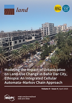
We use an integrated cellular automata–Markov chain model to analyze and predict urban expansion and its impact on LUC in Bahir Dar, Ethiopia, aided by high-resolution Landsat images (1991, 2002, 2011, 2018). We use an analytical hierarchy process method to identify factors underlying expansion in the area. Built-up areas rapidly expanded while overall farmland and vegetation declined. Using a 2018 model calibration, we predict LUCs in the area for 2025, 2034, and 2045 in the area. Based on this prediction, the conversion of other land-use types into built-up areas will persist in the southern, southwestern, and northeastern areas of the city—attributable to uneven geographies of road accessibility, proximity to the city center, and slope variables. Our results are useful for land use management and city planning, as they present factors and trends of urban expansion in light of ongoing LUCs.View this [...] Read more.
  • Issues are regarded as officially published after their release is announced to the table of contents alert mailing list.
  • You may sign up for e-mail alerts to receive table of contents of newly released issues.
  • PDF is the official format for papers published in both, html and pdf forms. To view the papers in pdf format, click on the "PDF Full-text" link, and use the free Adobe Reader to open them.
Order results
Result details
Section
Select all
Export citation of selected articles as:
14 pages, 255 KiB  
Article
Inclusive Landscape Governance for Sustainable Development: Assessment Methodology and Lessons for Civil Society Organizations
by Koen Kusters, Maartje De Graaf, Louise Buck, Katherine Galido, Alphonse Maindo, Heidi Mendoza, Tran Huu Nghi, Edi Purwanto and Roderick Zagt
Land 2020, 9(4), 128; https://doi.org/10.3390/land9040128 - 24 Apr 2020
Cited by 28 | Viewed by 7986
Abstract
Landscape governance refers to the combination of rules and decision-making processes of civic, private, and public actors with stakes in the landscape, that together shape the future of that landscape. As part of the Green Livelihoods Alliance, a program that supports civil society [...] Read more.
Landscape governance refers to the combination of rules and decision-making processes of civic, private, and public actors with stakes in the landscape, that together shape the future of that landscape. As part of the Green Livelihoods Alliance, a program that supports civil society organizations (CSOs) to strengthen the governance of tropical forested landscapes, we developed and implemented a method that facilitates stakeholders to assess the status of governance in their own landscape and to identify options for improvement. In this article, we aim to reflect on landscape governance, based on our work within the Green Livelihoods Alliance. We present the method, summarize the results of its implementation, and draw practical lessons regarding the role of CSOs to improve landscape governance. We conducted workshops with stakeholders in 17 forested landscapes across 10 countries in Asia, Africa, and Latin America. During each workshop, participants scored and discussed a set of governance indicators, developed a common vision for landscape governance, and identified the practical steps that would need to be taken to achieve that vision. Analyzing the results from the workshops, we found that landscape stakeholders tend to perceive that: opportunities to influence decision-making are unequal; integrated landscape planning efforts remain noncommittal; and implementation and enforcement of regulations is weak. To improve governance in the future, it is common to call for the development of multi-stakeholder processes, to allow different actors to discuss, negotiate, and develop collaborative action to address landscape-level challenges. CSOs can support such processes, by helping to develop a shared understanding of landscape governance, differences in interests, and possibilities for collaborative action. CSOs can also help stakeholders to develop multi-stakeholder procedures, and build trust and capacity among stakeholders to take an active role in such processes. Full article
20 pages, 507 KiB  
Article
Effects of China’s Collective Forestland Tenure Reform Policies on Forest Product Firm Values
by Tingting Zhang, Shunbo Yao, Jinna Yu, Assem Abu Hatab and Zhen Liu
Land 2020, 9(4), 127; https://doi.org/10.3390/land9040127 - 24 Apr 2020
Cited by 5 | Viewed by 4357
Abstract
China’s collective forestland tenure reform has dramatically affected the business environment of domestic forest product firms. This study examines the impact of the said reform on the expected values of these firms, via the reaction of investors (as seen on the stock markets) [...] Read more.
China’s collective forestland tenure reform has dramatically affected the business environment of domestic forest product firms. This study examines the impact of the said reform on the expected values of these firms, via the reaction of investors (as seen on the stock markets) towards the issuance of related policies. Based on signaling theory and the assumption that the Chinese stock markets are efficient in terms of work form, this study adopts an event study method and examines five policies during the 2003–2009 period. The numbers of forest product firms used in the examinations herein differ among the policies and range from 21 to 29. This study found that the policies have differentially affected the expected values of forest product firms and that the impact on firms lacking forestland holdings is generally more significant than that on firms that hold forestland. The findings of this study enhance our understanding of the effect of collective forestland tenure reform on the value of forest product firms; they also have implications on forest product firms as they work to adapt to the reform. Full article
(This article belongs to the Section Land Socio-Economic and Political Issues)
Show Figures

Figure 1

12 pages, 2575 KiB  
Article
Latitudinal Gradient in Urban Pressure and Socio-Environmental Quality: The “Peninsula Effect” in Italy
by Bernardino Romano, Lorena Fiorini, Chiara Di Dato and Vanessa Tomei
Land 2020, 9(4), 126; https://doi.org/10.3390/land9040126 - 23 Apr 2020
Cited by 7 | Viewed by 1837
Abstract
The purpose of this work is to synthesize, for an international audience, certain fundamental elements that characterize the Italian peninsular territory, through the use of a biogeographical model known as the “peninsula effect” (PE). Just as biodiversity in peninsulas tends to change, diverging [...] Read more.
The purpose of this work is to synthesize, for an international audience, certain fundamental elements that characterize the Italian peninsular territory, through the use of a biogeographical model known as the “peninsula effect” (PE). Just as biodiversity in peninsulas tends to change, diverging from the continental margin, so do some socio-economic and behavioral characteristics, for which it is possible to detect a progressive and indisputable variation depending on the distance from the continental mass. Through the use of 14 indicators, a survey was conducted on the peninsular sensitivity (which in Italy is also latitudinal) of as many phenomena. It obtained confirmation results for some of them, well known as problematic for the country, but contradictory results for others, such as those related to urban development. In the final part, the work raises a series of questions, also showing how peninsular Italy, and in particular Central–Southern Italy, is not penalized so dramatically by its geography and morphology as many political and scientific opinions suggest. The result is a very ambiguous image of Italy, in which the country appears undoubtedly uniform in some aspects, while the PE is very evident in others; it is probably still necessary to investigate, without relying on simplistic and misleading equations, the profound reasons for some phenomena that could be at the basis of less ephemeral rebalancing policies than those practiced in the past. Full article
(This article belongs to the Section Land Socio-Economic and Political Issues)
Show Figures

Figure 1

18 pages, 8824 KiB  
Article
Quantification of Erosion in Selected Catchment Areas of the Ruzizi River (DRC) Using the (R)USLE Model
by Joachim Eisenberg and Fabrice A. Muvundja
Land 2020, 9(4), 125; https://doi.org/10.3390/land9040125 - 23 Apr 2020
Cited by 19 | Viewed by 3622
Abstract
Inappropriate land management leads to soil loss with destruction of the land’s resource and sediment input into the receiving river. Part of the sediment budget of a catchment is the estimation of soil loss. In the Ruzizi catchment in the Eastern Democratic Republic [...] Read more.
Inappropriate land management leads to soil loss with destruction of the land’s resource and sediment input into the receiving river. Part of the sediment budget of a catchment is the estimation of soil loss. In the Ruzizi catchment in the Eastern Democratic Republic of the Congo (DRC), only limited research has been conducted on soil loss mainly dealing with local observations on geomorphological forms or river load measurements; a regional quantification of soil loss is missing so far. Such quantifications can be calculated using the Universal Soil Loss Equation (USLE). It is composed of four factors: precipitation (R), soil (K), topography (LS), and vegetation cover (C). The factors can be calculated in different ways according to the characteristics of the study area. In this paper, different approaches for calculating the single factors are reviewed and validated with field work in two sub-catchments of Ruzizi River supplying the water for the reservoirs of Ruzizi I and II hydroelectric dams. It became obvious that the (R)USLE model provides the best results with revised R and LS factors. C factor calculations required to conduct a supervised classification using the Maximum Likelihood Procedure. Different C factor values were assigned to the land cover classes. The calculations resulted in a soil loss rate for the predominantly occurring Ferralsols and Leptosols of around 576 kt/yr in both catchments, when 2016 landcover and precipitation are used. This represents an area-normalized value of 40.4 t/ha/yr for Ruzizi I and 50.5 t/ha/yr for Ruzizi II due to different landcover in the two sub-catchments. The mean value for the whole study area is 47.8 t/ha/yr or even 27.1 t/ha/yr when considering land management techniques like terracing on the slopes (P factor). This work has shown that the (R)USLE model can serve as an easy to handle tool for soil loss quantification when comprehensive field work results are sparse. The model can be implemented in Geographic Information Systems (GIS) with free data; hence, a validation is crucial. It becomes apparent that the use of high resolution Sentinel 2a MSI data as the basis for C factor calculations is an appropriate method for considering heterogeneous Land Use Land Cover (LULC) patterns. To transfer the approach to other regions, the calculation of factor R needs to be modified. Full article
(This article belongs to the Section Soil-Sediment-Water Systems)
Show Figures

Figure 1

34 pages, 1662 KiB  
Article
Evaluating the Community Land Record System in Monwabisi Park Informal Settlement in the Context of Hybrid Governance and Organisational Culture
by Michael Barry and Rosalie Kingwill
Land 2020, 9(4), 124; https://doi.org/10.3390/land9040124 - 22 Apr 2020
Cited by 2 | Viewed by 2601
Abstract
The study examined the effectiveness of a community-operated land record system (CRS), a product of an evolutionary information system planning approach under hybrid governance arrangements in Monwabisi Park informal settlement in Cape Town. To structure the analysis, the authors adapted an analytical framework [...] Read more.
The study examined the effectiveness of a community-operated land record system (CRS), a product of an evolutionary information system planning approach under hybrid governance arrangements in Monwabisi Park informal settlement in Cape Town. To structure the analysis, the authors adapted an analytical framework for analysing land registration effectiveness to community records systems. It serves as a tool for analysing, designing and managing similar information systems. The CRS is an element of a participatory planning and development project involving a triad: (a) community-based organisations (CBOs); (b) a non-governmental organisation (NGO), which has acted as a change agent, facilitator and resource provider; and (c) the City of Cape Town. The hybrid governance institutions comprised a set of local community and government protocols. Of further significance are the organisational cultures of the CBOs, and the NGO’s information system team differs markedly from that of most land registries. The researchers examined the CRS database and operations management, interviewed key-informants and interviewed shack residents door-to-door. The CRS was effective because residents used it and largely adhered to the associated documented community protocols to defend their tenure and to effect transactions in shacks. Further contributors were the NGO and CBOs continually managed the institutional and leadership dynamics relevant to the CRS, factors often ignored in similar projects. Full article
Show Figures

Figure 1

23 pages, 3963 KiB  
Article
Monitoring of Urban Landscape Ecology Dynamics of Islamabad Capital Territory (ICT), Pakistan, Over Four Decades (1976–2016)
by Hammad Gilani, Sohail Ahmad, Waqas Ahmed Qazi, Syed Muhammad Abubakar and Murtaza Khalid
Land 2020, 9(4), 123; https://doi.org/10.3390/land9040123 - 20 Apr 2020
Cited by 16 | Viewed by 5893
Abstract
In the late 1960s, the Islamic Republic of Pakistan’s capital shifted from Karachi to Islamabad, officially named Islamabad Capital Territory (ICT). In this aspect, the ICT is a young city, but undergoing rapid expansion and urbanization, especially in the last two decades. This [...] Read more.
In the late 1960s, the Islamic Republic of Pakistan’s capital shifted from Karachi to Islamabad, officially named Islamabad Capital Territory (ICT). In this aspect, the ICT is a young city, but undergoing rapid expansion and urbanization, especially in the last two decades. This study reports the measurement and characterization of ICT land cover change dynamics using Landsat satellite imagery for the years 1976, 1990, 2000, 2010, and 2016. Annual rate of change, landscape metrics, and urban forest fragmentation spatiotemporal analyses have been carried out, along with the calculation of the United Nations Sustainable Development Goal (SDG) indicator 11.3.1 Land Consumption Rate to the Population Growth Rate (LCRPGR). The results show consistent increase in the settlement class, with highest annual rate of 8.79% during 2000–2010. Tree cover >40% and <40% canopy decreased at an annual rate of 0.81% and 0.77% between 1976 to 2016, respectively. Forest fragmentation analysis reveals that ‘core forests of >500 acres’ class decreased from 392 km2 (65.41%) to 241 km2 (55%), and ‘patch forest’ class increased from 15 km2 (2.46%) to 20 km2 (4.54%), from 1976 to 2016. The LCRPGR ratio was 0.62 from 1976 to 2000, increasing to 1.36 from 2000 to 2016. Full article
(This article belongs to the Special Issue Urban Ecosystem Services)
Show Figures

Figure 1

17 pages, 674 KiB  
Article
Not Affected the Same Way: Gendered Outcomes for Commons and Resilience Grabbing by Large-Scale Forest Investors in Tanzania
by Désirée Gmür
Land 2020, 9(4), 122; https://doi.org/10.3390/land9040122 - 18 Apr 2020
Cited by 11 | Viewed by 2729
Abstract
The topic of large-scale land acquisition (LSLA) has attracted wide interest in the literature and the media. However, there is little work on the gendered institutional changes and gendered impacts on common pool resources (CPR) due to LSLA. The aim of this paper [...] Read more.
The topic of large-scale land acquisition (LSLA) has attracted wide interest in the literature and the media. However, there is little work on the gendered institutional changes and gendered impacts on common pool resources (CPR) due to LSLA. The aim of this paper is to address these impacts. This is done by discussing data from participatory research (using the methods of participatory observation, semi-structured and narrative interviews, biographies, focus group discussions, value chain analysis, and household questionnaires) on a forestry plantation operated by the British investor, the New Forests Company (NFC) in the Kilolo district, in the Iringa region. The institutional arrangements regarding different land-related common pool resources from pre-colonial times until the arrival of this investment will be shown. Furthermore, how these arrangements have changed over time and since the LSLA is presented. Then, the effects on men’s and women’s access to CPR and, thus, the impacts on their capacities to perform their reproductive work and resilience will be addressed. Furthermore, the paper focuses on how different stakeholders in the land deal (the investor, the government, different local people) make use of these different institutions to push through their own interests regarding the land. Finally, the paper looks at collective compensation payments (such as monetary compensation and jobs) and forms of corporate social responsibility (CSR) schemes, and how they are perceived emically. It is argued that the LSLA in this case clearly grabs land and land-related common pool resources that were previously held in common. Women, such as daughters, sisters, and wives, had specific access and property rights to these. Thus, the paper concludes that this grabbing lowers women’s resilience and deprives them of important resources for their livelihoods, and for food and cash production at critical times. CSR programmes and compensation rarely reach women and are, for them, an anti-politics machine, hiding the grabbing processes, and impacting the poorest of the poor, while the company uses a development discourse to legitimise its activities. In fact, the people perceive the investment as trapping them in underdevelopment. Full article
Show Figures

Figure 1

15 pages, 1986 KiB  
Article
Soil Carbon, Nitrogen and Phosphorus Contents along a Gradient of Agricultural Intensity in the Kilombero Valley, Tanzania
by John Livsey, Edmond Alavaisha, Madaka Tumbo, Steve W. Lyon, Antonio Canale, Michele Cecotti, Regina Lindborg and Stefano Manzoni
Land 2020, 9(4), 121; https://doi.org/10.3390/land9040121 - 18 Apr 2020
Cited by 7 | Viewed by 3039
Abstract
The preservation of soils which provide many important services to society is a pressing global issue. This is particularly the case in countries like Tanzania, which will experience rapid population growth over coming decades. The country is also currently experiencing rapid land-use change [...] Read more.
The preservation of soils which provide many important services to society is a pressing global issue. This is particularly the case in countries like Tanzania, which will experience rapid population growth over coming decades. The country is also currently experiencing rapid land-use change and increasing intensification of its agricultural systems to ensure sufficient food production. However, little is known regarding what the long term effects of this land use change will be, especially concerning soil quality. Therefore, we assessed the effect of irrigation and fertilization in agricultural systems, going from low intensity smallholder to high intensity commercial production, on soil organic carbon (SOC), total nitrogen (TN), and total phosphorous (TP) concentrations and stocks. Soil sampling was conducted within Kilombero Plantations Ltd. (KPL), a high intensity commercial farm located in Kilombero, Tanzania, and also on surrounding smallholder farms, capturing a gradient of agricultural intensity. We found that irrigation had a positive effect on SOC concentrations and stocks while fertilization had a negative effect. Rain-fed non-fertilized production had no effect on soil properties when compared to native vegetation. No difference was found in concentrations of TN or TP across the intensity gradient. However, TN stocks were significantly larger in the surface soils (0–30 cm) of the most intensive production system when compared to native vegetation and smallholder production. Full article
(This article belongs to the Special Issue Soil Management for Sustainability)
Show Figures

Figure 1

19 pages, 1029 KiB  
Article
Farming System Transformation Impacts on Landscape: A Case Study on Quality Wine Production in a Highly Contested Agricultural Landscape
by George Vlahos
Land 2020, 9(4), 120; https://doi.org/10.3390/land9040120 - 17 Apr 2020
Cited by 6 | Viewed by 2659
Abstract
This paper is an attempt to synthesize the conclusions of a series of consecutive research projects along a common thread. It focuses on the landscape impacts of a gradual transformation undergone by a low input and bulk wine producing system into a quality [...] Read more.
This paper is an attempt to synthesize the conclusions of a series of consecutive research projects along a common thread. It focuses on the landscape impacts of a gradual transformation undergone by a low input and bulk wine producing system into a quality wine system. This transformation took place on the island of Santorini, in Cyclades, Greece, during the last four decades in a highly contested landscape. A polarization in the power game has been identified, with two poles having different priorities and perceptions about the two issues at stake: agricultural landscape and wine quality. In the course of this process, both synergistic and antagonistic transition dynamics are encountered, transforming significantly the balance of driving forces. Our analysis suggests that market forces influenced landscape change to a far greater degree than policy measures implemented on the island. Developments in the international markets for tourism and quality wine have played a crucial role in land use change and farming intensity. Public intervention in the form of both regulatory land use planning policy and incentive measures like Rural Development Policy, including an agri-environmental measure, targeted to the vineyards of Santorini, did not seem to have an equally important impact. Integration of landscape maintenance practices within the wine quality regime could create beneficial synergies. Full article
(This article belongs to the Section Land Socio-Economic and Political Issues)
Show Figures

Figure 1

21 pages, 1678 KiB  
Article
A Comprehensive Process for Stakeholder Identification and Engagement in Addressing Wicked Water Resources Problems
by William L. Hargrove and Josiah M. Heyman
Land 2020, 9(4), 119; https://doi.org/10.3390/land9040119 - 14 Apr 2020
Cited by 29 | Viewed by 4694
Abstract
Various sectors of stakeholders (urban, agricultural, policymakers, etc.) are frequently engaged in participatory research projects aimed at improving water resources’ sustainability. However, a process for comprehensive and integrative identification, classification, and engagement of all types of water stakeholders for a region or river [...] Read more.
Various sectors of stakeholders (urban, agricultural, policymakers, etc.) are frequently engaged in participatory research projects aimed at improving water resources’ sustainability. However, a process for comprehensive and integrative identification, classification, and engagement of all types of water stakeholders for a region or river basin, especially in a transboundary context, is missing for water resources research projects. Our objective was to develop a systematic approach to identifying and classifying water stakeholders, and engage them in a discussion of water futures, as a foundation for a participatory modeling research project to address the wicked water resource problems of the Middle Rio Grande basin on the U.S./Mexico border. This part of the Rio Grande basin can be characterized as having limited and dwindling supplies of water, increasing demands for water from multiple sectors, and a segmented governance system spanning two U.S. states and two countries. These challenges are being exacerbated by climate change; a transitioning agriculture to more water demanding, high value crops; urbanization; and growing demand for environmental services. Moving forward, a core question for this region is how can water be managed so that the three competing sectors—agricultural, urban, and environmental—can realize a sustainable future in this challenged water system? We identified the major water-using sectors who represent competing demands as including agricultural, municipal, self-supplied industrial users, environmental, and a sector we labeled “social justice”, comprised of individuals who lack access to potable water, or who represent groups who advocate for access to water. We included stakeholders from both the U.S. and Mexico, which is seldom done, who share transboundary water resources in the region. We hosted a series of stakeholder dialogues and obtained results that identified and described their vision for the future of water; challenges to be overcome; and important research questions that could be addressed using participatory modeling approaches. Four broad themes common to multiple sectors emerged: (1) quantity, drought, and scarcity; (2) quality/salinization; (3) urbanization; and (4) conservation and sustainability. Each sector expressed distinctive views regarding the future of water. Agricultural stakeholders, in particular, had strong feelings of ownership of water rights as part of land ownership and a concomitant sense of threat to those water rights emanating from dwindling supplies and competing demands. The contribution of this work is a methodology for identifying, classifying, and engaging all types of stakeholders in the context of a research project, enabling us to compare and contrast views of different types of stakeholders. Heretofore, this has been accomplished in “bits and pieces”, but never comprehensively and holistically. Full article
Show Figures

Figure 1

15 pages, 1449 KiB  
Article
Land Consolidation in Rural China: Life Satisfaction among Resettlers and Its Determinants
by Weiming Tong, Kevin Lo and Pingyu Zhang
Land 2020, 9(4), 118; https://doi.org/10.3390/land9040118 - 14 Apr 2020
Cited by 25 | Viewed by 2952
Abstract
The Chinese government has pursued rural land consolidation under the Building New Rural Communities (BNRC) initiative. The consolidation projects aim to address the hollowing village problem, improve the living standards of rural dwellers, and promote urban-rural integration. Rural villages with small populations and [...] Read more.
The Chinese government has pursued rural land consolidation under the Building New Rural Communities (BNRC) initiative. The consolidation projects aim to address the hollowing village problem, improve the living standards of rural dwellers, and promote urban-rural integration. Rural villages with small populations and poor infrastructure are merged into a centralized rural community, and their inhabitants are resettled. The newly vacated buildings are then converted to agriculture land, which allows cities to expand under the “no net loss” land-use policy. Despite the significance of the initiative, both in terms of the scale of operation and the impacts on the affected households, there are few empirical studies that scrutinize this form of rural restructuring. Drawing on data collected via surveys and interviews, this paper examines the processes of land consolidation and its impacts on villagers. From a development-as-modernization perspective, we outline three main processes of land consolidation: village mergers and resettlement, land circulation to rural cooperatives, and rural industrial development. Overall, the effects of land consolidation on the livelihood of resettled villagers are positive. This system generally improves housing and living conditions through increased levels of off-farm employment and income, but there are a number of barriers that may hinder a villager’s ability to find different employment. Housing and neighborhood characteristics have significant effects on the life satisfaction of villagers. Full article
Show Figures

Figure 1

17 pages, 2608 KiB  
Article
Trade-Offs between Economic Benefits and Ecosystem Services Value under Three Cropland Protection Scenarios for Wuhan City in China
by Liye Wang, Xinli Ke and Assem Abu Hatab
Land 2020, 9(4), 117; https://doi.org/10.3390/land9040117 - 11 Apr 2020
Cited by 9 | Viewed by 4391
Abstract
Over the past few decades urbanization and population growth have been the main trend all over the world, which brings the increase of economic benefits (EB) and the decrease of cropland. Cropland protection policies play an important role in the urbanization progress. In [...] Read more.
Over the past few decades urbanization and population growth have been the main trend all over the world, which brings the increase of economic benefits (EB) and the decrease of cropland. Cropland protection policies play an important role in the urbanization progress. In this study, we assess the trade-offs between EB and ecosystem services value (ESV) under three cropland protection policy scenarios using the LAND System Cellular Automata for Potential Effects (LANDSCAPE) model. The empirical results reveal that trade-offs between EB and ESV in urbanizing areas are dynamic, and that they considerably vary under different cropland protection policy scenarios. Especially, the results identify certain “turning points” for each policy scenario at which a small to moderate growth in EB would result in greater ESV losses. Among the three scenarios, we found that the cropland protection policy has the most adverse effect on trade-offs between EB and ESV and the results in the business as usual scenario have the least effect on the trade-offs. Furthermore, the results show that a strict balance between requisition and compensation of cropland is an inappropriate policy option in areas where built-up areas are increasing rapidly from the perspective of mitigating conflict between EB and ESV and the numbers of cropland protection that restrained by land use planning policy of Wuhan is a better choice. Full article
(This article belongs to the Section Land Systems and Global Change)
Show Figures

Figure 1

16 pages, 6713 KiB  
Article
Environmental Transformations in the Area of the Kuźnica Warężyńska Sand Mine, Southern Poland
by Jacek Różkowski, Oimahmad Rahmonov and Artur Szymczyk
Land 2020, 9(4), 116; https://doi.org/10.3390/land9040116 - 10 Apr 2020
Cited by 7 | Viewed by 2765
Abstract
On the basis of the analysis and interpretation of maps, published literature, and environmental reconnaissance, this article discusses environmental transformations in the area of the Kuźnica Warężyńska sand mine in southern Poland over the years 1944–2015. A comprehensive ecological analysis was carried out [...] Read more.
On the basis of the analysis and interpretation of maps, published literature, and environmental reconnaissance, this article discusses environmental transformations in the area of the Kuźnica Warężyńska sand mine in southern Poland over the years 1944–2015. A comprehensive ecological analysis was carried out concerning spatial development, mining activity, hydrogeological and hydrological conditions as well as the biotic environment. Among the unfavourable changes found were a drastic reduction in the agricultural function of the area (from 7.03 to 0.47 km2), mainly due to periodic activity of sand mine in 1967–2002, covering an area of about 5.80 km2, the destruction of the original biocenoses, the depletion and deterioration in quality of the groundwater resources, and man-made transformations of the hydrographic network (during the mine’s activity its length reached over 103 km). Vegetation changes during the 70-year period examined were closely related to human mining activity. The greatest changes occurred at the end of the 1960s when large areas of pine forest were cut down. The analysis of vegetation in the former workings demonstrated that the diversity of habitats within the workings results in a significant increase in species (367 plant species, 2002 birds) and community diversity (Molinion caeruleae, Molinion caeruleae, three Natura habitats) there compared to the adjacent areas. On the other hand, favourable changes included the construction of a flood control reservoir, with an area of 560 ha and a volume of 51 million m3, created in 2003–2005, making the area more attractive for tourism and recreation, and an increase in biodiversity, including the establishment of a Natura 2000 site. Full article
Show Figures

Figure 1

20 pages, 3613 KiB  
Article
Spatial-Temporal Characteristics of Cultivated Land Use Efficiency in Major Function-Oriented Zones: A Case Study of Zhejiang Province, China
by Chaozheng Zhang, Yangyue Su, Gangqiao Yang, Danling Chen and Rongxuan Yang
Land 2020, 9(4), 114; https://doi.org/10.3390/land9040114 - 10 Apr 2020
Cited by 23 | Viewed by 2784
Abstract
Promoting cultivated land use efficiency (CLUE) coordinated development in various major function-oriented zones is a measure to deal with unbalanced development of territorial space in China. Taking the optimized development, key development, agricultural production, ecological function, and ecological economic zones of Zhejiang province [...] Read more.
Promoting cultivated land use efficiency (CLUE) coordinated development in various major function-oriented zones is a measure to deal with unbalanced development of territorial space in China. Taking the optimized development, key development, agricultural production, ecological function, and ecological economic zones of Zhejiang province as research objects, this study incorporated agricultural carbon emission into the measurement framework of CLUE and analyzed the regional disparity and the convergence of CLUE from 2008 to 2017, using slack-based measure model (SBM), the Theil index, and convergence theory. The main results are as follows: (1) The CLUE value that considered agricultural carbon emissions was lower than the CLUE value that did not consider agricultural carbon emissions; thus, agricultural carbon emissions had a negative effect on CLUE. (2) The CLUE value of the five major function-oriented zones showed an increasing trend; after ranking the CLUE value, the CLUE of the optimized development zones was the highest, followed by the ecological function, ecological economic, and key development zones, and that of the agricultural production zones was the lowest, indicating significant regional disparity. (3) The overall disparity of CLUE presented an upward trend, and the within-regional disparity is the main source of the overall disparity. (4) Neither σ convergence nor absolute β convergence occurred in the CLUE of the five major function-oriented zones, but conditional β convergence occurred among the optimized development and ecological economic zones. Although the planning of major function-oriented zones reflects the regional disparity and convergence of CLUE to some extent, the CLUE under the control of major function-oriented zones is not consistent with the function positioning. Full article
Show Figures

Figure 1

17 pages, 3419 KiB  
Article
Modeling the Impact of Urbanization on Land-Use Change in Bahir Dar City, Ethiopia: An Integrated Cellular Automata–Markov Chain Approach
by Melaku Bogale Fitawok, Ben Derudder, Amare Sewnet Minale, Steven Van Passel, Enyew Adgo and Jan Nyssen
Land 2020, 9(4), 115; https://doi.org/10.3390/land9040115 - 09 Apr 2020
Cited by 49 | Viewed by 5859
Abstract
The fast-paced urbanization of recent decades entails that many regions are facing seemingly uncontrolled land-use changes (LUCs) that go hand in hand with a range of environmental and socio-economic challenges. In this paper, we use an integrated cellular automata–Markov chain (CA–MC) model to [...] Read more.
The fast-paced urbanization of recent decades entails that many regions are facing seemingly uncontrolled land-use changes (LUCs) that go hand in hand with a range of environmental and socio-economic challenges. In this paper, we use an integrated cellular automata–Markov chain (CA–MC) model to analyze and predict the urban expansion of and its impact on LUC in the city of Bahir Dar, Ethiopia. To this end, the research marshals high-resolution Landsat images of 1991, 2002, 2011, and 2018. An analytical hierarchy process (AHP) method is then used to identify the biophysical and socioeconomic factors underlying the expansion in the research area. It is shown that, during the period of study, built-up areas are rapidly expanding in the face of an overall decline of the farmland and vegetation cover. Drawing on a model calibration for 2018, the research predicts the possible geographies of LUC in the Bahir Dar area for 2025, 2034, and 2045. It is predicted that the conversions of other land-use types into built-up areas will persist in the southern, southwestern, and northeastern areas of the sprawling city, which can mainly be traced back to the uneven geographies of road accessibility, proximity to the city center, and slope variables. We reflect on how our findings can be used to facilitate sustainable urban development and land-use policies in the Bahir Dar area. Full article
Show Figures

Figure 1

20 pages, 1146 KiB  
Article
Drivers and Implications of Land Use/Land Cover Dynamics in Finchaa Catchment, Northwestern Ethiopia
by Wakjira Takala Dibaba, Tamene Adugna Demissie and Konrad Miegel
Land 2020, 9(4), 113; https://doi.org/10.3390/land9040113 - 08 Apr 2020
Cited by 88 | Viewed by 5596
Abstract
Understanding the trajectories and extents of land use/land cover change (LULCC) is important to generate and provide helpful information to policymakers and development practitioners about the magnitude and trends of LULCC. This study presents the contributing factors of LULCC, the extent and implications [...] Read more.
Understanding the trajectories and extents of land use/land cover change (LULCC) is important to generate and provide helpful information to policymakers and development practitioners about the magnitude and trends of LULCC. This study presents the contributing factors of LULCC, the extent and implications of these changes for sustainable land use in the Finchaa catchment. Data from Landsat images 1987, 2002, and 2017 were used to develop the land use maps and quantify the changes. A supervised classification with the maximum likelihood classifier was used to classify the images. Key informant interviews and focused group discussions with transect walks were used for the socio-economic survey. Over the past three decades, agricultural land, commercial farm, built-up, and water bodies have increased while forestland, rangeland, grazing land, and swampy areas have decreased. Intensive agriculture without proper management practice has been a common problem of the catchment. Increased cultivation of steep slopes has increased the risk of erosion and sedimentation of nearby water bodies. Multiple factors, such as biophysical, socio-economic, institutional, technological, and demographic, contributed to the observed LULCC in the study area. A decline in agricultural yield, loss of biodiversity, extended aridity and drought, land and soil degradation, and decline of water resources are the major consequences of LULCC in the Finchaa catchment. The socio-economic developments and population growth have amplified the prolonged discrepancy between supply and demand for land and water in the catchment. More comprehensive and integrated watershed management policies will be indispensable to manage the risks. Full article
Show Figures

Figure 1

21 pages, 2526 KiB  
Article
Landscape as Digital Content and a Smart Tourism Resource in the Mining Area of Cartagena-La Unión (Spain)
by Carlos J. Pardo Abad and José Fernández Álvarez
Land 2020, 9(4), 112; https://doi.org/10.3390/land9040112 - 07 Apr 2020
Cited by 19 | Viewed by 3637
Abstract
This research makes a highly relevant contribution to the scientific analysis of the mining landscape using the example of Cartagena-La Unión (Spain). The landscape is interpreted from a twin perspective: as a type of digital content offered to visitors and as a highly [...] Read more.
This research makes a highly relevant contribution to the scientific analysis of the mining landscape using the example of Cartagena-La Unión (Spain). The landscape is interpreted from a twin perspective: as a type of digital content offered to visitors and as a highly valuable scenic tourism resource. The article features an extensive bibliographical review and offers different perspectives on the relationship between landscape, tourism, and smart promotion. The method used is both qualitative and quantitative due to the presentation of statistical data. It describes a purpose-designed form used for analyzing the landscape in question and a synthetic landscape assessment index, as a result of creating and using different indicators. Extensive field work and consultation with several sources provided information about the enclave, how much it appeals to visitors, and their level of satisfaction. The results achieved offer a new scientific vision of what a spectacular cultural landscape, and a point of reference for “mining heritage tourism”, can represent. Full article
(This article belongs to the Special Issue Landscape and Tourism, Landscapes of Tourism)
Show Figures

Figure 1

25 pages, 8085 KiB  
Article
Effect of Land Use and Land Cover Change on Soil Erosion in Erer Sub-Basin, Northeast Wabi Shebelle Basin, Ethiopia
by Gezahegn Weldu Woldemariam and Arus Edo Harka
Land 2020, 9(4), 111; https://doi.org/10.3390/land9040111 - 05 Apr 2020
Cited by 36 | Viewed by 6233
Abstract
Land use and land cover change (LULCC) is a critical factor for enhancing the soil erosion risk and land degradation process in the Wabi Shebelle Basin. Up-to-date spatial and statistical data on basin-wide erosion rates can provide an important basis for planning and [...] Read more.
Land use and land cover change (LULCC) is a critical factor for enhancing the soil erosion risk and land degradation process in the Wabi Shebelle Basin. Up-to-date spatial and statistical data on basin-wide erosion rates can provide an important basis for planning and conservation of soil and water ecosystems. The objectives of this study were to examine the magnitude of LULCC and consequent changes in the spatial extent of soil erosion risk, and identify priority areas for Soil and Water Conservation (SWC) in the Erer Sub-Basin, Wabi Shebelle Basin, Ethiopia. The soil loss rates were estimated using an empirical prediction model of the Revised Universal Soil Loss Equation (RUSLE) outlined in the ArcGIS environment. The estimated total annual actual soil loss at the sub-basin level was 1.01 million tons in 2000 and 1.52 million tons in 2018 with a mean erosion rate of 75.85 t ha−1 y−1 and 107.07 t ha−1 y−1, respectively. The most extensive soil loss rates were estimated in croplands and bare land cover, with a mean soil loss rate of 37.60 t ha−1 y−1 and 15.78 t ha−1 y−1, respectively. The soil erosion risk has increased by 18.28% of the total area, and decreased by 15.93%, showing that the overall soil erosion situation is worsening in the study area. We determined SWC priority areas using a Multi Criteria Decision Rule (MCDR) approach, indicating that the top three levels identified for intense SWC account for about 2.50%, 2.38%, and 2.14%, respectively. These priority levels are typically situated along the steep slopes in Babile, Fedis, Fik, Gursum, Gola Oda, Haramaya, Jarso, and Kombolcha districts that need emergency SWC measures. Full article
Show Figures

Figure 1

16 pages, 1375 KiB  
Article
Synergies and Determinants of Sustainable Intensification Practices in Pakistani Agriculture
by Awais Jabbar, Qun Wu, Jianchao Peng, Jian Zhang, Asma Imran and Luo Yao
Land 2020, 9(4), 110; https://doi.org/10.3390/land9040110 - 05 Apr 2020
Cited by 15 | Viewed by 2995
Abstract
Sustainable intensification practices (SIPs) involve a process to produce high yields for existing land without affecting the environment. The significance and relevance of SIPs in a Pakistani context demands an investigation. Hence, this study takes the initiative to investigate the determinants regarding the [...] Read more.
Sustainable intensification practices (SIPs) involve a process to produce high yields for existing land without affecting the environment. The significance and relevance of SIPs in a Pakistani context demands an investigation. Hence, this study takes the initiative to investigate the determinants regarding the adoption of these practices. Based on the evidence, we selected five SIPs, namely, improved seeds, organic manure, crop rotation, intercropping, and low tillage. Furthermore, this study analyzes the adoption of SIPs with randomly collected data from 612 farmers through multistage sampling. A multivariate probit model (MVP) is employed to analyze the mutually dependent adoption decisions and identify the factors associated with them. The results revealed that education, the area under cultivation, access to information, extension access, social participation, rainfall variability, and temperature increase significantly predict the adoption of SIPs. The adoption of organic manure and crop rotation was highest between all the ecological zones, whereas low tillage was the least adopted practice. Adoption intensity in mixed cropping zones was slightly higher than the other ecological zones. Moreover, the findings also reveal the important synergies amid natural resource management and input-based SIPs. Hence, the study highlights the perseverance and importance of social groups and recommends the government to formulate comprehensive policies to facilitate institutional access and elevate the adoption level amongst the farming community. Full article
(This article belongs to the Special Issue Soil Tillage Systems and Conservative Agriculture)
Show Figures

Figure 1

15 pages, 1775 KiB  
Article
Community-Led Green Land Acquisition: Social Innovative Initiatives for Forest Protection and Regional Development
by Karina Castro-Arce and Frank Vanclay
Land 2020, 9(4), 109; https://doi.org/10.3390/land9040109 - 04 Apr 2020
Cited by 6 | Viewed by 3817
Abstract
Land acquisition often involves power and displacement and can be carried out on a large scale. There are many forms of land acquisition, including for environmental and conservation purposes as well as for production activities. While green grabbing has joined land grabbing as [...] Read more.
Land acquisition often involves power and displacement and can be carried out on a large scale. There are many forms of land acquisition, including for environmental and conservation purposes as well as for production activities. While green grabbing has joined land grabbing as an environmental justice issue of concern, it is not necessarily the case that all green land acquisition is large scale, done by powerful outsiders, or leads to displacement and exclusion. The outcomes of green land acquisition are dependent on the mechanisms used, the adequacy of resettlement and/or compensation, and the social and environmental context in which it happens. We discuss the outcomes of community-led land acquisition for conservation purposes in Costa Rica. We considered a special case of green land acquisition done by local civil society to defend the forest and water resources of the Juan Castro Blanco National Water Park in Costa Rica. We used the literature on green grabbing, social ecological systems, and social innovation to discuss local environmental governance and regional sustainable development. This paper makes a fresh contribution to environmental planning and environmental governance by bringing in aspects of green land acquisition that have not been previously explored. Full article
(This article belongs to the Special Issue Land, Land Use and Social Issues)
Show Figures

Figure 1

15 pages, 1820 KiB  
Article
Gendered Species Preferences Link Tree Diversity and Carbon Stocks in Cacao Agroforest in Southeast Sulawesi, Indonesia
by Rika Ratna Sari, Danny Dwi Saputra, Kurniatun Hairiah, Danaë M. A. Rozendaal, James M. Roshetko and Meine van Noordwijk
Land 2020, 9(4), 108; https://doi.org/10.3390/land9040108 - 03 Apr 2020
Cited by 31 | Viewed by 6454
Abstract
The degree to which the maintenance of carbon (C) stocks and tree diversity can be jointly achieved in production landscapes is debated. C stocks in forests are decreased by logging before tree diversity is affected, while C stocks in monoculture tree plantations increase, [...] Read more.
The degree to which the maintenance of carbon (C) stocks and tree diversity can be jointly achieved in production landscapes is debated. C stocks in forests are decreased by logging before tree diversity is affected, while C stocks in monoculture tree plantations increase, but diversity does not. Agroforestry can break this hysteresis pattern, relevant for policies in search of synergy. We compared total C stocks and tree diversity among degraded forest, complex cacao/fruit tree agroforests, simple shade-tree cacao agroforestry, monoculture cacao, and annual crops in the Konawe District, Southeast Sulawesi, Indonesia. We evaluated farmer tree preferences and the utility value of the system for 40 farmers (male and female). The highest tree diversity (Shannon–Wiener H index 2.36) and C stocks (282 Mg C ha−1) were found in degraded forest, followed by cacao-based agroforestry systems (H index ranged from 0.58–0.93 with C stocks of 75–89 Mg ha−1). Male farmers selected timber and fruit tree species with economic benefits as shade trees, while female farmers preferred production for household needs (fruit trees and vegetables). Carbon stocks and tree diversity were positively related (R2 = 0.72). Adding data from across Indonesia (n = 102), agroforestry systems had an intermediate position between forest decline and reforestation responses. Maintaining agroforestry in the landscape allows aboveground C stocks up to 50 Mg ha−1 and reduces biodiversity loss. Agroforestry facilitates climate change mitigation and biodiversity goals to be addressed simultaneously in sustainable production landscapes. Full article
(This article belongs to the Special Issue Agroforestry-Based Ecosystem Services)
Show Figures

Figure 1

20 pages, 3691 KiB  
Article
Vegetation Structure, Species Composition, and Carbon Sink Potential of Urban Green Spaces in Nagpur City, India
by Shruti Lahoti, Ashish Lahoti, Rajendra Kumar Joshi and Osamu Saito
Land 2020, 9(4), 107; https://doi.org/10.3390/land9040107 - 01 Apr 2020
Cited by 26 | Viewed by 6859
Abstract
Nagpur is rapidly urbanizing, and in the process witnessing decline in its green status which is one of the identities of the city. The study aims to understand the current species diversity, composition and structure in different classes of greens prevalent in the [...] Read more.
Nagpur is rapidly urbanizing, and in the process witnessing decline in its green status which is one of the identities of the city. The study aims to understand the current species diversity, composition and structure in different classes of greens prevalent in the city. As urban green spaces (UGS) are also reservoirs of carbon stock, the study estimates their biomass. Through rigorous field work, data were collected from 246 sample plots across various UGS classes as pre-stratification. Then the biomass was estimated using non-destructive method with species-specific equation. The diversity of tree species recorded in UGS varies, with high diversity recorded in avenue plantation and institutional compounds. The overall variation in species composition among UGS classes was 36.8%. While in managed greens the species composition was similar, in institutional greens and forest it was different. Particularly, in forest the evenness was high with low diversity and low species richness. The structural distribution indicate lack of old trees in the city, with high number of tree species between diameter classes of 10–40 cm. Biomass was recorded high in road-side plantations (335 t ha−1) and playgrounds (324 t ha−1), and trees with bigger girth size where the main contributors. The dominant species indicates that high growth rate, tolerance to drought and pollution are the key attributes considered for species selection by local authorities. Though the city holds green image, vegetation along the avenues and institutions are stressed, exposed, and threatened by felling activities for grey infrastructure expansions. In such scenario, protection and preservation of older trees is crucial to maintain the carbon stock of the city. In addition, local authorities need to focus on effective afforestation programs through public participation to achieve high survival rate and reduce the maintenance cost. For species selection in addition to phenology and growth rate, tree biomass and life span needs to be considered to significantly enhance the urban environment and increase the benefits derived from UGS. Full article
Show Figures

Figure 1

15 pages, 3147 KiB  
Article
Influence of Logos on Social Attitudes toward the Landscape of Protected Areas: The Case of National and Natural Parks in Spain
by Andrés Caballero-Calvo and José Luis Serrano-Montes
Land 2020, 9(4), 106; https://doi.org/10.3390/land9040106 - 01 Apr 2020
Viewed by 2614
Abstract
This study is the first analysis of the influence of the design of the logos of the National and Natural Parks of Spain on social attitudes toward these protected areas (PAs). The effect of certain elements in the logo of a PA on [...] Read more.
This study is the first analysis of the influence of the design of the logos of the National and Natural Parks of Spain on social attitudes toward these protected areas (PAs). The effect of certain elements in the logo of a PA on its attractiveness and on support for its conservation was explored through a questionnaire survey of groups of university students. The respondents were asked to choose between different park logos, using three main criteria: tourist interest, conservation priority, and willingness to pay for conservation. The results showed a higher preference for PAs whose logos include animals and a lower preference for those with heritage elements. No significant differences were found in terms of types of university programs. The results suggest that greater attention should be paid to the role of iconographic elements in considerations of the protection and management of landscapes. This study adds to our understanding of the social mechanisms that influence the interest of the public in Natural and National Parks. These results can be used to increase the involvement of the general population in conservation goals, contributing to the social, economic, and environmental sustainability of PAs. Full article
Show Figures

Figure 1

15 pages, 4191 KiB  
Article
Cultural Ecosystem Services of Geodiversity: A Case Study from Stránská skála (Brno, Czech Republic)
by Lucie Kubalíková
Land 2020, 9(4), 105; https://doi.org/10.3390/land9040105 - 31 Mar 2020
Cited by 29 | Viewed by 3612
Abstract
The concept of ecosystem services developed in the second half of the 20th century, and the Millennium Ecosystem Assessment was crucial for its acceptance. This assessment identified the services that ecosystems provide to society, but geodiversity (as an indispensable component of ecosystems) was [...] Read more.
The concept of ecosystem services developed in the second half of the 20th century, and the Millennium Ecosystem Assessment was crucial for its acceptance. This assessment identified the services that ecosystems provide to society, but geodiversity (as an indispensable component of ecosystems) was somewhat underestimated. At present, geodiversity is intensively used by human society and it provides numerous services including cultural as a resource for tourism, recreation, as a part of natural heritage, and to satisfy matters of spiritual importance. The main purpose of this paper is to present the geocultural issues of Stránská skála (a limestone cliff with caves and an anthropogenic underground) in Brno (Czech Republic) and to evaluate the cultural ecosystem services of geodiversity by using the abiotic ecosystem services approach. This assessment of cultural ecosystem services of the Stránská skála enables the identification and description of the functions and services which are provided by geodiversity and confirms the high cultural and geoheritage value of the site. Full article
(This article belongs to the Section Landscape Ecology)
Show Figures

Figure 1

31 pages, 6489 KiB  
Article
Natural Resource Conservation Based on Community Economic Empowerment: Perspectives on Watershed Management and Slum Settlements in Makassar City, South Sulawesi, Indonesia
by Batara Surya, Syafri Syafri, Hernita Sahban and Harry Hardian Sakti
Land 2020, 9(4), 104; https://doi.org/10.3390/land9040104 - 30 Mar 2020
Cited by 52 | Viewed by 6498
Abstract
The purpose of this study is to analyze the influence of slum development, community poverty, and community behavior on environmental degradation in the Tallo river basin in Makassar City and to analyze the effects of natural resource conservation, economic empowerment, community capacity building [...] Read more.
The purpose of this study is to analyze the influence of slum development, community poverty, and community behavior on environmental degradation in the Tallo river basin in Makassar City and to analyze the effects of natural resource conservation, economic empowerment, community capacity building on the productivity of economic enterprises and ecosystem-based sustainability. This study uses a qualitative-quantitative approach in sequence. Data were obtained through observation, surveys, and documentation. The research findings show that slums, poverty, and community behavior have a significant effect on the decline in the environmental quality of the Tallo river basin in Makassar City, with a coefficient of determination of 32.2%. The results showed that the conservation of natural resources, economic empowerment, and community capacity building were positively correlated to increasing the productivity of community economic enterprises and the sustainability of watershed ecosystems. The assertion is that watershed conservation, integrated with economic empowerment, contributes positively to economic, social, and environmental sustainability. This study offers the concept of conservation of natural resources based on community economic empowerment as a solution to the handling of slums for the case of metropolitan cities in Indonesia, to support metropolitan city development programs nationally. Full article
(This article belongs to the Section Landscape Ecology)
Show Figures

Figure 1

19 pages, 4760 KiB  
Article
Emerging Patterns of Mountain Tourism in a Dynamic Landscape: Insights from Kamikochi Valley in Japan
by Abhik Chakraborty
Land 2020, 9(4), 103; https://doi.org/10.3390/land9040103 - 29 Mar 2020
Cited by 6 | Viewed by 5855
Abstract
This article analyzes the emerging contours of mountain tourism in a highly popular destination in the North Japan Alps by reporting the findings of a two-year long study at the Kamikochi Valley. The main aim was to understand the dynamic character of the [...] Read more.
This article analyzes the emerging contours of mountain tourism in a highly popular destination in the North Japan Alps by reporting the findings of a two-year long study at the Kamikochi Valley. The main aim was to understand the dynamic character of the biophysical landscape and the perceptions of tourism service providers and visitors. The study was conducted using a qualitative design and involved in-depth interviews, observations, and a questionnaire survey for visitors. It was found that while different stakeholders held different perceptions of the landscape, there was a general lack of understanding among tourism service providers and visitors regarding the relationship between long-term processes and fine-scale heterogeneity of the landscape. The prevalence of an engineering approach has led to sweeping changes of key landscape interaction pathways over the years, threatening the heterogeneity and resilience of the natural environment. The findings also indicate a general visitor demand of information on the biophysical environment, and therefore it is of urgent need to address the biophysical integrity of such landscapes, and raise visitor awareness through the provision of relevant information. Full article
(This article belongs to the Special Issue Landscape and Tourism, Landscapes of Tourism)
Show Figures

Figure 1

21 pages, 590 KiB  
Article
Regional Economic Sustainability: Universities’ Role in Their Territories
by Dolores Gallardo-Vázquez and José A. Folgado-Fernández
Land 2020, 9(4), 102; https://doi.org/10.3390/land9040102 - 28 Mar 2020
Cited by 10 | Viewed by 2783
Abstract
The sustainability of territories (e.g., regions and countries) is currently an issue that should be considered when implementing organizational strategies. The globalization, industrialization, and population growth trends observed in recent decades have forced experts to adopt a sustainable approach capable of guaranteeing that [...] Read more.
The sustainability of territories (e.g., regions and countries) is currently an issue that should be considered when implementing organizational strategies. The globalization, industrialization, and population growth trends observed in recent decades have forced experts to adopt a sustainable approach capable of guaranteeing that a population’s present needs can be met without compromising future generations’ well-being. Among the essential pillars of successful sustainability strategies, social development stands out as quite important, so the present study focused on it. Social development strategies include ensuring a satisfactory level of education while simultaneously fostering an adequate quality of life and long-term sustainability. Thus, this study’s objective was to gain a clearer understanding of universities’ role as promoters of education and generators of populations that become more deeply rooted in their territory of origin. One public university, the University of Extremadura in Spain, was found to play a unique, specific role in its region, as this institution has quite unique characteristics that differentiate it from other nearby universities. This study measured the regional population’s preferences by assessing an interest group’s levels of satisfaction and by observing the influence of quality and innovation on this group’s perceptions of the public university’s operations. A questionnaire was prepared and distributed electronically to all University of Extremadura students. The final sample consisted of data from 362 questionnaires, which were analyzed using structural equation modeling. The results indicated that the students’ perceptions of this institution’s innovation and quality are determinants of their satisfaction levels. In addition, this university is considered to be a reason to remain in the region, promoting residents’ sense of belonging and helping consolidate the region as a sustainable area. Full article
Show Figures

Figure A1

23 pages, 1215 KiB  
Article
Land Inequality Trends and Drivers
by Marc C. A. Wegerif and Arantxa Guereña
Land 2020, 9(4), 101; https://doi.org/10.3390/land9040101 - 28 Mar 2020
Cited by 16 | Viewed by 9431
Abstract
Land related inequality is a central component of the wider inequality that is one of the burning issues of our society today. It affects us all and directly determines the quality of life for billions of people who depend on land and related [...] Read more.
Land related inequality is a central component of the wider inequality that is one of the burning issues of our society today. It affects us all and directly determines the quality of life for billions of people who depend on land and related resources for their livelihoods. This paper explores land inequality based on a wide scoping of available information and identifies the main trends and their drivers. A wider conceptualization of what constitutes land inequality is suggested in response to shifts in how power is concentrated within the agri-food system. Land inequality is the difference in the quantity and value of land people have access to, the relative strengths of their land tenure rights, and about the appropriation of value derived from the land and its use. More data gathering and research needs to be done to better understand and monitor land inequality. Despite data limitations, what can be seen globally is a growing concentration of land in larger holdings leaving the majority of farmers, along with indigenous people and other communities, with less land. As importantly, elites and large corporations are appropriating more of the value within the agri-food sector, leaving farmers and workers with a shrinking proportion of the value produced. A framework is offered to explain the self-perpetuating nature of land inequalities that involve the mutually reinforcing concentration of both wealth and power. This is an unsustainable situation that can only be effectively addressed through challenging the fundamental drivers of accumulation by the few. Full article
Show Figures

Graphical abstract

15 pages, 3359 KiB  
Article
Determination of the Environmental Factors that Affect the Growth and Survival of Greek Fir Seedlings
by Vassilis Detsis, Georgios Efthimiou, Olga Theodoropoulou and Stavroula Siorokou
Land 2020, 9(4), 100; https://doi.org/10.3390/land9040100 - 28 Mar 2020
Cited by 4 | Viewed by 2093
Abstract
Forests in the montane-Mediterranean zone have only recently began to be affected by wildfires, therefore the knowledge necessary for restoration projects is missing. The aim of the study was to assess the effects of factors related to seedling attributes, weather conditions and site [...] Read more.
Forests in the montane-Mediterranean zone have only recently began to be affected by wildfires, therefore the knowledge necessary for restoration projects is missing. The aim of the study was to assess the effects of factors related to seedling attributes, weather conditions and site suitability on seedling performance. The characterisation of sites was based on bedrock and soil clay content as well as pre-fire vegetation. Apical growth and survival of seedlings was monitored for four years in Parnitha National Park. The parameters of a linear mixed model were estimated using annual apical growth of seedlings surviving in the end of the study as the dependent variable and type of site, rainfall, initial seedling height and age as explanatory ones. A quantile regression model using all the data available was estimated for each year of study, taking into account only initial height and site type as well as a logistic regression model of survival. The findings indicate that the growth of Greek fir seedlings depends on May rainfall mediated by soil clay content, which in turn depends on bedrock, which is consistent with the “inverse texture hypothesis”. Sites with low soil clay content were always more beneficial for survival, which was stronger affected by summer–autumn rainfall. In both contexts, drought stress due to soil clay content fades with increasing age. Sites that were not fir dominated prior to fire proved unsuitable also for planting fir seedlings. A minor part of the observed variability could be associated with the initial height of seedlings, especially for seedlings showing high rates of apical growth. Full article
(This article belongs to the Section Soil-Sediment-Water Systems)
Show Figures

Figure 1

20 pages, 6113 KiB  
Article
Public Perception of Wilderness in Iceland
by Rannveig Ólafsdóttir and Anna Dóra Sæþórsdóttir
Land 2020, 9(4), 99; https://doi.org/10.3390/land9040099 - 27 Mar 2020
Cited by 13 | Viewed by 6437
Abstract
In recent years, there has been a gradually growing emphasis on the protection of wilderness in Iceland. This is highlighted in the current preparation of a new national park in the Icelandic central highlands, which will become Europe’s largest national park. However, in [...] Read more.
In recent years, there has been a gradually growing emphasis on the protection of wilderness in Iceland. This is highlighted in the current preparation of a new national park in the Icelandic central highlands, which will become Europe’s largest national park. However, in order to protect the wilderness, a mutual understanding, both on what it is and where it is, is needed. This paper seeks to evaluate Icelanders’ perception and understanding of wilderness. Furthermore, to assess the value of wilderness for the Icelandic public and determine what lies behind the valuation, an online survey aided by maps from Google Earth and photographic scenarios of different landscapes was sent out to a nationally representative sample of Icelanders. The survey respondents mapped their perceived scope of Icelandic wilderness and furthermore chose between several landscape scenarios they thought most and least suited to their perception of wilderness. The results show that nearly all land located above the 300 m elevation line is perceived as wilderness, reflecting the country’s uninhabited highlands areas. The results also show that for the general public in Iceland it is chiefly an open and vast landscape, uninhabited areas, and the absence of anthropogenic features that bestow an area with the status of wilderness. The results demonstrate that any sign of anthropogenic interference, aside from archaeological remains, decrease Icelanders’ perception of wilderness. Moreover, despite being mostly categorized as urbanists or neutralists according to the purism scale, the majority of Icelanders still consider services, such as petrol stations, hotels, shops, restaurants, and diverse leisure services, along with energy production, to negatively impact the value of wilderness. Most Icelanders thus seem to regard wilderness as a valuable asset from the economic, cultural, and environmental perspectives, which underscores its uniqueness. Full article
Show Figures

Figure 1

Previous Issue
Next Issue
Back to TopTop