Next Issue
Volume 9, April
Previous Issue
Volume 9, February


Land, Volume 9, Issue 3 (March 2020) – 36 articles

Cover Story (view full-size image): 
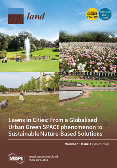
Our opinion paper discusses urban lawns, the most common part of green infrastructure. It highlights the ecosystem services and disservices provided by urban lawns based on the authors’ experience of working within interdisciplinary research projects in Europe, New Zealand, the USA, and Australia. It shares a paradigm of nature-based solutions in the context of lawns, which can be an important step towards finding resilient solutions in the time of urbanisation, climate change, and related societal challenges. The article overviews existing approaches to conventional lawns, alternatives to lawns, and suggests the vision of future sustainable lawns based on a complex hybrid approach. We introduce and discuss the concept of two natures, including the understanding and appreciation of lawns in different climatic and sociocultural conditions.View this paper.
  • Issues are regarded as officially published after their release is announced to the table of contents alert mailing list.
  • You may sign up for e-mail alerts to receive table of contents of newly released issues.
  • PDF is the official format for papers published in both, html and pdf forms. To view the papers in pdf format, click on the "PDF Full-text" link, and use the free Adobe Reader to open them.
Order results
Result details
Section
Select all
Export citation of selected articles as:
18 pages, 2298 KiB  
Article
The Factors Affecting Farmland Rental Prices in Slovakia
by Ivan Takáč, Jarmila Lazíková, Ľubica Rumanovská, Anna Bandlerová and Zuzana Lazíková
Land 2020, 9(3), 96; https://doi.org/10.3390/land9030096 - 24 Mar 2020
Cited by 14 | Viewed by 4386
Abstract
Agricultural land is a limited natural resource with increasing economic value. This study analyses land rental relationships in Slovakia, including legal rental regulations, and identifies the impact of certain factors, such as the European Union Common Agricultural Policy (CAP) payments, and geographical and [...] Read more.
Agricultural land is a limited natural resource with increasing economic value. This study analyses land rental relationships in Slovakia, including legal rental regulations, and identifies the impact of certain factors, such as the European Union Common Agricultural Policy (CAP) payments, and geographical and economic factors on land rental prices. From the results of econometric models, it was found that certain CAP payments have an effect on rental prices, mainly the single area payment scheme (SAPS), payments for agri-environmental-climate schemes (AECS), and animal welfare, which were found to have positive effects. Other important factors found to influence rental prices are economic indicators (such as total revenue share of total costs, share of revenue from agricultural production in terms of total revenue, share of production costs as a percentage of total costs, wages, and number of employees) and geographical factors (such as region or partial production areas). However, the distance of the farm from the district city (LAU 1) and the share of farmland affected by natural constraints do not considerably affect rental prices in Slovakia. Land consolidation is a statistically significant factor according to the models; however, its impact is almost zero. Knowledge of these factors constitutes important know-how, not only for policy makers but also for the actors operating in the land rental market (e.g., landlords, tenants, experts on land valuation, and real estate agents). Full article
(This article belongs to the Section Land Socio-Economic and Political Issues)
Show Figures

Figure 1

43 pages, 9182 KiB  
Article
Land Use Change, Spatial Interaction, and Sustainable Development in the Metropolitan Urban Areas, South Sulawesi Province, Indonesia
by Batara Surya, Despry Nur Annisa Ahmad, Harry Hardian Sakti and Hernita Sahban
Land 2020, 9(3), 95; https://doi.org/10.3390/land9030095 - 24 Mar 2020
Cited by 79 | Viewed by 9160
Abstract
Metropolitan Urban Mamminasata South Sulawesi, Indonesia as the object of study is explored in the core-peripheral spatial interaction towards the formation of suburban service centers. The problems raised in this study are (i) is there a relationship/correlation between spatial integration, spatial interaction, and [...] Read more.
Metropolitan Urban Mamminasata South Sulawesi, Indonesia as the object of study is explored in the core-peripheral spatial interaction towards the formation of suburban service centers. The problems raised in this study are (i) is there a relationship/correlation between spatial integration, spatial interaction, and urban agglomeration to the formation of urban activity systems and (ii) how the formation of urban activity systems works as a determinant of economic growth, land use change and environmental quality degradation towards sustainable development in the metropolitan city of Mamminasata. Comparative studies of suburban areas have been carried out over three time periods (2001, 2015 and 2019). Data elaboration on observations, surveys and documentation is done to describe urban dynamics in terms of economic, social and environmental aspects. Path analysis is used to address direct effects, indirect effects, differences, and dependencies between urban elements. The gravity model is used to analyze the spatial interactions of the core city with the periphery. The study results show that spatial integration, spatial interaction and urban agglomeration have a positive effect on the system of urban activity and economic growth in the outskirts of the Mamminasata Metropolitan area. The results of this study recommend policy makers and urban planners that land use change, spatial integration and urban spatial interactions on the spatial scale of metropolitan cities to require the implementation of sustainable development concepts oriented towards saving the environment, ensuring fairness in economic access and creating social cohesion, in line with meeting national Metropolitan city development targets by 2030. Full article
(This article belongs to the Section Urban Contexts and Urban-Rural Interactions)
Show Figures

Figure 1

26 pages, 12032 KiB  
Article
A Visual Typology of Abandonment in Rural America: From End-of-Life to Treading Water, Recycling, Renaissance, and Revival
by Jason P. Holcomb, Paul Frederic and Stanley D. Brunn
Land 2020, 9(3), 94; https://doi.org/10.3390/land9030094 - 23 Mar 2020
Cited by 4 | Viewed by 4830
Abstract
The contemporary American rural landscape reflects a mix of ongoing economic changes in agricultural land use, population change, and built environments. The mix depends on past and recent change which represent landscapes of memory and silence to those experiencing economic and demographic renaissance. [...] Read more.
The contemporary American rural landscape reflects a mix of ongoing economic changes in agricultural land use, population change, and built environments. The mix depends on past and recent change which represent landscapes of memory and silence to those experiencing economic and demographic renaissance. We develop a typology of five stages that reflect the contemporary rural scene and conduct field transects in Northwest Iowa and Central Maine. Features of the dynamics in rural America are evident in photographs of residences, land use changes, and commercial structure. The study calls for additional studies on rural settlement populations, economies, and society in different environmental settings. Full article
(This article belongs to the Special Issue Agricultural Land Abandonment: Patterns, Drivers and Consequences)
Show Figures

Figure 1

17 pages, 7765 KiB  
Article
Applying the RUSLE and ISUM in the Tierra de Barros Vineyards (Extremadura, Spain) to Estimate Soil Mobilisation Rates
by Jesús Barrena-González, Jesús Rodrigo-Comino, Yeboah Gyasi-Agyei, Manuel Pulido Fernández and Artemi Cerdà
Land 2020, 9(3), 93; https://doi.org/10.3390/land9030093 - 23 Mar 2020
Cited by 32 | Viewed by 4476
Abstract
Spain is one of the largest wine producers in the world, with Extremadura (south-west Spain) being its second-largest producing region after Castilla La Mancha. Within Extremadura, the most traditional and productive viticulture region is the Tierra de Barros, which boasts an annual production [...] Read more.
Spain is one of the largest wine producers in the world, with Extremadura (south-west Spain) being its second-largest producing region after Castilla La Mancha. Within Extremadura, the most traditional and productive viticulture region is the Tierra de Barros, which boasts an annual production of 3×10⁶ litres. However, no soil erosion assessment has been undertaken in any vineyard in the region to ascertain environmental sustainability. Therefore, the Improved Stock Unearthing Method (ISUM) and the Revised Universal Soil Loss Equation (RUSLE) were applied to assess the long-term soil erosion rates. Both methods were applied using an experimental plot (2.8 m × 148.5 m) encompassing 99 paired vines in a 20-year-old vineyard under a tillage management system and on bare soils throughout the year. The ISUM and RUSLE found total soil mobilization values of 45.7 Mg ha−1 yr−1 and 17.4 Mg ha−1 yr−1, respectively, a difference of about 5 times. Mapping techniques showed that soil surface declined to an average of −6.2 cm, with maximum values of −28 cm. The highest values of soil depletion were mainly observed in the upper part and the form of linear features following the hillslope direction. On the other hand, under the vines, the soil surface level showed accumulations of up to +2.37 cm due to tillage practices. Our study demonstrated the potential of high soil erosion rates occurring in conventional vineyards managed with tillage in the inter-row areas and herbicides under the vines within the Tierra de Barros. Also, we demonstrated the elevated differences in soil mobilisation rates using the ISUM and RUSLE. Therefore, further research must be conducted in other vineyards to determine the suitability of the models for assessing soil erosion rates. Undoubtedly, soil conservation measures must be designed and applied immediately due to high erosion rates. Full article
(This article belongs to the Special Issue Soil Erosion Processes and Rates in Arid and Semiarid Ecosystems)
Show Figures

Figure 1

25 pages, 1261 KiB  
Article
Rural Women’s Invisible Work in Census and State Rural Development Plans: The Argentinean Patagonian Case
by Paula Gabriela Núñez, Carolina Lara Michel, Paula Alejandra Leal Tejeda and Martín Andrés Núñez
Land 2020, 9(3), 92; https://doi.org/10.3390/land9030092 - 22 Mar 2020
Cited by 4 | Viewed by 3554
Abstract
This article reviews the invisibility and the recognition of rural female work in the Patagonian region of Argentina over time. The analysis is carried out based on (a) the systematisation of research articles (b) a historical study of censuses, and (c) the systematisation [...] Read more.
This article reviews the invisibility and the recognition of rural female work in the Patagonian region of Argentina over time. The analysis is carried out based on (a) the systematisation of research articles (b) a historical study of censuses, and (c) the systematisation of rural development plans related to the subject. The article adopts an ecofeminist perspective. The results have been organised into four sections. (1) An overview of the later Patagonian integration; (2) the work of Patagonian women in history; (3) the recognition of rural production in censuses; (4) Patagonian family farming. We found out that the metaphors that relate women with the land are used to deny both rural female work and the family land use. One of its consequences is that Patagonia has become one of the most affected by extractivism. We conclude reviewing the forms of economic and political recognition, which could intervene in future planning. Full article
(This article belongs to the Special Issue Land, Women, Youths, and Land Tools or Methods)
Show Figures

Graphical abstract

21 pages, 7991 KiB  
Article
Survey of Community Livelihoods and Landscape Change along the Nzhelele and Levuvhu River Catchments in Limpopo Province, South Africa
by Walter Musakwa, Shuai Wang, Fangli Wei, Olgah Lerato Malapane, Masala Makumule Thomas, Sydney Mavengahama, Hongwei Zeng, Bingfang Wu, Wenwu Zhao, Nesisa Analisa Nyathi, Zama Eric Mashimbye, Nitesh Poona, James Chakwizira, Trynos Gumbo, Baleseng Mokoena, Francis Kaitano, Emmanuel Fundisi and Vuyiswa Yeni-Letsoko
Land 2020, 9(3), 91; https://doi.org/10.3390/land9030091 - 19 Mar 2020
Cited by 11 | Viewed by 5823
Abstract
Landscape-change studies have attracted increasing interest because of their importance to land management and the sustainable livelihoods of rural communities. However, empirical studies on landscape change and its drivers are often poorly understood, particularly, in small rural communities in developing countries such as [...] Read more.
Landscape-change studies have attracted increasing interest because of their importance to land management and the sustainable livelihoods of rural communities. However, empirical studies on landscape change and its drivers are often poorly understood, particularly, in small rural communities in developing countries such as South Africa. The present study surveyed local community livelihoods and perceptions of landscape change in the Nzhelele and Levuvhu river catchments in Limpopo Province, South Africa. These areas have experienced land reform and are also characterized by environmental degradation, poverty, inequality and environmental justice concerns among other issues. Land-cover maps derived from Landsat satellite imagery were used for purposes of correlating and validating the survey data findings and results. The survey results showed that education levels, working status and marital status have statistically significant effects on community livelihoods (indicated by levels of income, p < 0.05). Maize, fruits and vegetables are the main cultivated crop varieties in the study area, and these crops are mainly used for subsistence to meet household self-consumption requirements. Moreover, local community members and stakeholders argue that the landscape has changed over the past 20 years mainly as a result of urban expansion, deforestation, agricultural diversification and forestry intensification. These landscape changes were largely confirmed by the land-cover change maps derived from satellite imagery. Soil erosion as a result of landscape changes was identified as a major threat and hazard in the study area. Political, natural, economic and cultural factors have been identified as the major underlying drivers for the observed landscape changes. These results have implications for understanding landscape change, coupled with human–nature relationships as well as informing government policy with respect to advancing land management and further promotion of the sustainable livelihoods of rural communities. Overall, the study proposes a multiple stakeholders’ approach and ecosystem-based approach to promote the sustainable management of landscapes in rural areas. Full article
Show Figures

Figure 1

18 pages, 5724 KiB  
Article
Climate Change Affected Vegetation Dynamics in the Northern Xinjiang of China: Evaluation by SPEI and NDVI
by Nana Luo, Dehua Mao, Bolong Wen and Xingtu Liu
Land 2020, 9(3), 90; https://doi.org/10.3390/land9030090 - 18 Mar 2020
Cited by 43 | Viewed by 4061
Abstract
Drought and vegetation dynamics in the northern Xinjiang Uygur Autonomous Region of China (NXC), the centre of Asia with arid climate, were assessed using the standardized precipitation evapotranspiration index (SPEI) and the normalized difference vegetation index (NDVI). Analyses were performed through the use [...] Read more.
Drought and vegetation dynamics in the northern Xinjiang Uygur Autonomous Region of China (NXC), the centre of Asia with arid climate, were assessed using the standardized precipitation evapotranspiration index (SPEI) and the normalized difference vegetation index (NDVI). Analyses were performed through the use of Sen’s method and Spearman’s correlation to investigate variations in the NDVI and the impacts of drought on vegetation from 1998 to 2015. The severity of droughts in the NXC was assessed by the SPEI, which was revealed to increase over the last 60 years at a rate of 0.017 per decade. This indicates that an alleviating tendency of drought intensity occurred in the NXC. Specifically, the spatial pattern of drought intensity increased gradually from the north-western to south-eastern regions. The average yearly NDVI was 0.28 and increased slightly by 0.001 yr−1 (r = 0.94, p = 3.64) between 1998 and 2015. Additionally, the NDVI showed an obviously spatial heterogeneity, with greater values in the west and small values in the east. Significantly, positive correlations between SPEI and NDVI were observed, while drought exerted a five-year lag effect on vegetation. Full article
(This article belongs to the Section Land Systems and Global Change)
Show Figures

Figure 1

14 pages, 1603 KiB  
Article
Land Registration, Adjustment Experience, and Agricultural Machinery Adoption: Empirical Analysis from Rural China
by Xin Deng, Zhongcheng Yan, Dingde Xu and Yanbin Qi
Land 2020, 9(3), 89; https://doi.org/10.3390/land9030089 - 17 Mar 2020
Cited by 11 | Viewed by 3581
Abstract
Land property security and advanced factor inputs play critical roles in agricultural modernization in developing countries. However, there are unclear relationships between land property security and advanced factor inputs. This study aims to clarify these relationships from the perspective of the differentiation of [...] Read more.
Land property security and advanced factor inputs play critical roles in agricultural modernization in developing countries. However, there are unclear relationships between land property security and advanced factor inputs. This study aims to clarify these relationships from the perspective of the differentiation of the realization process of land property security. From the perspective of property rights theory and endowment effects, data from 2934 farming households in rural China are used to determine the quantitative impacts of land registration and adjustment experience on the adoption of agricultural machinery. The results are as follows: (i) Land registration does not affect the adoption of agricultural machinery. (ii) Adjustment experience has a negative impact on the adoption of agricultural machinery. (iii) The interaction of land registration and adjustment experience has a positive impact on the adoption of agricultural machinery. This study provides some policy references with which developing countries can achieve agricultural modernization and revitalize the countryside by improving property rights security. Full article
(This article belongs to the Special Issue Land, Innovation, and Social Good)
Show Figures

Figure 1

23 pages, 6453 KiB  
Article
Migration, Remittances, and Forest Cover Change in Rural Guatemala and Chiapas, Mexico
by Arild Angelsen, Mariel Aguilar-Støen, John Herbert Ainembabazi, Edwin Castellanos and Matthew Taylor
Land 2020, 9(3), 88; https://doi.org/10.3390/land9030088 - 17 Mar 2020
Cited by 23 | Viewed by 6567
Abstract
This article investigates how migration and remittances affect forest cover in eight rural communities in Guatemala and Chiapas, Mexico. Based on household surveys and remote sensing data, we found little evidence to support the widespread claim that migration takes pressure off forests. In [...] Read more.
This article investigates how migration and remittances affect forest cover in eight rural communities in Guatemala and Chiapas, Mexico. Based on household surveys and remote sensing data, we found little evidence to support the widespread claim that migration takes pressure off forests. In the Chiapas sites, we observed no significant changes in forest cover since 1990, while in the Guatemalan sites, migration may have increased demand for agricultural land, leading to an average annual forest loss of 0.73% during the first decade of the millennium. We suggest that when attractive opportunities exist to invest in agriculture and land expansion, remittances and returnee savings provide fresh capital that is likely to increase pressure on forests. Our study also has implications for the understanding of migration flows; in particular, migration has not implied an exodus out of agriculture for the remaining household members nor for the returning migrants. On the contrary, returning migrants are more likely to be involved in farming activities after their return than they were before leaving. Full article
(This article belongs to the Special Issue Migration and Land)
Show Figures

Figure 1

15 pages, 1456 KiB  
Article
Unveiling Contrasting Preferred Trajectories of Local Development in Southeast Portugal
by Catarina Esgalhado and Maria Helena Guimaraes
Land 2020, 9(3), 87; https://doi.org/10.3390/land9030087 - 17 Mar 2020
Cited by 3 | Viewed by 2221
Abstract
Mediterranean land systems are amongst the most susceptible to global change, in part due to the region’s vulnerability to climate change and misfit within a high production demanding political and societal setting. The impact of global drivers at a local scale (i.e., the [...] Read more.
Mediterranean land systems are amongst the most susceptible to global change, in part due to the region’s vulnerability to climate change and misfit within a high production demanding political and societal setting. The impact of global drivers at a local scale (i.e., the possible trajectories of change of a territory) are context-dependent, and to some extent dependent on how local actors perceive them and act upon them. In this study, we focused on southeast Portugal and conducted 22 interviews and 1 collective workshop to understand how different actors across the territory anticipate the development of the region and its land systems. From our results, we get a picture of a depopulated territory, constrained by ill-adjusted policies to its harsh conditions, including little water availability and continuous depopulation. We found contrasting preferred trajectories of development for the territory. On one hand, there is a preference for prioritizing traditional land systems, usually rainfed and multifunctional. Contrasting, a need for water reservoirs that would increase water availability and allow for profitable agricultural activities and thus fixate population is recognized. The different perspectives fit with a wider debate on the role of agriculture, intensification and ecosystem services under an increasingly arid Mediterranean. The next challenge is to integrate technical expertise and knowledge with local needs and initiatives, to fit in a broader scale strategic plan. We identify a lack of technical support regarding soil health. Poor soil, from the perspective of several stakeholders, is a characteristic of the region. Knowledge dissemination is urgent so that farmers can proactively improve soil health and benefit from its capacity to increase production and retain water. We urge a higher effort from the scientific community focusing on marginal areas, supporting knowledge dissemination and analysis of the impacts of different trajectories of development. Full article
Show Figures

Figure 1

20 pages, 5927 KiB  
Article
Hunting Tourism as a Possible Development Tool in Protected Areas of Extremadura, Spain
by Luz-María Martín-Delgado, Juan-Ignacio Rengifo-Gallego and José-Manuel Sánchez-Martín
Land 2020, 9(3), 86; https://doi.org/10.3390/land9030086 - 17 Mar 2020
Cited by 15 | Viewed by 3409
Abstract
The constant declaration of new protected natural spaces that has taken place on a world scale in recent decades has caused changes in rural areas, where these spaces are often host to traditional activities that have acted over time as the area’s main [...] Read more.
The constant declaration of new protected natural spaces that has taken place on a world scale in recent decades has caused changes in rural areas, where these spaces are often host to traditional activities that have acted over time as the area’s main sources of wealth. Among these activities, hunting has been one of the most affected. For this reason, the following study analyzes the incidence of one of the economic sectors linked to venatoria, hunting tourism, in two protected areas with an established hunting tradition: Sierra de San Pedro and Monfragüe. In order to achieve this objective, a questionnaire was drawn up and subsequently completed by a large proportion of the tourist accommodation establishments located in these areas. The results were obtained by means of statistical techniques and yielded very interesting information. This included information about the strong presence of hunting tourism in both regions, the differences in the presence of hunters according to the type of tourist accommodation, and the interest of hunters in taking part in activities other than hunting. Full article
Show Figures

Figure 1

32 pages, 3912 KiB  
Article
Access to Affordable Houses for the Low-Income Urban Dwellers in Kigali: Analysis Based on Sale Prices
by Ernest Uwayezu and Walter T. de Vries
Land 2020, 9(3), 85; https://doi.org/10.3390/land9030085 - 16 Mar 2020
Cited by 11 | Viewed by 8236
Abstract
The government of Rwanda recently passed housing development regulations and funding schemes which aim at promoting access to affordable houses for the low- and middle-income Kigali city inhabitants. The existing studies on housing affordability in this city did not yet discuss whether this [...] Read more.
The government of Rwanda recently passed housing development regulations and funding schemes which aim at promoting access to affordable houses for the low- and middle-income Kigali city inhabitants. The existing studies on housing affordability in this city did not yet discuss whether this government-supported programme is likely to promote access to housing for these target beneficiaries. This study applies the price-to-income ratio (PIR) approach and the 30-percent of household income standard through the bank loan to assess whether housing units developed in the framework of affordable housing schemes are, for the target recipients, affordable at all. It relies mainly on housing prices schemes held by real estate developers, data on households’ incomes collected through the household survey and a review of the existing studies and socio-economic censuses reports. Findings reveal that the developed housing units are seriously and severely unaffordable for most of the target beneficiaries, especially the lowest-income urban dwellers, due to the high costs of housing development, combined with the high profits expected by real estate developers. The study suggests policy and practical options for promoting inclusive urban (re)development and housing affordability for various categories of Kigali city inhabitants. These options include upgrading the existing informal settlements, combined with their conversion into shared apartments through the collaboration between property owners and real estate developers, the development of affordable rental housing for the low-income tenants, tax exemption on construction materials, progressive housing ownership through a rent-to-own approach, and incremental self-help housing development using the low-cost local materials. Full article
Show Figures

Figure 1

22 pages, 1977 KiB  
Review
A Synopsis of Farmland Abandonment and Its Driving Factors in Nepal
by Suresh Chaudhary, Yukuan Wang, Amod Mani Dixit, Narendra Raj Khanal, Pei Xu, Bin Fu, Kun Yan, Qin Liu, Yafeng Lu and Ming Li
Land 2020, 9(3), 84; https://doi.org/10.3390/land9030084 - 16 Mar 2020
Cited by 40 | Viewed by 8307
Abstract
Farmland abandonment is considered as an important phenomenon for changing eco-environmental and sociocultural landscapes of mountainous rural landscape. Many studies have analyzed farmland abandonment, its driving factors, geophysical processes and consequences at landscape: however, very few have focused on mountainous developing countries such [...] Read more.
Farmland abandonment is considered as an important phenomenon for changing eco-environmental and sociocultural landscapes of mountainous rural landscape. Many studies have analyzed farmland abandonment, its driving factors, geophysical processes and consequences at landscape: however, very few have focused on mountainous developing countries such as in Nepal, which is a rapidly urbanizing country suffering from serious farmland abandonment. Therefore, our study was an attempt to (i) assess the spatiotemporal extent of farmland abandonment in Nepal, (ii) explore driving factors of farmland abandonment, and (iii) discuss on the eco-environmental and sociocultural consequences in Nepal. We reviewed various literature, documents, and national reports to obtain a dataset pertaining to the overall status of farmland use and changes along with political and socioeconomic changes, economic development processes, and policy and governance in Nepal. Our results showed that farmland abandonment is widespread; however, it is more prevalent in the hilly and mountainous regions of Nepal. A total of 9,706,000 ha, accounting for 23.9% of the total cultivated farmland in Nepal, was abandoned during the period of 2001 to 2010. The driving factors included population growth, scattered distribution of settlements, urbanization, socio-economic development, poor access to physical services, and poor implementation of agriculture development policies. Furthermore, the increasing extent of natural disasters, malaria eradication, land reform and resettlement programs, the complex system of land ownership, land fragmentation, political instabilities, and the intensification of trading in agricultural products also acted as drivers of farmland abandonment in Nepal. Farmland abandonment generates negative effects on rural societies eco-environmentally and sociologically. Abandoned plots were subjected to different forms of geomorphic damage (e.g. landslide, debris flows, gully formation, sinkhole development etc.). Farmland landscape fragmented into a group of smaller interspersed patches. Such patches were opened for grassland. Furthermore, farmland abandonment also has effects on the local population and the whole society in terms of the production of goods (e.g., foods, feed, fiber), as well as services provided by the multi-functionality (e.g. sociocultural practices, values and norms) of the agricultural landscape. Therefore, this study plays an important role in planning and implementing eco-environmental management and social development processes in Nepal. Full article
(This article belongs to the Special Issue Agricultural Land Abandonment: Patterns, Drivers and Consequences)
Show Figures

Figure 1

24 pages, 387 KiB  
Article
Peatland Governance: The Problem of Depicting in Sustainability Governance, Regulatory Law, and Economic Instruments
by Felix Ekardt, Benedikt Jacobs, Jessica Stubenrauch and Beatrice Garske
Land 2020, 9(3), 83; https://doi.org/10.3390/land9030083 - 14 Mar 2020
Cited by 35 | Viewed by 6498
Abstract
Limiting global warming to well below 2 degrees Celsius and better even to 1.5 degrees Celsius, according to Article 2 paragraph 1 of the Paris Agreement requires global zero emissions in a very short time. These targets imply that not only emissions from [...] Read more.
Limiting global warming to well below 2 degrees Celsius and better even to 1.5 degrees Celsius, according to Article 2 paragraph 1 of the Paris Agreement requires global zero emissions in a very short time. These targets imply that not only emissions from degraded peatlands have to be avoided, but conservation and rewetting of peatlands are also necessary to figure as sinks to compensate for unavoidable residual emissions. However, with regard to instruments for meeting these targets, measuring, depicting, and baseline definition are difficult for greenhouse gas emissions from peatlands. In the absence of an easily comprehensible control variable (such as fossil fuels), economic instruments reach their limits. This is remarkable in so far as economic instruments can otherwise handle governance problems and react to various behavioral motivational factors very well. Still, peatlands can be subject to certain regulations and prohibitions under command-and-control law even without precise knowledge of the emissions from peatland use, which will be shown using the example of the European Union (EU) and German legislation. This paper is a contribution to governance research and illustrates that even comprehensive quantity-control instruments for fossil fuels and livestock farming—which would address various environmental problems and reflect findings from behavioral research regarding motivation towards sustainability—require complementary fine-tuning through command-and-control law, e.g., for integrating peatland governance. Full article
(This article belongs to the Section Land Socio-Economic and Political Issues)
21 pages, 10113 KiB  
Article
Detecting Land Abandonment in Łódź Voivodeship Using Convolutional Neural Networks
by Stanisław Krysiak, Elżbieta Papińska, Anna Majchrowska, Maciej Adamiak and Mikołaj Koziarkiewicz
Land 2020, 9(3), 82; https://doi.org/10.3390/land9030082 - 13 Mar 2020
Cited by 5 | Viewed by 5677
Abstract
The wide availability of multispectral satellite imagery through projects such as Landsat and Sentinel, combined with the introduction of deep learning in general and Convolutional Neural Networks (CNNs) in particular, has allowed for the rapid and effective analysis of multiple classes of problems [...] Read more.
The wide availability of multispectral satellite imagery through projects such as Landsat and Sentinel, combined with the introduction of deep learning in general and Convolutional Neural Networks (CNNs) in particular, has allowed for the rapid and effective analysis of multiple classes of problems pertaining to land coverage. Taking advantage of the two phenomena, we propose a machine learning model for the classification of land abandonment. We designed a Convolutional Neural Network architecture that outputs a classification probability for the presence of land abandonment in a given 15–25 ha grid element by using multispectral imaging data obtained through Sentinel Hub. For both the training and validation of the model, we used imagery of the Łódź Voivodeship in central Poland. The main source of truth was a 2009 orthophoto study available from the WMS (Web Map Service) of the Geoportal site. The model achieved 0.855 auc (area under curve), 0.47 loss, and 0.78 accuracy for the test dataset. Using the classification results and the Getis–Ord Gi* statistic, we prepared a map of cold- and hotspots with individual areas that exceed 50 km2. This thresholded heatmap allowed for an analysis of contributing factors for both low and intense land abandonment, demonstrating that common trends are identifiable through the interpretation of the classification results of the chosen model. We additionally performed a comparative field study on two selected cold- and hotspots. The study, along with the high-accuracy results of the model’s validation, confirms that CNN-type models are an effective tool for the automatic detection of land abandonment. Full article
Show Figures

Graphical abstract

15 pages, 281 KiB  
Article
Rural-Urban Migration and its Effect on Land Transfer in Rural China
by Dingde Xu, Zhuolin Yong, Xin Deng, Linmei Zhuang and Chen Qing
Land 2020, 9(3), 81; https://doi.org/10.3390/land9030081 - 11 Mar 2020
Cited by 67 | Viewed by 5682
Abstract
Labor force rural-urban migration will lead to changes to the land use patterns of farmers. Using the survey data on dynamic migration of the Chinese labor force in 2014, iv-probit and iv-tobit models were used to analyze the impact of labor migration on [...] Read more.
Labor force rural-urban migration will lead to changes to the land use patterns of farmers. Using the survey data on dynamic migration of the Chinese labor force in 2014, iv-probit and iv-tobit models were used to analyze the impact of labor migration on the land transfer of farmers. The results show that: (1) Off-farm employment would significantly impact land transfer of farmers and the results are robust. With every 10% increase in the proportion of off-farm employment of farmers, the average probability of rent-in land of farmers decreases by 1.55%, and the average transfer in land area of farmers decreased by 1.04%. Similarly, with every 10% increase in the proportion of off-farm employment of farmers, the average probability of rent-out land of farmers increases by 4.77%, and the average transfer out land area of farmers increases by 3.98%. (2) Part-time employment also has a significant impact on land transfer of farmers, but the impact of part-time employment on land transfer in is not robust. Specifically, with every 10% increase in part-farm employment, the average probability of rent-out land of farmers increases by 7.64%, and the average transfer out land area of farmers increases by 6.85%. Full article
(This article belongs to the Section Land Socio-Economic and Political Issues)
Show Figures

Graphical abstract

21 pages, 825 KiB  
Article
The Potential Supply and Demand of Farmers’ Land Contract Rights-Based on 697 Households in Four Provinces of China
by Wujing Wang and Xingqing Ye
Land 2020, 9(3), 80; https://doi.org/10.3390/land9030080 - 10 Mar 2020
Cited by 2 | Viewed by 2915
Abstract
A new urbanization and rural revitalization strategy has been implemented in China over a number of years, under which farmers’ land contract rights (LCRs) flow inevitably through various means. The practice in reform pilot areas indicates that government funds cannot meet all the [...] Read more.
A new urbanization and rural revitalization strategy has been implemented in China over a number of years, under which farmers’ land contract rights (LCRs) flow inevitably through various means. The practice in reform pilot areas indicates that government funds cannot meet all the needs, so exploring market-based LCR payout paths is important for rural land tenure system reform. The purpose of this study is to answer questions such as the following: How would farmers respond if they were allowed to trade LCRs? Is there an equilibrium point between the potential supply and demand of LCRs? Which factors would affect the potential supply and demand of LCRs? In this study, 697 valid questionnaires from Ningxia, Hebei, Henan, and Shandong provinces, China, were used for analysis by the multiple bounded discrete choice (MBDC) method and MBDC-Tobit model. The results show that there is a potential market among rural collective households in China, with an equilibrium price of ¥27,800/mu ($59,714.4/ha), and a proportion of farmers who are willing to buy or sell LCRs is around 10.0%. The factors affecting the potential supply and demand of LCRs include land grade, average agricultural income per unit, total money to buy urban houses and cars, age, number of household members with a college education or above, and risk appetite. If the institutional barriers that hinder LCR transactions were eliminated, the potential supply and demand of LCRs would be matched, and the market would provide funds for next-stage reforms. Full article
(This article belongs to the Section Urban Contexts and Urban-Rural Interactions)
Show Figures

Figure 1

27 pages, 10420 KiB  
Project Report
Participatory Land Administration in Indonesia: Quality and Usability Assessment
by Trias Aditya, Eva Maria-Unger, Christelle vd Berg, Rohan Bennett, Paul Saers, Han Lukman Syahid, Doni Erwan, Tjeerd Wits, Nurrohmat Widjajanti, Purnama Budi Santosa, Dedi Atunggal, Imam Hanafi and Dewi Sutejo
Land 2020, 9(3), 79; https://doi.org/10.3390/land9030079 - 09 Mar 2020
Cited by 19 | Viewed by 6607
Abstract
This paper presents the results from a quality and usability analysis of participatory land registration (PaLaR) in Indonesia’s rural areas, focusing on data quality, cost, and time. PaLaR was designed as a systematic community-centered land titling project collecting requisite spatial and legal data. [...] Read more.
This paper presents the results from a quality and usability analysis of participatory land registration (PaLaR) in Indonesia’s rural areas, focusing on data quality, cost, and time. PaLaR was designed as a systematic community-centered land titling project collecting requisite spatial and legal data. PaLaR was piloted in two communities situated in Tanggamus and Grobogan districts in Indonesia. The research compared spatial data accuracy between two approaches, PaLaR and the normal systematic land registration approach (PTSL) with respect to point accuracy and polygon area. Supplementary observations and interviews were undertaken in order to evaluate the effectiveness of the spatial and legal data collection, as well as logical consistency of the data collected by the community committee, using a mobile application. Although the two pilots showed a lower spatial accuracy than the normal method (PTSL), PaLaR better suited local circumstances and still delivered complete spatial and legal data in a more effective means. The accuracy and efficiency of spatial data collection could be improved through the use of more accurate GNSS antennas and a seamless connection to the national land databases. The PaLaR method is dependent on, amongst other aspects, inclusive and flexible community awareness programs, as well as the committed participation of the community and local offices. Full article
(This article belongs to the Special Issue Land, Innovation, and Social Good)
Show Figures

Graphical abstract

18 pages, 485 KiB  
Article
Farmers’ Intentions to Lease Forestland: Evidence from Rural China
by Xiaoyong Li, Giuseppe T. Cirella, Yali Wen and Yi Xie
Land 2020, 9(3), 78; https://doi.org/10.3390/land9030078 - 06 Mar 2020
Cited by 8 | Viewed by 2460
Abstract
In the last decade, despite considerable research developed for the forestland leasing market, little has been published in terms of econometric results on determinants of intentions and behaviors of Chinese farmers. With respect to leasing forestland, this study uses a Bayesian logit model [...] Read more.
In the last decade, despite considerable research developed for the forestland leasing market, little has been published in terms of econometric results on determinants of intentions and behaviors of Chinese farmers. With respect to leasing forestland, this study uses a Bayesian logit model to examine the factors that influence farmers’ intentions, using household data collected in one county in 2017. The results show that farmers’ past experience of leasing forestlands have significant impacts on their leasing intentions. Once farmers participated in leasing in or leasing out forestland in the last five years, it was shown that they will have stronger intentions of doing so in the future. Farmers will neither lease in or out forestland if the leasing profits are less than the profits originated from forestland management. As such, household head age, household population, proportion of income from nonfarm sources to total income, and security of rights to forestland use are significant factors in influencing farmers’ decisions on leasing in forestland. On the other hand, household head age and educational level, proportion of income from nonfarm sources to total income, and importance of forestland in terms of inheritance are significant factors in influencing farmers’ decisions on leasing it out. Results imply that institutional and market factors, which have impacts on transaction costs, are important for farmers in making decisions on forestland leases. Policy implications to reduce institutional intervention are discussed. Full article
Show Figures

Figure 1

19 pages, 970 KiB  
Article
How Government’s Policy Implementation Methods Influence Urban Villagers’ Acceptance of Urban Revitalization Programs: Evidence from China
by Xizan Jin, Tachia Chin, Junli Yu, Yanjiang Zhang and Yingshuang Shi
Land 2020, 9(3), 77; https://doi.org/10.3390/land9030077 - 06 Mar 2020
Cited by 2 | Viewed by 3137
Abstract
This study aims to provide new knowledge for the governments to enact more effective policies to proceed housing redevelopment programs. We conducted a survey on local urban villagers in Hangzhou city of China. Overall, our results provide valuable theoretical and practical implications for [...] Read more.
This study aims to provide new knowledge for the governments to enact more effective policies to proceed housing redevelopment programs. We conducted a survey on local urban villagers in Hangzhou city of China. Overall, our results provide valuable theoretical and practical implications for sustainable urban development. Firstly, we found that more reasonable compensation and more respecting justice and democracy during redevelopment implementation increases people’s acceptance of government’s housing redevelopment program. Secondly, we demonstrated that experiences from social learning, such as government–homeowner conflicts and quality of living of other homeowners who have experienced similar programs, and people’s own historical housing redevelopment experience, significantly influence their acceptance of the program. Thirdly, if the governments ensure more justice and democracy, it largely enhances effectiveness of compensation in promoting people’s acceptance of the housing redevelopment programs. Full article
Show Figures

Figure 1

25 pages, 1471 KiB  
Article
Dynamic Linkages among Mining Production and Land Rehabilitation Efficiency in China
by Zhen Shi, Yingju Wu, Yung-ho Chiu, Fengping Wu and Changfeng Shi
Land 2020, 9(3), 76; https://doi.org/10.3390/land9030076 - 06 Mar 2020
Cited by 5 | Viewed by 3044
Abstract
In the context of China’s economic transformation, the consumption of mineral resources plays an important role in its economy’s sustainable development, and so improving mining efficiency is regarded as the basis of industrial development. However, in the pursuit of mine exploitation, the destruction [...] Read more.
In the context of China’s economic transformation, the consumption of mineral resources plays an important role in its economy’s sustainable development, and so improving mining efficiency is regarded as the basis of industrial development. However, in the pursuit of mine exploitation, the destruction of land resources has attracted greater attention by government and society, with many scholars focusing more on land rehabilitation in recent years. Thus, from the perspective of climate change, this research synthetically analyzes the two stages of mining production and land rehabilitation, by applying mining employees, fixed assets’ investment stock, production of non-petroleum mineral resources, accumulated destruction of land area, rehabilitation investment, rehabilitation of land area, and average temperature to the dynamic two-stage directional-distance-function data envelopment analysis (DEA) model under exogenous variables for 29 provinces in China. The results show that the overall efficiency of mining-production-land rehabilitation in most provinces fluctuates around 0.5 and spans a large range of improvement. The efficiency of the mining production stage fluctuates around 0.55 and is relatively flat over four years. The efficiency of the land rehabilitation stage fluctuates during the four years, with it being higher in 2014, but lower in 2015. Generally speaking, the efficiency of the land rehabilitation stage is higher, promoting the improvement of overall efficiency, but the efficiencies of some provinces’ land rehabilitation stage are quite different, as some provinces still need to improve their overall efficiency level. There are also differences in the efficiencies of each decision-making units (DMU)’s variables. In sum, China should initiate corresponding policies according to specific situations, promote scientific mining in each province, and coordinate the development of mining production and land rehabilitation. Full article
Show Figures

Figure 1

11 pages, 1361 KiB  
Article
Post-NAFTA Changes in Peasant Land Use—The Case of the Pátzcuaro Lake Watershed Region in the Central-West México
by Marta Astier, Quetzalcóatl Orozco-Ramírez, Robert Walker, Yankuic Galván-Miyoshi, Carlos González-Esquivel and Cynthia S. Simmons
Land 2020, 9(3), 75; https://doi.org/10.3390/land9030075 - 05 Mar 2020
Cited by 9 | Viewed by 3110
Abstract
Rural life in México has changed drastically over the past several decades in the wake of structural reforms in the 1980s and the North American Free Trade Agreement (NAFTA) implemented in 1994. Researchers predicted dire consequences for smallholder farmers following trade liberalization and [...] Read more.
Rural life in México has changed drastically over the past several decades in the wake of structural reforms in the 1980s and the North American Free Trade Agreement (NAFTA) implemented in 1994. Researchers predicted dire consequences for smallholder farmers following trade liberalization and in certain respects the prophecies have been fulfilled. Indeed, many regions experienced significant out-migration as smallholders, unable to compete with global maize imports without price subsidies, sold or abandoned their lands, making way for the expansion of industrial agriculture into forests, secondary vegetation and primary crops. Nevertheless, many smallholders have adapted to the new economic environment with farming systems that manage risk by diversifying portfolios to incorporate commercialized maize and livestock production. This article examines the evolution of smallholder farming systems since the mid 1980s, when the impact of neoliberal reforms emerged, using data collected from field research on 130 smallholder farms in the Pátzcuaro Lake Watershed (PLW) in the State of Michoacán. Farmers in the PLW have been characterized as traditional peasant farmers, planting crops for subsistence, including a diverse array of domestic maize varieties and practicing limited animal husbandry with chickens, turkeys, pigs, an oxen and a cow or two for milk. But the results presented in this article show that the traditional peasant farming systems in the region have changed substantially to a highly diversified agriculture-cattle-forest system. Most notable changes include the use of fertilizers and pesticides; and the increase in livestock herd and reorientation to beef production. The results demonstrate the resilience of smallholder farmers, while at the same time raising potential concern that increased reliance on livestock and beef production specialization, might lead to shifts in farming systems that replace domestic maize varieties with hybrid corn used primarily for animal feed and thereby leaving vulnerable the genetic reservoir of traditional maize landraces. Full article
(This article belongs to the Section Land Systems and Global Change)
Show Figures

Figure 1

15 pages, 3542 KiB  
Article
Actors, Scales and Spaces Dynamics Linked to Groundwater Resources use for Agriculture Production in Haouaria Plain, Tunisia. A Territory Game Approach
by Intissar Ferchichi, Insaf Mekki, Mohamed Elloumi, Lamia Arfa and Sylvie Lardon
Land 2020, 9(3), 74; https://doi.org/10.3390/land9030074 - 05 Mar 2020
Cited by 6 | Viewed by 2720
Abstract
Groundwater resources became a recognized enabler of important rural and socio-economic development in Mediterranean countries. However, the development of this groundwater economy is currently associated with an increased pressure on the available resource and negative implications on the socio-ecological system. Managing complex socio-ecological [...] Read more.
Groundwater resources became a recognized enabler of important rural and socio-economic development in Mediterranean countries. However, the development of this groundwater economy is currently associated with an increased pressure on the available resource and negative implications on the socio-ecological system. Managing complex socio-ecological systems, such as those that occur in water resource management, is a multi-actor, multi-scale and dynamic decision-making process. This study aims to build a collective learning and collaborative construction tool through the territory game method. It was implemented in the Haouaria Plain, in Northern Tunisia, where farmers are currently dependent upon groundwater use for their livelihood and food security. After the diagnosis of the territorial issues, the drivers of change and a common spatial representation of the future trend of the territory, we dive into the dimensions that hinder or facilitate the implementation of scenarios and the pathways of actions. Thereafter, we analyzed these dimensions together again and reflect on the interactions among actors at different levels to transform the local territory. From the perspective of evolution scenarios for the Haouaria plain, the participants indicated the conditions that hinder or facilitate their implementation and they proposed twenty-three possible actions to be carried out in order to achieve the desired trends. They indicated how these propositions can be achieved, by whom, and where. The local stakeholders coordinate actors, activities and spaces on their territory. Spaces such as El Garâa basin, littoral forest or food processing companies are at stake to develop an integrated response to territorial issues. Full article
Show Figures

Figure 1

27 pages, 9398 KiB  
Opinion
Lawns in Cities: From a Globalised Urban Green Space Phenomenon to Sustainable Nature-Based Solutions
by Maria Ignatieva, Dagmar Haase, Diana Dushkova and Annegret Haase
Land 2020, 9(3), 73; https://doi.org/10.3390/land9030073 - 02 Mar 2020
Cited by 90 | Viewed by 25482
Abstract
This opinion paper discusses urban lawns, the most common part of open green spaces and urban green infrastructures. It highlights both the ecosystem services and also disservices provided by urban lawns based on the authors’ experience of working within interdisciplinary research projects on [...] Read more.
This opinion paper discusses urban lawns, the most common part of open green spaces and urban green infrastructures. It highlights both the ecosystem services and also disservices provided by urban lawns based on the authors’ experience of working within interdisciplinary research projects on lawns in different cities of Europe (Germany, Sweden and Russia), New Zealand (Christchurch), USA (Syracuse, NY) and Australia (Perth). It complements this experience with a detailed literature review based on the most recent studies of different biophysical, social, planning and design aspects of lawns. We also used an international workshop as an important part of the research methodology. We argue that although lawns of Europe and the United States of America are now relatively well studied, other parts of the world still underestimate the importance of researching lawns as a complex ecological and social phenomenon. One of the core objectives of this paper is to share a paradigm of nature-based solutions in the context of lawns, which can be an important step towards finding resilient sustainable alternatives for urban green spaces in the time of growing urbanisation, increased urban land use competition, various user demands and related societal challenges of the urban environment. We hypothesise that these solutions may be found in urban ecosystems and various local native plant communities that are rich in species and able to withstand harsh conditions such as heavy trampling and droughts. To support the theoretical hypothesis of the relevance of nature-based solutions for lawns we also suggest and discuss the concept of two natures—different approaches to the vision of urban nature, including the understanding and appreciation of lawns. This will help to increase the awareness of existing local ecological approaches as well as an importance of introducing innovative landscape architecture practices. This article suggests that there is a potential for future transdisciplinary international research that might aid our understanding of lawns in different climatic and socio-cultural conditions as well as develop locally adapted (to environmental conditions, social needs and management policies) and accepted nature-based solutions. Full article
Show Figures

Figure 1

17 pages, 4039 KiB  
Article
A Clear Past and a Murky Future: Life in the Anthropocene on the Pampana River, Sierra Leone
by Richard Marcantonio and Agustin Fuentes
Land 2020, 9(3), 72; https://doi.org/10.3390/land9030072 - 01 Mar 2020
Cited by 5 | Viewed by 4432
Abstract
The impacts of human activities on ecosystems are significantly increasing the rate of environmental change in the earth system, reshaping the global landscape. The rapid rate of environmental change is disrupting the ability of millions of people around the globe to live their [...] Read more.
The impacts of human activities on ecosystems are significantly increasing the rate of environmental change in the earth system, reshaping the global landscape. The rapid rate of environmental change is disrupting the ability of millions of people around the globe to live their everyday lives and maintain their human niche. Evidence suggests that we have entered (or created) a new epoch, the Anthropocene, which is defined as the period in which humans and human activities are the primary drivers of planetary change. The Anthropocene denotes a global shift, but it is the collective of local processes. This is our frame for investigating local accounts of human-caused disruptive environmental change in the Pampana River in Tonkolili District, Northern Province, Sierra Leone. Since the end of the Sierra Leonean civil war in 2002, the country has experienced a rapid increase in extractive industries, namely mining. We explored the effects of this development by working with communities along the Pampana River in Tonkolili, with a specific focus given to engaging local fishermen through ethnographic interviews (N = 21 fishermen and 33 non-fishermen), focus group discussions (N = 21 fishermen), and participant observation. We deployed theoretical and methodological frameworks from human niche construction theory, complex adaptive systems, and ethnography to track disruptive environmental change in and on the Pampana from upstream activities and the concomitant shifts in the local human niche. We highlight the value of integrating ethnographic methods with human evolutionary theory, produce important insights about local human coping processes with disruptive environmental change, and help to further account for and understand the ongoing global process of human modification of the earth system in the Anthropocene. Full article
Show Figures

Figure 1

18 pages, 290 KiB  
Article
Impacts of Land Ownership on the Economic Performance and Viability of Rice Farming in Thailand
by Amorn Pochanasomboon, Witsanu Attavanich and Akaranant Kidsom
Land 2020, 9(3), 71; https://doi.org/10.3390/land9030071 - 01 Mar 2020
Cited by 3 | Viewed by 4530
Abstract
This article evaluates the impacts of land ownership on the economic performance and viability of rice farming in Thailand, and explores whether they are heterogeneous across different types of farming while using the propensity score matching (PSM) technique. This study categorizes land ownership [...] Read more.
This article evaluates the impacts of land ownership on the economic performance and viability of rice farming in Thailand, and explores whether they are heterogeneous across different types of farming while using the propensity score matching (PSM) technique. This study categorizes land ownership into two types: full land ownership and weak land ownership. We reveal that full land ownership enhances the rice yield of small and midsize farms, with values of 115.789–127.414 kg/hectare and 51.926–70.707 kg/hectare, respectively. On the other hand, weak land ownership only enhances the rice yield of small farms, with an increased yield of 65.590–72.574 kg/hectare. Full land ownership also helps to reduce the informal debt of small and midsize farms by $16.972–$24.877 per farm and $31.393–$37.819 per farm, respectively. On the other hand, weak land ownership helps to reduce the informal debt of midsize farms, ranging from $36.909 to $44.681 per farm. Therefore, policy makers should encourage small and midsize farm households to adopt full land ownership instead of weak land ownership, as this will provide the greatest benefits to farm households and efficient land use. Full article
(This article belongs to the Section Land Socio-Economic and Political Issues)
16 pages, 797 KiB  
Article
Going Beyond Panaceas: The Diversity of Land Observatory Forms in Africa
by Quentin Grislain, Jeremy Bourgoin, Ward Anseeuw, Perrine Burnod, Eva Hershaw and Djibril Diop
Land 2020, 9(3), 70; https://doi.org/10.3390/land9030070 - 01 Mar 2020
Cited by 4 | Viewed by 3971 | Correction
Abstract
In recent decades, mechanisms for observation and information production have proliferated in an attempt to meet the growing needs of stakeholders to access dynamic data for the purposes of informed decision-making. In the land sector, a growing number of land observatories are producing [...] Read more.
In recent decades, mechanisms for observation and information production have proliferated in an attempt to meet the growing needs of stakeholders to access dynamic data for the purposes of informed decision-making. In the land sector, a growing number of land observatories are producing data and ensuring its transparency. We hypothesize that these structures are being developed in response to the need for information and knowledge, a need that is being driven by the scale and diversity of land issues. Based on the results of a study conducted on land observatories in Africa, this paper presents existing and past land observatories on the continent and proposes to assess their diversity through an analysis of core dimensions identified in the literature. The analytical framework was implemented through i) an analysis of existing literature on land observatories, ii) detailed assessments of land observatories based on semi-open interviews conducted via video conferencing, iii) fieldwork and visits to several observatories, and iv) participant observation through direct engagement and work at land observatories. We emphasize that the analytical framework presented here can be used as a tool by land observatories to undertake ex-post self-evaluations that take the observatory’s trajectory into account, or in the case of proposed new land observatories, to undertake ex-ante analyses and design the pathway towards the intended observatory. Full article
(This article belongs to the Section Land Socio-Economic and Political Issues)
Show Figures

Figure 1

19 pages, 2563 KiB  
Article
Social Capital in Community Organizing for Land Protection and Food Security
by Pornsiri Cheevapattananuwong, Claudia Baldwin, Athena Lathouras and Nnenna Ike
Land 2020, 9(3), 69; https://doi.org/10.3390/land9030069 - 28 Feb 2020
Cited by 11 | Viewed by 3914
Abstract
Since 2016, the Thai Government has pursued a twenty-year national economic growth policy, Thailand 4.0, promoting innovation and stimulating international investment through the Eastern Economic Corridor (EEC) project. The EEC project involves significant land acquisition resulting in the need to relocate villagers with [...] Read more.
Since 2016, the Thai Government has pursued a twenty-year national economic growth policy, Thailand 4.0, promoting innovation and stimulating international investment through the Eastern Economic Corridor (EEC) project. The EEC project involves significant land acquisition resulting in the need to relocate villagers with potential impact on food security in a major food production area. This research explored the concerns of a local farming community regarding the potential loss of their farmland and means of livelihood under the EEC project using a case study in Ban Pho District of Chachoengsao (CCS) province. It described their resulting action to protect their farmland using community organizing. Data was collected through documents, observation and semi-structured interviews of key stakeholders. The results demonstrate the role of social capital in community organizing. We contend that high social capital stock is a necessary precursor to create conditions for community members to take steps to defend and protect their interests. This paper contributes to a deeper understanding of the role of social capital in community organizing in cases involving natural resource management. Full article
(This article belongs to the Special Issue Land, Land Use and Social Issues)
Show Figures

Figure 1

13 pages, 282 KiB  
Perspective
The Drivers of Maize Area Expansion in Sub-Saharan Africa. How Policies to Boost Maize Production Overlook the Interests of Smallholder Farmers
by Romy Santpoort
Land 2020, 9(3), 68; https://doi.org/10.3390/land9030068 - 28 Feb 2020
Cited by 55 | Viewed by 6139
Abstract
Maize has become the second most produced crop in the world. Specifically, in sub-Saharan Africa, global statistics show that more and more land is being used for (small-scale) maize production to meet future food demands. From 2007 to 2017, the area on which [...] Read more.
Maize has become the second most produced crop in the world. Specifically, in sub-Saharan Africa, global statistics show that more and more land is being used for (small-scale) maize production to meet future food demands. From 2007 to 2017, the area on which maize is grown in sub-Saharan Africa has increased by almost 60%. This rate of expansion is considered unsustainable and is expected to come at the expense of crop diversity and the environment. Based on available literature, this paper explores the political and economic processes that contributed to the increased use of land for maize production in sub-Saharan Africa. It discusses population growth as an important driver. Moreover, it unravels some of the politics and narratives triggered by climate change that have paved the way for policy measures that aimed to boost maize production in the region. These measures, which often emphasize the need for increased production, the need for new technologies and resource scarcity, overlook the largest group of maize producers that are least powerful, but most crucial for food security in sub-Saharan Africa: smallholder farmers. Full article
21 pages, 303 KiB  
Article
The FPIC Principle Meets Land Struggles in Cambodia, Indonesia and Papua New Guinea
by Colin Filer, Sango Mahanty and Lesley Potter
Land 2020, 9(3), 67; https://doi.org/10.3390/land9030067 - 27 Feb 2020
Cited by 7 | Viewed by 4602
Abstract
Social and environmental safeguards are now commonplace in policies and procedures that apply to certain kinds of foreign investment in developing countries. Prominent amongst these is the principle of free, prior and informed consent (FPIC), which is commonly tied to policies and procedures [...] Read more.
Social and environmental safeguards are now commonplace in policies and procedures that apply to certain kinds of foreign investment in developing countries. Prominent amongst these is the principle of free, prior and informed consent (FPIC), which is commonly tied to policies and procedures relating to investments that have an impact on ‘indigenous peoples’. This paper treats international safeguards as a possible manifestation of what Karl Polanyi called the ‘double movement’ in the operation of a capitalist market economy. Our concern here is with the way that the FPIC principle has been applied in struggles over the alienation of land and associated natural resources claimed by indigenous peoples or customary landowners in three developing countries—Cambodia, Indonesia and Papua New Guinea. Case studies of recent land struggles in these countries are used to illustrate the existence of a spectrum in which the application of the FPIC principle may contribute more or less to the defence of customary rights. On one hand, it may be little more than a kind of ‘performance’ that simply adds some extra value to a newly created commodity. On the other hand, it may sometimes enable local or indigenous communities and their allies in ‘civil society’ to mount an effective defence of their rights in opposition to the processes of alienation or commodification. The paper finds that all three countries have political regimes and national policy frameworks that are themselves resistant to the imposition of social and environmental safeguards by foreign investors or international financial institutions. However, they differ widely in the extent to which they make institutional space for the FPIC principle to become the site of a genuine double movement of the kind that Polanyi envisaged. Full article
(This article belongs to the Special Issue Land, Land Use and Social Issues)
Previous Issue
Next Issue
Back to TopTop