Next Issue
Volume 10, January
Previous Issue
Volume 9, November


Land, Volume 9, Issue 12 (December 2020) – 67 articles

Cover Story (view full-size image): 
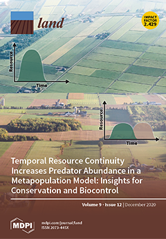
The amount of habitat in a landscape, a metric of resource availability, helps us to understand how land cover change affects biodiversity. Nonetheless, the timing of resource availability may be as important as the total amount. In simple landscapes, for example, if ephemeral resources are all available synchronously, consumers may be left without crucial resources for a significant length of time. Complex landscapes, on the other hand, that provide resources at complementary times may allow mobile species to move across the landscape, consuming ephemeral resources as they become available in different habitats. Using a predator–prey metapopulation model, we demonstrated the joint importance of both the amount and temporal variability of resources in a landscape for predator–prey communities and ecosystem services such as the biological control. View this paper
  • Issues are regarded as officially published after their release is announced to the table of contents alert mailing list.
  • You may sign up for e-mail alerts to receive table of contents of newly released issues.
  • PDF is the official format for papers published in both, html and pdf forms. To view the papers in pdf format, click on the "PDF Full-text" link, and use the free Adobe Reader to open them.
Order results
Result details
Section
Select all
Export citation of selected articles as:
13 pages, 2103 KiB  
Article
Strategies for the Management of Traditional Chestnut Landscapes in Pesio Valley, Italy: A Participatory Approach
by Paola Gullino, Maria Gabriella Mellano, Gabriele Loris Beccaro, Marco Devecchi and Federica Larcher
Land 2020, 9(12), 536; https://doi.org/10.3390/land9120536 - 21 Dec 2020
Cited by 9 | Viewed by 3072
Abstract
Through an exploratory case study conducted in the Pesio Valley, northwest Italy, this paper proposes a framework for maintaining traditional chestnut production landscapes and addressing future development policies. The main goal was to understand how to promote a bottom-up planning approach, including stakeholder [...] Read more.
Through an exploratory case study conducted in the Pesio Valley, northwest Italy, this paper proposes a framework for maintaining traditional chestnut production landscapes and addressing future development policies. The main goal was to understand how to promote a bottom-up planning approach, including stakeholder perceptions in traditional chestnut landscape management. To ensure the sustainability of the landscape, current driving forces and their landscape effects were identified by local stakeholders using a focus group technique. Population ageing, local forestry policies directed towards supporting chestnut growers’ income, social and economic needs, and land fragmentation are the main driving forces that will influence future chestnut landscapes. The focus group participants built two scenarios of possible future development of the chestnut landscape, one characterized by the disappearance and transformation of chestnut stands, the other by their permanence and maintenance. The most recommended strategies for maintaining traditional chestnut cultivation were chestnut processing, fruit designation of origin, and the cultivation of traditional varieties. This study shows that, to preserve the traditional chestnut landscape, the participation of multiple stakeholders is a useful approach in landscape planning. This methodology could guide decision-makers and planners who desire to implement a participatory approach to a sustainable development program for traditional chestnut landscapes. Full article
(This article belongs to the Special Issue Cultural Landscapes)
Show Figures

Figure 1

22 pages, 5336 KiB  
Article
Nationwide Susceptibility Mapping of Landslides in Kenya Using the Fuzzy Analytic Hierarchy Process Model
by Suhua Zhou, Shuaikang Zhou and Xin Tan
Land 2020, 9(12), 535; https://doi.org/10.3390/land9120535 - 21 Dec 2020
Cited by 16 | Viewed by 3763
Abstract
Landslide susceptibility mapping (LSM) is a cost-effective tool for landslide hazard mitigation. To date, no nationwide landslide susceptibility maps have been produced for the entire Kenyan territory. Hence, this work aimed to develop a landslide susceptibility map at the national level in Kenya [...] Read more.
Landslide susceptibility mapping (LSM) is a cost-effective tool for landslide hazard mitigation. To date, no nationwide landslide susceptibility maps have been produced for the entire Kenyan territory. Hence, this work aimed to develop a landslide susceptibility map at the national level in Kenya using the fuzzy analytic hierarchy process method. First, a hierarchical evaluation index system containing 10 landslide contributing factors and their subclasses was established to produce a susceptibility map. Then, the weights of these indexes were determined through pairwise comparisons, in which triangular fuzzy numbers (TFNs) were employed to scale the relative importance based on the opinions of experts. Ultimately, these weights were merged in a hierarchical order to obtain the final landslide susceptibility map. The entire Kenyan territory was divided into five susceptibility levels. Areas with very low susceptibility covered 5.53% of the Kenyan territory, areas with low susceptibility covered 20.58%, areas with the moderate susceptibility covered 29.29%, areas with high susceptibility covered 29.16%, and areas with extremely high susceptibility covered 15.44% of Kenya. The resulting map was validated using an inventory of 425 historical landslides in Kenya. The results indicated that the TFN-AHP model showed a significantly improved performance (AUC = 0.86) compared with the conventional AHP (AUC = 0.72) in LSM for the study area. In total, 31.53% and 29.88% of known landslides occurred within the “extremely high” and “high” susceptibility zones, respectively. Only 8.24% and 1.65% of known landslides fell within the “low” and “very low” susceptibility zones, respectively. The map obtained as a result of this study is beneficial to inform planning and land resource management in Kenya. Full article
(This article belongs to the Special Issue Landslide Hazard and Environment Risk Assessment)
Show Figures

Figure 1

20 pages, 6727 KiB  
Article
Green Stormwater Infrastructure Planning in Urban Landscapes: Understanding Context, Appearance, Meaning, and Perception
by Mahbubur Meenar, Jordan P. Howell, Devon Moulton and Shane Walsh
Land 2020, 9(12), 534; https://doi.org/10.3390/land9120534 - 21 Dec 2020
Cited by 10 | Viewed by 4002
Abstract
Prior research has documented environmental and economic benefits of green stormwater infrastructure (GSI); literature on GSI social benefits is also becoming more prevalent among scholars around the world. This paper aims to understand whether GSI projects are considered as assets to urban neighborhoods [...] Read more.
Prior research has documented environmental and economic benefits of green stormwater infrastructure (GSI); literature on GSI social benefits is also becoming more prevalent among scholars around the world. This paper aims to understand whether GSI projects are considered as assets to urban neighborhoods or as projects that might introduce a new set of social concerns. Based on field observations of 238 GSI projects and 50 intercept interviews, we investigate selected social aspects of GSI, such as project context, visual appearance, recreational appeal, meaning, and public perception, in two neighboring US cities—Philadelphia and Camden. Analysis of field data and observation notes revealed that GSI project setting impacted recreational appeal; their appearance was related to maintenance and signage; and their interaction with the public depended on location, land use, and visual/recreational appeal. Most GSI sites with the presence of trash, but the absence of signage were found in potentially disadvantaged areas. According to intercept interviews, many people were not aware of GSI presence in the neighborhood, were not familiar with GSI or its functionality, did not find a way to get access to GSI or interact with them, and were generally concerned about poor design, defective construction, or lack of maintenance. We argue that lack of information and community care/support for GSI can result in social disinvestments in these projects, which can facilitate improper use and maintenance issues, affecting their intended basic environmental functions. Consistent with prior research, we speak to the importance of participatory planning processes in improving community acceptance and interests around GSI planning and installation in urban landscapes. Full article
(This article belongs to the Section Land Planning and Landscape Architecture)
Show Figures

Figure 1

15 pages, 2065 KiB  
Article
Impact of Water Level on Species Quantity and Composition Grown from the Soil Seed Bank of the Inland Salt Marsh: An Ex-Situ Experiment
by Eva Čížková, Jana Navrátilová, Stanislav Martinát, Josef Navrátil and Ryan J. Frazier
Land 2020, 9(12), 533; https://doi.org/10.3390/land9120533 - 20 Dec 2020
Cited by 6 | Viewed by 2255
Abstract
The near elimination of inland salt marshes in Central Europe occurred throughout the 19th and 20th centuries, and the currently remaining marshes exist in a degraded condition. This work examines the impact of groundwater level on the growth of plants from a seed [...] Read more.
The near elimination of inland salt marshes in Central Europe occurred throughout the 19th and 20th centuries, and the currently remaining marshes exist in a degraded condition. This work examines the impact of groundwater level on the growth of plants from a seed bank obtained from a degraded salt marsh in proximity to still existing one through an ex-situ experiment. An experimental tank was set up with the sample seed bank experiencing differing levels of water level. There were 1233 specimens of 44 taxa grown from the seed bank, of which 5 species were abundant, and 10 species are considered as halophytes. Only Lotus tenuis from halophytes was more abundant, and only five species of halophytes were represented by more than three individuals. The water level has a significant impact on the number of species (based on linear regression analysis) as well as species distribution among different water level treatments (a non-metric multidimensional analysis (nMDS) followed by linear regression). The results show a strong negative relationship between the average water level and the number of species. The water level did not affect the species composition of halophytes, but differences in individual species abundances were found among the halophytes. The species Bupleurum tenuissimum, Crypsis schoenoides, Melilotus dentatus, and Plantago maritima grew on the drier and non-inundated soils. Tripolium pannonicum, Spergularia maritima, and Lotus tenuis grew on both wet and dry soils. Trifolium fragiferum and Bolboschoenus maritimus were found in places with water stagnant at the soil level. Pulicaria dysenterica grew in inundated soil. Full article
(This article belongs to the Special Issue Grassland Restoration)
Show Figures

Figure 1

19 pages, 2983 KiB  
Article
Effect of Complex Road Networks on Intensive Land Use in China’s Beijing-Tianjin-Hebei Urban Agglomeration
by Chen Zeng, Zhe Zhao, Cheng Wen, Jing Yang and Tianyu Lv
Land 2020, 9(12), 532; https://doi.org/10.3390/land9120532 - 18 Dec 2020
Cited by 15 | Viewed by 3062
Abstract
Coupled with rapid urbanization and urban expansion, the spatial relationship between transportation development and land use has gained growing interest among researchers and policy makers. In this paper, a complex network model and land use intensity assessment were integrated into a spatial econometric [...] Read more.
Coupled with rapid urbanization and urban expansion, the spatial relationship between transportation development and land use has gained growing interest among researchers and policy makers. In this paper, a complex network model and land use intensity assessment were integrated into a spatial econometric model to explore the spatial spillover effect of the road network on intensive land use patterns in China’s Beijing–Tianjin–Hebei (BTH) urban agglomeration. First, population density, point of interest (POI) density, and aggregation index were selected to measure land use intensity from social, physical, and ecological aspects. Then, the indicator of average degree (i.e., connections between counties) was used to measure the characteristics of the road network. Under the hypothesis that the road network functions in shaping land use patterns, a spatial econometric model with the road network embedded spatial weight matrix was established. Our results revealed that, while the land use intensity in the BTH urban agglomeration increased from 2010 to 2015, the road network became increasingly complex with greater spatial heterogeneity. The spatial lag coefficients of land use intensity were positively significant in both years and showed a declining trend. The spatially lagged effects of sector structure, fixed asset investment, and consumption were also significant in most of our spatial econometric models, and their contributions to the total spillover effect increased from 2010 to 2015. This study contributes to the literature by providing an innovative quantitative method to analyze the spatial spillover effect of the road network on intensive land use. We suggest that the spatial spillover effect of the road network could be strengthened in the urban–rural interface areas by improving accessibility and promoting population, resource, and technology flows. Full article
Show Figures

Figure 1

34 pages, 5970 KiB  
Article
Agroforestry as Policy Option for Forest-Zone Oil Palm Production in Indonesia
by Edi Purwanto, Hery Santoso, Idsert Jelsma, Atiek Widayati, Hunggul Y. S. H. Nugroho and Meine van Noordwijk
Land 2020, 9(12), 531; https://doi.org/10.3390/land9120531 - 18 Dec 2020
Cited by 18 | Viewed by 7584
Abstract
With 15–20% of Indonesian oil palms located, without a legal basis and permits, within the forest zone (‘Kawasan hutan’), international concerns regarding deforestation affect the totality of Indonesian palm oil export. ‘Forest zone oil palm’ (FZ-OP) is a substantive issue that requires analysis [...] Read more.
With 15–20% of Indonesian oil palms located, without a legal basis and permits, within the forest zone (‘Kawasan hutan’), international concerns regarding deforestation affect the totality of Indonesian palm oil export. ‘Forest zone oil palm’ (FZ-OP) is a substantive issue that requires analysis and policy change. While spatial details of FZ-OP remain contested, we review literature on (1) the legal basis of the forest zone and its conversion, (2) social stratification in oil palm production (large-scale, plasma and independent growers), and (3) environmental consequences of forest conversion to FZ-OP, before discussing policy options in a range of social and ecological contexts. Policy options range from full regularization (as FZ-OP stands could meet international forest definitions), to conditional acceptance of diversified smallholder plantings in ‘agroforestry concessions’, to gradually phasing out FZ-OP and eviction/destruction. A nuanced and differentiated approach to FZ-OP is needed, as certification of legality along supply chains is vulnerable to illegal levies and corruption. Corporate actors trading internationally can avoid use of uncertified raw materials, effectively shifting blame and depressing farmgate prices for domestic-market palm oil, but this will not return forest conditions or stop further forest conversion. We discuss an agenda for follow-up policy research. Full article
(This article belongs to the Special Issue Agroforestry-Based Ecosystem Services)
Show Figures

Figure 1

14 pages, 940 KiB  
Communication
Social-Ecological Connectivity to Understand Ecosystem Service Provision across Networks in Urban Landscapes
by Monika Egerer and Elsa Anderson
Land 2020, 9(12), 530; https://doi.org/10.3390/land9120530 - 18 Dec 2020
Cited by 9 | Viewed by 4552
Abstract
Landscape connectivity is a critical component of dynamic processes that link the structure and function of networks at the landscape scale. In the Anthropocene, connectivity across a landscape-scale network is influenced not only by biophysical land use features, but also by characteristics and [...] Read more.
Landscape connectivity is a critical component of dynamic processes that link the structure and function of networks at the landscape scale. In the Anthropocene, connectivity across a landscape-scale network is influenced not only by biophysical land use features, but also by characteristics and patterns of the social landscape. This is particularly apparent in urban landscapes, which are highly dynamic in land use and often in social composition. Thus, landscape connectivity, especially in cities, must be thought of in a social-ecological framework. This is relevant when considering ecosystem services—the benefits that people derive from ecological processes and properties. As relevant actors move through a connected landscape-scale network, particular services may “flow” better across space and time. For this special issue on dynamic landscape connectivity, we discuss the concept of social-ecological networks using urban landscapes as a focal system to highlight the importance of social-ecological connectivity to understand dynamic urban landscapes, particularly in regards to the provision of urban ecosystem services. Full article
(This article belongs to the Special Issue Dynamic Landscape Connectivity)
Show Figures

Figure 1

18 pages, 1554 KiB  
Article
Gendered Migration and Agroforestry in Indonesia: Livelihoods, Labor, Know-How, Networks
by Elok Mulyoutami, Betha Lusiana and Meine van Noordwijk
Land 2020, 9(12), 529; https://doi.org/10.3390/land9120529 - 18 Dec 2020
Cited by 17 | Viewed by 3694
Abstract
Migration connects land use in areas of origin with areas of new residence, impacting both through individual, gendered choices on the use of land, labor, and knowledge. Synthesizing across two case studies in Indonesia, we focus on five aspects: (i) conditions within the [...] Read more.
Migration connects land use in areas of origin with areas of new residence, impacting both through individual, gendered choices on the use of land, labor, and knowledge. Synthesizing across two case studies in Indonesia, we focus on five aspects: (i) conditions within the community of origin linked to the reason for people to venture elsewhere, temporarily or permanently; (ii) the changes in the receiving community and its environment, generally in rural areas with lower human population density; (iii) the effect of migration on land use and livelihoods in the areas of origin; (iv) the dynamics of migrants returning with different levels of success; and (v) interactions of migrants in all four aspects with government and other stakeholders of development policies. In-depth interviews and focus group discussions in the study areas showed how decisions vary with gender and age, between individuals, households, and groups of households joining after signs of success. Most of the decision making is linked to perceived poverty, natural resource and land competition, and emergencies, such as natural disasters or increased human conflicts. People returning successfully may help to rebuild the village and its agricultural and agroforestry systems and can invest in social capital (mosques, healthcare, schools). Full article
(This article belongs to the Special Issue Agroforestry-Based Ecosystem Services)
Show Figures

Figure 1

24 pages, 3369 KiB  
Article
Enhancing Vietnam’s Nationally Determined Contribution with Mitigation Targets for Agroforestry: A Technical and Economic Estimate
by Rachmat Mulia, Duong Dinh Nguyen, Mai Phuong Nguyen, Peter Steward, Van Thanh Pham, Hoang Anh Le, Todd Rosenstock and Elisabeth Simelton
Land 2020, 9(12), 528; https://doi.org/10.3390/land9120528 - 17 Dec 2020
Cited by 10 | Viewed by 4691
Abstract
The Nationally Determined Contributions (NDCs) of several non-Annex I countries mention agroforestry but mostly without associated mitigation target. The absence of reliable data, including on existing agroforestry practices and their carbon storage, partially constrains the target setting. In this paper, we estimate the [...] Read more.
The Nationally Determined Contributions (NDCs) of several non-Annex I countries mention agroforestry but mostly without associated mitigation target. The absence of reliable data, including on existing agroforestry practices and their carbon storage, partially constrains the target setting. In this paper, we estimate the mitigation potential of agroforestry carbon sequestration in Vietnam using a nationwide agroforestry database and carbon data from the literature. Sequestered carbon was estimated for existing agroforestry systems and for areas into which these systems can be expanded. Existing agroforestry systems in Vietnam cover over 0.83 million hectares storing a 1346 ± 92 million ton CO2 equivalent including above-, belowground, and soil carbon. These systems could be expanded to an area of 0.93–2.4 million hectares. Of this expansion area, about 10% is considered highly suitable for production, with a carbon sequestration potential of 2.3–44 million ton CO2 equivalent over the period 2021–2030. If neglecting agroforestry’s potential for modifying micro-climates, climate change can reduce the highly suitable area of agroforestry and associated carbon by 34–48% in 2050. Agroforestry can greatly contribute to Vietnam’s 2021–2030 NDC, for example, to offset the greenhouse gas emissions of the agriculture sector. Full article
(This article belongs to the Special Issue Agroforestry-Based Ecosystem Services)
Show Figures

Figure 1

21 pages, 3731 KiB  
Article
Analysis, Systemization of the Impacts of Planning on the Territory: Applied to the Ordesa National Park
by María Jesús González González
Land 2020, 9(12), 527; https://doi.org/10.3390/land9120527 - 17 Dec 2020
Cited by 1 | Viewed by 1810
Abstract
In recent decades, a new paradigm on the rational and careful use of land as a non-renewable resource has arisen. This definition requires new management methods based on the application of the “CLORPT” equation (state factor model) (CL—Climate, O—Organisms:living beings, R—Relief (topography), P—Parent [...] Read more.
In recent decades, a new paradigm on the rational and careful use of land as a non-renewable resource has arisen. This definition requires new management methods based on the application of the “CLORPT” equation (state factor model) (CL—Climate, O—Organisms:living beings, R—Relief (topography), P—Parent material. T—Time. Thus, factors that we determine, as well as the impacts of planning, are analysed. We have used the factor model CLORPT (is an instrument by which any planning model can be analysed and diagnosed (e.g., planning carried out in the Ordesa National Park (Huesca-Spain)). The Ordesa and Monte Perdido National Park has exceptional qualities in terms of landscape, lithology, fauna, flora, relief and climate. Its territorial-environmental value is mainly landscape and nature. A more sustainable use of National Parks is analysed, and possible problems observed for correction. This method provides a univocal vision as it standardizes all the factors. Large range quartiles were used so that even though expert opinions differed, the result was the same. Full article
Show Figures

Figure 1

21 pages, 19108 KiB  
Article
Ejidos, Urbanization, and the Production of Inequality in Formerly Agricultural Lands, Guadalajara, Mexico, 1975–2020
by Leonardo Barleta, Mateo Carrillo, Zephyr Frank and Erik Steiner
Land 2020, 9(12), 526; https://doi.org/10.3390/land9120526 - 16 Dec 2020
Cited by 6 | Viewed by 3523
Abstract
The ejido is an institution of communal land tenure and governance administered by the Mexican government. This paper assesses the current visual appearance of landscapes and implicit land use in ejidal lands on the periphery of Guadalajara, Mexico, using Google Street View (GSV) [...] Read more.
The ejido is an institution of communal land tenure and governance administered by the Mexican government. This paper assesses the current visual appearance of landscapes and implicit land use in ejidal lands on the periphery of Guadalajara, Mexico, using Google Street View (GSV) images tagged for signs of urban distress. Distressed landscapes are associated with the temporal process of urban expansion—newer settlements tend to be more visibly impoverished. Concentrations of vulnerable housing are correlated with encroached-upon ejidal lands in a process that was underway by the 1970s, well before Mexico’s neoliberal turn. Ejidos on the urban periphery, created to support agricultural communities during Mexico’s radical period of agrarian reform, are now sites of urban sprawl and impoverishment. Nevertheless, these communities remain legally salient as federal entities with respect to the disposition of land. Their presence complicates the historical evolution of land use in the urban periphery in ways that do not fit into classical central place models. We conclude that the presence of ejidos is associated with rapid and chaotic urbanization by migrants and the loss of agricultural capacity in Guadalajara’s periphery. Full article
(This article belongs to the Section Urban Contexts and Urban-Rural Interactions)
Show Figures

Figure 1

19 pages, 804 KiB  
Article
Green Infrastructure Planning Principles: An Integrated Literature Review
by Renato Monteiro, José C. Ferreira and Paula Antunes
Land 2020, 9(12), 525; https://doi.org/10.3390/land9120525 - 16 Dec 2020
Cited by 86 | Viewed by 18641
Abstract
Green infrastructure is a strategically planned network of natural and semi-natural areas, including green and blue spaces and other ecosystems, designed and managed to deliver a wide range of ecosystem services at various scales. Apart from the ecological functions, green infrastructure, as a [...] Read more.
Green infrastructure is a strategically planned network of natural and semi-natural areas, including green and blue spaces and other ecosystems, designed and managed to deliver a wide range of ecosystem services at various scales. Apart from the ecological functions, green infrastructure, as a planning tool, contributes to social and economic benefits, leading to the achievement of sustainable, resilient, inclusive and competitive urban areas. Despite recent developments, there is still no consensus among researchers and practitioners regarding the concept of green infrastructure as well as its implementation approaches, which makes it often difficult for urban planners and other professionals in the field to develop a robust green infrastructure in some parts of the world. To address this issue, an integrative literature review was conducted to identify which green infrastructure planning principles should be acknowledged in spatial planning practices to promote sustainability and resilience. As a result of this literature review, the most common eight green infrastructure planning principles were selected—connectivity, multifunctionality, applicability, integration, diversity, multiscale, governance, and continuity. These principles intend to promote and simplify the development and use of green infrastructure by different academic and implementation organizations and provide a more defined model for sustainable landscape management in order to help practitioners and decision makers during the conceptualization and planning of green infrastructure. Full article
(This article belongs to the Section Land Planning and Landscape Architecture)
Show Figures

Figure 1

22 pages, 6503 KiB  
Article
Cocoa Production and Forest Dynamics in Ivory Coast from 1985 to 2019
by Barima Yao Sadaiou Sabas, Konan Gislain Danmo, Kouakou Akoua Tamia Madeleine and Bogaert Jan
Land 2020, 9(12), 524; https://doi.org/10.3390/land9120524 - 16 Dec 2020
Cited by 18 | Viewed by 10846
Abstract
The cocoa economy of Ivory Coast started in the eastern part of the country in the 1970s and spread to the central-western and then south-western regions. For nearly a decade, it has been in the West of Ivory Coast with a population increase [...] Read more.
The cocoa economy of Ivory Coast started in the eastern part of the country in the 1970s and spread to the central-western and then south-western regions. For nearly a decade, it has been in the West of Ivory Coast with a population increase caused by large waves of migration. This study aims to determine different factors explaining dynamics of the cocoa economy from the East to West of Ivory Coast. The method adopted consisted of processing Landsat images from 1985–2018 and an individual survey of 278 heads of households. The results obtained showed that the development of the cocoa economy led forest cover degradation with a total loss estimated at 60.80%, 46.39%, 20.76% and 51.18% of forest area in the East, Centre-West, South-West and West, respectively. The creation of new cocoa farms in the West of Ivory Coast is governed by non-native people (51.13%) settled between 2010 and 2018. About 41% of these producers come mainly from the Centre-West (25%) and the South-West (16%). In addition, 29% of producers come from the West of Ivory Coast. Despite the abiotic characteristics being considered unfavourable, the west of Ivory Coast is in the process of becoming the country’s new zone of high cocoa production. Full article
Show Figures

Figure 1

19 pages, 4261 KiB  
Article
Deagrarianisation of the Economic Structure and the Evolution of Rural Settlement Patterns in Poland
by Andrzej Rosner and Monika Wesołowska
Land 2020, 9(12), 523; https://doi.org/10.3390/land9120523 - 16 Dec 2020
Cited by 29 | Viewed by 3338
Abstract
Since the Second World War, Poland has been undergoing an intensive process of transformation of the economic structure of rural areas, manifested, among other things, in the change in the occupational make-up of its inhabitants. The development of non-agricultural methods of management in [...] Read more.
Since the Second World War, Poland has been undergoing an intensive process of transformation of the economic structure of rural areas, manifested, among other things, in the change in the occupational make-up of its inhabitants. The development of non-agricultural methods of management in rural areas has led to the emergence of multifunctional rural areas, where the role of agriculture as a source of income for the inhabitants is decreasing. There is a process of deagrarianisation of the economic structure, which has been indicated by many researchers as an unavoidable process, connected with the changes taking place in rural areas. One of the effects of this process are changes in rural settlement patterns. The aim of this article is to present the spatial effects of the deagrarianisation process in the Polish countryside, expressed in the changes in the rural settlement network. The authors used the statistical database of the Central Statistical Office (over 41 thousand records) to draw up the classification of rural areas by the nature of changes in population numbers in the period 1950–2011, which was compared with the research carried out as part of the Monitoring of Rural Development in Poland. The study confirmed that the factor behind the evolution of the rural settlement network is the process of decreasing agricultural demand for labour. As a consequence, there is a polarisation of localities into multifunctional rural localities, mainly headquarter villages and local government offices, and those with a predominantly agricultural function. On a supra-local scale, a process of polarisation of rural areas between a growing suburban population and a reducing peripheral location around large and medium-sized towns has been observed. Full article
(This article belongs to the Special Issue Urban and Regional Planning in Post-socialist Countries)
Show Figures

Figure 1

21 pages, 1389 KiB  
Article
Understanding the Implementation of Airbnb in Urban Contexts: Towards a Categorization of European Cities
by Laura Serrano, Antonio Sianes and Antonio Ariza-Montes
Land 2020, 9(12), 522; https://doi.org/10.3390/land9120522 - 16 Dec 2020
Cited by 13 | Viewed by 3937
Abstract
The sharing economy has experienced exponential growth in recent years, especially in the short-term rentals (STRs) tourist accommodation sector. This growth has caused disruptive effects in rural and urban contexts, especially in highly touristic cities. These effects can be both positive and negative, [...] Read more.
The sharing economy has experienced exponential growth in recent years, especially in the short-term rentals (STRs) tourist accommodation sector. This growth has caused disruptive effects in rural and urban contexts, especially in highly touristic cities. These effects can be both positive and negative, revitalizing certain areas and bringing about tension in the socioeconomic fabric. Today, Airbnb is considered the paradigm of this sharing economy model and the STR industry leader. However, as this study suggests, on many occasions the implementation of Airbnb exhibits more of a traditional economic business model than a collaborative economic business model. Through hierarchical cluster analysis, this study identifies different groups of European cities according to the degree of professionalization of Airbnb implementation in their territory. The goal is to find similar patterns in the Airbnbisation process in major European cities, as the social, economic, and spatial impacts of various typologies are very different and even contrary. By understanding and identifying such different models implemented in each territory, better policies can be informed, and more adapted strategies can be pursued by local governments and the tourism industry. Full article
Show Figures

Figure 1

6 pages, 210 KiB  
Editorial
Rural Landscapes—Challenges and Solutions to Landscape Governance
by Jørgen Primdahl, Veerle Van Eetvelde and Teresa Pinto-Correia
Land 2020, 9(12), 521; https://doi.org/10.3390/land9120521 - 15 Dec 2020
Cited by 6 | Viewed by 3262
Abstract
Rural landscape dynamics are challenging existing policy regimes for a number of reasons and new approaches to landscape governance are needed [...] Full article
(This article belongs to the Special Issue Rural Landscapes - Challenges and Solutions to Landscape Governance)
17 pages, 20775 KiB  
Article
Infiltration Capacity of Rain Gardens Using Full-Scale Test Method: Effect of Infiltration System on Groundwater Levels in Bergen, Norway
by Guri Venvik and Floris C. Boogaard
Land 2020, 9(12), 520; https://doi.org/10.3390/land9120520 - 15 Dec 2020
Cited by 10 | Viewed by 4203
Abstract
The rain gardens at Bryggen in Bergen, Western Norway, is designed to collect, retain, and infiltrate surface rainfall runoff water, recharge the groundwater, and replenish soil moisture. The hydraulic infiltration capacity of the Sustainable Drainage System (SuDS), here rain gardens, has been tested [...] Read more.
The rain gardens at Bryggen in Bergen, Western Norway, is designed to collect, retain, and infiltrate surface rainfall runoff water, recharge the groundwater, and replenish soil moisture. The hydraulic infiltration capacity of the Sustainable Drainage System (SuDS), here rain gardens, has been tested with small-scale and full-scale infiltration tests. Results show that infiltration capacity meets the requirement and is more than sufficient for infiltration in a cold climate. The results from small-scale test, 245–404 mm/h, shows lower infiltration rates than the full-scale infiltration test, with 510–1600 mm/h. As predicted, an immediate response of the full-scale infiltration test is shown on the groundwater monitoring in the wells located closest to the infiltration point (<30 m), with a ca. 2 days delayed response in the wells further away (75–100 m). Results show that there is sufficient capacity for a larger drainage area to be connected to the infiltration systems. This study contributes to the understanding of the dynamics of infiltration systems such as how a rain garden interacts with local, urban water cycle, both in the hydrological and hydrogeological aspects. The results from this study show that infiltration systems help to protect and preserve the organic rich cultural layers below, as well as help with testing and evaluating of the efficiency, i.e., SuDS may have multiple functions, not only storm water retention. The functionality is tested with water volumes of 40 m3 (600 L/min for 2 h and 10 min), comparable to a flash flood, which give an evaluation of the infiltration capacity of the system. Full article
(This article belongs to the Special Issue Urban Ecosystem Services)
Show Figures

Figure 1

25 pages, 1903 KiB  
Review
Agent-Based Modeling for Integrating Human Behavior into the Food–Energy–Water Nexus
by Nicholas R. Magliocca
Land 2020, 9(12), 519; https://doi.org/10.3390/land9120519 - 15 Dec 2020
Cited by 21 | Viewed by 5315
Abstract
The nexus of food, energy, and water systems (FEWS) has become a salient research topic, as well as a pressing societal and policy challenge. Computational modeling is a key tool in addressing these challenges, and FEWS modeling as a subfield is now established. [...] Read more.
The nexus of food, energy, and water systems (FEWS) has become a salient research topic, as well as a pressing societal and policy challenge. Computational modeling is a key tool in addressing these challenges, and FEWS modeling as a subfield is now established. However, social dimensions of FEWS nexus issues, such as individual or social learning, technology adoption decisions, and adaptive behaviors, remain relatively underdeveloped in FEWS modeling and research. Agent-based models (ABMs) have received increasing usage recently in efforts to better represent and integrate human behavior into FEWS research. A systematic review identified 29 articles in which at least two food, energy, or water sectors were explicitly considered with an ABM and/or ABM-coupled modeling approach. Agent decision-making and behavior ranged from reactive to active, motivated by primarily economic objectives to multi-criteria in nature, and implemented with individual-based to highly aggregated entities. However, a significant proportion of models did not contain agent interactions, or did not base agent decision-making on existing behavioral theories. Model design choices imposed by data limitations, structural requirements for coupling with other simulation models, or spatial and/or temporal scales of application resulted in agent representations lacking explicit decision-making processes or social interactions. In contrast, several methodological innovations were also noted, which were catalyzed by the challenges associated with developing multi-scale, cross-sector models. Several avenues for future research with ABMs in FEWS research are suggested based on these findings. The reviewed ABM applications represent progress, yet many opportunities for more behaviorally rich agent-based modeling in the FEWS context remain. Full article
(This article belongs to the Special Issue The Water-Energy-Food Nexus: Progress and Prospects)
Show Figures

Figure 1

20 pages, 3792 KiB  
Article
Understanding the Relationships between Extensive Livestock Systems, Land-Cover Changes, and CAP Support in Less-Favored Mediterranean Areas
by Laurence Delattre, Marta Debolini, Jean Christophe Paoli, Claude Napoleone, Michel Moulery, Lara Leonelli and Pierre Santucci
Land 2020, 9(12), 518; https://doi.org/10.3390/land9120518 - 14 Dec 2020
Cited by 14 | Viewed by 2753
Abstract
Farm abandonment and over-extensification trends in less-favored livestock breeding areas in the Mediterranean have led to socio-environmental issues that are difficult to assess and address, due to the characteristics of these areas (e.g., poor data availability and reliability). In a study case that [...] Read more.
Farm abandonment and over-extensification trends in less-favored livestock breeding areas in the Mediterranean have led to socio-environmental issues that are difficult to assess and address, due to the characteristics of these areas (e.g., poor data availability and reliability). In a study case that presents many of the characteristics common to these areas, we combine qualitative and quantitative approaches to assess (i) the relationship between livestock production and land-cover change and (ii) the drivers of farmer decisions, concerning the types of livestock they breed. We show that the Common Agricultural Policy’s objective of open-landscape preservation cannot be achieved through the observed livestock management practices, with the most heavily CAP subsidy-dependent activities (e.g., suckler-cow breeding) having one of the weakest contributions to this objective. We also econometrically show that suckler-cow breeding is more likely to be adopted as a complementary or main activity in farms facing a labor scarcity and land abundance context. These results complement the literature and contribute to the discussion regarding the design of CAP support for less-favored Mediterranean areas. Full article
Show Figures

Figure 1

22 pages, 520 KiB  
Article
Environmental Regulations, the Industrial Structure, and High-Quality Regional Economic Development: Evidence from China
by Lingming Chen, Wenzhong Ye, Congjia Huo and Kieran James
Land 2020, 9(12), 517; https://doi.org/10.3390/land9120517 - 14 Dec 2020
Cited by 48 | Viewed by 4355
Abstract
Environmental regulation is an important means of restraining enterprises and protecting the environment. Rationalization of environmental regulatory policies can promote high-quality regional economic development. The optimization and upgrading of the industrial structure has an intermediary effect on the impact of environmental regulations on [...] Read more.
Environmental regulation is an important means of restraining enterprises and protecting the environment. Rationalization of environmental regulatory policies can promote high-quality regional economic development. The optimization and upgrading of the industrial structure has an intermediary effect on the impact of environmental regulations on the high-quality development of the regional economy. After collating and analyzing previous research, this article proposes to classify 30 Chinese provinces into regions with higher than the national average HDI (human development index) and lower than the national average HDI based on the average HDI of Chinese provinces. We explore the mediating effect of industrial structure on environmental regulation and high-quality regional economic development. The model passed the full-sample robustness test and the robustness test with GDP as the replacement variable. The empirical results show that environmental regulations of different intensities have different effects on the quality of regional economic development. The effect of environmental regulations on development quality is mainly mediated through the transformation and upgrading of the industrial structure. Enterprises need reasonable incentives from environmental regulations to transform and upgrade. The mediating effect of the industrial structure on environmental regulations is greater in regions with below-average HDI values than in regions with above-average HDI values, which shows that the industrial structure is the mechanism underlying the effect of environmental regulations on the quality of regional economic development. This result proves that adjusting environmental regulatory policies can effectively promote the upgrading of industrial structure, thereby promoting high-quality regional economic development. Based on this, the article puts forward several policy recommendations. Full article
Show Figures

Figure 1

24 pages, 4418 KiB  
Article
Drivers of Fire Anomalies in the Brazilian Amazon: Lessons Learned from the 2019 Fire Crisis
by Marcus V. F. Silveira, Caio A. Petri, Igor S. Broggio, Gabriel O. Chagas, Mateus S. Macul, Cândida C. S. S. Leite, Edson M. M. Ferrari, Carolina G. V. Amim, Ana L. R. Freitas, Alline Z. V. Motta, Luiza M. E. Carvalho, Celso H. L. Silva Junior, Liana O. Anderson and Luiz E. O. C. Aragão
Land 2020, 9(12), 516; https://doi.org/10.3390/land9120516 - 14 Dec 2020
Cited by 50 | Viewed by 8361
Abstract
The 2019 fire crisis in Amazonia dominated global news and triggered fundamental questions about the possible causes behind it. Here we performed an in-depth investigation of the drivers of active fire anomalies in the Brazilian Amazon biome. We assessed a 2003–2019 time-series of [...] Read more.
The 2019 fire crisis in Amazonia dominated global news and triggered fundamental questions about the possible causes behind it. Here we performed an in-depth investigation of the drivers of active fire anomalies in the Brazilian Amazon biome. We assessed a 2003–2019 time-series of active fires, deforestation, and water deficit and evaluated potential drivers of active fire occurrence in 2019, at the biome-scale, state level, and local level. Our results revealed abnormally high monthly fire counts in 2019 for the states of Acre, Amazonas, and Roraima. These states also differed from others by exhibiting in this year extreme levels of deforestation. Areas in 2019 with active fire occurrence significantly greater than the average across the biome had, on average, three times more active fires in the three previous years, six times more deforestation in 2019, and five times more deforestation in the five previous years. Approximately one-third of yearly active fires from 2003 to 2019 occurred up to 1 km from deforested areas in the same year, and one-third of deforested areas in a given year were located up to 500 m from deforested areas in the previous year. These findings provide critical information to support strategic decisions for fire prevention policies and fire combat actions. Full article
(This article belongs to the Special Issue Monitoring Brazilian Natural and Human-Modified Landscapes)
Show Figures

Figure 1

21 pages, 7498 KiB  
Article
Chaos in Motion: Measuring Visual Pollution with Tangential View Landscape Metrics
by Szymon Chmielewski
Land 2020, 9(12), 515; https://doi.org/10.3390/land9120515 - 12 Dec 2020
Cited by 14 | Viewed by 4099
Abstract
Visual pollution (VP) in the form of outdoor advertisements (OA) is a threat to landscape physiognomy. Despite their proven usefulness in landscape aesthetic studies, landscape metrics have not yet been applied to address the phenomenon of VP. To fill this knowledge gap, a [...] Read more.
Visual pollution (VP) in the form of outdoor advertisements (OA) is a threat to landscape physiognomy. Despite their proven usefulness in landscape aesthetic studies, landscape metrics have not yet been applied to address the phenomenon of VP. To fill this knowledge gap, a methodological framework for the measurement of VP using tangential view landscape metrics is proposed, which is accompanied by statistically significant proofs. Raster products derived from aerial laser scanning data were used to characterize two study areas with different topographic conditions in the city of Lublin, East Poland. The visibility of the cityscape in motion was simulated through viewshed measurements taken at equal intervals in the forwards and backwards directions along pedestrian walkways. The scrutinized tangential view landscape metrics (visible area, maximum visible distance, skyline, Shannon depth, view depth line) was the object of a two-fold interpretation wherein the spatial occurrence of VP as well as its impacts on the visual landscape character (VLC) were examined. The visible area metrics were found to be highly sensitive VP indicators. The maximum visible distance metrics provided evidence for the destructive effect of OA on view corridors. The Shannon depth and depth line metrics were not found to be statistically significant indicators of VP. Results from directional viewshed modelling indicate that distortion in the analyzed cityscape physiognomy depends on the view direction. The findings allow for particular recommendations with practical implementations in land use planning, which are discussed along with limitations to our proposed methods. Full article
(This article belongs to the Special Issue Conditions, Effects and Costs of Spatial Chaos)
Show Figures

Figure 1

24 pages, 5129 KiB  
Article
Spatio-Temporal Evolution of Land Use Transition and Its Eco-Environmental Effects: A Case Study of the Yellow River Basin, China
by Dengyu Yin, Xiaoshun Li, Guie Li, Jian Zhang and Haochen Yu
Land 2020, 9(12), 514; https://doi.org/10.3390/land9120514 - 11 Dec 2020
Cited by 46 | Viewed by 3886
Abstract
Human activities and environmental deterioration have resulted in land use transition (LUT), which seriously affects the ecosystem service value (ESV) of its region. Therefore, relevant policy measures are urgently needed. Nevertheless, research on the relationships between LUTs and ESVs from the overall watershed [...] Read more.
Human activities and environmental deterioration have resulted in land use transition (LUT), which seriously affects the ecosystem service value (ESV) of its region. Therefore, relevant policy measures are urgently needed. Nevertheless, research on the relationships between LUTs and ESVs from the overall watershed scale is lacking. Thus, the geo-information Tupu method was applied to analyze the dynamic patterns of LUT based on land use data from 1990, 2000, 2010, and 2018 of the Yellow River Basin (YRB). Then, a newly revised ecosystem services calculation method was utilized to the responses of ESV to LUTs. The results indicated that the Tupu units of the LUT were mainly based on the mutual transformation of grassland and unused land, and cultivated land and forestland, which were widely distributed in the upper and middle reaches of the basin. The spatial distribution was concentrated, and the expansion’s trend was also obvious. Moreover, the conversion of cultivated land into construction land was mainly distributed in the lower reaches of the basin. During 1990–2018, the total ESV fluctuated and increased (+10.47 × 10⁸ USD) in the YRB. Thereinto, the ESV of grassland (45%) and forestland (30%) made the greatest contribution to the total ESV. As for different reaches, the ESV increased in the upstream, but decreased in the midstream and the downstream. In terms of contribution rate, the conversion of unused land into grassland (12.477%) and grassland into forestland (9.856%) were the main types to enhance the ESV in the YRB, while the conversion of forestland into grassland (−8.047%) and grassland to unused land (−7.358%) were the main types to reduce the ESV. Furthermore, the range of ecological appreciation zones was widely distributed and scattered, while the range of ecological impairment zones was gradually expanded. These findings could have theoretical support and policy implications for land use planning and environmental services in the YRB. Full article
(This article belongs to the Special Issue Land Use Transitions under Rapid Urbanization)
Show Figures

Figure 1

12 pages, 1115 KiB  
Article
Does Minimum Tillage Improve Smallholder Farmers’ Welfare? Evidence from Southern Tanzania
by Maurice Osewe, Chris Miyinzi Mwungu and Aijun Liu
Land 2020, 9(12), 513; https://doi.org/10.3390/land9120513 - 11 Dec 2020
Cited by 9 | Viewed by 3016
Abstract
Conservation agriculture continues to be promoted in developing nations as a sustainable and suitable agricultural practice to enhance smallholder productivity. A look at the literature indicates that this practice is successful in non-African countries. Thus, this research sought to test whether minimum tillage [...] Read more.
Conservation agriculture continues to be promoted in developing nations as a sustainable and suitable agricultural practice to enhance smallholder productivity. A look at the literature indicates that this practice is successful in non-African countries. Thus, this research sought to test whether minimum tillage (MT), a subset of conservation agriculture, could lead to a significant impact on smallholder households’ welfare in Southern Tanzania. Using cross-sectional data from 608 randomly selected smallholder households, we applied propensity score matching to determine the effects of adopting minimum tillage on smallholder households’ per capita net crop income and labor demand. Our results indicated that minimum tillage adoption has positive impacts on smallholder households’ per capita net crop income. Further, it reduces the total household labor demands, allowing households to engage in other income-generating activities. However, the adoption rate of minimum tillage is in the early majority stage (21.38%). Thus, we propose the government to support household credit access and extension-specific information to improve the probability of adopting minimum tillage. Full article
(This article belongs to the Special Issue Soil Tillage Systems and Conservative Agriculture)
Show Figures

Figure 1

32 pages, 434 KiB  
Article
Agricultural Resources and Trade Strategies: Response to Falling Land-to-Labor Ratios in Malawi
by Sarah Ephrida Tione
Land 2020, 9(12), 512; https://doi.org/10.3390/land9120512 - 11 Dec 2020
Cited by 3 | Viewed by 2379
Abstract
This study assesses how growing land scarcity relative to family labor is influencing farm household decisions to trade in agricultural land and labor markets to improve their livelihood. Using the farm household model, I analyze decisions to rent-in land or hire out labor [...] Read more.
This study assesses how growing land scarcity relative to family labor is influencing farm household decisions to trade in agricultural land and labor markets to improve their livelihood. Using the farm household model, I analyze decisions to rent-in land or hire out labor among smallholders in Malawi. I use data from two rounds of a nationally representative balanced-household panel and apply a systems approach to jointly estimate land rental and labor market decisions while controlling for simultaneity and unobserved heterogeneity. The results indicate that the falling owned-land-to-labor-endowment ratio can push households to participate in either land rental or seasonal agricultural labor markets. However, the probability of hiring out labor for casual work and short-term gains decreases when potential tenant households rent-in land. Based on asset-wealth-to-labor-endowment ratios, wealthier households are more likely to rent-in land while poorer households, including most smallholder households, are more likely to hire out labor. These results suggest higher friction in the land rental market compared to the agricultural labor markets and liquidity constraints dictating what is necessary to support agricultural operations and household needs. Accordingly, agricultural policy in Malawi should aim to reduce friction in factor markets. Full article
(This article belongs to the Section Land Socio-Economic and Political Issues)
Show Figures

Figure 1

17 pages, 1654 KiB  
Article
Exploring Linkages between Supporting, Regulating, and Provisioning Ecosystem Services in Rangelands in a Tropical Agro-Forest Frontier
by Rocío Aguilar-Fernández, Mayra E. Gavito, Marielos Peña-Claros, Mirjam Pulleman and Thomas W. Kuyper
Land 2020, 9(12), 511; https://doi.org/10.3390/land9120511 - 11 Dec 2020
Cited by 5 | Viewed by 4489
Abstract
Rangeland management in former tropical rainforest areas may affect ecosystem services. We hypothesized that management practices like burning and overgrazing reduce supporting (soil quality) and consequently also provisioning (forage productivity and quality) and regulating (nutrient cycling) ecosystem services. We established 31 exclosures in [...] Read more.
Rangeland management in former tropical rainforest areas may affect ecosystem services. We hypothesized that management practices like burning and overgrazing reduce supporting (soil quality) and consequently also provisioning (forage productivity and quality) and regulating (nutrient cycling) ecosystem services. We established 31 exclosures in two landscape categories (alluvial soils, low-hills), documented management practices, and assessed 18 soil quality indicators, litter decomposition as a proxy for nutrient cycling, and forage quantity and quality during one year in grasslands of the Lacandon region, southeast Mexico. Path analysis was used to explore direct and indirect effects of livestock management practices on soil-based ecosystem services. Landscape position had direct effects on management practices, and direct and indirect effects on soil properties. Altitude (a proxy for the soil catena, ranging from alluvial soils along the Lacantún river to Cambisols and Acrisols in the low-hills) was the variable showing most significant negative relations with soil quality and forage production. Decomposition rate was site-specific and had no relation with landscape position and management. Our study suggests that position on the landscape, which relates to nutrient and water availability, had stronger effects than management practices on forage productivity and quality and drives farmers management practices. Full article
(This article belongs to the Special Issue Exploring the Relationships between Land Use and Ecosystem Services)
Show Figures

Figure 1

22 pages, 10464 KiB  
Article
Spatiotemporal Dynamics of Cultivated Land and Its Influences on Grain Production Potential in Hunan Province, China
by De Yu, Shougeng Hu, Luyi Tong and Cong Xia
Land 2020, 9(12), 510; https://doi.org/10.3390/land9120510 - 10 Dec 2020
Cited by 23 | Viewed by 3065
Abstract
Understanding the impact of changes in cultivated land in terms of structure, distribution, and quantity on grain production potential (GPP) is essential for a sustainable land utilization strategy and food security. Cultivated land balance (CLB), as a critical policy aiming at protecting farmland [...] Read more.
Understanding the impact of changes in cultivated land in terms of structure, distribution, and quantity on grain production potential (GPP) is essential for a sustainable land utilization strategy and food security. Cultivated land balance (CLB), as a critical policy aiming at protecting farmland in China, has greatly restricted the loss of cultivated land. However, changes in cultivated land were largely generated due to the land-use activities led by the CLB policy. To clarify how the spatiotemporal dynamics of cultivated land led by the CLB policy affects the GPP, this work discusses the impact mechanism of cultivated land changes on GPP and provides an empirical analysis in Hunan Province, China. This study shows that the activities that merely aim at restricting the loss of cultivated land under CLB cannot stop the decline in GPP in China, since it requires the government to reclaim a certain amount of cultivated land that is equal to that occupied for non-cultivated land use. Furthermore, the distribution of cultivated land changed after the implementation of CLB and, as a result, contributed to the decrease in the quality of cultivated land and GPP. Quantity, productivity, and other elements that may potentially facilitate cultivated land protection are greatly advocated to be considered to enrich the connotation of the CLB policy in China. It also found that less developed regions located in central and western Hunan Province, among other areas, observed a higher sensitivity of GPP to cultivated land change. More attention should be paid to protecting cultivated land in these regions and addressing issues such as the abandonment of high-quality cultivated land. Full article
Show Figures

Figure 1

17 pages, 1904 KiB  
Article
The Potential of Switchgrass and Miscanthus to Enhance Soil Organic Carbon Sequestration—Predicted by DayCent Model
by Marek Jarecki, Kumudinie Kariyapperuma, Bill Deen, Jordan Graham, Amir Behzad Bazrgar, Sowthini Vijayakumar, Mahendra Thimmanagari, Andrew Gordon, Paul Voroney and Naresh Thevathasan
Land 2020, 9(12), 509; https://doi.org/10.3390/land9120509 - 10 Dec 2020
Cited by 8 | Viewed by 4018
Abstract
Warm season perennial C4 grasses (WSGs), switchgrass (Panicum virgatum L.) and miscanthus species (Miscanthus spp.), have been reported to positively influence short-term (15–20 years) soil organic carbon (SOC). In this study, the DayCent model was used to predict changes in long-term [...] Read more.
Warm season perennial C4 grasses (WSGs), switchgrass (Panicum virgatum L.) and miscanthus species (Miscanthus spp.), have been reported to positively influence short-term (15–20 years) soil organic carbon (SOC). In this study, the DayCent model was used to predict changes in long-term SOC stocks under WSGs for moderate (Representative Concentration Pathway (RCP) 4.5) and high (RCP 8.5) warming climate change scenarios in southern Ontario, Canada, and to determine how long the enhanced SOC stock will last when WSGs are converted back to annual crop rotation. The model predicted that a consistent corn–corn–soybean–winter wheat (CCSW) rotation prevented SOC from depletion over the 21st century. Under WSGs, the model predicted high rates of SOC sequestration during the first 20–30 years which then tended to stabilize after 50–60 years. However, the rate of SOC sequestration over 90 years for RCP 4.5 was 0.26 and 0.94 Mg C ha−1 yr−1 for switchgrass and miscanthus, respectively. If 40-year stands of WSGs are converted back to CCSW, the model predicted SOC decline to the previous level in 40–50 years. DayCent predicted that under RCP 8.5 scenario in the second half of the 21st century and in the future, there will be a reduction in SOC stocks, especially under miscanthus stands. Full article
(This article belongs to the Special Issue Bioenergy and Land)
Show Figures

Figure 1

18 pages, 583 KiB  
Article
Being on Land and Sea in Troubled Times: Climate Change and Food Sovereignty in Nunavut
by Bindu Panikkar and Benjamin Lemmond
Land 2020, 9(12), 508; https://doi.org/10.3390/land9120508 - 10 Dec 2020
Cited by 13 | Viewed by 6302
Abstract
Climate change driven food insecurity has emerged as a topic of special concern in the Canadian Arctic. Inuit communities in this region rely heavily on subsistence; however, access to traditional food sources may have been compromised due to climate change. Drawing from a [...] Read more.
Climate change driven food insecurity has emerged as a topic of special concern in the Canadian Arctic. Inuit communities in this region rely heavily on subsistence; however, access to traditional food sources may have been compromised due to climate change. Drawing from a total of 25 interviews among Inuit elders and experienced hunters from Cambridge Bay and Kugluktuk in Nunavut, Canada, this research examines how climate change is impacting food sovereignty and health. Our results show that reports of food insecurity were more pronounced in Kugluktuk than Cambridge Bay. Participants in Kugluktuk consistently noted declining availability of preferred fish and game species (e.g., caribou, Arctic char), a decline in participation of sharing networks, and overall increased difficulty accessing traditional foods. Respondents in both communities presented a consistent picture of climate change compounding existing socio-economic (e.g., poverty, disconnect between elders and youth) and health stressors affecting multiple aspects of food sovereignty. This article presents a situated understanding of how climate change as well as other sociocultural factors are eroding food sovereignty at the community-scale in the Arctic. We argue that a communal focus is required to address resilience and adaptation at the local level through programs that protect the local cultural knowledge, traditional ways of life, and indigenous sovereignty to reduce the severities of food insecurity in the Arctic stemming from climate change. Full article
(This article belongs to the Section Land Systems and Global Change)
Show Figures

Figure 1

6 pages, 627 KiB  
Editorial
Land, Women, Youths, and Land Tools or Methods: Emerging Lessons for Governance and Policy
by Uchendu Eugene Chigbu
Land 2020, 9(12), 507; https://doi.org/10.3390/land9120507 - 10 Dec 2020
Cited by 4 | Viewed by 2599
Abstract
Women and youths encounter problems with access to land, as well as securing tenure in land resources [...] Full article
(This article belongs to the Special Issue Land, Women, Youths, and Land Tools or Methods)
Show Figures

Figure 1

Previous Issue
Next Issue
Back to TopTop