Next Issue
Volume 8, November
Previous Issue
Volume 8, September


Land, Volume 8, Issue 10 (October 2019) – 14 articles

Cover Story (view full-size image): 
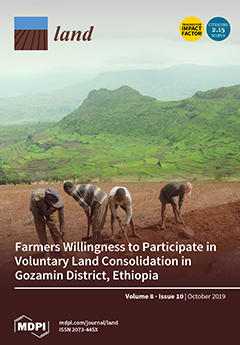
In many African countries in general, and in the highlands of Ethiopia in particular, agricultural land is highly fragmented. Small and scattered parcels impede a necessary increase in agricultural efficiency. Land consolidation is a proper tool to solve inefficiencies in agricultural production, as it enables consolidating plots based on the consent of landholders. This paper investigates the determinants influencing the willingness of landholder farmers to participate in voluntary land consolidation processes. The study was conducted in the Gozamin District, Amhara Region, Ethiopia. Survey data were collected from 343 randomly selected landholder farmers. In addition, structured interviews and focus group discussions with farmers were held. The collected data were analyzed quantitatively and qualitatively. View this paper.
  • Issues are regarded as officially published after their release is announced to the table of contents alert mailing list.
  • You may sign up for e-mail alerts to receive table of contents of newly released issues.
  • PDF is the official format for papers published in both, html and pdf forms. To view the papers in pdf format, click on the "PDF Full-text" link, and use the free Adobe Reader to open them.
Order results
Result details
Section
Select all
Export citation of selected articles as:
17 pages, 328 KiB  
Article
Challenges for Monitoring the Extent and Land Use/Cover Changes in Monarch Butterflies’ Migratory Habitat across the United States and Mexico
by Rafael Moreno-Sanchez, James Raines, Jay Diffendorfer, Mark A. Drummond and Jessica Manko
Land 2019, 8(10), 156; https://doi.org/10.3390/land8100156 - 21 Oct 2019
Cited by 4 | Viewed by 3150
Abstract
This paper presents a synopsis of the challenges and limitations presented by existing and emerging land use/land cover (LULC) digital data sets when used to analyze the extent, habitat quality, and LULC changes of the monarch (Danaus plexippus) migratory habitat across [...] Read more.
This paper presents a synopsis of the challenges and limitations presented by existing and emerging land use/land cover (LULC) digital data sets when used to analyze the extent, habitat quality, and LULC changes of the monarch (Danaus plexippus) migratory habitat across the United States of America (US) and Mexico. First, the characteristics, state of the knowledge, and issues related to this habitat are presented. Then, the characteristics of the existing and emerging LULC digital data sets with global or cross-border coverage are listed, followed by the data sets that cover only the US or Mexico. Later, we discuss the challenges for determining the extent, habitat quality, and LULC changes in the monarchs’ migratory habitat when using these LULC data sets in conjunction with the current state of the knowledge of the monarchs’ ecology, behavior, and foraging/roosting plants used during their migration. We point to approaches to address some of these challenges, which can be categorized into: (a) LULC data set characteristics and availability; (b) availability of ancillary land management information; (c) ability to construct accurate forage suitability indices for their migration habitat; and (d) level of knowledge of the ecological and behavioral patterns of the monarchs during their journey. Full article
20 pages, 7348 KiB  
Article
Dynamics of Land Use and Land Cover Changes in Harare, Zimbabwe: A Case Study on the Linkage between Drivers and the Axis of Urban Expansion
by Andrew K. Marondedze and Brigitta Schütt
Land 2019, 8(10), 155; https://doi.org/10.3390/land8100155 - 19 Oct 2019
Cited by 20 | Viewed by 8541
Abstract
With increasing population growth, the Harare Metropolitan Province has experienced accelerated land use and land cover (LULC) changes, influencing the city’s growth. This study aims to assess spatiotemporal urban LULC changes, the axis, and patterns of growth as well as drivers influencing urban [...] Read more.
With increasing population growth, the Harare Metropolitan Province has experienced accelerated land use and land cover (LULC) changes, influencing the city’s growth. This study aims to assess spatiotemporal urban LULC changes, the axis, and patterns of growth as well as drivers influencing urban growth over the past three decades in the Harare Metropolitan Province. The analysis was based on remotely sensed Landsat Thematic Mapper and Operational Land Imager data from 1984–2018, GIS application, and binary logistic regression. Supervised image classification using support vector machines was performed on Landsat 5 TM and Landsat 8 OLI data combined with the soil adjusted vegetation index, enhanced built-up and bareness index and modified difference water index. Statistical modelling was performed using binary logistic regression to identify the influence of the slope and the distance proximity characters as independent variables on urban growth. The overall mapping accuracy for all time periods was over 85%. Built-up areas extended from 279.5 km2 (1984) to 445 km2 (2018) with high-density residential areas growing dramatically from 51.2 km2 (1984) to 218.4 km2 (2018). The results suggest that urban growth was influenced mainly by the presence and density of road networks. Full article
Show Figures

Graphical abstract

21 pages, 285 KiB  
Article
The Legal Boundaries of ‘Public Purpose’ in India and South Africa: A Comparative Assessment in Light of the Voluntary Guidelines
by Björn Hoops and Nicholas K. Tagliarino
Land 2019, 8(10), 154; https://doi.org/10.3390/land8100154 - 17 Oct 2019
Cited by 1 | Viewed by 3996
Abstract
The Voluntary Guidelines on the Responsible Governance of Tenure (VGGT) call for governments to clearly define the term ‘public purpose’ to allow for judicial review of the goals of expropriations of property. However, recent research indicates that national-level legal frameworks that govern expropriation [...] Read more.
The Voluntary Guidelines on the Responsible Governance of Tenure (VGGT) call for governments to clearly define the term ‘public purpose’ to allow for judicial review of the goals of expropriations of property. However, recent research indicates that national-level legal frameworks that govern expropriation decision-making not only vary greatly from country to country but also often fail to comply with the VGGT standards on expropriation. This creates the potential for unpredictable and, in some cases, arbitrary applications of expropriation law in practice. Focusing on legal norms and jurisprudence applicable to ‘public purpose’ decision-making in South Africa and India, this article provides a comparative analysis of these countries’ legal frameworks as means of ascertaining (1) the current legal boundaries to decisions on the expropriation’s goal; (2) whether these boundaries comply with the VGGTs; and (3) what these two countries can learn from one another in terms enacting legislation and regulations that comply with the VGGTs. To conduct this comparative analysis, we thoroughly examine constitutional provisions, relevant case law, legislation, regulations, and relevant secondary sources to highlight the current status of India’s and South Africa’s law on ‘public purpose’ and how they relate to the VGGTs. We conclude by distilling some key findings that can inform the decisions of expropriation lawmakers in both countries, especially in South Africa where a draft Expropriation Bill is currently being considered. Full article
(This article belongs to the Special Issue Land, Land Use and Social Issues)
31 pages, 2204 KiB  
Article
Interactive Relationship among Urban Expansion, Economic Development, and Population Growth since the Reform and Opening up in China: An Analysis Based on a Vector Error Correction Model
by Yanwei Zhang and Hualin Xie
Land 2019, 8(10), 153; https://doi.org/10.3390/land8100153 - 17 Oct 2019
Cited by 49 | Viewed by 5985
Abstract
Based on cointegration analysis, a vector error correction model (VECM), and the impulse response function method, this paper empirically analyses the interaction among urban expansion, economic development, and population growth in China from 1980 to 2016. The results show that (I) there is [...] Read more.
Based on cointegration analysis, a vector error correction model (VECM), and the impulse response function method, this paper empirically analyses the interaction among urban expansion, economic development, and population growth in China from 1980 to 2016. The results show that (I) there is a long-term equilibrium relationship among urban expansion, economic development and population growth, but there is an imbalance in the short term. When urban expansion deviates from the long-term equilibrium, it cannot be restored to equilibrium in the short term. However, when economic development and population growth deviate from equilibrium, they will adjust back to equilibrium with strengths of −0.1770 and −0.0217, respectively. (II) From the results of the impulse response, there is an interactive statistical relationship between urban expansion, economic development, and population growth; In the short term, both economic development and population growth will cause urban expansion. In the long term, economic development will inhibit urban expansion, and economic development will be less dependent on land. Also, population growth has a long-lasting positive effect on urban expansion. (III) The results of variance decomposition show that urban expansion and economic development were most affected by the structural impact of population growth, and the relative variance contribution (RVC) rate was stable at 29.2% and 42%, respectively. However, economic development contributes the least to the RVC of urban expansion and population growth, and only stabilizes at 12.3% and 8.0% after 30 periods. Finally, the paper proposes that the Chinese government should maintain stable and healthy economic growth and promote sustainable land use in terms of improving land use efficiency, improving human capital levels, and promoting industrial structure. Full article
Show Figures

Figure 1

18 pages, 293 KiB  
Article
The Treaty Claims Settlement Process in New Zealand and Its Impact on Māori
by Margaret Mutu
Land 2019, 8(10), 152; https://doi.org/10.3390/land8100152 - 15 Oct 2019
Cited by 23 | Viewed by 16566
Abstract
This article considers research conducted on the impact of the Crown’s treaty claims settlement policy on Māori in New Zealand. It provides a brief background to the Treaty of Waitangi and the subsequent British colonisation process that relied on the Doctrine of Discovery [...] Read more.
This article considers research conducted on the impact of the Crown’s treaty claims settlement policy on Māori in New Zealand. It provides a brief background to the Treaty of Waitangi and the subsequent British colonisation process that relied on the Doctrine of Discovery in breach of the treaty. It outlines how colonisation dispossessed Māori of 95 percent of their lands and resources, usurped Māori power and authority and left them in a state of poverty, deprivation and marginalisation while procuring considerable wealth, prosperity and privilege for British settlers. The work of the Waitangi Tribunal, the commission of inquiry set up to investigate those breaches, is considered, as is the Crown’s reaction to the 1987 Lands case in developing its treaty claims settlement policy. The Crown unilaterally imposed the policy despite vehement opposition from Māori. Since 1992, it has legislated more than seventy ‘settlements’. The research shows that overall, the process has traumatised claimants, divided their communities, and returned on average less than one percent of their stolen lands. Proposals for constitutional transformation have drawn widespread support from Māori as a solution to British colonisation. United Nations treaty-monitoring bodies have recommended that the government discuss this with Māori. Full article
18 pages, 1118 KiB  
Article
Improving the Socioeconomic Status of Rural Women Associated with Agricultural Land Acquisition: A Case Study in Huong Thuy Town, Thua Thien Hue Province, Vietnam
by Nhung Pham Thi, Martin Kappas and Heiko Faust
Land 2019, 8(10), 151; https://doi.org/10.3390/land8100151 - 14 Oct 2019
Cited by 7 | Viewed by 4184
Abstract
Since the 2000s, agricultural land acquisition (ALA) for urbanization and industrialization has been quickly implemented in Vietnam, which has led to a huge socioeconomic transformation in rural areas. This paper applies the sustainable livelihoods framework to analyze how ALA has impacted the socioeconomic [...] Read more.
Since the 2000s, agricultural land acquisition (ALA) for urbanization and industrialization has been quickly implemented in Vietnam, which has led to a huge socioeconomic transformation in rural areas. This paper applies the sustainable livelihoods framework to analyze how ALA has impacted the socioeconomic status (SES) of rural women whose agricultural land was acquired. To get primary data, we surveyed 150 affected households, conducted three group discussions and interviewed nine key informants. The research findings reveal that ALA, when applied toward urbanization, has significantly improved the occupational status of rural women by creating non-farm job opportunities that have improved their income, socioeconomic knowledge and working skills. While their SES has been noticeably enhanced, these positive impacts are still limited in cases where ALA is applied toward industrial and energy development, since these purposes do not create many new jobs. Moreover, the unclear responsibility of stakeholders and inadequate livelihood rehabilitation programs of ALA projects have obstructed the opportunities of rural women. To improve the SES of rural women, we recommend that ALA policy initiate a flexible livelihoods support plan based on the purpose of ALA and the concrete responsibilities of stakeholders and investors. Full article
(This article belongs to the Special Issue Land, Land Use and Social Issues)
Show Figures

Figure 1

16 pages, 2386 KiB  
Article
Participatory Rural Appraisal Approaches for Public Participation in EIA: Lessons from South Africa
by Luke A. Sandham, Jason J. Chabalala and Harry H. Spaling
Land 2019, 8(10), 150; https://doi.org/10.3390/land8100150 - 12 Oct 2019
Cited by 17 | Viewed by 5978
Abstract
Public participation in environmental impact assessment (EIA) often falls short of the requirements of best practice in the move towards sustainable development, particularly for disadvantaged and marginalized communities. This paper explores the value of a participatory rural appraisal (PRA) approach for improved public [...] Read more.
Public participation in environmental impact assessment (EIA) often falls short of the requirements of best practice in the move towards sustainable development, particularly for disadvantaged and marginalized communities. This paper explores the value of a participatory rural appraisal (PRA) approach for improved public participation in a sample of EIA’s for photovoltaic projects in South Africa. PRA was conducted post facto making use of selected PRA tools. Findings show that a great deal more information was obtained by the PRA approach, confirming the perceived weakness of traditional PP for vulnerable and disadvantaged communities. It is concluded that a PRA approach has considerable potential for improving meaningful public participation, which should improve EIA, build capacity in those communities, and enhance livelihoods and sustainable resource use. Full article
(This article belongs to the Special Issue Land, Land Use and Social Issues)
Show Figures

Figure 1

14 pages, 792 KiB  
Article
Functionality of the Land Certification Program in Ethiopia: Exploratory Evaluation of the Processes of Updating Certificates
by Logan Cochrane and Sebsib Hadis
Land 2019, 8(10), 149; https://doi.org/10.3390/land8100149 - 12 Oct 2019
Cited by 7 | Viewed by 4077
Abstract
Ethiopia has implemented one of the world’s most cost-effective systems to document land holdings, the land certification system. After more than 15 years since its launch, questions have been raised regarding its functionality. Specifically, there are concerns about the process of updating land [...] Read more.
Ethiopia has implemented one of the world’s most cost-effective systems to document land holdings, the land certification system. After more than 15 years since its launch, questions have been raised regarding its functionality. Specifically, there are concerns about the process of updating land certificates, thus ensuring the certificates and the registry are up-to-date. This exploratory evaluation seeks to provide formative evidence regarding this question, and, if warranted, give direction as to where additional research is needed. We find that in some areas, the mechanisms for updating land certificates are functional and in other areas not. Based upon these findings, we suggest four areas for future research, namely: (1) assessing the extent of non-functionality on a broader scale, (2) investigating the causes of non-functionality and viable options for addressing the cases thereof, (3) how policy can best address uninheritable land due to its small size, and (4) evaluating the viability of the future of rural livelihoods and what services ought to be put in place to enable a transition that provides decent livelihood alternatives. Full article
Show Figures

Figure 1

21 pages, 9515 KiB  
Article
Farmers Willingness to Participate In Voluntary Land Consolidation in Gozamin District, Ethiopia
by Abebaw Andarge Gedefaw, Clement Atzberger, Walter Seher and Reinfried Mansberger
Land 2019, 8(10), 148; https://doi.org/10.3390/land8100148 - 12 Oct 2019
Cited by 25 | Viewed by 5550
Abstract
In many African countries and especially in the highlands of Ethiopia—the investigation site of this paper—agricultural land is highly fragmented. Small and scattered parcels impede a necessary increase in agricultural efficiency. Land consolidation is a proper tool to solve inefficiencies in agricultural production, [...] Read more.
In many African countries and especially in the highlands of Ethiopia—the investigation site of this paper—agricultural land is highly fragmented. Small and scattered parcels impede a necessary increase in agricultural efficiency. Land consolidation is a proper tool to solve inefficiencies in agricultural production, as it enables consolidating plots based on the consent of landholders. Its major benefits are that individual farms get larger, more compact, contiguous parcels, resulting in lower cultivation efforts. This paper investigates the determinants influencing the willingness of landholder farmers to participate in voluntary land consolidation processes. The study was conducted in Gozamin District, Amhara Region, Ethiopia. The study was mainly based on survey data collected from 343 randomly selected landholder farmers. In addition, structured interviews and focus group discussions with farmers were held. The collected data were analyzed quantitatively mainly by using a logistic regression model and qualitatively by using focus group discussions and expert panels. According to the results, landholder farmers are predominantly willing to participate in voluntary land consolidation (66.8%), while a substantive fraction of farmers express unease with voluntary land consolidation. The study highlighted the following four determinants to be significant in influencing the willingness of farmers for voluntary land consolidation: (1) the exchange should preferably happen with parcels of neighbors, (2) land consolidation should lead to better arranged parcels, (3) nearness of plots to the farmstead, and (4) an expected improvement in productivity. Interestingly, the majority of farmers believes that land consolidation could reduce land use conflicts. The study provides evidence that policymakers should consider these socio-economic, legal, cultural, infrastructural, and land-related factors when designing and implementing voluntary land consolidation policies and programs. Full article
(This article belongs to the Special Issue Land, Women, Youths, and Land Tools or Methods)
Show Figures

Figure 1

16 pages, 6450 KiB  
Article
Valuing Environmental Amenities across Space: A Geographically Weighted Regression of Housing Preferences in Greenville County, SC
by Joseph Hiebert and Karen Allen
Land 2019, 8(10), 147; https://doi.org/10.3390/land8100147 - 11 Oct 2019
Cited by 8 | Viewed by 3314
Abstract
As global consumption and development rates continue to grow, there will be persistent stress placed on public goods, namely environmental amenities. Urban sprawl and development places pressure on forested areas, as they are often displaced or degraded in the name of economic development. [...] Read more.
As global consumption and development rates continue to grow, there will be persistent stress placed on public goods, namely environmental amenities. Urban sprawl and development places pressure on forested areas, as they are often displaced or degraded in the name of economic development. This is problematic because environmental amenities are valued by the public, but traditional market analysis typically obscures the value of these goods and services that are not explicitly traded in a market setting. This research examines the non-market value of environmental amenities in Greenville County, SC, by utilizing a hedonic price model of home sale data in 2011. We overlaid home sale data with 2011 National Land Cover Data to estimate the value of a forest view, proximity to a forest, and proximity to agriculture on the value of homes. We then ran two regression models, an ordinary least squares (OLS) and a geographically weighted regression to compare the impact of space on the hedonic model variables. Results show that citizens in Greenville County are willing to pay for environmental amenities, particularly views of a forest and proximity to forested and agricultural areas. However, the impact and directionality of these variables differ greatly across space. These findings suggest the need for an integration of spatial dynamics into environmental valuation estimates to inform conservation policy and intentional city planning. Full article
Show Figures

Figure 1

21 pages, 8270 KiB  
Article
Evolution and Collapse of Ejidos in Mexico—To What Extent Is Communal Land Used for Urban Development?
by Melissa Schumacher, Pamela Durán-Díaz, Anne Kristiina Kurjenoja, Eduardo Gutiérrez-Juárez and David A. González-Rivas
Land 2019, 8(10), 146; https://doi.org/10.3390/land8100146 - 07 Oct 2019
Cited by 22 | Viewed by 14675
Abstract
The ejido system, based on communal land in Mexico, was transformed to private ownership due to neoliberal trends in the 1990s. Based on the theory of stakeholders being agents of change, this study aimed to describe the land policies that changed the ejido [...] Read more.
The ejido system, based on communal land in Mexico, was transformed to private ownership due to neoliberal trends in the 1990s. Based on the theory of stakeholders being agents of change, this study aimed to describe the land policies that changed the ejido system into private development to show how land tenure change is shaping urban growth. To demonstrate this, municipalities of San Andrés Cholula and Santa Clara Ocoyucan were selected as case studies. Within this context, we evaluated how much ejido land is being urbanized due to real estate market forces and what type of urbanization model has been created. These two areas represent different development scales with different stakeholders—San Andrés Cholula, where ejidos were expropriated as part of a regional urban development plan and Santa Clara Ocoyucan, where ejidos and rural land were reached by private developers without local planning. To analyze both municipalities, historical satellite images from Google Earth were used with GRASS GIS 7.4 (Bonn, Germany) and corrected with QGIS 2.18 (Boston, MA, US). We found that privatization of ejidos fragmented and segregated the rural world for the construction of massive gated communities as an effect of a disturbing land tenure change that has occurred over the last 30 years. Hence, this research questions the roles of local authorities in permitting land use changes with no regulations or local planning. The resulting urbanization model is a private sector development that isolates rural communities in their own territories, for which we provide recommendations. Full article
(This article belongs to the Special Issue Land Tenure and the Future of Cities)
Show Figures

Figure 1

17 pages, 1636 KiB  
Article
Planning for Democracy in Protected Rural Areas: Application of a Voting Method in a Spanish-Portuguese Reserve
by Mónica de Castro-Pardo, Fernando Pérez-Rodríguez, José María Martín-Martín and João C. Azevedo
Land 2019, 8(10), 145; https://doi.org/10.3390/land8100145 - 01 Oct 2019
Cited by 10 | Viewed by 3058
Abstract
The planning of protected rural areas is usually defined by institutional decision-makers without considering the preferences of the local communities that live on the land, which frequently leads to conflicts in land management. This paper proposes a voting method based on the Borda [...] Read more.
The planning of protected rural areas is usually defined by institutional decision-makers without considering the preferences of the local communities that live on the land, which frequently leads to conflicts in land management. This paper proposes a voting method based on the Borda count to rank the management goals of a protected rural area. The method was applied in a Spanish-Portuguese reserve called Iberian Plateau with the aim of collecting the preferences of institutional decision-makers (government and scientists) and rural landowners (farmers and businesspersons). Regarding the conservation and development objectives, the results show differences in spatial planning when only the preferences of institutional decision-makers are taken into consideration, as opposed to when the preferences of landowners are included within the analysis. Full article
(This article belongs to the Special Issue Land, Land Use and Social Issues)
Show Figures

Figure 1

28 pages, 51654 KiB  
Article
Projecting Urbanization and Landscape Change at Large Scale Using the FUTURES Model
by Derek Van Berkel, Ashwin Shashidharan, Rua S. Mordecai, Raju Vatsavai, Anna Petrasova, Vaclav Petras, Helena Mitasova, John B. Vogler and Ross K. Meentemeyer
Land 2019, 8(10), 144; https://doi.org/10.3390/land8100144 - 24 Sep 2019
Cited by 13 | Viewed by 5169
Abstract
Increasing population and rural to urban migration are accelerating urbanization globally, permanently transforming natural systems over large extents. Modelling landscape change over large regions, however, presents particular challenges due to local-scale variations in social and environmental factors that drive land change. We simulated [...] Read more.
Increasing population and rural to urban migration are accelerating urbanization globally, permanently transforming natural systems over large extents. Modelling landscape change over large regions, however, presents particular challenges due to local-scale variations in social and environmental factors that drive land change. We simulated urban development across the South Atlantic States (SAS), a region experiencing rapid population growth and urbanization, using FUTURES—an open source land change model that uses demand for development, local development suitability factors, and a stochastic patch growing algorithm for projecting alternative futures of urban form and landscape change. New advances to the FUTURES modelling framework allow for high resolution projections over large spatial extents by leveraging parallel computing. We simulated the adoption of different urban growth strategies that encourage settlement densification in the SAS as alternatives to the region’s increasing sprawl. Evaluation of projected patterns indicate a 15% increase in urban lands by 2050 given a status quo development scenario compared to a 14.8% increase for the Infill strategy. Status quo development resulted in a 3.72% loss of total forests, 2.97% loss of highly suitable agricultural land, and 3.69% loss of ecologically significant lands. An alternative Infill scenario resulted in similar losses of total forest (3.62%) and ecologically significant lands (3.63%) yet consumed less agricultural lands (1.23% loss). Moreover, infill development patterns differed qualitatively from the status quo and resulted in less fragmentation of the landscape. Full article
(This article belongs to the Special Issue Land Change Modelling)
Show Figures

Figure 1

18 pages, 6621 KiB  
Case Report
Industrial Sprawl and Residential Housing: Exploring the Interplay between Local Development and Land-Use Change in the Valencian Community, Spain
by Ilaria Zambon, Artemi Cerdà, Filippo Gambella, Gianluca Egidi and Luca Salvati
Land 2019, 8(10), 143; https://doi.org/10.3390/land8100143 - 20 Sep 2019
Cited by 12 | Viewed by 3757
Abstract
Urbanization in Mediterranean Europe has occurred in recent decades with expansion of residential, commercial and industrial settlements into rural landscapes outside the traditional metropolitan boundaries. Industrial expansion in peri-urban contexts was particularly intense in Southern Europe. Based on these premises, this work investigates [...] Read more.
Urbanization in Mediterranean Europe has occurred in recent decades with expansion of residential, commercial and industrial settlements into rural landscapes outside the traditional metropolitan boundaries. Industrial expansion in peri-urban contexts was particularly intense in Southern Europe. Based on these premises, this work investigates residential and industrial settlement dynamics in the Valencian Community, Spain, between 2005 and 2015, with the aim to clarify the role of industrial expansion in total urban growth in a paradigmatic Mediterranean region. Since the early 1990s, the Valencian industrial sector developed in correspondence with already established industrial nodes, altering the surrounding rural landscape. Six variables (urban hierarchy, discontinuous settlements, pristine land under urban expansion, isolated industrial settlements, within- and out-of-plan industrial areas) were considered with the aim at exploring land-use change. Empirical results indicate a role of industrial development in pushing urban sprawl in coastal Valencia. A reflection on the distinctive evolution of residential and industrial settlements is essential for designing new planning measures for sustainable land management and containment of urban sprawl in Southern Europe. A comparative analysis of different alternatives of urban development based on quantitative assessment of land-use change provides guidelines for local development and ecological sustainability. Full article
Show Figures

Figure 1

Previous Issue
Next Issue
Back to TopTop