Next Issue
Volume 11, September
Previous Issue
Volume 11, July


Land, Volume 11, Issue 8 (August 2022) – 254 articles

Cover Story (view full-size image): 
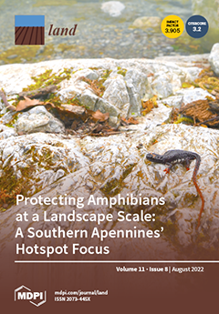
Severe concerns weigh on the conservation status of amphibians, the most threatened vertebrates. In Europe, the southernmost part of the Italian Peninsula, recognized as a glacial refugium, harbors a high level of diversity and endemism. We, therefore, focused on updating the current distribution and conservation status in the Calabrian hotspot of three biogeographic- and conservation-relevant species: Bombina pachypus, Salamandrina terdigitata, and Triturus carnifex. Taking advantage of observations collected over 40 years, our analysis increased spatial knowledge of these species and their ecological requirements. Moreover, we found a tangled pattern of historical gains/losses, sometimes overlapping, and a hotspot coverage by nationally designated protected areas reported to protect far less than the Natura 2000 sites. View this paper
  • Issues are regarded as officially published after their release is announced to the table of contents alert mailing list.
  • You may sign up for e-mail alerts to receive table of contents of newly released issues.
  • PDF is the official format for papers published in both, html and pdf forms. To view the papers in pdf format, click on the "PDF Full-text" link, and use the free Adobe Reader to open them.
Order results
Result details
Section
Select all
Export citation of selected articles as:
18 pages, 7025 KiB  
Article
A Settlement Density Based Allocation Method for Historical Cropland Cover: A Case Study of Jilin Province, China
by Zhilei Wu, Xiuqi Fang and Yu Ye
Land 2022, 11(8), 1374; https://doi.org/10.3390/land11081374 - 22 Aug 2022
Cited by 4 | Viewed by 1617
Abstract
A key focus in research on changes in historical land cover has been to improve existing gridded cropland allocation methods based on land suitability for cultivation to generate credible historical cropland cover data. This study developed a settlement-density-based method for gridded cropland allocation [...] Read more.
A key focus in research on changes in historical land cover has been to improve existing gridded cropland allocation methods based on land suitability for cultivation to generate credible historical cropland cover data. This study developed a settlement-density-based method for gridded cropland allocation using the locations of settlements to identify the cropland grid and the settlement density as the weight for allocating the cropland area to the grid. This method was applied to allocate the provincial cropland areas in Jilin Province, China, to a 5′ × 5′ cropland cover at six time points during the last 300 years. The credibility of the reconstruction was assessed using three methods. The following conclusions emerged. First, the settlement density method is funded on the fact of coexistence between rural settlements and cropland. Cropland is only distributed in the grid where the settlements exist, and the cropland area of a grid equals to the cropland area per settlement multiplying by the number of settlements within the grid, without considering differences of settlement size. Second, all three quantitative or qualitative assessments of Jilin Province confirmed the credibility and feasibility of the settlement density method. Therefore, the use of this method to reproduce the temporal and spatial changes in cropland cover in new reclamation regions, such as Jilin Province, is valid. This study provides valuable inputs for enhancing the credibility of historical global land cover data by incorporating human factors into the cropland allocation method. Full article
(This article belongs to the Section Land Systems and Global Change)
Show Figures

Figure 1

21 pages, 1464 KiB  
Article
Urbanization Influences CO2 Emissions in the Pearl River Delta: A Perspective of the “Space of Flows”
by Yabo Zhao, Ruiyang Chen, Tong Sun, Ying Yang, Shifa Ma, Dixiang Xie, Xiwen Zhang and Yunnan Cai
Land 2022, 11(8), 1373; https://doi.org/10.3390/land11081373 - 22 Aug 2022
Cited by 2 | Viewed by 1688
Abstract
As the largest carbon emitter in the world, China is facing increasing challenge to reduce CO2 emissions. Given this issue, exploring the influencing factors is of great significance for scientific low-carbon emission policymaking. Although previous literature has explored the effects of urbanization [...] Read more.
As the largest carbon emitter in the world, China is facing increasing challenge to reduce CO2 emissions. Given this issue, exploring the influencing factors is of great significance for scientific low-carbon emission policymaking. Although previous literature has explored the effects of urbanization on CO2 emissions, the impact of the space of flow on urban carbon emissions have been less explored. Due to the increasing connection between cities, its impact on urban carbon emissions cannot be ignored. Thus, this paper takes the space of flows into account as an aspect of urbanization to supplement the existing literature and empirically examines the multiple effects of urbanization on CO2 emissions in the Pearl River Delta (PRD) urban agglomeration. By using a STIRPAT model, statistical data, and web crawler data, we examined impacts of different types of urbanization on CO2 emissions. Our empirical results show that: (1) Within the PRD urban agglomeration, urban linkage intensity is strongly connected to urban socioeconomic growth, establishing a geographical structure with Guangzhou and Shenzhen as the double core. (2) Our results show that urbanization exerts two opposite effects on CO2 emissions: positively connects carbon emissions with population urbanization, integrated urban linkage flow, and energy intensity, whereas economic urbanization and social urbanization are shown to be negatively correlated. However, spatial urbanization has no significant positive effect on urban CO2 emissions. (3) It is worth noting that urban linkage flows are the second most important factor affecting urban carbon emissions after economic urbanization. Our study could formulate effective planning suggestions for future CO2 emission reduction paths and development modes in the PRD. Full article
(This article belongs to the Special Issue Urban Planning Pathways to Carbon Neutrality)
Show Figures

Figure 1

17 pages, 12357 KiB  
Article
Physical Model Test on the Interface of Loess Fill Slope
by Weijia Tan, Qiangbing Huang and Xing Chen
Land 2022, 11(8), 1372; https://doi.org/10.3390/land11081372 - 22 Aug 2022
Cited by 4 | Viewed by 1722
Abstract
The interface between the filling slope and the original slope is inevitable in the process of building a city in the loess area, which will affect the deformation and stability of the filling slope. In this paper, the loess fill slope of mountain [...] Read more.
The interface between the filling slope and the original slope is inevitable in the process of building a city in the loess area, which will affect the deformation and stability of the filling slope. In this paper, the loess fill slope of mountain excavation and city construction project in Yan’an City, China, is taken as the research object, and, based on field investigation and sampling, the effect of Loess Fill Slope Interface (LFSI) under rainfall is revealed by physical model test. The test samples were taken from a Loess Fill in Qilipu community, Yan’an, and three layers of sensors were arranged at the left and right interfaces of the original slope and the filled slope to monitor the water content, pore water pressure and deformation and failure characteristics during the experiment. The results show that ILFS is a rainfall dominant seepage channel, and the infiltration of rainfall along the interface lags behind. In addition, the variation laws of water content and pore water pressure at the interface between fill slope and original slope under rainfall are obtained. Finally, the failure process of loess fill slope under rainfall is summarized: local mud flow failure at the toe of the slope → erosion in the middle of the slope → crack initiation on the shoulder of the slope → local slip on the slope → crack propagation on the shoulder of the slope → shallow slip on the shoulder of the slope, and the instability mechanism of loess fill slope under rainfall is further revealed. The research results can provide theoretical and experimental reference for the protection of fill slopes in loess areas. Full article
Show Figures

Figure 1

15 pages, 3129 KiB  
Article
Dynamic Changes of Nitrogen Loads in Source–Sink Landscapes under Urbanization
by Yanmin Li, Jianxiong Tang and Shenghui Cui
Land 2022, 11(8), 1371; https://doi.org/10.3390/land11081371 - 22 Aug 2022
Cited by 4 | Viewed by 1214
Abstract
The dynamic changes of nitrogen (N) loads have been significantly impacted by the rapid expansion of many cities, potentially escalating the risk of N pollution in cities. However, the spatiotemporal changes of N loads in source and sink landscapes remain unclear in urbanization. [...] Read more.
The dynamic changes of nitrogen (N) loads have been significantly impacted by the rapid expansion of many cities, potentially escalating the risk of N pollution in cities. However, the spatiotemporal changes of N loads in source and sink landscapes remain unclear in urbanization. In this research, we used source–sink landscape theory to identify the source–sink landscape in the process of N flow at the city scale and investigated the spatiotemporal changes of N loads in the source–sink landscape from 2005 to 2015 in Xiamen, a rapidly urbanizing city in southern China. The total N loads of source landscapes increased by 2 times between 2005 and 2015, with an average annual growth of 26%, while the total N loads of sink landscapes climbed gradually, with an average annual increase of 8%, according to our findings. Moreover, in terms of the spatial gradient, the N loads of the source landscape fluctuated downward and reached their peak in the urban center, whereas the N loads of the sink landscape tended to rise and reached their peak outside of the city. Our findings offered a fresh viewpoint on the source–sink landscape in N flows at the city scale and offered useful guidance for N spatial management to support sustainable city development. Full article
(This article belongs to the Special Issue Rural–Urban Gradients: Landscape and Nature Conservation)
Show Figures

Figure 1

12 pages, 928 KiB  
Review
Feral Animal Populations: Separating Threats from Opportunities
by Eduardo J. Rodríguez-Rodríguez, Jesús Gil-Morión and Juan J. Negro
Land 2022, 11(8), 1370; https://doi.org/10.3390/land11081370 - 22 Aug 2022
Cited by 3 | Viewed by 2903
Abstract
Feral animals are those that live in the wild but are descendants of domesticated populations. Although, in many cases, these feral populations imply a demonstrable risk to the ecosystems in which they live and may conflict with local wild species and human activities, [...] Read more.
Feral animals are those that live in the wild but are descendants of domesticated populations. Although, in many cases, these feral populations imply a demonstrable risk to the ecosystems in which they live and may conflict with local wild species and human activities, there are feral populations that are considered worth preserving and, in some cases, they already enjoy protection by interest groups and even public authorities. In this review, we aim to identify valuable populations using three criteria: (a) Genetic conservation value (for instance, if the wild ancestor is extinct), (b) the niche occupancy criterion and, finally, (c) a cultural criterion. We propose a detailed analysis of feral populations under scrutiny, supporting control measures when necessary, but also allowing for international protection at the same level as wild animals for feral taxa of special concern. Feral taxa, which are already in the focus of conservation efforts, and should be awarded extended recognition and protection, mainly include ancient lineages with relevant genetic or cultural importance. Full article
(This article belongs to the Special Issue Feature Papers for Land, Biodiversity, and Human Wellbeing Section)
Show Figures

Figure 1

19 pages, 1195 KiB  
Article
Analysis of the Difference in Changes to Farmers’ Livelihood Capital under Different Land Transfer Modes—A Case Study of Manas County, Xinjiang, China
by Difan Liu, Yuejian Wang, Yuejiao Chen, Guang Yang, Hailiang Xu and Yuxiang Ma
Land 2022, 11(8), 1369; https://doi.org/10.3390/land11081369 - 22 Aug 2022
Cited by 2 | Viewed by 1283
Abstract
Farmers’ livelihoods alter as a direct result of land transfer. This study examined the impacts of land transfer on several indicators of farmers’ livelihood capital, as well as variations in the effects of different land transfer methods on farmers’ capital, in an effort [...] Read more.
Farmers’ livelihoods alter as a direct result of land transfer. This study examined the impacts of land transfer on several indicators of farmers’ livelihood capital, as well as variations in the effects of different land transfer methods on farmers’ capital, in an effort more effectively to enhance farmers’ livelihoods. To compare the changes in farmers’ livelihood capital under four different modes—the farmers’ spontaneous model, centralized and continuous, joint-stock cooperative, and leaseback and re-contracting—this study calculated farmers’ livelihood capital index based on 600 questionnaires in accordance with the sustainable livelihood capital framework. The study’s findings indicate the following outcomes: (1) Farmers’ livelihood capital is significantly impacted favorably by land transfers. (2) Different types of farmers experienced different changes in their livelihood capital after land transfer: purely agricultural farmers’ livelihood capital value increased by 0.138, primarily due to an increase in physical capital; agricultural part-time farmers’ livelihood capital value increased by 0.105; non-agricultural part-time farmers’ livelihood capital value increased by 0.081; and non-agricultural farmers’ livelihood capital value increased by 0.081. (3) The most efficient strategy to increase livelihood capital was to use the leaseback and recontracting model with “village collective + planting leadership company” as the primary business organization. The results provide practical guidance for land transfer in Manas County, and valuable suggestions for improving farmers’ livelihoods in arid areas. Full article
(This article belongs to the Special Issue Rural Land Use in China)
Show Figures

Figure 1

17 pages, 12874 KiB  
Article
Evaluating the Effect of the Location and Design of Retention Ponds on Flooding in a Peri-Urban River Catchment
by Stephen J. Birkinshaw and Vladimir Krivtsov
Land 2022, 11(8), 1368; https://doi.org/10.3390/land11081368 - 22 Aug 2022
Cited by 4 | Viewed by 2243
Abstract
In order to reduce the flooding risk in urban and peri-urban river catchments, retention ponds or wet detention ponds are often used. However, there has been little work that uses distributed hydrological modeling to consider their optimum location and design in order to [...] Read more.
In order to reduce the flooding risk in urban and peri-urban river catchments, retention ponds or wet detention ponds are often used. However, there has been little work that uses distributed hydrological modeling to consider their optimum location and design in order to reduce the flood risk in a river catchment. This work considers two existing and two potential ponds in the 22.8 km2 Braid Burn catchment, Edinburgh, Scotland. Using the Shetran physically based distributed hydrological model, the effect of these ponds on the river discharges for eight measured rainfall events and two design rainfall events is considered. The results show the larger Blackford pond is best at reducing the peak discharge at the catchment outlet. The other three ponds are designed to be almost the same. The potential pond in the upper part of the catchment reduces the peak discharge at the outlet; the pond in the middle at Oxgangs makes little difference to the peak discharge, while the potential pond in the lower part of the catchment increases the peak discharge at the outlet. These results show that when considering flood risk, the location of a retention pond within a river catchment is important, and it can make the flooding worse at the outlet if it is located in the wrong location. This work suggests the pond should be located in the upper part of the catchment, although the ideal location will depend on the catchment’s shape and lag time. Full article
(This article belongs to the Special Issue Hydrological Processes in Urban Environments)
Show Figures

Figure 1

19 pages, 12610 KiB  
Article
A Spatio-Temporal Monitoring Method Based on Multi-Source Remote Sensing Data Applied to the Case of the Temi Landslide
by Hua Wang, Qing Guo, Xiaoqing Ge and Lianzi Tong
Land 2022, 11(8), 1367; https://doi.org/10.3390/land11081367 - 21 Aug 2022
Cited by 4 | Viewed by 1725
Abstract
It is challenging to monitor landslides due to their heavy concealment and the extreme destructiveness during the long development of landslides. Many landslide monitoring tools are somewhat onefold. In this paper, a comprehensive landslide monitoring method involving multiple factors from time-series multi-data sources [...] Read more.
It is challenging to monitor landslides due to their heavy concealment and the extreme destructiveness during the long development of landslides. Many landslide monitoring tools are somewhat onefold. In this paper, a comprehensive landslide monitoring method involving multiple factors from time-series multi-data sources is proposed. We focus on the changes in three aspects consisting of the vegetation condition, the surface deformation information and the landslide susceptibility. Firstly, the fractional vegetation cover of the landslide is extracted from optical remote sensing Gaofen-1 (GF-1) images using the dimidiate pixel model. Next, the surface deformation information of the landslide is derived from SAR remote sensing Sentinel-1A images applying the SBAS-InSAR method. Then, the landslide susceptibility based on GF-1, Sentinel-1A images and DEM data is computed using the analytic hierarchy process method. Finally, the spatio-temporal correlations of the vegetation condition, the surface deformation information and the landslide susceptibility are compared and interpreted. The Temi landslide is located along the Jinsha River and poses a high risk of blocking the river. Taking the Temi landslide as the study area, it is indicated from the results that the fractional vegetation cover, surface deformation information and landslide susceptibility reveal a consistency in the patterns of changes in spatial and temporal terms. As the surface deformation information improves, the status of the landslide vegetation also deteriorates and the landslide susceptibility becomes high, which indicates an increased probability of the creep and even the occurrence of landslides. In contrast, when the surface deformation information drops, the vegetation condition of the landslide becomes superior and the landslide becomes less susceptible, which means the likelihood of sliding declines. This study provides a new idea for a landslide monitoring method and potential way for natural disaster prevention and mitigation. Full article
(This article belongs to the Special Issue Landslide and Natural Hazard Monitoring)
Show Figures

Figure 1

18 pages, 8370 KiB  
Article
The IASI Water Deficit Index to Monitor Vegetation Stress and Early Drying in Summer Heatwaves: An Application to Southern Italy
by Guido Masiello, Francesco Ripullone, Italia De Feis, Angelo Rita, Luigi Saulino, Pamela Pasquariello, Angela Cersosimo, Sara Venafra and Carmine Serio
Land 2022, 11(8), 1366; https://doi.org/10.3390/land11081366 - 21 Aug 2022
Cited by 6 | Viewed by 7136
Abstract
The boreal hemisphere has been experiencing increasing extreme hot and dry conditions over the past few decades, consistent with anthropogenic climate change. The continental extension of this phenomenon calls for tools and techniques capable of monitoring the global to regional scales. In this [...] Read more.
The boreal hemisphere has been experiencing increasing extreme hot and dry conditions over the past few decades, consistent with anthropogenic climate change. The continental extension of this phenomenon calls for tools and techniques capable of monitoring the global to regional scales. In this context, satellite data can satisfy the need for global coverage. The main objective we have addressed in the present paper is the capability of infrared satellite observations to monitor the vegetation stress due to increasing drought and heatwaves in summer. We have designed and implemented a new water deficit index (wdi) that exploits satellite observations in the infrared to retrieve humidity, air temperature, and surface temperature simultaneously. These three parameters are combined to provide the water deficit index. The index has been developed based on the Infrared Atmospheric Sounder Interferometer or IASI, which covers the infrared spectral range 645 to 2760 cm−1 with a sampling of 0.25 cm−1. The index has been used to study the 2017 heatwave, which hit continental Europe from May to October. In particular, we have examined southern Italy, where Mediterranean forests suffer from climate change. We have computed the index’s time series and show that it can be used to indicate the atmospheric background conditions associated with meteorological drought. We have also found a good agreement with soil moisture, which suggests that the persistence of an anomalously high water deficit index was an essential driver of the rapid development and evolution of the exceptionally severe 2017 droughts. Full article
(This article belongs to the Special Issue Land Surface Monitoring Based on Satellite Imagery)
Show Figures

Graphical abstract

21 pages, 3542 KiB  
Article
Spatiotemporal Dynamics and Driving Forces of Land Urbanization in the Yangtze River Delta Urban Agglomeration
by Huxiao Zhu, Xiangjun Ou, Zhen Yang, Yiwen Yang, Hongxin Ren and Le Tang
Land 2022, 11(8), 1365; https://doi.org/10.3390/land11081365 - 21 Aug 2022
Cited by 7 | Viewed by 1848
Abstract
Land urbanization is a comprehensive mapping of the relationship between urban production, life and ecology in urban space and a spatial carrier for promoting the modernization of cities. Based on the remote sensing monitoring data of the land use status of the Yangtze [...] Read more.
Land urbanization is a comprehensive mapping of the relationship between urban production, life and ecology in urban space and a spatial carrier for promoting the modernization of cities. Based on the remote sensing monitoring data of the land use status of the Yangtze River Delta urban agglomeration collected in 2010 and 2020, the spatial differentiation characteristics and influencing factors of land urbanization in the area were analyzed comprehensively using hot spot analysis, kernel density estimation, the multi-scale geographically weighted regression (MGWR) model and other methods. The results indicated the following: (1) From 2010 to 2020, the average annual growth rate of land urbanization in the Yangtze River Delta urban agglomeration was 0.50%, and nearly 64.28% of the counties had an average annual growth rate that lagged behind the overall growth rate. It exhibited dynamic convergence characteristics. (2) The differentiation pattern of land urbanization in the Yangtze River Delta urban agglomeration was obvious from the southeast to the northwest. The hot spots of land urbanization were consistently concentrated in the southeastern coastal areas and showed a trend of spreading, while the cold spots were concentrated in the northwest of Anhui Province, showing a shrinking trend. (3) Compared with the GWR model and the OLS model, the MGWR model has a better fitting effect and is more suitable for studying the influencing factors of land urbanization. In addition, there were significant spatial differences in the scale and degree of influence of different influencing factors. Analyzing and revealing the spatiotemporal characteristics and driving mechanism of land urbanization in the Yangtze River Delta urban agglomeration has important theoretical value and practical significance for the scientific understanding of new-type urbanization and the implementation of regional integration and rural revitalization strategies. Full article
(This article belongs to the Special Issue Regional Sustainable Development of Yangtze River Delta, China)
Show Figures

Figure 1

13 pages, 2363 KiB  
Article
Impacts of Sand Mining Activities on the Wetland Ecosystem of Poyang Lake (China)
by Mingming Deng, Qiyue Li, Wenya Li, Geying Lai and Yue Pan
Land 2022, 11(8), 1364; https://doi.org/10.3390/land11081364 - 21 Aug 2022
Cited by 6 | Viewed by 2154
Abstract
Increasing anthropogenic activities are threatening freshwater ecosystems worldwide. Sand mining in Poyang Lake has significantly impacted the wetland ecosystem over the past 20 years, yet a quantitative analysis of these impacts remains insufficient. Here, we used 63 Landsat images taken from 2000 to [...] Read more.
Increasing anthropogenic activities are threatening freshwater ecosystems worldwide. Sand mining in Poyang Lake has significantly impacted the wetland ecosystem over the past 20 years, yet a quantitative analysis of these impacts remains insufficient. Here, we used 63 Landsat images taken from 2000 to 2020 along with the support vector machine (SVM) method and a retrieval model of suspended sediment concentration (SSC) to identify sand mining vessels and areas affected by sand mining. Then, we analyzed the changes in landscape patterns in the areas affected by sand mining. The potential impact of underwater noise generated by sand mining vessels on Yangtze finless porpoises was analyzed by a sound propagation model. The number of sand mining vessels in Poyang Lake during the flood, normal, and dry seasons increased from 2000 to 2016 but rapidly decreased from 2017 to 2020. Sand mining vessels were mainly distributed in the northern channel from 2000 to 2006, moved toward the center of the lake from 2007 to 2010, then moved northward in 2017. Within the areas affected by sand mining, water and mudflats declined, grassland and sandbars increased, and the landscape discontinuity increased. The habitat of the Yangtze finless porpoise affected by underwater noise from sand mining vessels in all seasons has significantly increased overtime. The mean area of the affected habitats was 70.65% (dry), 64.48% (normal), and 63.30% (flood) of the total habitat areas. The porpoise habitats in the northern channel and the west branch of the Ganjiang River are more seriously affected by the underwater noise of sand mining vessels than the southern lake. The impact of sand mining activities on wetland landscape and aquatic species demands systematic investigation in the future. Full article
Show Figures

Figure 1

17 pages, 2130 KiB  
Article
The Spatial Features and Driving Mechanism of Homestead Agglomeration in the Mountainous and Hilly Areas of Southwestern China: An Empirical Study of 22 Villages in Chongqing
by Yan Yan, Qingyuan Yang, Huiming Zhang, Rongrong Zhang, Kaiyue Yang and Xiaochi Qu
Land 2022, 11(8), 1363; https://doi.org/10.3390/land11081363 - 21 Aug 2022
Cited by 1 | Viewed by 1289
Abstract
Scientific analysis of the spatial features and driving factors of homestead agglomeration in different landform types of mountainous and hilly areas in Southwest China is of great significance for the optimization of national spatial patterns and high-quality rural development. This paper selects 22 [...] Read more.
Scientific analysis of the spatial features and driving factors of homestead agglomeration in different landform types of mountainous and hilly areas in Southwest China is of great significance for the optimization of national spatial patterns and high-quality rural development. This paper selects 22 villages in 3 towns with different landform types in Chongqing and examines the spatial features and driving factors of homestead agglomeration in different landform types from the perspectives of terrain gradient, kernel density estimation, farmer household agglomeration status, and landscape index. We analyzed the agglomeration spatial features of different landform types and explored their driving factors and mechanisms. It was found that (1) the distribution of homesteads in mountainous and hilly areas has obvious terrain gradient characteristics, and the layout of platform area homesteads is not constrained by terrain conditions. (2) Chongqing homesteads show a spatially dispersed pattern, but the degree of homestead spatial agglomeration varies significantly among different landform types, with those in mountainous and hilly areas being mainly dispersed and those in platform areas being mainly clustered. (3) Homestead spatial agglomeration is characterized by a combination of factors inside and outside the rural system and farmers’ willingness. There are differences in the driving factors of homestead agglomeration in different landform types. Homestead agglomeration in mountainous and hilly areas is mainly driven externally, while homestead agglomeration in platform areas is mainly driven internally. In both situations, farmers’ willingness must be fully considered. The results of this study can provide a scientific basis for the spatial planning and optimal allocation of land resources in the southwestern hilly area. Full article
(This article belongs to the Section Land Planning and Landscape Architecture)
Show Figures

Figure 1

28 pages, 5666 KiB  
Article
Increased Attention to Smart Development in Rural Areas: A Scientometric Analysis of Smart Village Research
by Qian Wang, Shixian Luo, Jiao Zhang and Katsunori Furuya
Land 2022, 11(8), 1362; https://doi.org/10.3390/land11081362 - 21 Aug 2022
Cited by 16 | Viewed by 3848
Abstract
As the research on smart cities matures and thrives, research focusing on smart rural development has also emerged into the spotlight in recent years. An increasing number of scholars have called for extending the discussion of smart development in the rural context. In [...] Read more.
As the research on smart cities matures and thrives, research focusing on smart rural development has also emerged into the spotlight in recent years. An increasing number of scholars have called for extending the discussion of smart development in the rural context. In response, this paper aims to conduct a comprehensive scientometric review of the current academic literature in the discussion of smart development in rural areas, centering on the concept of the smart village, which is the most recognized concept in the existing literature and practices. The contributions of this study are threefold. First, an overview of the current implementation and understanding of smart village initiatives and conceptual frameworks provides practical and theoretical insights as prerequisites for comprehending the concept. Second, to the best of our knowledge, this is the first complete scientometric study in the smart village field and will establish baseline data for future analysis and comparison. It describes the status of the scientific landscape based on quantitative analysis and an intuitive visualization, identifying patterns, hotspots, trends, and gaps. Finally, we find that the current trend puts a relatively narrow focus on the technology-driven approaches, while the dimensions of society, services, and culture have been largely neglected. Therefore, a dynamic conceptual model is proposed to call for more human-driven perspectives. We believe that a knowledge-based, community-led, and human-centric rural society is the core of a smart village ecosystem. Full article
Show Figures

Figure 1

16 pages, 4697 KiB  
Article
Revealing the Impact of Protected Areas on Land Cover Volatility in China
by Yajuan Wang, Yongheng Rao and Hongbo Zhu
Land 2022, 11(8), 1361; https://doi.org/10.3390/land11081361 - 21 Aug 2022
Cited by 3 | Viewed by 1496
Abstract
Protected areas are fundamental for maintaining ecosystem functions and have generally been considered to affect land use change. Here, we explored how protected areas affected land cover volatility in China from 2011 to 2020 with LandTrendr using the Google Earth Engine (GEE) platform [...] Read more.
Protected areas are fundamental for maintaining ecosystem functions and have generally been considered to affect land use change. Here, we explored how protected areas affected land cover volatility in China from 2011 to 2020 with LandTrendr using the Google Earth Engine (GEE) platform by comparing the difference in volatility of the Normalized Difference Vegetation Index (NDVI) in protected and unprotected areas. The results show that the regions with frequent land cover volatility are mainly located in eastern, central, and southwestern China, indicating that land cover volatility with high NDVI loss values is spatially aggregated in most cases. Considering the impact of protected areas, land cover volatility is relatively consistent inside and outside the protected area throughout the study period, showing a trend of first fluctuating and then rising. Approximately 22% of detected land cover volatility occurred in protected areas, though the average NDVI loss value (0.56) for protected areas was greater than unprotected areas (0.51). Combined with the outliers, land cover volatility accompanied by larger NDVI loss values is still primarily distributed in unprotected areas in most years. The detection of NDVI gain values in protected areas shows that protected areas (average value is 0.48) are larger than unprotected areas (average value is 0.47) almost every year, even combined with the outliers, and land cover volatility accompanied by larger NDVI gain values is also primarily distributed in protected areas in most years. Elucidating land cover volatility is helpful in understanding land cover changes and how to formulate an effective land use policy. Full article
(This article belongs to the Special Issue Trends in Land Change Monitoring)
Show Figures

Figure 1

37 pages, 11382 KiB  
Article
The Use of High-Resolution Remote Sensing Data in Preparation of Input Data for Large-Scale Landslide Hazard Assessments
by Marko Sinčić, Sanja Bernat Gazibara, Martin Krkač, Hrvoje Lukačić and Snježana Mihalić Arbanas
Land 2022, 11(8), 1360; https://doi.org/10.3390/land11081360 - 21 Aug 2022
Cited by 6 | Viewed by 1830
Abstract
The objective of the study is to show that landslide conditioning factors derived from different source data give significantly different relative influences on the weight factors derived with statistical models for landslide susceptibility modelling and risk analysis. The analysis of the input data [...] Read more.
The objective of the study is to show that landslide conditioning factors derived from different source data give significantly different relative influences on the weight factors derived with statistical models for landslide susceptibility modelling and risk analysis. The analysis of the input data for large-scale landslide hazard assessment was performed on a study area (20.2 km2) in Hrvatsko Zagorje (Croatia, Europe), an area highly susceptible to sliding with limited geoinformation data, including landslide data. The main advantage of remote sensing technique (i.e., LiDAR, Light Detection and Ranging) data and orthophoto images is that they enable 3D surface models with high precision and spatial resolution that can be used for deriving all input data needed for landslide hazard assessment. The visual interpretation of LiDAR DTM (Digital Terrain Model) morphometric derivatives resulted in a detailed and complete landslide inventory map, which consists of 912 identified and mapped landslides, ranging in size from 3.3 to 13,779 m2. This inventory was used for quantitative analysis of 16 input data layers from 11 different sources to analyse landslide presence in factor classes and thus comparing landslide conditioning factors from available small-scale data with high-resolution LiDAR data and orthophoto images, pointing out the negative influence of small-scale source data. Therefore, it can be concluded that small-scale landslide factor maps derived from publicly available sources should not be used for large-scale analyses because they will result in incorrect assumptions about conditioning factors compared with LiDAR DTM derivative factor maps. Furthermore, high-resolution LiDAR DTM and orthophoto images are optimal input data because they enable derivation of the most commonly used landslide conditioning factors for susceptibility modelling and detailed datasets about elements at risk (i.e., buildings and traffic infrastructure data layers). Full article
Show Figures

Figure 1

20 pages, 4921 KiB  
Article
Evaluation of the Spatial Effect of Network Resilience in the Yangtze River Delta: An Integrated Framework for Regional Collaboration and Governance under Disruption
by Lei Che, Jiangang Xu, Hong Chen, Dongqi Sun, Bao Wang, Yunuo Zheng, Xuedi Yang and Zhongren Peng
Land 2022, 11(8), 1359; https://doi.org/10.3390/land11081359 - 21 Aug 2022
Cited by 6 | Viewed by 1758
Abstract
Public health emergencies are characterized by significant uncertainty and robust transmission, both of which will be exacerbated by population mobility, threatening urban security. Enhancing regional resilience in view of these risks is critical to the preservation of human lives and the stability of [...] Read more.
Public health emergencies are characterized by significant uncertainty and robust transmission, both of which will be exacerbated by population mobility, threatening urban security. Enhancing regional resilience in view of these risks is critical to the preservation of human lives and the stability of socio-economic development. Network resilience (NR) is widely accepted as a strategy for reducing the risk of vulnerability and maintaining regional sustainability. However, past assessments of it have not sufficiently focused on its spatial effect and have overlooked both its internal evolution characteristics and external threats which may affect its function and effectiveness. Therefore, we used the Yangtze River Delta Region (YRDR) as a case study and conceptualized an integrated framework to evaluate the spatial pattern and mechanisms of NR under the superposition of the COVID-19 pandemiv and major holidays. The results indicated that the topology of a population mobility network has a significant effect on its resilience. Accordingly, the network topology indexes differed from period to period, which resulted in a decrease of 17.7% in NR. For network structure, the Shanghai-Nanjing and Shanghai-Hangzhou development axes were dependent, and the network was redundant. In the scenario where 20% of the cities were disrupted, the NR was the largest. Furthermore, the failure of dominant nodes and the emergence of vulnerable nodes were key factors that undermined the network’s resilience. For network processes, NR has spatial effects when it is evolute and there is mutual inhibition between neighboring cities. The main factors driving changes in resilience were found to be GDP, urbanization rate, labor, and transportation infrastructure. Therefore, we propose a trans-scale collaborative spatial governance system covering “region-metropolitan-city” which can evaluate the uncertain disturbances caused by the network cascade effect and provide insights into the sustainable development of cities and regions. Full article
(This article belongs to the Special Issue Regional Sustainable Development of Yangtze River Delta, China)
Show Figures

Figure 1

13 pages, 6757 KiB  
Article
Old, Lost, and Forgotten Rural Materialities: Old Local Irrigation Channels and Lost Local Walking Trails
by Angel Paniagua
Land 2022, 11(8), 1358; https://doi.org/10.3390/land11081358 - 20 Aug 2022
Cited by 4 | Viewed by 1393
Abstract
Geo-historical studies have essentially focused on analyzing the historical evolution of the landscape and the processes of material resistance of rural landscapes against the dynamics of rural change. Historical landscapes are cumulative life micro-worlds. In the present contribution, the historical evolution of lost [...] Read more.
Geo-historical studies have essentially focused on analyzing the historical evolution of the landscape and the processes of material resistance of rural landscapes against the dynamics of rural change. Historical landscapes are cumulative life micro-worlds. In the present contribution, the historical evolution of lost and disappeared rural roads and caceras—old local irrigation channels—is analyzed in a comparative way. The case studies were the Berbedillo river cacera system in the north of the province of Guadalajara and the Bustar path in the municipality of Bustarviejo in the province of Madrid. The methodology was based on a variety of research sources: written and archival documents, oral testimonies of the elderly, and micro-territorial recognition. The roads and caceras are lost but can continue to be represented, even if they can no longer be used for the life of rural communities. A new history of depopulation, restructuring, and loss is possible to (re)write based on spectral agrarian (im)materialities. Full article
Show Figures

Figure 1

18 pages, 38534 KiB  
Article
Industrial Park Role as a Catalyst for Regional Development: Zooming on Middle East Countries
by Soniya Falahatdoost and Xingping Wang
Land 2022, 11(8), 1357; https://doi.org/10.3390/land11081357 - 19 Aug 2022
Viewed by 2476
Abstract
The development of the industrial park has been one of the priorities of the plans of different countries and has created a magnitude challenge concerning regional disparities. Globally, the Middle Eastern countries have demonstrated a more remarkable dedication to industrial park development, given [...] Read more.
The development of the industrial park has been one of the priorities of the plans of different countries and has created a magnitude challenge concerning regional disparities. Globally, the Middle Eastern countries have demonstrated a more remarkable dedication to industrial park development, given its general importance since the 1970s. Due to this importance, this paper is divided into three sections due to the critical role of industrial park development in the case of Middle Eastern countries. First, this study highlighted the relevant literature using Scinotometric analysis. In the second step, following the investigation of the relationship between selected critical variables and the development of industrial parks towards regional development in the Middle Eastern countries from 2000 to 2018. In this regard, panel data were used to determine the association between the selected variables and industrial park performance. According to the findings, the author suggests policy implementation for industrial park development in three categories: economic growth, environmental issues, and reduction in regional disparities. Finally, this study can serve as a foundation for future research, such as comparing the first batch of industrial parks with their upgraded counterparts in the Middle East and studying the competitive advantages issues. Full article
Show Figures

Figure 1

17 pages, 1032 KiB  
Article
Effect of Policy Cognition on the Intention of Villagers’ Withdrawal from Rural Homesteads
by Ranran Shi, Ling Hou, Binghui Jia, Yaya Jin, Weiwei Zheng, Xiangdong Wang and Xianhui Hou
Land 2022, 11(8), 1356; https://doi.org/10.3390/land11081356 - 19 Aug 2022
Cited by 12 | Viewed by 1665
Abstract
The Chinese government encourages villagers to withdraw from rural homesteads and puts these homesteads into the land market to revitalize rural homestead resources and make up for the lack of new construction land. Unfortunately, the implementation of the withdrawal from rural homesteads (WRH) [...] Read more.
The Chinese government encourages villagers to withdraw from rural homesteads and puts these homesteads into the land market to revitalize rural homestead resources and make up for the lack of new construction land. Unfortunately, the implementation of the withdrawal from rural homesteads (WRH) policy remains slow. To realize the effective promotion of WRH policy, exploring the impact of policy cognition (PC) on villagers’ WRH intentions has become the key to solving the above problems. Thus, field survey data on 280 villagers in 13 administrative villages in the Yangling Demonstration district of Shaanxi province were collected through a face-to-face household survey. In addition, combined with the extended theory of planned behavior (TPB), this study used the structural equation model (SEM) to empirically analyze the influence of PC on the intentions of villagers’ WRH. Our empirical results indicated that benefit cognition and difficulty cognition were the focus of the villagers and had positive and negative effects on the intention of WRH, respectively. Government behavior also played a positive role in villagers’ WRH intentions. Villagers would consider compensation standards, pay closer attention to improving the living environment and employment opportunities, and express individual intentions. We believe policymakers should systematically consider the various impacts of WRH policy on villagers and build the villagers’ participation system of WRH and cross-regional transaction system for WRH indicators. This paper further enriches the conceptual framework of PC, which may help us better understand villagers’ responses to relevant policy reforms. Full article
Show Figures

Figure 1

25 pages, 7098 KiB  
Article
Model-Based Yield Gap Assessment in Nepal’s Diverse Agricultural Landscape
by Amit Kumar Basukala and Livia Rasche
Land 2022, 11(8), 1355; https://doi.org/10.3390/land11081355 - 19 Aug 2022
Cited by 1 | Viewed by 2742
Abstract
Rice, wheat, maize, millet, and barley are the five major staple cereal crops in Nepal. However, their yields are low, and imports are needed to meet domestic demand. In this study, we quantify the gap between current and potentially attainable yields in Nepal, [...] Read more.
Rice, wheat, maize, millet, and barley are the five major staple cereal crops in Nepal. However, their yields are low, and imports are needed to meet domestic demand. In this study, we quantify the gap between current and potentially attainable yields in Nepal, estimate how much additional fertilizer and irrigation are required to close the gap, and assess if self-sufficiency can thus be achieved. For this, we first test the ability of the crop model EPIC to reproduce reported yields in 1999–2014 accurately. On average, simulated and reported yields at the national level were in the same range, but at the district level, the error was large, as the resolutions of the available climate and soil input data were not high enough to depict the heterogenic conditions in Nepal adequately. In the main study, we show that average yield gaps in Nepal amount to 3.0 t/ha (wheat), 2.7 t/ha (rice), 2.9 t/ha (maize), 0.4 t/ha (barley), and 0.5 t/ha (millet). With additional irrigation and fertilization, yields can be increased by 0.1/2.3 t/ha (wheat), 0.4/1.3 t/ha (rice), 1.6/1.9 t/ha (maize), 0.1/0.3 t/ha (barley), and 0.1/0.4 t/ha (millet), respectively. The results show that providing reliable and affordable access to fertilizer should be a priority for closing yield gaps in Nepal. Full article
(This article belongs to the Special Issue Modelling Land Use in Challenging Terrains)
Show Figures

Figure 1

21 pages, 3970 KiB  
Article
The Distribution Model and Spatial Structure of Market Towns in the Pearl River Delta during the Ming, Qing, and Min-Guo Periods: A Case Study of Taishan County
by Shuyin Feng, Qi Lu, Zhaohui Wu and Zihui Guo
Land 2022, 11(8), 1354; https://doi.org/10.3390/land11081354 - 19 Aug 2022
Cited by 3 | Viewed by 1387
Abstract
Previous studies have clarified that there are certain regularities in the spatial organization of traditional Chinese rural market towns as viewed from the perspective of the economic geography and local society. Nevertheless, the results of some studies concerning distribution patterns and factors influencing [...] Read more.
Previous studies have clarified that there are certain regularities in the spatial organization of traditional Chinese rural market towns as viewed from the perspective of the economic geography and local society. Nevertheless, the results of some studies concerning distribution patterns and factors influencing these patterns are contradictory, and there are few comprehensive analyses of the influence of interconnected variables. Taishan County in the Pearl River Delta of Guangdong Province is used as an example, and the results of the identification of the distribution pattern of market towns within this county are determined as clustered by using the Voronoi method and the calculated coefficients of variation (Cv). The correlation between the market towns and the physical and social environment is quantified and illustrated through Geographic Information Systems (GIS), logistic regression analysis, and graphic methods, and the application of nuclear density change rates clarifies the development trajectory, which explains the phenomenon of market town clustering with ecological and cultural significance. Overall, the results indicate traditional preferences for sites characterized by low elevation, little slope, proximity to water, and productive agricultural land, while at the local scale, the spatial–temporal arrangement of market towns reflects partitioning and interactions between distinct clans. Further integrating the perspective of environmental history, we propose that the structural relationships of natural ecology, subsistence mode, and social organization crucially constitute the site selection and layout logic of market towns. Full article
Show Figures

Figure 1

19 pages, 3116 KiB  
Article
Large Shear Strength Parameters for Landslide Analyses on Highly Weathered Flysch
by Sofia Anagnostopoulou, Nikolaos Depountis, Nikolaos Sabatakakis and Panagiotis Pelekis
Land 2022, 11(8), 1353; https://doi.org/10.3390/land11081353 - 19 Aug 2022
Viewed by 1666
Abstract
Many significant landslide movements are often observed in the upper weathering zone of flysch, which constitutes the most critical landslide-prone geological formation in Western Greece. In this article, a laboratory approach is adopted to investigate the behavior of highly weathered and tectonically decomposed [...] Read more.
Many significant landslide movements are often observed in the upper weathering zone of flysch, which constitutes the most critical landslide-prone geological formation in Western Greece. In this article, a laboratory approach is adopted to investigate the behavior of highly weathered and tectonically decomposed flysch for slope stability analyses with the performance of large shear testing in reconstituted soil specimens. The testing program included several reconstituted flysch specimens derived from three representative landslides. Tests under large direct shearing (300 × 300 × 120 mm) were conducted in moisture- and density-controlled conditions and ring shear tests were conducted in the finer material. The test results revealed that the values of the effective angle of friction in the flysch material decrease with the increasing water content. Moreover, dense specimens showed curved failure envelopes due to dilatancy, especially in dry conditions. A comparison of laboratory test results with those obtained by performing back-analyses under saturated conditions has shown that the sliding of the weathered and decomposed flysch mainly depends on its residual angle of friction which was found to be 1°–6° lower than the ultimate angle of friction as it was estimated by the large shear tests. Full article
Show Figures

Figure 1

21 pages, 14760 KiB  
Article
Assessment of Synergistic Development Potential between Tourism and Rural Restructuring Using a Coupling Analysis: A Case Study of Southern Shaanxi, China
by Wenli Jing, Wei Zhang, Pingping Luo, Lian Wu, Lei Wang and Kanhua Yu
Land 2022, 11(8), 1352; https://doi.org/10.3390/land11081352 - 19 Aug 2022
Cited by 11 | Viewed by 1522
Abstract
Tourism plays an important role in rural restructuring, especially in mountainous areas. Mismatches between tourism and rural in terms of the development level and efficiency have given rise to a variety of challenges. In order to achieve the orderly growth of tourism and [...] Read more.
Tourism plays an important role in rural restructuring, especially in mountainous areas. Mismatches between tourism and rural in terms of the development level and efficiency have given rise to a variety of challenges. In order to achieve the orderly growth of tourism and sustainable rural restructuring, there is an urgent need to explore the interaction between the two. Thus, we introduce the concept of synergistic development potential (SDP) and construct an assessment framework using coupling analysis. Southern Shaanxi, in the Qin-Ba mountainous area, a Chinese region rich in ecological tourism resources, was selected as a case study to evaluate the SDP during the period 2013 to 2018. In our framework, a comprehensive index system with 21 indicators was developed to evaluate the tourism development levels (TDL) and rural development levels (RDL) in 2013 and 2018, and the tourism development efficiency (TDE) and rural restructuring efficiency (RRE) during this period. Secondly, correlations between TDL and RDL, as well as correlations between TDE and RDE, were quantified using the coupling coordination degree model (CCDM). Finally, the SDP evaluation model was constructed through combing the coupling coordination degrees of current development levels and development efficiencies. The case study results indicate that the primary-level coordination counties are both dominated in this region in terms of the relationship of development levels as well as the development efficiencies. Additionally, the SDP results show a significant difference in 25 counties, with 36% of them having low potential, 48% having medium potential, and 16% having high potential. This study could intuitively show the development differences among various units and provide theoretical and methodological support for the rural tourism zoning strategies. Full article
(This article belongs to the Section Land Socio-Economic and Political Issues)
Show Figures

Figure 1

23 pages, 5629 KiB  
Article
Past Human Mobility Corridors and Least-Cost Path Models South of General Carrera Lake, Central West Patagonia (46° S, South America)
by Paulo Moreno-Meynard, César Méndez, Iñigo Irarrázaval and Amalia Nuevo-Delaunay
Land 2022, 11(8), 1351; https://doi.org/10.3390/land11081351 - 19 Aug 2022
Cited by 3 | Viewed by 1762
Abstract
Understanding the use of natural corridors is critical for characterizing the past use of marginally occupied landscapes at the Andean fringes of western Patagonia by the hunter-gatherer groups who inhabited this region. In this paper, we combine least-cost path models and archaeological surveys [...] Read more.
Understanding the use of natural corridors is critical for characterizing the past use of marginally occupied landscapes at the Andean fringes of western Patagonia by the hunter-gatherer groups who inhabited this region. In this paper, we combine least-cost path models and archaeological surveys and excavations to determine the possible movements along the southern margin of General Carrera Lake. The methodology includes defining uncertainties that allow for modeling a set of equiprobable routes, thereby avoiding problems with errors and biases from predictors, such as slope, land-use cover, and seasonality. The results identify mobility corridor bottlenecks, i.e., geographical areas with a high probability of travel routes with equiprobable routes that converge. In addition, we identify areas where travel routes are likely to diverge into multiple semi-parallel routes. The study of archaeological sites provides stratigraphic data to control for the chronology and characteristics of mobility along this transect. The correlation between archaeological sites and paths, specifically for the control and winter scenarios, shows the quality of these route predictions. These results indicate the repeated use of internodal spaces that were effectively incorporated into mobility during the last three millennia. Full article
(This article belongs to the Section Landscape Archaeology)
Show Figures

Figure 1

20 pages, 2204 KiB  
Article
Adoption of Digital Aerial Photogrammetry in Forest Planning: A Case Study of Canavese Forestry Consortium, NW Italy with Technical and Economic Issues
by Enrico Borgogno-Mondino, Samuele De Petris, Filippo Sarvia, Evelyn Joan Momo, Fabio Sussio and Paolo Pari
Land 2022, 11(8), 1350; https://doi.org/10.3390/land11081350 - 19 Aug 2022
Viewed by 1637
Abstract
The forestry sector has been significantly affected by the recent advances in geomatics. Photogrammetric aerial acquisitions provide full coverage of forests, making possible a wall-to-wall mapping of the main forestry key variables, such as tree height and tree density, needed for forest planning [...] Read more.
The forestry sector has been significantly affected by the recent advances in geomatics. Photogrammetric aerial acquisitions provide full coverage of forests, making possible a wall-to-wall mapping of the main forestry key variables, such as tree height and tree density, needed for forest planning and management purposes. This work summarizes the role that digital aerial photogrammetry (DAP) is expected to have in the forest planning context and analyzes the main products from DAP that are significantly required. According to their technical features, some strategies are proposed to program acquisitions in order to consciously set operational parameters needed for obtaining accuracy of measures compliant with forest planning requirements. Admitting that, in most cases, forest planners externalize DAP acquisitions to flying companies, the authors propose simple strategies for making an ex-post evaluation of flight conditions through a conscious processing of the external orientation parameters of images resulting after the bundle adjustment. Theoretical aspects are exemplified with reference to a practical case study relying on an aerial acquisition that, in 2019, the Canavese Forestry Consortium (NW Italy) made to support the ongoing redaction of its new forest plans. Finally, some economic concerns are presented to demonstrate the capability of this technique to absorb the most of costs associated with ground surveys, especially when large areas have to be investigated. In particular, about 66% of cost savings were found when comparing DAP-based forest mapping to traditional forest inventory strategies. Full article
Show Figures

Figure 1

20 pages, 4890 KiB  
Article
Analysis Long-Term and Spatial Changes of Forest Cover in Typical Karst Areas of China
by Fei Chen, Xiaoyong Bai, Fang Liu, Guangjie Luo, Yichao Tian, Luoyi Qin, Yue Li, Yan Xu, Jinfeng Wang, Luhua Wu, Chaojun Li, Sirui Zhang and Chen Ran
Land 2022, 11(8), 1349; https://doi.org/10.3390/land11081349 - 18 Aug 2022
Cited by 19 | Viewed by 2000
Abstract
In recent decades, China has exhibited the fastest and most remarkable social-economic development in the world. As a result of such development, the forest cover of the country has undergone radical changes. This paper aims to develop a method for analyzing long-term and [...] Read more.
In recent decades, China has exhibited the fastest and most remarkable social-economic development in the world. As a result of such development, the forest cover of the country has undergone radical changes. This paper aims to develop a method for analyzing long-term and spatial changes in forest cover based on historical maps and remote sensing images. Moreover, we will focus on the reduction or restoration of forests distributed at different altitudes, slopes, soils, and lithologic types in different periods, to reveal the problems that should be paid attention to in forest restoration in karst areas. A typical county of China was selected as the study area. A historical military operation map was considered the principal source of basic data. These data were then combined with Landsat satellite images to conduct quantitative analysis on changes in the spatial area and location of forest cover with a long time series. The findings are as follows: in terms of time series, the forest area in the study area showed a trend of decreasing at first and then increasing, with the year 1986 as the turning point. In terms of spatial patterns, a considerable difference is observed in regions with changes in forest cover under different historical periods. Changes are obvious in limestone areas, rock soil areas, and areas with an elevation of 2000–2500 m and a slope gradient of 6°–15°. Spatial–temporal changes in forest cover reflect the effects of the war, national policy, and economic development to some extent. All these results indicate that, despite its limitations, a historical map is a valuable document for studying an ecological environment. Full article
(This article belongs to the Special Issue Karst Land System and Sustainable Development)
Show Figures

Figure 1

40 pages, 542 KiB  
Article
The (In)Ability of a Multi-Stakeholder Platform to Address Land Conflicts—Lessons Learnt from an Oil Palm Landscape in Myanmar
by Lara M. Lundsgaard-Hansen, Christoph Oberlack, Glenn Hunt and Flurina Schneider
Land 2022, 11(8), 1348; https://doi.org/10.3390/land11081348 - 18 Aug 2022
Cited by 1 | Viewed by 1785
Abstract
Oil palm landscapes are often characterised by land conflicts. Multi-stakeholder platforms (MSP) may be a promising means to contribute to conflict resolution. However, the merits of MSPs are limited in contexts with strong power imbalances and entrenched conflict histories. This study analyses an [...] Read more.
Oil palm landscapes are often characterised by land conflicts. Multi-stakeholder platforms (MSP) may be a promising means to contribute to conflict resolution. However, the merits of MSPs are limited in contexts with strong power imbalances and entrenched conflict histories. This study analyses an MSP from Myanmar. We developed an analytical framework based on literature on MSPs and social learning and used qualitative methods such as participatory observation and interviews. The study investigates how the MSP was designed and governed and whether it was effective in addressing the land conflicts around oil palm concessions. The study discusses several promising factors of the MSP for being effective, such as adequate inclusion of stakeholders, secured resources, or effective facilitation. However, the analysis also reveals how hindering factors such as lack of a clear mandate, goal, and decision-making competences of the MSP, insufficient communication, or lack of legal and land governance expertise contributed to only limited effectiveness of the MSP. Further, we discuss whether the MSP was a suitable approach in the given context of nontransparent land governance mechanisms, persisting power disparities, and longstanding conflict history. We conclude that designing and governing an MSP in such a context needs to be done very cautiously—if at all—and recommend paying special attention to ten specific points. Full article
Show Figures

Figure 1

25 pages, 7286 KiB  
Article
The Mechanism of Land Registration Program on Land Transfer in Rural China: Considering the Effects of Livelihood Security and Agricultural Management Incentives
by Lei Xu, Shixiang Chen and Shuliu Tian
Land 2022, 11(8), 1347; https://doi.org/10.3390/land11081347 - 18 Aug 2022
Cited by 4 | Viewed by 1797
Abstract
The key to a smooth land transfer (including land transfer-out and transfer-in) lies in the cooperation between the land supply and demand parties. Existing studies explore how land registration programs affect land transfer from a macro level or from a micro level in [...] Read more.
The key to a smooth land transfer (including land transfer-out and transfer-in) lies in the cooperation between the land supply and demand parties. Existing studies explore how land registration programs affect land transfer from a macro level or from a micro level in a certain area, but little consideration has been given to the interaction and behavioral disciplines of stakeholders. This article aims at testing the possible mechanism of the land registration program on land transfer in rural China by bridging and extending concepts from peasant theories and by employing mediation models. The empirical results reveal that the land registration program has a significant positive impact on land transfer, which is an important path in order to overcome the cooperative dilemma between land supply and demand parties. Additionally, livelihood security inhibits the positive impact of the land registration program on land transfer-out. While agricultural management incentives promote the positive impact of the land registration program on land transfer-in. Furthermore, these findings contribute to a novel perspective for evaluating land registration programs and deepen the understanding that intricate driving factors behind the decrease in the land transfer growth rate can have in rural China. Full article
Show Figures

Figure 1

14 pages, 1092 KiB  
Article
Distribution Characteristics and Risk Assessment of Heavy Metals in Soils of the Typical Karst and Non-Karst Areas
by Weijie Li, Tongbin Zhu, Hui Yang, Chunlai Zhang and Xia Zou
Land 2022, 11(8), 1346; https://doi.org/10.3390/land11081346 - 18 Aug 2022
Cited by 2 | Viewed by 1781
Abstract
To investigate the distribution characteristics and hazard levels of eight heavy metals (As, Cd, Cr, Cu, Hg, Ni, Pb, Zn) in karst soil with a high geological background of heavy metals, 32 and 40 surface soil samples were collected from limestone and clastic [...] Read more.
To investigate the distribution characteristics and hazard levels of eight heavy metals (As, Cd, Cr, Cu, Hg, Ni, Pb, Zn) in karst soil with a high geological background of heavy metals, 32 and 40 surface soil samples were collected from limestone and clastic rock areas, respectively, in the northern part of Mashan County, Guangxi Province, a typical mountainous county dominated by primary industries in China. Geostatistical methods, Pearson’s correlation analysis, the geo-accumulation index, and the potential ecological hazard index were applied to explore the influencing factors of those heavy metals and evaluate their potential contamination risks. The results show that (1) the levels of the eight heavy metal elements in the surface soils of karst areas exceeded the background values of soil for Mashan County, the background value of soil (layer A) in China, and abundance value of upper crust. According to the soil pollution risk screening values specified in the Soil Environmental Quality: Risk Control Standard for Contamination of Agricultural Land, the proportions of heavy metals in the soils of karst areas were ranked as Cd (100%) > As (90.6%) > Cr (84.4%) > Zn (68.8%) > Ni (37.5%). Meanwhile, the heavy metals in the soils of non-karst areas did not exceed the overall values for Mashan County, and Ni, Pb, and Zn did not exceed the overall national soil values. One-quarter of Cd in non-karst samples exceeded the risk-threshold screening value. There was a high degree of variation and a significant difference in the contents of heavy metal elements between karst and non-karst areas. (2) The element combinations of As-Cd-Cu-Hg-Ni-Pb-Zn and Cr in karst areas were characterized by the influence of carbonate rock parent material. The non-karst areas were characterized by Ni-Cu-Pb-Zn, As-Cr-Hg, and Cd assemblages, which were mainly influenced by the mixture of laterite parent materials, sand shale parent materials, and basic-rock residual materials, and that may be affected by element migration caused by soil erosion and anthropogenic activities. (3) Analysis of the geo-accumulation index showed that karst areas were generally found to be at the clean to light pollution level, except for in the areas whose samples exhibited medium/high pollution levels for Cd and Cr, with the Cd pollution being the more serious of the two. Small amounts of Cd and Cu were present in the non-karst areas at a light contamination level, while other elements were at the level of no pollution. (4) The results of the potential ecological risk index showed that Cd and Hg were the main ecologically hazardous heavy metal elements in the soils of the study areas. The potential ecological risk level in karst areas was much higher than in non-karst areas, especially for Cd, and was mainly influenced by the carbonate rock parent material. Full article
(This article belongs to the Special Issue New Insights in Soil Quality and Management in Karst Ecosystem)
Show Figures

Figure 1

13 pages, 4634 KiB  
Article
Pasture Management to Reduce the Risk of Acer pseudoplatanus Poisoning While Preserving Ecological Sustainability
by Barbara Ghislain, Arnaud Farinelle, Benoît Renaud, Anne-Christine François, Clovis P. Wouters and Dominique-Marie Votion
Land 2022, 11(8), 1345; https://doi.org/10.3390/land11081345 - 18 Aug 2022
Cited by 1 | Viewed by 1996
Abstract
In spring, grazing equids may suffer from a severe rhabdomyolysis syndrome named atypical myopathy. This environmental intoxication results from ingestion of toxins contained in Acer pseudoplatanus seedlings. The aim of this study was to investigate the effectiveness of herbicide spraying and mowing to [...] Read more.
In spring, grazing equids may suffer from a severe rhabdomyolysis syndrome named atypical myopathy. This environmental intoxication results from ingestion of toxins contained in Acer pseudoplatanus seedlings. The aim of this study was to investigate the effectiveness of herbicide spraying and mowing to reduce the toxic pressure of sycamore seedlings. In a first experiment, the efficacy of three herbicides to eradicate seedlings was compared to mowing. In a second experiment, the influence of the mowing timing on pasture productivity was determined. In both experiments, sycamore seedling counting, grass height and botanical composition were determined. In experiment 2, the final harvest biomass and its nutritional value were also determined. Herbicides and mowing both reduced the number of seedlings, which nevertheless disappear naturally over time without intervention (i.e., in control areas). As opposed to mowing, herbicide spraying altered the composition of the pasture flora. Both sprayed and mowed seedlings remain toxic until full decomposition. Early mowing (i.e., early April) did not affect the harvest yield. Late mowing (i.e., end of April) reduced the harvest yield but its nutritional value fitted the horses’ need. In conclusion, mowing is the best strategy to reduce the risk of Acer pseudoplatanus poisoning in grazing equids while preserving ecological sustainability and nutritional value of pastures. Full article
(This article belongs to the Special Issue Sustainable Management of Natural Resources in Livestock System)
Show Figures

Figure 1

Previous Issue
Back to TopTop