Next Issue
Volume 11, July
Previous Issue
Volume 11, May


Land, Volume 11, Issue 6 (June 2022) – 190 articles

Cover Story (view full-size image): 
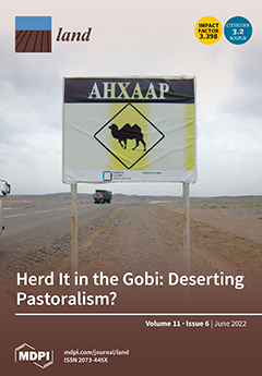
Global drylands host more than USD 1 trillion in resource extraction investments. In Mongolia’s Gobi Desert, mega-mining brings social challenges and environmental changes that question whether nomadic herding and mining can co-exist. Company and community conflict are common yet nascent frameworks, and mediation models suggest alternate ways to resolve the mining-community conundrum. Here, we investigate transformations that herders encounter with the Oyu Tolgoi mega-mine in the Khanbogd district. Using socioeconomic and physical data, we assessed local engagement and adaptation to large-scale mining and the implications for herder lives and lands. This study presents an integrated assessment of herder, government, and mining roles in reshaping pastoralism. Contrary to common narratives, mining and herding can, and do, coexist in Khanbogd, Mongolia. View this paper
  • Issues are regarded as officially published after their release is announced to the table of contents alert mailing list.
  • You may sign up for e-mail alerts to receive table of contents of newly released issues.
  • PDF is the official format for papers published in both, html and pdf forms. To view the papers in pdf format, click on the "PDF Full-text" link, and use the free Adobe Reader to open them.
Order results
Result details
Section
Select all
Export citation of selected articles as:
38 pages, 2194 KiB  
Article
The Digitization of Seniors: Analyzing the Multiple Confluence of Social and Spatial Divides
by Millán Arroyo-Menéndez, Noelia Gutiérrez-Láiz and Blanca Criado-Quesada
Land 2022, 11(6), 953; https://doi.org/10.3390/land11060953 - 20 Jun 2022
Cited by 4 | Viewed by 2583
Abstract
The lower digitization among seniors must be understood in the context of the coming together of multiple digital divides. In addition to the obvious generation divide (age is one of the factors most determining digital uses), others also have an influence, such as [...] Read more.
The lower digitization among seniors must be understood in the context of the coming together of multiple digital divides. In addition to the obvious generation divide (age is one of the factors most determining digital uses), others also have an influence, such as a lower education or income level, which is characteristic of this group and also strongly correlated with lower use of new technologies. We also find gender differences in the digital uses of seniors (more pronounced than in the population as a whole) and a significant geospatial inequality in several variables. The latter is important due to both the rapid aging of the rural population, greater than that seen in the urban population, and the fact that the geographical areas with a lower income level, where the aging population tends to be concentrated to a greater extent, are also the areas where digitization reaches the least, in terms of both infrastructures and uses. This article addresses the multiconfluence of the aforementioned “digital divides in older people” (or “seniors”), trying to determine the effects and degree of importance of each, identify the main groups at risk of digital exclusion, and to characterize the technological uses of seniors and their main segments. To do this, we have used the microdata from the “Survey on Equipment and Use of Information and Communication Technologies in homes”, produced by the Spanish Statistical Office (INE) for the year 2020. Full article
Show Figures

Figure 1

17 pages, 378 KiB  
Article
Labor Structure, Land Fragmentation, and Land-Use Efficiency from the Perspective of Mediation Effect: Based on a Survey of Garlic Growers in Lanling, China
by Fujia Sui, Yinsheng Yang and Shizhen Zhao
Land 2022, 11(6), 952; https://doi.org/10.3390/land11060952 - 20 Jun 2022
Cited by 11 | Viewed by 1997
Abstract
In the context of China’s agricultural labor shortage and the pressure of aging, this paper uses the land fragmentation index and the intermediary efficiency model to measure the degree of land fragmentation based on farmer-level data from the main garlic producing area in [...] Read more.
In the context of China’s agricultural labor shortage and the pressure of aging, this paper uses the land fragmentation index and the intermediary efficiency model to measure the degree of land fragmentation based on farmer-level data from the main garlic producing area in Lanling County in Shandong Province in 2020. The direct effect of labor structure on land-use efficiency and the mediating effect through land fragmentation are analyzed. The research results show that: (1) the average land-use efficiency of the sample farmers is relatively low; (2) the change in labor structure has an “inverted U”-shaped direct effect on land-use efficiency; and (3) the change in land fragmentation in the labor structure has a direct effect on land-use efficiency. The influence of land-use efficiency played a nonlinear mediating effect. The change in labor structure with the degree of land fragmentation showed an “inverted U”-shaped relationship, and the degree of land fragmentation and land-use efficiency had a “U”-shaped relationship. In order to improve land-use efficiency, two aspects of policy support should be increased: encouraging farmers to integrate land and supporting specialized and diversified planting. Full article
Show Figures

Figure 1

16 pages, 4216 KiB  
Article
Hydrological Cycle Performance at a Permeable Pavement Site and a Raingarden Site in a Subtropical Region
by Chi-Feng Chen, Jhe-Wei Lin and Jen-Yang Lin
Land 2022, 11(6), 951; https://doi.org/10.3390/land11060951 - 20 Jun 2022
Cited by 32 | Viewed by 2160
Abstract
Low-impact development (LID) structures are widely used to mitigate urbanization impacts on hydrology. The performances of such structures are strongly affected by field conditions, such as the ratio of LID area to drainage area and rainfall properties, such as rainfall intensity. In this [...] Read more.
Low-impact development (LID) structures are widely used to mitigate urbanization impacts on hydrology. The performances of such structures are strongly affected by field conditions, such as the ratio of LID area to drainage area and rainfall properties, such as rainfall intensity. In this study, onsite continuous monitoring was performed at a permeable pavement site and a raingarden site in Taipei, Taiwan, to determine their water retention and groundwater recharge potential under subtropical weather. In addition, the verified Storm Water Management Model (SWMM) was used to illustrate the annual performance on the hydrological cycle. Based on one year of monitoring, data on 41 and 24 rainfall events were obtained at the permeable pavement and raingarden sites, respectively. The ratio of the permeable pavement area to the total drainage area was 36.0%, and this ratio was 15.9% for the raingarden. The results showed that the average runoff reduction rate was 14.7% at the permeable pavement site, and 98.3% of the rainfall was retained in the raingarden and an underground storage tank. The validated model showed that the permeable pavement site experienced 45.3% outflow, 31.6% evaporation, and 23.1% infiltration annually. For the raingarden with an underground storage tank, 91.4% of the annual rainfall infiltrated and was stored, with only 4.1% outflow. According to the observed rainfall event performance and the simulated annual performance, the permeable pavement and raingarden performed well in subtropical regions. Pavement that was approximately 1/3 permeable in a drainage area increased infiltration by approximately 20%, and a raingarden with a sufficient underground storage tank preserved over 90% of the rainfall. Full article
(This article belongs to the Special Issue Hydrological Processes in Urban Environments)
Show Figures

Figure 1

15 pages, 2336 KiB  
Article
A Framework for Cloud to Coast Adaptation: Maturity and Experiences from across the North Sea
by Paul Sayers, Berry Gersonius, Gül Özerol, Erwin Nugraha and Cor A. Schipper
Land 2022, 11(6), 950; https://doi.org/10.3390/land11060950 - 20 Jun 2022
Cited by 3 | Viewed by 2099
Abstract
The low-lying coastal areas of the countries around the North Sea are exposed to flooding and the influence of sea level rise. The countries in the North Sea Region need to continue to adapt if the associated risk is to be well-managed into [...] Read more.
The low-lying coastal areas of the countries around the North Sea are exposed to flooding and the influence of sea level rise. The countries in the North Sea Region need to continue to adapt if the associated risk is to be well-managed into the future. In addition to reducing flood risk, adaptation measures can bring development opportunities for those same places. These opportunities, however, are unlikely to be achieved through a ‘defence only’ paradigm, and instead a new approach is needed that simultaneously reduces risk and promotes liveable places, ecosystem health and social well-being. The building blocks of this new approach are promoted here and are based on an adaptation process that is collaborative and takes a whole-system, long-term perspective. The approach developed through the Interreg funded project, C5a, brings together governments, practitioners and researchers from across the North Sea to share policies, practices and the emerging science of climate change adaptation and enabling sustainable development. The new approach reflects a Cloud to Coast management paradigm and emerged through a combination of knowledge exchange and peer-to-peer learning across seven case studies. Central to the case studies was a maturity analysis of existing capabilities across the North Sea countries and their ability to adopt the new approach. This paper presents the results of this analysis, including the common challenges that emerged and the methods and examples of good practice to overcome them. Building upon these findings, the paper concludes by presenting four priority policy directions to support the uptake of the Cloud to Coast approach. Full article
Show Figures

Figure 1

18 pages, 6052 KiB  
Article
Baroque Gardens in Transylvania: A Historic Overview
by Albert Fekete and Máté Sárospataki
Land 2022, 11(6), 949; https://doi.org/10.3390/land11060949 - 20 Jun 2022
Cited by 3 | Viewed by 2130
Abstract
For over more than 20 years, Transylvanian ensembles, gardens and parks have been investigated, described and analysed by a research group from Hungary, led by Albert Fekete. The goal of this study of Transylvanian ensembles is to get background information, insight for developing [...] Read more.
For over more than 20 years, Transylvanian ensembles, gardens and parks have been investigated, described and analysed by a research group from Hungary, led by Albert Fekete. The goal of this study of Transylvanian ensembles is to get background information, insight for developing a strategy for landscape preservation and development in the long run that comprises the cultural and historical values and the demands from society on what to do with them in the contemporary context. The goal of the article is to give an overview of what is already known and what could be done from the viewpoint of protection, planning and design. The research methods are mixed, but are largely based on the case study approach, supplemented by experimental design, fieldwork and research by design. The conclusion is that, given the state of what is left over from these historical artefacts, restoration in the strict sense will be impossible. This will be a major challenge for landscape architecture to take into account the historical values, integrate them with new functions and use and the recent demands of improving water management, energy transition and the creation of comfort and healthy living environments for people. Full article
Show Figures

Figure 1

16 pages, 4554 KiB  
Article
The Forage Plantation Program between Desertification Mitigation and Livestock Feeding: An Economic Analysis
by Fathi Abdellatif Belhouadjeb, Abdallah Boumakhleb, Abdelhalim Toaiba, Abdelghafour Doghbage, Benbader Habib, Hassen Boukerker, Enrique Murgueitio, Walid Soufan, Mohamad Isam Almadani, Belkacem Daoudi and Amar Khadoumi
Land 2022, 11(6), 948; https://doi.org/10.3390/land11060948 - 20 Jun 2022
Cited by 1 | Viewed by 2074
Abstract
To combat desertification and land degradation in arid and semi-arid zones, the government has adopted an approach of rehabilitation of pasturelands through forage plantations. This program was launched at the beginning of the 1990s and, to date, there has been no global or [...] Read more.
To combat desertification and land degradation in arid and semi-arid zones, the government has adopted an approach of rehabilitation of pasturelands through forage plantations. This program was launched at the beginning of the 1990s and, to date, there has been no global or national study on the sustainability of the program, particularly its economic profitability. Our work’s principal objective was to perform an economic analysis of the forage plantation program across the different periods since the creation of the program until the year 2020, focusing on the economic evaluation parameters of the projects, such as mean annual net income, net present value, annuity of the net present value, profitability index and payback period, based on the data collected from the official institutions. The results showed that the forage plantation program significantly contributes to sustainable development in steppe areas. Full article
(This article belongs to the Special Issue Sustainable Management of Natural Resources in Livestock System)
Show Figures

Figure 1

5 pages, 198 KiB  
Editorial
Preface: Arable Land Quality: Observation, Estimation, Optimization, and Application
by Sijing Ye, Changqing Song, Yakov Kuzyakov, Feng Cheng, Xiangbin Kong, Zhe Feng and Peichao Gao
Land 2022, 11(6), 947; https://doi.org/10.3390/land11060947 - 20 Jun 2022
Cited by 9 | Viewed by 1517
Abstract
Food security is a worldwide challenge that is related to the basic human needs of sustainable development [...] Full article
2 pages, 158 KiB  
Correction
Correction: Ejaz et al. The Use of Soil Conditioners to Ensure a Sustainable Wheat Yield under Water Deficit Conditions by Enhancing the Physiological and Antioxidant Potentials. Land 2022, 11, 368
by Muhammad Kashif Ejaz, Muhammad Aurangzaib, Rashid Iqbal, Muhammad Shahzaman, Muhammad Habib-ur-Rahman, Mohamed El-Sharnouby, Rahul Datta, Fahad M. Alzuaibr, Mohamed I. Sakran, Chukwuma C. Ogbaga and Ayman EL Sabagh
Land 2022, 11(6), 946; https://doi.org/10.3390/land11060946 - 20 Jun 2022
Cited by 2 | Viewed by 1002
Abstract
In the published publication [...] Full article
25 pages, 1468 KiB  
Article
Boon or Bane? Urban Food Security and Online Food Purchasing during the COVID-19 Epidemic in Nanjing, China
by Yajia Liang, Taiyang Zhong and Jonathan Crush
Land 2022, 11(6), 945; https://doi.org/10.3390/land11060945 - 19 Jun 2022
Cited by 8 | Viewed by 3206
Abstract
This paper examines the relationship between the rapid growth of online food purchasing and household food security during the first wave of the COVID-19 pandemic in China using the city of Nanjing as a case study. The paper presents the results of an [...] Read more.
This paper examines the relationship between the rapid growth of online food purchasing and household food security during the first wave of the COVID-19 pandemic in China using the city of Nanjing as a case study. The paper presents the results of an online survey of 968 households in Nanjing in March 2020 focused on their food purchasing behavior and levels of food security during the early weeks of the pandemic. While online food purchasing has increased rapidly in many countries during the COVID-19 pandemic, little research attention has been paid to the relationship between online food purchasing and household food security. This paper provides detailed insights into this relationship in China. The medium- and longer-term food security and other consequences of the pandemic pivot to online food purchasing are a fertile area for future research in China and elsewhere. Full article
(This article belongs to the Special Issue Impacts of COVID-19 on Urban Food Security)
Show Figures

Figure 1

19 pages, 5146 KiB  
Article
Assessment of Spatial Temporal Changes of Ecological Environment Quality: A Case Study in Huaibei City, China
by Ruihao Cui, Jiazheng Han and Zhenqi Hu
Land 2022, 11(6), 944; https://doi.org/10.3390/land11060944 - 19 Jun 2022
Cited by 19 | Viewed by 2736
Abstract
Under the short-term economic development goal, the excessive exploitation of natural resources and the destruction of the ecological environment make the ecological environment of Huaibei cities increasingly fragile. This study constructed the Remote Sensing Ecological Index (RSEI) to evaluate the ecological environment change [...] Read more.
Under the short-term economic development goal, the excessive exploitation of natural resources and the destruction of the ecological environment make the ecological environment of Huaibei cities increasingly fragile. This study constructed the Remote Sensing Ecological Index (RSEI) to evaluate the ecological environment change trend and its driving factors in Huaibei City from 2000 to 2020. The barycenter migration model was used to determine the RSEI spatial change trend, and the geographic detector was used to analyze the influencing factors of the RSEI value change. The results showed that: (1) the average RSEI value of Huaibei City generally fluctuates within the range of good and excellent grades. (2) The migration direction of the barycenter of RSEI is similar when the level of RSEI improves or decreases from 2000 to 2020, and the barycenter migration is most severe from 2005 to 2015. (3) The driving factors of RSEI change were population density (0.47) > land use (0.24) > slope (0.14) > precipitation (0.08) > temperature (0.04) > altitude (0.03). All the factors had interaction effects on the RSEI, mainly with nonlinear enhancement. (4) From 2000 to 2010, urban construction encroached on all kinds of land, which was the direct reason for the decline in ecological environment quality. From 2010 to 2020, the surge of water and meadow areas improved the ecological environment quality of Huaibei city. Therefore, reducing the expansion of artificial land, returning farmland to forests and meadows, wetland park construction, and other ecological protection measures are the keys to ensuring the sustainable development of regional social and economic development. This study can provide a reference and scientific basis for sustainable development strategy and ecological protection planning to improve the ecological environment quality of Huaibei City. Full article
(This article belongs to the Special Issue The Eco-Environmental Effects of Urban Land Use)
Show Figures

Figure 1

28 pages, 15411 KiB  
Article
The Effects of Soil Improving Cropping Systems (SICS) on Soil Erosion and Soil Organic Carbon Stocks across Europe: A Simulation Study
by Jantiene E. M. Baartman, Joao Pedro Nunes, Hedwig van Delden, Roel Vanhout and Luuk Fleskens
Land 2022, 11(6), 943; https://doi.org/10.3390/land11060943 - 19 Jun 2022
Cited by 3 | Viewed by 2582
Abstract
Healthy soils are fundamental for sustainable agriculture. Soil Improving Cropping Systems (SICS) aim to make land use and food production more sustainable. To evaluate the effect of SICS at EU scale, a modelling approach was taken. This study simulated the effects of SICS [...] Read more.
Healthy soils are fundamental for sustainable agriculture. Soil Improving Cropping Systems (SICS) aim to make land use and food production more sustainable. To evaluate the effect of SICS at EU scale, a modelling approach was taken. This study simulated the effects of SICS on two principal indicators of soil health (Soil Organic Carbon stocks) and land degradation (soil erosion) across Europe using the spatially explicit PESERA model. Four scenarios with varying levels and combinations of cover crops, mulching, soil compaction alleviation and minimum tillage were implemented and simulated until 2050. Results showed that while in the scenario without SICS, erosion slightly increased on average across Europe, it significantly decreased in the scenario with the highest level of SICS applied, especially in the cropping areas in the central European Loess Belt. Regarding SOC stocks, the simulations show a substantial decrease for the scenario without SICS and a slight overall decrease for the medium level scenario and the scenario with a mix of high, medium and no SICS. The scenario with a high level of SICS implementation showed an overall increase in SOC stocks across Europe. Potential future improvements include incorporating dynamic land use, climate change and an optimal spatial allocation of SICS. Full article
Show Figures

Figure 1

31 pages, 6933 KiB  
Article
A Dynamic Performance and Differentiation Management Policy for Urban Construction Land Use Change in Gansu, China
by Yajun Ma, Ping Zhang, Kaixu Zhao, Yong Zhou and Sidong Zhao
Land 2022, 11(6), 942; https://doi.org/10.3390/land11060942 - 19 Jun 2022
Cited by 9 | Viewed by 1965
Abstract
Making efforts to promote rationalized urban construction land change, distribution, allocation, and its performance is the core task of territory spatial planning and a complex issue that the government must face and solve. Based on the Boston Consulting Group matrix, a decoupling model, [...] Read more.
Making efforts to promote rationalized urban construction land change, distribution, allocation, and its performance is the core task of territory spatial planning and a complex issue that the government must face and solve. Based on the Boston Consulting Group matrix, a decoupling model, and a GIS tool, this paper constructs a new tool that integrates “dynamic analysis + performance evaluation + policy design” for urban construction land. We reached the following findings from an empirical study of Gansu, China: (1) Urban construction land shows diversified changes, where expansion is dominant and shrink cannot be ignored. (2) Most cities are in the non-ideal state of LH (Low-High) and LL (Low-Low), with a small number in the state of HH (High-High) and HL (High-Low). (3) Urban construction land change and population growth, economic development, and income increase are in a discordant relationship, mostly in strong negative decoupling and expansive negative decoupling. (4) The spatial heterogeneity of urban construction land change and its performance are at a high level, and they show a slow upward trend. Additionally, the cold and the hot spots show obvious spatial clustering characteristics, and the spatial pattern of different indexes is different to some extent. (5) It is suggested that in territory spatial planning Gansu should divide the space into four policy areas—incremental, inventory, a reduction development policy area, and a transformation leading policy area—to implement differentiated management policies and to form a new spatial governance system of “control by zoning and management by class”. The change of urban construction land, characterized by dynamics and complexity, is a direct mapping of the urban growth process. The new tools constructed in this paper will help to reveal the laws of urban development and to improve the accuracy of territory spatial planning in the new era. They are of great theoretical significance and practical value for promoting high-quality and sustainable urban development. Full article
(This article belongs to the Special Issue Territory Spatial Planning toward High-Quality Development in China)
Show Figures

Figure 1

12 pages, 1878 KiB  
Article
Assessment of the Efficiency of Cultivated Land Occupied by Urban and Rural Construction Land in China from 1990 to 2020
by Xiaoyu Liu and Liangjie Xin
Land 2022, 11(6), 941; https://doi.org/10.3390/land11060941 - 18 Jun 2022
Cited by 16 | Viewed by 1881
Abstract
The rapid urbanization and economic growth experienced by China in recent years has led to the expansion of construction land. This has resulted in the substantial transformation of cultivated land to construction land. However, the efficiency of cultivated land occupation by construction land, [...] Read more.
The rapid urbanization and economic growth experienced by China in recent years has led to the expansion of construction land. This has resulted in the substantial transformation of cultivated land to construction land. However, the efficiency of cultivated land occupation by construction land, its regional differences, and the urban-rural disparity in China remain unclear. Therefore, using population and land use data, we measured the efficiency of cultivated land occupied by urban and rural construction land in China during 1990–2020 by proposing absolute, differential, and relative efficiency evaluation methods. Our study revealed that the cultivated land area occupied by rural construction land is 22.4% higher than that of urban construction land. The efficiency of cultivated land occupied by construction land in urban areas was higher than that in rural areas. Spatially, the population in the urban and rural construction land-occupied cultivated land area shows a pattern of high in the southeast and low in the northwest. The efficiency of urban and rural construction land-occupied cultivated land increases with increasing urban size. Thus, to improve the efficiency of cultivated land occupied by construction land, the strict control on the urban construction occupation of cultivated land should be loosened, particularly for larger cities, and the control on inefficient construction in rural areas should be tightened. Full article
(This article belongs to the Special Issue Agricultural Land Use and Food Security)
Show Figures

Figure 1

22 pages, 4333 KiB  
Article
Exploring Changes in Land Use and Landscape Ecological Risk in Key Regions of the Belt and Road Initiative Countries
by Xuebin Zhang, Litang Yao, Jun Luo and Wenjuan Liang
Land 2022, 11(6), 940; https://doi.org/10.3390/land11060940 - 18 Jun 2022
Cited by 9 | Viewed by 1976
Abstract
The Belt and Road Initiative (BRI) has revealed that it is necessary to strengthen research on land use and land cover change (LUCC) and ecological risk in key regions of countries around the world. In this study, the spatiotemporal characteristics of LUCC in [...] Read more.
The Belt and Road Initiative (BRI) has revealed that it is necessary to strengthen research on land use and land cover change (LUCC) and ecological risk in key regions of countries around the world. In this study, the spatiotemporal characteristics of LUCC in the five capitals of Central Asian countries within the BRI were analyzed. Based on the grid scale, a landscape pattern index was introduced to quantitatively evaluate the landscape ecological risk levels of the five capitals. The results showed the following: first, the components of land use types in the five capitals have different structural characteristics, which are mainly grassland, unused land, and cultivated land. The landscape types that changed significantly were water and unused land, while the construction land area showed a trend of continuous increase. Second, different capitals have different land-use transfer patterns. Akmola State is mainly converted from cultivated land to grassland; Chuy State is mainly converted from forest land to grassland; Dushanbe and Tashkent City are mainly converted from grassland to forestland; and Ahal State is mainly converted from grassland to unused land. Third, the overall landscape ecological risks of the five capitals were low. Akmola State had the largest proportion of lowest ecological risk areas, whereas Chuy State and Dushanbe City had an increasing trend of highest ecological risk areas. The level of ecological risk in Tashkent remained stable during the study period, and the highest ecological risk areas in Ahal State decreased to 49,227.86 km2. This study has enriched the research results of land use change and landscape ecological risk assessment of countries within the BRI and can provide a research reference for these countries and regions to achieve ecological sustainable development and strengthen ecosystem management. Full article
Show Figures

Figure 1

22 pages, 1017 KiB  
Article
Driving Mechanisms of Cropland Abandonment from the Perspectives of Household and Topography in the Poyang Lake Region, China
by Guohua Ding, Mingjun Ding, Kun Xie and Jingru Li
Land 2022, 11(6), 939; https://doi.org/10.3390/land11060939 - 18 Jun 2022
Cited by 4 | Viewed by 1698
Abstract
Cropland abandonment is driven by various mechanisms and is best viewed from multiple perspectives to suggest targeted policy changes which may change the status quo of abandonment. Here, we systematically analyze the characteristics of abandonment and its driving mechanisms by different farming households [...] Read more.
Cropland abandonment is driven by various mechanisms and is best viewed from multiple perspectives to suggest targeted policy changes which may change the status quo of abandonment. Here, we systematically analyze the characteristics of abandonment and its driving mechanisms by different farming households (pure, part-time, and non-farm) in three topographic regions of the Poyang Lake region using a binary logistic regression model. Results show that: (1) The overall abandonment probability in the Poyang Lake region is largest for non-farm households, followed by part-time households and pure households. In the mountainous region, abandonment is largest for non-farm households, followed by pure households and part-time households. Both the hilly and plain regions show the largest abandonment probability for pure households, followed by part-time households, and non-farm households. (2) The low agricultural economic benefits and the uneconomical investments of time in plots are the main abandonment determinants for pure households. Economic efficiency, both the time invested in plots and economic efficiency, are key abandonment determinants for pure households in the mountainous and plain regions, respectively. (3) Labor shortage and plots which are time-consuming and unfavorable to cultivation are the main abandonment determinants for part-time households, with different factors in different topographic regions. (4) For non-farm households, many factors can influence the occurrence of abandonment. Non-farm households in the mountainous and hilly regions are more influenced by non-farm work and the number of farming workers, respectively; in addition, the inconvenience of using agricultural machinery has a significant influence. Full article
(This article belongs to the Special Issue Agricultural Land Use and Food Security)
Show Figures

Figure 1

29 pages, 1005 KiB  
Article
How Has the COVID-19 Pandemic Affected the Different Branches of the Agri-Food Industry in Extremadura (Spain)?
by Celia Sama-Berrocal and Beatriz Corchuelo Martínez-Azúa
Land 2022, 11(6), 938; https://doi.org/10.3390/land11060938 - 18 Jun 2022
Cited by 5 | Viewed by 2222
Abstract
The COVID-19 pandemic has had a significant impact on the world economy since 2020. This study analyzed the impact of the pandemic on innovative agri-food companies from different branches of agro-industrial activity located in Extremadura (Spain). The main aim of this study was [...] Read more.
The COVID-19 pandemic has had a significant impact on the world economy since 2020. This study analyzed the impact of the pandemic on innovative agri-food companies from different branches of agro-industrial activity located in Extremadura (Spain). The main aim of this study was to determine which activities have been most affected. Differences between actions and changes made depending on the nature of the product, process, or services were also evaluated. The information was obtained from an online questionnaire in which the research questions were posed (what consequences, actions, or changes has the pandemic had on the development of firms’ activities?). Data were analyzed descriptively, and a statistical study was conducted on the existence or absence of independence between effects and actions based on the branches of activity of agri-food industries. The main results showed that companies’ financial (decrease in turnover and reduction/displacement of product demand) and operational functioning (difficulty in marketing activities and standstill/decline in the fiscal year) has mainly been affected. In response, innovative agro-industries have acted regarding their processes (increased ICT use and new marketing strategies) and procedures (implementation of stricter hygienic-sanitary protocols and reorganization of activities and personnel) to deal with the negative effects on their activities. In general, all agro-industrial branches have incorporated changes in their products and services, mainly by providing new and better customer benefits, and improving product formats and forms of payment to suppliers. These findings provide information for the regional public administration in the development of initiatives that mitigate the negative effects of the pandemic and favor the implementation of actions that help the adaptation of agro-industrial activities. Agricultural policies should incorporate specialized measures to ensure the global sustainability of the food and agriculture system and the supply and production. Full article
Show Figures

Figure 1

22 pages, 4400 KiB  
Article
Study on Eco-Environmental Effects of Land-Use Transitions and Their Influencing Factors in the Central and Southern Liaoning Urban Agglomeration: A Production–Living–Ecological Perspective
by Ruiqiu Pang, Ning Hu, Jingrui Zhou, Dongqi Sun and Hongying Ye
Land 2022, 11(6), 937; https://doi.org/10.3390/land11060937 - 18 Jun 2022
Cited by 15 | Viewed by 2204
Abstract
From the perspective of the production–living–ecological space, this paper reclassifies the land-use categories in the central and southern Liaoning urban agglomeration in the years 1990, 2000, 2010 and 2018. It then quantitatively analyzes the spatiotemporal evolution characteristics of land-use transitions by adopting the [...] Read more.
From the perspective of the production–living–ecological space, this paper reclassifies the land-use categories in the central and southern Liaoning urban agglomeration in the years 1990, 2000, 2010 and 2018. It then quantitatively analyzes the spatiotemporal evolution characteristics of land-use transitions by adopting the land-use transfer matrix and other methods. This paper further uses the eco-environmental quality index and ecological contribution rate to explore the eco-environmental effects of the land-use transition. Finally, it identifies the influencing factors of the eco-environmental effect and the spatial differentiation law of the effect in the study area through the multi-scale geographically weighted regression (MGWR) model. The main conclusions reached are as follows: (1) During the study period, a slow increase was seen in the ecological land of the central and southern Liaoning urban agglomeration. A sharp decline occurred in the production land, and a rapid rise was found in the living land. (2) From 1990 to 2018, the eco-environmental quality index in the study region showed significant spatial differentiation, with the distribution characteristics being high in the east and low in the west. The areas have expanded and spread along the Shenyang-Dalian axis to form medium-low quality agglomerations. The encroachment of agricultural production land and urban and rural living land on forest ecological land is the main contributor to the deterioration of the eco-environmental quality during the study period. (3) Compared with the geographically weighted regression model and the ordinary least squares model, a remarkable advancement can be seen in the MGWR model, which is more suitable for research on the influencing factors of eco-environmental quality. In addition, different influencing factors have significant spatial differences in the degree and scale of impact. Full article
(This article belongs to the Topic Climate Change and Environmental Sustainability)
Show Figures

Figure 1

25 pages, 5510 KiB  
Article
Mining Educational Trail in Slovakia
by Ľubica Ilkovičová and Ján Ilkovič
Land 2022, 11(6), 936; https://doi.org/10.3390/land11060936 - 17 Jun 2022
Cited by 2 | Viewed by 2092
Abstract
Mining was part of the development of industrial society and a driving force of technological education and economic growth of the region. After mining ceased, many mining sites and their surrounding areas found themselves in a state of insecurity. Mining in Slovakia has [...] Read more.
Mining was part of the development of industrial society and a driving force of technological education and economic growth of the region. After mining ceased, many mining sites and their surrounding areas found themselves in a state of insecurity. Mining in Slovakia has had a long and rich history in the mountainous regions (e.g., Spiš, Gemer, a well-known area around Banská Štiavnica). This research is focused on the potential of the marginal mining areas Markušovce, Rudňany Poráč in the Spiš region and is oriented towards linking mining, landscape and tourism. The main analytical and synthetic research methods were supported by field research and participatory methods with a questionnaire and emotional maps. The results obtained were used in an alternative solution for eco-park case studies. The research results are operational trail models of geotourism. Further research results are concepts of eco-geoparks, which were based on the evaluation of case studies. In terms of landscape design, concepts have been specified in which landscape design dominates. Mining traces are an inseparable part of the landscape. Mining has brought its benefits but also its negatives. How do we deal with this heritage? This research responds that landscape revitalization, the development of educational tourism and the creation of a diverse environment is one of the good ways. Full article
Show Figures

Figure 1

14 pages, 3935 KiB  
Article
Quantifying Dynamic Coupling Coordination Degree of Human–Environmental Interactions during Urban–Rural Land Transitions of China
by Bowen Cai, Zhenfeng Shao, Shenghui Fang and Xiao Huang
Land 2022, 11(6), 935; https://doi.org/10.3390/land11060935 - 17 Jun 2022
Cited by 7 | Viewed by 1982
Abstract
Urban–rural land transition and the coordination of coupled human–environmental systems are two important issues in the process of global urban–rural development. Although existing studies have explored the coupling coordination degree (CCD) of human–environmental interactions under the context of urbanization, few studies have taken [...] Read more.
Urban–rural land transition and the coordination of coupled human–environmental systems are two important issues in the process of global urban–rural development. Although existing studies have explored the coupling coordination degree (CCD) of human–environmental interactions under the context of urbanization, few studies have taken land transitions into consideration. In this study, we investigated the dynamics of CCD in China from 2001 to 2018 using multisource remote sensing data and quantified the CCD changes in land transitions among urban construction land (UCL), rural residential land (RRL), and non-construction land (NCL). The CCD alterations mainly occurred in the decline in NCL stock, the increase in UCL stock, and especially the losses during RRL to NCL transfers. We urge academics and government decision-makers to pay more attention to the CCD transfers and losses during urban–rural transitions. This study provides scientific guidance for the development of urban–rural integration and is expected to assist the coordinated evaluation of human–environmental interactions in the process of sustainable development. Full article
Show Figures

Figure 1

22 pages, 6785 KiB  
Article
Land Use Change under Population Migration and Its Implications for Human–Land Relationship
by Xuan Luo, Zhaomin Tong, Yifan Xie, Rui An, Zhaochen Yang and Yanfang Liu
Land 2022, 11(6), 934; https://doi.org/10.3390/land11060934 - 17 Jun 2022
Cited by 5 | Viewed by 1951
Abstract
With the rural-to-urban population migration under the new era of rapid urbanization, China has experienced dramatic rural land change, especially the change in cultivated land and rural residential land, resulting in the serious uncoordinated human–land relationships in rural areas. The efficient use of [...] Read more.
With the rural-to-urban population migration under the new era of rapid urbanization, China has experienced dramatic rural land change, especially the change in cultivated land and rural residential land, resulting in the serious uncoordinated human–land relationships in rural areas. The efficient use of these two kinds of land resources becomes one of the paramount challenges for governments to achieve sustainable and balanced rural development. This challenge highlights the need for quantifying the formation mechanism of the relationship between cultivated land and rural residential land (RCR) and exploring the corresponding relation between human–land relationships with RCR to guide the high-efficiency rural land use structure and coordinated development of human–land relationships. This study aims to quantitatively characterize the matching modes of RCR and the underlying formation mechanism via a grid-based, integrated decoupling model and multiclass explainable boosting machine analysis method. The findings are as follows: (1) The variation in cultivated land and rural residential land is characterized by quantity match and spatial mismatch. The six matching modes of RCR are strong decoupling (SD) (33.36%), weak decoupling (9.86%), recessive decoupling (4.15%), expansive negative decoupling (15.05%), weak negative decoupling (4.92%), and strong negative decoupling (SND) (18.65%). (2) Average grain product per cultivated land and population variation have the highest relative importance and play the greatest role in determining the type of matching modes. A concomitant phenomenon is noted in the matching modes; that is, SD occurs with recessive decoupling and weak negative decoupling, and the weak decoupling and expansive negative decoupling occur with SND in the same conditions. (3) A significant corresponding relationship exists between the matching modes and human–land relationship, indicating that the six matching modes correspond to four different stages of the human–land relationship. The study could provide some decision-making guidance for sustainable rural development, so as to improve the differentiated land management and regional response strategies. Full article
(This article belongs to the Special Issue Digital Landscape Architecture in Practice)
Show Figures

Figure 1

25 pages, 6867 KiB  
Article
A New Framework of Green Transition of Cultivated Land-Use for the Coordination among the Water-Land-Food-Carbon Nexus in China
by Shandong Niu, Xiao Lyu and Guozheng Gu
Land 2022, 11(6), 933; https://doi.org/10.3390/land11060933 - 17 Jun 2022
Cited by 13 | Viewed by 2206
Abstract
As a fundamental solution to the ecological problems of resources and environment, the Green Transition of Cultivated Land-use (GTCL) has become an inherent requirement for promoting ecological progress and implementing the food security strategy in the new era. This paper proposed a theoretical [...] Read more.
As a fundamental solution to the ecological problems of resources and environment, the Green Transition of Cultivated Land-use (GTCL) has become an inherent requirement for promoting ecological progress and implementing the food security strategy in the new era. This paper proposed a theoretical framework of GTCL and constructed a GTCL development index system based on four aspects: water, land, food and carbon; then, by applying a comprehensive evaluation model, a coupling coordination model and exploratory spatial data analysis, the development level of GTCL in China’s 31 provinces, municipalities and autonomous regions in 2000, 2005, 2010, 2015 and 2020 was evaluated and the spatial and temporal rates of change of “water, land, food and carbon” (WLFC) and their coupling coordination were finally analyzed to reveal the “water, land, food and carbon” effect of GTCL. Results showed that the systemic changes of WLFC and its coupling coordination degree of GTCL presented a spatial and temporal coincidence with a high degree of consistency; from 2000 to 2020, the overall GTCL rate in all Chinese provinces, municipalities and autonomous regions showed a “W”-shaped fluctuation uptrend. In the past five years, the development level of GTCL was higher in Northeast China, followed by Central China and North China, while South China was at a low level. In addition, WLFC showed a more obvious “W”-shaped fluctuation, with higher coupling coordination in Northeast China in good coordination and lower coordination in East China and Southwest China. Therefore, according to the results of the study, areas were divided into: benefit leading area, quality improvement area, connotation tapping potential area, ductile development area and ecological reserve area for the regulation of GTCL in all Chinese provinces, municipalities and autonomous regions. Full article
(This article belongs to the Special Issue Rural Land Use in China)
Show Figures

Figure 1

18 pages, 1655 KiB  
Article
Influence of Leguminous Cover Crops on Soil Chemical and Biological Properties in a No-Till Tropical Fruit Orchard
by Ariel Freidenreich, Sanku Dattamudi, Yuncong Li and Krishnaswamy Jayachandran
Land 2022, 11(6), 932; https://doi.org/10.3390/land11060932 - 17 Jun 2022
Cited by 7 | Viewed by 3442
Abstract
South Florida’s agricultural soils are traditionally low in organic matter (OM) and high in carbonate rock fragments. These calcareous soils are inherently nutrient-poor and require management for successful crop production. Sunn hemp (SH, Crotalaria juncea) and velvet bean (VB, Mucuna pruriens) [...] Read more.
South Florida’s agricultural soils are traditionally low in organic matter (OM) and high in carbonate rock fragments. These calcareous soils are inherently nutrient-poor and require management for successful crop production. Sunn hemp (SH, Crotalaria juncea) and velvet bean (VB, Mucuna pruriens) are highly productive leguminous cover crops (CCs) that have shown potential to add large quantities of dry biomass to nutrient- and organic-matter-limited systems. This study focuses on intercropping these two CCs with young carambola (Averrhoa carambola) trees. The objective was to test the effectiveness of green manure crops in providing nutrients and supplementing traditional fertilizer regimes with a sustainable soil-building option. Typically, poultry manure (PM) is the standard fertilizer used in organic or sustainable production in the study area. As such, PM treatments and fallow were included for comparison. The treatments were fallow control (F), fallow with PM (FM), sunn hemp (SH), SH with PM (SHM), velvet bean (VB), and VB with PM (VBM). Sunn hemp and VB were grown for two summer growing seasons. At the end of each 90-day growing period, the CCs were terminated and left on the soil surface to decompose in a no-till fashion. The results suggest that SH treatments produced the greatest amount of dry biomass material ranging from 48 to 71% higher than VB over two growing seasons. As a result, SH CCs also accumulated significantly higher amounts of total carbon (TC) and total nitrogen (TN) within their dry biomass that was added to the soil. Sunn hemp, SHM, and FM treatments showed the greatest accumulation of soil OM, TC, and TN. Soil inorganic N (NH₄⁺ + NO3 + NO2) fluctuated throughout the experiment. Our results indicate that generally, VB-treated soils had their highest available N around 2 months post termination, while SH-treated soils exhibited significantly higher N values at CC termination time. Sunn hemp + PM (SHM)treatments had highest soil N availability around 4 months after CC termination. Soil enzyme activity results indicate that at CC termination, SHM exhibited the highest levels of β-1-4- glucosidase and β-N-acetylglucosaminidase among all treatments. Overall, SH, SHM, and FM treatments showed the greatest potential for supplementing soil nutrients and organic matter in a no-till fruit production setting. Full article
(This article belongs to the Special Issue Soil Management for Sustainable Agriculture and Ecosystem Services)
Show Figures

Figure 1

16 pages, 1440 KiB  
Article
Factors Affecting Spatial Autocorrelation in Residential Property Prices
by Daniel Lo, Kwong Wing Chau, Siu Kei Wong, Michael McCord and Martin Haran
Land 2022, 11(6), 931; https://doi.org/10.3390/land11060931 - 17 Jun 2022
Cited by 4 | Viewed by 2219
Abstract
Within housing literature, the presence of spatial autocorrelation (S.A.) in housing prices is typically examined horizontally in a two-dimensional setting. However, in the context of apartment buildings, there is also a vertical component of S.A. for housing units located on different floor levels. [...] Read more.
Within housing literature, the presence of spatial autocorrelation (S.A.) in housing prices is typically examined horizontally in a two-dimensional setting. However, in the context of apartment buildings, there is also a vertical component of S.A. for housing units located on different floor levels. This paper therefore explores the determinants of both horizontal and vertical S.A. within residential property prices. First, we posit that S.A. in housing prices is a consequence of the price discovery process of real estate, in which property traders acquire price information from recent market transactions (i.e., comparables) to value a subject property. Furthermore, we contend that the extent to which property traders rely on comparables to determine housing prices is governed by the liquidity and volatility conditions of the market, which in turn affects the magnitude of the S.A. By developing and testing several spatial autoregressive hedonic models using open market transaction data for the Hong Kong residential property market, we find that market liquidity tends to increase both vertical and horizontal S.A., whilst market volatility is more prone to increase vertical S.A. but depress horizontal S.A. Full article
Show Figures

Figure 1

25 pages, 1277 KiB  
Article
What Drives Smallholders to Utilize Socialized Agricultural Services for Farmland Scale Management? Insights from the Perspective of Collective Action
by Liangzhen Zang, Yahua Wang, Jinkai Ke and Yiqing Su
Land 2022, 11(6), 930; https://doi.org/10.3390/land11060930 - 17 Jun 2022
Cited by 18 | Viewed by 2204
Abstract
The diseconomies of scale found in smallholders’ agricultural production is a common problem faced by global agricultural development. Notable examples of regions in which this occurs include Central and Eastern Europe, India, Brazil, and China. Smallholders usually differ in their demands for socialized [...] Read more.
The diseconomies of scale found in smallholders’ agricultural production is a common problem faced by global agricultural development. Notable examples of regions in which this occurs include Central and Eastern Europe, India, Brazil, and China. Smallholders usually differ in their demands for socialized agricultural services due to scattered farmland, various soil conditions, different selections of crop varieties, and diverse farming arrangements. Such differences make it difficult for smallholders to cooperate on farmland scale management, resulting in a collective action dilemma. Based on the Institutional Analysis and Development framework, this paper provides insights into the influencing factors and effects of smallholders’ utilization of socialized agricultural services and constructs a cooperative mechanism for the purpose of solving the collective action dilemma in rural areas of China. We found that household characteristics, biophysical conditions, attributes of community, and rules-in-use jointly generate the action situation in the process of smallholders’ cooperative utilization of agricultural socialized services. Among them, the rules-in-use not only have a direct impact on the action situation but also regulate the role of the other three sets of factors. Various factors and mechanisms affecting the cooperative utilization of socialized agricultural services by smallholders interact in the action arena and finally form relevant outcomes that can deal with the diseconomies of farmland fragmentation. These outcomes will be fed back to each external variable again along the feedback path, so as to promote the system and create a virtuous circle. This study provides a theoretical contribution to understanding smallholders’ cooperation in the process of agricultural large-scale operation, especially in regions and countries with a large number of smallholders. Full article
(This article belongs to the Section Land Socio-Economic and Political Issues)
Show Figures

Figure 1

18 pages, 1536 KiB  
Article
Frontiers in Social–Ecological Urbanism
by Johan Colding, Karl Samuelsson, Lars Marcus, Åsa Gren, Ann Legeby, Meta Berghauser Pont and Stephan Barthel
Land 2022, 11(6), 929; https://doi.org/10.3390/land11060929 - 17 Jun 2022
Cited by 6 | Viewed by 4307
Abstract
This paper describes a new approach in urban ecological design, referred to as social–ecological urbanism (SEU). It draws from research in resilience thinking and space syntax in the analysis of relationships between urban processes and urban form at the microlevel of cities, where [...] Read more.
This paper describes a new approach in urban ecological design, referred to as social–ecological urbanism (SEU). It draws from research in resilience thinking and space syntax in the analysis of relationships between urban processes and urban form at the microlevel of cities, where social and ecological services are directly experienced by urban dwellers. The paper elaborates on three types of media for urban designers to intervene in urban systems, including urban form, institutions, and discourse, that together function as a significant enabler of urban change. The paper ends by presenting four future research frontiers with a potential to advance the field of social–ecological urbanism: (1) urban density and critical biodiversity thresholds, (2) human and non-human movement in urban space, (3) the retrofitting of urban design, and (4) reversing the trend of urban ecological illiteracy through affordance designs that connect people with nature and with each other. Full article
(This article belongs to the Special Issue Integrating Urban Design and Landscape Architecture)
Show Figures

Figure 1

12 pages, 2962 KiB  
Article
Transformation of Rural Space under the Impact of Tourism: The Case of Xiamen, China
by Jinkun Yang, Haitao Ma and Lisheng Weng
Land 2022, 11(6), 928; https://doi.org/10.3390/land11060928 - 17 Jun 2022
Cited by 9 | Viewed by 2701
Abstract
Tourism plays a key role in sustaining economic development. Previous research has established the connections between tourism and urban growth, as well as the influence of tourism on population and social structure, and the impact of tourism on the landscape. Fewer studies have [...] Read more.
Tourism plays a key role in sustaining economic development. Previous research has established the connections between tourism and urban growth, as well as the influence of tourism on population and social structure, and the impact of tourism on the landscape. Fewer studies have been conducted on the impact of tourism on the process of rural development change, especially how rural spatial transformation and local community development are driven through tourism. This paper investigates the link between tourism and rural spatial development in China, using in-depth interviews. The research demonstrates that the ambiguity of collective land ownership in China is a key factor in the process of village development. The transformation of villages from “production space” to “consumption space” is driven by tourism based on the land institution arrangement. It is hoped that this research will contribute to a deeper understanding that tourism should be valued in the future as part of the village development process, especially when tourism plays a long-term role in promoting village development. Full article
Show Figures

Figure 1

17 pages, 2802 KiB  
Article
Spatio-Temporal Patterns of Land-Use Changes and Conflicts between Cropland and Forest in the Mekong River Basin during 1990–2020
by Jiahao Zhai, Chiwei Xiao, Zhiming Feng and Ying Liu
Land 2022, 11(6), 927; https://doi.org/10.3390/land11060927 - 17 Jun 2022
Cited by 10 | Viewed by 2098
Abstract
The Mekong River Basin (MRB) has experienced drastic and extensive land-use and land-cover changes (LULCCs) since the 1990s, including the conflicts between cropland and forest, yet remain quantitatively uninvestigated. With three decades (1990–2020) of land-use products, here we reveal the characteristics of LULCCs [...] Read more.
The Mekong River Basin (MRB) has experienced drastic and extensive land-use and land-cover changes (LULCCs) since the 1990s, including the conflicts between cropland and forest, yet remain quantitatively uninvestigated. With three decades (1990–2020) of land-use products, here we reveal the characteristics of LULCCs and the conflicts between cropland and forest in the MRB and its three sub-basins, i.e., upstream area (UA), midstream area (MA), and downstream area (DA). The four main results are as follows: (1) Since 1990, the dominated features are forest loss and cropland expansion in the MRB and show obvious sub-basin differences. (2) The LULCC was most active before 2000, with a comprehensive dynamic degree of almost 2%. Among them, construction land has the highest single dynamic degree (5%), especially in the DA, reaching 12%. (3) The key features of land-use transfer are the interconversions of forest and cropland, as well as cropland converted into construction land. About 18% (63,940 km2) of forest was reclaimed as cropland, and 17% (45,967 km2) of cropland was returned to forest in the past 31 years. (4) The conflict between cropland and forest was the most dominant LULCC, accounting for 86% of the MRB area. Overall, cropland expansion and forest loss (CEFL) were more dominant in the DA, while cropland fallow and forest restoration (CFFR) had an advantage in the MA. Indeed, CEFL was mainly seen in the plains below a 200 m elevation level, while CFFR tended to occur in the highlands. Our basin-scale study can enrich the existing pan-regional results of LULCCs, and facilitates the understanding of the dynamics and related mechanisms of CFER and CFFR in the tropics. Full article
(This article belongs to the Special Issue Trends in Land Change Monitoring)
Show Figures

Figure 1

16 pages, 1836 KiB  
Review
Collective Action for the Market-Based Reform of Land Element in China: The Role of Trust
by Lin Zhou and Walter Timo de Vries
Land 2022, 11(6), 926; https://doi.org/10.3390/land11060926 - 17 Jun 2022
Cited by 6 | Viewed by 2025
Abstract
The market entry of collectively-owned operating construction land (COCL) is an important policy of the Chinese government to promote the flow of rural land elements in the market. Describ-ing, characterizing, and understanding collective action for COCL marketization in China is conducive to identifying [...] Read more.
The market entry of collectively-owned operating construction land (COCL) is an important policy of the Chinese government to promote the flow of rural land elements in the market. Describ-ing, characterizing, and understanding collective action for COCL marketization in China is conducive to identifying potential contradictions in a timely manner, constructing common goals, and promoting stakeholder cooperation to improve the efficiency of land marketization. Our re-search question is to identify which conceptual and theoretical models would be most appropriate to evaluate the market-based land reform in China. Relying on a narrative review approach, we interpret the literature and infer that trust is conducive to cracking the collective action puzzle of COCL marketization, and propose a conceptual or theoretical framework for the joint analysis of social capital, trust, and cooperation performance for modeling and investigating the important role of trust in collective action. Concentrating on the role of social rationality in land marketization, we suggest a pathway to break away from the collective action dilemma focusing on land property rights to build stakeholder trust relationships. Subsequent research could continue by developing indicators to measure social capital, trust, and cooperation performance and empirically investigate the relationship between them on this basis. Full article
Show Figures

Figure 1

14 pages, 4380 KiB  
Article
City-Level Determinants of Household CO2 Emissions per Person: An Empirical Study Based on a Large Survey in China
by Jiansheng Qu, Lina Liu, Jingjing Zeng, Tek Narayan Maraseni and Zhiqiang Zhang
Land 2022, 11(6), 925; https://doi.org/10.3390/land11060925 - 16 Jun 2022
Cited by 3 | Viewed by 1783
Abstract
Studies have shown that household consumption accounts for more than 60% of global greenhouse gas (GHG) emissions. Reducing household CO2 emissions (HCEs) can help combat climate change globally and can provide a wide range of environmental, financial and public health benefits. Here, [...] Read more.
Studies have shown that household consumption accounts for more than 60% of global greenhouse gas (GHG) emissions. Reducing household CO2 emissions (HCEs) can help combat climate change globally and can provide a wide range of environmental, financial and public health benefits. Here, we present data from a large survey on 14,928 households in eighty-eight Chinese cities to investigate the spatial patterns in HCEs per person (PHCEs) and the drivers behind these patterns based on a multi-scale geographically weighted regression (MGWR) model. We found that higher PHCEs were mainly in northern cities with a severe and cold climate. Our findings suggest that PHCEs could be modeled as a function of household size, education level, income level, consumption tendency and HCEs intensity. HCEs intensity was identified as the most important determinant, and its effect increased from eastern cities to central and western cities in China. The quantification of city-level PHCEs and their drivers help policy makers to make fair and equitable GHG mitigation polices, and they help achieve many of the United Nations Sustainable Development Goals, including affordable and clean energy, sustainable cities and communities, and climate action. Full article
(This article belongs to the Special Issue The Eco-Environmental Effects of Urban Land Use)
Show Figures

Figure 1

14 pages, 2343 KiB  
Article
Protected Area Effectiveness in the Scientific Literature: A Decade-Long Bibliometric Analysis
by Javier Martínez-Vega and David Rodríguez-Rodríguez
Land 2022, 11(6), 924; https://doi.org/10.3390/land11060924 - 16 Jun 2022
Cited by 3 | Viewed by 2198
Abstract
Protected areas (PAs) aim to safeguard biodiversity and ecosystem services in the long term. Despite remarkable growth in the area covered by PAs in recent years, biodiversity trends still show worrisome outcomes. Here, we conducted a systematic literature review (SLR) of scientific articles [...] Read more.
Protected areas (PAs) aim to safeguard biodiversity and ecosystem services in the long term. Despite remarkable growth in the area covered by PAs in recent years, biodiversity trends still show worrisome outcomes. Here, we conducted a systematic literature review (SLR) of scientific articles focusing on the ecological effectiveness of PAs that were published in the 2010–2019 decade using Scopus in order to show the latest publication trends in that research field. After three consecutive screenings, we analyzed a final census sample of 76 articles that used semiexperimental research designs. We assessed 3 thematic variables (i.e., related to ecological effectiveness) and 13 bibliometric variables through descriptive statistics, Spearman correlation tests, and Kruskal–Wallis difference tests. Our results demonstrate the growing size of research teams working on this topic, broader international collaboration, and greater length of the articles published on this subject. During that decade, the number of normalized citations (+28%) and the mean field-weighted citation impact (FWCI) of the set of reviewed articles (33% higher than expected) increased. We also observed an increase in open access publications (+13%). However, this mode of publication did not ensure more citations. Finally, we observed a positive correlation between the number of normalized citations and the inclusion of Supplementary Data in the articles. Full article
Show Figures

Figure 1

Previous Issue
Next Issue
Back to TopTop