
Landscape and Settlement over 4 Millennia on the South Side of Lake Issyk Kul, Kyrgyzstan: Preliminary Results of Survey Research in 2019–2021

Abstract
:1. Introduction
2. Materials and Methods
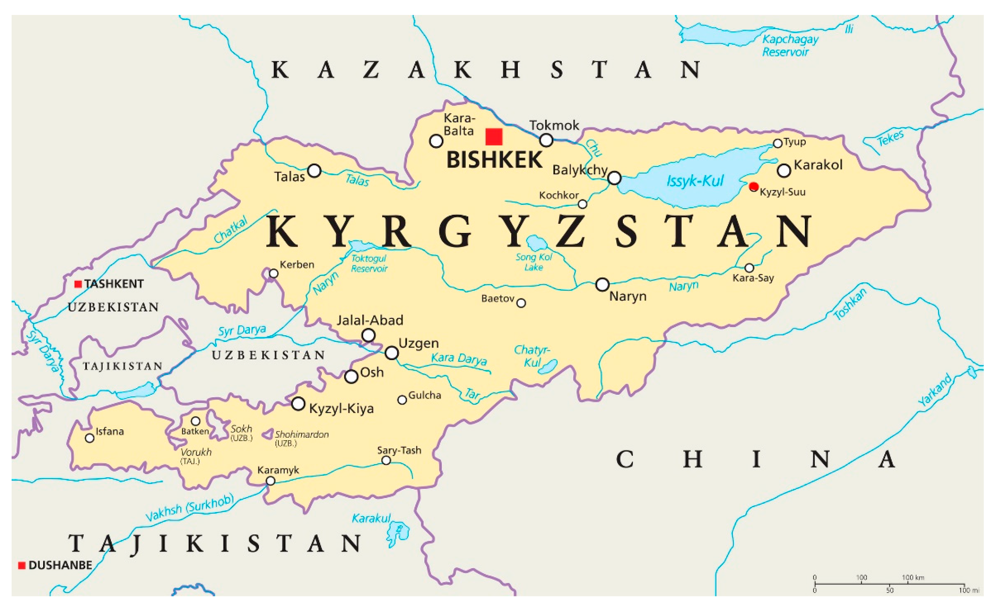
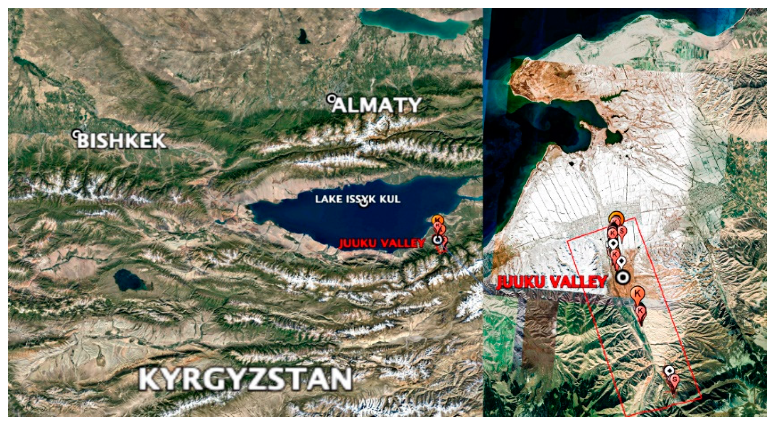
Study Area
3. Results
3.1. Chronology
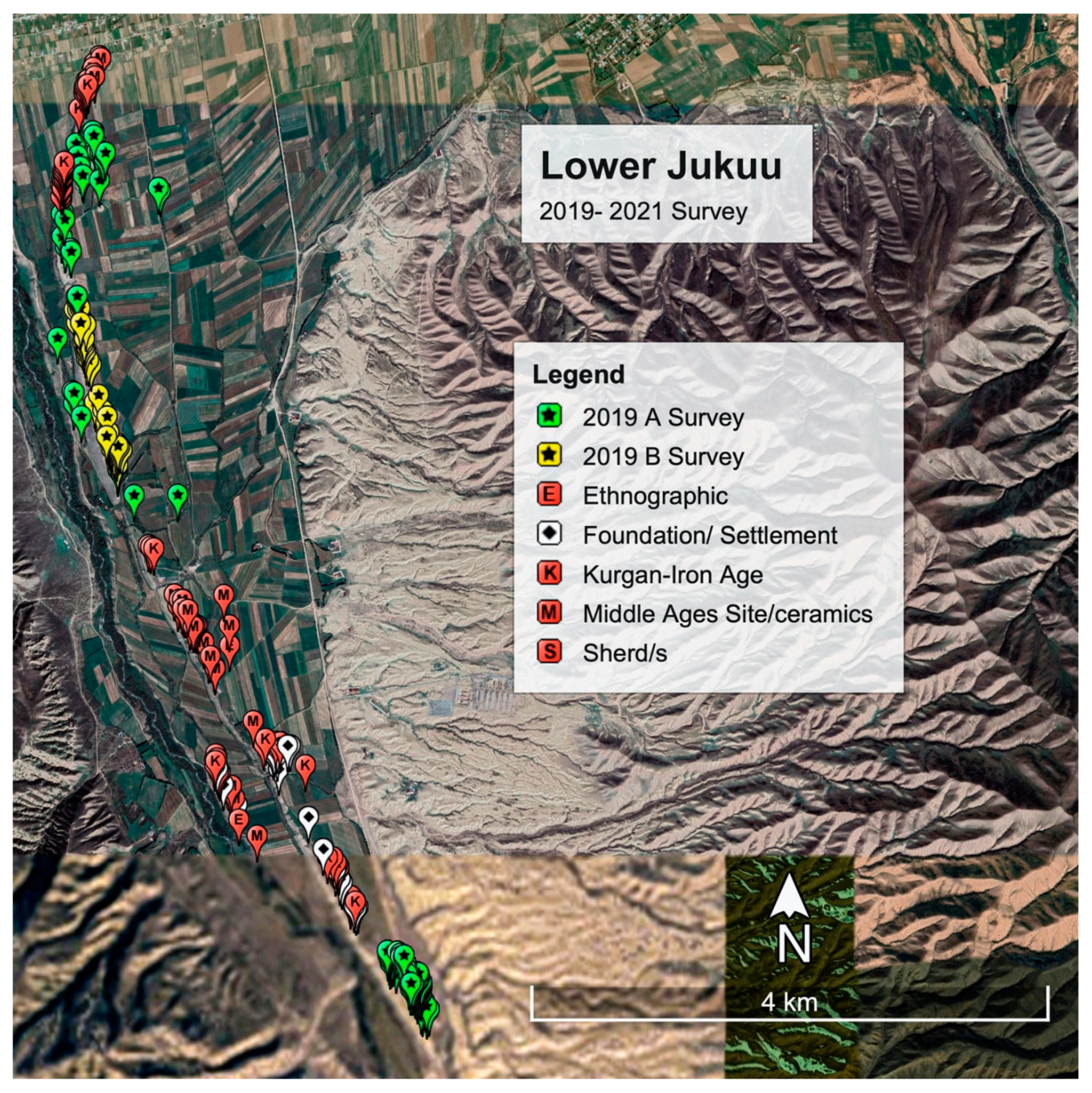
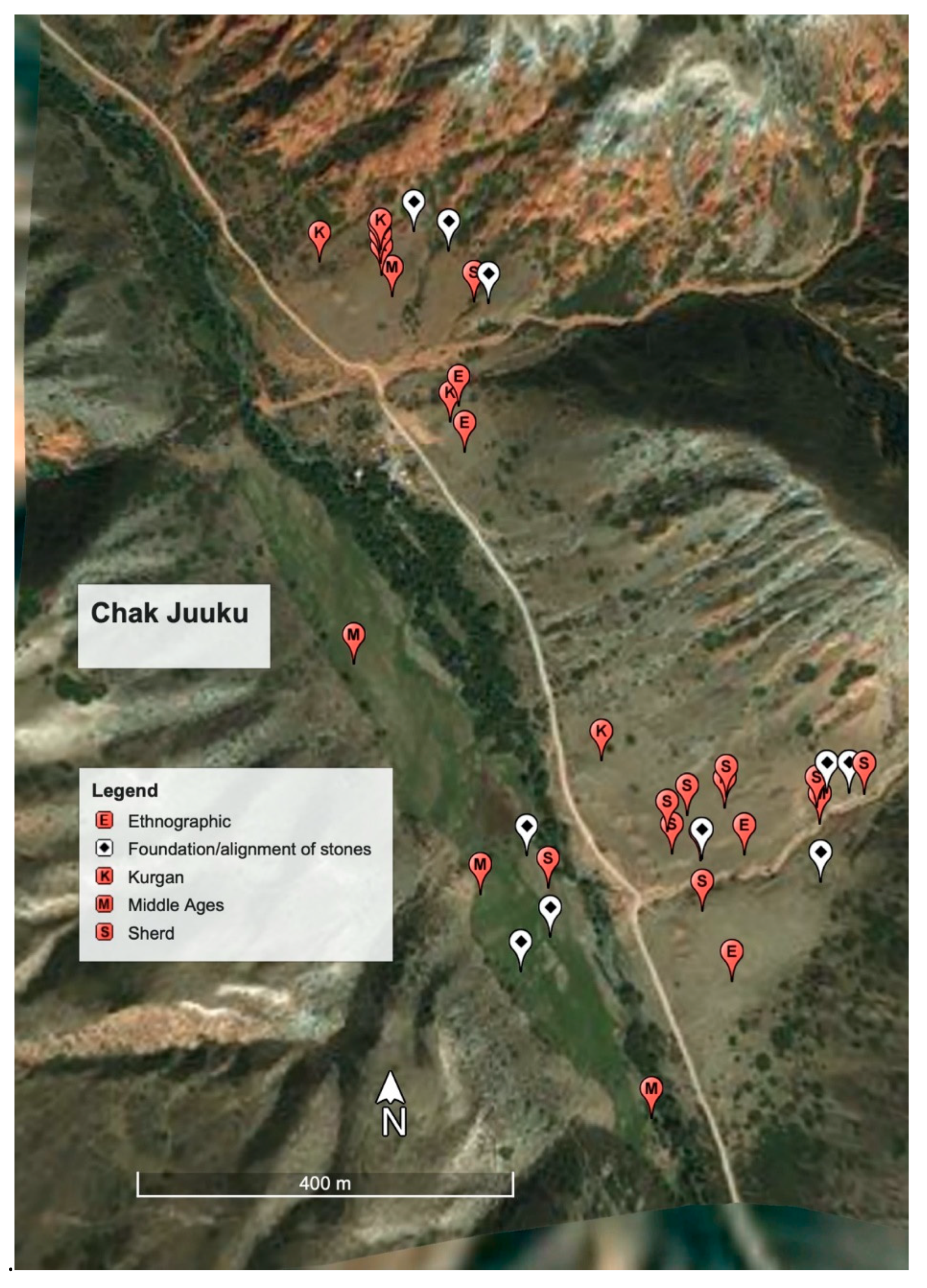
3.2. Polygon 1
3.2.1. Site Types Found in Lower Juuku
3.2.2. Settlements in Polygon 1
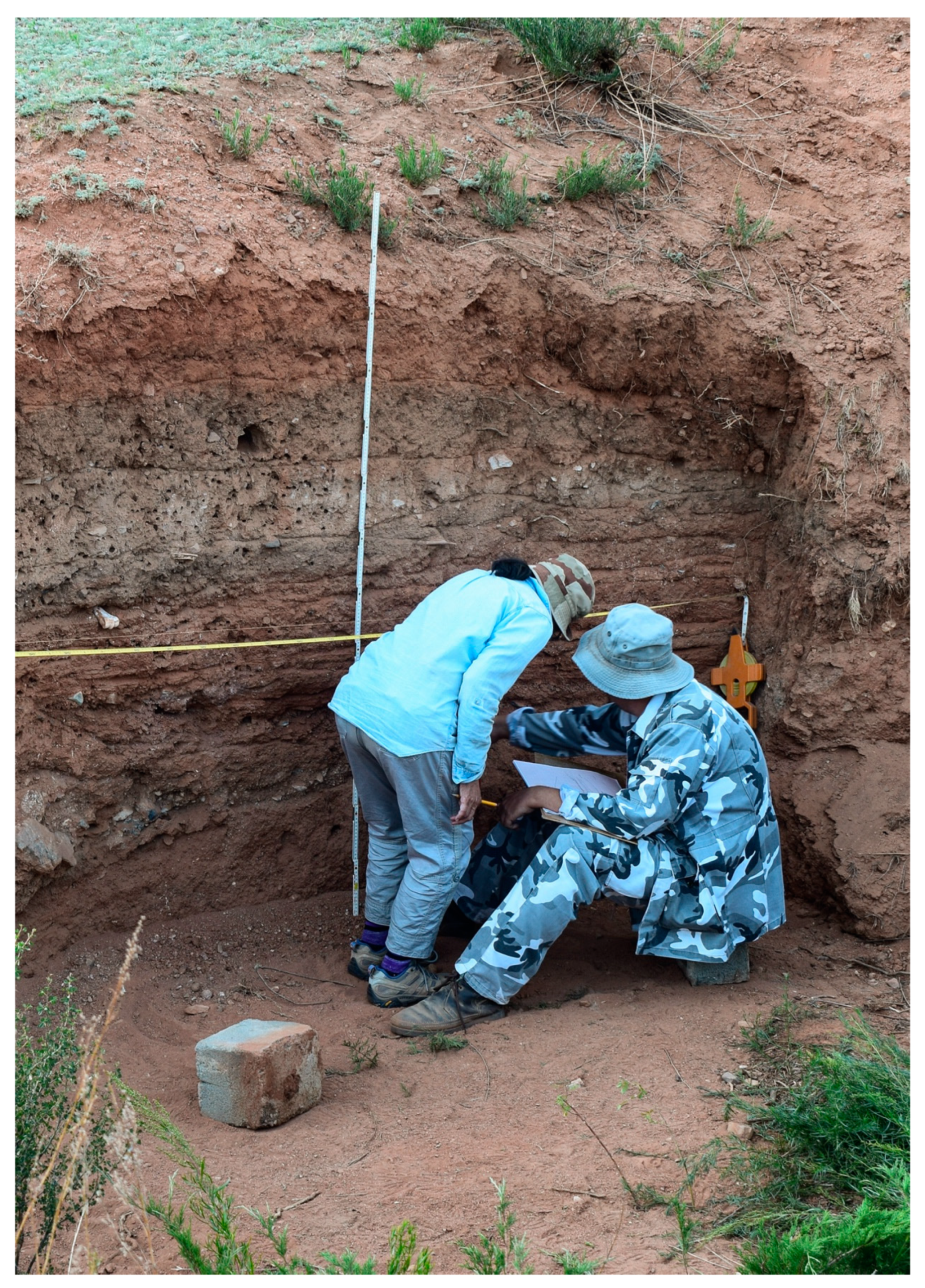
3.2.3. Locus 387: Historic or Ethnographic Kirghiz House
3.2.4. Preliminary Archaeobotanical Results from Locus 387
3.3. Polygon 2
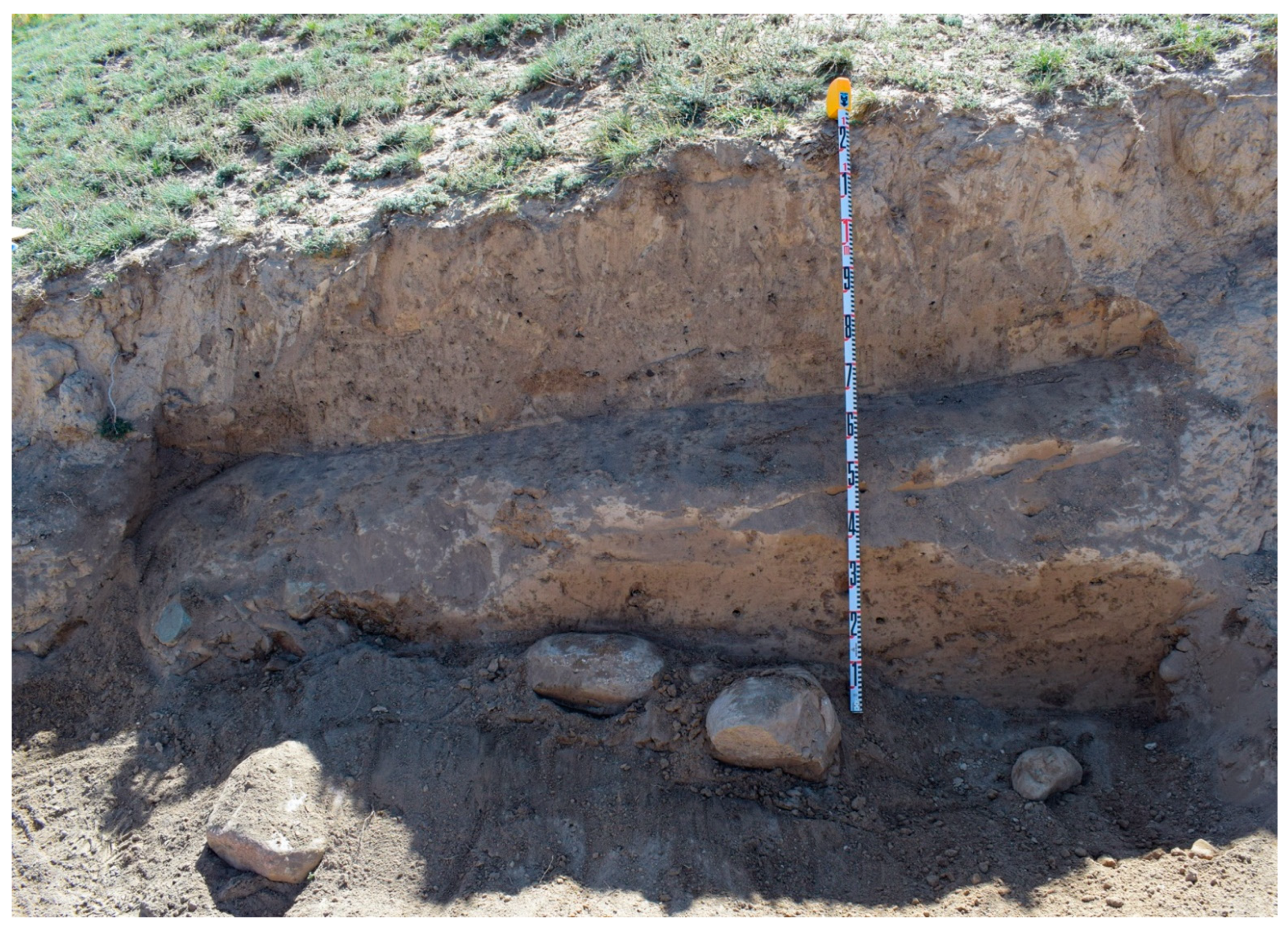
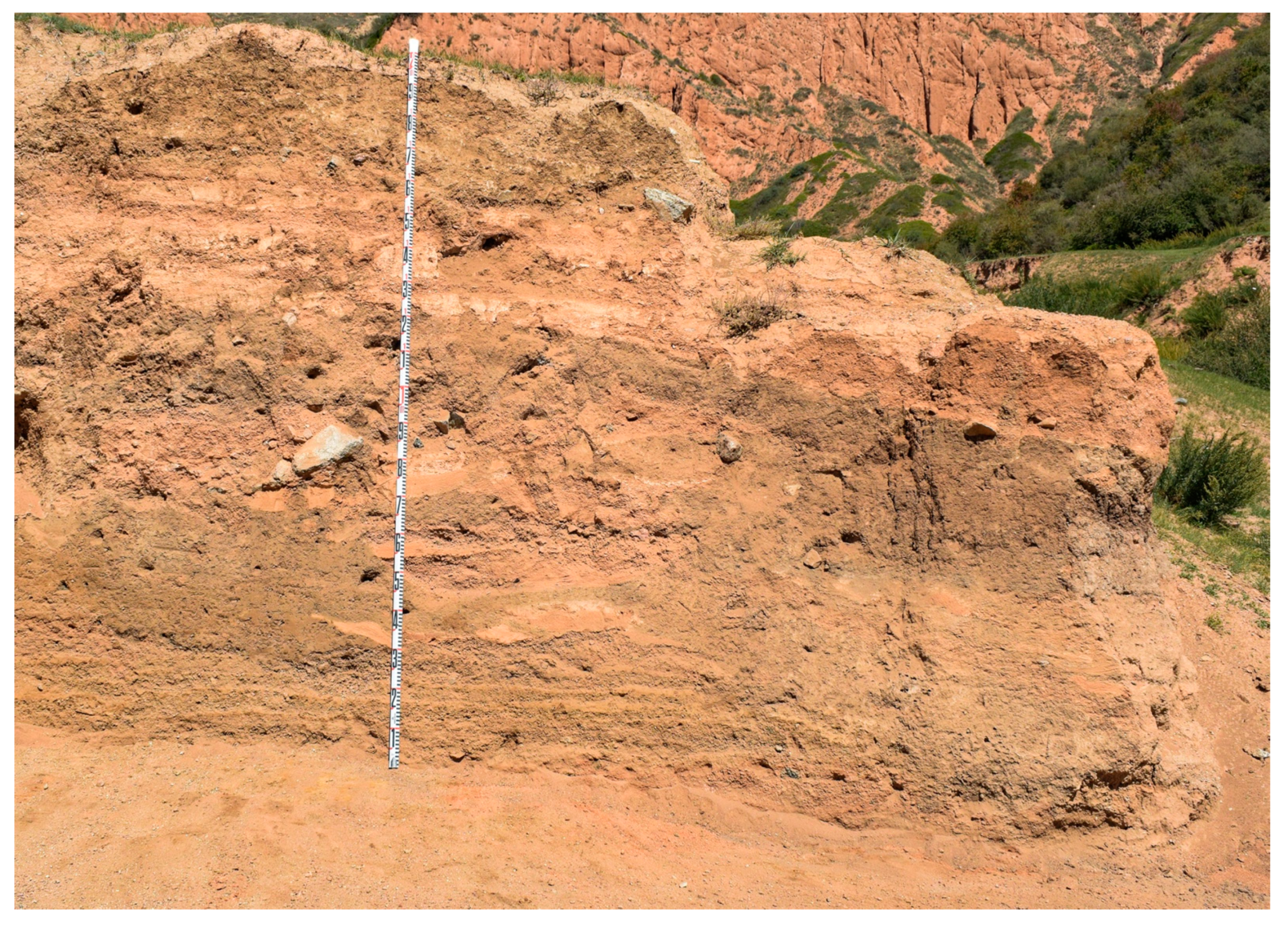
3.3.1. Settlement 1
3.3.2. Settlement 2
3.3.3. Radiometric Dating
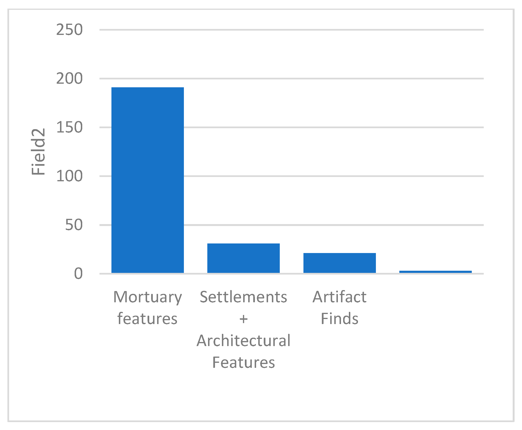
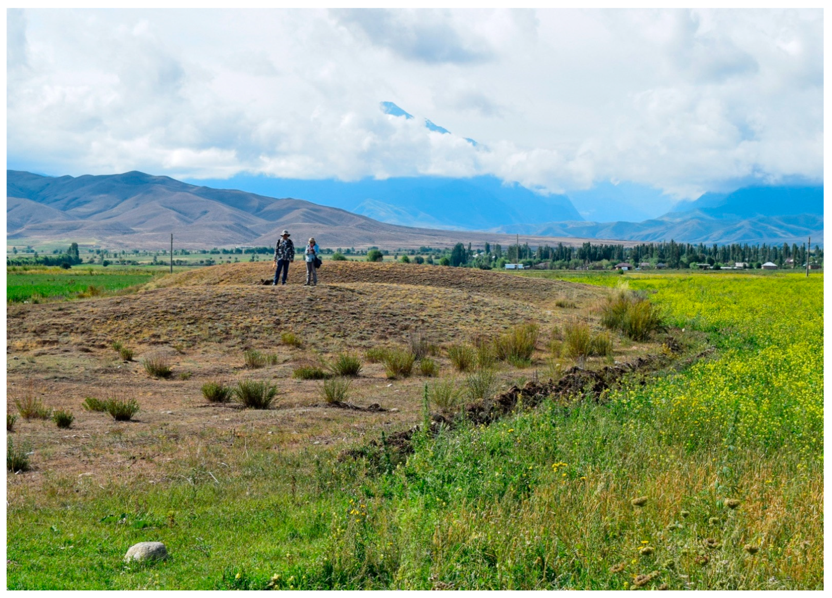
3.4. Mortuary Complexes
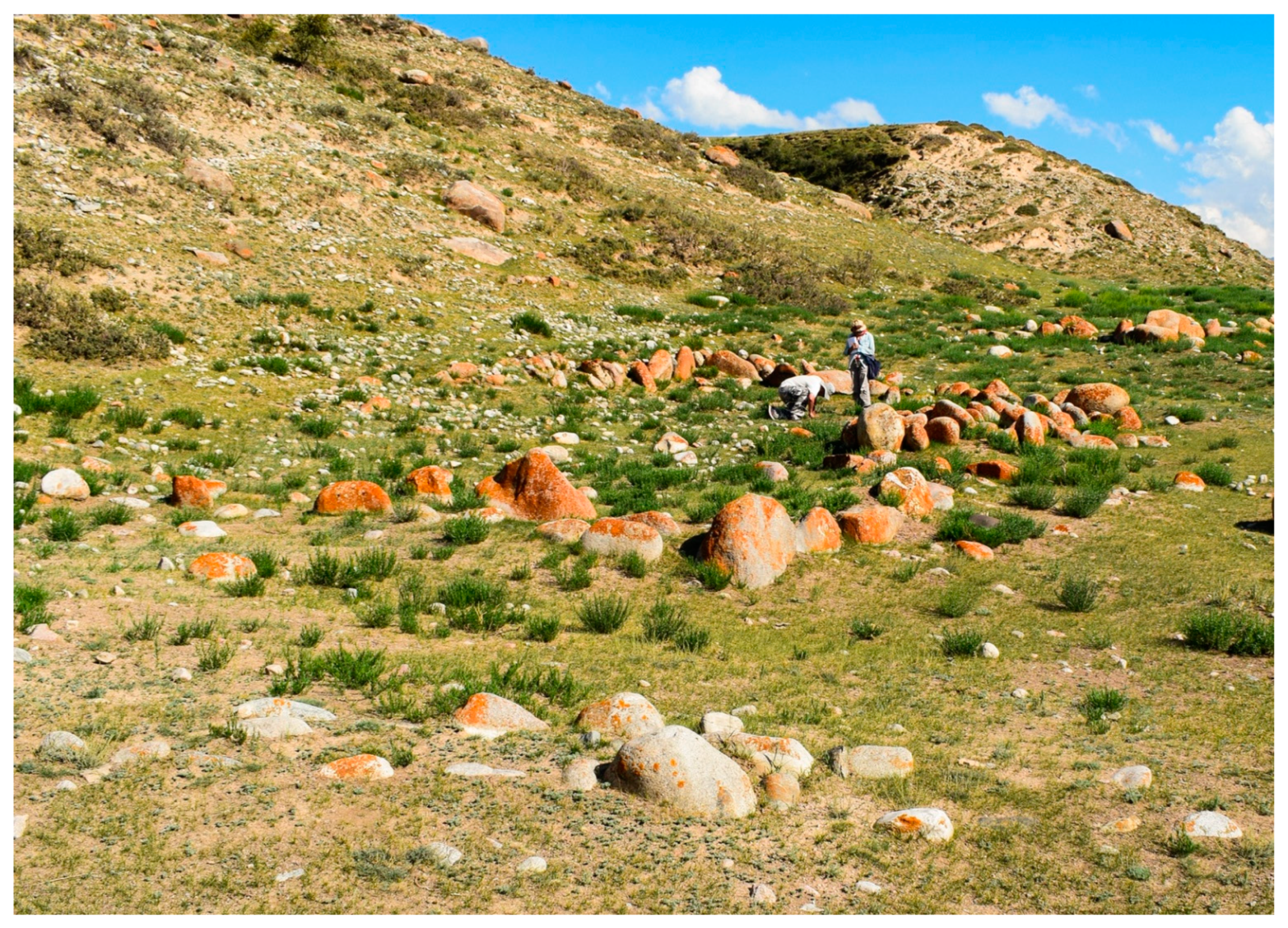
3.5. Stone Corral
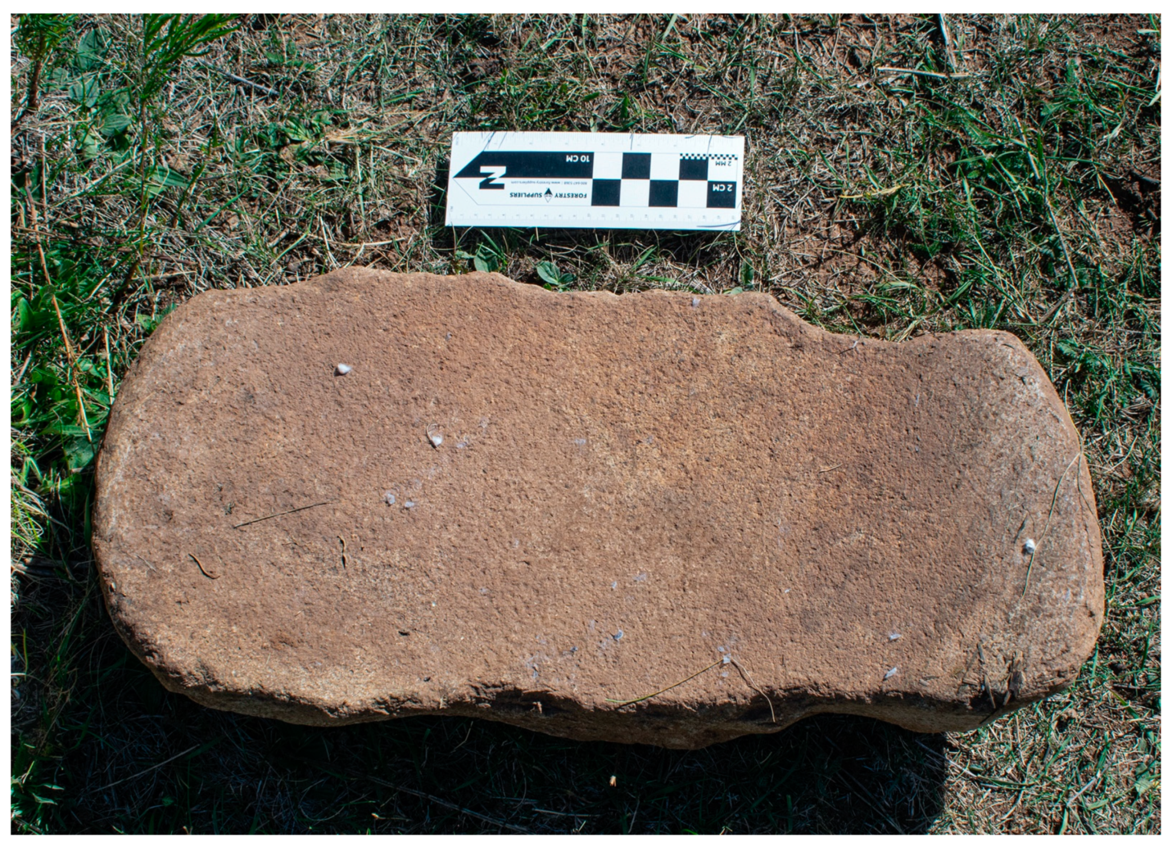
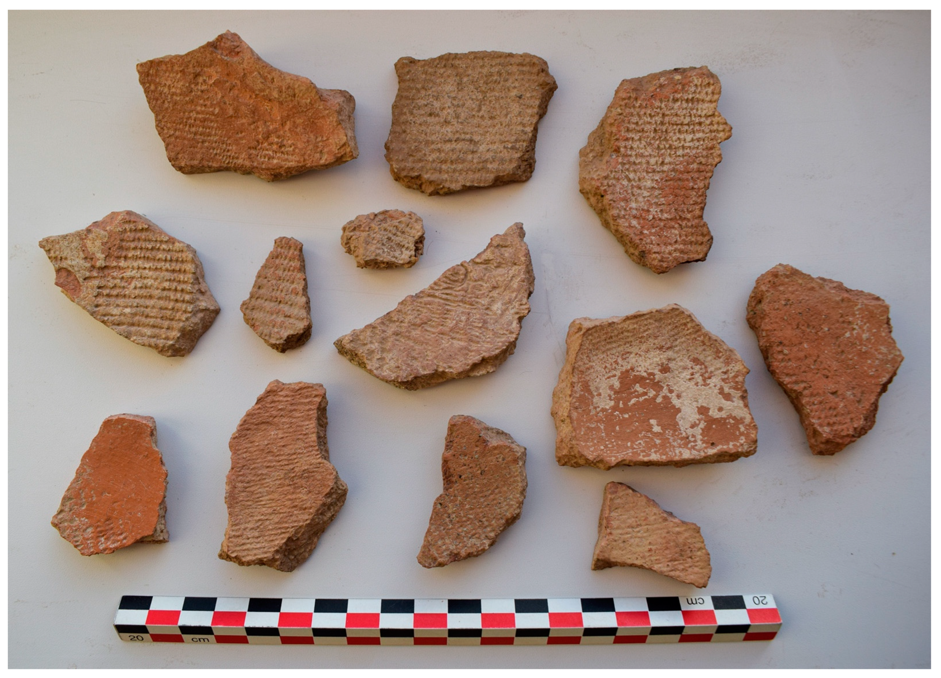
3.6. Artifacts
4. Discussion
5. Conclusions
Author Contributions
Funding
Institutional Review Board Statement
Data Availability Statement
Acknowledgments
Conflicts of Interest
References
- Frachetti, M.D. Multiregional emergence of mobile pastoralism and nonuniform institutional complexity across Eurasia. Curr. Anthropol. 2012, 53, 2–38. [Google Scholar] [CrossRef] [Green Version]
- Spengler, R., III. Fruit from the Sand: The Silk Route Origins of the Foods We Eat; University of California Press: Berkeley, CA, USA, 2019. [Google Scholar]
- Fuller, D.Q.; Lucas, L. Adapting crops, landscapes, and food choices: Patterns in the dispersal of domesticated plants across Eurasia. In Human Dispersal and Species Movement; Boivin, N., Petraglia, M., Cressard, R., Eds.; Cambridge University Press: Cambridge, UK, 2017; pp. 304–331. [Google Scholar]
- Hermes, T.; Frachetti, M.D.; Doumani Dupuy, P.; Mar’yashev, A.; Nebel, A.; Makarewicz, C.A. Early integration of pastoralism and millet cultivation in Bronze Age Eurasia. Proc. R. Soc. B Biol. Sci. 2019, 286, 20191273. [Google Scholar] [CrossRef]
- Motuzaite-Matuzeviciute, G. The earliest appearance of domesticated plant species and their origins on the western fringes of the Eurasian Steppe. Doc. Praehist. 2012, 39, 1–21. [Google Scholar] [CrossRef]
- Lister, D.L.; Jones, H.; Oliveira, H.R.; Petrie, C.A.; Liu, X.; Cockram, J.; Kneale, C.J.; Kovaleva, O.; Jones, M.K. Barley heads east: Genetic analyses reveal routes of spread through diverse Eurasian landscapes. PLoS ONE 2018, 13, e0196652. [Google Scholar] [CrossRef]
- Scorrano, G.; Yediay, F.E.; Pinotti, T.; Feizabadifarahani, M.; Kristiansen, K. The genetic and cultural impact of the Steppe migration into Europe. Ann. Hum. Biol. 2021, 48, 223–233. [Google Scholar] [CrossRef]
- Jeong, C.; Balanovsky, O.; Lukaniova, E.; Kahbatkyzy, N.; Flegontov, P.; Zaporozhchenko, V.; Immel, A.; Wang, C.C.; Ixan, O.; Khussainova, E.; et al. The genetic history of admixture across inner Eurasia. Nat. Ecol. Evol. 2019, 3, 944–976. [Google Scholar] [CrossRef]
- Gokcumen, O.; Frachetti, M. The Impact of Ancient Genome Studies in Archaeology. Annu. Rev. Anthropol. 2020, 41, 277–298. [Google Scholar] [CrossRef]
- Ventresca Miller, A.R.; Makarewicz, C.A. Isotopic approaches to pastoralism in prehistory: Diet, mobility, and isotopic reference sets. In Isotopic Investigations of Pastoralism in Prehistory; Routledge Press: Abingdon, UK, 2017; pp. 1–14. [Google Scholar]
- Ventresca Miller, A.R.; Haruda, A.; Varfolomeev, V.; Goryachev, A.; Makarewicz, C.A. Close management of sheep in ancient Central Asia: Evidence for foddering, transhumance, and extended lambing seasons during the Bronze and Iron Ages. Sci. Technol. Archaeol. Res. 2020, 6, 41–60. [Google Scholar] [CrossRef]
- Chang, C.; Tourtellotte, P.A. The Kazakh-American Talgar Project Archaeological Field Surveys in the Talgar and Turgen-Asi Areas of Southeastern Kazakhstan: 1997–1999 by Claudia Chang and Perry A. Tourtellotte. In Kurgans, Ritual Sites, and Settlements Eurasian Bronze and Iron Age; Davis-Kimball, J., Murphy, E.M., Koryakova, L., Yablonsky, L.T., Eds.; International Series 890; BAR Publishing: Oxford, UK, 2000; pp. 83–88. [Google Scholar]
- Chang, C.; Tourtellotte, P.; Baipakov, K.M.; Grigoriev, F.P. The Evolution of Steppe Communities from the Bronze Age to Medieval Periods in Southern Kazakhstan (Zhetysu); Almaty, KZ.: Sweet Briar, VA, USA, 2002. [Google Scholar]
- Chang, C. Rethinking Prehistoric Central Asia: Shepherds, Farmers, and Nomads; Routledge: Abingdon, UK, 2017. [Google Scholar]
- Ullah, I.I.T.; Chang, C.; Tourtellotte, P. Water, dust, and agro-pastoralism: Modeling socio-ecological co-evolution of landscapes, farming, and human society in southeast Kazakhstan during the mid to late Holocene. J. Anthropol. Archaeol. 2019, 48, 101067. [Google Scholar] [CrossRef]
- Frachetti, M.D. Pastoralist Landscapes and Social Interaction in Bronze Age Eurasia; University of California Press: Berkeley, CA, USA, 2009. [Google Scholar]
- Beardmore, R.; Bonora, G.L.; Kurmankulov, Z. Preliminary Report on the 2007–2008 IAEK Campaigns in the Syrdarya Delta. East West 2008, 58, 385–390. [Google Scholar]
- Caspari, G.; Betts, A.; Jia, P. The Bronze Age in the Western Tianshan, China: A new model for determining seasonal use of sites. J. Archaeol. Sci. Rep. 2017, 14, 12–20. [Google Scholar] [CrossRef]
- Tian, D.; Festa, M.; Cong, D.; Zhao, Z.; Jia, P.W.; Betts, A. New evidence for supplementary crop production, foddering and fuel use by Bronze Age transhumant pastoralists in the Tianshan Mountains. Sci. Rep. 2021, 11, 13718. [Google Scholar] [CrossRef]
- Rouse, L.M.; Krumnow, J. On the fly: Strategies for UAV-based archaeological survey in mountainous areas of Central Asia and their implications for landscape research. J. Archaeol. Sci. Rep. 2020, 30, 102275. [Google Scholar] [CrossRef]
- Rouse, L.M.; Tabaldiev, K.; Motuzaite Matuzeviciute, G. Exploring Landscape Archaeology and UAV-Based Survey in the Kochkor Valley, Kyrgyzstan. J. Field Archaeol. 2021, 47, 32–58. [Google Scholar] [CrossRef]
- Matuzeviciute, G.M.; Mir-Makhamad, B.; Tabaldiev, K. The first comprehensive archaeobotanical analysis of prehistoric agriculture in Kyrgyzstan. Veg. Hist. Archaeobotany 2021, 30, 743–758. [Google Scholar] [CrossRef]
- Motuzaite Matuzeviciute, G.; Tabaldiev, K.; Hermes, T.; Ananyevskaya, E.; Grikpedis, M.; Luneau, E.; Merkyte, I.; Rouse, L.M. High-altitude agro-pastoralism in the Kyrgyz Tien Shan: New excavations of the Chap farmstead (1065–825 cal BC). J. Field Archaeol. 2020, 45, 29–45. [Google Scholar] [CrossRef]
- Motuzaite Matuzeviciute, G.; Hermes, T.R.; Mir-Makhamad, B.; Tabaldiev, K. Southwest Asian cereal crops facilitated high-elevation agriculture in the central Tien Shan during the mid-third millennium BCE. PLoS ONE 2020, 15, e0229372. [Google Scholar] [CrossRef]
- Spengler, R.N., III; Miller, A.V.; Schmaus, T.; Matuzevičiūtė, G.M.; Miller, B.K.; Wilkin, S.; Taylor, W.T.T.; Li, Y.; Roberts, P.; Boivin, N. An Imagined Past? Nomadic Narratives in Central Asian Archaeology. Curr. Anthropol. 2021, 62, 251–286. [Google Scholar] [CrossRef]
- Giralt, S.; Julia, R.; Klerkx, J.; Riera, S.; Leroy, S.; Buchaca, T.; Catalan, J.; De Batist, M.; Beck, C.; Bobrov, V.; et al. 1000-Year Environmental History of Lake Issyk-Kul. In Dying and Dead Seas Climatic Versus Anthropic Causes; Nihoul, J.C.J., Zavialov, P.O., Micklin, P.P., Eds.; NATO Science Series: IV: Earth and Environmental Sciences; Springer: Dordrecht, The Netherlands, 2004; Volume 36, pp. 253–285. [Google Scholar] [CrossRef] [Green Version]
- Abdrakhmetov, K.; Korjenkov, A.M. Climate Evolution in Central Asia during the Past Few Million Years: A Case Study from Issyk-Kul, ICDP Workshop Bishkek, Kyrgyzstan, June 12th to 17th, 2011. Field Excursions Guidebook; GFZ Helmskotz-Zentrum: Potsdam, Germany, 2011. [Google Scholar]
- Korjenkov, A.M. (Ed.) Strong Earthquakes, Historical and Ancient Earthquakes of Issyk kul and Their Position in the Formation of the Northern Tian Shan Range; IFZ: Moscow, Russia, 2018; pp. 1–173. [Google Scholar]
- Strelnikov, A.A.; Korzhenkov, A.M. Destruction of medieval archaeological monuments by strong earthquakes in the Southwestern Issyk-Kul Basin, Tien Shan. Seism. Instrum. 2021, 57, 55–74. [Google Scholar] [CrossRef]
- Millard, A.R. Conventions for Reporting Radiocarbon Determinations. Radiocarbon 2014, 56, 555–559. [Google Scholar] [CrossRef]
- Cappers, R.T.; Bekker, R.M. A Manual for the Identification of Plant Seeds and Fruits; Barkhuis: Eelde, The Netherlands, 2022; Volume 23. [Google Scholar]
- Neef, R.; Cappers, R.T.; Bekker, R.M. Digital Atlas of Economic Plants in Archaeology; Barkhuis: Eelde, The Netherlands, 2012; Volume 17. [Google Scholar]
- Mir-Makhamad, B.; (Max Planck Institute for the Science of Human History, Department of Archaeology, Jena, Germany); Spengler, R.N., III; (Archaeobotanical Laboratory, Max Planck Institute for the Science of Human History, Department of Archaeology, Jena, Germany). Preliminary Archaeobotanical Report on the Juuku Valley. 2021; Unpublished work. [Google Scholar]
- Dunnell, R.C.; Dancey, W.S. The siteless survey: A regional scale data collection strategy. In Advances in Archaeological Method and Theory; Schiffer, M.B., Ed.; Academic Press: New York, NY, USA, 1983; Volume 6, pp. 267–287. [Google Scholar]
- Cherry, J.F.; Davis, J.L.; Mantzourani, E. Landscape history and archaeology. In Northern Keos in the Cycladic Islands; Cherry, J.F., Davis, J.L., Mantzourani, E., Eds.; Institute of Archaeology, University of California: Los Angeles, CA, USA, 1991; pp. 57–68. [Google Scholar]
- Akishev, K.A.; Kozhomberdiev, I. Archaeological Monuments in the Vicinity of Issyk Kul; Izdatel’sko Ilim: Bonn, Germany, 1975. [Google Scholar]
- Ivanov, S.S. On the problem of the cultural gap at the turn of the Saka and Wusun periods in the area surrounding the Tian Shan mountains. Strat. Plus Archaeol. Cult. Anthropol. J. 2016, 3, 67–86. [Google Scholar]
- Biran, M. The Qarakhanids’ Eastern Exchange: Preliminary Notes on the Silk Roads in the Eleventh and Twelfth Centuries. In Complexity of Interaction along the Eurasian Steppe Zone in the First Millennium CE; Bemman, J., Schamuder, M., Eds.; Bonn Contributions to Asian Archaeology; Vor-und Frubgeschitchtliche Archaologie Rheinische Friedvich-Wilhelms-Universitat: Bonn, Germany, 2015; Volume 7, pp. 575–595. [Google Scholar]
- Caspari, G. Assessing Looting from Space: The Destruction of Early Iron Age Burials in Northern Xinjiang. Heritage 2018, 1, 320–327. [Google Scholar] [CrossRef] [Green Version]
- Caspari, G. Quantifying Ritual Funerary Activity of the Late Prehistoric Southern Kansas Region (Xinjiang, China). Asian Perspect. 2020, 59, 421–452. Available online: https://www.muse.jhu.edu/article/774820 (accessed on 8 March 2022). [CrossRef]
- Vinnik, D.F.K. The historical topography of medieval Issyk kul basin. In Ancient Medieval Cultures of Kyrgyzstan; USSR: Frunze, Kirghizstan, 1967. [Google Scholar]
- Amanbaeva, B.E.; Kol’chenkov, B.A.; Sulaimanova, A.T. Archaeological Monuments of the Kyrgyzstan Portion of the Great Silk Road; Institute of History and Culture: Bishkek, Kyrgyzstan, 2015. [Google Scholar]
- Reimer, P.T.; Austin, W.E.N.; Bard, E.; Bayliss, A.; Blackwell, P.G.; Ramsey, C.B.; Butzin, M.; Cheng, H.; Edwards, R.L.; Friedrich, M.; et al. The IntCal20 Northern Hemisphere Radiocarbon Age Calibration Curve (0–55 cal kBP). Radiocarbon 2020, 62, 725–757. [Google Scholar] [CrossRef]
- Mir-Makhamad, B.; Mirzaakhmedov, S.; Rahmonov, H.; Stark, S.; Omel’chenko, A.; Spengler, R.N. Qarakhanids on the Edge of the Bukhara Oasis: Archaeobotany of Medieval Paykend. Econ. Bot. 2021, 75, 195–214. [Google Scholar] [CrossRef]
- Parzinger, H. Burial mounds of Scythian elites in the Eurasian steppe: New discoveries. J. Br. Acad. 2017, 5, 331–335. [Google Scholar] [CrossRef]
- Doumani Dupuy, P.N.; Spengler, R.N.; Frachetti, M.D. Eurasian textiles: Case studies in exchange during the incipient and later Silk Road periods. Quat. Int. 2018, 468, 228–239. [Google Scholar] [CrossRef]
- Heinsch, M.; Vandiver, P.B.; Lyublyanovics, K.; Choyke, A.M.; Reedy, C.; Tourtellotte, P.; Chang, C. Ceramics at the Emergence of the Silk Road: A Case of Village Potters from Southeastern Kazakhstan during the Late Iron Age. MRS Proc. 2015, 1656, 251–281. [Google Scholar] [CrossRef]
- Shnaider, S.V.; Krajcarz, M.T.; Viola, T.B.; Abdykanova, A.; Kolobova, K.A.; Fedorchenko, A.Y.; Alisher-Kyzy, S.; Krivoshapkin, A.I. New investigations of the Epipalaeolithic in western Central Asia: Obishir-5. Antiquity 2017, 91, e3. [Google Scholar] [CrossRef] [Green Version]
- Osipova, E.; Danukalova, G.; Brancaleoni, G.; Krajcarz, M.T.; Abdykanova, A.; Shnaider, S. Palaeoenvironmental conditions of the Palaeolithic–Neolithic transition in the Fergana Valley (Central Asia)—New data inferred from fossil molluscs in Obishir-V rockshelter (Kyrgyzstan). Quat. Int. 2021, 605, 287–299. [Google Scholar] [CrossRef]
- Taylor, W.T.; Pruvost, M.; Posth, C.; Rendu, W.; Krajcarz, M.T.; Abdykanova, A.; Brancaleoni, G.; Spengler, R.; Hermes, T.; Schiavinato, S.; et al. Evidence for early dispersal of domestic sheep into Central Asia. Nat. Hum. Behav. 2021, 5, 1169–1179. [Google Scholar] [CrossRef] [PubMed]
- Tabaldiev, K.S. Ancient Monuments of the Tian Shan; Centralnoaziatskogo Universiteta: Bishkek, Kyrgyzstan, 2011; 318p. [Google Scholar]
- Chang, C. Archaeological sites, cultural heritage, and sustainable development in the Republic of Kazakhstan. In Education, Human Rights and Peace in Sustainable Development; Nugmanova, M., Mikkola, H., Rozanov, A., Komleva, V., Eds.; Intechopen: London, UK, 2019; Volume 87, pp. 1–8. [Google Scholar] [CrossRef] [Green Version]


| Time Period | Phase Designation | Dates |
|---|---|---|
| Late Bronze Age | 2000 BCE–900 BCE | |
| Final Bronze | 1100 BCE–800 BCE | |
| Iron Age | 800 BCE–550 CE | |
| Saka | 800 BCE–260 BCE | |
| Wusun | 140 BCE–437 CE | |
| Kenkol (only in TianShan) | 200 CE–550 CE | |
| Medieval Period | 500 CE–1500 CE | |
| Turkic Period | 552 CE–900 CE | |
| Qarakhanid | 942 CE–1228 CE | |
| Early Kirghiz | 1500 CE–1700 CE | |
| Kirghiz Ethnographic Period | 1700 CE–Present | |
| Soviet Period | 1917–1991 | |
| Post-Soviet, Kyrgyz Nation | 1991– |
| Lab. ID # | Sample ID # | Material/ Pretreatment | d13C o/oo (IRMS) | Conventional 14C Age | Calendar Calibration of Radiocarbon AGE to Calendar Years |
|---|---|---|---|---|---|
| Beta-6093781 | Locus 387 | (charred material): acid/alkali/acid | −26.5 | 110 +/− 30 BP | 95.4% probability: (68.6%) 1800–1938 cal AD (150-12 cal BP) (25.7%) 1682–1738 cal AD (268–212 cal BP) (1.2%) 1754–1762 cal AD (196–186 cal BP) |
| Chronological Period | Settlements | Mortuary Remains | Artifacts |
|---|---|---|---|
| Ethnographic Kirghiz Period (1700 CE to Present) | Stone corral with possible room blocks | Group 1 * (10+ stone graves Locus 144) Group 2 * (6+ stone graves Locus 181) Group 3 * (2 stone graves Locus 174) Single Stone Grave (Locus 160) Single Stone Grave (Locus 502) | |
| Medieval Period (500 to 1500 CE) | Settlement 2 (17.5 m × 12 m), 3–5 rooms, double stone wall construction, Qarakhanid Period, Redware sherd, Grinding Stone fragment (Locus 170/493) Settlement 4: Large mudbrick and stone complex on w. bank of Chak Juuku stream, 51 m × 20 m (Locus 498) Settlement 5 or Mill: Double stone wall construction, on west bank of Chak Juuku stream, 8 m × 6 m (Locus 500) Settlement 6: Mudbrick room block (2 rooms), 5 m × 10 m, on west bank of Chak Juuku stream, (Locus 501) | 3 Qarakhanid glazed ceramics, 5+ redware sherds found at modern corral (Locus 191) | |
| Iron Age (Saka and Wusun period, ca. 800 BCE to 437 CE) | Settlement 1: Double stone alignments, consisting of four rooms with deep depressions, 15 m × 10 m, 1 redware rim, (Loci 182-83) | Saka kurgan Group * 1: 5 stone kurgans, (Loci. 186-88 and possibly Locus 190) 3 separate Saka kurgan, (Loci 177, 180, 192) | 1 redware sherd with yellow slip, (Locus192) |
| Late Bronze Age (2000–900 BCE | Rectangular stone enclosure, possibly 1–4 graves (Locus 154) |
| Lab. ID # | Sample ID # | Material/Pretreat | d13C o/oo (IRMS) | Conventional 14C Age | Calendar Calibration of Radiocarbon Age to Calendar Years |
|---|---|---|---|---|---|
| Beta-603779 | Locus 183 | (charred material): acid/alkali/acid | −22.7 | 1930 +/− 30 BP | 95.4% probability (95.4%) 22–206 cal AD (1928–1744 cal BP) |
| Beta-603780 | Locus 170 | (charred material): acid/alkali/acid | −25.3 | 1020 +/− 30 BP | 95.4% probability (81.7%) 978–1048 cal AD (972–902 cal BP) (11.4%) 1082–1130 cal AD (868–820 cal BP) (2.3%) 1127–1151 cal AD (813–799 cal BP) |
Publisher’s Note: MDPI stays neutral with regard to jurisdictional claims in published maps and institutional affiliations. |
© 2022 by the authors. Licensee MDPI, Basel, Switzerland. This article is an open access article distributed under the terms and conditions of the Creative Commons Attribution (CC BY) license (https://creativecommons.org/licenses/by/4.0/).
Share and Cite
Chang, C.; Ivanov, S.S.; Tourtellotte, P.A. Landscape and Settlement over 4 Millennia on the South Side of Lake Issyk Kul, Kyrgyzstan: Preliminary Results of Survey Research in 2019–2021. Land 2022, 11, 456. https://doi.org/10.3390/land11040456
Chang C, Ivanov SS, Tourtellotte PA. Landscape and Settlement over 4 Millennia on the South Side of Lake Issyk Kul, Kyrgyzstan: Preliminary Results of Survey Research in 2019–2021. Land. 2022; 11(4):456. https://doi.org/10.3390/land11040456
Chicago/Turabian StyleChang, Claudia, Sergei S. Ivanov, and Perry A. Tourtellotte. 2022. "Landscape and Settlement over 4 Millennia on the South Side of Lake Issyk Kul, Kyrgyzstan: Preliminary Results of Survey Research in 2019–2021" Land 11, no. 4: 456. https://doi.org/10.3390/land11040456