Next Issue
Volume 12, January
Previous Issue
Volume 11, November


Land, Volume 11, Issue 12 (December 2022) – 235 articles

Cover Story (view full-size image): 
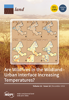
Wildfires in the wildland–urban interface (WUI) represent an important environmental and social issue, threatening vegetated areas and periurban inhabitants, as is the case in many Latin American cities. This study analyzes whether wildfires contribute to the increase in land surface temperature (LST) in the WUI of the metropolitan area of the city of Guanajuato (MACG), a semi-arid Mexican city. Our results show that periurban wildfires increase the local LST. Most wildfires occurred near isolated and dispersed built-up areas, which commonly correspond to informal settlements in the Latin American context. This may dramatically affect people living in such areas, which lack the adequate infrastructure and adaptive capacity to cope with the cumulative effect of local, regional and global climate change. View this paper
  • Issues are regarded as officially published after their release is announced to the table of contents alert mailing list.
  • You may sign up for e-mail alerts to receive table of contents of newly released issues.
  • PDF is the official format for papers published in both, html and pdf forms. To view the papers in pdf format, click on the "PDF Full-text" link, and use the free Adobe Reader to open them.
Order results
Result details
Section
Select all
Export citation of selected articles as:
26 pages, 5050 KiB  
Article
Spatial-Temporal Characteristics and Influencing Factors of Particulate Matter: Geodetector Approach
by Hansol Mun, Mengying Li and Juchul Jung
Land 2022, 11(12), 2336; https://doi.org/10.3390/land11122336 - 19 Dec 2022
Viewed by 1877
Abstract
In 2019, South Korea’s Framework Act on The Management of Disasters and Safety was revised to include respirable particulate matter as a social disaster. Urban air pollution, especially particulate matter pollution, has been a serious threat to socioeconomic development and public health. In [...] Read more.
In 2019, South Korea’s Framework Act on The Management of Disasters and Safety was revised to include respirable particulate matter as a social disaster. Urban air pollution, especially particulate matter pollution, has been a serious threat to socioeconomic development and public health. In order to address this problem, strong climate crisis response strategies and policies to improve urban air quality are necessary. Therefore, it is of great importance to assess the frequency of urban air pollution occurrence and its influencing factors. The objective of this study is to develop consistent methodologies for the construction of an index system and for assessing the influencing factors of urban particulate matter pollution based on population, social welfare, land use, environmental, transportation, and economic governance considerations. We applied the local indicators of spatial association and geographical detector methods, and 35 influencing factors were selected to assess their influence on urban air pollution occurrence in 229 cities and counties in South Korea. The results indicated the spatial pattern of the particulate matter concentration in these locations showed strong spatial correlation, and it was confirmed that there was a difference in distribution according to the season. As a result of the analysis of influencing factors, it was found that environment and land use characteristics were the main influencing factors for PM10 and PM2.5. The explanatory power between the two influencing factors of particulate matter was greater than that of a single influencing factor. In addition, most influencing factors resulted in both positive and negative effects on urban fine particulate matter pollution. The interaction relationship of all factors showed a strong action effect in the case of both PM10 and PM2.5, so it was confirmed that all influencing factors were interdependent. In particular, the findings proved that combining the two factors would have a more pronounced effect on particulate matter than when they were independent. We confirmed the significant results for the factors affecting particulate matter. This study offers suggestions on reducing urban air pollution occurrence that can be used to provide a basis and reference for the government to form policies on urban air pollution control in cities and counties. Full article
(This article belongs to the Special Issue The Impact of Land Use on Atmospheric Environment)
Show Figures

Figure 1

15 pages, 718 KiB  
Review
Harms to Community Food Security Resulting from Gender-Based Violence
by Uche T. Okpara and Ifeoma Q. Anugwa
Land 2022, 11(12), 2335; https://doi.org/10.3390/land11122335 - 19 Dec 2022
Cited by 2 | Viewed by 1801
Abstract
While the right to food and community self-reliance underpin current knowledge and interpretation of community food security (CFS), the literature on CFS seldom accounts for the ways in which gender-based violence (GBV) disrupts and undermines CFS. In this review, we make the case [...] Read more.
While the right to food and community self-reliance underpin current knowledge and interpretation of community food security (CFS), the literature on CFS seldom accounts for the ways in which gender-based violence (GBV) disrupts and undermines CFS. In this review, we make the case that GBV in CFS contexts manifests as a continuum, involving different forms of violence that blend into and reinforce each other, fueling social degradation and undermining the capacity of community food system workers to prioritise and pursue CFS. We show that harms to CFS resulting from GBV manifest through (i) GBV-induced social degradation, (ii) erosion of moral and ethical values anchoring CFS, (iii) disruption of crucial food systems sustainability pathways to CFS, (iv) the challenges, behaviours and activities of community food system workers, and (v) the crippling of community-level on-farm and off-farm food value chains, which oftentimes disrupt food access, consumption and utilisation. We further outline that the diversion of CFS funds into GBV prevention services may reduce CFS-related economic outputs and that CFS efforts that are GBV-blind can undermine the agency of community food system workers, pushing them into decisions that undermine CFS. We conclude that there is a dearth of information on how to mainstream GBV-sensitivity into CFS plans, and it is unclear whether GBV-responsive CFS initiatives can enhance the legitimacy of CFS efforts in GBV-exposed settings. We suggest that the spectrum of what is considered “community” in relation to CFS be expanded; and that scholars and practitioners pay attention to the dynamics of GBV, focusing on how GBV occurring at individual and household levels spills over into communities to undermine CFS. Finally, since GBV is not only a human rights violation issue but also a catalyst for social degradation and food insecurity, we encourage refocusing CFS efforts to prioritise early detection and prevention of GBV across specific community-level, on-farm and off-farm food value chains in order to better enhance community ties and foster food security. Full article
(This article belongs to the Section Land–Climate Interactions)
Show Figures

Figure 1

32 pages, 2904 KiB  
Article
Development of a Systems Model for Assessing Pathways to Resilient, Sustainable, and Profitable Agriculture in New Zealand
by Clémence Vannier, Thomas A. Cochrane, Peyman Zawar-Reza and Larry Bellamy
Land 2022, 11(12), 2334; https://doi.org/10.3390/land11122334 - 19 Dec 2022
Cited by 1 | Viewed by 3736
Abstract
There is a clear research gap in understanding how future pathways and disruptions to the New Zealand (NZ) agricultural system will have an impact on the environment and productivity. Agriculture is in a period of significant change due to market disruptions, climate change, [...] Read more.
There is a clear research gap in understanding how future pathways and disruptions to the New Zealand (NZ) agricultural system will have an impact on the environment and productivity. Agriculture is in a period of significant change due to market disruptions, climate change, increasingly stringent environmental regulations, and emerging technologies. In NZ, agriculture is a key sector of the economy, therefore government and industry need to develop policies and strategies to respond to the risks and opportunities associated with these disruptors. To address this gap, there is a need to develop an assessment tool to explore pathways and interventions for increasing agricultural profitability, resilience, and sustainability over the next 5–30 years. A decision support tool was developed through Stella Architect, bringing together production, market values, land use, water use, energy, fertiliser consumption, and emissions from agricultural sectors (dairy, beef, sheep, cereals, horticulture, and forests). The parameters are customisable by the user for scenario building. Two future trend scenarios (Business as usual, Optimisation and technology) and two breakaway scenarios (Carbon farming, Reduction in dairy demand) were simulated and all met carbon emissions goals, but profitability differed. Future environmental regulations can be met by adjusting levers associated with technology, carbon offsets, and land use. The model supports the development and assessment of pathways to achieve NZ’s national agriculture goals and has the potential to be scaled globally. Full article
Show Figures

Figure 1

23 pages, 8232 KiB  
Article
Response of Ecosystem Service Value to Landscape Pattern Changes under Low-Carbon Scenario: A Case Study of Fujian Coastal Areas
by Guo Cai, Yuying Lin, Fazi Zhang, Shihe Zhang, Linsheng Wen and Baoyin Li
Land 2022, 11(12), 2333; https://doi.org/10.3390/land11122333 - 19 Dec 2022
Cited by 9 | Viewed by 1582
Abstract
Assessing the influence of landscape pattern changes on ecosystem service value (ESV) is critical for developing land-use polies and increasing ecosystem services. The data sources include remote-sensing image data and statistical yearbooks from 2000, 2010, and 2020. This study employs the patch-generating land-use [...] Read more.
Assessing the influence of landscape pattern changes on ecosystem service value (ESV) is critical for developing land-use polies and increasing ecosystem services. The data sources include remote-sensing image data and statistical yearbooks from 2000, 2010, and 2020. This study employs the patch-generating land-use simulation model, landscape pattern index, and ecological service value estimation to analyse the changes in landscape patterns and ESV in Fujian coastal areas over the last 20 years. The landscape pattern and ESV in the future (2050) are then simulated under the low-carbon scenario (LCS), with the natural development scenario (NDS) serving as a comparison. The results show that: (1) the most noticeable changes from 2000 to 2020 are the reduced cultivated land area and the rapid expansion of construction land area. By 2050, construction land will account for 7.67% of the total land area under LCS, whereas NDS will account for 9.45%, and changes in the landscape pattern indices all indicate there will be greater variety and fragmentation of the landscape, with the NDS being more serious than the LCS; (2) From 2000–2020, the total ESV value showed a decreasing trend. In 2050, the ESV under the LCS will be 122.387 billion yuan, which is higher than the 121.434 billion yuan under the NDS. Regulating services contribute the most to the total ESV, followed by support services; and (3) In the past 20 years, except for a slight increase in water area, the ESV of other landscapes has decreased, with a net decrease of 3.134 billion yuan in total. The R2 fitting between the area change of cultivated and construction land and the total ESV reached 0.9898 and 0.9843, respectively. The correlations between ESV and landscape indices indicate that landscape pattern changes significantly impact ESV. Simulating ESV in LCS can provide guidance for optimising landscape patterns, promoting the benign operation of the regional ecosystem, and achieving sustainable ecological development. Full article
(This article belongs to the Section Landscape Ecology)
Show Figures

Figure 1

19 pages, 3698 KiB  
Article
Pesticide Residues and Heavy Metals in Vineyard Soils of the Karst and Istria
by Borut Vrščaj, Helena Baša Česnik, Špela Velikonja Bolta, Sanja Radeka and Klemen Lisjak
Land 2022, 11(12), 2332; https://doi.org/10.3390/land11122332 - 19 Dec 2022
Cited by 2 | Viewed by 1446
Abstract
Pesticide residues and heavy metal concentrations were determined in two depths (0–20 and 20–40 cm) of Chromic Cambisol in 69 vineyards in the Slovenian winegrowing region of the Karst. Similarly, pesticide residues and heavy metal concentrations were also determined in two depths of [...] Read more.
Pesticide residues and heavy metal concentrations were determined in two depths (0–20 and 20–40 cm) of Chromic Cambisol in 69 vineyards in the Slovenian winegrowing region of the Karst. Similarly, pesticide residues and heavy metal concentrations were also determined in two depths of Calcaric Cambisol in 11 vineyards in the other Slovenian and Croatian winegrowing regions of Istria. The topsoil (0–20 cm) was analysed for the presence of 176 different pesticidal active substances using two multiresidue analytical methods: (a) gas chromatography coupled with mass spectrometry (GC/MS) and (b) liquid chromatography coupled with tandem mass spectrometry (LC/MS/MS). Seven active substances (five fungicides and two insecticides) were detected in the soil samples. Their concentrations were compared with the maximum concentrations observed in the vineyards of the winegrowing regions of France, Italy, and Spain. In addition to pesticides, the soil samples were analysed for the presence of nine heavy metals commonly detected in vineyard soils. The concentrations of arsenic, cadmium, cobalt, chromium, copper, molybdenum, nickel, lead, and zinc were below the critical thresholds set by Slovenian legislation, with the exception of one soil sample in which the Cu concentration exceeded the critical threshold. Compared with the maximum concentrations measured in other vineyard soils in Spain, Italy, and France, the heavy metal concentrations in the vineyard soils of Karst and Istria were lower. Both the heavy metal concentrations and the residual concentrations of pesticidal active substances in the vineyard soils of the Karst and Istria regions were significantly lower than the concentrations that are occasionally discussed in the literature. Full article
(This article belongs to the Special Issue Landscapes and Sustainable Farming)
Show Figures

Figure 1

15 pages, 4276 KiB  
Article
Monitoring the Permafrost Conditions along Pipeline Routes in Central Yakutia, Russia
by Stepan Varlamov, Pavel Skryabin, Aleksandr Zhirkov and Zhi Wen
Land 2022, 11(12), 2331; https://doi.org/10.3390/land11122331 - 19 Dec 2022
Cited by 4 | Viewed by 1149
Abstract
Pipelines are critical infrastructure for Yakutia, transporting vital supplies to communities in this vast northern region. The pipeline routes in central Yakutia traverse areas of ice-rich permafrost that is sensitive to temperature changes. This study examined the thermal state of permafrost in undisturbed [...] Read more.
Pipelines are critical infrastructure for Yakutia, transporting vital supplies to communities in this vast northern region. The pipeline routes in central Yakutia traverse areas of ice-rich permafrost that is sensitive to temperature changes. This study examined the thermal state of permafrost in undisturbed and disturbed settings along the Lena River to Mundulakh Reservoir water pipeline and the Mastakh to Yakutsk gas pipeline and considered the effects of climatic fluctuations and surface disturbances (forest removal and wildfire) over the monitoring periods of 28 and 18 years, respectively. The geocryological conditions in the study area, as well as the methods of permafrost thermal monitoring, are described. The observation results demonstrated significant increases in the mean annual ground temperature in the upper permafrost layers, as well as in the active-layer thickness following fire and post-fire clearing. At some sites, progressive deepening of the active layer caused the formation of taliks and reached the top of massive ground ice, initiating permafrost degradation. The development of extreme ground temperatures in the layer of annual temperature fluctuations was analyzed according to the combination of seasonal and annual meteorological conditions and the type of anthropogenic impact. The research results can be extrapolated to similar anthropogenic landscapes. Full article
(This article belongs to the Special Issue Permafrost Landscape Response to Global Change)
Show Figures

Figure 1

21 pages, 2239 KiB  
Article
Deployment of Solar Energy at the Expense of Conservation Sensitive Areas Precludes Its Classification as an Environmentally Sustainable Activity
by Francisco Valera, Luis Bolonio, Abel La Calle and Eulalia Moreno
Land 2022, 11(12), 2330; https://doi.org/10.3390/land11122330 - 19 Dec 2022
Cited by 3 | Viewed by 3350
Abstract
Solar energy (SE) is essential for the decarbonization of our economy and for energetic transition. Solar energy can be a sustainable economic activity, as long as a balance is struck between the benefits it brings to climate change mitigation and the damage it [...] Read more.
Solar energy (SE) is essential for the decarbonization of our economy and for energetic transition. Solar energy can be a sustainable economic activity, as long as a balance is struck between the benefits it brings to climate change mitigation and the damage it can cause to biodiversity and ecosystems. Here, we study this balance in an area with high biodiversity under pressure for installation of numerous photovoltaic plants (PPs). Our results show that developers give priority to the cheapest land close to connection points, while other values (e.g., environmental, landscape) are secondary. The regulatory process carried out by the Administration does not ensure the preservation of natural values, as several PPs with a high impact on important conservation areas have been approved. Experts’ allegations provide quality information to the Administration to evaluate and demand changes to the projects presented. Such demands show that companies are willing to relocate plants to land occupied by olive groves. In this way, greater efficiency is achieved in land occupation, as well as shorter evacuation lines, water savings and a smaller environmental impact. Prior strategic territorial planning could have avoided the impact of PPs already built, made the deployment of new PPs compatible with biodiversity conservation, and contributed to improving the management of key resources, such as subway aquifers. The proposed regulatory changes to the environmental assessment procedure (exclusion of renewables and public participation from the procedure) are detrimental, as they will make SE unable to meet the requirements of the Taxonomy Regulation. Full article
Show Figures

Figure 1

11 pages, 684 KiB  
Communication
Ice Volumes in Permafrost Landscapes of Arctic Yakutia
by Alexander N. Fedorov, Pavel Y. Konstantinov, Nikolay F. Vasiliev, Nikolay I. Basharin, Andrei G. Shepelev, Varvara A. Andreeva, Valerii P. Semenov, Yaroslav I. Torgovkin, Alexey R. Desyatkin, Mikhail N. Zheleznyak and Igor P. Semiletov
Land 2022, 11(12), 2329; https://doi.org/10.3390/land11122329 - 19 Dec 2022
Cited by 1 | Viewed by 1435
Abstract
This article is devoted to the study of the distribution of ground ice volumes in the upper layers of 5–10 m permafrost in the permafrost landscapes of Arctic Yakutia. Compilation of such a map will serve as a basis for assessing the vulnerability [...] Read more.
This article is devoted to the study of the distribution of ground ice volumes in the upper layers of 5–10 m permafrost in the permafrost landscapes of Arctic Yakutia. Compilation of such a map will serve as a basis for assessing the vulnerability of permafrost to global warming, anthropogenic impact and forecasting the evolution of permafrost landscapes. The map was compiled using ArcGIS software, which supports attribute table mapping. The ground ice map of Arctic Yakutian permafrost landscapes shows that about 19% of the area is occupied by ultra ice-rich (above 0.6 in volumetric ice content) sediments. Very high ice volumes (0.4–0.6) are cover approximately 27%, moderate ice volumes (0.2–0.4)—25% of the area, and low ice volumes (less than 0.2)—about 29% of Arctic Yakutia. Full article
(This article belongs to the Special Issue Permafrost Landscape Response to Global Change)
Show Figures

Figure 1

23 pages, 5143 KiB  
Article
Short-Term Effects and Vegetation Response after a Megafire in a Mediterranean Area
by Ivo Rossetti, Donatella Cogoni, Giulia Calderisi and Giuseppe Fenu
Land 2022, 11(12), 2328; https://doi.org/10.3390/land11122328 - 19 Dec 2022
Cited by 8 | Viewed by 2427
Abstract
In Mediterranean-climate areas, wildfires have an important ecological role, selecting organisms, influencing species composition and structure of vegetation, and shaping landscapes. However, the increase in frequency and severity of fires can cause, among others, progressive vegetation degradation, biodiversity, and ecosystem services loss. Under [...] Read more.
In Mediterranean-climate areas, wildfires have an important ecological role, selecting organisms, influencing species composition and structure of vegetation, and shaping landscapes. However, the increase in frequency and severity of fires can cause, among others, progressive vegetation degradation, biodiversity, and ecosystem services loss. Under the climate change scenario, the frequency and severity of wildfires are expected to increase, especially in the Mediterranean Basin, recognized as among the most affected by the intensification of droughts and heat waves in the future. Therefore, from the perspective of adaptation, it is important not only to assess the sudden effects after a fire but also to investigate the ecological changes and vegetation response over time. In this framework, this study investigates the effects and the short-term vegetation response in an area struck by a megafire. The vegetation response one year after a fire has been assessed in semi-natural grasslands, shrublands, and woodlands at the landscape scale through spectral indices, and at the field scale through floristic and vegetation surveys. Our results showed that after a severe wildfire, although some areas did not exhibit vegetation regrowth, the response of natural vegetation was notable after one year. In the study area, the most resilient vegetation type was semi-natural grasslands, suggesting that this type of vegetation can be crucial for landscape recovery. The other vegetation types showed different response patterns that also prefigure possible changes in species composition and loss of plant diversity over the medium term. This study highlights the value of combining remote sensing spectral analyses and detailed floristic and vegetation surveys for understanding the direction of the early stages of post-fire vegetation dynamics. Full article
Show Figures

Figure 1

19 pages, 1126 KiB  
Article
Coordinated Development of Farmland Transfer and Labor Migration in China: Spatio-Temporal Evolution and Driving Factors
by Yijie Wang, Guoyong Liu, Bangbang Zhang, Zhiyou Liu and Xiaohu Liu
Land 2022, 11(12), 2327; https://doi.org/10.3390/land11122327 - 19 Dec 2022
Cited by 2 | Viewed by 1181
Abstract
The coordinated development of farmland transfer (FT) and labor migration (LM) is of great efficiency significance to facilitate the development of rural economy and implement the rural revitalization strategy. The study used socioeconomic data from 30 provinces/autonomous regions/municipalities (hereafter referred to as provinces) [...] Read more.
The coordinated development of farmland transfer (FT) and labor migration (LM) is of great efficiency significance to facilitate the development of rural economy and implement the rural revitalization strategy. The study used socioeconomic data from 30 provinces/autonomous regions/municipalities (hereafter referred to as provinces) in China to measure the coupling coordination degree (CCD) of FT and LM. It adopted the coupling coordination degree model (CCDM), exploratory spatial data analysis method (ESDA), and gray relational analysis model (GARM) to investigate the spatial differences in the CCD and its influencing factors. The results indicate the following: (1) Regional differences are evident despite the fact that the comprehensive evaluation level of FT and LM in the various provinces is relatively low and displaying a rising trend. (2) The CCD of FT and LM exhibits a fluctuating upward trend and is at the primary coupling coordination stage, with a significant difference in coupling coordination levels between regions, and a spatial distribution pattern of central region > eastern region > northeast region > western region. (3) The CCD shows a strong global spatial positive correlation with clear fluctuations, demonstrating the agglomeration dispersion development tendency over time; the local spatial agglomeration state emerges and stabilizes. According to the distribution pattern, the Western region exhibits weak agglomeration type, whereas the eastern and central regions exhibit strong agglomeration type. (4) There are significant variations between provinces in terms of the intensity of the CCD of FT and LM, as well as the level of concurrent employment business, the level of non-agricultural industry development, the level of urbanization, the level of agricultural equipment, and the land approval. Full article
(This article belongs to the Special Issue Rural Land Use in China)
Show Figures

Figure 1

14 pages, 3134 KiB  
Article
Assessing Project Proposals Based on National and Global Tiger Action Plans: Lessons from the Integrated Tiger Habitat Conservation Programme (ITHCP)
by Johan Diepstraten, Mitali Sharma, Mohammad Khalid Sayeed Pasha and Sugoto Roy
Land 2022, 11(12), 2326; https://doi.org/10.3390/land11122326 - 19 Dec 2022
Viewed by 1857
Abstract
Tigers play a crucial role in maintaining healthy ecosystems. Unfortunately, tigers are threatened by poaching, human–wildlife conflict, habitat loss, and more. In response to these threats, the conservation community pledged to double the worldwide wild tiger population by 2022 (known as TX2) at [...] Read more.
Tigers play a crucial role in maintaining healthy ecosystems. Unfortunately, tigers are threatened by poaching, human–wildlife conflict, habitat loss, and more. In response to these threats, the conservation community pledged to double the worldwide wild tiger population by 2022 (known as TX2) at the “Tiger Summit” in St. Petersburg in 2010, and to track the progress of Tiger Range Countries. Between 2010 and 2022, the Global Tiger Recovery Programme was implemented. To accomplish this TX2 goal, each Tiger Range Country developed a National Tiger Action Plan (NTAP). The Integrated Tiger Habitat Conservation Programme (ITHCP) is a grant-making mechanism that focusses on a subsection of the Global Tiger Recovery Programme. It had twelve projects in six Tiger Range Countries during Phase 1 of the program. Evaluating the proposals of these projects is crucial for resource allocation. In this study, we assessed project proposals by evaluating how the proposed activities of all twelve ITHCP projects addressed their corresponding NTAPs, by comparing the plans against the proposals. A further comparison was undertaken using the Conservation Assured|Tiger Standards Lite, a site-based tiger conservation accreditation system. Overall, this study shows the importance of both global and national action plans and how comparing project activities with NTAP requirements can help address resource allocation needs to fill gaps in management. We conclude that projects should be designed to closely align with national action plans, best practice standards, and the activities of other projects in their landscape to maximize conservation outputs and impact. However, projects on their own are not enough to satisfy whole NTAPs. Full article
(This article belongs to the Special Issue Designing Biodiversity−Friendly Landscapes)
Show Figures

Figure 1

13 pages, 4814 KiB  
Article
Comparison between Artificial and Human Estimates in Urban Tree Canopy Assessments
by Eden F. Clymire-Stern, Richard J. Hauer, Deborah R. Hilbert, Andrew K. Koeser, Dan Buckler, Laura Buntrock, Eric Larsen, Nilesh Timilsina and Les P. Werner
Land 2022, 11(12), 2325; https://doi.org/10.3390/land11122325 - 18 Dec 2022
Viewed by 1643
Abstract
Urban tree canopy (UTC) is commonly used to assess urban forest extent and has traditionally been estimated using photointerpretation and human intelligence (HI). Artificial intelligence (AI) models may provide a less labor-intensive method to estimate urban tree canopy. However, studies on how human [...] Read more.
Urban tree canopy (UTC) is commonly used to assess urban forest extent and has traditionally been estimated using photointerpretation and human intelligence (HI). Artificial intelligence (AI) models may provide a less labor-intensive method to estimate urban tree canopy. However, studies on how human intelligence and artificial intelligence estimation methods compare are limited. We investigated how human intelligence and artificial intelligence compare with estimates of urban tree canopy and other landcovers. Change in urban tree canopy between two time periods and an assessment agreement accuracy also occurred. We found a statistically significant (p < 0.001) difference between the two interpretations for a statewide urban tree canopy estimate (n = 397). Overall, urban tree canopy estimates were higher for human intelligence (31.5%, 0.72 SE) than artificial intelligence (26.0%, 0.51 SE). Artificial intelligence approaches commonly rely on a training data set that is compared against a human decision maker. Within the artificial intelligence training region (n = 21) used for this study, no difference (p = 0.72) was found between the two methods, suggesting other regional factors are important for training the AI system. Urban tree canopy also increased (p < 0.001) between two time periods (2013 to 2018) and two assessors could detect the same sample point over 90 % of the time. Full article
Show Figures

Figure 1

19 pages, 4315 KiB  
Article
Rapid Characterisation of Stakeholder Networks in Three Catchments Reveals Contrasting Land-Water Management Issues
by Kathleen C. Stosch, Richard S. Quilliam, Nils Bunnefeld and David M. Oliver
Land 2022, 11(12), 2324; https://doi.org/10.3390/land11122324 - 18 Dec 2022
Viewed by 1586
Abstract
Catchments are socio-ecological systems integrating land, water and people with diverse roles and views. Characterising stakeholder networks and their levels of influence and interaction within catchments can help deliver more effective land and water management. In this study, we combined stakeholder analysis and [...] Read more.
Catchments are socio-ecological systems integrating land, water and people with diverse roles and views. Characterising stakeholder networks and their levels of influence and interaction within catchments can help deliver more effective land and water management. In this study, we combined stakeholder analysis and social network methods to provide a novel stakeholder-mapping tool capable of identifying interactions among the land and water management communities across three contrasting study catchments. The overarching aim was to characterise the influence of different stakeholders involved in catchment management based on the perceptions of participants from four key stakeholder groups (Environmental Regulators, Water Industry Practitioners, the Farm Advisor Community, and Academics). A total of 43 participants identified 28 types of specific catchment management stakeholder groups with either core or peripheral importance to our three case study catchments. Participants contributed 490 individual scores relating to the perceived influence of these different stakeholder groups and categorised whether this influence was positive, negative or neutral for the management of catchment resources. Local Government, Farmers and Environmental Regulators were perceived to have the greatest level of influence. Social network analysis further determined which stakeholders were most commonly connected in all of the study catchments and hence formed the core of stakeholder networks in each catchment. Comparing outputs from the analysis of three contrasting river catchments, as well as between participants from four key stakeholder groups allowed identification of which stakeholders were more central to the catchment management networks. Such analyses could help facilitate effective communication within land and water management stakeholder networks by targeting highly connected opinion leaders or promoting peer learning via distinct catchment subgroups. Full article
(This article belongs to the Special Issue Water Resources and Land Use Planning)
Show Figures

Figure 1

3 pages, 198 KiB  
Editorial
Climate Change and Current Challenges for Landscapes and Cultural Heritage
by Jan K. Kazak, Katarzyna Hodor and Magdalena Wilkosz-Mamcarczyk
Land 2022, 11(12), 2323; https://doi.org/10.3390/land11122323 - 18 Dec 2022
Cited by 2 | Viewed by 1137
Abstract
Landscapes and cultural heritage have faced many challenges over time, including modifications and degradation that appear with time, overlap with other challenges not previously observed, and the influence of cities and management [...] Full article
24 pages, 5049 KiB  
Article
An Experimental Study of the Social Dimension of Land Consolidation Using Trust Games and Public Goods Games
by Matsatso Tepnadze, Walter Timo de Vries, Pamela Duran Diaz and Quji Bichia
Land 2022, 11(12), 2322; https://doi.org/10.3390/land11122322 - 18 Dec 2022
Cited by 1 | Viewed by 2128
Abstract
Most land consolidation projects envisage reducing fragmentation and aim at increasing productivity, land use efficiency, and competitiveness of rural areas. However, recent insights suggest that social aspects are crucial as well. Hence, a critical assessment of the conditions under which land consolidation can [...] Read more.
Most land consolidation projects envisage reducing fragmentation and aim at increasing productivity, land use efficiency, and competitiveness of rural areas. However, recent insights suggest that social aspects are crucial as well. Hence, a critical assessment of the conditions under which land consolidation can be socially beneficial is necessary. This article aims to identify values and qualitative indicators to measure social preferences and to assess whether one can optimize decision support tools for land consolidation projects with such indicators. Based on an exploratory and concept-centric qualitative literature review, we propose game applications from experimental economics to measure empirical indicators of social capital. The games help to disclose conflicting social preferences and enable a more accurate response to public policy programs/interventions. This is achieved by assessing commonly shared norms of trust, reciprocity, and cooperation within and across social groups in a targeted area. We posit, however, the disparity among bonding, bridging, and linking dimensions of a social capital could have a differential effect on land consolidation instruments. This experimental method applied in Kakheti, Georgia reveals that 1. the farmer communities have varying combinations of bonding, bridging, and linking social capital; 2. the local farmer societies are the archetype of the collaborative model and sharing economy; 3. only a few municipalities show the highest potential for sustainably managing land consolidation projects. Hence, applying economic games that explore social scenarios helps to derive more favourable solutions for land consolidation. Full article
(This article belongs to the Special Issue Agricultural Land Use and Food Security)
Show Figures

Figure 1

18 pages, 5943 KiB  
Article
Ecological Compensation in the Context of Carbon Neutrality: A Case Involving Service Production-Transmission and Distribution-Service Consumption
by Tianlin Zhai, Linke Wu, Yuanmeng Chen, Mian Faisal Nazir, Mingyuan Chang, Yuanbo Ma, Enxiang Cai, Guanyu Ding, Chenchen Zhao, Ling Li and Longyang Huang
Land 2022, 11(12), 2321; https://doi.org/10.3390/land11122321 - 17 Dec 2022
Cited by 1 | Viewed by 1754
Abstract
Carbon ecological compensation is essential to coordinate regional environmental protection, reduce the gap between the economic development of protected areas and beneficiary areas, and achieve carbon neutrality. This paper proposed a theoretical framework for ecological compensation using the theories of carbon balance, externality, [...] Read more.
Carbon ecological compensation is essential to coordinate regional environmental protection, reduce the gap between the economic development of protected areas and beneficiary areas, and achieve carbon neutrality. This paper proposed a theoretical framework for ecological compensation using the theories of carbon balance, externality, ecosystem services, and carbon trading mechanisms. Based on the analysis of the ecological compensation priority sequence in Henan Province, the suppliers and consumers of carbon sequestration were identified, and cross-regional ecological compensation was realized through ecosystem services flow. The results showed that the carbon sequestration supply in Henan Province was characterized as being high in the west and low in the east, while the demand was the opposite. Affected by the suitable environmental conditions, many areas had an ecological surplus pattern, and the carbon sequestration supply was more significant than the demand. Central and south-western Henan Province were distinct ecological compensation payment areas and receiving areas, respectively. Nanyang, which had the largest carbon sequestration flow and the largest ecological contribution to other regions, received the highest ecological compensation fund of CNY 4.069 billion. This study can provide decision support for carbon ecological compensation in the context of carbon neutrality. Full article
Show Figures

Figure 1

12 pages, 3696 KiB  
Article
Responses of Phragmites australis to Nitrogen Addition along Salinity Gradients in Coastal Saline–Alkali Soil
by Huarui Gong, Yanyun Han, Jing Li, Zhen Liu, Ruixing Hou, Yitao Zhang, Wenjun Dou, Bing Wang and Zhu Ouyang
Land 2022, 11(12), 2320; https://doi.org/10.3390/land11122320 - 17 Dec 2022
Viewed by 1056
Abstract
Soil salinization and nitrogen (N) enrichment in saline–alkali soils resulting from human activities cause potential environmental pressure on Phragmites australis. However, the response of P. australis to N addition under different salt conditions remains unknown. This study examined the changes in soil [...] Read more.
Soil salinization and nitrogen (N) enrichment in saline–alkali soils resulting from human activities cause potential environmental pressure on Phragmites australis. However, the response of P. australis to N addition under different salt conditions remains unknown. This study examined the changes in soil properties and growth indices as well as their relationship to N addition through an in situ field experiment using three soil salinity levels with P. australis in the Yellow River Delta. The study showed that soil salinity levels significantly affected the effects of N addition on soil pH and water contents. N addition increased the soil NO3 contents and decreased soil available phosphorus (Avail. P) contents; however, soil salinity levels did not impact the effects of N addition on soil NO3 and Avail. P contents. N addition decreased the biomass of P. australis, since the decrease in the competitiveness for N sources changed the vegetation diversity. The results suggest that the biomass, plant height, and leaf soil plant analysis development (SPAD) values of P. australis increased with increasing soil Avail. P contents rather than soil NO3 contents. Therefore, we suggest the important role of Avail. P addition in N enrichment conditions in saline–alkali wasteland and estuarine wetland ecosystems. Full article
Show Figures

Figure 1

18 pages, 5189 KiB  
Article
Mobilizing the Midstream for Supporting Smallholder Intensification
by Ruerd Ruben, Rob Kuijpers and Youri Dijkxhoorn
Land 2022, 11(12), 2319; https://doi.org/10.3390/land11122319 - 17 Dec 2022
Viewed by 1502
Abstract
Most policies and incentives that aim to enable smallholder farmers towards the intensification of their agri-food production systems focus on supply-side strategies, such as training, technical assistance or credit services. Far less attention is usually given to demand-side drivers, such as the role [...] Read more.
Most policies and incentives that aim to enable smallholder farmers towards the intensification of their agri-food production systems focus on supply-side strategies, such as training, technical assistance or credit services. Far less attention is usually given to demand-side drivers, such as the role of midstream value chain actors supporting smallholder’s investments in primary production. This explorative paper provides new insights on the value addition in the production vs. the midstream segments of agri-food value chains. It focusses attention on the influence of value chain integration on smallholders’ production and investment opportunities, and the implications for the structure of primary production. We use data from several value chains in sub-Saharan Africa to illustrate how farmers link to commercial midstream actors are able to enhance resource productivity, efficiency and profitability. In addition, we show that a larger role of the midstream in value added creation is associated with a more equal farm size distribution. Full article
Show Figures

Figure 1

19 pages, 6519 KiB  
Article
Inconsistencies in Cadastral Boundary Data—Digitisation and Maintenance
by Bujar Fetai, Jernej Tekavec, Mojca Kosmatin Fras and Anka Lisec
Land 2022, 11(12), 2318; https://doi.org/10.3390/land11122318 - 17 Dec 2022
Cited by 2 | Viewed by 2326
Abstract
Most cadastral systems today are coordinate-based and contain only a weak or no reference to measurements or the origin of the information. In some contexts, this is largely due to the transition of land data management and maintenance from an analogue to a [...] Read more.
Most cadastral systems today are coordinate-based and contain only a weak or no reference to measurements or the origin of the information. In some contexts, this is largely due to the transition of land data management and maintenance from an analogue to a digital environment. This study focuses on analysing the importance of the measurement-based cadastre and the digitisation process in North Macedonia and Slovenia. The survey-based boundary data and their integration into the digital environment were not considered in either case study. The positional differences between the survey-based boundary coordinates and the graphical coordinates of the boundaries are significant. The RMSE(2D) for Trebosh was 48 cm, and the RMSE(2D) for Ivanjševci was 56 cm. Consequently, the differences in location affected the areas of the cadastral parcels, resulting in an RMSE of 26 m2 and 23 m2 for Trebosh and Ivanjševci, respectively. These differences can be considered as differences within the cadastral boundary data. Therefore, before harmonising the data between the cadastre and the land register, the inconsistencies within the cadastral data should be eliminated first. The differences in the location of cadastral boundaries and parcel area create new challenges in cadastral procedures (formatting of parcels), conflicts in the relocation of boundaries, and impacts on the land market. The solution lies in the way data is maintained, avoiding duplication of attributes or eliminating inconsistencies (after duplication). Both solutions require further modifications of the legal framework for cadastral procedures related to boundary adjustments and data compliance. This study provides a basis for evaluating inconsistencies in cadastral data and highlights the importance of proper source data selection in the digitization process. Full article
Show Figures

Figure 1

22 pages, 5508 KiB  
Article
Coastal Wetlands Play an Important Role in the Ecological Security Pattern of the Coastal Zone
by Qingchuan Yang, Congying He, Yuankai Xu, Yunqi Ye, Hong Guo, Shu Zhang, Fan Li and Kui Liu
Land 2022, 11(12), 2317; https://doi.org/10.3390/land11122317 - 16 Dec 2022
Cited by 1 | Viewed by 1513
Abstract
The construction of an ecological security pattern can effectively overcome the contradiction between regional human exploitation and ecological protection in the coastal zone. Taking the Xiangshan Bay (XSB) basin as an example, this study identified ecological source areas from three aspects, namely ecosystem [...] Read more.
The construction of an ecological security pattern can effectively overcome the contradiction between regional human exploitation and ecological protection in the coastal zone. Taking the Xiangshan Bay (XSB) basin as an example, this study identified ecological source areas from three aspects, namely ecosystem services’ importance, ecological sensitivity, and landscape connectivity, and then constructed ecological resistance surfaces, identified ecological corridors, and constructed an ecological security pattern. The results show that the natural reserves in the XSB basin were all located in the identified primary ecological source areas, thus indicating the feasibility and reliability of the “importance–connectivity–sensitivity” ecological source identification mechanism in this study. The ecological corridor in the coastal wetland area accounts for about 40% of the total corridor length, which is the link connecting other ecological sources, revealing the important role of coastal wetlands in the coastal ecosystem. Through the ecological security pattern of the XSB basin and field investigation, we put forward suggestions such as clearing Spartina alterniflora, restoring salt marsh wetland vegetation, and strengthening follow-up monitoring for the restoration of coastal wetlands. This study is expected to provide reference and guidance for the improvement of coastal zone ecological protection and restoration. Full article
(This article belongs to the Special Issue Regional Sustainable Development of Yangtze River Delta, China)
Show Figures

Figure 1

15 pages, 13078 KiB  
Article
Evaluating Ecosystem Services for the Expansion of Irrigation on Agricultural Land
by Maurice G. Estes, Jr., James Cruise, Walter Lee Ellenburg, Rachel Suhs, Alexandria Cox, Max Runge and Adam Newby
Land 2022, 11(12), 2316; https://doi.org/10.3390/land11122316 - 16 Dec 2022
Cited by 1 | Viewed by 1380
Abstract
Managing water resources requires consideration of both environmental and socio-economic benefits to effectively balance the benefits and costs. This includes identifying ecosystem services (ES) of concern and how to evaluate the project or proposed changes effect on these ES. The purpose of this [...] Read more.
Managing water resources requires consideration of both environmental and socio-economic benefits to effectively balance the benefits and costs. This includes identifying ecosystem services (ES) of concern and how to evaluate the project or proposed changes effect on these ES. The purpose of this effort is to describe methods to evaluate ecosystem services to provide expanded irrigation to existing agricultural lands in Alabama and the potential application to other areas. A case study has been undertaken on the Middle Alabama watershed in central Alabama and methods have been developed and applied to evaluate ES in terms of how irrigated versus rainfed fields will affect sediment retention, fertilizer usage and the effect of the subsequent discharges of sediment and nitrogen from fertilizer on water quality. The results of case studies in the Middle Alabama watershed indicate positive ES benefits from sustainable agricultural practices and the irrigation of agricultural lands versus rainfed fields. We anticipate these methods will be applicable to other watersheds outside the southeast region too. Full article
Show Figures

Figure 1

12 pages, 824 KiB  
Article
Ecological Niche Modelling and Potential Distribution of Artemisia sieberi in the Iranian Steppe Vegetation
by Hamidreza Mirdavoudi, Darush Ghorbanian, Sedigheh Zarekia, Javad Miri Soleiman, Mashaalaah Ghonchepur, Eileen Mac Sweeney and Andrea Mastinu
Land 2022, 11(12), 2315; https://doi.org/10.3390/land11122315 - 16 Dec 2022
Cited by 6 | Viewed by 1592
Abstract
Artemisia sieberi Besser occurs in many parts of the Irano-Turanian floristic region, which is mostly distributed throughout the Iranian plateau, especially in Iran. This study aimed to identify the effect of the soil and topography variables on A. sieberi distribution. We used canopy [...] Read more.
Artemisia sieberi Besser occurs in many parts of the Irano-Turanian floristic region, which is mostly distributed throughout the Iranian plateau, especially in Iran. This study aimed to identify the effect of the soil and topography variables on A. sieberi distribution. We used canopy cover data to fit models using generalized additive models (GAMs). The results showed that the response pattern of A. sieberi along with the gradient of soil clay, soil saturation moisture, soil nitrogen and soil acidity followed the monotonic increase model, and its canopy cover percentage augmented by increasing the values of the factors. Conversely, the A. sieberi canopy cover percentage decreased by increasing the amount of soil sand, bare soil and the geographic aspect. The A. sieberi responses are in contrast to the niche theory. The relationship between the species response pattern and the gradients of soil silt, soil salinity, lime percentage, organic carbon, altitude, land slope, litter, gravel percentage, stone percentage, mean annual precipitation and mean annual temperature followed a unimodal model (consistent with the niche theory). The optimal growth limits for these factors were 32%, 1.75 ds/m, 35%, 1.3%, 2000 m, 43%, 10%, 32%, 250 mm and 15 °C, respectively. Our results highlight that environmental factors, such as soil texture, amount of soil lime, mean annual precipitation, altitude and land slope, had quantifiable effects on the performance of A. sieberi. Our findings could provide useful information for improvement, restoration and conservation programs. However, a further comprehension of the species–environment relationship is needed to predict the effects of climate change on the species habitat. Full article
Show Figures

Figure 1

24 pages, 3426 KiB  
Article
Influencing Factors of Traditional Village Protection and Development from the Perspective of Resilience Theory
by Xiangbin Wang and Quan Zhu
Land 2022, 11(12), 2314; https://doi.org/10.3390/land11122314 - 16 Dec 2022
Cited by 7 | Viewed by 2158
Abstract
In the process of urbanization in China, traditional villages are facing many challenges and impacts which impose certain constraints on their sustainable development. Based on the perspective of resilience theory, this paper uses fuzzy-set qualitative comparative analysis to construct a complex causal model [...] Read more.
In the process of urbanization in China, traditional villages are facing many challenges and impacts which impose certain constraints on their sustainable development. Based on the perspective of resilience theory, this paper uses fuzzy-set qualitative comparative analysis to construct a complex causal model of traditional village conservation and development, conducts an empirical study on 28 national traditional villages in Liandu District and Qingyuan County, Lishui City, Zhejiang Province, and analyzes four high-level history paths by using fsQCA3.0 software (Developed by the American scholar Charles Ragin et al.), based on which four traditional conservation and development models are proposed and concretized into different conservation and development strategies for different village types. The research analysis shows that (1) resilience theory is applicable to the study of traditional village conservation and development, and has certain relevance and can effectively improve the response ability of traditional villages to uncertainty risks; (2) The framework of traditional village protection and development is based on landscape environmental protection, guaranteed by village industry development, and supported by other influencing factors (natural disaster response, social organization, and cultural heritage); (3) under the perspective of resilience theory, there are four models of traditional village conservation and development (JSC model, Z&C model, J&W model, and S&C model), which have good explanatory power and coverage and can address the real problems of different village types in a targeted manner. Full article
(This article belongs to the Section Land Planning and Landscape Architecture)
Show Figures

Figure 1

17 pages, 13626 KiB  
Article
Extinct Settlements and Their Reflection in the Land-Use Changes and Historical Landscape Elements
by Veronika Peřinková, Hana Vavrouchová, David Kovařík, Tomáš Mašíček, Antonín Vaishar and Milada Šťastná
Land 2022, 11(12), 2313; https://doi.org/10.3390/land11122313 - 16 Dec 2022
Cited by 1 | Viewed by 1574
Abstract
The paper is aimed at the variability of historical landscape elements on the territory of the selected extinct settlements, to classify and to evaluate their development in the context of changes in anthropic pressure between the years 1945 and 2022, focusing on the [...] Read more.
The paper is aimed at the variability of historical landscape elements on the territory of the selected extinct settlements, to classify and to evaluate their development in the context of changes in anthropic pressure between the years 1945 and 2022, focusing on the Moravian-Silesian Region. The article presents a methodology for identifying physically extinct settlements and historical landscape elements by using statistical data, historical and current maps and field verification. Territorial dispersion and classification according to cases of the extinction, and according to individual landscape elements are elaborated. Research has confirmed a link between the cause of the settlement’s demise: the expulsion of German residents and proximity to the state border, a military training area, the construction of water reservoirs, mining and development projects, and surviving groups of historical landscape elements. The results can serve as a methodology for research in other areas. On a practical level, they can be used for landscape planning, territorial dispersion of tourism, and educational purposes. Full article
(This article belongs to the Section Landscape Ecology)
Show Figures

Figure 1

17 pages, 3137 KiB  
Article
Wastewater Reuse for Irrigation Agriculture in Morocco: Influence of Regulation on Feasible Implementation
by Jose Luis Ortega-Pozo, Francisco Javier Alcalá, José Manuel Poyatos and Jaime Martín-Pascual
Land 2022, 11(12), 2312; https://doi.org/10.3390/land11122312 - 16 Dec 2022
Cited by 5 | Viewed by 2361
Abstract
Morocco is a water-scarce developing country with a growing marketable agro-food industry, where untreated or insufficiently treated wastewater represents less than 1% of the irrigation water and treated wastewater reuse is virtually nil. The Government of Morocco is planning to increase the volume [...] Read more.
Morocco is a water-scarce developing country with a growing marketable agro-food industry, where untreated or insufficiently treated wastewater represents less than 1% of the irrigation water and treated wastewater reuse is virtually nil. The Government of Morocco is planning to increase the volume of treated wastewater reuse for irrigation agriculture under the current permissive regulation to alleviate the pressure on conventional water sources. However, the reuse of insufficiently treated wastewater implies environmental and human health risks besides the degradation of land and renewable natural resources. This paper shows the feasibility of increasing wastewater reuse for irrigation agriculture in Morocco and how the existing permissive regulation must be improved to force more efficient technologies aimed at ensuring the export of agricultural goods to the most restrictive international markets. The results show how the quality standards of Moroccan regulation are below that of their equivalents in developed countries, as well as in most of the consulted developing countries. After verifying that tertiary treatment is financially feasible, the updated regulation must also consider climatic water scarcity and the locally low cultural perception of environmental and human health risks in order to design optimal solutions. Full article
Show Figures

Figure 1

17 pages, 4433 KiB  
Article
Historical Floods on the Spanish Mediterranean Basin: A Methodological Proposal for the Classification of Information at High Spatio–Temporal Resolution—AMICME Database (CE 1035–2022)
by Jordi Tuset, Mariano Barriendos and Josep Barriendos
Land 2022, 11(12), 2311; https://doi.org/10.3390/land11122311 - 16 Dec 2022
Cited by 1 | Viewed by 1237
Abstract
The uncertainties raised by climate change in the Mediterranean region justify a detailed study on rainfall regime over a long time scale. This study is not just about reconstructing and characterizing climate variability, but also identifying the hydrometeorological episodes of greater severity and [...] Read more.
The uncertainties raised by climate change in the Mediterranean region justify a detailed study on rainfall regime over a long time scale. This study is not just about reconstructing and characterizing climate variability, but also identifying the hydrometeorological episodes of greater severity and low frequency. These phenomena, such as floods and droughts, affect the availability of water resources, generate casualties and have significant impacts on human activity. In this context of global warming, knowledge of past extreme hydrometeorological events has gained importance over time. Moreover, the ability to classify these past extreme events in order to compare them with current ones strengthens research capabilities. For this reason, this paper proposes a multivariable classification system for flood episodes, both historical and recent. The classification considers the physical conditions of a flood, its damage to structures and its social impacts. The proposed methodology has been applied to the AMICME flood database for the Spanish Mediterranean catchment areas from CE 1035 to 2022. This paper shows the application of this methodology for six flood episodes from different centuries and locations. It has been possible to display all the indexed information for the different flood cases of every episode through cartographic summary representations. Results prove the adaptability of the classification system to different hydrographical and historical contexts. Full article
Show Figures

Figure 1

13 pages, 2317 KiB  
Article
Recognizing the Importance of an Urban Soil in an Open-Air City Museum: An Opportunity in the City of Madrid, Spain
by Raimundo Jiménez-Ballesta, Isabel S. De Soto-García, Francisco Jesús García-Navarro and Rosario García-Giménez
Land 2022, 11(12), 2310; https://doi.org/10.3390/land11122310 - 16 Dec 2022
Cited by 3 | Viewed by 1726
Abstract
This article examines the presence of urban soil buried under anthropogenic debris in an air-museum park in the Madrid city center (Spain), and highlights the particularities of this singular urbanized setting to indicate ecological evaluation options for soils. The study of a soil [...] Read more.
This article examines the presence of urban soil buried under anthropogenic debris in an air-museum park in the Madrid city center (Spain), and highlights the particularities of this singular urbanized setting to indicate ecological evaluation options for soils. The study of a soil profile (with a thickness of about 2.30 m), classified as Urbic Technosols, allowed us to devise that it is formed by a series of filled-in amounts of artifacts (construction debris and other anthropogenic waste) of about 10–30%, plus organic and mineral materials. These soils’ composition and morphology depend on the natural conditions of the territory and also on anthropogenic activities. The soil properties (analyzed by conventional techniques) are moderate in acidity reaction and have relatively higher organic matter content. The Pb, Cu and Zn concentrations in anthropogenic horizons do not exceed the approximate permissible concentrations by 1.5–10-fold. Over the course of time, the soil profile has been transformed as a result of the impact of pedogenetic processes developing under the Mediterranean climate and man’s hand. Although urban environments present a certain complexity, at least the role of soil should be recognized regarding flood mitigation, recycling of wastes and toxins, filtering of nutrients or carbon storage and GHG regulation. The analysis of our results concludes the need to better perceive this soil profile and its green space to improve the urban ecosystem and to ensure better citizen well-being. Full article
(This article belongs to the Section Urban Contexts and Urban-Rural Interactions)
Show Figures

Figure 1

14 pages, 35264 KiB  
Article
Tracking Changing Evidence of Water Erosion in Ordos Plateau, China Using the Google Earth Engine
by Yang Liu, Junhui Liu, Yingjuan Zheng, Yulin Kang, Su Ma and Jianan Zhou
Land 2022, 11(12), 2309; https://doi.org/10.3390/land11122309 - 15 Dec 2022
Viewed by 1499
Abstract
Ordos Plateau is one of the primary sources of sediment in the Yellow River, and changes in regional soil erosion directly affect the ecological status of the lower reaches of the Yellow River. Many recent studies have been published using remote sensing (RS) [...] Read more.
Ordos Plateau is one of the primary sources of sediment in the Yellow River, and changes in regional soil erosion directly affect the ecological status of the lower reaches of the Yellow River. Many recent studies have been published using remote sensing (RS) and geographic information systems (GIS) to evaluate soil erosion. In this study, much satellite remote sensing data in the Google Earth Engine (GEE) can better track soil erosion protection, which is significant in guiding the ecological protection and restoration of the Ordos Plateau and the Yellow River basin. In this study, we used GEE to observe the changes in soil erosion in the Ordos area from 2013 to 2021. The Theil–Sen procedure and Mann–Kendall significance test methods were used to evaluate the trend of land erosion in the Ordos area from 2013 to 2021. Based on GEE, the RUSLE is applied to evaluate soil erosion and analyze the changing trend. As a result, (1) we found that the annual change of soil and water loss in the Ordos Plateau showed three stages: 2013–2015, 2016–2018, and 2018–2021. After 2018, soil loss decreased from 14 × 1017 Mg in 2018 to 4 × 10¹⁷ Mg in 2021, which indicates that the environmental restoration project started in 2018 has achieved encouraging results. (2) The results showed that 40.9% of the regional soil erosion trend showed a significant decline, and 45.7% of the regional soil erosion trend showed a slight decline. Only 13.3% of the regional soil erosion is on the rise. (3) The test results of different land use types show that 87.3% of soil erosion occurs in bare and cultivated land. Because the terrain of Ordos is relatively flat, 95.39–96.17% of soil erosion occurs in areas with a slope of 0 to 5. (4) The reliability of the RUSLE model based on the GEE platform is proved by regression model verification of observation data and model prediction results. (5) GEE’s cloud-based features can provide data and scripts to users in developing countries which lack sufficient observation data or the necessary computing resources to develop these data. The results show that GEE has robust analysis and processing ability, can analyze a large amount of data, and can provide efficient digital products for soil erosion research. Full article
Show Figures

Figure 1

27 pages, 11360 KiB  
Article
Regulating Façade Length for Streetscapes of Human Scale
by Marianne Gatti, Markus Nollert and Elena Pibernik
Land 2022, 11(12), 2308; https://doi.org/10.3390/land11122308 - 15 Dec 2022
Viewed by 1371
Abstract
This paper starts from the hypothesis that streetscapes with shorter façade lengths are more pleasant for pedestrians than long and monotonous façades. It analyses four case studies where short façade lengths were implemented by applying different means of regulation and gives insight into [...] Read more.
This paper starts from the hypothesis that streetscapes with shorter façade lengths are more pleasant for pedestrians than long and monotonous façades. It analyses four case studies where short façade lengths were implemented by applying different means of regulation and gives insight into an experimental planning example from Schlieren, Switzerland. Through the investigation of these cases, different possibilities to regulate façade length were revealed and categorised. The applied comparative case study analysis and comparative approach showed that most case studies are project-based solutions, either by applying text-based regulations or by reducing parcel size. The experiment in Schlieren offered a possibility to reduce façade length to a maximum value within the standard building regulations (Rahmennutzungsplanung) and therefore make it applicable to more than just singular projects. This approach failed, since it falls into the category of form-based codes, which in the canton of Zurich are by law not allowed in all zones. The experiment showed, however, that form-based codes can act as a powerful alternative to reduce façade length if parcel size cannot be influenced and more than just one single project perimeter is to be regulated. Full article
(This article belongs to the Special Issue Contemporary Cityscape—Structure, Aesthetics, Perception)
Show Figures

Figure 1

21 pages, 4891 KiB  
Article
Estimation and Dynamic Analysis of Soil Salinity Based on UAV and Sentinel-2A Multispectral Imagery in the Coastal Area, China
by Zixuan Zhang, Beibei Niu, Xinju Li, Xingjian Kang and Zhenqi Hu
Land 2022, 11(12), 2307; https://doi.org/10.3390/land11122307 - 15 Dec 2022
Cited by 2 | Viewed by 1858
Abstract
An efficient, convenient, and accurate method for monitoring the distribution characteristics of soil salinity is required to effectively control the damage of saline soil to the land environment and maintain a virtuous cycle of the ecological environment. There are still problems with single-monitoring [...] Read more.
An efficient, convenient, and accurate method for monitoring the distribution characteristics of soil salinity is required to effectively control the damage of saline soil to the land environment and maintain a virtuous cycle of the ecological environment. There are still problems with single-monitoring data that cannot meet the requirements of different regional scales and accuracy, including inconsistent band reflectance between multi-source sensor data. This article proposes a monitoring method based on the multi-source data fusion of unmanned aerial vehicle (UAV) multispectral remote sensing, Sentinel-2A satellite remote sensing, and ground-measured salinity data. The research area and two experimental fields were located in the Yellow River Delta (YRD). The results show that the back-propagation neural network model (BPNN) in the comprehensive estimation model is the best prediction model for soil salinity (modeling accuracy R2 reaches 0.769, verification accuracy R2 reaches 0.774). There is a strong correlation between the satellite and UAV imagery, while the Sentinel-2A imagery after reflectivity correction has a superior estimation effect. In addition, the results of dynamic analysis show that the area of non-saline soil and mild-saline soil decreased, while the area of moderately and heavily saline soils and solonchak increased. Additionally, the average area share of different classes of saline soils distributed over the land use types varied in order, from unused land > grassland > forest land > arable land, where the area share of severe-saline soil distributed on unused land changed the most (89.142%). In this study, the results of estimation are close to the true values, which supports the feasibility of the multi-source data fusion method of UAV remote sensing satellite ground measurements. It not only achieves the estimation of soil salinity and monitoring of change patterns at different scales, but also achieve high accuracy of soil salinity prediction in ascending scale regions. It provides a theoretical scientific basis for the remediation of soil salinization, land use, and environmental protection policies in coastal areas. Full article
Show Figures

Figure 1

Previous Issue
Next Issue
Back to TopTop