Next Issue
Volume 11, November
Previous Issue
Volume 11, September


Land, Volume 11, Issue 10 (October 2022) – 264 articles

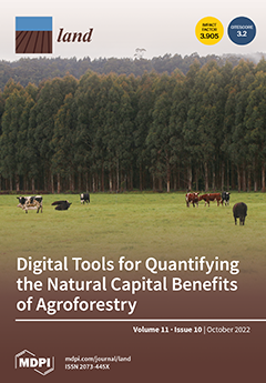
Cover Story (view full-size image): Agroforestry is one nature-based solution that holds significant potential for improving the sustainability and resilience of agricultural systems. Digital tools designed for agroforestry typically focus on timber and crop production, and not on the broader range of benefits usually considered in assessments of ecosystem services and natural capital. We evaluated 63 tools, but several would currently be required in combination in order to address each of the natural capital themes identified. We find that model complexity, spatial processes, accessibility, regional applicability, development speed, and interoperability present significant challenges. These challenges can be considered as opportunities to develop new, as well as to build upon existing, tools to enhance decision support in agroforestry systems. View this paper
  • Issues are regarded as officially published after their release is announced to the table of contents alert mailing list.
  • You may sign up for e-mail alerts to receive table of contents of newly released issues.
  • PDF is the official format for papers published in both, html and pdf forms. To view the papers in pdf format, click on the "PDF Full-text" link, and use the free Adobe Reader to open them.
Order results
Result details
Section
Select all
Export citation of selected articles as:
24 pages, 3317 KiB  
Article
Resources or Capital?—The Quality Improvement Mechanism of Precision Poverty Alleviation by Land Elements
by Dongsheng Zhang, Ming Yang and Ziyou Wang
Land 2022, 11(10), 1874; https://doi.org/10.3390/land11101874 - 21 Oct 2022
Cited by 4 | Viewed by 1530
Abstract
With China facing the challenges of fragmentation, multidimensionality, and the dynamics of relative poverty under the present situation, more attention is being paid to the role of land in poverty alleviation. In order to improve the quality of precision in poverty alleviation, it [...] Read more.
With China facing the challenges of fragmentation, multidimensionality, and the dynamics of relative poverty under the present situation, more attention is being paid to the role of land in poverty alleviation. In order to improve the quality of precision in poverty alleviation, it is urgent to clarify the micromechanisms of precision poverty alleviation methods that utilize land elements. On the basis of panel data from 29 provinces from 2010 to 2016, this research uses a panel vector autoregressive model to empirically analyze the mechanisms of interaction among land resource endowment, land capital endowment, and rural poverty. The research results show that the improvement of land resource endowment has had a relatively prominent effect on short-term poverty reduction, while the improvement of land capital endowment has had a relatively longer-term effect on the improvement of rural poverty. Land capital endowment and rural poverty can constitute a positive, cumulative circular effect, which can play a sustainable role in improving poverty. The increase in land resource endowment has a positive effect on land capital endowment, but excessive increases in land capital endowment were found to have a negative effect on land resource endowment. Therefore, the implementation of land element resource-based and capital-based poverty alleviation policies can distinguish between shorter-term and relatively longer-term goals, enabling a more accurate improvement of the quality of poverty alleviation. At the same time, this approach is more sustainable, since it makes full use of the circular effect constituted by land capital endowment and rural poverty. However, attention should be paid to preventing damages to land resource endowment, which can be caused by the excessive capitalization of land. Full article
(This article belongs to the Special Issue Land Use and Rural Sustainability)
Show Figures

Figure 1

17 pages, 4206 KiB  
Article
Assessment of Agricultural Areas Suitable for Agroforestry in Latvia
by Andis Bārdulis, Jānis Ivanovs, Arta Bārdule, Dagnija Lazdiņa, Dana Purviņa, Aldis Butlers and Andis Lazdiņš
Land 2022, 11(10), 1873; https://doi.org/10.3390/land11101873 - 21 Oct 2022
Cited by 1 | Viewed by 2286
Abstract
The role of trees on agricultural land is predicted to increase rapidly in order to achieve biodiversity, environmental, and climate goals. This study demonstrated the selection and evaluation approach and assessed the suitable agricultural land for agroforestry practices in hemiboreal Latvia, which was [...] Read more.
The role of trees on agricultural land is predicted to increase rapidly in order to achieve biodiversity, environmental, and climate goals. This study demonstrated the selection and evaluation approach and assessed the suitable agricultural land for agroforestry practices in hemiboreal Latvia, which was selected as the demonstration area by synthesizing knowledge of environmental sciences, remote sensing, and relevant legislation on land use and management. The total area of agricultural land suitable for agroforestry was estimated to be 14.1% of the total agricultural land in Latvia (351.5 kha). The selected agricultural land mainly comprised semihydromorphic soils; the dominant soil texture was loamy sand. Current dominant land use in the selected agricultural land consisted of heterogeneous agriculture and pastures; however, the selected agricultural parcels were outside intensive agricultural production for the most part—only 0.38% of the total selected agricultural land was accepted to receive state support and/or EU support to farmers under the Common Agricultural Policy (CAP). Considering the lengthy process of implementation of new agricultural-land-management practices, as well as taking into account the ambitious timeframe for reaching biodiversity, environmental, and climate goals, we recommend reducing hindrances to the introduction of agroforestry systems. The provided selection and evaluation approach is transferable to other countries and regions by adaptation of the elaborated methodologies to available country-specific spatial information and data Full article
Show Figures

Figure 1

13 pages, 1800 KiB  
Article
Effective Communication and Campground Recycling: Lessons Learned from Yosemite, Grand Teton, and Denali National Parks
by B. Derrick Taff, Zachary Miller, Ben Lawhon, Stephanie Freeman and Peter Newman
Land 2022, 11(10), 1872; https://doi.org/10.3390/land11101872 - 21 Oct 2022
Viewed by 1518
Abstract
Outdoor recreation continues to be persistently high in national parks across the United States, particularly as the COVID-19 pandemic has led to increased use. In popular frontcountry destinations such as national park campgrounds managers are challenged with new issues more familiar to urban [...] Read more.
Outdoor recreation continues to be persistently high in national parks across the United States, particularly as the COVID-19 pandemic has led to increased use. In popular frontcountry destinations such as national park campgrounds managers are challenged with new issues more familiar to urban settings. One of these challenges is waste management. The largest source of visitor-generated waste in national parks is campgrounds. This research uses a mixed-methods approach to develop and test strategic communications designed to increase recycling and minimize trash to the landfill by altering campground visitor behaviors. Intercept surveys were used to create theory-based messages, and a quasi-experimental approach was used to evaluate message effectiveness. Our results show that messages emphasizing ease concepts were two times more effective at changing campground visitor waste disposal behaviors than control conditions. The results help inform the management of visitors as national parks strive to meet sustainability goals. Full article
Show Figures

Figure 1

16 pages, 427 KiB  
Article
Relationship Analysis of Local Community Participation in Sustainable Ecotourism Development in Protected Areas, Iran
by Parvaneh Sobhani, Hassan Esmaeilzadeh, Seyed Mohammad Moein Sadeghi, Isabelle D. Wolf and Azade Deljouei
Land 2022, 11(10), 1871; https://doi.org/10.3390/land11101871 - 21 Oct 2022
Cited by 12 | Viewed by 3101
Abstract
Nature conservation efforts cannot succeed without stakeholder participation. The inherent complexity of nature-based ecotourism has made the development of sustainable ecotourism operations a challenge, so it is essential to increase community stakeholder participation. Hence, this study investigates local community participation in Lar National [...] Read more.
Nature conservation efforts cannot succeed without stakeholder participation. The inherent complexity of nature-based ecotourism has made the development of sustainable ecotourism operations a challenge, so it is essential to increase community stakeholder participation. Hence, this study investigates local community participation in Lar National Park (LNP) and the Jajrud Protected Area with the Sustainable Use of Natural Resource Areas (JPA) in Iran and evaluates how this influences the sustainability of ecotourism. This study found that in LNP, sustainable ecotourism development involving local communities is increasing because of the high level of attachment and interest to this part of pristine nature. In the JPA, the relationship between local community participation and ecotourism sustainability is significant too. As a result, natural habitats have been degraded and sustainability has decreased. To conserve these critically endangered natural areas, managers and decision-makers must increase community participation and education to encourage local communities to engage more in developing sustainable ecotourism. Full article
(This article belongs to the Section Urban Contexts and Urban-Rural Interactions)
Show Figures

Figure 1

18 pages, 4929 KiB  
Article
Coupling Coordination Analysis of Ecosystem Services and Urbanization in Inner Mongolia, China
by Li Na, Yangling Zhao and Luo Guo
Land 2022, 11(10), 1870; https://doi.org/10.3390/land11101870 - 21 Oct 2022
Cited by 6 | Viewed by 1437
Abstract
Given that ecological and environmental functions are greatly influenced by rapid urbanization, a clear understanding of the relationship between ecosystem services (ESs) and urbanization is urgently needed to improve sustainable development in Inner Mongolia. In this study, we first carried out ecosystem service [...] Read more.
Given that ecological and environmental functions are greatly influenced by rapid urbanization, a clear understanding of the relationship between ecosystem services (ESs) and urbanization is urgently needed to improve sustainable development in Inner Mongolia. In this study, we first carried out ecosystem service valuation (ESV) using the value coefficient method. We then examined the urbanization level using a comprehensive indicator system. Finally, we applied the coupling coordination degree model to analyze the coordination relationship between ecosystem services and urbanization from 1995 to 2020 in Inner Mongolia. The results showed that there was an increase in both the urbanization level and all ecosystem services excluding climate regulation, environmental purification, and biodiversity services. The coupling coordination degree (CCD) of Inner Mongolia is not ideal, and most counties remain at a low level of coordination degree. Furthermore, spatiotemporal heterogeneity was evident in the CCD of ecosystem services and urbanization as it was higher in the center and east of the country, but lower in the north and west regions. Relevant policies should be implemented to strengthen the advantages of local ecology, encourage environmentally friendly industrialization, and promote ecologically and economically sustainable development. Full article
(This article belongs to the Special Issue Dynamics of Urbanization and Ecosystem Services Provision)
Show Figures

Figure 1

23 pages, 893 KiB  
Article
Sustainability through STEM and STEAM Education Creating Links with the Land for the Improvement of the Rural World
by Elisa Gavari-Starkie, Patricia-Teresa Espinosa-Gutiérrez and Cristina Lucini-Baquero
Land 2022, 11(10), 1869; https://doi.org/10.3390/land11101869 - 21 Oct 2022
Cited by 5 | Viewed by 3581
Abstract
Rural environment is suffering from serious problems, as reflected in the term “Empty Spain”. One of these problems is the pronounced depopulation that rural areas suffer in our time, so creating links with the land thanks to education is of great interest for, [...] Read more.
Rural environment is suffering from serious problems, as reflected in the term “Empty Spain”. One of these problems is the pronounced depopulation that rural areas suffer in our time, so creating links with the land thanks to education is of great interest for, among other things, establishing population in rural areas. Interdisciplinary education becomes relevant today as the necessary education in our current world capable of providing answers and solutions to the social demands of our time. Interdisciplinary STEM education had the United States of America as its cradle in the 1990s; later it passed to the acronym STEAM when the Arts were later introduced, this is how you find a true interdisciplinary education. Since 2010, government policies have been developed in the USA, highlighting the Educate to Innovate program and in that same country the STEM4SD Education program, which develops education for sustainability by creating links with the local population. Precisely, this article will collect the educational policies that have been carried out in the USA for the development of this type of education. In this article and thanks to the analysis of certain programs, the importance of interdisciplinary STEM and STEAM education in our days will be exposed for the promotion of sustainability directed towards sustainable development, thereby creating more sustainable societies made up of more sustainable citizens, highlighting the importance of education for sustainability through STEM and STEAM education creating links with the land for the improvement of the rural world, which means establishing population, among other aspects. Full article
Show Figures

Figure 1

25 pages, 11407 KiB  
Article
Comparative Analysis of Photosynthetically Active Radiation Models Based on Radiometric Attributes in Mainland Spain
by Ousmane Wane, Julián A. Ramírez Ceballos, Francisco Ferrera-Cobos, Ana A. Navarro, Rita X. Valenzuela and Luis F. Zarzalejo
Land 2022, 11(10), 1868; https://doi.org/10.3390/land11101868 - 21 Oct 2022
Cited by 2 | Viewed by 1562
Abstract
The aims of this work are to present an analysis of quality solar radiation data and develop several hourly models of photosynthetically active radiation (PAR) using combinations of radiometric variables such as global horizontal irradiance (GHI), diffuse horizontal irradiance (DHI), and direct normal [...] Read more.
The aims of this work are to present an analysis of quality solar radiation data and develop several hourly models of photosynthetically active radiation (PAR) using combinations of radiometric variables such as global horizontal irradiance (GHI), diffuse horizontal irradiance (DHI), and direct normal irradiance (DNI) from their dimensionless indices atmospheric clearness index (kt), horizontal diffuse fraction (kd), and normal direct fraction (kb) together with solar elevation angle (α). GHI, DHI, and DNI data with 1-minute frequencies in the period from 2016 to 2021 from CEDER-CIEMAT, in a northern plateau, and PSA-CIEMAT in the southeast of the Iberian Peninsula, were used to compare two locations with very different climates according to the Köppen—Geiger classification. A total of 15 multilinear models were fitted and validated (with independent training and validation data) using first the whole dataset and then by kt intervals. In most cases, models including the clearness index showed better performance, and among them, models that also use the solar elevation angle as a variable obtained remarkable results. Additionally, according to the statistical validation, these models presented good results when they were compared with models in the bibliography. Finally, the model validation statistics indicate a better performance of the interval models than the complete models. Full article
Show Figures

Figure 1

21 pages, 3684 KiB  
Article
Accommodation and Avoidance: Functional Conflict Theory (FCT)-Based Governance Logic of Resettled Community Conflict in China
by Kexi Xu, Hui Gao, Jieyu Su, Haijun Bao, Bingqian Zhan, Chun Jiang and Liuzhao Chen
Land 2022, 11(10), 1867; https://doi.org/10.3390/land11101867 - 21 Oct 2022
Cited by 1 | Viewed by 2186
Abstract
The resettled community is a special type of transitional community in China where the residents are urbanized peasants who lost their lands during urbanization development. However, resettled community conflicts (RCCs) are barriers to sustainable community transformation. Focusing on functional conflict, this study identified [...] Read more.
The resettled community is a special type of transitional community in China where the residents are urbanized peasants who lost their lands during urbanization development. However, resettled community conflicts (RCCs) are barriers to sustainable community transformation. Focusing on functional conflict, this study identified the conflicts in the resettled community and proposed feasible governance logic for RCCs. The research in this article has a significant theoretical foundation in functional conflict theory. By examining a large sample of cases, seven RCC types were identified (e.g., inner discontent of residents, mass incidents), of which three have positive functions and four have negative impacts. Furthermore, three RCC causes were identified: right-based, interest-based, and value-based conflicts. Their mechanisms for the conflict function are, respectively, the contextual dual-functional, destructive one-way, and structural dual-functional paths. Considering these findings, we propose a dual governance logic of RCC: accommodation and avoidance. Within the dual logic, specific governance strategies are proposed for the different RCC causes and their functional formation paths. This research serves as an important reference for proper policy measures to govern RCCs and promote the sustainable transformation of resettled communities. The methodology adopted can be extended to the study of RCC in broader global contexts. Full article
(This article belongs to the Special Issue Urban Land Development in the Process of Urbanization)
Show Figures

Figure 1

14 pages, 1552 KiB  
Article
Sulphur Contents in Arable Soils from Four Agro-Ecological Zones of Ghana
by Dora Neina and Barbara Adolph
Land 2022, 11(10), 1866; https://doi.org/10.3390/land11101866 - 21 Oct 2022
Cited by 1 | Viewed by 1811
Abstract
There is limited data on Sulphur (S) contents in arable soils for appropriate fertilizer recommendations in Ghana. Five study areas in a reconnaissance survey (RS), followed by an in-depth study of two areas comprising farms of different durations of cultivation, were investigated for [...] Read more.
There is limited data on Sulphur (S) contents in arable soils for appropriate fertilizer recommendations in Ghana. Five study areas in a reconnaissance survey (RS), followed by an in-depth study of two areas comprising farms of different durations of cultivation, were investigated for the current total S and sulphate contents. Basic soil properties were measured using standard laboratory procedures. Total S and sulphate contents were determined using LECO instrument dry combustion and HPLC, respectively. The results showed wide variations in total S contents from 31 to 603 mg kg−1 in the Guinea Savannah (GS) zone. The mean trend was Forest > Forest-Transition (F-S) > north Guinea Savannah (nGS) > Deciduous Forest (DF) > south Guinea Savannah (sGS) in the RS sites, with a similar trend in the main study sites. Sulphate contents ranged from 5 to 25 mg kg−1, constituting 0.8 to 37% of the total S. The mean percent trend was sGS = DF > Forest > nGS > F-S. Soil organic carbon (SOC) was the major predictor of total S along with pedogenic minerals. Total S and crystalline pedogenic minerals predicted the sulphate contents. The results highlight the need for ecologically-based S fertilizer programmes to boost crop yields. Full article
Show Figures

Figure 1

23 pages, 3975 KiB  
Article
Overcoming the Collaboration Barriers among Stakeholders in Urban Renewal Based on a Two-Mode Social Network Analysis
by Lingyan Li, Jiaxin Zhu, Mimi Duan, Pingbo Li and Xiaotong Guo
Land 2022, 11(10), 1865; https://doi.org/10.3390/land11101865 - 21 Oct 2022
Cited by 3 | Viewed by 2562
Abstract
The relationship among stakeholders is complicated and full of collaboration barriers, which makes urban renewal an intersection of various contradictions. However, the existing literature considers the barriers to urban renewal independent of stakeholders, and the interaction between multiple stakeholders and barriers to collaboration [...] Read more.
The relationship among stakeholders is complicated and full of collaboration barriers, which makes urban renewal an intersection of various contradictions. However, the existing literature considers the barriers to urban renewal independent of stakeholders, and the interaction between multiple stakeholders and barriers to collaboration has been ignored. Therefore, this study uses a literature review and expert interviews to identify stakeholders and their collaboration barriers in the process of urban renewal. Based on the results of expert questionnaires, a two-mode network model of stakeholder–collaboration barrier is constructed to clarify the complex interaction and reveal the power and status of stakeholders in a network relationship. The study found that each barrier was associated with at least three stakeholders, indicating the necessity of stakeholders to establish partnerships. Further analysis shows that the government, local and other administrative organizations, consulting parties, and developers are the most influential stakeholders. The vague boundary of property rights, lack of expert advice and expertise, and different stakeholder awareness were identified as key barriers affecting sustainable collaboration. Finally, this study proposes and validates five strategies to promote collaboration among stakeholders. This study helps practitioners identify the priority problems to be solved under limited resources and provides effective measures to promote stakeholder collaboration. Full article
(This article belongs to the Special Issue Urban Regeneration and Sustainable Construction Management)
Show Figures

Figure 1

14 pages, 462 KiB  
Review
Agricultural Production Networks and Upgrading from a Global–Local Perspective: A Review
by Xinyu Yang and Weidong Liu
Land 2022, 11(10), 1864; https://doi.org/10.3390/land11101864 - 21 Oct 2022
Cited by 5 | Viewed by 2429
Abstract
The COVID-19 pandemic, extreme temperatures and the Russia–Ukraine conflict have exposed deficiencies in global agricultural production capacity and governance systems, which left low-income countries and regions to face more severe food insecurity. Thus, there is an urgent need for agricultural upgrading and the [...] Read more.
The COVID-19 pandemic, extreme temperatures and the Russia–Ukraine conflict have exposed deficiencies in global agricultural production capacity and governance systems, which left low-income countries and regions to face more severe food insecurity. Thus, there is an urgent need for agricultural upgrading and the establishment of a more sustainable agricultural system. Although there is a large body of literature with rich theoretical and empirical case studies, there is still a lack of systematic analysis of these studies, and the summary of global agricultural production networks and the agricultural upgrading process is not sufficient. This article will first set up an organisational framework of global agricultural production networks and explore the implications of governance and agricultural upgrading within this framework. It will then summarise the local agricultural upgrading processes on global, national and local scales based on a review of the existing literature. The article argues that agricultural upgrading in the context of global linkages is mainly driven by private-sector standards while the state also plays multiple roles. Moreover, in the embedding process of global agricultural production networks into local areas, local actors can promote agricultural upgrading through capacity building and organisational innovation. This review has implications for the economic, social and environmental sustainability of agriculture in developing countries, and provides a reference for future research. Full article
(This article belongs to the Section Land Socio-Economic and Political Issues)
Show Figures

Figure 1

22 pages, 9786 KiB  
Article
Centennial Change and Source–Sink Interaction Process of Traditional Agricultural Landscape: Case from Xin’an Traditional Cherry Cultivation System (1920–2020)
by Maolin Li, Yongxun Zhang, Changhong Miao, Lulu He and Jiatao Chen
Land 2022, 11(10), 1863; https://doi.org/10.3390/land11101863 - 21 Oct 2022
Viewed by 1496
Abstract
In contrast to modern agriculture, long-standing traditional agricultural practices such as agricultural heritage systems (AHS) are important inspirations for promoting harmonious human–land relations. However, some AHS have been in danger as their traditional agricultural landscapes (TALs) were changed by rapid modernization and urbanization. [...] Read more.
In contrast to modern agriculture, long-standing traditional agricultural practices such as agricultural heritage systems (AHS) are important inspirations for promoting harmonious human–land relations. However, some AHS have been in danger as their traditional agricultural landscapes (TALs) were changed by rapid modernization and urbanization. Thus, how do we figure out the change processes? What conservation measures can be taken? Taking the Xin’an Traditional Cherry Cultivation System in the loess hilly areas of Henan Province as a case, this study introduced the source–sink landscape theory to analyze the structure and process of the TAL during 1920–2020. Results show that, during 1920–1950, the traditional rural landscape (TRL) and the agricultural (natural) ecological landscape (ANEL) in the TAL were relatively balanced because they were source and sink to each other. Since 1985, the source expansion and sink resistance of both TRL and ANEL have been greatly hindered by the sink growth of modern village landscapes (MVL). As the core source landscape, TRL needs salvage protection for inheriting local characteristics by effective measures. TAL conservation should highlight rurality preservation through expanding the protection scope of TRL, endowing the MVL with more indigenous cultural features, etc. All these may contribute to rural vitalization and sustainable development. Full article
(This article belongs to the Special Issue Impacts of Local Land-Use on the Global Ecological Crisis)
Show Figures

Figure 1

17 pages, 5734 KiB  
Article
Spatial Distribution Changes in Nature-Based Recreation Service Supply from 2008 to 2018 in Shanghai, China
by Song Liu, Peiyu Shen, Yishan Huang, Li Jiang and Yongjiu Feng
Land 2022, 11(10), 1862; https://doi.org/10.3390/land11101862 - 20 Oct 2022
Cited by 1 | Viewed by 2059
Abstract
Nature-based recreation has become an important activity in contemporary society and a key component of cultural ecosystem services. Although the methods of mapping the outdoor recreation supply have been gradually improved, few studies have carried out multi-temporal evaluations. Based on land use/land cover [...] Read more.
Nature-based recreation has become an important activity in contemporary society and a key component of cultural ecosystem services. Although the methods of mapping the outdoor recreation supply have been gradually improved, few studies have carried out multi-temporal evaluations. Based on land use/land cover (LULC), POI, and other web-open data, we mapped the recreational service supply in Shanghai in 2008 and 2018, combining recreation potential and recreation opportunities. We first selected the evaluation indicators, using LULC to measure recreational potential, and POI density and accessibility to measure recreational opportunities. Then, we used principal component analysis (PCA) to determine the weights of the 12 factors that measure recreational opportunities, and made RO and RP maps, respectively. Finally, we overlaid RO and RP maps to obtain the spatial distribution map of recreation service supply. Our results showed that the supply of recreation services in 2008 and 2018 presented a “V-shaped” gradient along the city center areas—the peri-urban areas—the rural areas. Compared with the year 2008, the average recreation value decreased in nine regions, but increased in Chongming District in 2018. The assessment and mapping of recreation service supply value provide a basis for the development of local recreational resources, land use decisions, and the management of recreational cultural ecosystem services. Full article
Show Figures

Figure 1

34 pages, 3016 KiB  
Review
Building Information Modelling (BIM) Capabilities in the Design and Planning of Rural Settlements in China: A Systematic Review
by Yu Cao, Liyan Huang, Nur Mardhiyah Aziz and Syahrul Nizam Kamaruzzaman
Land 2022, 11(10), 1861; https://doi.org/10.3390/land11101861 - 20 Oct 2022
Cited by 2 | Viewed by 3389
Abstract
With rural revitalization being established as the national policy in China, the environmental quality and residential comfort of rural settlements has received widespread attention from the whole society in China. However, due to the over-exploitation of resources and the uneven development between urban [...] Read more.
With rural revitalization being established as the national policy in China, the environmental quality and residential comfort of rural settlements has received widespread attention from the whole society in China. However, due to the over-exploitation of resources and the uneven development between urban and rural in China, the environmental conditions and residential experience in rural settlements in China are still relatively backward. To prompt the environmental quality and residential comfort of rural settlements in China, it is necessary to optimize the planning and design of rural settlements in China. As a multi-function method, Building Information Modeling (BIM) can significantly contribute to the planning and design of rural settlements in China. To optimize the environmental quality and residential experience in rural settlements in China, this study is developed to perform a systematic literature review of the BIM capabilities in the design and planning phase of rural settlements in China. To achieve this aim, the PRISMA protocol was used to perform this systematic review. The review and discussion of this study were conducted between June 2022 and September 2022. In this study, Web of Science (WoS) and Scopus were adopted as the main databases, and 189 articles were reviewed. Through this systematic review, it can be identified that BIM capabilities have significant advantages in the following aspects of the design and planning of rural settlements in China: Data storage and management; 3D modeling and visualization; Disaster prevention and environmental analysis; Cost estimation and optimization. Furthermore, through the discussion and analysis of research results, it can be concluded that BIM capabilities can perform their benefits in the rural settlements’ design and planning through their following characteristics: knowledge management, simulation, and modeling. Based on the research results, it can be identified that knowledge management capabilities in BIM can effectively provide information support and knowledge assistance throughout the design and planning phase of rural settlements in China. BIM’s simulation and modeling capabilities can simulate and demonstrate the rural environment and their internal structures in rural settlements’ design and planning phase to achieve their environmental optimization, residential comfort improvement, clash detection, disaster prevention, and expenditure reduction. Moreover, the challenge and future directions of BIM capabilities in the design and planning phase of rural settlements in China are discussed and analyzed. This study can effectively promote and optimize the BIM utilization in the design and planning phase of rural settlements in China, to better enhance their environmental quality and residential experience. Full article
(This article belongs to the Special Issue Future Evolution of the Land Use Structure of Rural Settlements)
Show Figures

Figure 1

17 pages, 3734 KiB  
Article
Designing Perennial Landscapes: Plant Form and Species Richness Influence the Gaze Perception Associated with Aesthetic Preference
by Yangyang Shi, Jiao Zhang, Xinyue Shen, Liang Chen, Yunchen Xu, Rui Fu, Yang Su and Yiping Xia
Land 2022, 11(10), 1860; https://doi.org/10.3390/land11101860 - 20 Oct 2022
Cited by 4 | Viewed by 3861
Abstract
The up-close experience of perennial landscapes has been shown to enhance residents’ perception of naturalness in the context of increasing small-scale vegetation landscapes. This study explored how formal aesthetic characteristics were related to landscape perception and whether landscape preference correlated with eye movements. [...] Read more.
The up-close experience of perennial landscapes has been shown to enhance residents’ perception of naturalness in the context of increasing small-scale vegetation landscapes. This study explored how formal aesthetic characteristics were related to landscape perception and whether landscape preference correlated with eye movements. We created a series of photomontages showing perennial combinations that contained different plant forms, degrees of species richness, and plant arrangements and recorded 73 participants’ eye movements during 10 s of free viewing in Experiment A and task-oriented viewing in Experiment B and ratings of landscape preference collected through rating scales. We found that the effects of plant form and species richness were significant for gaze behavior, while arrangement showed no significant effect. We also found that landscape preference was positively correlated with fixation count but negatively correlated with mean fixation duration and total fixation duration. Additionally, women had more but shorter fixations than men while viewing these photomontages, and the difference in aesthetic preferences between men and women was not significant. Concerning the different professional background groups, no significant gaze behavior difference between professionals and nonprofessionals was detected, but compared with professionals, nonprofessionals tended to give strongly higher preference ratings. The outcomes shed light on the influence of formal aesthetic characteristics on gaze behavior and advanced the application of eye-tracking technology in perennial landscape studies. Our findings also confirmed the efficiency of vegetation landscapes designed based on public preferences for providing restoration from stress or fatigue. Full article
(This article belongs to the Special Issue Landscape Planning for Human Wellbeing in Asia)
Show Figures

Figure 1

17 pages, 1161 KiB  
Article
The Impact of the Regional Differentiation of Land Supply on Total Factor Productivity in China: From the Perspective of Total Factor Productivity Decomposition
by Lili Yang, Jian Wang, Yuhao Feng and Qun Wu
Land 2022, 11(10), 1859; https://doi.org/10.3390/land11101859 - 20 Oct 2022
Cited by 3 | Viewed by 1335
Abstract
Increasing total factor productivity is the key to promoting high-quality economic development. This paper starts with land supply as an institutional source factor and discusses the impact of the regional differentiation of land supply on total factor productivity in China. Based on the [...] Read more.
Increasing total factor productivity is the key to promoting high-quality economic development. This paper starts with land supply as an institutional source factor and discusses the impact of the regional differentiation of land supply on total factor productivity in China. Based on the panel data of 273 cities in China from 2003 to 2017, this paper measures total factor productivity (TFP) using the DEA-Malmquist index, decomposes it into technical progress (TE), pure technical efficiency (PE) and scale efficiency (SE), and analyzes the effect of the regional differentiation of land supply on TFP using the spatial Durbin model and mediating model. This study finds the following: (1) At the national level, the tilting of land supply to the central and western regions leads to a contradiction between land supply and demand, which hinders TFP by suppressing TE, PE and SE. (2) At the regional level, the reduction in land supply in the eastern region expands the technological substitution rate, induces the substitution effect of enterprise innovation, and thus promotes TE, but inhibits PE and SE under the resource constraint and congestion effect, which hinders the improvement of TFP. The estimates for the central and western regions are generally consistent with the national results; again, as land supply increases, this hinders TFP by suppressing TE, PE and SE. (3) In terms of the mechanism of influence, the decrease in land supply in the eastern region promotes TE and TFP by promoting urban innovation and inhibiting SE through productive services agglomeration; the increase in land supply in the central and western regions hinders TE and TFP by inhibiting urban innovation, and hinders SE through manufacturing agglomeration. The conclusion of this paper has great significance for deepening the structural reform of land supply and promoting high-quality economic development. Full article
Show Figures

Figure 1

19 pages, 6590 KiB  
Article
Spatial Driven Effects of Multi-Dimensional Urbanization on Carbon Emissions: A Case Study in Chengdu-Chongqing Urban Agglomeration
by Jie Chang, Pingjun Sun and Guoen Wei
Land 2022, 11(10), 1858; https://doi.org/10.3390/land11101858 - 20 Oct 2022
Cited by 7 | Viewed by 1430
Abstract
Previous studies lacked attention to the spatial heterogeneity of the impact of urbanization on carbon emissions. To fill this knowledge gap, this study analyzed the spatio-temporal variations of carbon emissions (TCE), the per capita carbon intensity (PCI), and the economic carbon intensity (ECI) [...] Read more.
Previous studies lacked attention to the spatial heterogeneity of the impact of urbanization on carbon emissions. To fill this knowledge gap, this study analyzed the spatio-temporal variations of carbon emissions (TCE), the per capita carbon intensity (PCI), and the economic carbon intensity (ECI) in the Chengdu-Chongqing urban agglomeration (CUA) based on the Open-Data Inventory for Anthropogenic Carbon dioxide (ODIAC) from 2000–2018. Bivariate spatial autocorrelation, and spatial Durbin models were combined to quantify the spatial correlation and driving mechanisms between carbon emission intensity and multi-dimensional urbanization (population, economic, and land urbanization). The following are the main results: (1) The TCE in CUA increased by 3.918 million tons at an average annual growth of 6.86%; CUA ranked last among China’s national strategic urban agglomerations in terms of TCE, PCI, and ECI. (2) High carbon emission values were concentrated in the Chengdu and Chongqing metropolitan areas, presenting a spatial feature of “Core-Periphery” gradient decay. (3) Nearly 30% of the agglomeration had carbon emission growth at low rates, with the growth cores concentrated in the main urban areas of Chengdu and Chongqing. (4) The “Low-Low” positive correlation was the main correlation type between multi-dimensional urbanization and carbon emissions and was distributed mainly in mountainous areas (e.g., Leshan and Ya’an). (5) Among the urbanization dimensions, the impacts on carbon emissions in local and adjacent areas exhibited varying levels of spatial heterogeneity. Economic urbanization was found to have the strongest positive direct and spillover effects; land urbanization inhibited the growth of carbon emissions in local and adjacent areas; population urbanization promoted carbon emission reduction in adjacent areas. Our findings provide support for CUA to carry out cross-city joint governance strategies of carbon emissions, also proving that regional carbon emission reduction should be an integration of various efforts including low-carbon living of residents, green transformation of economy and optimal land management. Full article
Show Figures

Figure 1

35 pages, 4233 KiB  
Article
Shedding Light on Agritourism in Iberian Cross-Border Regions from a Lodgings Perspective
by Dora Isabel Rodrigues Ferreira and José-Manuel Sánchez-Martín
Land 2022, 11(10), 1857; https://doi.org/10.3390/land11101857 - 20 Oct 2022
Cited by 8 | Viewed by 2436
Abstract
Agritourism has been widely discussed in the literature. As the range of options for its interpretation increased, studies have come to focus their objectives on its systematization, evaluated with respect to the nature of the interactions between tourists and agriculture, the level of [...] Read more.
Agritourism has been widely discussed in the literature. As the range of options for its interpretation increased, studies have come to focus their objectives on its systematization, evaluated with respect to the nature of the interactions between tourists and agriculture, the level of contact with agricultural activities, and the authenticity of the experience. Adding to this complexity is the association of agritourism with experiences related to the agri-food sector, as well as the typologies of accommodation. This research contributes to an improved understanding of agritourism based on evidence from a cross-border region between Portugal and Spain. We identify the links between agriculture and tourism by identifying different categories of agritourism activities via the application of geostatistical analysis. The main results highlight that landscapes, agricultural activities, and agri-food products have a positive influence in creating tourism products and services. Despite this result, passive agritourism activities prevail, such as tasting experiences, contact with endogenous products, enjoyment of the agricultural landscape, or on-farm entertainment. This reality highlights a gap related to authentic agritourism, pointing to the absence of or weak links to agricultural activities and weaknesses in the local “farm-to-table” channel. The grouping analysis results led to the creation of six homogeneous groups, three of which correspond to lodging establishments capable of creating agritourism. However, these groups represent only 39% of the supply. Given this reality, it is of utmost importance to implement policies that encourage tour operators to create agritourism products. Full article
Show Figures

Figure 1

37 pages, 13391 KiB  
Article
Spatial Estimates of Soil Moisture for Understanding Ecological Potential and Risk: A Case Study for Arid and Semi-Arid Ecosystems
by Michael S. O’Donnell and Daniel J. Manier
Land 2022, 11(10), 1856; https://doi.org/10.3390/land11101856 - 20 Oct 2022
Cited by 4 | Viewed by 1970
Abstract
Soil temperature and moisture (soil-climate) affect plant growth and microbial metabolism, providing a mechanistic link between climate and growing conditions. However, spatially explicit soil-climate estimates that can inform management and research are lacking. We developed a framework to estimate spatiotemporal-varying soil moisture (monthly, [...] Read more.
Soil temperature and moisture (soil-climate) affect plant growth and microbial metabolism, providing a mechanistic link between climate and growing conditions. However, spatially explicit soil-climate estimates that can inform management and research are lacking. We developed a framework to estimate spatiotemporal-varying soil moisture (monthly, annual, and seasonal) and temperature-moisture regimes as gridded surfaces by enhancing the Newhall simulation model. Importantly, our approach allows for the substitution of data and parameters, such as climate, snowmelt, soil properties, alternative potential evapotranspiration equations and air-soil temperature offsets. We applied the model across the western United States using monthly climate averages (1981–2010). The resulting data are intended to help improve conservation and habitat management, including but not limited to increasing the understanding of vegetation patterns (restoration effectiveness), the spread of invasive species and wildfire risk. The demonstrated modeled results had significant correlations with vegetation patterns—for example, soil moisture variables predicted sagebrush (R2 = 0.51), annual herbaceous plant cover (R2 = 0.687), exposed soil (R2 = 0.656) and fire occurrence (R2 = 0.343). Using our framework, we have the flexibility to assess dynamic climate conditions (historical, contemporary or projected) that could improve the knowledge of changing spatiotemporal biotic patterns and be applied to other geographic regions. Full article
(This article belongs to the Section Soil-Sediment-Water Systems)
Show Figures

Figure 1

24 pages, 9755 KiB  
Article
Agricultural Land Abandonment in Bulgaria: A Long-Term Remote Sensing Perspective, 1950–1980
by Mustafa Erdem Kabadayı, Paria Ettehadi Osgouei and Elif Sertel
Land 2022, 11(10), 1855; https://doi.org/10.3390/land11101855 - 20 Oct 2022
Cited by 4 | Viewed by 2127
Abstract
Agricultural land abandonment is a globally significant threat to the sustenance of economic, ecological, and social balance. Although the driving forces behind it can be multifold and versatile, rural depopulation and urbanization are significant contributors to agricultural land abandonment. In our chosen case [...] Read more.
Agricultural land abandonment is a globally significant threat to the sustenance of economic, ecological, and social balance. Although the driving forces behind it can be multifold and versatile, rural depopulation and urbanization are significant contributors to agricultural land abandonment. In our chosen case study, focusing on two locations, Ruen and Stamboliyski, within the Plovdiv region of Bulgaria, we use aerial photographs and satellite imagery dating from the 1950s until 1980, in connection with official population census data, to assess the magnitude of agricultural abandonment for the first time from a remote sensing perspective. We use multi-modal data obtained from historical aerial and satellite images to accurately identify Land Use Land Cover changes. We suggest using the rubber sheeting method for the geometric correction of multi-modal data obtained from aerial photos and Key Hole missions. Our approach helps with precise sub-pixel alignment of related datasets. We implemented an iterative object-based classification approach to accurately map LULC distribution and quantify spatio-temporal changes from historical panchromatic images, which could be applied to similar images of different geographical regions. Full article
(This article belongs to the Special Issue Modeling Land Use Change Using Historical and Archaeological Datasets)
Show Figures

Figure 1

24 pages, 1936 KiB  
Article
Promoting Effect of Whole-Region Comprehensive Land Consolidation on Rural Revitalization from the Perspective of Farm Households: A China Study
by Dongli Zhang, Lihong Yu and Wenxiong Wang
Land 2022, 11(10), 1854; https://doi.org/10.3390/land11101854 - 20 Oct 2022
Cited by 9 | Viewed by 2067
Abstract
With the rapid advances in globalization, industrialization, urbanization, and informatization, rural space continues to be occupied by urban expansion, and numerous production elements are aggregated in cities, resulting in global rural decline. The long-standing Chinese urban-rural dual system and urban-first development strategy have [...] Read more.
With the rapid advances in globalization, industrialization, urbanization, and informatization, rural space continues to be occupied by urban expansion, and numerous production elements are aggregated in cities, resulting in global rural decline. The long-standing Chinese urban-rural dual system and urban-first development strategy have exacerbated a downturn in rural areas during the socio-economic transition. Combined with land management systems and innovation policies, whole-region comprehensive land consolidation (WRCLC) has become a crucial tool and platform for rural revitalization, extensively implemented nationwide. From the perspective of farm households, this paper employs the element-structure-function framework in the system theory to theoretically reveal the mechanism by which different WRCLC modes promote rural revitalization. Based on the questionnaire survey data from 1080 farm households in Zhejiang Province, the propensity score matching-difference in difference (PSM-DID) method based on quasi-experiment was employed to explore the impact of different WRCLC modes on the overall rural revitalization and its five dimensions (thriving industry, ecological livability, rural civilization, effective governance, and affluent life). The results show that WRCLC can optimize the rural structure and enhance rural functions by integrating the core elements of rural development to achieve complete rural revitalization. The empirical results show that implementing all WRCLC modes has significantly increased overall and five-dimension rural revitalization levels, with the city-suburb integration mode having a better effect on promoting rural revitalization than the characteristic industry mode and small-town construction mode. Based on this, some relevant policy recommendations have been put forward to enhance the effectiveness of WRCLC in promoting rural revitalization. Our findings will provide a Chinese practice for other countries and regions to develop more effective WRCLC modes and policies for promoting rural revitalization. Full article
(This article belongs to the Special Issue Land Consolidation and Rural Revitalization)
Show Figures

Figure 1

21 pages, 5685 KiB  
Article
Analysis of the Image of Global Glacier Tourism Destinations from the Perspective of Tourists
by Fan Tang, Jianping Yang, Yanxia Wang and Qiuling Ge
Land 2022, 11(10), 1853; https://doi.org/10.3390/land11101853 - 20 Oct 2022
Cited by 6 | Viewed by 2227
Abstract
Glaciers are attracting increasing attention in the context of climate change, and glacier tourism has also become a popular tourist product. However, few studies have been conducted concerning the image of glacier tourism destinations. To address this gap in the literature, in this [...] Read more.
Glaciers are attracting increasing attention in the context of climate change, and glacier tourism has also become a popular tourist product. However, few studies have been conducted concerning the image of glacier tourism destinations. To address this gap in the literature, in this study, we extracted destination images from 138,709 visitor reviews of 107 glacier tourism destinations on TripAdvisor using latent Dirichlet allocation (LDA) topic modeling, identified destination image characteristics using salience−valence analysis (SVA), and analyzed the differences in glacier tourism destination image characteristics across seasons and regions. According to the findings, the image of a glacier tourism destination consists of 14 dimensions and 53 attributes, with landscapes and specific activities representing the core image and viewing location and necessity representing the unique image. We identified significant seasonal and regional differences in the image of glacier tourism destinations. Finally, we discussed the unique image of glacier tourism destinations, the reasons for differences in the images, and the characteristics of different glacier tourism regions. This research could assist in the scientific management of their core images by glacier tourism destinations, as well as in the rational selection of destinations and travel timing by glacier tourists. Full article
(This article belongs to the Special Issue Landscape Governance in the Age of Social Media)
Show Figures

Figure 1

19 pages, 3582 KiB  
Essay
Identifying Driving Factors of Basin Ecosystem Service Value Based on Local Bivariate Spatial Correlation Patterns
by Xue Ding, Yuqin Shu, Xianzhe Tang and Jingwen Ma
Land 2022, 11(10), 1852; https://doi.org/10.3390/land11101852 - 20 Oct 2022
Cited by 3 | Viewed by 1429
Abstract
Ecosystem service value (ESV) is a crucial indicator for evaluating ecosystem health, and identifying its spatial driving factors will help to provide scientific decision support for ecological protection and restoration. This study took the Liuxi River Basin in China as the research object [...] Read more.
Ecosystem service value (ESV) is a crucial indicator for evaluating ecosystem health, and identifying its spatial driving factors will help to provide scientific decision support for ecological protection and restoration. This study took the Liuxi River Basin in China as the research object and used the value equivalent method to estimate regional ESV. In the process of using the Geodetector model (GDM), the study area was spatially stratified by using the local bivariate spatial correlation pattern to mine the potential driving factors of ESV. The results show that: (1) From 2005 to 2018, the total value of ecosystem services in the Liuxi River Basin showed a fluctuating and increasing trend. ESV had high-value aggregation in the northeastern mountainous areas with high green space coverage and high river distance accessibility and low-value aggregation in the central and southwestern urban areas with frequent human activities. Its spatial heterogeneity and aggregation patterns were of statistical significance. (2) The spatial distribution characteristics of ESV were affected by various driving factors to varying degrees. The order of their degree of influence on ESV was per capita green area > slope > the proportion of urban and rural human settlements > river distance accessibility > population. (3) Compared to the previous study, the stratification method employing the local bivariate spatial correlation pattern more fully considers spatial autocorrelation and spatial heterogeneity. It effectively captured the spatial explanatory power of driving factors. This study can provide new ideas for capturing the driving mechanisms of ESV and insights into the sustainable development of the ecological environment in other regions with similar characteristics worldwide. Full article
Show Figures

Figure 1

20 pages, 18232 KiB  
Article
Spatial–Temporal Change in Paddy Field and Dryland in Different Topographic Gradients: A Case Study of China during 1990–2020
by Shuai Xie, Guanyi Yin, Wei Wei, Qingzhi Sun and Zhan Zhang
Land 2022, 11(10), 1851; https://doi.org/10.3390/land11101851 - 20 Oct 2022
Cited by 1 | Viewed by 1548
Abstract
As a country with a vast area and complex terrain, the differentiation between paddy field and dryland under different topographic gradients in China is difficult. Based on a land-use grid data set with an accuracy of 1 km, this study applied the Topographic [...] Read more.
As a country with a vast area and complex terrain, the differentiation between paddy field and dryland under different topographic gradients in China is difficult. Based on a land-use grid data set with an accuracy of 1 km, this study applied the Topographic Potential Index and used land-use transition matrices and landscape analysis to compare the change in dryland and paddy field in China from 1990 to 2020 at different elevations, slopes, and slope aspects. The results indicate that paddy field and dryland were mostly distributed in areas with better photothermal conditions. However, in recent years, the paddy field and dryland on the “sunny” slope decreased. Specifically, the area of paddy field and dryland on the southeast, south, and southwest slopes decreased, while they increased on the northwest, north, and northeast slopes. From 1990 to 2020, land conversion among paddy field, dryland, and other land use was mostly concentrated in the third ladder (<500 m elevation) of China. However, the changes in paddy field and dryland have now become active on the second ladder of China. Moreover, the change from other land to dryland on the second ladder accounted for nearly 50% of the country’s change from other land to dryland. Paddy fields and drylands in areas with low elevation and low slopes were reduced, whereas those with higher elevation and higher slopes increased, indicating that the arable land in mountainous areas increased. This indicates that the topographic conditions of arable land that become worse may aggravate soil erosion in the planting process. The landscape fragmentation of paddy field and dryland increased. Compared with paddy field, the dryland was more aggregated, the shape was more complex, and the land plots were more fragmented. As a result, paddy field and dryland show significant differences in their spatial–temporal pattern, landscape characteristics, and land-use changes, and these results can provide an important reference for the sustainable utilization of arable land resources. Full article
(This article belongs to the Special Issue Rural Land Use in China)
Show Figures

Figure 1

19 pages, 8572 KiB  
Review
Current Practices and Prospects of Climate-Smart Agriculture in Democratic Republic of Congo: A Review
by Katcho Karume, Jean M. Mondo, Géant B. Chuma, Angele Ibanda, Espoir M. Bagula, Alex Lina Aleke, Serge Ndjadi, Bintu Ndusha, Pascaline Azine Ciza, Nadege Cirezi Cizungu, Daniel Muhindo, Anthony Egeru, Florence Mayega Nakayiwa, Jackson-Gilbert M. Majaliwa, Gustave N. Mushagalusa and Rodrigue B. Basengere Ayagirwe
Land 2022, 11(10), 1850; https://doi.org/10.3390/land11101850 - 20 Oct 2022
Cited by 9 | Viewed by 5077
Abstract
Climate-smart agriculture (CSA) is one of the innovative approaches for sustainably increasing the agricultural productivity, improving livelihoods and incomes of farmers, while at the same time improving resilience and contributing to climate change mitigation. In spite of the fact that there is neither [...] Read more.
Climate-smart agriculture (CSA) is one of the innovative approaches for sustainably increasing the agricultural productivity, improving livelihoods and incomes of farmers, while at the same time improving resilience and contributing to climate change mitigation. In spite of the fact that there is neither explicit policy nor practices branded as CSA in Democratic Republic of Congo (DRC), farmers are utilizing an array of farming practices whose attributes meet the CSA criteria. However, the intensity, distribution, efficiency, and dynamics of use as well as the sources of these technologies are not sufficiently documented. Therefore, this review paper provides a comprehensive evidence of CSA-associated farming practices in DRC, public and private efforts to promote CSA practices, and the associated benefits accruing from the practices as deployed by farmers in the DRC. We find evidence of progress among farming communities in the use of practices that can be classified as CSA. Communities using these practices are building on the traditional knowledge systems and adaptation of introduced technologies to suit the local conditions. Reported returns on use of these practices are promising, pointing to their potential continued use into the future. While progressive returns on investment are reported, they are relatively lower than those reported from other areas in sub-Saharan Africa deploying similar approaches. We recommend for strategic support for capacity building at various levels, including public institutions for policy development and guidance, extension and community level to support uptake of technologies and higher education institutions for mainstreaming CSA into curricula and training a generation of CSA sensitive human resources. Full article
Show Figures

Figure 1

25 pages, 6098 KiB  
Article
Research on the Satisfaction of Beijing Waterfront Green Space Landscape Based on Social Media Data
by Siya Cheng, Zheran Zhai, Wenzhuo Sun, Yuan Wang, Rui Yu and Xiaoyu Ge
Land 2022, 11(10), 1849; https://doi.org/10.3390/land11101849 - 20 Oct 2022
Cited by 6 | Viewed by 2822
Abstract
Urban blue–green space is essential to the normal functioning of the urban landscape ecosystem, and it is also a significant metric for assessing the quality of urban human settlements. In China’s territorial space planning, the overall planning strategy’s implementation depends on constructing the [...] Read more.
Urban blue–green space is essential to the normal functioning of the urban landscape ecosystem, and it is also a significant metric for assessing the quality of urban human settlements. In China’s territorial space planning, the overall planning strategy’s implementation depends on constructing the blue–green space network in the urbanized construction area. This paper used 85 typical riverside parks in Beijing’s blue–green space as the research object, collecting and analyzing multiple social media user data. It explored the main factors that influenced people’s satisfaction with the landscape design and sensory perception of urban waterfront green space from the perspectives of parks beside different river systems, parks of different types, and parks in different districts. The distinction between urban waterfront green space evaluation was further discussed through variance analysis. The research revealed the following findings: (1) by comparing the total number of park reviews in different seasons, it could be observed that tourists evidently preferred the spring landscape, and the winter landscape construction of waterfront green space needs to be improved. (2) By comparing the review stars of different parks, it could be observed that tourists appreciated parks with multiple functions, excellent recreation facilities, complete management services and parks close to the city center. Functions and services became important influencing factors for park evaluation. (3) There was room for improvement in water ecology in the river landscapes of parks adjacent to various river systems, and people paid more attention to the level of service facilities. (4) According to different categories of parks, people’s demand for service facilities, activity organization, cultural displays and other aspects was different. (5) Among parks in different districts, people preferred the distinctive animal and plant landscapes and recreational activities of parks in districts on the outskirts of the city. According to the conclusions, suggestions were made for optimizing and improving Beijing’s waterfront green space, providing managers with technical support and a basis for decision-making. Full article
(This article belongs to the Special Issue Landscape Governance in the Age of Social Media)
Show Figures

Figure 1

24 pages, 2117 KiB  
Article
Approaches to Enhance Integration and Monitoring for Social-Ecological Systems
by Adela Itzkin, Jai Kumar Clifford-Holmes, Mary Scholes and Kaera Coetzer
Land 2022, 11(10), 1848; https://doi.org/10.3390/land11101848 - 20 Oct 2022
Cited by 1 | Viewed by 1909
Abstract
Integration and monitoring are pressing conceptual and methodological challenges in social-ecological systems (SES) research. This paper follows a social learning process, called participatory self-observation, piloted by a group of action-researchers to improve SES integration and monitoring, using the Tsitsa River Catchment in South [...] Read more.
Integration and monitoring are pressing conceptual and methodological challenges in social-ecological systems (SES) research. This paper follows a social learning process, called participatory self-observation, piloted by a group of action-researchers to improve SES integration and monitoring, using the Tsitsa River Catchment in South Africa as a case study. The participatory self-observation process reflected on lessons to enhance integration and integrated monitoring of biophysical, social, and social-ecological data in SES projects; for adaptive planning and management. Three focal points emerged for improving the challenges of SES integration: the need for participatory people-based processes, the importance of applied praxis tasks to catalyze meaningful integration, and the need for transdisciplinary teams to value non-biophysical research. Five focal areas emerged as major challenges for SES monitoring: the integration of qualitative and quantitative data, data overload, the scale of SES monitoring, the need to center SES monitoring around learning, and good working relationships to enable data flow. Recommendations to further develop integrated monitoring and management of SESs include (i) using people-based approaches that focus on applied work which includes rigorous collection of quantitative, biophysical data, (ii) identifying essential data needs through an essential variable approach, and (iii) combining quantitative monitoring with participatory people-based processes. Full article
Show Figures

Figure 1

22 pages, 2370 KiB  
Article
Multi-Actor Partnerships for Agricultural Interactive Innovation: Findings from 17 Case Studies in Europe
by Susana B. Guerrero-Ocampo, José M. Díaz-Puente and Juan Felipe Nuñez Espinoza
Land 2022, 11(10), 1847; https://doi.org/10.3390/land11101847 - 20 Oct 2022
Cited by 4 | Viewed by 1829
Abstract
Innovation is widely regarded as a key factor for the economic development and competitiveness of companies and countries. It is, therefore, widely considered a policy instrument in various sectors, such as agriculture. In this sector, agricultural innovation is seen as a systemic and [...] Read more.
Innovation is widely regarded as a key factor for the economic development and competitiveness of companies and countries. It is, therefore, widely considered a policy instrument in various sectors, such as agriculture. In this sector, agricultural innovation is seen as a systemic and interactive phenomenon, which is the result of interactions between innovators and knowledge-generating organisations, as well as social and economic aspects of the context. This paper studies the social structures of multi-actor partnerships involved in interactive innovation processes in agricultural innovation systems, analysing the type of actors involved and the roles they play in the innovation process. For this purpose, 17 case studies were analysed in the framework of the Liaison project, an H2020 project, using social network analysis (SNA) and descriptive statistics. The results show that the studied multi-actor partnerships have been mostly funded by outside sources of funding, highlighting European funds. The innovation networks have a heterogeneous composition, but when we analyse the frequency of interactions there is a tendency to establish greater interaction between organisations that are of the same type. In the “core” of innovation networks, research entities and farmers are central actors with the main role of technician expert and case study field workers, respectively. Full article
Show Figures

Figure 1

22 pages, 4614 KiB  
Article
High-Speed Railway Network Development, Inter-County Accessibility Improvements, and Regional Poverty Alleviation: Evidence from China
by Jing Fan, Hironori Kato, Xinghua Liu, Ye Li, Changxi Ma, Liang Zhou and Mingzhang Liang
Land 2022, 11(10), 1846; https://doi.org/10.3390/land11101846 - 20 Oct 2022
Cited by 6 | Viewed by 1920
Abstract
The rapid expansion of the high-speed railway (HSR) network in China has significantly shortened the space–time distance between cities. China is striving to enter an anti-poverty era, which is increasing the importance of research on the poverty reduction effect created by upgrading transportation [...] Read more.
The rapid expansion of the high-speed railway (HSR) network in China has significantly shortened the space–time distance between cities. China is striving to enter an anti-poverty era, which is increasing the importance of research on the poverty reduction effect created by upgrading transportation infrastructure, in particular, HSR development. Describing the characteristics of accessibility and the mechanisms by which that accessibility reduces poverty could provide the insights needed for determining suitable anti-poverty paths. By using data for 2341 counties and equivalents in China during 2007–2018, this study analyses the railway accessibility improvements and the poverty reduction effect created by HSR development. On average, HSR in China contributed to a significant increase in potential economic accessibility (317.8%) and a decrease in weighted average travel time (39.9%) for counties. Based on accessibility calculations, the Theil index was used to measure the disparity level of regional accessibility and regional poverty measured based on the income of rural residents. The results indicate that HSR leads to an increase in inequality in terms of travel time and potential economic accessibility at a national level. Pearson coefficients reveal a strong correlation between disparities in accessibility and in rural income among provinces. Furthermore, using the full sample, and sub-samples of poor and non-poor counties in China, the association between regional accessibility and poverty was examined by using two-way fixed effect models and spatial econometric models. The estimated results show that a 1% improvement in potential economic accessibility leads to an aggregate rural income improvement of 0.03–0.17%; the ratio of rural income to urban income increases by 0.04–0.12% and a larger effect is observed in poor counties. The weighted average travel time reduction also leads to improvement in rural income and reduction in the urban–rural income gap. The empirical results obtained by different robust test methods, including different sample groups, different estimated methods and accessibility indicators, are shown to be robust. These findings can help transportation departments formulate poverty-alleviation-oriented transportation planning and investment policies and inform future policies for countries planning to construct HSRs. Full article
Show Figures

Figure 1

21 pages, 3200 KiB  
Article
County-Level City Shrinkage in China: Representation, Cause, and Response
by Dingpan Chen, Yuzhe Wu, Zhou Lin and Zhiyi Xu
Land 2022, 11(10), 1845; https://doi.org/10.3390/land11101845 - 19 Oct 2022
Cited by 5 | Viewed by 1899
Abstract
Shrinkage in China’s cities has gradually received increasing attention. Specifically, county-level shrinking cities are numerous and widely distributed. City shrinkage even appears throughout Zhejiang Province, which is highly developed and has stable economic growth. County-level shrinking cities resulting from regional competition can still [...] Read more.
Shrinkage in China’s cities has gradually received increasing attention. Specifically, county-level shrinking cities are numerous and widely distributed. City shrinkage even appears throughout Zhejiang Province, which is highly developed and has stable economic growth. County-level shrinking cities resulting from regional competition can still maintain long-term and stable economic growth, but their economic growth lags behind the whole competitive region. We identified five county-level shrinking cities in Zhejiang Province, and characterized the shrinkage phenomenon in Changshan County using census, nighttime lighting (NTL), and Tencent Location Big Data. City shrinkage resulted from the comprehensive effects of declining traditional industries, backward per capita income, highly skilled labor force shortages, and population age structure changes. Given the shrinkage status of Changshan, we proposed countermeasures and suggestions including aspects of industrial development, urban planning, social governance, and care for the elderly. Full article
(This article belongs to the Special Issue Urban Land Development in the Process of Urbanization)
Show Figures

Figure 1

Previous Issue
Next Issue
Back to TopTop