Next Issue
Volume 10, August
Previous Issue
Volume 10, June


Land, Volume 10, Issue 7 (July 2021) – 106 articles

Cover Story (view full-size image): 
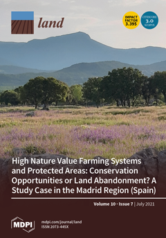
European rural landscapes contain high nature value farming systems that, in addition to being the main economic activity in many rural areas, host habitats and species of great conservation value. However, they have not been sufficiently appreciated and protected and, as such, are currently threatened. There is a significant loss of these systems and a marked increase in the rewilding processes, which implies negative consequences for both the high biocultural diversity that these systems host and the cultural identity and socioeconomics of the rural populations. Therefore, it remains a challenge to provide methodological tools for social–ecological land planning and the design of effective management strategies for the conservation of rural cultural landscapes. View this paper
  • Issues are regarded as officially published after their release is announced to the table of contents alert mailing list.
  • You may sign up for e-mail alerts to receive table of contents of newly released issues.
  • PDF is the official format for papers published in both, html and pdf forms. To view the papers in pdf format, click on the "PDF Full-text" link, and use the free Adobe Reader to open them.
Order results
Result details
Section
Select all
Export citation of selected articles as:
13 pages, 5728 KiB  
Article
Concept of Soil Moisture Ratio for Determining the Spatial Distribution of Soil Moisture Using Physiographic Parameters of a Basin and Artificial Neural Networks (ANNs)
by Edyta Kruk and Wioletta Fudała
Land 2021, 10(7), 766; https://doi.org/10.3390/land10070766 - 20 Jul 2021
Cited by 1 | Viewed by 1662
Abstract
The results of investigations on shaping the soil moisture ratio in the mountain basin of the Mątny stream located in the Gorce region, Poland, are presented. A soil moisture ratio was defined as a ratio of soil moisture in a given point in [...] Read more.
The results of investigations on shaping the soil moisture ratio in the mountain basin of the Mątny stream located in the Gorce region, Poland, are presented. A soil moisture ratio was defined as a ratio of soil moisture in a given point in a basin to the one located in a base point located on a watershed. Investigations were carried out, using a TDR device, for 379 measuring points located in an irregular network, in the 0–25 cm soil layer. Values of the soil moisture ratio fluctuated between 0.75 and 1.85. Based on measurements, an artificial neural network (ANN) model of the MLP type was constructed, with nine neurons in the input layer, four neurons in the hidden layer and one neuron in the output layer. Input parameters influencing the soil moisture ratio were chosen based on physiographic parameters: altitude, flow direction, height a.s.l., clay content, land use, exposition, slope shape, soil hydrologic group and place on a slope. The ANN model was generated in the module data mining in the program Statistica 12. Physiographic parameters were generated using a database, digital elevation model and the program ArcGIS. The value of the network learning parameter obtained, 0.722, was satisfactory. Comparison of experimental data with values obtained using the ANN model showed a good fit; the determination coefficient was 0.581. The ANN model showed a minimal tendency to overestimate values. Global network sensitivity analysis showed that the highest influence on the wetness coefficient were provided by the parameters place on slope, exposition, and land use, while the parameters with the lowest influence were slope, clay fraction and hydrological group. The chosen physiographic parameters explained the values of the relative wetness ratio a satisfactory degree. Full article
Show Figures

Graphical abstract

20 pages, 1161 KiB  
Review
Development of a Land Use Carbon Inventory for Agricultural Soils in the Canadian Province of Ontario
by Ahmed Laamrani, Paul R. Voroney, Adam W. Gillespie and Abdelghani Chehbouni
Land 2021, 10(7), 765; https://doi.org/10.3390/land10070765 - 20 Jul 2021
Cited by 5 | Viewed by 3343
Abstract
Globally, agricultural soils are being evaluated for their role in climate change regulation as a potential sink for atmospheric carbon dioxide (CO2) through sequestration of organic carbon as soil organic matter. Scientists and policy analysts increasingly seek to develop programs and [...] Read more.
Globally, agricultural soils are being evaluated for their role in climate change regulation as a potential sink for atmospheric carbon dioxide (CO2) through sequestration of organic carbon as soil organic matter. Scientists and policy analysts increasingly seek to develop programs and policies which recognize the importance of mitigation of climate change and insurance of ecological sustainability when managing agricultural soils. In response, many countries are exploring options to develop local land-use carbon inventories to better understand the flow of carbon in agriculture to estimate its contribution to greenhouse gas (GHG) reporting. For instance, the Canadian province of Ontario does not currently have its own GHG inventory and relies on the Canada’s National Inventory Report (NIR). To address this, the province explored options to develop its own land-use carbon inventory to better understand the carbon resource in agricultural soils. As part of this undertaking, a gap analysis was conducted to identify the critical information gaps and limitations in estimating soil organic carbon (SOC) monitoring to develop a land-use carbon inventory (LUCI) for the cropland sector in Ontario. We conducted a review of analytical and modeling methods used to quantify GHG emissions and reporting for the cropland sectors in Canada, and compared them with the methods used in seven other countries (i.e., France, United Kingdom; Germany; United States of America, Australia, New Zealand, and Japan). From this comparison, four target areas of research were identified to consider in the development of a cropland sector LUCI in Ontario. First, there needs to be a refinement of the modelling approach used for SOC accounting. The Century model, which is used for Ontario’s cropland sector, can benefit from updates to the crop growth model and from the inclusion of manure management and other amendments. Secondly, a raster-based spatially explicit modelling approach is recommended as an alternative to using polygon-based inputs for soil data and census information for land management. This approach can leverage readily available Earth Observation (EO) data (e.g., remote sensing maps, digital soil maps). Thirdly, the contributions from soil erosion need to be included in inventory estimates of SOC emissions and removals from cropland. Fourth, establishment of an extensive network of long-term experimental sites to calibrate and validate the SOC models (i.e., CENTURY) is required. This can be done by putting in place a ground-truth program, through farmer-led research initiatives and collaboration, to deal with uncertainties due to spatial variability and regional climates. This approach would provide opportunities for farmers to collaborate on data collection by keeping detailed records of their cropping and soil management practices, and crop yields. Full article
(This article belongs to the Special Issue Cropland Carbon)
Show Figures

Figure 1

30 pages, 3459 KiB  
Review
Maintaining the Many Societal Benefits of Rangelands: The Case of Hawaiʻi
by Leah L. Bremer, Neil Nathan, Clay Trauernicht, Puaʻala Pascua, Nicholas Krueger, Jordan Jokiel, Jayme Barton and Gretchen C. Daily
Land 2021, 10(7), 764; https://doi.org/10.3390/land10070764 - 20 Jul 2021
Cited by 4 | Viewed by 6222
Abstract
Well-managed rangelands provide important economic, environmental, and cultural benefits. Yet, many rangelands worldwide are experiencing pressures of land-use change, overgrazing, fire, and drought, causing rapid degradation. These pressures are especially acute in the Hawaiian Islands, which we explore as a microcosm with some [...] Read more.
Well-managed rangelands provide important economic, environmental, and cultural benefits. Yet, many rangelands worldwide are experiencing pressures of land-use change, overgrazing, fire, and drought, causing rapid degradation. These pressures are especially acute in the Hawaiian Islands, which we explore as a microcosm with some broadly relevant lessons. Absent stewardship, land in Hawaiʻi is typically subject to degradation through the spread and impacts of noxious invasive plant species; feral pigs, goats, deer, sheep, and cattle; and heightened fire risk. We first provide a framework, and then review the science demonstrating the benefits of well-managed rangelands, for production of food; livelihoods; watershed services; climate security; soil health; fire risk reduction; biodiversity; and a wide array of cultural values. Findings suggest that rangelands, as part of a landscape mosaic, contribute to social and ecological health and well-being in Hawaiʻi. We conclude by identifying important knowledge gaps around rangeland ecosystem services and highlight the need to recognize rangelands and their stewards as critical partners in achieving key sustainability goals, and in bridging the long-standing production-conservation divide. Full article
(This article belongs to the Special Issue Sustainable Rangeland Management to Protect Habitat and Livelihoods)
Show Figures

Figure 1

22 pages, 1048 KiB  
Article
Does Livelihood Capital Influence the Livelihood Strategy of Herdsmen? Evidence from Western China
by Manyu Wang, Min Li, Bei Jin, Lan Yao and Hao Ji
Land 2021, 10(7), 763; https://doi.org/10.3390/land10070763 - 20 Jul 2021
Cited by 18 | Viewed by 2674
Abstract
The deterioration of grassland ecology is threatening the livelihood of herdsmen and increasing their rates of poverty. This study aims to explore the characteristics of herdsmen’s livelihood and the impact of livelihood capital and environmental perception on livelihood strategy selection. Based on 453 [...] Read more.
The deterioration of grassland ecology is threatening the livelihood of herdsmen and increasing their rates of poverty. This study aims to explore the characteristics of herdsmen’s livelihood and the impact of livelihood capital and environmental perception on livelihood strategy selection. Based on 453 herdsmen households in the Province of Gansu and Qinghai, five types of livelihood capital were measured under the sustainable livelihoods framework. The influence of herdsmen’s livelihood capital on their decisions regarding their livelihood strategies was evaluated in multiple logistic functions. Meanwhile, hierarchical regression analysis and grouping regression methods were used to explore the moderating effects of two dimensions of environmental perception: ecological consciousness and sense of responsibility. The following results were obtained: First, all types of livelihood capital have a significant influence on the livelihood diversification of herdsmen; second, the direction and strength of these effects differ among types of livelihood capital. Moreover, environmental perception played a negative moderating role in the relationship between herdsmen’s livelihood capital and livelihood strategies. Therefore, it is expected to introduce policies ensuring the development of herdsmen’s livelihood capital and improve their environmental cognition, which can help realize the coordinated economic and ecological development of grassland. Full article
(This article belongs to the Special Issue Sustainable Management of Natural Resources in Livestock System)
Show Figures

Figure 1

19 pages, 3084 KiB  
Article
Sources of and Control Measures for PTE Pollution in Soil at the Urban Fringe in Weinan, China
by Lei Han, Rui Chen, Zhao Liu, Shanshan Chang, Yonghua Zhao, Leshi Li, Risheng Li and Longfei Xia
Land 2021, 10(7), 762; https://doi.org/10.3390/land10070762 - 20 Jul 2021
Cited by 6 | Viewed by 2336
Abstract
The environment of the urban fringe is complex and frangible. With the acceleration of industrialization and urbanization, the urban fringe has become the primary space for urban expansion, and the intense human activities create a high risk of potentially toxic element (PTE) pollution [...] Read more.
The environment of the urban fringe is complex and frangible. With the acceleration of industrialization and urbanization, the urban fringe has become the primary space for urban expansion, and the intense human activities create a high risk of potentially toxic element (PTE) pollution in the soil. In this study, 138 surface soil samples were collected from a region undergoing rapid urbanization and construction—Weinan, China. Concentrations of As, Pb, Cr, Cu, and Ni (Inductively Coupled Plasma Mass Spectrometry, ICP-MS) and Hg (Atomic Fluorescence Spectrometry, AFS) were measured. The Kriging interpolation method was used to create a visualization of the spatial distribution characteristics and to analyze the pollution sources of PTEs in the soil. The pollution status of PTEs in the soil was evaluated using the national environmental quality standards for soils in different types of land use. The results show that the content range of As fluctuated a small amount and the coefficient of variation is small and mainly comes from natural soil formation. The content of Cr, Cu, and Ni around the automobile repair factory, the prefabrication factory, and the building material factory increased due to the deposition of wear particles in the soil. A total of 13.99% of the land in the study area had Hg pollution, which was mainly distributed on category 1 development land and farmland. Chemical plants were the main pollution sources. The study area should strictly control the industrial pollution emissions, regulate the agricultural production, adjust the land use planning, and reduce the impact of pollution on human beings. Furthermore, we make targeted remediation suggestions for each specific land use type. These results are of theoretical significance, will be of practical value for the control of PTEs in soil, and will provide ecological environmental protection in the urban fringe throughout the urbanization process. Full article
Show Figures

Figure 1

18 pages, 5642 KiB  
Article
Semi-Natural Areas on Post-Mining Brownfields as an Opportunity to Strengthen the Attractiveness of a Small Town. An Example of Radzionków in Southern Poland
by Iwona Kantor-Pietraga, Aleksandra Zdyrko and Jakub Bednarczyk
Land 2021, 10(7), 761; https://doi.org/10.3390/land10070761 - 19 Jul 2021
Cited by 13 | Viewed by 3005
Abstract
The socio-economic and political changes of the end of the 20th century in Central and Eastern Europe had significant impacts on the transformation of urban spaces, especially in industrial and mining towns. The article attempts to explain the essence of these changes concerning [...] Read more.
The socio-economic and political changes of the end of the 20th century in Central and Eastern Europe had significant impacts on the transformation of urban spaces, especially in industrial and mining towns. The article attempts to explain the essence of these changes concerning the spatial development of—a small post-mining town in southern Poland. This article evaluates urban development policy in response to the significant land-use changes in the small post-mining city of Radzionków, with particular attention to the transformation of brownfield sites to semi-natural areas of regional importance. This issue is interesting for two reasons. First, this small city, located in a large European agglomeration, has to face competition focused on interesting regional projects. Second, there is a desire for reindustrialization as a remedy for job losses in mining and heavy industry. The successful establishment of a large botanical garden in this city provides a case study for discussing the future of small post-industrial cities and the development of land use policy regarding valuable natural areas located in post-industrial and post-mining areas. This study also indicates the vital role of the creative management factor. Full article
(This article belongs to the Special Issue Managing and Restoring of Degraded Land in Post-mining Areas)
Show Figures

Figure 1

17 pages, 5240 KiB  
Article
Multi-Year Mapping of Disturbance and Reclamation Patterns over Tronox’s Hillendale Mine, South Africa with DBEST and Google Earth Engine
by Sifiso Xulu, Philani T. Phungula, Nkanyiso Mbatha and Inocent Moyo
Land 2021, 10(7), 760; https://doi.org/10.3390/land10070760 - 19 Jul 2021
Cited by 8 | Viewed by 3423
Abstract
This study was devised to examine the pattern of disturbance and reclamation by Tronox, which instigated a closure process for its Hillendale mine site in South Africa, where they recovered zirconium- and titanium-bearing minerals from 2001 to 2013. Restoring mined-out areas is of [...] Read more.
This study was devised to examine the pattern of disturbance and reclamation by Tronox, which instigated a closure process for its Hillendale mine site in South Africa, where they recovered zirconium- and titanium-bearing minerals from 2001 to 2013. Restoring mined-out areas is of great importance in South Africa, with its ominous record of almost 6000 abandoned mines since the 1860s. In 2002, the government enacted the Mineral and Petroleum Resources Development Act (No. 28 of 2002) to enforce extracting companies to restore mined-out areas before pursuing closure permits. Thus, the trajectory of the Hillendale mine remains unstudied despite advances in the satellite remote sensing technology that is widely used in this field. Here, we retrieved a collection of Landsat-derived normalized difference vegetation index (NDVI) within the Google Earth Engine and applied the Detecting Breakpoints and Estimating Segments in Trend (DBEST) algorithm to examine the progress of vegetation transformation over the Hillendale mine between 2001 and 2019. Our results showed key breakpoints in NDVI, a drop from 2001, reaching the lowest point in 2009–2011, with a marked recovery pattern after 2013 when the restoration program started. We also validated our results using a random forests strategy that separated vegetated and non-vegetated areas with an accuracy exceeding 78%. Overall, our findings are expected to encourage users to replicate this affordable application, particularly in emerging countries with similar cases. Full article
(This article belongs to the Special Issue Managing and Restoring of Degraded Land in Post-mining Areas)
Show Figures

Figure 1

6 pages, 1623 KiB  
Editorial
High Spatial-Temporal Resolution Data across Large Scales Are Needed to Transform Our Understanding of Ecosystem Services
by Simon Willcock, Javier Martinez-Lopez, Norman Dandy and James M. Bullock
Land 2021, 10(7), 759; https://doi.org/10.3390/land10070759 - 19 Jul 2021
Cited by 3 | Viewed by 1981
Abstract
Many assessments of ecosystem services (ESs; nature’s contribution to people [...] Full article
(This article belongs to the Special Issue Exploring the Relationships between Land Use and Ecosystem Services)
Show Figures

Figure 1

18 pages, 1518 KiB  
Article
Assessing Ecological Disturbance in Neotropical Forest Landscapes Using High-Level Diversity and High-Level Functionality: Surprising Outcomes from a Case Study with Spider Assemblages
by Darinka Costa Gonzalez, Reinaldo Lucas Cajaiba, Eduardo Périco, Wully Barreto da Silva, Antônio Domingos Brescovite, António Maria Luis Crespi and Mário Santos
Land 2021, 10(7), 758; https://doi.org/10.3390/land10070758 - 19 Jul 2021
Viewed by 2481
Abstract
Spiders have been increasingly used as environmental and ecological indicators in conservation and ecosystem management. In the Neotropics, there is a shortage of information regarding spiders’ taxonomies and ecological responses to anthropogenic disturbances. To unravel these hitches, we tested the possibility of using [...] Read more.
Spiders have been increasingly used as environmental and ecological indicators in conservation and ecosystem management. In the Neotropics, there is a shortage of information regarding spiders’ taxonomies and ecological responses to anthropogenic disturbances. To unravel these hitches, we tested the possibility of using high-level diversity and high-level functionality indicators to evaluate spider assemblages’ sensitivity to landscape changes. This approach, if proven informative, might overcome the relevant limitations of taxonomic derived indexes, which are considered time-consuming, cost-demanding and dependent on the (few) expert taxonomists’ availability. Our results highlight the pertinence of both indicators’ responses to the structural changes induced by increasing anthropogenic disturbance, and are associated with reductions in ecosystem complexity, microclimates, and microhabitats. Overall, both indicators were sensitive to structural changes induced by anthropogenic disturbance and should be considered a useful resource for assessing the extent of ecosystems’ disruptions in the Neotropics, and also to guide managers in landscapes’ restoration. Full article
Show Figures

Figure 1

27 pages, 3058 KiB  
Article
Sambaquis from the Southern Brazilian Coast: Landscape Building and Enduring Heterarchical Societies throughout the Holocene
by Paulo DeBlasis, Madu Gaspar and Andreas Kneip
Land 2021, 10(7), 757; https://doi.org/10.3390/land10070757 - 19 Jul 2021
Cited by 12 | Viewed by 4830
Abstract
This paper presents a heterarchical model for the regional occupation of the sambaqui (shellmound) societies settled in the southern coast of Santa Catarina, Brazil. Interdisciplinary approaches articulate the geographical scope and environmental dynamics of the Quaternary with human occupation patterns that took place [...] Read more.
This paper presents a heterarchical model for the regional occupation of the sambaqui (shellmound) societies settled in the southern coast of Santa Catarina, Brazil. Interdisciplinary approaches articulate the geographical scope and environmental dynamics of the Quaternary with human occupation patterns that took place therein between the middle and late Holocene (approximately 7.5 to 1.5 ky BP). The longue durée perspective on natural and social processes, as well as landscape construction, evince stable, integrated, and territorially organized communities around the lagoon setting. Funerary patterns, as well as mound distribution in the landscape, indicate a rather equalitarian society, sharing the economic use of coastal resources in cooperative ways. This interpretation is reinforced by a common ideological background involving the cult of the ancestors, which seems widespread all over the southern Brazilian shores along that period of time. Such a long-lived cultural tradition has endured until the arrival of fully agricultural Je and Tupi speaking societies in the southern shores. Full article
Show Figures

Figure 1

16 pages, 6790 KiB  
Article
Study on Land Consolidation Zoning in Hubei Province Based on the Coupling of Neural Network and Cluster Analysis
by Pengnan Xiao, Chong Zhao, Yong Zhou, Haoyu Feng, Xigui Li and Jinhui Jiang
Land 2021, 10(7), 756; https://doi.org/10.3390/land10070756 - 19 Jul 2021
Cited by 20 | Viewed by 2526
Abstract
Land consolidation zoning is the basis of land reclamation planning and provides a precondition for land management work. Zoning is beneficial to scientific decision-making regarding the use of cultivated land resources, and helps to ensure the quality and production level of cultivated land. [...] Read more.
Land consolidation zoning is the basis of land reclamation planning and provides a precondition for land management work. Zoning is beneficial to scientific decision-making regarding the use of cultivated land resources, and helps to ensure the quality and production level of cultivated land. Hence, land consolidation zoning is of national significance in terms of safeguarding food security. In this paper, an indicator system for land evaluation and zoning is described based on indicators of natural ecological conditions, socioeconomic conditions, land-use conditions, and the land consolidation potential of Hubei province. The application of self-organizing maps and Hierarchical clustering results in 11 and 12 categories, respectively. After comparing and adjusting these results according to the real situation and key points in the land consolidation of each zone, seven integrated categories are determined. Finally, the land consolidation zoning scheme for these seven integrated partitions is shown to be suitable for Hubei province and in line with the real situation. The proposed scheme offers support for land remediation in a coordinated and orderly way, and provides a scientific basis for improving land utilization efficiency and grain production capacity in Hubei province. Full article
Show Figures

Figure 1

22 pages, 2074 KiB  
Article
Unpacking Decades of Multi-Scale Events and Environment-Based Development in the Senegalese Sahel: Lessons and Perspectives for the Future
by Hugo Mazzero, Arthur Perrotton, Abdou Ka and Deborah Goffner
Land 2021, 10(7), 755; https://doi.org/10.3390/land10070755 - 19 Jul 2021
Cited by 2 | Viewed by 2697
Abstract
A major challenge faced by human societies is to promote development that truly makes difference for people without jeopardizing their environment. This is particularly urgent in developing countries where, despite decades of development programs, local populations often live under poverty thresholds. With this [...] Read more.
A major challenge faced by human societies is to promote development that truly makes difference for people without jeopardizing their environment. This is particularly urgent in developing countries where, despite decades of development programs, local populations often live under poverty thresholds. With this study, we participate in the ongoing debate about the necessary global revision of development theory and practice in the rural Sahel. We retrace the development trajectories in the Ferlo, the northern silvopastoral zone of Senegal. We highlight how development has evolved from the 1940s to the present, from centralized development action programs focused on hydraulic infrastructure to current polycentric development with growing environmental concerns. We highlight multi-scale events that have influenced the successive development paradigms in the area. Focusing on the past thirty years, we analyzed twenty-five environment and natural resource management-oriented projects, describing the evolution of their objectives and actions over time and identifying recurring flaws: redundancy, lack of synergy, and questionable relevance to local needs We put forth that a more resilient thinking-based development paradigm is necessary to guide the growing number of environment-oriented development actions, including the African Great Green Wall, for which massive investments are ongoing throughout Ferlo and across the Sahel. Full article
Show Figures

Figure 1

17 pages, 908 KiB  
Article
The Importance of the Sharing Economy in Improving the Quality of Life and Social Integration of Local Communities on the Example of Virtual Groups
by Anna Irena Szymańska
Land 2021, 10(7), 754; https://doi.org/10.3390/land10070754 - 19 Jul 2021
Cited by 10 | Viewed by 3554
Abstract
The main objective of the article was to demonstrate and prove the role of the sharing economy in integrating local communities as well as in improving the quality of life of urban residents. The sharing economy is an alternative model of consumption entered [...] Read more.
The main objective of the article was to demonstrate and prove the role of the sharing economy in integrating local communities as well as in improving the quality of life of urban residents. The sharing economy is an alternative model of consumption entered around an access to given goods without the need to possess it. The concept fits excellently into the ideas that are at the core of the social economy. Internet groups operating in the area of the sharing economy were analysed for the purpose of the article. Their members either live in or have other bonds with Krakow. They are usually focused around issues important for local communities. In the research, a triangulation method was used, involving a desk analysis as well as a passive observation and a covered participative observation. Such choice of methods allowed for the topic of the impact that the sharing economy has on the integration and the quality of life of urban residents to be analysed. The research confirmed that the sharing economy; as a form of social innovation; influences the improvement of the quality of life. Online groups integrate local communities and have a significant impact on the quality of life of city residents (T1; T2; T3; T4). The bilateral nature of dependency between the sharing economy and the quality of life was noticed. Firstly; the sharing economy affects the shape and quality of the product or service that is the subject of the transaction. It is also crucial to create a general “ambience of a site” in the internet group; which supports and stimulates satisfaction of the needs related to the sense of individuality; authenticity and community. On the other hand; the sharing economy affects the satisfaction of residents through economic; psychological; political and social impacts as well as individual ones; related to, e.g., the development of creativity and the acquisition of new skills Full article
(This article belongs to the Special Issue Quality of Urban Space versus Quality of Urban Life)
Show Figures

Figure 1

15 pages, 1650 KiB  
Article
Light Transmissivity of Tree Shelters Interacts with Site Environment and Species Ecophysiology to Determine Outplanting Performance in Mediterranean Climates
by Juan A. Oliet, Jaime Puértolas, Patricio Valenzuela and Alberto Vázquez de Castro
Land 2021, 10(7), 753; https://doi.org/10.3390/land10070753 - 19 Jul 2021
Cited by 6 | Viewed by 1960
Abstract
Plastic tree shelters are commonly used in plantations under Mediterranean climates to protect against herbivory and enhance outplanting performance. However, effects on outplanting performance cannot be generalized due to the complexity of plant responses to microenvironmental conditions within the tube wall. The interactions [...] Read more.
Plastic tree shelters are commonly used in plantations under Mediterranean climates to protect against herbivory and enhance outplanting performance. However, effects on outplanting performance cannot be generalized due to the complexity of plant responses to microenvironmental conditions within the tube wall. The interactions between the light transmissivity of the tubes and species-specific responses to light and site environment on two-year outplanting performance were studied in two species with contrasting shade tolerance planted inside tree shelters with four different light transmissivities and a non-tree shelter control at two Mediterranean sites with contrasting rainfall and temperature. In general, increasing light transmissivity enhanced biomass accumulation, suggesting that the use of clear tubes might be advisable. However, the shade-tolerant Q. ilex did not benefit from the greater light transmissivity in the most arid site, indicating that the positive effect of clear tubes depends on water stress experienced by seedlings, which ultimately is determined by drought resistance strategies and site conditions. The growth of both species and survival of P. halepensis were higher within clear tubes in the continental site than in unsheltered plants, which suggests that factors other than light, such as warmer daytime temperatures or the prevention of dust deposition, can explain this beneficial site-dependent effect of tree shelters. In conclusion, our results confirm the hypothesis that the effect of tree shelter and its light transmission on outplanting performance is site and species-specific, but further research is needed to identify the effect of other effects not related to light transmission. Full article
(This article belongs to the Special Issue Forest Landscape Restoration: Strategies, Challenges, and Impacts)
Show Figures

Figure 1

22 pages, 3775 KiB  
Article
Quantifying Drivers of Coastal Forest Carbon Decline Highlights Opportunities for Targeted Human Interventions
by Lindsey S. Smart, Jelena Vukomanovic, Paul J. Taillie, Kunwar K. Singh and Jordan W. Smith
Land 2021, 10(7), 752; https://doi.org/10.3390/land10070752 - 18 Jul 2021
Cited by 7 | Viewed by 3094
Abstract
As coastal land use intensifies and sea levels rise, the fate of coastal forests becomes increasingly uncertain. Synergistic anthropogenic and natural pressures affect the extent and function of coastal forests, threatening valuable ecosystem services such as carbon sequestration and storage. Quantifying the drivers [...] Read more.
As coastal land use intensifies and sea levels rise, the fate of coastal forests becomes increasingly uncertain. Synergistic anthropogenic and natural pressures affect the extent and function of coastal forests, threatening valuable ecosystem services such as carbon sequestration and storage. Quantifying the drivers of coastal forest degradation is requisite to effective and targeted adaptation and management. However, disentangling the drivers and their relative contributions at a landscape scale is difficult, due to spatial dependencies and nonstationarity in the socio-spatial processes causing degradation. We used nonspatial and spatial regression approaches to quantify the relative contributions of sea level rise, natural disturbances, and land use activities on coastal forest degradation, as measured by decadal aboveground carbon declines. We measured aboveground carbon declines using time-series analysis of satellite and light detection and ranging (LiDAR) imagery between 2001 and 2014 in a low-lying coastal region experiencing synergistic natural and anthropogenic pressures. We used nonspatial (ordinary least squares regression–OLS) and spatial (geographically weighted regression–GWR) models to quantify relationships between drivers and aboveground carbon declines. Using locally specific parameter estimates from GWR, we predicted potential future carbon declines under sea level rise inundation scenarios. From both the spatial and nonspatial regression models, we found that land use activities and natural disturbances had the highest measures of relative importance (together representing 94% of the model’s explanatory power), explaining more variation in carbon declines than sea level rise metrics such as salinity and distance to the estuarine shoreline. However, through the spatial regression approach, we found spatial heterogeneity in the relative contributions to carbon declines, with sea level rise metrics contributing more to carbon declines closer to the shore. Overlaying our aboveground carbon maps with sea level rise inundation models we found associated losses in total aboveground carbon, measured in teragrams of carbon (TgC), ranged from 2.9 ± 0.1 TgC (for a 0.3 m rise in sea level) to 8.6 ± 0.3 TgC (1.8 m rise). Our predictions indicated that on the remaining non-inundated landscape, potential carbon declines increased from 29% to 32% between a 0.3 and 1.8 m rise in sea level. By accounting for spatial nonstationarity in our drivers, we provide information on site-specific relationships at a regional scale, allowing for more targeted management planning and intervention. Accordingly, our regional-scale assessment can inform policy, planning, and adaptation solutions for more effective and targeted management of valuable coastal forests. Full article
(This article belongs to the Special Issue Land Modifications and Impacts on Coastal Areas)
Show Figures

Figure 1

19 pages, 1067 KiB  
Article
Can China’s Resource-Saving and Environmentally Friendly Society Really Improve the Efficiency of Industrial Land Use?
by Wenfang Pu, Anlu Zhang and Lanjiao Wen
Land 2021, 10(7), 751; https://doi.org/10.3390/land10070751 - 18 Jul 2021
Cited by 9 | Viewed by 2447
Abstract
The Chinese government is committed to its goal of building a resource-saving and environmentally friendly society (RES). The hope is that establishing an RES will accelerate social and economic development, improve resource utilization, and transform industrialization. This paper focuses on the Changsha–Zhuzhou–Xiangtan urban [...] Read more.
The Chinese government is committed to its goal of building a resource-saving and environmentally friendly society (RES). The hope is that establishing an RES will accelerate social and economic development, improve resource utilization, and transform industrialization. This paper focuses on the Changsha–Zhuzhou–Xiangtan urban agglomeration (CZTUA) in Hunan Province, which is a pilot for the RES, as an example. A slack-based measure model based on data envelopment analysis was used to evaluate industrial land use efficiency (ILUE), which includes undesirable outputs. We collected panel data from 2003 to 2018 and used the difference-in-differences method to investigate whether the ILUE in the CZTUA has improved since the implementation of the RES in 2007. The results showed that: (1) the ILUE in the CZTUA increased from 0.25 in 2003 to 0.48 in 2018; (2) from 2007 to 2018, the establishment of the RES increased the ILUE in the CZTUA by 24.6%; (3) gross domestic product and the secondary industry structure ratio had key roles in improving the ILUE in the CZTUA; (4) there is an inverted U-shaped relationship between economic development and the ILUE in the CZTUA; (5) since the establishment of the RES, the pollution emission index of the CZTUA has clearly decreased each year. These findings not only provide a reference for the Chinese government for following up the formation of the RES and its promotion in other regions of China, but may also contribute to sustainable economic development in other transitional countries in the world. Full article
Show Figures

Figure 1

14 pages, 1253 KiB  
Communication
Territorial Extrapolation of Basic Data as a Solution of the Problem of Its Deficiency during Mass Appraisal
by Jana Volkova, Elena Bykowa, Maria Hełdak, Katarzyna Przybyła and Sebastian Pawlak
Land 2021, 10(7), 750; https://doi.org/10.3390/land10070750 - 17 Jul 2021
Cited by 1 | Viewed by 2056
Abstract
The article is devoted to the application of the territorial extrapolation of basic data method during a mass (cadastral) assessment of a territory that is characterized by an acute lack of market information. In the framework of the study, an acute lack is [...] Read more.
The article is devoted to the application of the territorial extrapolation of basic data method during a mass (cadastral) assessment of a territory that is characterized by an acute lack of market information. In the framework of the study, an acute lack is understood as the conditions when for the assessing territory there are less than five transaction (offer) prices suitable for regression models. The idea of the method is to use market information of territories that are comparable in a composition of pricing factors and the nature of their influence on the cost, as well as in terms of price levels. The developed method includes such stages as collection of basic data, creation of thematic maps, grouping of estimated territories by price level and composition of pricing factors and modeling. The method was applied to assess land plots that have the type of permitted use “for individual housing construction” and belong to the mass appraisal segment “gardening and horticulture, low-rise residential buildings” in the settlements of the Republic of Udmurtia. The results of approbation shown that the method of territorial extrapolation helps to overcome an acute shortage of market information and build statistically significant models of the cadastral values of land plots. Full article
Show Figures

Figure 1

14 pages, 3407 KiB  
Case Report
Toward a Dualistic Growth? Population Increase and Land-Use Change in Rome, Italy
by Leonardo Bianchini, Gianluca Egidi, Ahmed Alhuseen, Adele Sateriano, Sirio Cividino, Matteo Clemente and Vito Imbrenda
Land 2021, 10(7), 749; https://doi.org/10.3390/land10070749 - 17 Jul 2021
Cited by 19 | Viewed by 2872
Abstract
The spatial mismatch between population growth and settlement expansion is at the base of current models of urban growth. Empirical evidence is increasingly required to inform planning measures promoting urban containment in the context of a stable (or declining) population. In these regards, [...] Read more.
The spatial mismatch between population growth and settlement expansion is at the base of current models of urban growth. Empirical evidence is increasingly required to inform planning measures promoting urban containment in the context of a stable (or declining) population. In these regards, per-capita indicators of land-use change can be adopted with the aim at evaluating long-term sustainability of urbanization processes. The present study assesses spatial variations in per-capita indicators of land-use change in Rome, Central Italy, at five years (1949, 1974, 1999, 2008, and 2016) with the final objective of quantifying the mismatch between urban expansion and population growth. Originally specialized in agricultural productions, Rome’s metropolitan area is a paradigmatic example of dispersed urban expansion in the Mediterranean basin. By considering multiple land-use dynamics, per-capita indicators of landscape change delineated three distinctive waves of growth corresponding with urbanization, suburbanization, and a more mixed stage with counter-urbanization and re-urbanization impulses. By reflecting different socioeconomic contexts on a local scale, urban fabric and forests were identified as the ‘winner’ classes, expanding homogeneously over time at the expense of cropland. Agricultural landscapes experienced a more heterogeneous trend with arable land and pastures declining systematically and more fragmented land classes (e.g., vineyards and olive groves) displaying stable (or slightly increasing) trends. The continuous reduction of per-capita surface area of cropland that’s supports a reduced production base, which is now insufficient to satisfy the rising demand for fresh food at the metropolitan scale, indicates the unsustainability of the current development in Rome and more generally in the whole Mediterranean basin, a region specialized traditionally in (proximity) agricultural productions. Full article
(This article belongs to the Special Issue Recent Progress in Urbanisation Dynamics Research)
Show Figures

Figure 1

32 pages, 9230 KiB  
Article
Landscape Changes in the Southern Coalfields of West Virginia: Multi-Level Intensity Analysis and Surface Mining Transitions in the Headwaters of the Coal River from 1976 to 2016
by Vincenzo Cribari, Michael P. Strager, Aaron E. Maxwell and Charles Yuill
Land 2021, 10(7), 748; https://doi.org/10.3390/land10070748 - 17 Jul 2021
Cited by 7 | Viewed by 2744
Abstract
This study analyzes land-cover transitions in the headwaters of the Big Coal River in the Central Appalachian Region of the US, from 1976 to 2016, where surface mining was found as the major driver of landscape change. The land-change analysis combined Multi-Level Intensity [...] Read more.
This study analyzes land-cover transitions in the headwaters of the Big Coal River in the Central Appalachian Region of the US, from 1976 to 2016, where surface mining was found as the major driver of landscape change. The land-change analysis combined Multi-Level Intensity Analysis for two-time intervals (1976–1996, 1996–2016) with Difference Components, to differentiate suspected misclassification errors from actual changes. Two land cover classifications were obtained with segmentation analysis and machine learning algorithms from historical high-resolution aerial images and ancillary data. Intensity Analysis allowed for the inspection of transitions across five land cover (LC) classes and measure the degree of non-stationarity of land change patterns. Results found surface mining-related classes and their transitions, including the effects of reclamation processes on areas mined before the enactment of the Surface Mining Control and Reclamation Act (SMCRA, 1977). Results included changes in settlement distribution, low vegetation, water bodies, and forest class transitions. The findings can be applied to infer similar land-change processes in the more extensive Appalachian region where Mountain Top Removal (MTR) operations are widespread. The overall method can be used to address similar problems and inform landscape managers with detailed data to support land use alternatives and conservation in regions that experienced intense changes and are characterized by anthropogenic disturbances and novel ecosystems. Full article
Show Figures

Figure 1

22 pages, 7908 KiB  
Article
A Participatory and Spatial Multicriteria Decision Approach to Prioritize the Allocation of Ecosystem Services to Management Units
by Marlene Marques, Keith M. Reynolds, Susete Marques, Marco Marto, Steve Paplanus and José G. Borges
Land 2021, 10(7), 747; https://doi.org/10.3390/land10070747 - 16 Jul 2021
Cited by 11 | Viewed by 3518
Abstract
Forest management planning can be challenging when allocating multiple ecosystem services (ESs) to management units (MUs), given the potentially conflicting management priorities of actors. We developed a methodology to spatially allocate ESs to MUs, according to the objectives of four interest groups—civil society, [...] Read more.
Forest management planning can be challenging when allocating multiple ecosystem services (ESs) to management units (MUs), given the potentially conflicting management priorities of actors. We developed a methodology to spatially allocate ESs to MUs, according to the objectives of four interest groups—civil society, forest owners, market agents, and public administration. We applied a Group Multicriteria Spatial Decision Support System approach, combining (a) Multicriteria Decision Analysis to weight the decision models; (b) a focus group and a multicriteria Pareto frontier method to negotiate a consensual solution for seven ESs; and (c) the Ecosystem Management Decision Support (EMDS) system to prioritize the allocation of ESs to MUs. We report findings from an application to a joint collaborative management area (ZIF of Vale do Sousa) in northwestern Portugal. The forest owners selected wood production as the first ES allocation priority, with lower priorities for other ESs. In opposition, the civil society assigned the highest allocation priorities to biodiversity, cork, and carbon stock, with the lowest priority being assigned to wood production. The civil society had the highest mean rank of allocation priority scores. We found significant differences in priority scores between the civil society and the other three groups, highlighting the civil society and market agents as the most discordant groups. We spatially evaluated potential for conflicts among group ESs allocation priorities. The findings suggest that this approach can be helpful to decision makers, increasing the effectiveness of forest management plan implementation. Full article
Show Figures

Figure 1

19 pages, 3435 KiB  
Article
The Transition Mechanism and Revitalization Path of Rural Industrial Land from a Spatial Governance Perspective: The Case of Shunde District, China
by Lianma Zhang, Dazhuan Ge, Pan Sun and Dongqi Sun
Land 2021, 10(7), 746; https://doi.org/10.3390/land10070746 - 16 Jul 2021
Cited by 9 | Viewed by 2712
Abstract
The transition of rural industrial land has a critical role to play in rural revitalization. The study of rural spatial governance is an important starting point for analyzing the processes and exploring the paths through which the transition of rural industrial land takes [...] Read more.
The transition of rural industrial land has a critical role to play in rural revitalization. The study of rural spatial governance is an important starting point for analyzing the processes and exploring the paths through which the transition of rural industrial land takes place. This study takes the case of Shunde District, China, a typical semi-urbanized area, as its research object and constructs an analytical framework for rural industrial land transition based on spatial governance; it uses this case to conduct an analysis of the spatiotemporal processes and dilemmas involved in rural industrial land transition. Hengding Industrial Park is taken as a specific example to study how the processes and mechanisms involved in the transition of rural industrial land work in practice from a spatial governance perspective, and the path of rural revitalization based on rural spatial governance is discussed. The conclusions are as follows: (1) the fragmentation of rural space, the difficulty of renewing rural industrial land, the chaos of ownership, and the incomplete mechanism of the differentiation and game of multiple subjects, are the main obstacles in the process of rural industrial land transition in Shunde District; (2) since the 1990s, the rural industrial land dominant morphology—including quantity, structure, and so on—and the recessive morphology, including property rights, organizational systems, and input–output efficiency, have all undergone significant changes; (3) the comprehensive governance of rural space under the analytical framework of “matter-ownership-organization,” is an important starting point for analyzing the process of transition of rural industrial land. The “top-down” and “bottom-up” approaches, combining rural spatial governance strategy and the effective participation of multiple subjects, are important means of promoting the transition of rural industrial land; (4) rural spatial governance is conducive to promoting the transition of rural land use and the healthy development of rural space. The experience of semi-urbanized regions with rural revitalization is of vital significance for other regions. Full article
(This article belongs to the Special Issue Land Use Transitions under Rapid Urbanization)
Show Figures

Figure 1

17 pages, 650 KiB  
Article
Governance Structure of Rural Homestead Transfer in China: Government and/or Market?
by Yongchao Zhang, André Torre and Marianne Ehrlich
Land 2021, 10(7), 745; https://doi.org/10.3390/land10070745 - 16 Jul 2021
Cited by 13 | Viewed by 3753
Abstract
Rapid urbanization in China has triggered the mass migration of rural populations to cities. These policies have resulted in a shortage of construction land for the urban population and in an inefficient use of rural homestead, causing a tremendous waste of rural land [...] Read more.
Rapid urbanization in China has triggered the mass migration of rural populations to cities. These policies have resulted in a shortage of construction land for the urban population and in an inefficient use of rural homestead, causing a tremendous waste of rural land resources. Rural homestead transfer has been identified as a tool to solve this problem: the saved construction land can be reclaimed to cultivated land, and the construction rights are transferred to urban areas, where they can be used to build new households for the demanding population. We consider that transaction costs analysis can help understand the governance structures of the homestead processes, and provide avenues for further research and policy recommendations. Our article draws on the practices and experiences gained in three areas in rural China (Jinzhai, Yiwu, and Jiangning in the Anhui, Zhejiang, and Jiangsu Provinces, China). Based on the empirical cases and information produced from the villages and households survey, we developed an analytical framework of transaction cost. Results suggest that Yiwu has lower assets specificity, lower uncertainty, and transaction frequency, hence the market driven model played a major role. In Jinzhai, which presents higher assets specificity, higher uncertainty, and transaction frequency, the government-oriented model also played a major role. In Jiangning, where most transaction attributes are situated in the middle, the mixed-oriented model acted as a main role in the local area. Our conclusion shows that various governance structures are appropriate for different areas of rural China, which is significantly related to the local transaction attributes. We suggest promoting the governance structure which corresponds to the local resource endowment, human and residential condition, the cultural atmosphere, and also the institutional (official) atmosphere. Matched with the government or/and market governance structure, it may develop the resource allocation efficiency and improve economic performance. Full article
Show Figures

Figure 1

24 pages, 4687 KiB  
Article
Securing Land Rights for All through Fit-for-Purpose Land Administration Approach: The Case of Nepal
by Uma Shankar Panday, Raja Ram Chhatkuli, Janak Raj Joshi, Jagat Deuja, Danilo Antonio and Stig Enemark
Land 2021, 10(7), 744; https://doi.org/10.3390/land10070744 - 16 Jul 2021
Cited by 8 | Viewed by 6421
Abstract
After the political change in Nepal of 1951, leapfrog land policy improvements have been recorded, however, the land reform initiatives have been short of full success. Despite a land administration system based on cadaster and land registries in place, 25% of the arable [...] Read more.
After the political change in Nepal of 1951, leapfrog land policy improvements have been recorded, however, the land reform initiatives have been short of full success. Despite a land administration system based on cadaster and land registries in place, 25% of the arable land with an estimated 10 million spatial units on the ground are informally occupied and are off-register. Recently, a strong political will has emerged to ensure land rights for all. Providing tenure security to all these occupants using the conventional surveying and land administration approach demands a large amount of skilled human resources, a long timeframe and a huge budget. To assess the suitability of the fit-for-purpose land administration (FFPLA) approach for nationwide mapping and registration of informality in the Nepalese context, the identification, verification and recordation (IVR) of the people-to-land relationship was conducted through two pilot studies using a participatory approach covering around 1500 and 3400 parcels, respectively, in an urban and a rural setting. The pilot studies were based on the FFPLA National Strategy and utilized satellite imageries and smartphones for identification and verification of land boundaries. Data collection to verification tasks were completed within seven months in the urban settlements and for an average cost of 7.5 USD per parcel; within the rural setting, the pilot study was also completed within 7 months and for an average cost of just over 3 USD per parcel. The studies also informed the discussions on building the legislative and institutional frameworks, which are now in place. With locally trained ‘grassroots surveyors’, the studies have provided a promising alternative to the conventional surveying technologies by providing a fast, inexpensive and acceptable solution. The tested approach may fulfill the commitment to resolve the countrywide mapping of informality. The use of consistent data model and mapping standards are recommended. Full article
Show Figures

Figure 1

18 pages, 24477 KiB  
Article
Remote Sensing Monitoring and Evaluation of Vegetation Restoration in Grassland Mining Areas—A Case Study of the Shengli Mining Area in Xilinhot City, China
by Jiawei Hui, Zhongke Bai, Baoying Ye and Zihao Wang
Land 2021, 10(7), 743; https://doi.org/10.3390/land10070743 - 15 Jul 2021
Cited by 18 | Viewed by 3062
Abstract
Coal production will cause serious damage to regional vegetation, especially in ecologically fragile grasslands. It is the consensus of all major countries to conduct vegetation restoration and management monitoring in areas damaged by coal production. This paper compares the adaptability of different data [...] Read more.
Coal production will cause serious damage to regional vegetation, especially in ecologically fragile grasslands. It is the consensus of all major countries to conduct vegetation restoration and management monitoring in areas damaged by coal production. This paper compares the adaptability of different data sources and different vegetation indices to grassland mining areas and proposes a normalized environmental vegetation index (NEVI) suitable for vegetation monitoring in grassland mining areas. Based on the Landsat and Sentinel data from 2005 to 2019, this paper uses NEVI to monitor the vegetation destruction and restoration of the Shengli mining area. The main result is that the vegetation restoration work in the Shengli mining area started in 2007 and was gradually carried out in subsequent years. The restoration effect of vegetation is significantly better in the east than in the west. The NEVI of the vegetation in the east can reach, or exceed, the level of natural vegetation in the same period. The restoration of vegetation degradation in some areas requires strengthening of management and maintenance measures. Full article
(This article belongs to the Section Land Systems and Global Change)
Show Figures

Figure 1

10 pages, 224 KiB  
Communication
Exploring the Relationship between Combined Household Housing and Transportation Costs and Regional Economic Activity in Virginia
by Thomas W. Sanchez
Land 2021, 10(7), 742; https://doi.org/10.3390/land10070742 - 15 Jul 2021
Cited by 1 | Viewed by 1974
Abstract
Transportation is the second-largest expenditure category for households, accounting for nearly 20 cents of every dollar spent annually across the U.S. Only housing costs exceed transportation, and combined they represent a substantial burden on households. A primary economic connection between housing and transportation [...] Read more.
Transportation is the second-largest expenditure category for households, accounting for nearly 20 cents of every dollar spent annually across the U.S. Only housing costs exceed transportation, and combined they represent a substantial burden on households. A primary economic connection between housing and transportation costs is related to the tradeoffs that households make in terms of residential location and what they have left of their household budget to spend on other needs. Families are forced to spend thousands of dollars annually on owning and operating private vehicles, forego wealth creation, and the ability to enjoy other benefits of homeownership. This analysis examines combined housing and transportation costs at the state level to regional economic performance. It contributes to the literature by testing the geographic scope of household expenditure burdens at this scale. Along with previous literature, this analysis provides evidence about the connection between the local and regional economic vitality and the burden of the combined effects of housing and transport on households. Overall, the results suggest that, from 2008 to 2018, these household cost burdens were a function of economic activity, household characteristics, and location in the state of Virginia. Full article
(This article belongs to the Section Urban Contexts and Urban-Rural Interactions)
14 pages, 484 KiB  
Article
Residential Mobility and Post-Move Community Satisfaction: Empirical Evidence from Guangzhou, China
by Sanqin Mao and Jie Chen
Land 2021, 10(7), 741; https://doi.org/10.3390/land10070741 - 15 Jul 2021
Cited by 5 | Viewed by 2111
Abstract
In the last few decades, urban communities in China have experienced unprecedented social and spatial changes under the heightened mobility, which is induced by urban redevelopment and expansion. Prior works of community satisfaction of Chinese urban residents gave little attention to the influence [...] Read more.
In the last few decades, urban communities in China have experienced unprecedented social and spatial changes under the heightened mobility, which is induced by urban redevelopment and expansion. Prior works of community satisfaction of Chinese urban residents gave little attention to the influence of past residential mobility experiences, which is insufficient to capture the dynamics of urban community in a rapidly changing environment. The paper attempts to address this deficiency in the literature by including characteristics of a resident’s last mobility experience in the model to understand the resident’s community satisfaction based on a city-wide survey in Guangzhou, China. The two-level linear hierarchical regression analysis substantiates the importance of the last mobility experience in a resident’s satisfaction with current community. It reveals that those experienced the “upgrade” relocation from informal communities to formal communities, or former work unit compounds to developed commodity housing estates, will be more satisfied with the community than those did not have such experience. It also reveals that the effects of a resident’s personal and socio-economic characteristics on the resident’s community satisfaction also heavily depend on his or her most recent mobility pattern. The findings in this paper have both policy and practical implications for informing community governance and urban planning in China and worldwide. Full article
(This article belongs to the Section Urban Contexts and Urban-Rural Interactions)
Show Figures

Figure 1

17 pages, 812 KiB  
Article
Spatial Targeting of Agricultural Support Measures: Indicator-Based Assessment of Coverages and Leakages
by Matthew C. LaFevor, Alexandra G. Ponette-González, Rebecca Larson and Leah M. Mungai
Land 2021, 10(7), 740; https://doi.org/10.3390/land10070740 - 15 Jul 2021
Cited by 6 | Viewed by 2866
Abstract
Agricultural support programs distribute payments to farms based on a diverse set of policy objectives. Adequate targeting of this support to priority areas is key to efficient and effective policy. We evaluated the targeting strategy of a national-level program in Mexico that distributed [...] Read more.
Agricultural support programs distribute payments to farms based on a diverse set of policy objectives. Adequate targeting of this support to priority areas is key to efficient and effective policy. We evaluated the targeting strategy of a national-level program in Mexico that distributed support based on seven criteria that prioritized poor smallholder farming communities at high risk of cropland failure. We used a series of logistic models to assess the coverage and leakage rates of the program’s targeting strategy and found rates of about 80 and 20 percent, respectively. We also found significant differences between the targeting priorities specified in program rules and the observed distribution of support measures. In general, the program favored arid and semi-arid regions at high risk of soil erosion but neglected smallholder farms in high-poverty regions with elevated rates of cropland failure. Our findings highlight the continued lack of financial support for smallholder agriculture in Mexico, despite program rules and priority statements that stress the vulnerability of this sector. This study also illustrates the important role of spatial targeting in better aligning agricultural support payments with stated policy priorities. This alignment is often overlooked in ex-post assessment, but it is critical for improving targeting precision, equity, and overall policy effectiveness. Full article
(This article belongs to the Section Land Socio-Economic and Political Issues)
Show Figures

Figure 1

16 pages, 3952 KiB  
Article
Landscape Ecological Risk Assessment under Multiple Indicators
by Xupu Li, Shuangshuang Li, Yufeng Zhang, Patrick J. O’Connor, Liwei Zhang and Junping Yan
Land 2021, 10(7), 739; https://doi.org/10.3390/land10070739 - 14 Jul 2021
Cited by 33 | Viewed by 3301
Abstract
Rapid urbanization and intensification of human activities increases the risk of disturbance of ecological systems via multiple sources, with consequences for regional ecological security and health. Landscape ecological risk assessment (LERA) is an effective way to identify and allocate risk to resources. We [...] Read more.
Rapid urbanization and intensification of human activities increases the risk of disturbance of ecological systems via multiple sources, with consequences for regional ecological security and health. Landscape ecological risk assessment (LERA) is an effective way to identify and allocate risk to resources. We used the north and south Qinling Mountain area as a case study to analyze the spatial heterogeneity of landscape ecological risk using a potential- connectedness-resilience three-dimensional (PCR 3D) framework based on an integrated and dynamic risk assessment concept from adaptive cycle theory. We explored factors driving the risks with a spatial model GeoDetector. The results show that the comprehensive landscape ecological risk was north–south polarized and dominated by low and moderate risk levels (90.13% of total risk) across the whole study area. The high-risk area was centered on the Weihe plain north of the Qinling Mountains (NQL), while low-risk areas accounted for 86.87% of the total area and were prevalent across the south of the study area. The areas with high potential and connectedness risks were centered in the Xi’an–Xianyang urban agglomeration and those with high-resilience risk were in the upper reaches of the Hanjiang River. The vast majority of the area to the south of the Qinling Mountains (SQL) is at low risk. In terms of driving forces, population density and vegetation coverage (NDVI) are the primary factors affecting landscape ecological risk. Our findings suggest that anthropogenic activity is the primary cause of landscape ecological risks in the study area and regional socioeconomic exploitation and environmental conservation need to be rebalanced to achieve sustainability for the social ecosystem. The PCR 3D LERA framework employed in this study can be used to inform landscape ecological health and security and to optimize socioeconomic progress at regional scales. Full article
(This article belongs to the Section Landscape Ecology)
Show Figures

Figure 1

28 pages, 7639 KiB  
Article
The Influence of Historical Irrigation Canals on Urban Morphology in Valencia, Spain
by Fumiko Ikemoto, Kosuke Sakura and Adrián Torres Astaburuaga
Land 2021, 10(7), 738; https://doi.org/10.3390/land10070738 - 14 Jul 2021
Cited by 4 | Viewed by 3938
Abstract
As one of the fundamental natural resources of life, water and its management within ecosystems has always been the most crucial aspect of any settlement. Prior to urban modernization, water was sourced upstream from rivers or groundwater, supplying settlements, with the runoff being [...] Read more.
As one of the fundamental natural resources of life, water and its management within ecosystems has always been the most crucial aspect of any settlement. Prior to urban modernization, water was sourced upstream from rivers or groundwater, supplying settlements, with the runoff being drained further downstream or to sea, creating a series of water flows; our livelihood coexisted with this series. In the rapid city growth led by modernization, due to the creation of uniform and homogeneous new urban areas, water flow became separated for each purpose and began to be specifically manipulated for, and by, human society. This study was designed as one of a series of research projects aiming to highlight the relationship between the historical hydraulic systems and the more recent urban spatial structure, with the focus on Valencia, one of the medium sized cities in Spain. Valencia is ideal as a case study due to the historical mechanisms of hydraulic systems still partially in use, such as irrigation canals in its agricultural regions and sewage canals in its urban areas. In more recent years, the ancient canals and the rivers that were neglected or buried, due to pollution and/or flooding concerns, began to regain significance in the face of the growing interest in and necessity of restructuring green spaces in the city as well as the preservation of the city’s unique identity and history, along with its remaining/evolving ecosystems. The purpose of our research is to interpret the interaction between Valencia’s urban morphology and its historical irrigation systems, particularly its waterways. The target period is from the modernization in the 20th century to their present conditions. Full article
(This article belongs to the Section Urban Contexts and Urban-Rural Interactions)
Show Figures

Figure 1

13 pages, 4224 KiB  
Article
Sustainable Landscape Planning to Mitigate Wildlife–Vehicle Collisions
by Ancuta Fedorca, Mihai Fedorca, Ovidiu Ionescu, Ramon Jurj, Georgeta Ionescu and Marius Popa
Land 2021, 10(7), 737; https://doi.org/10.3390/land10070737 - 14 Jul 2021
Cited by 15 | Viewed by 3401
Abstract
Road development, traffic intensification, and collisions with wildlife represent a danger both for road safety and species conservation. For planners, deciding which mitigation methods to apply is often problematic. Through a kernel density estimate, we analyzed 715 crossing locations and wildlife–vehicle collisions (WVCs) [...] Read more.
Road development, traffic intensification, and collisions with wildlife represent a danger both for road safety and species conservation. For planners, deciding which mitigation methods to apply is often problematic. Through a kernel density estimate, we analyzed 715 crossing locations and wildlife–vehicle collisions (WVCs) involving brown bears, lynx, wolf, red deer, roe deer, and wild boar in the Southeastern Carpathian Mountains. We identified 25 WVC hotspots, of which eight require urgent mitigation of existing infrastructure. Moreover, many of these hotspots are in Natura 2000 sites, along road sections where vegetation is in close proximity, animal movement is the highest, and driver visibility is low. Our study is the first in Romania to recommend practical solutions to remediate WVC hotspots and benefit sustainable landscape management. Full article
Show Figures

Figure 1

Previous Issue
Next Issue
Back to TopTop