Next Issue
Volume 11, January
Previous Issue
Volume 10, November


Land, Volume 10, Issue 12 (December 2021) – 128 articles

Cover Story (view full-size image): 
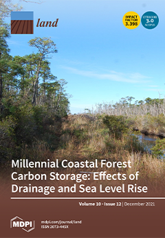
This 2015 image shows the role of a road and associated drainage ditch in accelerating ecosystem transition from healthy pond pine forest to ghost forest in response to sea level rise at the Alligator River National Wildlife Refuge in eastern North Carolina. Regionally, coastal ecosystem transition in response to sea-level rise is widespread, but our study shows that road networks and drainage systems accelerate the process due to enhanced inland propagation of flooding and salinity. Therefore, design of infrastructure in coastal forested landscapes must balance the need to protect human interests with the potential to alter hydrologic and salinity regimes in ways that compromise ecosystem function, currently manifested by the extensive formation of ghost forests along the US Atlantic and Gulf coastal plains, with significant implications for regional terrestrial C cycling and storage. View this paper.
  • Issues are regarded as officially published after their release is announced to the table of contents alert mailing list.
  • You may sign up for e-mail alerts to receive table of contents of newly released issues.
  • PDF is the official format for papers published in both, html and pdf forms. To view the papers in pdf format, click on the "PDF Full-text" link, and use the free Adobe Reader to open them.
Order results
Result details
Section
Select all
Export citation of selected articles as:
23 pages, 4889 KiB  
Article
Evaluation and Factor Analysis of Industrial Carbon Emission Efficiency Based on “Green-Technology Efficiency”—The Case of Yangtze River Basin, China
by Jingyi Wang, Kaisi Sun, Jiupai Ni and Deti Xie
Land 2021, 10(12), 1408; https://doi.org/10.3390/land10121408 - 20 Dec 2021
Cited by 19 | Viewed by 2666
Abstract
In the context of low-carbon development, effectively improving carbon emission efficiency is an inevitable requirement for achieving sustainable economic and social development. Based on panel data of 11 provinces and municipalities in the Yangtze River Basin (YRB), ranging from 2000 to 2019, this [...] Read more.
In the context of low-carbon development, effectively improving carbon emission efficiency is an inevitable requirement for achieving sustainable economic and social development. Based on panel data of 11 provinces and municipalities in the Yangtze River Basin (YRB), ranging from 2000 to 2019, this paper uses green-technology efficiency to measure industrial carbon emission efficiency via stochastic frontier analysis (SFA) incorporated with carbon productivity. This provides a comprehensive analytical framework for assessing the carbon emission efficiency, quantitatively measuring the reduction potential, and clarifying the incentive channels. The results are as follows: (1) The industrial carbon emission efficiency (ICEE) of YRB presents an increasing trend. Although differences in emission efficiency among provinces and municipalities are narrowing, their emission efficiency is still prominently imbalanced. (2) The potential for reducing industrial carbon emissions in this region shows an upward-to-downward trend. The decline in such potential of each province and municipality in recent years indicates that further reduction is becoming more difficult. (3) Effective means to improve ICEE are to improve the level of industrialization, promote technological innovation in industrial low-carbonization, and raise industrial productivity. Meanwhile, the significant spatial spillover effect of ICEE further emphasizes the necessity of strengthening the coordination of carbon reduction policies in YRB. The research in this paper adds a new perspective to the evaluation of ICEE and also provides reference and technical support for the government to enhance ICEE and formulate green and sustainable development policies. Full article
Show Figures

Figure 1

15 pages, 5075 KiB  
Article
Hydrogeomorphology as a Tool in the Evolutionary Analysis of the Dynamic Landscape—Application to Larrodrigo, Salamanca, Spain
by Lorena Lombana, Antonio Martínez-Graña, Marco Criado and Carlos Palacios
Land 2021, 10(12), 1407; https://doi.org/10.3390/land10121407 - 20 Dec 2021
Viewed by 1879
Abstract
Evolutionary analysis of the fluvial landscape provides relevant inputs for the environmental management of a territory, in such a way that the understanding of the dynamics of fluvial spaces becomes a preponderant factor in the definition of protection and management strategies. Although the [...] Read more.
Evolutionary analysis of the fluvial landscape provides relevant inputs for the environmental management of a territory, in such a way that the understanding of the dynamics of fluvial spaces becomes a preponderant factor in the definition of protection and management strategies. Although the development of geographic information systems is a step forward in the study of the landscape, it is necessary to establish methodological frameworks that make remote sensing techniques available at multiple spatio-temporal scales, especially in basins with high levels of intervention. In the present study, we develop a methodology for the analysis of the fluvial landscape development in the last century of a highly modified water body, through the detailed study of hydrogeomorphic elements, using remote sensing techniques including high-density surface data (LiDAR) and historical aerial imageries; when supported by fieldwork, these allow for the identification of the sequence of sedimentation–erosion zones, differentiating in detail the zones denominated as areas of current erosion, accretion zones, and historical erosion zones. An application of the methodology was carried out in the Larrodrigo stream, located in Salamanca, Spain. Full article
(This article belongs to the Special Issue Landscape Planning as a Catalyst for Sustainable Development)
Show Figures

Figure 1

20 pages, 2751 KiB  
Article
Multi-Scale Features of Regional Poverty and the Impact of Geographic Capital: A Case Study of Yanbian Korean Autonomous Prefecture in Jilin Province, China
by Binyan Wang, Junfeng Tian, Peifeng Yang and Baojie He
Land 2021, 10(12), 1406; https://doi.org/10.3390/land10121406 - 20 Dec 2021
Cited by 7 | Viewed by 2651
Abstract
Poverty is a challenge worldwide. Policy and regulations guiding anti-poverty measures for governments, NGOs, and multilateral institutions have not considered the spatial scale effect of regional poverty, resulting in low-efficiency poverty alleviation actions. This study addressed research gaps by analyzing the multi-scale (county, [...] Read more.
Poverty is a challenge worldwide. Policy and regulations guiding anti-poverty measures for governments, NGOs, and multilateral institutions have not considered the spatial scale effect of regional poverty, resulting in low-efficiency poverty alleviation actions. This study addressed research gaps by analyzing the multi-scale (county, township, and village) features of regional poverty in Yanbian Korean Autonomous Prefecture in Jilin province, China. It examined the impact of geographic capital and associated spatial heterogeneity from four dimensions: natural environment, transport location, facilities accessibility, and socioeconomic development. The results identified that regional poverty varied at different scales: lower-scale poverty had higher levels of spatial differences, agglomeration, and spatial autocorrelation than higher-scale poverty, and the “island effect” was prominent. The factors potentially impacting regional poverty varied at different scales for geographical capital. At the township scale, only transport location and socioeconomic development dimensions could make significant differences. Factors in all four dimensions could affect village-scale poverty significantly, and the natural environment dimension was more effective than the other three dimensions. The impact of geographic capital and its spatial heterogeneity at the village scale varied, implying that local and diverse anti-poverty measures should increase. This study improves understanding of the multi-scale features of regional poverty and supports the formulation of effective anti-poverty measures. Full article
(This article belongs to the Topic Climate Change and Environmental Sustainability)
Show Figures

Figure 1

13 pages, 2013 KiB  
Article
The Impact of China’s Grassland Ecological Compensation Policy on the Income Gap between Herder Households? A Case Study from a Typical Pilot Area
by Zhidong Li, Didi Rao and Moucheng Liu
Land 2021, 10(12), 1405; https://doi.org/10.3390/land10121405 - 20 Dec 2021
Cited by 10 | Viewed by 2395
Abstract
China’s policy of subsidies and rewards for grassland ecological protection (PSRGEP) aims to maintain the ecological function of grasslands and increase the income of herder households. Since 2011, the Chinese government has invested more than 150 billion yuan in this policy, making it [...] Read more.
China’s policy of subsidies and rewards for grassland ecological protection (PSRGEP) aims to maintain the ecological function of grasslands and increase the income of herder households. Since 2011, the Chinese government has invested more than 150 billion yuan in this policy, making it currently the largest grassland ecological compensation project in China. Based on a survey of 203 herder households in Xin Barag Left Banner, Inner Mongolia Autonomous Region, this study used the Lorenz curve and Gini index to describe the imbalance in the distribution of compensation funds. Then, the integrated livelihood capital scores before compensation were used as a baseline. The changes in ranking and standard deviation of the scores after receiving compensation funds were analysed to draw a conclusion about the impact on the income gap between herder households. Finally, we described the absolute income gap through a group comparison. The results show that the distribution of compensation funds is unbalanced (Gini index is 0.46). According to the order of compensation funds from high to low, the top 20% of sample herder households received 49% of the total funds. Given the unbalanced distribution, households with better family economic conditions received more compensation funds. After receiving the compensation funds, the change in the ranking of the household’s livelihood capital integrated score was small, but the standard deviation increased from 0.1697 to 0.1734, and the Gini index of the households’ capital integrated scores decreased from 0.35 to 0.34 (the coefficient of variation decreased from 0.66 to 0.63). The group with the highest integrated livelihood capital score received 3.6 times the compensation funds of the group with the lowest score. As a result, under the promotion of PSRGEP, the local absolute income gap has widened, but the relative income gap has reduced. This study evaluated the current distribution of compensation funds for PSRGEP, which could provide a scientific basis for managers to optimize the fund distribution in the future. Full article
Show Figures

Figure 1

16 pages, 946 KiB  
Article
Difference in Housing Finance Usage and Its Impact on Housing Wealth Inequality in Urban China
by Shan Yu and Can Cui
Land 2021, 10(12), 1404; https://doi.org/10.3390/land10121404 - 19 Dec 2021
Cited by 2 | Viewed by 2708
Abstract
With the increasing importance of financial loans in home purchases in urban China, the role of housing loans in the accumulation of housing wealth needs to be unraveled. Using the data from the 2017 China Household Finance Survey (CHFS), this study investigates the [...] Read more.
With the increasing importance of financial loans in home purchases in urban China, the role of housing loans in the accumulation of housing wealth needs to be unraveled. Using the data from the 2017 China Household Finance Survey (CHFS), this study investigates the use of housing loans and their impact on housing wealth inequality. It has been found that people with higher socioeconomic status and institutional advantages benefit more from housing provident fund loans and are more likely to fully invoke different financing channels to accumulate housing wealth. On the contrary, disadvantaged groups have to resort to costly market-based mortgages to finance their home purchases. This leads them to fall further behind in housing wealth accumulation. The spatial stratification of housing wealth accompanying the urban hierarchy was also observed and found to be closely linked to the type of housing loans. In this increasingly financialized era, relying on financial instruments in the process of household asset accumulation may further amplify the existing wealth inequality among social groups. Full article
Show Figures

Figure 1

27 pages, 1917 KiB  
Article
Comparative Study on Flora Characteristics and Species Diversity on Dam Slopes for Sustainable Ecological Management: Cases of Eight Dams in Korea
by Gwon-Soo Bahn, Sung-Yeol Kim and Jaeyong Choi
Land 2021, 10(12), 1403; https://doi.org/10.3390/land10121403 - 19 Dec 2021
Viewed by 2617
Abstract
Dams are gray infrastructure, providing various benefits such as flood control, water supply, and power generation. In order to create the next generation of infrastructure that explores how nature can act as infrastructure to meet development and ecological sustainability, artificial plantings have been [...] Read more.
Dams are gray infrastructure, providing various benefits such as flood control, water supply, and power generation. In order to create the next generation of infrastructure that explores how nature can act as infrastructure to meet development and ecological sustainability, artificial plantings have been attempted on dam slopes in Korea since 2000. As the planted trees are now stabilized to form a forest, it is time to study the floral characteristics and functions for effective ecological management and the safety of the dams. In this study, we investigated and analyzed flora in the slopes of eight dams in Korea. The comparative study of the whole flora in both the planted zones of the slopes of dams and left and right forests of dams revealed that the number of plant species was higher in the planted zones than in the left and right forests of the same size area. The plant family containing the greatest number of species in the slopes was Asteraceae, followed by Poaceae, Fabaceae, and Rosaceae. Currently, the community structures and families in the slopes of dams exhibit the characteristics of habitats in the initial stage of vegetation succession. Our investigation of planted species and immigration species in the slopes revealed that the latter comprised 89.9%. An average of 34.4% of species were interacting with the dam slope and the left and right forests. The species diversity index on dam slopes showed a tendency to be higher as the number of planted species increased and the period time increased. Average growth heights of planted trees were identified as 0.5–1.6 m for the shrubs layer, 3.5–4.5 m for the small trees layer, and 6.0–7.2 m for the trees layer. The heights of major trees, including Pinus densiflora, Quercus spp., Prunus sargentii, Styrax japonicus, and Cornus controversa, were similar to or higher than those of their counterparts in natural forests. As a result, dam slopes were similar to natural forests, having potential as habitats for various flora. To harmoniously maintain the ecological health and safety of water resource facilities of the slopes of dams, however, it is necessary to conduct periodic and various investigations on changes of the flora and growth of trees, and actively manage them. Full article
(This article belongs to the Special Issue Landscape Based Land Solutions and Big Data)
Show Figures

Graphical abstract

11 pages, 1270 KiB  
Communication
Improving Best Management Practice Decisions in Mixed Land Use and/or Municipal Watersheds: Should Approaches Be Standardized?
by Jason A. Hubbart
Land 2021, 10(12), 1402; https://doi.org/10.3390/land10121402 - 18 Dec 2021
Cited by 5 | Viewed by 2249
Abstract
Best management practices (BMP) are defined in the United States Clean Water Act (CWA) as practices or measures that have been demonstrated to be successful in protecting a given water resource from nonpoint source pollution. Unfortunately, the greatest majority of BMPs remain unvalidated [...] Read more.
Best management practices (BMP) are defined in the United States Clean Water Act (CWA) as practices or measures that have been demonstrated to be successful in protecting a given water resource from nonpoint source pollution. Unfortunately, the greatest majority of BMPs remain unvalidated in terms of demonstrations of success. Further, there is not a broadly accepted or standardized process of BMP implementation and monitoring methods. Conceivably, if standardized BMP validations were a possibility, practices would be much more transferrable, comparable, and prescriptive. The purpose of this brief communication is to present a generalized yet integrated and customizable BMP decision-making process to encourage decision makers to more deliberately work towards the establishment of standardized approaches to BMP monitoring and validation in mixed-use and/or municipal watersheds. Decision-making processes and challenges to BMP implementation and monitoring are presented that should be considered to advance the practice(s) of BMP implementation. Acceptance of standard approaches may result in more organized and transferrable BMP implementation policies and increased confidence in the responsible use of taxpayer dollars through broad acceptance of methods that yield predictable and replicable results. Full article
Show Figures

Figure 1

20 pages, 5661 KiB  
Article
Assessment of the Selected Regulating Ecosystem Services Using Ecosystem Services Matrix in Two Model Areas: Special Nature Reserve Obedska Bara (Serbia) and Protected Landscape Area Dunajske Luhy (Slovakia)
by Ivan Laco
Land 2021, 10(12), 1401; https://doi.org/10.3390/land10121401 - 18 Dec 2021
Cited by 1 | Viewed by 1953
Abstract
In this paper we are analyzing the potential of land cover features to provide three regulating ecosystem services (ESs), ES Local climate regulation, ES Water quality regulation and ES Biodiversity promotion, in two case study areas: Special nature reserve (SNR) Obedska bara (Serbia) [...] Read more.
In this paper we are analyzing the potential of land cover features to provide three regulating ecosystem services (ESs), ES Local climate regulation, ES Water quality regulation and ES Biodiversity promotion, in two case study areas: Special nature reserve (SNR) Obedska bara (Serbia) and Protected landscape area (PLA) Dunajske luhy (Slovakia). Regulating ESs are not only important for proper functioning of ecosystems, but they are also crucial for the existence of human society. To assess the potential of land cover features to provide regulating ESs, we used biophysical methods. The maps of land cover potential to provide regulating ES are the result of the analyses. The results indicate that forests are the most important ecosystems that provide ES Local climate regulation and ES Water quality regulation. For ES Biodiversity promotion, the most important ecosystems were natural and seminatural meadows, wetlands, natural and seminatural rivers and water bodies as well as forests. Overall SNR Obedska bara has higher potential to provide all three regulating ESs than PLA Dunajske luhy. These findings point to the importance of natural areas in ensuring the provision of regulating ESs. Properly selected landscape management is the key for maintaining or improving the potential of land cover features to provide regulating ESs. The research can help local authorities in decision making and in creating conservation strategies for selected protected areas. Full article
(This article belongs to the Special Issue Integrated Approach to Land Use Change Assessment)
Show Figures

Figure 1

23 pages, 1886 KiB  
Article
The Influence of Subjective and Objective Characteristics of Urban Human Settlements on Residents’ Life Satisfaction in China
by Xueming Li and He Liu
Land 2021, 10(12), 1400; https://doi.org/10.3390/land10121400 - 18 Dec 2021
Cited by 10 | Viewed by 2975
Abstract
Under the guidance of people-oriented development concepts, improving residents’ life satisfaction has gradually become the goal of urban governance. Based on Chinese household tracking survey data and national socio-economic statistics, this study used the entropy method, multi-layer linear regression model and geographically weighted [...] Read more.
Under the guidance of people-oriented development concepts, improving residents’ life satisfaction has gradually become the goal of urban governance. Based on Chinese household tracking survey data and national socio-economic statistics, this study used the entropy method, multi-layer linear regression model and geographically weighted regression model and discusses the spatial heterogeneity of the impact of objective environmental characteristics and subjective perceived characteristics of urban residential environments on residents’ life satisfaction. It is of great importance to study the mechanisms through which subjective and objective characteristics of urban human settlements influence living satisfaction among residents. It is also important to discuss how to improve living satisfaction levels through the urban human settlements and to realize high-quality urban development. The research results show that in 2018, the overall level of life satisfaction among Chinese urban residents was relatively high. However, it is still necessary to continue to optimize the urban human settlements to improve residents’ life satisfaction. The objective characteristics of the urban human settlements, such as natural environmental comfort and environmental health, have a significant positive impact on residents’ life satisfaction. Residents’ subjective perceptions of government integrity, environmental protection, wealth gap, social security, medical conditions and medical level, as well as residents’ individual gender, age and health status also have a significant impact on residents’ life satisfaction. The direction and intensity of effects of different elements of the urban human settlements and residents’ personal attributes on urban residents’ life satisfaction have different characteristics in different regions. Full article
(This article belongs to the Special Issue Quality of Urban Space versus Quality of Urban Life)
Show Figures

Figure 1

27 pages, 3988 KiB  
Article
Conserving Working Rangelands: A Social–Ecological Case Study from Northeastern Colorado
by Jasmine E. Bruno, Stephen J. Leisz, Jake S. Bobula and María E. Fernández-Giménez
Land 2021, 10(12), 1399; https://doi.org/10.3390/land10121399 - 17 Dec 2021
Cited by 2 | Viewed by 2119
Abstract
Land changes in rangeland systems cascade through interconnected social and ecological spheres, affecting both humans and the environment. This study applied a multi-method approach to examine the causes and consequences of change in two rangeland communities in northeastern (NE) Colorado. First, this study [...] Read more.
Land changes in rangeland systems cascade through interconnected social and ecological spheres, affecting both humans and the environment. This study applied a multi-method approach to examine the causes and consequences of change in two rangeland communities in northeastern (NE) Colorado. First, this study used a Random Forest supervised classifier to analyze 36 years of land-cover data and create a land-cover/use change classification model. Second, the research team analyzed transcripts of interviews with 32 ranchers, examining how ranchers’ adaptive strategies influence land-cover change trends. Lastly, the analysis integrated the quantitative and qualitative data, constructing a social–ecological rangeland change conceptual model. This study found that the cultivated area decreased in both study sites from 1984–2019, with 16.0% and 18.7% of each site transitioning out of the cultivated area. Moreover, 10.3% and 18.4% of each site, respectively, transitioned to herbaceous/grassland cover from 1984–2019. The qualitative analysis identified the role of conservation policies, such as open space programs, on land change. Also, despite the relatively small area that transitioned to developed cover—1.83% and 0.183% of each site—participants emphasized that the associated demographic and cultural shifts drive land-use change. This study highlights that while rangelands are undergoing social–ecological change, land-use decisions and land conservation programs can help mitigate the global trend of declining rangeland and grassland cover. Full article
Show Figures

Figure 1

23 pages, 4946 KiB  
Article
A Geospatial Approach to Measure Social Benefits in Urban Land Use Optimization Problem
by Md. Mostafizur Rahman and György Szabó
Land 2021, 10(12), 1398; https://doi.org/10.3390/land10121398 - 17 Dec 2021
Cited by 6 | Viewed by 2513
Abstract
Different conflicting objectives are used in urban land use optimization problems. The maximization of social benefit is one of the important objectives in urban land use optimization problems. Many researchers have used different methods to measure social benefits in land use optimization. Studies [...] Read more.
Different conflicting objectives are used in urban land use optimization problems. The maximization of social benefit is one of the important objectives in urban land use optimization problems. Many researchers have used different methods to measure social benefits in land use optimization. Studies show that there is no established method to measure social benefit in the urban land use allocation game. Against this background, this study aims to (a) identify the appropriate indicators as a measure of social benefit, and (b) propose a composite index to measure social benefit in urban land use optimization problems. Based on the literature review and expert opinion, this study identifies four indicators as a measure of social benefit. These are spatial compactness, land use compatibility, land use mix, and evenness of population distribution. Using the weighted sum approach, this study proposes a composite social benefit index (SBI) to measure social benefit in urban land use allocation/optimization problems and planning. The study suggests that spatial compactness is the most influential indicator to the SBI, but the most critical indicator is compatibility, whose 11.60% value reduction from 0.5 alters the decision of choice. Finally, the proposed method was applied in Rajshahi city in Bangladesh. The result suggests the potential of using SBI in the land use allocation problem. It is expected that the proposed social benefit index (SBI) will help the land use optimization and planning and will be helpful for decision makers. Full article
(This article belongs to the Special Issue Land: 10th Anniversary)
Show Figures

Figure 1

10 pages, 1302 KiB  
Article
Comparison of Compaction Alleviation Methods on Soil Health and Greenhouse Gas Emissions
by Jennifer Bussell, Felicity Crotty and Chris Stoate
Land 2021, 10(12), 1397; https://doi.org/10.3390/land10121397 - 17 Dec 2021
Cited by 2 | Viewed by 2440
Abstract
Soil compaction can occur due to trafficking by heavy equipment and be exacerbated by unfavourable conditions such as wet weather. Compaction can restrict crop growth and increase waterlogging, which can increase the production of the greenhouse gas nitrous oxide. Cultivation can be used [...] Read more.
Soil compaction can occur due to trafficking by heavy equipment and be exacerbated by unfavourable conditions such as wet weather. Compaction can restrict crop growth and increase waterlogging, which can increase the production of the greenhouse gas nitrous oxide. Cultivation can be used to alleviate compaction, but this can have negative impacts on earthworm abundance and increase the production of the greenhouse gas carbon dioxide. In this study, a field was purposefully compacted using trafficking, then in a replicated plot experiment, ploughing, low disturbance subsoiling and the application of a mycorrhizal inoculant were compared as methods of compaction alleviation, over two years of cropping. These methods were compared in terms of bulk density, penetration resistance, crop yield, greenhouse gas emissions and earthworm abundance. Ploughing alleviated topsoil compaction, as measured by bulk density and penetrometer resistance, and increased the crop biomass in one year of the study, although no yield differences were seen. Earthworm abundance was reduced in both years in the cultivated plots, and carbon dioxide flux increased significantly, although this was not significant in summer months. Outside of the summer months, nitrous oxide production increased in the non-cultivated treatments, which was attributed to increased denitrifying activity under compacted conditions. Full article
Show Figures

Figure 1

9 pages, 231 KiB  
Article
Who Started, Stopped, and Continued Participating in Outdoor Recreation during the COVID-19 Pandemic in the United States? Results from a National Panel Study
by B. Derrick Taff, William L. Rice, Ben Lawhon and Peter Newman
Land 2021, 10(12), 1396; https://doi.org/10.3390/land10121396 - 17 Dec 2021
Cited by 26 | Viewed by 9701
Abstract
The COVID-19 pandemic has been proposed as a catalyst for many U.S. residents to re-engage in outdoor recreation or engage in outdoor recreation for the first time. This manuscript describes the results of a representative U.S. national panel study aimed at better understanding [...] Read more.
The COVID-19 pandemic has been proposed as a catalyst for many U.S. residents to re-engage in outdoor recreation or engage in outdoor recreation for the first time. This manuscript describes the results of a representative U.S. national panel study aimed at better understanding the socio-demographic profile (gender, ethnicity, community type, income, and age) of those participants new to outdoor recreation since the start of the COVID-19 pandemic. In doing so, we address how these new outdoor recreationists differ from (1) those who frequently participated in outdoor recreation prior to the pandemic and continue to participate in outdoor recreation, (2) those who did not frequently participate in outdoor recreation prior to the pandemic and remain un-engaged, and (3) those who frequently participated in outdoor recreation prior to the pandemic but stopped their frequent participation following the onset of the pandemic. Results from this U.S. national study suggest that 35.8% of respondents indicated that they did not participate regularly in outdoor recreation prior to the pandemic or during the pandemic, 30.4% indicated that they did participate regularly in outdoor recreation prior to the pandemic and continued to do so regularly during the pandemic, and 13.5% indicated that they did participate regularly in outdoor recreation prior to the pandemic, but did not continue to do so during the pandemic. More than 20% of the sample indicated that they were new outdoor recreationists. The majority of respondents in all categories, including those that were new to outdoor recreation amidst the pandemic, identified as being white, however these new outdoor recreationists were also the least ethnically diverse. The previously but no longer outdoor recreationist respondents were significantly more ethnically diverse than the other three groups, and they tended to live in more urbanized settings. Discussion of these results includes implications for outdoor recreation managers, and researchers who seek to better understand who the COVID-19 pandemic has influenced with regard to outdoor recreation participation. Implications regarding social justice, access and equity to public places that facilitate outdoor recreation, and health-related policies are discussed. Full article
20 pages, 3718 KiB  
Article
Safeguarding Intangible Cultural Heritage: The Amazonian Kichwa People
by Claudia Patricia Maldonado-Erazo, Nancy P. Tierra-Tierra, María de la Cruz del Río-Rama and José Álvarez-García
Land 2021, 10(12), 1395; https://doi.org/10.3390/land10121395 - 17 Dec 2021
Cited by 6 | Viewed by 3233
Abstract
Indigenous communities express their concern about the weakening and low appreciation of their millenary and ancestral manifestations and knowledge, due to society’s accelerated globalization. This fact has caused intergenerational transmission to be minimal, resulting in a gradual cultural erosion and loss of collective [...] Read more.
Indigenous communities express their concern about the weakening and low appreciation of their millenary and ancestral manifestations and knowledge, due to society’s accelerated globalization. This fact has caused intergenerational transmission to be minimal, resulting in a gradual cultural erosion and loss of collective memory of human groups. The purpose of this study is to safeguard of the Intangible Cultural Heritage (ICH) of the Amazonian Kichwa nationality through identification and records of cultural manifestations. The analysis corresponds to a descriptive process of all the information collected, which was built from the development of multiple processes of cultural revitalization that correspond to in-depth interviews with community leaders and participatory workshops with all members of the community. During the process, an increase in the exchange of knowledge was observed, in addition to constant cultural insurgency in which the peoples maintain themselves in order to safeguard their cultures. Full article
Show Figures

Figure 1

26 pages, 1846 KiB  
Article
Determinants of the Land Registration Information System Operational Success: Empirical Evidence from Ethiopia
by Shewakena Aytenfisu Abab, Feyera Senbeta Wakjira and Tamirat Tefera Negash
Land 2021, 10(12), 1394; https://doi.org/10.3390/land10121394 - 16 Dec 2021
Cited by 7 | Viewed by 4590
Abstract
Ethiopia has embarked on one of the largest digitalization programs for rural land registration in Africa. The program is called the national rural land administration information system (NRLAIS). Over the past couple of years, NRLAIS was rolled-out and made operational in over 180 [...] Read more.
Ethiopia has embarked on one of the largest digitalization programs for rural land registration in Africa. The program is called the national rural land administration information system (NRLAIS). Over the past couple of years, NRLAIS was rolled-out and made operational in over 180 woredas (districts). There is, however, limited empirical evidence on whether and to what extent NRLAIS has been successful. This study explores the factors that influence the acceptance and actual use of NRLAIS to gauge its operational success in Ethiopia. Data were collected both from primary and secondary sources using surveys, key informant interviews, and a literature review. Survey data were collected from 201 staff of 50 woreda land administration offices in three regional states (Amhara, Oromia, and SNNP) and analyzed using a structural equation model. The results revealed that system quality, information quality, service quality, and perceived usefulness of NRLAIS have positively and significantly influenced the acceptance and actual use of the system. However, perceived ease of use has an insignificant influence. The predictive relevance of the research model is significant and indicates substantial operational success of NRLAIS. The quick acceptance and use of NRLAIS will likely improve service delivery, promote data integration, and strengthen informed decision-making. The study recommends strengthening behavioral changes of the land administration experts through two enhanced service quality measures—technical and operational capacity to a robust and sustainable digitalization. Policymakers could leverage operational success to upgrade the NRLAIS into a unified national land registration information system that bridges the urban–rural land governance divide. Full article
(This article belongs to the Special Issue Land Perspectives: People, Tenure, Planning, Tools, Space, and Health)
Show Figures

Figure 1

19 pages, 2577 KiB  
Article
The Alien Plants That Threaten South Africa’s Mountain Ecosystems
by Kim Canavan, Susan Canavan, Vincent Ralph Clark, Onalenna Gwate, David Mark Richardson, Guy Frederick Sutton and Grant Douglas Martin
Land 2021, 10(12), 1393; https://doi.org/10.3390/land10121393 - 16 Dec 2021
Cited by 5 | Viewed by 3692
Abstract
The six major mountain ranges in South Africa support critically important ecosystem services—notably water production—and are rich in biodiversity and endemism. These mountains are threatened by detrimental land uses, unsustainable use of natural resources, climate change, and invasive alien plants. Invasive alien plants [...] Read more.
The six major mountain ranges in South Africa support critically important ecosystem services—notably water production—and are rich in biodiversity and endemism. These mountains are threatened by detrimental land uses, unsustainable use of natural resources, climate change, and invasive alien plants. Invasive alien plants pose substantial and rapidly increasing problems in mountainous areas worldwide. However, little is known about the extent of plant invasions in the mountains of South Africa. This study assessed the status of alien plants in South African mountains by determining sampling efforts, species compositions and abundances across the six ranges in lower-and higher-elevation areas. Species occurrence records were obtained from three databases that used various approaches (roadside surveys, citizen science observations, focused botanical surveys). Most mountain ranges were found to be undersampled, and species composition assessments were only possible for two ranges. The majority of abundant alien plants in both the lower- and higher-elevation areas were species with broad ecological tolerances and characterised by long distance seed dispersal. These prevalent species were mostly woody plants—particularly tree species in the genera Acacia, Pinus, and Prosopis—that are contributing to the trend of woody plant encroachment across South African mountains. We suggest improved mountain-specific surveys to create a database which could be used to develop management strategies appropriate for each mountain range. Full article
(This article belongs to the Special Issue Mountains under Pressure)
Show Figures

Figure 1

15 pages, 1114 KiB  
Article
Biochar Enriched with Buffalo Slurry Improved Soil Nitrogen and Carbon Dynamics, Nutrient Uptake and Growth Attributes of Wheat by Reducing Leaching Losses of Nutrients
by Hafiz Muhammad Rashad Javeed, Mazhar Ali, Imtiaz Ahmed, Xiukang Wang, Ibrahim Al-Ashkar, Rafi Qamar, Abdullah Ibrahim, Muhammad Habib-Ur-Rahman, Allah Ditta and Ayman EL Sabagh
Land 2021, 10(12), 1392; https://doi.org/10.3390/land10121392 - 16 Dec 2021
Cited by 9 | Viewed by 2465
Abstract
The present investigation was conducted to understand the role of enriched biochar on soil nitrogen and carbon dynamics, leaching losses of nutrients, and growth attributes of wheat. Buffalo slurry (BS) was used to enrich the biochar for 24 h and 2% biochar (SB) [...] Read more.
The present investigation was conducted to understand the role of enriched biochar on soil nitrogen and carbon dynamics, leaching losses of nutrients, and growth attributes of wheat. Buffalo slurry (BS) was used to enrich the biochar for 24 h and 2% biochar (SB) or enriched biochar (SEB) was used. Enrichment of biochar with BS as SEB improved the C and N contents of biochar by 33–310% and 41–286% respectively. The application of biochar (SB) and enriched biochar (SEB) reduced the net nitrification by 81% and 94%, ammonification by 48% and 74%, and carbon dioxide by 50% and 92% respectively as compared to control. The leaching losses minerals i.e., C (by 30%), N (by 125%), P (by 50%), K (by 82%), Na (by 9%), Ca (by 24%), and Mg (by 12%) was decreased in SEB treatments compared to control. The soil enzyme activities, microbial biomass (MBC and MBN), wheat agronomy, soil bulk density and soil pore density, mineral uptake from the soil, and mineral contents in the plant body were improved in the SEB as compared to SB and control treatments. Our results revealed that the biochar enrichment process could improve the C and N storage in the soil reservoir and lower the environmental risks to soil and water. Full article
Show Figures

Figure 1

21 pages, 845 KiB  
Article
The Assessment of Density Bonus in Building Renovation Interventions. The Case of the City of Florence in Italy
by Fabrizio Battisti and Orazio Campo
Land 2021, 10(12), 1391; https://doi.org/10.3390/land10121391 - 15 Dec 2021
Cited by 6 | Viewed by 2142 | Correction
Abstract
The European Green Deal indicates the renovation of both public and private buildings as a key element for the improvement of energy efficiency in the building stock, in order to reach the goals of the document itself. New incentives, also including density bonus, [...] Read more.
The European Green Deal indicates the renovation of both public and private buildings as a key element for the improvement of energy efficiency in the building stock, in order to reach the goals of the document itself. New incentives, also including density bonus, can significantly contribute to foster diffuse actions. In Italy, the density bonus is under testing: the current framework has produced profitability for regeneration in some areas and unprofitability in others. This has led to a non-diffuse renewal, widening differences in richness and quality throughout territories subjected to the same reward measure. A territory is characterized by a high degree of typological and qualitative fragmentation and dissimilarity. Thus, the aim of the present work is the construction of a model that allows for identifying the entity of the reward measure in terms of density bonus. Density bonus can determine the feasibility of renovation interventions—in economic-financial terms and in relation to urban impact—taking into account the characteristics of the context (or micro-context) where they are performed. The research model is based on a Balance Sheet Model and is applied to the city of Florence. The model suggests an innovative approach where urban, landscape and environmental impacts produced by the density bonus are evaluated according to the economic amount needed for their mitigation. The expected results in the application of the model consist in the definition of an iso-bonus map organized by areas. Full article
Show Figures

Figure 1

19 pages, 3165 KiB  
Article
Identification of Regional Drought Processes in North China Using MCI Analysis
by Xiuhua Cai, Wenqian Zhang, Xiaoyi Fang, Qiang Zhang, Cunjie Zhang, Dong Chen, Chen Cheng, Wenjie Fan and Ying Yu
Land 2021, 10(12), 1390; https://doi.org/10.3390/land10121390 - 15 Dec 2021
Cited by 7 | Viewed by 3468
Abstract
Comprehensive identification of drought events is of great significance for monitoring and evaluating drought processes. Based on the date of daily precipitation, temperature and drought-affected area of 403 meteorological stations in North China from 1960 to 2019, the Comprehensive Drought Process Intensity Index [...] Read more.
Comprehensive identification of drought events is of great significance for monitoring and evaluating drought processes. Based on the date of daily precipitation, temperature and drought-affected area of 403 meteorological stations in North China from 1960 to 2019, the Comprehensive Drought Process Intensity Index (CDPII) has been developed by using the Meteorological-drought Composite Index (MCI) and regional drought process identification method, as well as the EIDR theory method. The regional drought processes in the past 60 years in North China, including Beijing, Tianjin, Hebei, Shanxi and Middle Inner Mongolia, were analyzed and identified. The result shows that the distribution characteristic of droughts with different intensities is as follows: The number of days of all annual-average mild droughts, moderate droughts and severe droughts was highest in Tianjin and that of extreme droughts was highest in Shanxi. The number of days of mild droughts was highest in May and lowest in January. The number of days of moderate droughts was highest in June. The number of days with mild and moderate drought showed an overall increasing trend, while the number of days with severe drought and above showed an overall decreasing trend (through a 95% significance test). The number of drought days was the highest in the 1990s. The annual frequency of drought is between 66.7% and 86.7%; the drought frequency in Hebei is the highest at 86.7%, followed by Beijing at 80%. There were 75 regional drought processes in North China from 1960 to 2019, and the correlation coefficient between process intensity and the drought-affected area was 0.55, which passed the 99% significance test. The comprehensive intensity of drought process from 27 April to 1 September 1972 was the strongest. From 18 May to 31 October 1965, the drought lasted 167 days. The overall drought intensity had a slight weakening trend in the past 60 years. A total of 75 regional drought processes occurred in North China, and the process intensity showed a trend of wavy decline with a determination coefficient (R2) of 0.079 (95% significance test). Overall, the regional drought process identification method and strength assessment result tally with the drought disaster, which can better identify the regional drought process. Furthermore, including the last days, the average intensity, average scope comprehensive strength, there are many angles to monitor and evaluate the drought and drought process. These provide a reference for drought control and decision-making. Full article
Show Figures

Figure 1

27 pages, 4988 KiB  
Article
Prediction of Crop Yield for New Mexico Based on Climate and Remote Sensing Data for the 1920–2019 Period
by Kamini Yadav and Hatim M. E. Geli
Land 2021, 10(12), 1389; https://doi.org/10.3390/land10121389 - 15 Dec 2021
Cited by 8 | Viewed by 2960
Abstract
Agricultural production systems in New Mexico (NM) are under increased pressure due to climate change, drought, increased temperature, and variable precipitation, which can affect crop yields, feeds, and livestock grazing. Developing more sustainable production systems requires long-term measurements and assessment of climate change [...] Read more.
Agricultural production systems in New Mexico (NM) are under increased pressure due to climate change, drought, increased temperature, and variable precipitation, which can affect crop yields, feeds, and livestock grazing. Developing more sustainable production systems requires long-term measurements and assessment of climate change impacts on yields, especially over such a vulnerable region. Providing accurate yield predictions plays a key role in addressing a critical sustainability gap. The goal of this study is the development of effective crop yield predictions to allow for a better-informed cropland management and future production potential, and to develop climate-smart adaptation strategies for increased food security. The objectives were to (1) identify the most important climate variables that significantly influence and can be used to effectively predict yield, (2) evaluate the advantage of using remotely sensed data alone and in combination with climate variables for yield prediction, and (3) determine the significance of using short compared to long historical data records for yield prediction. This study focused on yield prediction for corn, sorghum, alfalfa, and wheat using climate and remotely sensed data for the 1920–2019 period. The results indicated that the use of normalized difference vegetation index (NDVI) alone is less accurate in predicting crop yields. The combination of climate and NDVI variables provided better predictions compared to the use of NDVI only to predict wheat, sorghum, and corn yields. However, the use of a climate only model performed better in predicting alfalfa yield. Yield predictions can be more accurate with the use of shorter data periods that are based on region-specific trends. The identification of the most important climate variables and accurate yield prediction pertaining to New Mexico’s agricultural systems can aid the state in developing climate change mitigation and adaptation strategies to enhance the sustainability of these systems. Full article
(This article belongs to the Special Issue Advances in Remote Sensing for Crop Monitoring and Yield Estimation)
Show Figures

Figure 1

16 pages, 44826 KiB  
Article
The Effects of a Megafire on Ecosystem Services and the Pace of Landscape Recovery
by Diana Mancilla-Ruiz, Francisco de la Barrera, Sergio González and Ana Huaico
Land 2021, 10(12), 1388; https://doi.org/10.3390/land10121388 - 15 Dec 2021
Cited by 3 | Viewed by 3381
Abstract
(1) Background: Megafires have affected several regions in the world (e.g., Australia, California), including, in 2017, the central and south-central zones of Chile. These areas represent real laboratories to monitor the impacts on the sustainability of landscapes and their recovery after fires. The [...] Read more.
(1) Background: Megafires have affected several regions in the world (e.g., Australia, California), including, in 2017, the central and south-central zones of Chile. These areas represent real laboratories to monitor the impacts on the sustainability of landscapes and their recovery after fires. The present research examines the modification of dynamics and the provision of ecosystem services by a megafire in a Mediterranean landscape in central Chile, combining remote sensing technologies and ecosystem service assessments. (2) Methods: Land cover and spectral indices (NBRI, BAIS-2, NDVI, and EVI) were measured using Sentinel-2 imagery, while the provision of ecosystem services was evaluated using an expert-based matrix. (3) Results: The megafire affected forest plantations, formerly the dominant land cover, as well as other ecosystems, e.g., native forests. After five years, the landscape is dominated by exotic shrublands and grasslands. (4) Conclusions: The megafire caused a loss of 50% of the landscape’s capacity to supply ecosystem services. Given that native forests are the best provider of ecosystem services in this landscape, restoration is a key to recovering landscape sustainability. Full article
Show Figures

Graphical abstract

25 pages, 11216 KiB  
Article
Sub-Watershed Parameter Transplantation Method for Non-Point Source Pollution Estimation in Complex Underlying Surface Environment
by Xuekai Chen, Guojian He, Xiaobo Liu, Bogen Li, Wenqi Peng, Fei Dong, Aiping Huang, Weijie Wang and Qiuyue Lian
Land 2021, 10(12), 1387; https://doi.org/10.3390/land10121387 - 14 Dec 2021
Cited by 7 | Viewed by 2105
Abstract
The prevention and control of non-point source pollution is an important link in managing basin water quality and is an important factor governing the environmental protection of watershed water in China over the next few decades. The control of non-point source pollution relies [...] Read more.
The prevention and control of non-point source pollution is an important link in managing basin water quality and is an important factor governing the environmental protection of watershed water in China over the next few decades. The control of non-point source pollution relies on the recognition of the amount, location, and influencing factors. The watershed nonpoint source pollution mechanism model is an effective method to address the issue. However, due to the complexity and randomness of non-point source pollution, both the development and application of the watershed water environment model have always focused on the accuracy and rationality of model parameters. In this pursuit, the present study envisaged the temporal and spatial heterogeneity of non-point source pollution caused by the complex underlying surface conditions of the watershed, and the insufficient coverage of hydrological and water quality monitoring stations. A refined watershed non-point source pollution simulation method, combining the Monte Carlo analytic hierarchy process (MCAHP) and the sub-watershed parameter transplantation method (SWPT), was established on the basis of the migration and transformation theory of the non-point source pollution, considering the index selection, watershed division, sub-watershed simulation, and parameter migration. Taking the Erhai Lake, a typical plateau lake in China, as the representative research object, the MCAHP method effectively reduced the uncertainty of the weights of the watershed division indexes compared to the traditional AHP method. Furthermore, compared to the traditional all watershed parameter simulation (AWPS) approach, the simulation accuracy was improved by 40% using the SWPT method, which is important for the prevention and control of non-point source pollution in large-scale watersheds with significant differences in climatic and topographic conditions. Based on the simulation results, the key factors affecting the load of the non-point source pollution in the Erhai watershed were identified. The results showed that the agricultural land in Erhai Lake contributed a majority of the load for several reasons, including the application of nitro phosphor complex fertilizer. Among the different soil types, paddy soil was responsible for the largest pollution load of total nitrogen and total phosphorus discharge into the lake. The zones with slopes of 0–18° were found to be the appropriate area for farming. Our study presents technical methods for the assessment, prevention, and control of non-point source pollution load in complex watersheds. Full article
(This article belongs to the Special Issue Understanding Watershed Connectivity in a Changing Planet)
Show Figures

Figure 1

30 pages, 2725 KiB  
Review
A Framework for Reviewing Silvopastoralism: A New Zealand Hill Country Case Study
by Thomas H. Mackay-Smith, Lucy Burkitt, Janet Reid, Ignacio F. López and Chris Phillips
Land 2021, 10(12), 1386; https://doi.org/10.3390/land10121386 - 14 Dec 2021
Cited by 10 | Viewed by 3295 | Correction
Abstract
Silvopastoral systems can be innovative solutions to agricultural environmental degradation, especially in hilly and mountainous regions. A framework that expresses the holistic nature of silvopastoral systems is required so research directions can be unbiased and informed. This paper presents a novel framework that [...] Read more.
Silvopastoral systems can be innovative solutions to agricultural environmental degradation, especially in hilly and mountainous regions. A framework that expresses the holistic nature of silvopastoral systems is required so research directions can be unbiased and informed. This paper presents a novel framework that relates the full range of known silvopastoral outcomes to bio-physical tree attributes, and uses it to generate research priorities for a New Zealand hill country case study. Current research is reviewed and compared for poplar (Populus spp.), the most commonly planted silvopastoral tree in New Zealand hill country, and kānuka (Kunzea spp.), a novel and potentially promising native alternative. The framework highlights the many potential benefits of kānuka, many of which are underappreciated hill country silvopastoral outcomes, and draws attention to the specific outcome research gaps for poplar, despite their widespread use. The framework provides a formalised tool for reviewing and generating research priorities for silvopastoral trees, and provides a clear example of how it can be used to inform research directions in silvopastoral systems, globally. Full article
(This article belongs to the Special Issue Mountains under Pressure)
Show Figures

Figure 1

21 pages, 4330 KiB  
Article
Collective and Social Representations on Nature and Environment: Social Psychology Investigation in Rural Areas
by Iulian Dincă, Dragoș Dărăbăneanu and Ionuț Mihai Oprea
Land 2021, 10(12), 1385; https://doi.org/10.3390/land10121385 - 14 Dec 2021
Cited by 1 | Viewed by 2989
Abstract
This is a qualitative research based on a phenomenological perspective of understanding, that aim to captures the way in which the population of rural areas from the western part of Romania understands the terms of nature and environment. Starting from valuable scientific studies [...] Read more.
This is a qualitative research based on a phenomenological perspective of understanding, that aim to captures the way in which the population of rural areas from the western part of Romania understands the terms of nature and environment. Starting from valuable scientific studies related to the relationship between man and nature, we propose an original interdisciplinary approach that combines social methodology with a geographical, ecological and land use perspective. This study aims to identify the forms in which social representations about nature and environment are outlined on the level of rural areas people perceptions. As Romania is a European Union member state, its rural areas have seen transformations and changes in detail that reflect in the environmental-geographical ambience typical of the three main relief types (mountains, hills and plains), the mixed geomorphological type, its residents’ basic aspirations and conscious attitudinal and behavioral levels. The two study benchmarks are the notions of nature and environment, raising perception sensitivities and everyday concerns belonging to the residents of the rural areas surveyed. The administrative unit of Bihor County, belonging to the northern half of the Crișana Province and comprised of rural communities in 97 villages, was selected as the study’s target area. These villages were selected in such a way that they had to meet the requirements of balance and diversity of local environmental conditions, land use and the result of changing their land cover and the socio-geodemographic conditions of the population. A series of 1576 questionnaires were administered to subjects who are over 18 years old and are aware of the reality of their places. The results of the applied tests (Levene’s test) show that the concrete factors of daily activities are very good predictors of the relationship between man and nature. Full article
Show Figures

Figure 1

18 pages, 14982 KiB  
Article
Crop Intensity Mapping Using Dynamic Time Warping and Machine Learning from Multi-Temporal PlanetScope Data
by Raihan Rafif, Sandiaga Swahyu Kusuma, Siti Saringatin, Giara Iman Nanda, Pramaditya Wicaksono and Sanjiwana Arjasakusuma
Land 2021, 10(12), 1384; https://doi.org/10.3390/land10121384 - 14 Dec 2021
Cited by 9 | Viewed by 2671
Abstract
Crop intensity information describes the productivity and the sustainability of agricultural land. This information can be used to determine which agricultural lands should be prioritized for intensification or protection. Time-series data from remote sensing can be used to derive the crop intensity information; [...] Read more.
Crop intensity information describes the productivity and the sustainability of agricultural land. This information can be used to determine which agricultural lands should be prioritized for intensification or protection. Time-series data from remote sensing can be used to derive the crop intensity information; however, this application is limited when using medium to coarse resolution data. This study aims to use 3.7 m-PlanetScope™ Dove constellation data, which provides daily observations, to map crop intensity information for agricultural land in Magelang District, Indonesia. Two-stage histogram matching, before and after the monthly median composites, is used to normalize the PlanetScope data and to generate monthly data to map crop intensity information. Several methods including Time-Weighted Dynamic Time Warping (TWDTW) and the machine-learning algorithms: Random Forest (RF), Extremely Randomized Trees (ET), and Extreme Gradient Boosting (XGB) are employed in this study, and the results are validated using field survey data. Our results show that XGB generated the highest overall accuracy (OA) (95 ± 4%), followed by RF (92 ± 5%), ET (87 ± 6%), and TWDTW (81 ± 8%), for mapping four-classes of cropping intensity, with the near-infrared (NIR) band being the most important variable for identifying cropping intensity. This study demonstrates the potential of PlanetScope data for the production of cropping intensity maps at detailed resolutions. Full article
(This article belongs to the Special Issue Advances in Remote Sensing for Crop Monitoring and Yield Estimation)
Show Figures

Figure 1

12 pages, 9330 KiB  
Article
Estimation of the Rational Range of Ecological Compensation to Address Land Degradation in the Poverty Belt around Beijing and Tianjin, China
by Haiming Yan, Wei Li, Huicai Yang, Xiaonan Guo, Xingran Liu and Wenru Jia
Land 2021, 10(12), 1383; https://doi.org/10.3390/land10121383 - 14 Dec 2021
Cited by 2 | Viewed by 2032
Abstract
Ecological compensation provides innovative ecological solutions for addressing land degradation and guaranteeing the sustainable provision of essential ecosystem services. This study estimated the ecosystem service value and the opportunity cost of land use in the Poverty Belt of China—around Beijing and Tianjin—from 1980 [...] Read more.
Ecological compensation provides innovative ecological solutions for addressing land degradation and guaranteeing the sustainable provision of essential ecosystem services. This study estimated the ecosystem service value and the opportunity cost of land use in the Poverty Belt of China—around Beijing and Tianjin—from 1980 to 2015 on the small watershed scale, and thereafter estimated the rational range of ecological compensation in this ecologically fragile zone. Results showed that the total ecosystem service value in the study area gradually decreased from CNY 54.198 billion in 1980 to CNY 53.912 billion in 2015. Moreover, the annual total ecological compensation of the whole study area ranged between CNY 2.67 billion and 2.83 billion. More specifically, areas with higher ecological compensation standards are mainly concentrated in the northwestern and northern parts of the study area, with a lower economic development level, while areas with lower ecological compensation standards are mainly located in areas with a relatively high level of economic development, e.g., the southern and southeastern parts of the study area. These results can provide valuable decision-support information for the design and optimization of ecological compensation to address land degradation along with rapid urbanization in the Beijing–Tianjin–Hebei region. Full article
Show Figures

Figure 1

24 pages, 5031 KiB  
Article
Impacts of Future Sea-Level Rise under Global Warming Assessed from Tide Gauge Records: A Case Study of the East Coast Economic Region of Peninsular Malaysia
by Milad Bagheri, Zelina Z. Ibrahim, Mohd Fadzil Akhir, Bahareh Oryani, Shahabaldin Rezania, Isabelle D. Wolf, Amin Beiranvand Pour and Wan Izatul Asma Wan Talaat
Land 2021, 10(12), 1382; https://doi.org/10.3390/land10121382 - 14 Dec 2021
Cited by 7 | Viewed by 3785
Abstract
The effects of global warming are putting the world’s coasts at risk. Coastal planners need relatively accurate projections of the rate of sea-level rise and its possible consequences, such as extreme sea-level changes, flooding, and coastal erosion. The east coast of Peninsular Malaysia [...] Read more.
The effects of global warming are putting the world’s coasts at risk. Coastal planners need relatively accurate projections of the rate of sea-level rise and its possible consequences, such as extreme sea-level changes, flooding, and coastal erosion. The east coast of Peninsular Malaysia is vulnerable to sea-level change. The purpose of this study is to present an Artificial Neural Network (ANN) model to analyse sea-level change based on observed data of tide gauge, rainfall, sea level pressure, sea surface temperature, and wind. A Feed-forward Neural Network (FNN) approach was used on observed data from 1991 to 2012 to simulate and predict the sea level change until 2020 from five tide gauge stations in Kuala Terengganu along the East Coast of Malaysia. From 1991 to 2020, predictions estimate that sea level would increase at a pace of roughly 4.60 mm/year on average, with a rate of 2.05 ± 7.16 mm on the East Coast of Peninsular Malaysia. This study shows that Peninsular Malaysia’s East Coast is vulnerable to sea-level rise, particularly at Kula Terengganu, Terengganu state, with a rate of 1.38 ± 7.59 mm/year, and Tanjung Gelang, Pahang state, with a rate of 1.87 ± 7.33 mm/year. As a result, strategies and planning for long-term adaptation are needed to control potential consequences. Our research provides crucial information for decision-makers seeking to protect coastal cities from the risks of rising sea levels. Full article
Show Figures

Figure 1

16 pages, 2548 KiB  
Article
Threat Ranking to Improve Conservation Planning: An Example from the Gediz Delta, Turkey
by Dilara Arslan, Kerim Çiçek, Ömer Döndüren and Lisa Ernoul
Land 2021, 10(12), 1381; https://doi.org/10.3390/land10121381 - 14 Dec 2021
Cited by 2 | Viewed by 2985
Abstract
Mediterranean wetlands are among the most threatened natural areas. The needs and demands of an increasing human population are modifying land use and converting natural habitats into artificial areas. In order to combat these trends, effective conservation planning needs to provide clear, systematic [...] Read more.
Mediterranean wetlands are among the most threatened natural areas. The needs and demands of an increasing human population are modifying land use and converting natural habitats into artificial areas. In order to combat these trends, effective conservation planning needs to provide clear, systematic identification of threats to find sustainable conservation strategies. In this case study, we evaluated current threats in the Gediz Delta (Turkey) using a multi-method approach. First, we did a comprehensive literature review and stakeholder interviews to identify existing threats. We then did a complete survey of the Delta through intensive fieldwork. The threats were coded and ranked using the conservation standards. We used the threat ranking and field survey to map the most vulnerable areas of the Delta. The most commonly observed threats in the field were pollution and agriculture and aquaculture activities. According to the threat ranking, the most important threats are climate change and residential and commercial development. The habitats that are most at risk are agricultural grassland habitats. The results indicate a need to extend conservation actions in the inner part of the Delta. In addition, the multi-method threat ranking approach could serve as a model to improve conservation planning in other sites worldwide. Full article
(This article belongs to the Special Issue Land: 10th Anniversary)
Show Figures

Figure 1

23 pages, 5710 KiB  
Article
The Prediction of Carbon Emission Information in Yangtze River Economic Zone by Deep Learning
by Huafang Huang, Xiaomao Wu and Xianfu Cheng
Land 2021, 10(12), 1380; https://doi.org/10.3390/land10121380 - 13 Dec 2021
Cited by 18 | Viewed by 3129
Abstract
This study aimed to respond to the national “carbon peak” mid-and long-term policy plan, comprehensively promote energy conservation and emission reduction, and accurately manage and predict carbon emissions. Firstly, the proposed method analyzes the Yangtze River Economic Belt as well as its “carbon [...] Read more.
This study aimed to respond to the national “carbon peak” mid-and long-term policy plan, comprehensively promote energy conservation and emission reduction, and accurately manage and predict carbon emissions. Firstly, the proposed method analyzes the Yangtze River Economic Belt as well as its “carbon peak” and carbon emissions. Secondly, a support vector regression (SVR) machine prediction model is proposed for the carbon emission information prediction of the Yangtze River Economic Zone. This experiment uses a long short-term memory neural network (LSTM) to train the model and realize the experiment’s prediction of carbon emissions. Finally, this study obtained the fitting results of the prediction model and the training model, as well as the prediction results of the prediction model. Information indicators such as the scale of industry investment, labor efficiency output, and carbon emission intensity that affect carbon emissions in the “Yangtze River Economic Belt” basin can be used to accurately predict the carbon emissions information under this model. Therefore, the experiment shows that the SVR model for solving complex nonlinear problems can achieve a relatively excellent prediction effect under the training of LSTM. The deep learning model adopted herein realized the accurate prediction of carbon emission information in the Yangtze River Economic Zone and expanded the application space of deep learning. It provides a reference for the model in related fields of carbon emission information prediction, which has certain reference significance. Full article
Show Figures

Figure 1

19 pages, 353 KiB  
Article
Challenges and Opportunities for Public Participation in Urban and Regional Planning during the COVID-19 Pandemic—Lessons Learned for the Future
by Marijana Pantić, Juaneé Cilliers, Guido Cimadomo, Fernando Montaño, Olusola Olufemi, Sally Torres Mallma and Johan van den Berg
Land 2021, 10(12), 1379; https://doi.org/10.3390/land10121379 - 13 Dec 2021
Cited by 22 | Viewed by 4402
Abstract
The COVID-19 pandemic has spurred significant changes in the fields of economic development, social issues, everyday life, etc. Activities that used to depend on face-to-face communication were firstly suspended and then shifted to new forms of communication. This includes the public participation process [...] Read more.
The COVID-19 pandemic has spurred significant changes in the fields of economic development, social issues, everyday life, etc. Activities that used to depend on face-to-face communication were firstly suspended and then shifted to new forms of communication. This includes the public participation process in urban and spatial planning. Therefore, this study explores the new domain developed in urban and spatial planning with regard to public participation and surmises future realms in the post-pandemic era. On the occasion of the virtual collaboration platform Cyber Agora organized by the ISOCARP (International Society of City and Regional Planners), chosen participants got together virtually to share, discuss, and compare their practical knowledge in public participation before and during COVID-19. In addition, they addressed the potential benefits of shifting from traditional to virtual participation and potential benefits in the post-COVID-19 era. Considering the collected data and understanding them in the light of the available literature, this study concludes that the application of a combined approach (using both traditional and virtual modes of participation) is recommended because it would enable a larger number and higher diversity of participants. The study also elaborates particular modes of virtual participation with the pros and cons of their use in a particular context. Full article
(This article belongs to the Special Issue Reflecting on the Future of the Built Environment)
Previous Issue
Next Issue
Back to TopTop