Next Issue
Volume 9, June
Previous Issue
Volume 9, April


Water, Volume 9, Issue 5 (May 2017) – 63 articles

Cover Story (view full-size image): 
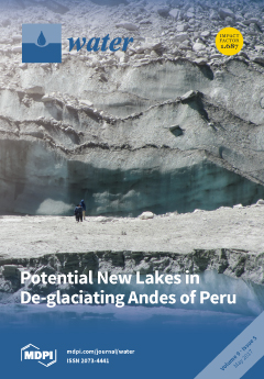
Global warming causes rapid shrinking of mountain glaciers and the formation of numerous new lakes. Such new lakes can be amplifiers of natural hazards to downstream populations, but also constitute tourist attractions, offer new potential for hydropower, and may be of interest for water management. Using GIS-based analysis and modeling techniques, a systematic inventory of glacier-bed overdeepenings as sites of possible future lake formation was compiled for the still glacierized parts of the Peruvian Andes. View this paper
  • Issues are regarded as officially published after their release is announced to the table of contents alert mailing list.
  • You may sign up for e-mail alerts to receive table of contents of newly released issues.
  • PDF is the official format for papers published in both, html and pdf forms. To view the papers in pdf format, click on the "PDF Full-text" link, and use the free Adobe Reader to open them.
Order results
Result details
Section
Select all
Export citation of selected articles as:
1293 KiB  
Article
Understanding the Role of Groundwater in a Remote Transboundary Lake (Hulun Lake, China)
by Hongbin Gao, M. Cathryn Ryan, Changyou Li and Biao Sun
Water 2017, 9(5), 363; https://doi.org/10.3390/w9050363 - 22 May 2017
Cited by 22 | Viewed by 6106
Abstract
Hulun Lake, located in a remote, semi-arid area in the northeast part of Inner Mongolia, China, shares a transboundary basin with Mongolia and supports a unique wetland ecosystem that includes many endangered species. Decadal scale decreases in the lake stage and increased salinity [...] Read more.
Hulun Lake, located in a remote, semi-arid area in the northeast part of Inner Mongolia, China, shares a transboundary basin with Mongolia and supports a unique wetland ecosystem that includes many endangered species. Decadal scale decreases in the lake stage and increased salinity make an understanding of the lake’s water and salt sources critical for appropriate design of strategies to protect and manage the lake. Multiple tracers (chloride, and δ18O and δ2H in water) in samples collected from lake water, rivers, and nearby water wells were used in conjunction with an annual water balance based on historic data to better understand the lake’s major water and salt sources. The average annual water balance was conducted for two time periods: 1981–2000 and 2001–2013. The contribution of river discharge to the annual lake input decreased by half (from 64% to 31%) between the two time periods, while the volumetric contribution of groundwater discharge increased four-fold (from about 11% to about 50% of the total lake input). Significant evaporation was apparent in the stable isotope composition of the present-day lake water, however, evaporation alone could not account for the high lake water chloride concentrations. Limited domestic well water sampling, a regional salinity survey, and saline soils suggest that high chloride groundwater concentrations exist in the region south of the lake. The chloride mass balance suggested that groundwater currently contributes more than 90% of the annual chloride loading to the lake, which is likely four times greater than the earlier period (1981–2000) with lower groundwater input. The use of water and chloride mass balances combined with water isotope analyses could be applied to other watersheds where hydrologic information is scarce. Full article
(This article belongs to the Special Issue Isotopes in Hydrology and Hydrogeology)
Show Figures

Figure 1

5949 KiB  
Article
Thermal and Physical Investigations into Lake Deepening Processes on Spillway Lake, Ngozumpa Glacier, Nepal
by Ulyana Nadia Horodyskyj
Water 2017, 9(5), 362; https://doi.org/10.3390/w9050362 - 22 May 2017
Cited by 2 | Viewed by 6102
Abstract
This paper investigates physical processes in the four sub-basins of Ngozumpa glacier’s terminal Spillway Lake for the period 2012–2014 in order to characterize lake deepening and mass transfer processes. Quantifying the growth and deepening of this terminal lake is important given its close [...] Read more.
This paper investigates physical processes in the four sub-basins of Ngozumpa glacier’s terminal Spillway Lake for the period 2012–2014 in order to characterize lake deepening and mass transfer processes. Quantifying the growth and deepening of this terminal lake is important given its close vicinity to Sherpa villages down-valley. To this end, the following are examined: annual, daily and hourly temperature variations in the water column, vertical turbidity variations and water level changes and map lake floor sediment properties and lake floor structure using open water side-scan sonar transects. Roughness and hardness maps from sonar returns reveal lake floor substrates ranging from mud, to rocky debris and, in places, bare ice. Heat conduction equations using annual lake bottom temperatures and sediment properties are used to calculate bottom ice melt rates (lake floor deepening) for 0.01 to 1-m debris thicknesses. In areas of rapid deepening, where low mean bottom temperatures prevail, thin debris cover or bare ice is present. This finding is consistent with previously reported localized regions of lake deepening and is useful in predicting future deepening. Full article
(This article belongs to the Special Issue Global Warming Impacts on Mountain Glaciers and Communities)
Show Figures

Figure 1

1929 KiB  
Article
Upscaling Stem to Community-Level Transpiration for Two Sand-Fixing Plants: Salix gordejevii and Caragana microphylla
by Limin Duan, Yang Lv, Xue Yan, Tingxi Liu and Xixi Wang
Water 2017, 9(5), 361; https://doi.org/10.3390/w9050361 - 22 May 2017
Cited by 7 | Viewed by 4551
Abstract
The information on transpiration is vital for sustaining fragile ecosystem in arid/semiarid environment, including the Horqin Sandy Land (HSL) located in northeast China. However, such information is scarce in existing literature. The objectives of this study were to: (1) measure sap flow of [...] Read more.
The information on transpiration is vital for sustaining fragile ecosystem in arid/semiarid environment, including the Horqin Sandy Land (HSL) located in northeast China. However, such information is scarce in existing literature. The objectives of this study were to: (1) measure sap flow of selected individual stems of two sand-fixing plants, namely Salix gordejevii and Caragana microphylla, in HSL; and (2) upscale the measured stem-level sap flow for estimating the community-level transpiration. The measurements were done from 1 May to 30 September 2015 (i.e., during the growing season). The upscaling function was developed to have one dependent variable, namely sap flow rate, and two independent variables, namely stem cross-sectional area of Salix gordejevii and leaf area of Caragana microphylla. The results indicated that during the growing season, the total actual transpiration of the Salix gordejevii and Caragana microphylla communities was found to be 287 ± 31 and 197 ± 24 mm, respectively, implying that the Salix gordejevii community might consume 1.5 times more water than the Caragana microphylla community. For this same growing season, based on the Penman–Monteith equation, the total actual evapotranspiration for these two communities was estimated to be 323 and 229 mm, respectively. The daily transpiration from the upscaling function was well correlated with the daily evapotranspiration by the Penman–Monteith equation (coefficient of determination R2 ≥ 0.67), indicating the applicability of this upscaling function, a useful tool for managing and restoring sand-fixing vegetations. Full article
(This article belongs to the Special Issue Water-Soil-Vegetation Dynamic Interactions in Changing Climate)
Show Figures

Figure 1

6267 KiB  
Article
Rooftop Rainwater Harvesting for Mombasa: Scenario Development with Image Classification and Water Resources Simulation
by Robert O. Ojwang, Jörg Dietrich, Prajna Kasargodu Anebagilu, Matthias Beyer and Franz Rottensteiner
Water 2017, 9(5), 359; https://doi.org/10.3390/w9050359 - 20 May 2017
Cited by 15 | Viewed by 12575
Abstract
Mombasa faces severe water scarcity problems. The existing supply is unable to satisfy the demand. This article demonstrates the combination of satellite image analysis and modelling as tools for the development of an urban rainwater harvesting policy. For developing a sustainable remedy policy, [...] Read more.
Mombasa faces severe water scarcity problems. The existing supply is unable to satisfy the demand. This article demonstrates the combination of satellite image analysis and modelling as tools for the development of an urban rainwater harvesting policy. For developing a sustainable remedy policy, rooftop rainwater harvesting (RRWH) strategies were implemented into the water supply and demand model WEAP (Water Evaluation and Planning System). Roof areas were detected using supervised image classification. Future population growth, improved living standards, and climate change predictions until 2035 were combined with four management strategies. Image classification techniques were able to detect roof areas with acceptable accuracy. The simulated annual yield of RRWH ranged from 2.3 to 23 million cubic meters (MCM) depending on the extent of the roof area. Apart from potential RRWH, additional sources of water are required for full demand coverage. Full article
Show Figures

Figure 1

3490 KiB  
Article
Exploring Streamwater Mixing Dynamics via Handheld Thermal Infrared Imagery
by Marta Antonelli, Julian Klaus, Keith Smettem, Adriaan J. Teuling and Laurent Pfister
Water 2017, 9(5), 358; https://doi.org/10.3390/w9050358 - 19 May 2017
Cited by 4 | Viewed by 5803
Abstract
Stream confluences are important hotspots of aquatic ecological processes. Water mixing dynamics at stream confluences influence physio-chemical characteristics of the stream as well as sediment mobilisation and pollutant dispersal. In this study, we investigated the potential for handheld thermal infrared (TIR) imagery to [...] Read more.
Stream confluences are important hotspots of aquatic ecological processes. Water mixing dynamics at stream confluences influence physio-chemical characteristics of the stream as well as sediment mobilisation and pollutant dispersal. In this study, we investigated the potential for handheld thermal infrared (TIR) imagery to provide rapid information on stream water mixing dynamics at small scales. In-situ visualisation of water mixing patterns can help reduce analytical errors related to stream water sampling locations and improve our understanding of how confluences and tributaries influence aquatic ecological communities. We compared TIR-inferred stream temperature distributions with water electrical conductivity and temperature (measured with a submerged probe) data from cross-channel transects. We show that the use of a portable TIR camera can enhance the visualisation of mixing dynamics taking place at stream confluences, identify the location of the mixing front between two different water sources and the degree of mixing. Interpretation of handheld TIR observations also provided information on how stream morphology and discharge can influence mixing dynamics in small streams. Overall, this study shows that TIR imagery is a valuable support technique for eco-hydrological investigation at small stream confluences. Full article
(This article belongs to the Special Issue New Developments in Methods for Hydrological Process Understanding)
Show Figures

Figure 1

6100 KiB  
Article
Shoreline Changes on the Wave-Influenced Senegal River Delta, West Africa: The Roles of Natural Processes and Human Interventions
by Mamadou Sadio, Edward J. Anthony, Amadou Tahirou Diaw, Philippe Dussouillez, Jules T. Fleury, Alioune Kane, Rafael Almar and Elodie Kestenare
Water 2017, 9(5), 357; https://doi.org/10.3390/w9050357 - 19 May 2017
Cited by 36 | Viewed by 10220
Abstract
The Senegal River delta in West Africa, one of the finest examples of “wave-influenced” deltas, is bounded by a spit periodically breached by waves, each breach then acting as a shifting mouth of the Senegal River. Using European Re-Analysis (ERA) hindcast wave data [...] Read more.
The Senegal River delta in West Africa, one of the finest examples of “wave-influenced” deltas, is bounded by a spit periodically breached by waves, each breach then acting as a shifting mouth of the Senegal River. Using European Re-Analysis (ERA) hindcast wave data from 1984 to 2015 generated by the Wave Atmospheric Model (WAM) of the European Centre for Medium-Range Weather Forecasts (ECMWF), we calculated longshore sediment transport rates along the spit. We also analysed spit width, spit migration rates, and changes in the position and width of the river mouth from aerial photographs and satellite images between 1954 and 2015. In 2003, an artificial breach was cut through the spit to prevent river flooding of the historic city of St. Louis. Analysis of past spit growth rates and of the breaching length scale associated with maximum spit elongation, and a reported increase in the frequency of high flood water levels between 1994 and 2003, suggest, together, that an impending natural breach was likely to have occurred close to the time frame of the artificial 2003 breach. Following this breach, the new river mouth was widened rapidly by flood discharge evacuation, but stabilised to its usual hydraulic width of <2 km. In 2012, severe erosion of the residual spit downdrift of the mouth may have been due to a significant drop (~15%) in the longshore sand transport volume and to a lower sediment bypassing fraction across the river mouth. This wave erosion of the residual spit led to rapid exceptional widening of the mouth to ~5 km that has not been compensated by updrift spit elongation. This wider mouth may now be acting as a large depocentre for sand transported alongshore from updrift, and has contributed to an increase in the tidal influence affecting the lower delta. Wave erosion of the residual spit has led to the destruction of villages, tourist facilities and infrastructure. This erosion of the spit has also exposed part of the delta plain directly to waves, and reinforced the saline intrusion within the Senegal delta. Understanding the mechanisms and processes behind these changes is important in planning of future shoreline management and decision-making regarding the articulations between coastal protection offered by the wave-built spit and flooding of the lower delta plain of the Senegal River. Full article
(This article belongs to the Special Issue Sediment Transport in Coastal Waters)
Show Figures

Figure 1

2030 KiB  
Article
The Use of Molluscan Fauna as Model Taxon for the Ecological Classification of River Estuaries
by Rei Itsukushima, Kai Morita and Yukihiro Shimatani
Water 2017, 9(5), 356; https://doi.org/10.3390/w9050356 - 18 May 2017
Cited by 8 | Viewed by 4525
Abstract
River estuaries are important aquatic environments characterized by large environmental gradients in their water quality, riverbed material, and microtopography in the longitudinal and transverse directions. The geography or habitats in river estuaries differ depending on the energy from the tide, waves, and river; [...] Read more.
River estuaries are important aquatic environments characterized by large environmental gradients in their water quality, riverbed material, and microtopography in the longitudinal and transverse directions. The geography or habitats in river estuaries differ depending on the energy from the tide, waves, and river; therefore, the biota inhabiting river estuaries vary depending on the river estuary type. In view of this, for effective conservation in river estuaries, there is a need for information about potential habitats and biota based on objective data about the river estuary type. The objective of this study thus was to classify river estuaries by their molluscan fauna and physical indicators to reveal the relationship between molluscan fauna and the physical environment. The classification results using physical indicators indicated three types of river estuaries (wave energy-dominated group, tide energy-dominated group, and low tide and wave energy group). This classification result was similar to the classification of molluscan fauna. Therefore, it was suggested that molluscan fauna is extremely useful as a variable representing the river estuary environment. From the comparison between molluscan fauna and the physical environment, some rivers were not classified into the same group in the classification of molluscan fauna, despite them having similar physical environments. Some of these rivers with a molluscan fauna that diverged from expectations had undergone channel modification, which is expected to have caused a shift in this fauna group. These results suggest that this approach could be used to identify rivers that have been degraded by human activities. Full article
Show Figures

Figure 1

2480 KiB  
Article
Contamination of Detained Sediment in Sustainable Urban Drainage Systems
by Deonie Allen, Heather Haynes and Scott Arthur
Water 2017, 9(5), 355; https://doi.org/10.3390/w9050355 - 18 May 2017
Cited by 6 | Viewed by 5963
Abstract
Adsorption is a key water pollution remediation measure used to achieve stormwater quality improvement in Sustainable urban Drainage Systems (SuDS). The level of contamination of detained sediment within SuDS assets is not well documented, with published investigations limited to specific contaminant occurrence in [...] Read more.
Adsorption is a key water pollution remediation measure used to achieve stormwater quality improvement in Sustainable urban Drainage Systems (SuDS). The level of contamination of detained sediment within SuDS assets is not well documented, with published investigations limited to specific contaminant occurrence in ponds, wetlands or infiltration devices (bioretention cells) and generally focused on solute or suspended sediment. Guidance on contamination threshold levels and potential deposited sediment contamination information is not included in current UK SuDS design or maintenance guidance, primarily due to a lack of evidence and understanding. There is a need to understand possible deposited sediment contamination levels in SuDS, specifically in relation to sediment removal maintenance activities and potential impact on receiving waterways of conveyed sediment. Thus, the objective of the research presented herein was to identify what major elements and trace metals were observable in (the investigated) SuDS assets detained sediment, the concentration of these major elements and trace metals and whether they met/surpassed ecotoxicity or contaminated land thresholds. The research presented here provides evidence of investigated SuDS sediment major element and trace metal levels to help inform guidance and maintenance needs, and presents a new methodology to identify the general cause (anthropocentric land use) and extent of detained SuDS fine urban sediment contamination through use of a contamination matrix. Full article
Show Figures

Figure 1

3720 KiB  
Article
Soil Moisture Stochastic Model in Pinus tabuliformis Forestland on the Loess Plateau, China
by Yi-Fang Chang, Hua-Xing Bi, Qing-Fu Ren, Hua-Sen Xu, Zhi-Cai Cai, Dan Wang and Wen-Chao Liao
Water 2017, 9(5), 354; https://doi.org/10.3390/w9050354 - 18 May 2017
Cited by 10 | Viewed by 4186
Abstract
As an important restrictive factor of ecological construction on the Loess Plateau, the study of soil moisture dynamics is essential, especially under the impact of climate change on hydrological processes. In this study, the applicability of the Laio soil moisture stochastic model on [...] Read more.
As an important restrictive factor of ecological construction on the Loess Plateau, the study of soil moisture dynamics is essential, especially under the impact of climate change on hydrological processes. In this study, the applicability of the Laio soil moisture stochastic model on a typical plantation Pinus tabuliformis forestland on the Loess Plateau was studied. On the basis of data concerning soil properties, climate, and plants of the typical forestland during the period 2005–2015 in the Chinese National Ecosystem Research Network (Ji County Station) in Ji County, Shanxi, model results were acquired and compared with observed soil moisture from 2005 to 2015 in the study area. The genetic algorithm method was used to optimize model parameters in the calibration process. In the calibration and validation periods, the relative error between numerical characteristics of simulated and observed soil moisture values was mostly within 10%, and model evaluation index J was close to 1, indicating that the Laio model had good applicability in the study area. When calibrating the model, it was recommended to use soil moisture data with a sampling interval of no more than 10 days so as to reduce the loss of soil moisture fluctuation information. In the study area, the Laio model was strongly sensitive to variations of input parameters, including maximum evapotranspiration rate Emax, average rainfall depth α, and average rainfall frequency λ, which should be paid more attention for stable and reliable simulation results. This study offers a method to obtain soil moisture data at ungauged sites. Results from this study provide guidance for Laio model application on the Loess Plateau. Full article
Show Figures

Figure 1

5924 KiB  
Article
Variations in Spectral Absorption Properties of Phytoplankton, Non-algal Particles and Chromophoric Dissolved Organic Matter in Lake Qiandaohu
by Liangliang Shi, Zhihua Mao, Jiaping Wu, Mingliang Liu, Yiwei Zhang and Zheng Wang
Water 2017, 9(5), 352; https://doi.org/10.3390/w9050352 - 18 May 2017
Cited by 12 | Viewed by 6628
Abstract
Light absorption by phytoplankton, non-algal particles (NAP) and chromophoric dissolved organic matter (CDOM) was investigated at 90 sites of a clear, deep artificial lake (Lake Qiandaohu) to study natural variability of absorption coefficients. Our study shows that CDOM absorption is a [...] Read more.
Light absorption by phytoplankton, non-algal particles (NAP) and chromophoric dissolved organic matter (CDOM) was investigated at 90 sites of a clear, deep artificial lake (Lake Qiandaohu) to study natural variability of absorption coefficients. Our study shows that CDOM absorption is a major contributor to the total absorption signal in Lake Qiandaohu during all seasons, except autumn when it has an equivalent contribution as total particle absorption. The exponential slope of CDOM absorption varies within a narrow range around a mean value of 0.0164 nm−1 ( s d = 0.00176 nm−1). Our study finds some evidence for thIS autochthonous production of CDOM in winter and spring. Absorption by phytoplankton, and therefore its contribution to total absorption, is generally greatest in spring, suggesting that phytoplankton growth in Lake Qiandaohu occurs predominantly in the spring. Phytoplankton absorption in freshwater lakes generally has a direct relationship with chlorophyll-a concentration, similar to the one established for open ocean waters. The NAP absorption, whose relative contribution to total absorption is highest in summer, has a spectral shape that can be well fitted by an exponential function with an average slope of 0.0065 nm−1 ( s d = 0.00076 nm−1). There is significant spatial variability present in the summer of Lake Qiandaohu, especially in the northwestern and southwestern extremes where the optical properties of the water column are strongly affected by the presence of allochthonous matter. Variations in the properties of the particle absorption spectra with depths provides evidence that the water column was vertically inhomogeneous and can be monitored with an optical measurement program. Moreover, the optical inhomogeneity in winter is less obvious. Our study will support the parameterization of the Bio-optical model for Lake Qiandaohu from in situ or remotely sensing aquatic color signals. Full article
(This article belongs to the Special Issue Water Quality Monitoring and Modeling in Lakes)
Show Figures

Figure 1

2087 KiB  
Article
A Semi-Infinite Interval-Stochastic Risk Management Model for River Water Pollution Control under Uncertainty
by Jing Liu, Yongping Li, Guohe Huang and Yurui Fan
Water 2017, 9(5), 351; https://doi.org/10.3390/w9050351 - 18 May 2017
Cited by 2 | Viewed by 5428
Abstract
In this study, a semi-infinite interval-stochastic risk management (SIRM) model is developed for river water pollution control, where various policy scenarios are explored in response to economic penalties due to randomness and functional intervals. SIRM can also control the variability of the recourse [...] Read more.
In this study, a semi-infinite interval-stochastic risk management (SIRM) model is developed for river water pollution control, where various policy scenarios are explored in response to economic penalties due to randomness and functional intervals. SIRM can also control the variability of the recourse cost as well as capture the notion of risk in stochastic programming. Then, the SIRM model is applied to water pollution control of the Xiangxihe watershed. Tradeoffs between risks and benefits are evaluated, indicating any change in the targeted benefit and risk level would yield varied expected benefits. Results disclose that the uncertainty of system components and risk preference of decision makers have significant effects on the watershed's production generation pattern and pollutant control schemes as well as system benefit. Decision makers with risk-aversive attitude would accept a lower system benefit (with lower production level and pollutant discharge); a policy based on risk-neutral attitude would lead to a higher system benefit (with higher production level and pollutant discharge). The findings can facilitate the decision makers in identifying desired product generation plans in association with financial risk minimization and pollution mitigation. Full article
(This article belongs to the Special Issue Modeling of Water Systems)
Show Figures

Figure 1

4650 KiB  
Letter
Reversed Currents in Charged Liquid Bridges
by Klaus Morawetz
Water 2017, 9(5), 353; https://doi.org/10.3390/w9050353 - 17 May 2017
Cited by 2 | Viewed by 4119
Abstract
The velocity profile in a water bridge is reanalyzed. Assuming hypothetically that the bulk charge has a radial distribution, a surface potential is formed that is analogous to the Zeta potential. The Navier–Stokes equation is solved, neglecting the convective term; then, analytically and [...] Read more.
The velocity profile in a water bridge is reanalyzed. Assuming hypothetically that the bulk charge has a radial distribution, a surface potential is formed that is analogous to the Zeta potential. The Navier–Stokes equation is solved, neglecting the convective term; then, analytically and for special field and potential ranges, a sign change of the total mass flow is reported caused by the radial charge distribution. Full article
(This article belongs to the Special Issue Electrohydrodynamic Liquid Bridges and Electrified Water)
Show Figures

Figure 1

1446 KiB  
Article
Mapping Dynamic Water Fraction under the Tropical Rain Forests of the Amazonian Basin from SMOS Brightness Temperatures
by Marie Parrens, Ahmad Al Bitar, Frédéric Frappart, Fabrice Papa, Stephane Calmant, Jean-François Crétaux, Jean-Pierre Wigneron and Yann Kerr
Water 2017, 9(5), 350; https://doi.org/10.3390/w9050350 - 17 May 2017
Cited by 34 | Viewed by 7688
Abstract
Inland surface waters in tropical environments play a major role in the water and carbon cycle. Remote sensing techniques based on passive, active microwave or optical wavelengths are commonly used to provide quantitative estimates of surface water extent from regional to global scales. [...] Read more.
Inland surface waters in tropical environments play a major role in the water and carbon cycle. Remote sensing techniques based on passive, active microwave or optical wavelengths are commonly used to provide quantitative estimates of surface water extent from regional to global scales. However, some of these estimates are unable to detect water under dense vegetation and/or in the presence of cloud coverage. To overcome these limitations, the brightness temperature data at L-band frequency from the Soil Moisture and Ocean Salinity (SMOS) mission are used here to estimate flood extent in a contextual radiative transfer model over the Amazon Basin. At this frequency, the signal is highly sensitive to the standing water above the ground, and the signal provides information from deeper vegetation density than higher-frequencies. Three-day and (25 km × 25 km) resolution maps of water fraction extent are produced from 2010 to 2015. The dynamic water surface extent estimates are compared to altimeter data (Jason-2), land cover classification maps (IGBP, GlobeCover and ESA CCI) and the dynamic water surface product (GIEMS). The relationships between the water surfaces, precipitation and in situ discharge data are examined. The results show a high correlation between water fraction estimated by SMOS and water levels from Jason-2 (R > 0.98). Good spatial agreements for the land cover classifications and the water cycle are obtained. Full article
(This article belongs to the Special Issue The Use of Remote Sensing in Hydrology)
Show Figures

Figure 1

1739 KiB  
Article
Using δ15N and δ18O Signatures to Evaluate Nitrate Sources and Transformations in Four Inflowing Rivers, North of Taihu Lake
by Da Li, Xia Jiang and Binghui Zheng
Water 2017, 9(5), 345; https://doi.org/10.3390/w9050345 - 17 May 2017
Cited by 12 | Viewed by 5188
Abstract
Taihu Lake is the third largest freshwater lake in China. Due to rapid economic development and excessive nutrient discharges, there is serious eutrophication in the northern part of the lake. Nitrogen (N) is one of the key factors for eutrophication in Taihu Lake, [...] Read more.
Taihu Lake is the third largest freshwater lake in China. Due to rapid economic development and excessive nutrient discharges, there is serious eutrophication in the northern part of the lake. Nitrogen (N) is one of the key factors for eutrophication in Taihu Lake, which mainly comes from the rivers around the lake. Samples from four inflowing rivers were analysed for δ15N and δ18O isotopes in December 2013 to identify the different sources of nitrogen in the northern part of Taihu Lake. The results indicated that the water quality in Taihu Lake was clearly influenced by the water quality of the inflowing rivers and nitrate (NO3-N) was the main component of the soluble inorganic nitrogen in water. The soil organic N represented more than 70% of the total NO3-N loads in the Zhihugang. Domestic sewage was the major NO3-N source in the Liangxi river, with a contribution of greater than 50%. Soil organic N and domestic sewage, with contributions of more than 30% and 35% respectively, were the major NO3-N sources in the Lihe river and Daxigang river. Denitrification might be responsible for the shifting δ15N-NO3 and δ18O-NO3 values in the Daxigang river, and a mixing process may play a major role in N transformations in the Lihe river in winter. The results of this study will be useful as reference values for reducing NO3 pollution in the inflowing rivers in the north of Taihu Lake. Full article
(This article belongs to the Special Issue Isotopes in Hydrology and Hydrogeology)
Show Figures

Figure 1

1280 KiB  
Article
Impacts of Accumulated Particulate Organic Matter on Oxygen Consumption and Organic Micro-Pollutant Elimination in Bank Filtration and Soil Aquifer Treatment
by Josefine Filter, Martin Jekel and Aki Sebastian Ruhl
Water 2017, 9(5), 349; https://doi.org/10.3390/w9050349 - 16 May 2017
Cited by 24 | Viewed by 5746
Abstract
Bank filtration (BF) and soil aquifer treatment (SAT) are efficient natural technologies in potable water reuse systems. The removal of many organic micro-pollutants (OMPs) depends on redox-conditions in the subsoil, especially on the availability of molecular oxygen. Due to microbial transformation of particulate [...] Read more.
Bank filtration (BF) and soil aquifer treatment (SAT) are efficient natural technologies in potable water reuse systems. The removal of many organic micro-pollutants (OMPs) depends on redox-conditions in the subsoil, especially on the availability of molecular oxygen. Due to microbial transformation of particulate and dissolved organic constituents, oxygen can be consumed within short flow distances and induce anoxic and anaerobic conditions. The effect of accumulated particulate organic carbon (POC) on the fate of OMPs in BF and SAT systems is not fully understood. Long-term column experiments with natural sediment cores from the bank of Lake Tegel and from a SAT basin were conducted to investigate the impact of accumulated POC on dissolved organic carbon (DOC) release, on oxygen consumption, on mobilization of iron and manganese, and on the elimination of the organic indicator OMPs. The cores were fed with aerated tap water spiked with OMPs to exclude external POC inputs. Complete oxygen consumption within the first infiltration decimeter in lake sediments caused mobilization of iron, manganese, and DOC. Redox-sensitive OMPs like diclofenac, sulfamethoxazole, formylaminoantipyrine, and gabapentin were eliminated by more than 50% in all sediment cores, but slightly higher residual concentrations were measured in effluents from lake sediments, indicating a negative impact of a high oxygen consumption on OMP removal. Full article
Show Figures

Figure 1

1685 KiB  
Article
Estimation of Active Stream Network Length in a Hilly Headwater Catchment Using Recession Flow Analysis
by Wei Li, Ke Zhang, Yuqiao Long and Li Feng
Water 2017, 9(5), 348; https://doi.org/10.3390/w9050348 - 16 May 2017
Cited by 7 | Viewed by 4397
Abstract
Varying active stream network lengths (ASNL) is a common phenomenon, especially in hilly headwater catchment. However, direct observations of ASNL are difficult to perform in mountainous catchments. Regarding the correlation between active stream networks and stream recession flow characteristics, we developed a new [...] Read more.
Varying active stream network lengths (ASNL) is a common phenomenon, especially in hilly headwater catchment. However, direct observations of ASNL are difficult to perform in mountainous catchments. Regarding the correlation between active stream networks and stream recession flow characteristics, we developed a new method to estimate the ASNL, under different wetness conditions, of a catchment by using streamflow recession analysis as defined by Brutsaert and Nieber in 1977. In our study basin, the Sagehen Creek catchment, we found that aquifer depth is related to a dimensionless parameter defined by Brutsaert in 1994 to represent the characteristic slope magnitude for a catchment. The results show that the estimated ASNL ranges between 9.8 and 43.9 km which is consistent with direct observations of dynamic stream length, ranging from 12.4 to 32.5 km in this catchment. We also found that the variation of catchment parameters between different recession events determines the upper boundary characteristic of recession flow plot on a log–log scale. Full article
(This article belongs to the Special Issue Hillslope and Watershed Hydrology)
Show Figures

Figure 1

1014 KiB  
Article
Estimation of Instantaneous Peak Flow Using Machine-Learning Models and Empirical Formula in Peninsular Spain
by Patricia Jimeno-Sáez, Javier Senent-Aparicio, Julio Pérez-Sánchez, David Pulido-Velazquez and José María Cecilia
Water 2017, 9(5), 347; https://doi.org/10.3390/w9050347 - 15 May 2017
Cited by 32 | Viewed by 7830
Abstract
The design of hydraulic structures and flood risk management is often based on instantaneous peak flow (IPF). However, available flow time series with high temporal resolution are scarce and of limited length. A correct estimation of the IPF is crucial to reducing the [...] Read more.
The design of hydraulic structures and flood risk management is often based on instantaneous peak flow (IPF). However, available flow time series with high temporal resolution are scarce and of limited length. A correct estimation of the IPF is crucial to reducing the consequences derived from flash floods, especially in Mediterranean countries. In this study, empirical methods to estimate the IPF based on maximum mean daily flow (MMDF), artificial neural networks (ANN), and adaptive neuro-fuzzy inference system (ANFIS) have been compared. These methods have been applied in 14 different streamflow gauge stations covering the diversity of flashiness conditions found in Peninsular Spain. Root-mean-square error (RMSE), and coefficient of determination (R2) have been used as evaluation criteria. The results show that: (1) the Fuller equation and its regionalization is more accurate and has lower error compared with other empirical methods; and (2) ANFIS has demonstrated a superior ability to estimate IPF compared to any empirical formula. Full article
Show Figures

Figure 1

4489 KiB  
Article
Summer Season Water Temperature Modeling under the Climate Change: Case Study for Fourchue River, Quebec, Canada
by Jaewon Kwak, André St-Hilaire, Fateh Chebana and Gilho Kim
Water 2017, 9(5), 346; https://doi.org/10.3390/w9050346 - 14 May 2017
Cited by 22 | Viewed by 7066
Abstract
It is accepted that human-induced climate change is unavoidable and it will have effects on physical, chemical, and biological properties of aquatic habitats. This will be especially important for cold water fishes such as trout. The objective of this study is to simulate [...] Read more.
It is accepted that human-induced climate change is unavoidable and it will have effects on physical, chemical, and biological properties of aquatic habitats. This will be especially important for cold water fishes such as trout. The objective of this study is to simulate water temperature for future periods under the climate change situations. Future water temperature in the Fourchue River (St-Alexandre-de-Kamouraska, QC, Canada) were simulated by the CEQUEAU hydrological and water temperature model, using meteorological inputs from the Coupled Model Intercomparison Project Phase 5 (CMIP5) Global Circulation Models (GCMs) with Representative Concentration Pathway (RCP) 2.6, 4.5 and 8.5 climate change scenarios. The result of the study indicated that water temperature in June will increase 0.2–0.7 °C and that in September, median water temperature could decrease by 0.2–1.1 °C. The rise in summer water temperature may be favorable to brook trout (Salvelinus fontinalis) growth, but several days over the Upper Incipient Lethal Temperature (UILT) are also likely to occur. Therefore, flow regulation procedures, including cold water releases from the Morin dam may have to be considered for the Fourchue River. Full article
(This article belongs to the Special Issue Ecological Responses of Lakes to Climate Change)
Show Figures

Figure 1

5126 KiB  
Article
Local Climate Change and the Impacts on Hydrological Processes in an Arid Alpine Catchment in Karakoram
by Jiao Liu, Min Luo, Tie Liu, Anming Bao, Philippe De Maeyer, Xianwei Feng and Xi Chen
Water 2017, 9(5), 344; https://doi.org/10.3390/w9050344 - 12 May 2017
Cited by 16 | Viewed by 5382
Abstract
Climate change and the impacts on hydrological processes in Karakoram region are highly important to the available water resources in downstream oases. In this study, a modified quantile perturbation method (QPM), which was improved by considering the frequency changes in different precipitation intensity [...] Read more.
Climate change and the impacts on hydrological processes in Karakoram region are highly important to the available water resources in downstream oases. In this study, a modified quantile perturbation method (QPM), which was improved by considering the frequency changes in different precipitation intensity ranges, and the Delta method were used to extract signals of change in precipitation and temperature, respectively. Using a historical period (1986–2005) for reference, an average ensemble of 18 available Global Circulation Models (GCMs) indicated that the annual precipitation will increase by 2.9–4.4% under Representative Concentration Pathway 4.5 (RCP4.5) and by 2.8–7.9% in RCP8.5 in different future periods (2020–2039, 2040–2059, 2060–2079 and 2080–2099) due to an increased intensity of extreme precipitation events in winter. Compared with the historical period, the average ensemble also indicated that temperature in future periods will increase by 0.31–0.38 °C/10a under RCP4.5 and by 0.34–0.58 °C/10a under RCP8.5. Through coupling with a well-calibrated MIKE SHE model, the simulations suggested that, under the climate change scenarios, increasing evaporation dissipation will lead to decreased snow storage in the higher altitude mountain region and likewise with regard to available water in the downstream region. Snow storage will vary among elevation bands, e.g., the permanent snowpack area below 5600 m will completely vanish over the period 2060–2079, and snow storage in 5600–6400 m will be reduced dramatically; however, little or no change will occur in the region above 6400 m. Warming could cause stronger spring and early summer stream runoff and reduced late summer flow due to a change in the temporal distribution of snowmelt. Furthermore, both the frequency and intensity of flooding will be enhanced. All the changes in hydrological processes are stronger under RCP8.5 than those under RCP4.5. In Karakoram region, the transformations among different forms of water resources alter the distributions of hydrologic components under future climate scenarios, and more studies are needed on the transient water resources system and the worsening of flood threats in the study area. Full article
Show Figures

Figure 1

1154 KiB  
Article
Cost-Benefit Analysis of the Managed Aquifer Recharge System for Irrigation under Climate Change Conditions in Southern Spain
by Carmen Rupérez-Moreno, Julio Pérez-Sánchez, Javier Senent-Aparicio, Pilar Flores-Asenjo and Carmen Paz-Aparicio
Water 2017, 9(5), 343; https://doi.org/10.3390/w9050343 - 12 May 2017
Cited by 20 | Viewed by 7662
Abstract
Droughts and climate change in regions with profitable irrigated agriculture will impact groundwater resources with associated direct and indirect impacts. In the integrated water resource management (IWRM), managed aquifer recharge (MAR) offers efficient solutions to protect, conserve, and ensure survival of aquifers and [...] Read more.
Droughts and climate change in regions with profitable irrigated agriculture will impact groundwater resources with associated direct and indirect impacts. In the integrated water resource management (IWRM), managed aquifer recharge (MAR) offers efficient solutions to protect, conserve, and ensure survival of aquifers and associated ecosystems, as the Water Framework Directive requires. The purpose of this paper is to analyse the socio-economic feasibility of the MAR system in the overexploited Boquerón aquifer in Hellín (Albacete, Spain) under climate change and varying irrigation demand conditions. To assess, in monetary terms, the profitability of the MAR system, a cost-benefit analysis (CBA) has been carried out. The results for the period 2020–2050 showed that the most favourable situations would be scenarios involving artificial recharge, in which future irrigation demand remains at the present level or falls below 10% of the current irrigation surface, as these scenarios generated an internal rate of return of between 53% and 57%. Additionally, the regeneration of the habitat will take between 5 and 9 years. Thus, the IWRM with artificial recharge will guarantee the sustainability of irrigation of the agricultural lands of Hellín and will achieve water balance even in severe climate change conditions. Full article
(This article belongs to the Special Issue Water Economics and Policy)
Show Figures

Figure 1

2266 KiB  
Article
The Water Footprint of Heavy Oil Extraction in Colombia: A Case Study
by Luis Gabriel Carmona, Kai Whiting and Angeles Carrasco
Water 2017, 9(5), 340; https://doi.org/10.3390/w9050340 - 12 May 2017
Cited by 6 | Viewed by 8557
Abstract
This paper is a Colombian case study that calculates the total water footprint (blue, green, and grey) for heavy crude production (11.5 average API gravity) occurring in three fields, located in the Magdalena watershed. In this case study, the highest direct blue footprint [...] Read more.
This paper is a Colombian case study that calculates the total water footprint (blue, green, and grey) for heavy crude production (11.5 average API gravity) occurring in three fields, located in the Magdalena watershed. In this case study, the highest direct blue footprint registers 0.19 m3/barrel and is heavily influenced by cyclic steam stimulation practices. This value could be reduced if the water coming out of the production well was to be cleaned with highly advanced wastewater treatment technologies. The highest grey water footprint, at 0.06 m3/barrel, is minimal and could be reduced with conventional wastewater treatment technologies and rigorous maintenance procedures. The green water footprint is negligible and cannot be reduced for legal reasons. The indirect blue water footprint is also considerable at 0.19–0.22 m3/barrel and could be reduced if electricity was produced onsite instead of purchased. In addition, the paper identifies methodological flaws in the Colombian National Water Study (2014), which wrongly calculated the direct blue water footprint, leading to a 5 to 32-fold sub-estimation. It also ignored the grey, with important implications for water resource policy and management. To rectify the situation, future National Surveys should follow the procedure published here. Full article
Show Figures

Figure 1

2528 KiB  
Article
Comparison of Spatial Interpolation Schemes for Rainfall Data and Application in Hydrological Modeling
by Tao Chen, Liliang Ren, Fei Yuan, Xiaoli Yang, Shanhu Jiang, Tiantian Tang, Yi Liu, Chongxu Zhao and Liming Zhang
Water 2017, 9(5), 342; https://doi.org/10.3390/w9050342 - 11 May 2017
Cited by 85 | Viewed by 8947
Abstract
The spatial distribution of precipitation is an important aspect of water-related research. The use of different interpolation schemes in the same catchment may cause large differences and deviations from the actual spatial distribution of rainfall. Our study analyzes different methods of spatial rainfall [...] Read more.
The spatial distribution of precipitation is an important aspect of water-related research. The use of different interpolation schemes in the same catchment may cause large differences and deviations from the actual spatial distribution of rainfall. Our study analyzes different methods of spatial rainfall interpolation at annual, daily, and hourly time scales to provide a comprehensive evaluation. An improved regression-based scheme is proposed using principal component regression with residual correction (PCRR) and is compared with inverse distance weighting (IDW) and multiple linear regression (MLR) interpolation methods. In this study, the meso-scale catchment of the Fuhe River in southeastern China was selected as a typical region. Furthermore, a hydrological model HEC-HMS was used to calculate streamflow and to evaluate the impact of rainfall interpolation methods on the results of the hydrological model. Results show that the PCRR method performed better than the other methods tested in the study and can effectively eliminate the interpolation anomalies caused by terrain differences between observation points and surrounding areas. Simulated streamflow showed different characteristics based on the mean, maximum, minimum, and peak flows. The results simulated by PCRR exhibited the lowest streamflow error and highest correlation with measured values at the daily time scale. The application of the PCRR method is found to be promising because it considers multicollinearity among variables. Full article
Show Figures

Figure 1

2142 KiB  
Article
Mechanism of Nitrogen Removal from Aqueous Solutions Using Natural Scoria
by Tianzi Dong, Yuling Zhang, Xiaosi Su, Zhiyu Chen and Chaoqun Si
Water 2017, 9(5), 341; https://doi.org/10.3390/w9050341 - 11 May 2017
Cited by 5 | Viewed by 4577
Abstract
The efficiencies and mechanisms of nitrogen removal from groundwater by scoria were studied. When NH4+-N concentration was 0.5–10 mg/L, the removal was 96–89%. When NO2-N concentration was 0.1–5 mg/L, the removal was 93–85%. When NO3 [...] Read more.
The efficiencies and mechanisms of nitrogen removal from groundwater by scoria were studied. When NH4+-N concentration was 0.5–10 mg/L, the removal was 96–89%. When NO2-N concentration was 0.1–5 mg/L, the removal was 93–85%. When NO3-N concentration was 30–150 mg/L, the removal was 85–70%. Additionally, van der Waals forces had a positive impact on the adsorption, which promoted NH4+-N adsorption. Ion exchange and dissolution did not exist. Functional groups of N-H, C-H, and C-N changed after adsorption. Overall, this study indicates that scoria is an ecologically friendly and safe material that can be utilized for groundwater purification to treat nitrogen-contaminated water. Full article
(This article belongs to the Special Issue Groundwater Monitoring and Remediation)
Show Figures

Figure 1

1641 KiB  
Article
Water Bridging Dynamics of Polymerase Chain Reaction in the Gauge Theory Paradigm of Quantum Fields
by L. Montagnier, J. Aïssa, A. Capolupo, T. J. A. Craddock, P. Kurian, C. Lavallee, A. Polcari, P. Romano, A. Tedeschi and G. Vitiello
Water 2017, 9(5), 339; https://doi.org/10.3390/w9050339 - 11 May 2017
Cited by 17 | Viewed by 12519
Abstract
We discuss the role of water bridging the DNA-enzyme interaction by resorting to recent results showing that London dispersion forces between delocalized electrons of base pairs of DNA are responsible for the formation of dipole modes that can be recognized by Taq polymerase. [...] Read more.
We discuss the role of water bridging the DNA-enzyme interaction by resorting to recent results showing that London dispersion forces between delocalized electrons of base pairs of DNA are responsible for the formation of dipole modes that can be recognized by Taq polymerase. We describe the dynamic origin of the high efficiency and precise targeting of Taq activity in PCR. The spatiotemporal distribution of interaction couplings, frequencies, amplitudes, and phase modulations comprise a pattern of fields which constitutes the electromagnetic image of DNA in the surrounding water, which is what the polymerase enzyme actually recognizes in the DNA water environment. The experimental realization of PCR amplification, achieved through replacement of the DNA template by the treatment of pure water with electromagnetic signals recorded from viral and bacterial DNA solutions, is found consistent with the gauge theory paradigm of quantum fields. Full article
(This article belongs to the Special Issue Electrohydrodynamic Liquid Bridges and Electrified Water)
Show Figures

Figure 1

9969 KiB  
Article
Dynamics of Suspended Sediments during a Dry Season and Their Consequences on Metal Transportation in a Coral Reef Lagoon Impacted by Mining Activities, New Caledonia
by Jean-Michel Fernandez, Jean-Dominique Meunier, Sylvain Ouillon, Benjamin Moreton, Pascal Douillet and Olivier Grauby
Water 2017, 9(5), 338; https://doi.org/10.3390/w9050338 - 10 May 2017
Cited by 12 | Viewed by 5537
Abstract
Coral reef lagoons of New Caledonia form the second longest barrier reef in the world. The island of New Caledonia is also one of the main producers of nickel (Ni) worldwide. Therefore, understanding the fate of metals in its lagoon waters generated from [...] Read more.
Coral reef lagoons of New Caledonia form the second longest barrier reef in the world. The island of New Caledonia is also one of the main producers of nickel (Ni) worldwide. Therefore, understanding the fate of metals in its lagoon waters generated from mining production is essential to improving the management of the mining activities and to preserve the ecosystems. In this paper, the vertical fluxes of suspended particulate matter (SPM) and metals were quantified in three bays during a dry season. The vertical particulate flux (on average 37.70 ± 14.60 g·m2·d−1) showed fractions rich in fine particles. In Boulari Bay (moderately impacted by the mining activities), fluxes were mostly influenced by winds and SPM loads. In the highly impacted bay of St Vincent and in the weakly impacted bay of Dumbéa, tide cycles clearly constrained the SPM and metal dynamics. Metals were associated with clay and iron minerals transported by rivers and lagoonal minerals, such as carbonates, and possibly neoformed clay as suggested by an unusually Ni-rich serpentine. Particle aggregation phenomena led to a reduction in the metal concentrations in the SPM, as identified by the decline in the metal distribution constants (Kd). Full article
(This article belongs to the Special Issue Sediment Transport in Coastal Waters)
Show Figures

Figure 1

8006 KiB  
Article
The Winter Environmental Continuum of Two Watersheds
by Benoit Turcotte and Brian Morse
Water 2017, 9(5), 337; https://doi.org/10.3390/w9050337 - 09 May 2017
Cited by 8 | Viewed by 4723
Abstract
This paper examines the winter ecosystemic behavior of two distinct watersheds. In cold-temperate regions, the hydrological signal and environmental parameters can fluctuate dramatically over short periods of time, causing major impacts to aquatic habitats. This paper presents the results of the 2011–2012 winter [...] Read more.
This paper examines the winter ecosystemic behavior of two distinct watersheds. In cold-temperate regions, the hydrological signal and environmental parameters can fluctuate dramatically over short periods of time, causing major impacts to aquatic habitats. This paper presents the results of the 2011–2012 winter field campaign in streams and rivers near Quebec City, QC, Canada. The objective was to quantify water quantity and quality parameters and their environmental connectivity from headwater creeks above to the larger rivers below over the entire freeze-up, mid-winter and breakup periods with a view toward exploring the watershed continuum. The paper presents how aquatic pulses (water level, discharge, temperature, conductivity, dissolved oxygen and turbidity, measured at seven sites on an hourly basis along channels of different sizes and orders) evolve through the aquatic environment. Ice conditions and the areal ice coverage were also evaluated (on a daily time step along each instrumented channel). Some findings of the investigation revealed that water temperatures remained well above 0 °C during winter in headwater channels, that dissolved oxygen levels during winter were relatively high, but with severe depletions prior to and during breakup in specific settings, that high conductivity spikes occurred during runoff events, that annual turbidity extremes were measured in the presence of ice and that dynamic ice cover breakup events have the potential to generate direct or indirect mortality among aquatic species and to dislodge the largest rocks in the channel. The authors believe that the environmental impact of a number of winter fluvial processes needs to be further investigated, and the relative significance of the winter period in the annual environmental cycle should be given additional attention. Full article
Show Figures

Figure 1

14925 KiB  
Article
Compiling an Inventory of Glacier-Bed Overdeepenings and Potential New Lakes in De-Glaciating Areas of the Peruvian Andes: Approach, First Results, and Perspectives for Adaptation to Climate Change
by Daniel Colonia, Judith Torres, Wilfried Haeberli, Simone Schauwecker, Eliane Braendle, Claudia Giraldez and Alejo Cochachin
Water 2017, 9(5), 336; https://doi.org/10.3390/w9050336 - 09 May 2017
Cited by 47 | Viewed by 9054
Abstract
Global warming causes rapid shrinking of mountain glaciers. New lakes can, thus, form in the future where overdeepenings in the beds of still-existing glaciers are becoming exposed. Such new lakes can be amplifiers of natural hazards to downstream populations, but also constitute tourist [...] Read more.
Global warming causes rapid shrinking of mountain glaciers. New lakes can, thus, form in the future where overdeepenings in the beds of still-existing glaciers are becoming exposed. Such new lakes can be amplifiers of natural hazards to downstream populations, but also constitute tourist attractions, offer new potential for hydropower, and may be of interest for water management. Identification of sites where future lakes will possibly form is, therefore, an essential step to initiate early planning of measures for risk reduction and sustainable use as part of adaptation strategies with respect to impacts from climate change. In order to establish a corresponding knowledge base, a systematic inventory of glacier-bed overdeepenings and possible future lakes was compiled for the still glacierized parts of the Peruvian Andes using the 2003–2010 glacier outlines from the national glacier inventory and the SRTM DEM from the year 2000. The resulting inventory contains 201 sites with overdeepened glacier beds >1 ha (104 m2) where notable future lakes could form, representing a total volume of about 260 million m3. A rough classification was assigned for the most likely formation time of the possible new lakes. Such inventory information sets the stage for analyzing sustainable use and hazard/risk for specific basins or regions. Full article
(This article belongs to the Special Issue Global Warming Impacts on Mountain Glaciers and Communities)
Show Figures

Figure 1

7080 KiB  
Article
Seasonal Variation in Flocculation Potential of River Water: Roles of the Organic Matter Pool
by Byung Joon Lee, Jin Hur and Erik A. Toorman
Water 2017, 9(5), 335; https://doi.org/10.3390/w9050335 - 08 May 2017
Cited by 30 | Viewed by 7362
Abstract
Organic matter in the water environment can enhance either flocculation or stabilization and, thus, controls the fate and transportation of cohesive sediments and causes seasonal variation in the turbidity of river water, determining floc morphology and settling velocity. The aim of this study [...] Read more.
Organic matter in the water environment can enhance either flocculation or stabilization and, thus, controls the fate and transportation of cohesive sediments and causes seasonal variation in the turbidity of river water, determining floc morphology and settling velocity. The aim of this study was to elucidate the way that biological factors change the organic matter composition and enhances either flocculation or stabilization in different seasons. Jar test experiments were performed using a mixture of standard kaolinite and the filtered river water samples collected (bi-)weekly or monthly from April to December 2015 upstream a constructed weir in Nakdong River, to estimate the flocculation potential of the seasonal river water samples. Chlorophyll-a concentration, algae number concentration, and the fluorescence characteristics of organic matter were used to represent the biological factors. Our results revealed that flocculation potential depended not only on the algal population dynamics, but also the origins (or chemical composition) of organic matter in the river water. Extracellular polymeric substances (EPS), as algal organic matter, enhanced flocculation, while humic substances (HS), as terrestrial organic matter, enhanced stabilization, rather than flocculation. Since flocculation potential reached its maximum around the peaks of algal population, algae-produced EPS likely enhanced flocculation by binding sediment particles in the flocs. This observation supports previous findings of seasonal variation in EPS production and EPS-mediated flocculation. However, when HS was transported from the surrounding basin by a heavy rainfall event, cohesive sediments tended to be rather stabilized. Supplementary flocculation potential tests, which were performed with artificial water containing refined EPS and HS, also showed the opposing effects of EPS and HS. Full article
Show Figures

Figure 1

2284 KiB  
Article
Uncertainty of Hydrological Drought Characteristics with Copula Functions and Probability Distributions: A Case Study of Weihe River, China
by Panpan Zhao, Haishen Lü, Guobin Fu, Yonghua Zhu, Jianbin Su and Jianqun Wang
Water 2017, 9(5), 334; https://doi.org/10.3390/w9050334 - 08 May 2017
Cited by 34 | Viewed by 5151
Abstract
This study investigates the sensitivity and uncertainty of hydrological droughts frequencies and severity in the Weihe Basin, China during 1960–2012, by using six commonly used univariate probability distributions and three Archimedean copulas to fit the marginal and joint distributions of drought characteristics. The [...] Read more.
This study investigates the sensitivity and uncertainty of hydrological droughts frequencies and severity in the Weihe Basin, China during 1960–2012, by using six commonly used univariate probability distributions and three Archimedean copulas to fit the marginal and joint distributions of drought characteristics. The Anderson-Darling method is used for testing the goodness-of-fit of the univariate model, and the Akaike information criterion (AIC) is applied to select the best distribution and copula functions. The results demonstrate that there is a very strong correlation between drought duration and drought severity in three stations. The drought return period varies depending on the selected marginal distributions and copula functions and, with an increase of the return period, the differences become larger. In addition, the estimated return periods (both co-occurrence and joint) from the best-fitted copulas are the closet to those from empirical distribution. Therefore, it is critical to select the appropriate marginal distribution and copula function to model the hydrological drought frequency and severity. The results of this study can not only help drought investigation to select a suitable probability distribution and copulas function, but are also useful for regional water resource management. However, a few limitations remain in this study, such as the assumption of stationary of runoff series. Full article
Show Figures

Figure 1

7010 KiB  
Article
Evaluation of Spatio-Temporal Patterns of Remotely Sensed Evapotranspiration to Infer Information about Hydrological Behaviour in a Data-Scarce Region
by Frank Joseph Wambura, Ottfried Dietrich and Gunnar Lischeid
Water 2017, 9(5), 333; https://doi.org/10.3390/w9050333 - 08 May 2017
Cited by 18 | Viewed by 6633
Abstract
Information about the hydrological behaviour of a river basin prior to setting up, calibrating and validating a distributed hydrological model requires extensive datasets that are hardly available for many parts of the world due to insufficient monitoring networks. In this study, the focus [...] Read more.
Information about the hydrological behaviour of a river basin prior to setting up, calibrating and validating a distributed hydrological model requires extensive datasets that are hardly available for many parts of the world due to insufficient monitoring networks. In this study, the focus was on prevailing spatio-temporal patterns of remotely sensed evapotranspiration (ET) that enabled conclusions to be drawn about the hydrological behaviour and spatial peculiarities of a river basin at rather high spatial resolution. The prevailing spatio-temporal patterns of ET were identified using a principal component analysis of a time series of 644 images of MODIS ET covering the Wami River basin (Tanzania) between the years 2000 and 2013. The time series of the loadings on the principal components were analysed for seasonality and significant long-term trends. The spatial patterns of principal component scores were tested for significant correlation with elevations and slopes, and for differences between different soil texture and land use classes. The results inferred that the temporal and spatial patterns of ET were related to those of preceding rainfalls. At the end of the dry season, high ET was maintained only in areas of shallow groundwater and in cloud forest nature reserves. A region of clear reduction of ET in the long-term was related to massive land use change. The results also confirmed that most soil texture and land use classes differed significantly. Moreover, ET was exceptionally high in natural forests and loam soil, and very low in bushland and sandy-loam soil. Clearly, this approach has shown great potential of publicly available remote sensing data in providing a sound basis for water resources management as well as for distributed hydrological models in data-scarce river basins at lower latitudes. Full article
Show Figures

Figure 1

Previous Issue
Next Issue
Back to TopTop