Next Issue
Volume 9, February
Previous Issue
Volume 8, December


Water, Volume 9, Issue 1 (January 2017) – 69 articles

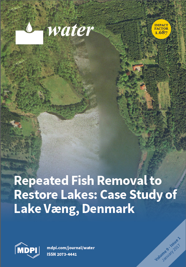
Cover Story (view full-size image): Biomanipulation by fish removal has been used in many shallow lakes as a method to improve lake water quality. Here, we present and analyse 30 years of chemical and biological data from the shallow and 16 ha large Lake Væng, Denmark, which has been biomanipulated twice with a 20-year interval by removing roach (Rutilus rutilus) and bream (Abramis brama). After both biomanipulations, Lake Væng shifted from a turbid, phytoplankton-dominated state to a clear, water macrophyte-dominated state. View the paper
  • Issues are regarded as officially published after their release is announced to the table of contents alert mailing list.
  • You may sign up for e-mail alerts to receive table of contents of newly released issues.
  • PDF is the official format for papers published in both, html and pdf forms. To view the papers in pdf format, click on the "PDF Full-text" link, and use the free Adobe Reader to open them.
Order results
Result details
Section
Select all
Export citation of selected articles as:
3855 KiB  
Article
Assessment on the Effect of Climate Change on Streamflow in the Source Region of the Yangtze River, China
by Huanqing Bian, Haishen Lü, Ali M. Sadeghi, Yonghua Zhu, Zhongbo Yu, Fen Ouyang, Jianbin Su and Rensheng Chen
Water 2017, 9(1), 70; https://doi.org/10.3390/w9010070 - 23 Jan 2017
Cited by 23 | Viewed by 7304
Abstract
Tuotuo River basin, known as the source region of the Yangtze River, is the key area where the impact of climate change has been observed on many of the hydrological processes of this central region of the Tibetan Plateau. In this study, we [...] Read more.
Tuotuo River basin, known as the source region of the Yangtze River, is the key area where the impact of climate change has been observed on many of the hydrological processes of this central region of the Tibetan Plateau. In this study, we examined six Global Climate Models (GCMs) under three Representative Concentration Pathways (RCPs) scenarios. First, the already impacted climate change was analyzed, based on the historical data available and then, the simulation results of the GCMs and RCPs were used for future scenario assessments. Results indicated that the annual mean temperature will likely be increased, ranging from −0.66 °C to 6.68 °C during the three future prediction periods (2020s, 2050s and 2080s), while the change in the annual precipitation ranged from −1.18% to 66.14%. Then, a well-known distributed hydrological soil vegetation model (DHSVM) was utilized to evaluate the effects of future climate change on the streamflow dynamics. The seasonal mean streamflows, predicted by the six GCMs and the three RCPs scenarios, were also shown to likely increase, ranging from −0.52% to 22.58%. Watershed managers and regulators can use the findings from this study to better implement their conservation practices in the face of climate change. Full article
Show Figures

Figure 1

2656 KiB  
Article
Herbivory of Omnivorous Fish Shapes the Food Web Structure of a Chinese Tropical Eutrophic Lake: Evidence from Stable Isotope and Fish Gut Content Analyses
by Jian Gao, Ping Zhong, Jiajia Ning, Zhengwen Liu and Erik Jeppesen
Water 2017, 9(1), 69; https://doi.org/10.3390/w9010069 - 23 Jan 2017
Cited by 19 | Viewed by 7085
Abstract
Studies suggest that, unlike the situation in temperate lakes, high biomasses of omnivorous fish are maintained in subtropical and tropical lakes when they shift from a turbid phytoplankton-dominated state to a clear water macrophyte-dominated state, and the predation pressure on large-bodied zooplankton therefore [...] Read more.
Studies suggest that, unlike the situation in temperate lakes, high biomasses of omnivorous fish are maintained in subtropical and tropical lakes when they shift from a turbid phytoplankton-dominated state to a clear water macrophyte-dominated state, and the predation pressure on large-bodied zooplankton therefore remains high. Whether this reflects a higher degree of herbivory in warm lakes than in temperate lakes is debatable. We combined food web studies using stable isotopes with gut content analyses of the most dominant fish species to elucidate similarities and differences in food web structure between a clear water macrophyte-dominated basin (MDB) and a turbid phytoplankton-dominated basin (PDB) of Huizhou West Lake, a shallow tropical Chinese lake. The δ13C–δ15N biplot of fish and invertebrates revealed community-wide differences in isotope-based metrics of the food webs between MDB and PDB. The range of consumer δ15N (NR) was lower in MDB than in PDB, indicating shorter food web length in MDB. The mean nearest neighbor distance (MNND) and standard deviation around MNND (SDNND) were higher in MDB than in PDB, showing a markedly low fish trophic overlap and a more uneven packing of species in niches in MDB than in PDB. The range of fish δ13C (CR) of consumers was more extensive in MDB than in PDB, indicating a wider feeding range for fish in MDB. Mixing model results showed that macrophytes and associated periphyton constituted a large fraction of basal production sources for the fish in MDB, while particulate organic matter (POM) contributed a large fraction in PDB. In MDB, the diet of the dominant fish species, crucian carp (Carassius carassius), consisted mainly of vegetal matter (macrophytes and periphyton) and zooplankton, while detritus was the most important food item in PDB. Our results suggest that carbon from macrophytes with associated periphyton may constitute an important food resource for omnivorous fish, and this may strongly affect the feeding niche and the strength of the top-down trophic cascade between fish and zooplankton in the restored, macrophyte-dominated basin of the lake. This dual effect (consumption of macrophytes and zooplankton) may reduce the chances of maintaining the clear water state at the prevailing nutrient levels in the lake, and regular removal of large crucian carp may therefore be needed to maintain a healthy ecosystem state. Full article
(This article belongs to the Special Issue Lake Restoration and Management in a Climate Change Perspective)
Show Figures

Figure 1

4684 KiB  
Article
Mg2+-Based Method for the Pertuso Spring Discharge Evaluation
by Giuseppe Sappa, Flavia Ferranti, Francesco Maria De Filippi and Giulia Cardillo
Water 2017, 9(1), 67; https://doi.org/10.3390/w9010067 - 23 Jan 2017
Cited by 9 | Viewed by 5341
Abstract
This paper deals with the Environmental Monitoring Plan concerning the catchment work project of the Pertuso karst spring, which is going to be exploited to supply an important drinking water network in the south part of Roma district. The Pertuso Spring, located in [...] Read more.
This paper deals with the Environmental Monitoring Plan concerning the catchment work project of the Pertuso karst spring, which is going to be exploited to supply an important drinking water network in the south part of Roma district. The Pertuso Spring, located in the Upper Valley of the Aniene River, is the main outlet of a large karst aquifer, which is one of the most important water resources in the southeast part of Latium Region, Central Italy, used for drinking, agriculture, and hydroelectric supplies. The environmental monitoring activities provided data about one spring and two cross-sections of the Aniene River, from July 2014 to May 2016. A combined approach based on discharge measurements and hydrogeochemical analysis has been used to study flow paths and groundwater–surface water interaction in the study area. Tracer methods are particularly suitable in hydrogeological studies to assess transit times and flow properties in karst aquifers. The analysis of solute contents in the sampling points brought forth the identification of the Mg2+ ion as a conservative tracer in this specific system and, consequently, to the development of a conceptual model based on chemical mass balance for the Pertuso Spring discharge evaluation. Full article
(This article belongs to the Special Issue Groundwater Monitoring and Remediation)
Show Figures

Figure 1

10274 KiB  
Article
Measuring Spatiotemporal Features of Land Subsidence, Groundwater Drawdown, and Compressible Layer Thickness in Beijing Plain, China
by Yongyong Li, Huili Gong, Lin Zhu and Xiaojuan Li
Water 2017, 9(1), 64; https://doi.org/10.3390/w9010064 - 22 Jan 2017
Cited by 28 | Viewed by 8277
Abstract
Beijing is located on multiple alluvial-pluvial fans with thick Quaternary unconsolidated sediments. It has suffered serious groundwater drawdown and land subsidence due to groundwater exploitation. This study aimed to introduce geographical distribution measure methods into land subsidence research characterizing, geographically, land subsidence, groundwater [...] Read more.
Beijing is located on multiple alluvial-pluvial fans with thick Quaternary unconsolidated sediments. It has suffered serious groundwater drawdown and land subsidence due to groundwater exploitation. This study aimed to introduce geographical distribution measure methods into land subsidence research characterizing, geographically, land subsidence, groundwater drawdown, and compressible layer thickness. Therefore, we used gravity center analysis and standard deviational ellipse (SDE) methods in GIS to statistically analyze their concentration tendency, principle orientation, dispersion trend, and distribution differences in 1995 (1999), 2007, 2009, 2011, and 2013. Results show that they were all concentrated in Chaoyang District of Urban Beijing. The concentration trend of land subsidence was consistent with that of groundwater drawdown. The principle orientation of land subsidence was SW–NE, which was more similar with that of the static spatial distribution of the compressible layer. The dispersion tendency of land subsidence got closer to that of the compressible layer with its increasing intensity. The spatial distribution difference between land subsidence and groundwater drawdown was about 0.2, and that between land subsidence and compressible layer thickness it decreased from 0.22 to 0.07, reflecting that the spatial distribution pattern of land subsidence was increasingly close to that of the compressible layer. Results of this study are useful for assessing the distribution of land subsidence development and managing groundwater resources. Full article
Show Figures

Figure 1

21259 KiB  
Article
Effect of Geogenic Factors on Water Quality and Its Relation to Human Health around Mount Ida, Turkey
by Alper Baba and Orhan Gündüz
Water 2017, 9(1), 66; https://doi.org/10.3390/w9010066 - 21 Jan 2017
Cited by 12 | Viewed by 10660
Abstract
Water–rock interactions strongly influence water quality. Waters originating from highly altered zones affect human health. Mount Ida region in western Anatolia is an example for such geogenic interactions and additional anthropogenic impacts. A water quality monitoring study was held and a total of [...] Read more.
Water–rock interactions strongly influence water quality. Waters originating from highly altered zones affect human health. Mount Ida region in western Anatolia is an example for such geogenic interactions and additional anthropogenic impacts. A water quality monitoring study was held and a total of 189 samples were collected from 63 monitoring stations to characterize the quality of water resources and its relation with human health. The results indicated that waters originating from altered volcanic rocks that are mainly used for drinking purposes have low pH, high conductivity and elevated trace element levels. In addition, a number of acidic mining lakes were formed in the open pits of abandoned mine sites in the study area and pyrite oxidation in altered volcanic rocks resulted in extremely acidic, high mineral content and toxic waters that demonstrate an eminent threat for the environmental health in the area. Overall, the water quality constituents in Mount Ida region had a spatially variable pattern and were locally found to exceed the national and international standards, mainly due to geogenic alteration zones and anthropogenic intervention. Full article
(This article belongs to the Special Issue Water Quality and Health)
Show Figures

Figure 1

6978 KiB  
Article
Influence of Rack Slope and Approaching Conditions in Bottom Intake Systems
by Luis G. Castillo, Juan T. García and José M. Carrillo
Water 2017, 9(1), 65; https://doi.org/10.3390/w9010065 - 21 Jan 2017
Cited by 15 | Viewed by 6305
Abstract
The study analyzes the flow over bottom racks made of longitudinal T-shaped bars. A clear water flow is considered in a laboratory flume. Free surface profiles, wetted rack lengths, and discharge coefficients are measured, changing parameters such as longitudinal slope, void ratio, and [...] Read more.
The study analyzes the flow over bottom racks made of longitudinal T-shaped bars. A clear water flow is considered in a laboratory flume. Free surface profiles, wetted rack lengths, and discharge coefficients are measured, changing parameters such as longitudinal slope, void ratio, and approaching flow. The present work complements existing experimental studies, considering the influence of the approaching flow conditions. The velocity field measured with Particle Image Velocimetry (PIV) technique and the pressure field with Pitot tubes are quantified. Numerical simulations (CFD) are used to complement laboratory data. The energy head along the rack is calculated and compared with the hypothesis of horizontal energy level with minimum energy at the beginning of the rack. A discharge coefficient adjustment that considers the slope, the void ratio, and the position along the rack is proposed and presented with the results of other works. Theoretical proposals to calculate the pressure field along the flow are compared with measurements in the laboratory. The relation between the static pressure head in the space of bars and the discharge coefficient is used as an alternative method to define the discharge. Full article
(This article belongs to the Special Issue Modeling of Water Systems)
Show Figures

Figure 1

9723 KiB  
Article
Experimental Study of Air Vessel Behavior for Energy Storage or System Protection in Water Hammer Events
by Mohsen Besharat, Maria Teresa Viseu and Helena M. Ramos
Water 2017, 9(1), 63; https://doi.org/10.3390/w9010063 - 20 Jan 2017
Cited by 27 | Viewed by 7106
Abstract
An experimental assessment of an air pocket (AP), confined in a compressed air vessel (CAV), has been investigated under several different water hammer (WH) events to better define the use of protection devices or compressed air energy storage (CAES) systems. This research focuses [...] Read more.
An experimental assessment of an air pocket (AP), confined in a compressed air vessel (CAV), has been investigated under several different water hammer (WH) events to better define the use of protection devices or compressed air energy storage (CAES) systems. This research focuses on the size of an AP within an air vessel and tries to describe how it affects important parameters of the system, i.e., the pressure in the pipe, stored pressure, flow velocity, displaced volume of water and water level in the CAV. Results present a specific range of air pockets based on a dimensionless parameter extractable for other real systems. Full article
(This article belongs to the Special Issue Water Systems towards New Future Challenges)
Show Figures

Figure 1

2391 KiB  
Article
Energy Saving in a Water Supply Network by Coupling a Pump and a Pump As Turbine (PAT) in a Turbopump
by Armando Carravetta, Lauro Antipodi, Umberto Golia and Oreste Fecarotta
Water 2017, 9(1), 62; https://doi.org/10.3390/w9010062 - 20 Jan 2017
Cited by 33 | Viewed by 5804
Abstract
The management of a water distribution network (WDN) is performed by valve and pump control, to regulate both the pressure and the discharge between certain limits. The energy that is usually merely dissipated by valves can instead be converted and used to partially [...] Read more.
The management of a water distribution network (WDN) is performed by valve and pump control, to regulate both the pressure and the discharge between certain limits. The energy that is usually merely dissipated by valves can instead be converted and used to partially supply the pumping stations. Pumps used as turbines (PAT) can be used in order to both reduce pressure and recover energy, with proven economic benefits. The direct coupling of the PAT shaft with the pump shaft in a PAT-pump turbocharger (P&P plant) allows us to transfer energy from the pressure control system to the pumping system without any electrical device. Based on experimental PAT and pump performance curves, P&P equations are given and P&P working conditions are simulated with reference to the operating conditions of a real water supply network. The annual energy saving demonstrates the economic relevance of the P&P plant. Full article
(This article belongs to the Special Issue Water Systems towards New Future Challenges)
Show Figures

Figure 1

11050 KiB  
Article
Hydrogeochemistry and Genesis Analysis of Thermal and Mineral Springs in Arxan, Northeastern China
by Xiaomin Gu, Qiulan Zhang, Yali Cui, Jingli Shao, Yong Xiao, Peng Zhang and Jinxing Liu
Water 2017, 9(1), 61; https://doi.org/10.3390/w9010061 - 19 Jan 2017
Cited by 14 | Viewed by 6253
Abstract
In this work, the hydrogeochemistry and environmental isotopic compositions of thermal and mineral springs in Arxan, northeastern China, were used to assess the genesis of the thermal system hosted by deep-seated faults. The reservoir temperature was calculated using the mineral saturation index and [...] Read more.
In this work, the hydrogeochemistry and environmental isotopic compositions of thermal and mineral springs in Arxan, northeastern China, were used to assess the genesis of the thermal system hosted by deep-seated faults. The reservoir temperature was calculated using the mineral saturation index and geothermometers. According to isotopic analysis, the spring water was of meteoric origin. Sixteen springs in the Arxan geothermal system with outlet temperatures ranging from 10.9 to 41.0 °C were investigated. The water samples can be classified into four groups by using a Piper diagram. The aquifer in which the Group I and Group III samples were obtained was a shallow cold aquifer of the Jurassic system, which is related to the local groundwater system and contains HCO3–Ca·Na groundwater. The Group II and Group IV samples were recharged by deeply circulating meteoric water with HCO3–Na and HCO3·SO4–Na·Ca groundwater, respectively. The springs rise from the deep basement faults. The estimated thermal reservoir temperature is 50.9–68.8 °C, and the proportion of shallow cold water ranges from 54% to 87%. A conceptual flow model based on hydrogeochemical results and hydrogeological features is given to describe the geothermal system of the Arxan springs. Full article
Show Figures

Figure 1

1212 KiB  
Article
Building a Foundation for Knowledge Co-Creation in Collaborative Water Governance: Dimensions of Stakeholder Networks Facilitated through Bridging Organizations
by Wietske Medema, Jan Adamowski, Christopher Orr, Alison Furber, Arjen Wals and Nicolas Milot
Water 2017, 9(1), 60; https://doi.org/10.3390/w9010060 - 19 Jan 2017
Cited by 28 | Viewed by 8820
Abstract
The sustainable governance of water resources relies on processes of multi-stakeholder collaborations and interactions that facilitate the sharing and integration of diverse sources and types of knowledge. In this context, it is essential to fully recognize the importance of fostering and enhancing critical [...] Read more.
The sustainable governance of water resources relies on processes of multi-stakeholder collaborations and interactions that facilitate the sharing and integration of diverse sources and types of knowledge. In this context, it is essential to fully recognize the importance of fostering and enhancing critical connections within and between networks of relationships between different government and non-government agencies, as well as the dynamics that are in support of the development of new knowledge and practices. In Quebec, a network of watershed organizations (WOs) has been put in place to serve as bridging organizations (BOs) for stakeholder groups in their watershed territories. Using the WOs as a case study, this research aims to contribute to a greater understanding of how stakeholder groups can be effectively connected to support knowledge co-creation through networked relationships facilitated by BOs. In line with this overall research aim, the following research objectives are proposed: (1) to assess the quality of the knowledge that is developed and shared through the WOs and their stakeholder networks; (2) to determine the characteristics of stakeholders participating in the WOs’ networks that either hinder or support collaborations and knowledge co-creation; (3) to describe the collaborative processes and mechanisms through which the WOs facilitate stakeholder interactions and knowledge co-creation; and (4) to assess the quality of the relationships and interactions between stakeholders participating in the WOs’ collaborative networks. A comprehensive literature review is provided of collaborative network dimensions that are in support of knowledge co-creation that forms the foundation of a research framework to assess knowledge co-creation processes that are facilitated through BOs and their collaborative networks. Documented experiences have been gathered through face-to-face semi-structured interviews, as well as a Quebec-wide survey distributed to all WOs and their staff. A total of 41 interviews were conducted, of which nine interviews were with staff members of six selected WOs. Stakeholder perspectives were captured through 33 interviews with diverse stakeholders from three of the six selected WOs. Additionally, interviews were also conducted with five decision makers at the Quebec provincial government level. The findings of this study point to some key challenges and constraints for the effective facilitation of collaboration and knowledge co-creation through the Quebec WOs and their stakeholder networks. Through diverse collaborative mechanisms, most WOs have, to an extent, succeeded in creating opportunities for learning through a renewed sense making of different practices (and related identities) through the development of their watershed master plans, as well as through the facilitation of new communicative connections and translation efforts between diverse stakeholder groups. Key challenges to their effectiveness have been relating to a limited capacity and resources, limited territory-wide impacts, as well as limited perceived legitimacy that hindered the WOs as BOs in their ability to facilitate effective knowledge co-creation. Areas for further research to overcome these challenges are in developing a greater understanding of how BOs can optimize resources and capacities available in their collaborative networks through, e.g., the development of boundary-crossing leaders and competences, as well as the use of Information Communication Technology (ICT). Full article
Show Figures

Figure 1

1759 KiB  
Editorial
Twenty-Five Years of Hydroinformatics
by Zoran Vojinovic and Michael B. Abbott
Water 2017, 9(1), 59; https://doi.org/10.3390/w9010059 - 18 Jan 2017
Cited by 13 | Viewed by 7387
Abstract
Hydroinformatics emerged in 1991 when numerical modelling of water expanded its range from one that was restricted to the modelling of flows to a much wider ranging sociotechnical discipline that supports stakeholders in addressing their water-related problems. However, despite numerous advances in hydroinformatics, [...] Read more.
Hydroinformatics emerged in 1991 when numerical modelling of water expanded its range from one that was restricted to the modelling of flows to a much wider ranging sociotechnical discipline that supports stakeholders in addressing their water-related problems. However, despite numerous advances in hydroinformatics, the current practical and research effort is still very much technocratic (or techno-centric) which in turn may restrict the potential of hydroinformatics in its scope and its reach. This Special Issue, through the compilation of thirteen papers, illustrates some of the developments and applications in the field of hydroinformatics and marks the twenty-five years of its existence. We hope that this will help to further raise the awareness of the subject and its developments and applications. In the Editorial of this Special Issue, we briefly discuss the origin of hydroinformatics and we introduce the papers that are featuring in this Special Issue. We also give a way forward for future research and application. Full article
(This article belongs to the Special Issue Hydroinformatics and Urban Water Systems)
Show Figures

Figure 1

3026 KiB  
Article
SWAT Modeling for Depression-Dominated Areas: How Do Depressions Manipulate Hydrologic Modeling?
by Mohsen Tahmasebi Nasab, Vishal Singh and Xuefeng Chu
Water 2017, 9(1), 58; https://doi.org/10.3390/w9010058 - 17 Jan 2017
Cited by 35 | Viewed by 7854
Abstract
Modeling hydrologic processes for depression-dominated areas such as the North American Prairie Pothole Region is complex and reliant on a clear understanding of dynamic filling-spilling-merging-splitting processes of numerous depressions over the surface. Puddles are spatially distributed over a watershed and their sizes, storages, [...] Read more.
Modeling hydrologic processes for depression-dominated areas such as the North American Prairie Pothole Region is complex and reliant on a clear understanding of dynamic filling-spilling-merging-splitting processes of numerous depressions over the surface. Puddles are spatially distributed over a watershed and their sizes, storages, and interactions vary over time. However, most hydrologic models fail to account for these dynamic processes. Like other traditional methods, depressions are filled as a required preprocessing step in the Soil and Water Assessment Tool (SWAT). The objective of this study was to facilitate hydrologic modeling for depression-dominated areas by coupling SWAT with a Puddle Delineation (PD) algorithm. In the coupled PD-SWAT model, the PD algorithm was utilized to quantify topographic details, including the characteristics, distribution, and hierarchical relationships of depressions, which were incorporated into SWAT at the hydrologic response unit (HRU) scale. The new PD-SWAT model was tested for a large watershed in North Dakota under real precipitation events. In addition, hydrologic modeling of a small watershed was conducted under two extreme high and low synthetic precipitation conditions. In particular, the PD-SWAT was compared against the regular SWAT based on depressionless DEMs. The impact of depressions on the hydrologic modeling of the large and small watersheds was evaluated. The simulation results for the large watershed indicated that SWAT systematically overestimated the outlet discharge, which can be attributed to the failure to account for the hydrologic effects of depressions. It was found from the PD-SWAT modeling results that at the HRU scale surface runoff initiation was significantly delayed due to the threshold control of depressions. Under the high precipitation scenario, depressions increased the surface runoff peak. However, the low precipitation scenario could not fully fill depressions to reach the overflow thresholds in the selected sub-basins. These results suggest the importance of depressions as gatekeepers in watershed modeling. Full article
(This article belongs to the Special Issue Water-Soil-Vegetation Dynamic Interactions in Changing Climate)
Show Figures

Figure 1

2262 KiB  
Article
Evaluation of TRMM Product for Monitoring Drought in the Kelantan River Basin, Malaysia
by Mou Leong Tan, Kok Chooi Tan, Vivien P. Chua and Ngai Weng Chan
Water 2017, 9(1), 57; https://doi.org/10.3390/w9010057 - 17 Jan 2017
Cited by 71 | Viewed by 8504
Abstract
Assessment of satellite precipitation products’ capability for monitoring drought is relatively new in tropical regions. The purpose of this paper is to evaluate the reliability of the Tropical Rainfall Measuring Mission (TRMM) Multisatellite Precipitation Analysis (TMPA) 3B43 product in estimating the standardized precipitation [...] Read more.
Assessment of satellite precipitation products’ capability for monitoring drought is relatively new in tropical regions. The purpose of this paper is to evaluate the reliability of the Tropical Rainfall Measuring Mission (TRMM) Multisatellite Precipitation Analysis (TMPA) 3B43 product in estimating the standardized precipitation index (SPI) in the Kelantan River Basin, Malaysia from 1998 to 2014, by comparing it with data from 42 rain gauges. Overall, the TMPA-3B43 performed well in the monthly precipitation estimation, but performed moderately in the seasonal scale. Better performance was found in the northeast monsoon (wet season) than in the southwest monsoon (dry season). The product is more reliable in the northern and north-eastern regions (coastal zone) compared to the central, southern and south-eastern regions (mountainous area). For drought assessment, the correlations between the TMPA-3B43 and ground observations are moderate at various time-scales (one to twelve months), with better performance at shorter time-scales. The TMPA-3B43 shows similar temporal drought behavior by capturing most of the drought events at various time-scales, except for the 2008–2009 drought. These findings show that the TMPA-3B43 is not suitable to be used directly for SPI estimation in this basin. More bias correction and algorithm improvement work are needed to improve the accuracy of the TMPA-3B43 in drought monitoring. Full article
Show Figures

Figure 1

5574 KiB  
Article
3D CFD Modeling of Local Scouring, Bed Armoring and Sediment Deposition
by Gergely T. Török, Sándor Baranya and Nils Rüther
Water 2017, 9(1), 56; https://doi.org/10.3390/w9010056 - 17 Jan 2017
Cited by 25 | Viewed by 7020
Abstract
3D numerical models are increasingly used to simulate flow, sediment transport and morphological changes of rivers. For the simulation of bedload transport, the numerical flow model is generally coupled with an empirical sediment transport model. The application range of the most widely used [...] Read more.
3D numerical models are increasingly used to simulate flow, sediment transport and morphological changes of rivers. For the simulation of bedload transport, the numerical flow model is generally coupled with an empirical sediment transport model. The application range of the most widely used empirical models is, however, often limited in terms of hydraulic and sedimentological features and therefore the numerical model can hardly be applied to complex situations where different kinds of morphological processes take place at the same time, such as local scouring, bed armoring and aggradation of finer particles. As a possible solution method for this issue, we present the combined application of two bedload transport formulas that widens the application range and thus gives more appropriate simulation results. An example of this technique is presented in the paper by combining two bedload transport formulas. For model validation, the results of a laboratory experiment, where bed armoring, local scouring and local sediment deposition processes occurred, were used. The results showed that the combined application method can improve the reliability of the numerical simulations. Full article
(This article belongs to the Special Issue Watershed Sediment Process)
Show Figures

Figure 1

644 KiB  
Review
From Flood Control to Water Management: A Journey of Bangladesh towards Integrated Water Resources Management
by Animesh K. Gain, M. Shahjahan Mondal and Rezaur Rahman
Water 2017, 9(1), 55; https://doi.org/10.3390/w9010055 - 17 Jan 2017
Cited by 49 | Viewed by 14618
Abstract
Integrated Water Resources Management (IWRM) is considered as a practical approach in solving water-related problems, which are socio-ecologically complex in nature. Bangladesh has also embraced the IWRM approach against its earlier attempt to flood control. In this paper, we evaluate the current status [...] Read more.
Integrated Water Resources Management (IWRM) is considered as a practical approach in solving water-related problems, which are socio-ecologically complex in nature. Bangladesh has also embraced the IWRM approach against its earlier attempt to flood control. In this paper, we evaluate the current status of IWRM in Bangladesh through the lens of policy shifts, institutional transitions and project transformations using seven key dimensions of IWRM. Looking at IWRM from such perspectives is lacking in current literature. A thorough review of policy shifts suggests that all the key dimensions of IWRM are “highly reflected” in the current policy documents. The dimension of “integrated management” is “highly reflected” in both institutional transition and project-level transformation. Most other dimensions are also recognised at both institutional and project levels. However, such reflections gradually weaken as we move from policies to institutions to projects. Despite catchment being considered as a spatial unit of water management at both institutional and project levels, transboundary basin planning is yet to be accomplished. The participation of local people is highly promoted in various recent projects. However, equity and social issues have received less attention at project level, although it has significant potential for supporting some of the key determinants of adaptive capacity. Thus, the IWRM dimensions are in general reflected in recent policies, institutional reforms and project formulation in Bangladesh. However, to solve the complex water-problems, basin scale management through transboundary cooperation and equity and social issues need to be implemented at institutional and project levels. Full article
Show Figures

Figure 1

2007 KiB  
Article
Testing the SWAT Model with Gridded Weather Data of Different Spatial Resolutions
by Youen Grusson, François Anctil, Sabine Sauvage and José Miguel Sánchez Pérez
Water 2017, 9(1), 54; https://doi.org/10.3390/w9010054 - 17 Jan 2017
Cited by 32 | Viewed by 9007
Abstract
This study explored the influence of the spatial resolution of a gridded weather dataset when inputted in the soil and water assessment tool (SWAT) over the Garonne River watershed. Several datasets are compared: ground-based weather stations, the 8-km SAFRAN product (Système d’Analyse Fournissant [...] Read more.
This study explored the influence of the spatial resolution of a gridded weather dataset when inputted in the soil and water assessment tool (SWAT) over the Garonne River watershed. Several datasets are compared: ground-based weather stations, the 8-km SAFRAN product (Système d’Analyse Fournissant des Renseignements Adaptés à la Nivologie), the 0.5° CFSR product (Climate Forecasting System Reanalysis) and several derived SAFRAN grids upscaled to 16, 32, 64 and 128 km. The SWAT model, calibrated on weather stations, was successively run with each gridded weather dataset. Performances with SAFRAN up to 64 or 128 km were poor, due to a contraction of the spatial variance of daily precipitation. Performances with 8-km SAFRAN are similar to that of the aggregated 16- and 32-km SAFRAN grids. The ~30-km CFSR product was found to perform well at some sites, while in others, its performance was considerably inferior because of grid points where precipitation was overestimated. The same problem was found in the calibration, where data at some weather stations did not appear to be representative of the subwatershed in which they are used to compute hydrology. These results suggest that the difference in the representation of the climate was more influential than its spatial resolution, an analysis that was confirmed by similar performances obtained with the SWAT model calibrated on the 16- and 32-km SAFRAN grids. However, the better performances obtained from these two weather datasets than from the ground-based stations’ dataset confirmed the advantage of using the SAFRAN product in SWAT modelling. Full article
Show Figures

Figure 1

3500 KiB  
Review
High Variability Is a Defining Component of Mediterranean-Climate Rivers and Their Biota
by Núria Cid, Núria Bonada, Stephanie M. Carlson, Theodore E. Grantham, Avital Gasith and Vincent H. Resh
Water 2017, 9(1), 52; https://doi.org/10.3390/w9010052 - 17 Jan 2017
Cited by 89 | Viewed by 11599
Abstract
Variability in flow as a result of seasonal precipitation patterns is a defining element of streams and rivers in Mediterranean-climate regions of the world and strongly influences the biota of these unique systems. Mediterranean-climate areas include the Mediterranean Basin and parts of Australia, [...] Read more.
Variability in flow as a result of seasonal precipitation patterns is a defining element of streams and rivers in Mediterranean-climate regions of the world and strongly influences the biota of these unique systems. Mediterranean-climate areas include the Mediterranean Basin and parts of Australia, California, Chile, and South Africa. Mediterranean streams and rivers can experience wet winters and consequent floods to severe droughts, when intermittency in otherwise perennial systems can occur. Inter-annual variation in precipitation can include multi-year droughts or consecutive wet years. Spatial variation in patterns of precipitation (rain vs. snow) combined with topographic variability lead to spatial variability in hydrologic patterns that influence populations and communities. Mediterranean streams and rivers are global biodiversity hotspots and are particularly vulnerable to human impacts. Biomonitoring, conservation efforts, and management responses to climate change require approaches that account for spatial and temporal variability (including both intra- and inter-annual). The importance of long-term data sets for understanding and managing these systems highlights the need for sustained and coordinated research efforts in Mediterranean-climate streams and rivers. Full article
Show Figures

Figure 1

5205 KiB  
Article
Design and Testing of Recharge Wells in a Coastal Aquifer: Summary of Field Scale Pilot Tests
by Joseph Guttman, Ido Negev and Genadi Rubin
Water 2017, 9(1), 53; https://doi.org/10.3390/w9010053 - 14 Jan 2017
Cited by 15 | Viewed by 10030
Abstract
Surplus water from seawater desalination plants along the Israeli Coast can be injected underground for seasonal storage. Two pilot projects were established to simulate the movement of air bubbles and changes in the well hydraulic parameters during pumping and recharging. The study showed [...] Read more.
Surplus water from seawater desalination plants along the Israeli Coast can be injected underground for seasonal storage. Two pilot projects were established to simulate the movement of air bubbles and changes in the well hydraulic parameters during pumping and recharging. The study showed that it is impossible to remove the smaller air bubbles (dissolved air) that are created during the injection process, even when the injection pipe is fully saturated. The pumping tests showed that there were large differences in the well hydraulic parameters between the pumping and the recharge tests despite that they were conducted at the same well. Two mechanisms are responsible for the reduction in the aquifer coefficients during the recharge event. The first mechanism is the pressures that the injected water needs to overcome; the aquifer pressure and the pore water pressure it is supposed to replace at the time of the injection. The second mechanism is the pressure that the injected water needs to overcome the clogging process. It is expressed as the high water level inside the recharge well in comparison to the small rising of the water level in the observation wells. This research gives good insight into the injection mechanism through wells and is essential for any further development of injection facilities and for the operation and management protocols. Full article
(This article belongs to the Special Issue Water Quality Considerations for Managed Aquifer Recharge Systems)
Show Figures

Figure 1

3486 KiB  
Article
Farm Typology in the Berambadi Watershed (India): Farming Systems Are Determined by Farm Size and Access to Groundwater
by Marion Robert, Alban Thomas, Muddu Sekhar, Shrinivas Badiger, Laurent Ruiz, Magali Willaume, Delphine Leenhardt and Jacques-Eric Bergez
Water 2017, 9(1), 51; https://doi.org/10.3390/w9010051 - 13 Jan 2017
Cited by 32 | Viewed by 8037
Abstract
Farmers’ production decisions and agricultural practices directly and indirectly influence the quantity and quality of natural resources, some being depleted common resources such as groundwater. Representing farming systems while accounting for their flexibility is needed to evaluate targeted, regional water management policies. Farmers’ [...] Read more.
Farmers’ production decisions and agricultural practices directly and indirectly influence the quantity and quality of natural resources, some being depleted common resources such as groundwater. Representing farming systems while accounting for their flexibility is needed to evaluate targeted, regional water management policies. Farmers’ decisions regarding investing in irrigation and adopting cropping systems are inherently dynamic and must adapt to changes in climate and agronomic, economic and social, and institutional, conditions. To represent this diversity, we developed a typology of Indian farmers from a survey of 684 farms in Berambadi, an agricultural watershed in southern India (state of Karnataka). The survey provided information on farm structure, the cropping system and farm practices, water management for irrigation, and economic performances of the farm. Descriptive statistics and multivariate analysis (Multiple Correspondence Analysis and Agglomerative Hierarchical Clustering) were used to analyze relationships between observed factors and establish the farm typology. We identified three main types of farms: (1) large diversified and productivist farms; (2) small and marginal rainfed farms, and (3) small irrigated marketing farms. This typology represents the heterogeneity of farms in the Berambadi watershed. Full article
(This article belongs to the Special Issue Adaptation Strategies to Climate Change Impacts on Water Resources)
Show Figures

Figure 1

3345 KiB  
Article
Comparing Sprinkler and Surface Irrigation for Wheat Using Multi-Criteria Analysis: Water Saving vs. Economic Returns
by Hanaa Darouich, Maria R. Cameira, José M. Gonçalves, Paula Paredes and Luis S. Pereira
Water 2017, 9(1), 50; https://doi.org/10.3390/w9010050 - 13 Jan 2017
Cited by 23 | Viewed by 8231
Abstract
Coping with water scarcity using supplemental irrigation of wheat (Triticum aestivum L.) in the semi-arid northeast Syria is a great challenge for sustainable water use in agriculture. Graded borders and set sprinkler systems were compared using multi-criteria analysis. Alternative solutions for surface [...] Read more.
Coping with water scarcity using supplemental irrigation of wheat (Triticum aestivum L.) in the semi-arid northeast Syria is a great challenge for sustainable water use in agriculture. Graded borders and set sprinkler systems were compared using multi-criteria analysis. Alternative solutions for surface irrigation and for sprinkler systems were developed with the SADREG and the PROASPER design models, respectively. For each alternative, two deficit irrigation strategies were considered, which were characterized using indicators relative to irrigation water use, yields and water productivity, including farm economic returns. Alternatives were ranked considering two contrasting priorities: economic returns and water saving. A first step in ranking led to a selection of graded borders with and without precise land levelling and of solid set and semi-permanent sprinkler systems. Precise-levelled borders were better for water saving, while non-precise ones ranked higher for economic returns. Semi-permanent set systems have been shown to be better in economic terms and similar to solid set systems when water saving is prioritized. Semi-permanent sprinkler systems rank first when comparing all type of systems together regardless of the considered deficit irrigation strategy. Likely, border irrigation is appropriate when wheat is in rotation with cotton if the latter is surface irrigated. When peace becomes effective, appropriate economic incentives and training for farmers are required to implement innovative approaches. Full article
Show Figures

Figure 1

2296 KiB  
Article
Impacts of Ridge-Furrow Planting on Salt Stress and Cotton Yield under Drip Irrigation
by Chitao Sun, Di Feng, Zhaorong Mi, Caixia Li, Junpeng Zhang, Yang Gao and Jingsheng Sun
Water 2017, 9(1), 49; https://doi.org/10.3390/w9010049 - 13 Jan 2017
Cited by 12 | Viewed by 6280
Abstract
Flat (F), mini-ditch (MD), and ridge-furrow (RF) are three conventional cotton planting patterns that are usually adopted around the world, yet soil and crop responses to these three patterns are poorly studied, as is their suitability for increasing yield for coastal areas in [...] Read more.
Flat (F), mini-ditch (MD), and ridge-furrow (RF) are three conventional cotton planting patterns that are usually adopted around the world, yet soil and crop responses to these three patterns are poorly studied, as is their suitability for increasing yield for coastal areas in Eastern China. The effects of three planting methods on water and salt dynamics as well as on growth and lint yield of cotton (Gossypium hirsutum L.) were investigated in a saline field in Bohai Rim, China, to select the best planting pattern for cultivating coastal saline fields of Eastern China. Soil moisture in the root zone with RF was 11.9% and 12.1% higher than with F and MD, whereas the electrical conductivity of a saturated soil extract (ECe) in the root zone with RF was 18.0% and 13.8% lower than with MD and F, respectively, during the growth period, which indicated that RF could efficiently collect rainfall and leach salt in the root zone. After drip irrigation, the infiltration and salt-leaching depth with RF were both deeper than that with F and MD. The stand establishment of MD was the highest (80.3%) due to the greenhouse effect from film mulching, and was 12.8% and 4.6% higher than that with F and RF, respectively. Growth indicators and lint yield demonstrated that RF was superior to F and MD because of the higher soil moisture and lower ECe. The lint yield was significantly higher in RF, suggesting that RF can be an optimal planting pattern for agricultural reclamation in similar saline-alkaline areas around the world. Full article
(This article belongs to the Special Issue Resilient Water Management in Agriculture)
Show Figures

Figure 1

1931 KiB  
Article
Application of BP Neural Network Algorithm in Traditional Hydrological Model for Flood Forecasting
by Jianjin Wang, Peng Shi, Peng Jiang, Jianwei Hu, Simin Qu, Xingyu Chen, Yingbing Chen, Yunqiu Dai and Ziwei Xiao
Water 2017, 9(1), 48; https://doi.org/10.3390/w9010048 - 13 Jan 2017
Cited by 95 | Viewed by 8929
Abstract
Flooding contributes to tremendous hazards every year; more accurate forecasting may significantly mitigate the damages and loss caused by flood disasters. Current hydrological models are either purely knowledge-based or data-driven. A combination of data-driven method (artificial neural networks in this paper) and knowledge-based [...] Read more.
Flooding contributes to tremendous hazards every year; more accurate forecasting may significantly mitigate the damages and loss caused by flood disasters. Current hydrological models are either purely knowledge-based or data-driven. A combination of data-driven method (artificial neural networks in this paper) and knowledge-based method (traditional hydrological model) may booster simulation accuracy. In this study, we proposed a new back-propagation (BP) neural network algorithm and applied it in the semi-distributed Xinanjiang (XAJ) model. The improved hydrological model is capable of updating the flow forecasting error without losing the leading time. The proposed method was tested in a real case study for both single period corrections and real-time corrections. The results reveal that the proposed method could significantly increase the accuracy of flood forecasting and indicate that the global correction effect is superior to the second-order autoregressive correction method in real-time correction. Full article
Show Figures

Figure 1

466 KiB  
Review
Chemical and Microbiological Quality of Effluents from Different On-Site Wastewater Treatment Systems across Finland and Sweden
by Helvi Heinonen-Tanski and Ville Matikka
Water 2017, 9(1), 47; https://doi.org/10.3390/w9010047 - 13 Jan 2017
Cited by 7 | Viewed by 6504
Abstract
Domestic wastewaters, which cannot be disposed through sewage networks, must be treated with different on-site treatment systems; these are usually commercial, small-scale treatment plants or built sand filters. These systems are usually maintained by the house’s inhabitants. This study was achieved by analysing [...] Read more.
Domestic wastewaters, which cannot be disposed through sewage networks, must be treated with different on-site treatment systems; these are usually commercial, small-scale treatment plants or built sand filters. These systems are usually maintained by the house’s inhabitants. This study was achieved by analysing the chemical and microbiological data of 717 effluents collected in Finland and Sweden. There were inadequate reductions in 31% of phosphorus effluents, 22% of nitrogen effluents and 5% of biological oxygen demand compounds. The addition of a coagulant capable of precipitating phosphorus improved the performance of sand filters and biorotors. There are no legally binding limitations on the number of enteric microorganisms that can be present in an effluent, but the number of Escherichia coli and enterococci exceeded more than 100 colony forming units per 100 mL in 59% and 53% effluents studied, with the highest numbers for these indicators being more than 100,000 cfu per 100 mL. The number of E. coli and enterococci were lower when the concentration of phosphorus in effluent was less than 1 mg/L. The treatment efficiency varied extensively, even between similar plant models, possibly due to either irregular use, or after long pauses, when they were not being used. In addition, it is possible that the end users are not capable of properly maintaining these wastewater treatment plants. Full article
(This article belongs to the Special Issue New Advances in Disinfection of Wastewater)
Show Figures

Figure 1

1480 KiB  
Article
UV-LEDs Efficiently Inactivate DNA and RNA Coliphages
by Alyaa M. Zyara, Helvi Heinonen-Tanski, Anna-Maria Veijalainen and Eila Torvinen
Water 2017, 9(1), 46; https://doi.org/10.3390/w9010046 - 12 Jan 2017
Cited by 11 | Viewed by 7490
Abstract
UV-LEDs are a new method of disinfecting drinking water. Some viruses are very resistant to UV and the efficiency of UV-LEDs to disinfect them needs to be studied. Drinking water was disinfected with UV-LEDs after spiking the water with MS2 and four UV- [...] Read more.
UV-LEDs are a new method of disinfecting drinking water. Some viruses are very resistant to UV and the efficiency of UV-LEDs to disinfect them needs to be studied. Drinking water was disinfected with UV-LEDs after spiking the water with MS2 and four UV- and/or Cl-resistant coliphages belonging to RNA or DNA coliphages isolated from municipal wastewater. UV-LEDs operating at a wavelength of 270 nm for 2 min with 120 mW of irradiation caused 0.93–2.73 Log10-reductions of coliphages tested in a reactor of a 5.2 L volume. Irradiation time of 10 min in the same system increased the Log10-reductions to 4.30–5.16. Traditional mercury UV (Hg-UV) lamp at a 254 nm wavelength caused 0.67–4.08 Log10-reductions in 2 min and 4.56–7.21 Log10-reductions in 10 min in 10 mL of water. All coliphages tested except MS2 achieved 4 Log10-reductions with UV-LEDs at a dose that corresponded to 70 mWs/cm2 using Hg-UV. Thus, UV-LEDs are a promising method of disinfecting UV- and/or Cl-resistant viruses. Full article
Show Figures

Figure 1

143 KiB  
Erratum
Erratum: Xue, C., et al. Characterization and Sorptivity of the Plesiomonas shigelloides Strain and Its Potential Use to Remove Cd2+ from Wastewater. Water 2016, 8, 241
by Chao Xue, Peishi Qi, Mengsha Li and Yunzhi Liu
Water 2017, 9(1), 45; https://doi.org/10.3390/w9010045 - 12 Jan 2017
Cited by 2 | Viewed by 2811
Abstract
The authors wish to make the following corrections to their paper [1].[...] Full article
242 KiB  
Editorial
Acknowledgement to Reviewers of Water in 2016
by Water Editorial Office
Water 2017, 9(1), 44; https://doi.org/10.3390/w9010044 - 12 Jan 2017
Viewed by 5018
Abstract
The editors of Water would like to express their sincere gratitude to the following reviewers for assessing manuscripts in 2016.[...] Full article
3626 KiB  
Article
Repeated Fish Removal to Restore Lakes: Case Study of Lake Væng, Denmark—Two Biomanipulations during 30 Years of Monitoring
by Martin Søndergaard, Torben L. Lauridsen, Liselotte S. Johansson and Erik Jeppesen
Water 2017, 9(1), 43; https://doi.org/10.3390/w9010043 - 11 Jan 2017
Cited by 33 | Viewed by 8031
Abstract
Biomanipulation by fish removal has been used in many shallow lakes as a method to improve lake water quality. Here, we present and analyse 30 years of chemical and biological data from the shallow and 16 ha large Lake Væng, Denmark, which has [...] Read more.
Biomanipulation by fish removal has been used in many shallow lakes as a method to improve lake water quality. Here, we present and analyse 30 years of chemical and biological data from the shallow and 16 ha large Lake Væng, Denmark, which has been biomanipulated twice with a 20-year interval by removing roach (Rutilus rutilus) and bream (Abramis brama). After both biomanipulations, Lake Væng shifted from a turbid, phytoplankton-dominated state to a clear, water macrophyte-dominated state. Chlorophyll a was reduced from 60–80 μg·L−1 to 10–30 μg·L−1 and the coverage of submerged macrophytes, dominated by Elodea canadensis, increased from <0.1% to 70%–80%. Mean summer total phosphorus was reduced from about 0.12 to 0.07 mg·L−1 and total nitrogen decreased from 1.0 to 0.4 mg·L−1. On a seasonal scale, phosphorus and chlorophyll concentrations changed from a summer maximum during turbid conditions to a winter maximum under clear conditions. The future of Lake Væng is uncertain and a relatively high phosphorus loading via the groundwater, and the accumulation of a mobile P pool in the sediment make it likely that the lake eventually will return to turbid conditions. Repeated fish removals might be a relevant management strategy to apply in shallow lakes with a relatively high external nutrient loading. Full article
(This article belongs to the Special Issue Lake Restoration and Management in a Climate Change Perspective)
Show Figures

Figure 1

6095 KiB  
Article
Groundwater Governance and the Growth of Center Pivot Irrigation in Cimarron County, OK and Union County, NM: Implications for Community Vulnerability to Drought
by Kathryn Wenger, Jacqueline M. Vadjunec and Todd Fagin
Water 2017, 9(1), 39; https://doi.org/10.3390/w9010039 - 11 Jan 2017
Cited by 15 | Viewed by 6162
Abstract
Cimarron County, Oklahoma and Union County, New Mexico, neighboring counties in the Southern High Plains, are part of a vital agricultural region in the United States. This region experiences extended periods of cyclical drought threatening its ability to produce, creating an incentive for [...] Read more.
Cimarron County, Oklahoma and Union County, New Mexico, neighboring counties in the Southern High Plains, are part of a vital agricultural region in the United States. This region experiences extended periods of cyclical drought threatening its ability to produce, creating an incentive for extensive center pivot irrigation (CPI). Center pivots draw from the rapidly depleting High Plains Aquifer System. As a result, the prospect of long-term sustainability for these agricultural communities is questionable. We use Remote Sensing and Geographic Information Systems to quantify growth in land irrigated by CPI between the 1950s and 2014, and key informant interviews to explore local perspectives on the causes and impact of such growth. In Cimarron County, OK, CPI increased by the mid-1980s, and has continually increased since. Results suggest adaptation to drought, a depleting aquifer, high corn prices, and less rigid groundwater regulations contribute to CPI growth. Conversely, CPI in Union County, NM, increased until 2010, and then declined. Results also suggest that drought-related agricultural changes and more aggressive well drilling regulations contribute to this decrease. Nevertheless, in both counties, there is a growing concern over the depleting aquifer, the long-term sustainability of CPI, and the region’s economic future. Full article
Show Figures

Figure 1

9665 KiB  
Article
Evaluation of the Oh, Dubois and IEM Backscatter Models Using a Large Dataset of SAR Data and Experimental Soil Measurements
by Mohammad Choker, Nicolas Baghdadi, Mehrez Zribi, Mohammad El Hajj, Simonetta Paloscia, Niko E. C. Verhoest, Hans Lievens and Francesco Mattia
Water 2017, 9(1), 38; https://doi.org/10.3390/w9010038 - 11 Jan 2017
Cited by 67 | Viewed by 8041
Abstract
The aim of this paper is to evaluate the most used radar backscattering models (Integral Equation Model “IEM”, Oh, Dubois, and Advanced Integral Equation Model “AIEM”) using a wide dataset of SAR (Synthetic Aperture Radar) data and experimental soil measurements. These forward models [...] Read more.
The aim of this paper is to evaluate the most used radar backscattering models (Integral Equation Model “IEM”, Oh, Dubois, and Advanced Integral Equation Model “AIEM”) using a wide dataset of SAR (Synthetic Aperture Radar) data and experimental soil measurements. These forward models reproduce the radar backscattering coefficients ( σ 0 ) from soil surface characteristics (dielectric constant, roughness) and SAR sensor parameters (radar wavelength, incidence angle, polarization). The analysis dataset is composed of AIRSAR, SIR-C, JERS-1, PALSAR-1, ESAR, ERS, RADARSAT, ASAR and TerraSAR-X data and in situ measurements (soil moisture and surface roughness). Results show that Oh model version developed in 1992 gives the best fitting of the backscattering coefficients in HH and VV polarizations with RMSE values of 2.6 dB and 2.4 dB, respectively. Simulations performed with the Dubois model show a poor correlation between real data and model simulations in HH polarization (RMSE = 4.0 dB) and better correlation with real data in VV polarization (RMSE = 2.9 dB). The IEM and the AIEM simulate the backscattering coefficient with high RMSE when using a Gaussian correlation function. However, better simulations are performed with IEM and AIEM by using an exponential correlation function (slightly better fitting with AIEM than IEM). Good agreement was found between the radar data and the simulations using the calibrated version of the IEM modified by Baghdadi (IEM_B) with bias less than 1.0 dB and RMSE less than 2.0 dB. These results confirm that, up to date, the IEM modified by Baghdadi (IEM_B) is the most adequate to estimate soil moisture and roughness from SAR data. Full article
(This article belongs to the Special Issue Remote Sensing of Soil Moisture)
Show Figures

Figure 1

9328 KiB  
Article
Impact of Volcanic Eruptions on the Occurrence of PAHs Compounds in the Aquatic Ecosystem of the Southern Part of West Spitsbergen (Hornsund Fjord, Svalbard)
by Katarzyna Kozak, Marek Ruman, Klaudia Kosek, Grzegorz Karasiński, Łukasz Stachnik and Żaneta Polkowska
Water 2017, 9(1), 42; https://doi.org/10.3390/w9010042 - 10 Jan 2017
Cited by 42 | Viewed by 7860
Abstract
The paper presents changes in concentration levels of dioxin-like compounds that can be observed over the course of four study seasons in water samples collected from the Arctic watershed of Svalbard. The conducted analysis involved anthropogenic and natural factors that may affect the [...] Read more.
The paper presents changes in concentration levels of dioxin-like compounds that can be observed over the course of four study seasons in water samples collected from the Arctic watershed of Svalbard. The conducted analysis involved anthropogenic and natural factors that may affect the concentration of PAHs in the study samples of water. An attempt is made to indicate the emission source of the compounds being deposited and to identify the extent to which the substances under analysis actually affect the Arctic ecosystems. Moreover, the work employs the following: diagnostic ratios PAHs, air masses backward trajectory analysis, Lidar observations and land relief analysis in order to provide a multi-level interpretation of the obtained data. Natural environment constitutes a complex system of subtle correlations that need to be perceived as a dynamic medium, in which multi-faceted processes take place. Full article
(This article belongs to the Special Issue Emerging Contaminants: Occurrence, Fate and Transport, and Removal)
Show Figures

Figure 1

Previous Issue
Next Issue
Back to TopTop