Next Issue
Volume 15, April-2
Previous Issue
Volume 15, March-2


Water, Volume 15, Issue 7 (April-1 2023) – 188 articles

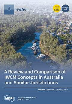
Cover Story (view full-size image): Interpretations of integrated water cycle management (IWCM) differ across jurisdictions. This paper discusses 10 interpretations of the IWCM concept globally, in Australia and jurisdictions similar to Australia. This strategic concept aims to address the internal challenges of managing water demand and supply, appropriate disposal and/or wastewater recycling for re-use and distribution networks and provide services at an affordable rate, per changing community needs. The 10 concepts reviewed recognise IWCM as a resource planning tool to address external challenges such as uncertainties of climate change, circular economy and resilience. Technology, which is changing very fast, is considered, but not as an immediate or primary challenge. These differences have been mainly attributed to the organisation’s responsibilities and constraints, which drive IWCM concept design. View this paper
  • Issues are regarded as officially published after their release is announced to the table of contents alert mailing list.
  • You may sign up for e-mail alerts to receive table of contents of newly released issues.
  • PDF is the official format for papers published in both, html and pdf forms. To view the papers in pdf format, click on the "PDF Full-text" link, and use the free Adobe Reader to open them.
Order results
Result details
Section
Select all
Export citation of selected articles as:
20 pages, 8942 KiB  
Article
Assessment of Present and Future Water Security under Anthropogenic and Climate Changes Using WEAP Model in the Vilcanota-Urubamba Catchment, Cusco, Perú
by Andrés Goyburo, Pedro Rau, Waldo Lavado-Casimiro, Wouter Buytaert, José Cuadros-Adriazola and Daniel Horna
Water 2023, 15(7), 1439; https://doi.org/10.3390/w15071439 - 06 Apr 2023
Cited by 1 | Viewed by 4429
Abstract
Water is an essential resource for social and economic development. The availability of this resource is constantly threatened by the rapid increase in its demand. This research assesses current (2010–2016), short- (2017–2040), middle- (2041–2070), and long-term (2071–2099) levels of water security considering socio-economic [...] Read more.
Water is an essential resource for social and economic development. The availability of this resource is constantly threatened by the rapid increase in its demand. This research assesses current (2010–2016), short- (2017–2040), middle- (2041–2070), and long-term (2071–2099) levels of water security considering socio-economic and climate change scenarios using the Water Evaluation and Planning System (WEAP) in Vilcanota-Urubamba (VUB) catchment. The streamflow data of the Pisac hydrometric station were used to calibrate (1987–2006) and validate (2007–2016) the WEAP Model applied to the VUB region. The Nash Sutcliffe efficiency values were 0.60 and 0.84 for calibration and validation, respectively. Different scenarios were generated for socio-economic factors (population growth and increased irrigation efficiency) and the impact of climate change to evaluate their effect on the current water supply system. The results reveal that water availability is much higher than the current demand in the VUB for the period (2010–2016). For short-, middle- and long term, two scenarios were considered, “Scenario 1” (RCP 4.5) and “Scenario 2” (RCP 8.5). Climate change scenarios show that water availability will increase. However, this increase will not cover the future demands in all the sub-basins because water availability is not evenly distributed in all of the VUB. In both scenarios, an unmet demand was detected from 2050. For the period 2071–2099, an unmet demand of 477 hm3/year for “Scenario 1” and 446 hm3/year for “Scenario 2” were estimated. Because population and agricultural demands are the highest, the effects of reducing the growth rate and improving the irrigation structure were simulated. Therefore, two more scenarios were generated “Scenario 3” (RCP 4.5 with management) and “Scenario 4” (RCP 8.5 with management). This socio-economic management proved to be effective in reducing the unmet demand up to 50% in all sub-basins for the period 2071–2099. Full article
Show Figures

Figure 1

17 pages, 4632 KiB  
Article
Application of Artificial Intelligence in the Assessment and Forecast of Avalanche Danger in the Ile Alatau Ridge
by Viktor Blagovechshenskiy, Akhmetkal Medeu, Tamara Gulyayeva, Vitaliy Zhdanov, Sandugash Ranova, Aidana Kamalbekova and Ulzhan Aldabergen
Water 2023, 15(7), 1438; https://doi.org/10.3390/w15071438 - 06 Apr 2023
Cited by 2 | Viewed by 2559
Abstract
The assessment and forecast of avalanche danger are very important means of preventing avalanche fatalities, especially in recreational areas. The use of artificial intelligence methods for these purposes significantly increases the accuracy of avalanche forecasts. The purpose of this re-search was to improve [...] Read more.
The assessment and forecast of avalanche danger are very important means of preventing avalanche fatalities, especially in recreational areas. The use of artificial intelligence methods for these purposes significantly increases the accuracy of avalanche forecasts. The purpose of this re-search was to improve the methods for assessing and forecasting avalanche danger in the Ile Alatau Ridge. To create a training sample, the data from three meteorological and two avalanche stations for the period from 2002 to 2022 were used. The following predictors were chosen: air temperature, snow cover depth, precipitation, and snowpack stability index. The subject of the assessment and forecasts was the level of avalanche danger, assessed on a five-point scale. The program Statistica StatSoft was used as a neurosimulator. When forecasting avalanche danger, the predictive values of air temperature and precipitation, obtained from numerical weather forecast models, were used. The model correctly assessed the current level of avalanche danger in 90% of cases. The forecast of avalanche danger was justified in 80% of cases. The artificial intelligence program helped the avalanche forecaster to improve the forecast quality. This method is currently being used for compiling an avalanche bulletin for two river basins in the Ile Alatau. Full article
(This article belongs to the Special Issue The Application of Artificial Intelligence in Hydrology, Volume II)
Show Figures

Figure 1

28 pages, 4906 KiB  
Article
Prediction of Sediment Yields Using a Data-Driven Radial M5 Tree Model
by Behrooz Keshtegar, Jamshid Piri, Waqas Ul Hussan, Kamran Ikram, Muhammad Yaseen, Ozgur Kisi, Rana Muhammad Adnan, Muhammad Adnan and Muhammad Waseem
Water 2023, 15(7), 1437; https://doi.org/10.3390/w15071437 - 06 Apr 2023
Cited by 6 | Viewed by 1664
Abstract
Reliable estimations of sediment yields are very important for investigations of river morphology and water resources management. Nowadays, soft computing methods are very helpful and famous regarding the accurate estimation of sediment loads. The present study checked the applicability of the radial M5 [...] Read more.
Reliable estimations of sediment yields are very important for investigations of river morphology and water resources management. Nowadays, soft computing methods are very helpful and famous regarding the accurate estimation of sediment loads. The present study checked the applicability of the radial M5 tree (RM5Tree) model to accurately estimate sediment yields using daily inputs of the snow cover fraction, air temperature, evapotranspiration and effective rainfall, in addition to the flow, in the Gilgit River, Upper Indus Basin (UIB) tributary, Pakistan. The results of the RM5Tree model were compared with support vector regression (SVR), artificial neural network (ANN), multivariate adaptive regression spline (MARS), M5Tree, sediment rating curve (SRC) and response surface method (RSM) models. The resulting accuracy of the models was assessed using Pearson’s correlation coefficient (R2), the root-mean-square error (RMSE) and the mean absolute percentage error (MAPE). The prediction accuracy of the RM5Tree model during the testing period was superior to the ANN, MARS, SVR, M5Tree, RSM and SRC models with the R2, RMSE and MAPE being 0.72, 0.51 tons/day and 11.99%, respectively. The RM5Tree model predicted suspended sediment peaks better, with 84.10% relative accuracy, in comparison to the MARS, ANN, SVR, M5Tree, RSM and SRC models, with 80.62, 77.86, 81.90, 80.20, 74.58 and 62.49% relative accuracies, respectively. Full article
Show Figures

Figure 1

21 pages, 11456 KiB  
Article
Delineation of Groundwater Potential Area using an AHP, Remote Sensing, and GIS Techniques in the Ifni Basin, Western Anti-Atlas, Morocco
by Mustapha Ikirri, Said Boutaleb, Ismael M. Ibraheem, Mohamed Abioui, Fatima Zahra Echogdali, Kamal Abdelrahman, Mouna Id-Belqas, Tamer Abu-Alam, Hasna El Ayady, Sara Essoussi and Farid Faik
Water 2023, 15(7), 1436; https://doi.org/10.3390/w15071436 - 06 Apr 2023
Cited by 10 | Viewed by 2865
Abstract
An assessment of potential groundwater areas in the Ifni basin, located in the western Anti-Atlas range of Morocco, was conducted based on a multicriteria analytical approach that integrated a set of geomorphological and hydroclimatic factors influencing the availability of this resource. This approach [...] Read more.
An assessment of potential groundwater areas in the Ifni basin, located in the western Anti-Atlas range of Morocco, was conducted based on a multicriteria analytical approach that integrated a set of geomorphological and hydroclimatic factors influencing the availability of this resource. This approach involved the use of geographic information systems (GIS) and hierarchical analytical process (AHP) models. Different factors were classified and weighted according to their contribution to and impact on groundwater reserves. Their normalized weights were evaluated using a pairwise comparison matrix. Four classes of potentiality emerged: very high, high, moderate, and low, occupying 15.22%, 20.17%, 30.96%, and 33.65%, respectively, of the basin’s area. A groundwater potential map (GWPA) was validated by comparison with data from 134 existing water points using a receiver operating characteristic (ROC) curve. The AUC was calculated at 80%, indicating the good predictive accuracy of the AHP method. These results will enable water operators to select favorable sites with a high groundwater potential. Full article
(This article belongs to the Special Issue Groundwater Exploration and Hydrogeophysical Research)
Show Figures

Figure 1

25 pages, 6521 KiB  
Article
Evaluation of SPI and Rainfall Departure Based on Multi-Satellite Precipitation Products for Meteorological Drought Monitoring in Tamil Nadu
by Sellaperumal Pazhanivelan, Vellingiri Geethalakshmi, Venkadesh Samykannu, Ramalingam Kumaraperumal, Mrunalini Kancheti, Ragunath Kaliaperumal, Marimuthu Raju and Manoj Kumar Yadav
Water 2023, 15(7), 1435; https://doi.org/10.3390/w15071435 - 06 Apr 2023
Cited by 4 | Viewed by 2825
Abstract
The prevalence of the frequent water stress conditions at present was found to be more frequent due to increased weather anomalies and climate change scenarios, among other reasons. Periodic drought assessment and subsequent management are essential in effectively utilizing and managing water resources. [...] Read more.
The prevalence of the frequent water stress conditions at present was found to be more frequent due to increased weather anomalies and climate change scenarios, among other reasons. Periodic drought assessment and subsequent management are essential in effectively utilizing and managing water resources. For effective drought monitoring/assessment, satellite-based precipitation products offer more reliable rainfall estimates with higher accuracy and spatial coverage than conventional rain gauge data. The present study on satellite-based drought monitoring and reliability evaluation was conducted using four high-resolution precipitation products, i.e., IMERGH, TRMM, CHIRPS, and PERSIANN, during the northeast monsoon season of 2015, 2016, and 2017 in the state of Tamil Nadu, India. These four precipitation products were evaluated for accuracy and confidence level by assessing the meteorological drought using standard precipitation index (SPI) and by comparing the results with automatic weather station (AWS) and rain gauge network data-derived SPI. Furthermore, considering the limited number of precipitation products available, the study also indirectly addressed the demanding need for high-resolution precipitation products with consistent temporal resolution. Among different products, IMERGH and TRMM rainfall estimates were found equipollent with the minimum range predictions, i.e., 149.8, 32.07, 80.05 mm and 144.31, 34.40, 75.01 mm, respectively, during NEM of 2015, 2016, and 2017. The rainfall data from CHIRPS were commensurable in the maximum range of 1564, 421, and 723 mm in these three consequent years (2015 to 2017) compared to AWS data. CHIRPS data recorded a higher per cent of agreement (>85%) compared to AWS data than other precipitation products in all the agro-climatic zones of Tamil Nadu. The SPI values were positive > 1.0 during 2015 and negative < −0.99 for 2016 and 2017, indicating normal/wet and dry conditions in the study area, respectively. This study highlighted discrepancies in the capability of the precipitation products IMERGH and TRMM estimates for low rainfall conditions and CHIRPS estimates in high rainfall regimes. Full article
Show Figures

Figure 1

22 pages, 5829 KiB  
Article
Wave Overtopping and Flooding Costs in the Pre-Design of Longitudinal Revetments
by Márcia Lima, Carlos Coelho and Filipa Jesus
Water 2023, 15(7), 1434; https://doi.org/10.3390/w15071434 - 06 Apr 2023
Cited by 3 | Viewed by 1811
Abstract
Wave overtopping, mainly caused by growing coastal erosion processes, directly affects populations, causing coastal flooding and potential damages. This work aims to develop the relationship between overtopping phenomena and their impact costs through an approach that considers wave runup, corresponding overtopping events, their [...] Read more.
Wave overtopping, mainly caused by growing coastal erosion processes, directly affects populations, causing coastal flooding and potential damages. This work aims to develop the relationship between overtopping phenomena and their impact costs through an approach that considers wave runup, corresponding overtopping events, their flow volume and related flooding costs. Herewith, it is possible to evaluate the relationship between the structure construction and maintenance costs and the consequent costs due to overtopping and flooding damages, leading to the design of optimised coastal structures solutions. To apply the proposed approach, a real case study on the Portuguese northwest coast (Ovar municipality) was analysed, evaluating overtopping and flooding data recorded by the Portuguese Environment Agency (APA), allowing costs per unit flooded volume to be estimated. Then, future scenarios were predicted to assess the influence of climate change, discuss intervention scenarios and evaluate the uncertainty of economic parameters’ evolution. The proposed methodological approach represents a step forward in the estimative of coastal overtopping and flooding impacts, leading to increasing the knowledge about flooding and overtopping costs and optimised mitigation measures in artificialised coastal areas, where coastal defence works (longitudinal revetments) are present. This approach fills a gap in knowledge regarding this type of forecast in a medium- to long-term perspective. Full article
Show Figures

Figure 1

13 pages, 4750 KiB  
Article
Characteristics of Very Large-Scale Motions in Rough-Bed Open-Channel Flows
by Ying Shen, Shengfa Yang and Jie Liu
Water 2023, 15(7), 1433; https://doi.org/10.3390/w15071433 - 06 Apr 2023
Viewed by 1154
Abstract
Rough-bed open-channel flows (OCFs) are ubiquitous in rivers and canals. However, the scaling and energy contents of very-large-scale motions (VLSMs) in such flows remain unclear. In this study, the above characteristics of VLSMs are experimentally investigated with the measurement of particle imaging velocimetry [...] Read more.
Rough-bed open-channel flows (OCFs) are ubiquitous in rivers and canals. However, the scaling and energy contents of very-large-scale motions (VLSMs) in such flows remain unclear. In this study, the above characteristics of VLSMs are experimentally investigated with the measurement of particle imaging velocimetry (PIV). VLSM wavelengths obtained via premultiplied spectra analysis were consistent with previously reported values. Comparisons with these studies ruled out the role of relative submergence, and suggested that the channel aspect ratio is key to controlling the VLSM wavelengths in OCFs. VLSMs carry approximately 60% of the turbulence kinetic energy (TKE) and 38–50% of the Reynolds stress in rough-bed OCFs. The VLSM-related TKE fraction in the 0.1–0.5H range increased with increasing friction Reynolds number, while variation in the Reynolds shear stress did not exhibit any explicit trend. Full article
(This article belongs to the Section Hydraulics and Hydrodynamics)
Show Figures

Figure 1

11 pages, 2752 KiB  
Article
Motion Characteristics of Gas–Liquid Two-Phase Flow of Microbubbles in a Labyrinth Channel Used for Aerated Drip Irrigation
by Yanfang Liu, Guocui Wang, Xianna Zhang, Hongchen Li, Bingcheng Si, Wenqian Liu and Zhenhua Zhang
Water 2023, 15(7), 1432; https://doi.org/10.3390/w15071432 - 06 Apr 2023
Cited by 1 | Viewed by 1511
Abstract
The indefinite characteristics of gas–liquid two-phase flow limit the usage of aerated drip irrigation. Gas–liquid two-phase flow in a labyrinth channel was observed using a particle tracking velocimetry (PTV) technique in this study. The motion trajectory and velocity vector of large numbers of [...] Read more.
The indefinite characteristics of gas–liquid two-phase flow limit the usage of aerated drip irrigation. Gas–liquid two-phase flow in a labyrinth channel was observed using a particle tracking velocimetry (PTV) technique in this study. The motion trajectory and velocity vector of large numbers of microbubbles were characterized and analyzed at 0.01, 0.02, 0.04 MPa inlet pressure and in three labyrinth channels with different geometries. The results indicated that bubbly flow was the typical flow pattern in a labyrinth channel, with slug flow occurring occasionally. Smooth and gliding motion trajectories of bubbles were observed in the mainstream zone, while twisted trajectories were seen in the vortex zone. Increasing the inlet pressure increased the number of bubbles and the trajectory length in the vortex zone. When the inlet pressure increased from 0.02 to 0.04 MPa, the 25th percentile of Rc-t (the Ratio of Circular path length in the vortex zone to the Total trajectory length for a single bubble) increased from 0 to 12.3%, 0 to 6.1%, and 0 to 5.2% for channels A, B, and C, respectively; the 75th percentile increased from 31.3% to 43.9%, 27.5% to 31.9%, and 18.7% to 22.3%. The velocity vectors of the bubbles showed position dependence. Bubbles with high speed were found in the mainstream zone with their directions parallel to the water flow direction. Bubbles with low speed were seen in the vortex zone, moving in all directions. With inlet pressure increased from 0.01 to 0.04 MPa, the mean instantaneous velocities of bubbles in channels A, B, and C are increased by 106.2%, 107.6%, and 116.6%, respectively. At 0.04 MPa, channel A has the longest path length and the highest instantaneous velocity of bubbles in the vortex zone among three channels, exhibiting the highest anti-clogging performance of the three channels. This study will help in the comprehensive understanding of gas–liquid two-phase flow in a labyrinth channel used for aerated drip irrigation. Full article
(This article belongs to the Section Hydraulics and Hydrodynamics)
Show Figures

Figure 1

17 pages, 3203 KiB  
Article
Sr Isotope, Major, and Trace Element Signatures in Karst Groundwaters
by Anamaria Iulia Török, Ana Moldovan, Claudiu Tănăselia, Eniko Kovacs, Ionuț Cornel Mirea, Oana Teodora Moldovan and Erika Andrea Levei
Water 2023, 15(7), 1431; https://doi.org/10.3390/w15071431 - 06 Apr 2023
Cited by 1 | Viewed by 1652
Abstract
Natural and anthropogenic factors highly influence the concentration of major (Na, Mg, K, Ca) and trace (Sr, Ba, Mn, Li) elements, anions (HCO3, NO3, SO42−, Cl), and Sr isotopic signatures. The current [...] Read more.
Natural and anthropogenic factors highly influence the concentration of major (Na, Mg, K, Ca) and trace (Sr, Ba, Mn, Li) elements, anions (HCO3, NO3, SO42−, Cl), and Sr isotopic signatures. The current study identified the Sr isotopic signature in groundwaters from the Southern Carpathians and Apuseni Mountains karst areas of Romania and its relation to the water’s chemistry. The Sr concentration ranged between 16.5 and 658 µg/L, but in most groundwaters, it was below 200 µg/L. A considerable spatial variation and a low temporal variation, with a slightly lower Sr concentration in the winter than in spring, were observed. The strong positive correlation of the Sr with Ca, Mg, K, and Na indicated the common source of these elements. The main source of the Sr in groundwaters was the dissolution of carbonates, especially calcite, and dolomite to a lesser extent. The 87Sr/86Sr isotopic ratio ranged between 0.7038 and 0.7158. Generally, waters with a high Sr concentration and moderate 87Sr/86Sr ratios indicated carbonate dissolution, whereas samples with low Sr concentrations and high 87Sr/86Sr ratios suggested the dissolution of silicates. Full article
(This article belongs to the Special Issue Research on Karst Eco-Hydrology and Sediment)
Show Figures

Figure 1

17 pages, 3185 KiB  
Article
Membrane Processes Treatment and Possibility of Agriculture Reuse of Textile Effluents: Study Case in Tunisia
by Sourour Mzahma, Joelle Duplay, Dalila Souguir, Raja Ben Amar, Malika Ghazi and Mohamed Hachicha
Water 2023, 15(7), 1430; https://doi.org/10.3390/w15071430 - 06 Apr 2023
Cited by 1 | Viewed by 2249
Abstract
Several processes have been developed to treat the textile effluents. Membrane technologies are among the most reliable processes for purifying these effluents. However, due to high costs, only reduced quantities are being treated. The recycling practices of treated textile effluents (TTE) in agriculture [...] Read more.
Several processes have been developed to treat the textile effluents. Membrane technologies are among the most reliable processes for purifying these effluents. However, due to high costs, only reduced quantities are being treated. The recycling practices of treated textile effluents (TTE) in agriculture have not been appropriately explored. This work evaluates the quality of waters treated by membrane processes and puts forward a scenario for optimizing TTEs in agriculture. Four types of TTE have been tested to irrigate Sesbania bispinosa plants: water from biological treatment (BT) and water from three membrane processes after BT (Ultrafiltration (UF), Nanofiltration (NF), and Reverse Osmosis (RO)). The results indicate that the NF and RO membranes have a high affinity to remove monovalent and multivalent ions. Indeed, the removal of SO42−, Na+, and Cl by NF was 83, 61, and 55%, respectively. Thus, the RO reduces approximately 96% of these elements. Irrigation with NF and RO waters has no negative effect on the soil and Sesbania plants, contrary to BT and UF waters. It appears that the reuse of TTE resulting from BT is not a good alternative; however, by carrying out additional treatments by NF and RO, their reuses have been made possible. The achieved results are a proposal to simultaneously solve three major problems affecting most of the world’s population: (1) environmental pollution by reducing the discharge of untreated textile effluents and improving the quality of this discharged water; (2) the pressure on water resources in the agricultural sector by replacing a conventional resource with a non-conventional resource (TTE); and (3) the lack of fodder, especially in the summer, by opting for crops that adapt to the quality of these TTE. Full article
(This article belongs to the Special Issue Monitoring, Reclamation and Management of Salt-Affected Lands)
Show Figures

Figure 1

19 pages, 4434 KiB  
Article
Geochemistry of Metals and Organic Matter in Water and Sediments of the Karst River Cetina, Croatia
by Krešimir Maldini, Neven Cukrov, Kristina Pikelj, Natalija Matić and Marina Mlakar
Water 2023, 15(7), 1429; https://doi.org/10.3390/w15071429 - 06 Apr 2023
Cited by 1 | Viewed by 2261
Abstract
The Cetina River Basin (CRB) belongs to a Dinaric karst area (Croatia). According to the obtained results on water and sediment quality, the Cetina River reaches the sixth goal of Sustainable Development (source of drinking water). Together with the CRB water quality assessment, [...] Read more.
The Cetina River Basin (CRB) belongs to a Dinaric karst area (Croatia). According to the obtained results on water and sediment quality, the Cetina River reaches the sixth goal of Sustainable Development (source of drinking water). Together with the CRB water quality assessment, it was confirmed that sediments undoubtedly contribute to the purification of watercourses from trace metals as well as organic matter. In 5 years, water samples were collected at 20 sampling sites and sediment samples were collected at 18 sampling sites. The fresh water of the Cetina River belongs to the hydrocarbonate type due to its lithology. The concentrations of the measured elements in the sediments, normalized to Al, are an indicator of possible pressures affecting the ecosystem of the river. According to the Principal Component Analysis (PCA) for elements in sediments, Principal Component 1 (PC1) describes the geogenic origin of the elements, while Principal Component 2 (PC2) describes positive values reflecting anthropogenic pressures (Total Nitrogen, TN; and Total Phosphorus, TP). Depending on element composition, the factor scores related to PC1 and PC2 resulted in four different groups of sites. The first three groups of sediments showed geological impact, while the fourth group was partially anthropogenic in origin. The hierarchical cluster analysis showed four clusters in relation to the content of the elements. Cluster analysis of all elements and the Total Organic Carbon (TOC) in the sediments showed grouping in only two clusters, the first cluster consisting of Ca, and the second of TOC with other elements. Full article
(This article belongs to the Special Issue Fluvial Sediment and Geomorphology)
Show Figures

Figure 1

12 pages, 1731 KiB  
Article
Field Calibration of Semipermeable Membrane Devices (SPMDs) for Persistent Organic Pollutant Monitoring in a Reservoir
by Jhon Fredy Narvaez Valderrama, Juan D. González, Jazmín Porras and Francisco J. Molina
Water 2023, 15(7), 1428; https://doi.org/10.3390/w15071428 - 06 Apr 2023
Cited by 1 | Viewed by 1484
Abstract
Persistent Organic Pollutants (POPs) in water can reach levels below ppt (ng L−1), representing a challenge for risk assessment using long-term exposure. Therefore, sampling devices to monitor trace levels of organic compounds are suitable due to their sensitivity and low detection [...] Read more.
Persistent Organic Pollutants (POPs) in water can reach levels below ppt (ng L−1), representing a challenge for risk assessment using long-term exposure. Therefore, sampling devices to monitor trace levels of organic compounds are suitable due to their sensitivity and low detection limits. In this work, the field calibration and monitoring for POPs, such as Polycyclic Aromatic Hydrocarbons (PAHs) and pesticides, in a drinking water reservoir were carried out using semipermeable membrane devices (SPMDs). The SPMDs were spiked with deuterated PCBs used as PRCs, and their dissipation was measured at 5, 10, 15 and 24 days. The SPMDs were dialyzed in hexane twice and the initial amount (N) and final amount (No) of PRCs in extracts were estimated by GC/MS to calculate the sampling rate (Rs) for target compounds. The PCBs were dissipated more than 30% at 24 days, and Rs were calculated between 27.8 and 72.7 L day−1 for PAHs and 35.8 and 71.3 L day−1 for pesticides. Finally, PAH congeners such as Naphthalene, Acenaphthylene, Acenaphthene, Fluorene, Phenanthrene, Anthracene, Fluoranthene and Pyrene were detected at water concentration (Cw) ranges between 0.5 and 2.7 ng L−1, whilst chlorpyrifos was the only pesticide detected at 19.0 ng L−1 in the reservoir. This calibration showed that PRCs do not dissipate entirely in 24 days and that dissipation modelling may be applied for Cw estimation of POPs in reservoirs. Full article
(This article belongs to the Section Water Quality and Contamination)
Show Figures

Graphical abstract

23 pages, 92102 KiB  
Article
Remediation of Methylene Blue Dye from Wastewater by Using Zinc Oxide Nanoparticles Loaded on Nanoclay
by Nisha Choudhary, Virendra Kumar Yadav, Huma Ali, Daoud Ali, Bader O. Almutairi, Simona Cavalu and Ashish Patel
Water 2023, 15(7), 1427; https://doi.org/10.3390/w15071427 - 06 Apr 2023
Cited by 7 | Viewed by 2075
Abstract
Dyes are one of the major environmental pollutants throughout the world, leading to pollution and numerous diseases. Though several techniques have been applied for the remediation of dyes, most of them are ineffective. The authors developed a halloysite clay/zinc oxide nanocomposite (HC/ZnONC) via [...] Read more.
Dyes are one of the major environmental pollutants throughout the world, leading to pollution and numerous diseases. Though several techniques have been applied for the remediation of dyes, most of them are ineffective. The authors developed a halloysite clay/zinc oxide nanocomposite (HC/ZnONC) via a chemical route in the present study. The nanocomposite and its constituents, i.e., raw halloysite clay (HC) and zinc oxide nanoparticles (ZnONPs) (synthesized using the same chemical method) were analyzed for their detailed properties by sophisticated instruments. The field emission scanning electron microscope (FE-SEM) and transmission electron microscope (TEM) analysis showed spherical-shaped ZnONPs with an average size of 54.9 nm and tube-like shapes of HC with a diameter ranging from 40–200 nm and a length at the micron scale, while the nanocomposite had incorporated ZnONPs in their tube-like structures. Ultraviolet-Diffuse Reflectance Spectroscopic (UV-DRS) study revealed the photocatalytic ability of the nanocomposite with a band of 3.08 eV. A high surface area of 60.25 m2/g and the microporous and mesoporous nature of the nanocomposite were confirmed by the Brunauer–Emmet–Teller (BET) surface area analyzer. Finally, the developed nanocomposite was used for the remediation of methylene blue from the aqueous solutions, and the efficiency of removal varied from 90 to 97%. Full article
Show Figures

Figure 1

15 pages, 3892 KiB  
Article
The Spatio-Temporal Dynamic Patterns of Shallow Groundwater Level and Salinity: The Yellow River Delta, China
by Xiaomei Fan, Tong Min and Xiaojie Dai
Water 2023, 15(7), 1426; https://doi.org/10.3390/w15071426 - 06 Apr 2023
Cited by 5 | Viewed by 1676
Abstract
Shallow groundwater in coastal aquifers is a highly dynamic and complex system with a high risk of seawater intrusion. Analyzing the spatio-temporal dynamic patterns of groundwater can help to manage the groundwater resource and prevent it from degradation. Based on the groundwater level [...] Read more.
Shallow groundwater in coastal aquifers is a highly dynamic and complex system with a high risk of seawater intrusion. Analyzing the spatio-temporal dynamic patterns of groundwater can help to manage the groundwater resource and prevent it from degradation. Based on the groundwater level (GWL) and electrical conductivity (EC) monitoring data of 18 observation wells in the Yellow River Delta (YRD) from 2004 to 2010, this research analyses the groundwater dynamics using a robust seasonal trend decomposition technique (STL) and spatial interpolation method to detect the groundwater spatio-temporal dynamic patterns of groundwater level and salinity. Combined with hydro-climatic data, the Pearson correlation method and the Mann-Kendall (MK) trend analysis were used to further reveal the impacts that induce their trends and seasonal variations. Our analyses show that the risk of seawater intrusion into local shallow aquifers in this region is high, with the mean groundwater level over 42% of the region lower than the local sea level, and the mean groundwater EC over 96% of the region met the standards for seawater intrusion. In addition, the trends of groundwater level generally declined by 0.01~0.45 m/a and salinity increased by 1.153~25.608 μs/cm.a, which are consistent with the trend of precipitation decline. The seasonal dynamics of groundwater level and salinity are highly correlated with the seasonal components of rainfall and evaporation. It can be concluded that the extent of seawater intrusion will increase in the future with sea level rise. The approaches used in this study proved to be effective and can certainly serve as an example for the analysis of the spatio-temporal dynamics of groundwater in other coastal regions. Full article
Show Figures

Figure 1

17 pages, 1625 KiB  
Article
Visitors’ Environmental Concerns in Gray’s Reef National Marine Sanctuary: An Offshore Marine Protected Area
by Marieke Lemmen, Robert C. Burns, Ross G. Andrew and Jasmine Cardozo Moreira
Water 2023, 15(7), 1425; https://doi.org/10.3390/w15071425 - 06 Apr 2023
Cited by 1 | Viewed by 1716
Abstract
Marine sanctuaries serve as popular destinations for ecotourism, natural resource exploration, and recreation across the US. While often positive, visitation in marine and coastal areas can cause ecological threats to these ecosystems. Increased visitation in marine environments has led to the need for [...] Read more.
Marine sanctuaries serve as popular destinations for ecotourism, natural resource exploration, and recreation across the US. While often positive, visitation in marine and coastal areas can cause ecological threats to these ecosystems. Increased visitation in marine environments has led to the need for management due to negative ecological and social impacts. Understanding environmental values, attitudes, and perceptions is important to the success of environmental protection. Using online surveys sent via Qualtrics asking questions regarding the users’ knowledge, attitudes, and perceptions of ocean resources, goods and services, this research focused on identifying user profiles and understanding their environmental perception associated with Gray’s Reef National Marine Sanctuary, an offshore marine protected area, and surrounding coastal Georgia. The results show that across multiple types of threats or phenomena, respondents are most concerned about threats to resources related to pollution. Furthermore, they support marine protection and are willing to adjust their consumption habits, such as recycling and energy use, to ensure the sustainable use of ocean resources. The inclusion of insights achieved through research about visitor perceptions into management decision making and planning can positively contribute to the success of environmental protection. Full article
Show Figures

Figure 1

20 pages, 6810 KiB  
Article
Social Innovation Perspective of Community-Based Climate Change Adaptation: A Framework-Based Study of Ladakh, India
by Tusharkanti Kumar and Izuru Saizen
Water 2023, 15(7), 1424; https://doi.org/10.3390/w15071424 - 06 Apr 2023
Cited by 4 | Viewed by 3458
Abstract
Indigenous knowledge of local environments is crucial for developing innovative and contextual climate change adaptation strategies. Although the significance of community-led efforts based on this knowledge has been well acknowledged, they have not been effectively incorporated into mainstream development processes. The mountainous region [...] Read more.
Indigenous knowledge of local environments is crucial for developing innovative and contextual climate change adaptation strategies. Although the significance of community-led efforts based on this knowledge has been well acknowledged, they have not been effectively incorporated into mainstream development processes. The mountainous region of Ladakh presents a novel case of water storage in the form of ice reservoirs as an adaptive strategy against intensified water scarcity. This study aims to assess community-based innovations in climate change adaptation strategies and find solutions for their effective integration. This study theorizes a framework for Social Innovation in Climate Change Adaptation (SICCA) for a structured analysis of the situation in Ladakh. This research was conducted through interviews, surveys, Geographic Information System-based mapping, and field observations to analyze the use of ice reservoirs as a solution to water scarcity issues. The results demonstrate the wide recognition of these techniques’ effectiveness and the role of the community in the planning, execution, and operation of the initiatives. The findings highlight the challenges in their scaling up and diffusion. The research emphasizes the need to recognize and value community-based adaptation strategies to address the challenges posed by climate change. It offers recommendations for integrating them into the mainstream development process, and the framework serves as a significant outcome to guide policymakers and civil society actors for practical implementation. Full article
(This article belongs to the Section Water and Climate Change)
Show Figures

Figure 1

12 pages, 3252 KiB  
Article
Prediction of Earth Dam Seepage Using a Transient Thermal Finite Element Model
by Jarrett Wise, Sherry Hunt and Mohammed Al Dushaishi
Water 2023, 15(7), 1423; https://doi.org/10.3390/w15071423 - 06 Apr 2023
Cited by 2 | Viewed by 1492
Abstract
With the majority of the United States Department of Agriculture-Natural Resources Conservation Service (USDA-NRCS)-sponsored earthen dams exceeding their planned service life, seepage is a concern since it is a common failure mechanism among earthen dams as a whole. Seepage occurs when water penetrates [...] Read more.
With the majority of the United States Department of Agriculture-Natural Resources Conservation Service (USDA-NRCS)-sponsored earthen dams exceeding their planned service life, seepage is a concern since it is a common failure mechanism among earthen dams as a whole. Seepage occurs when water penetrates a hydraulic barrier to create open pathways, channels, or piping leading to internal erosion or stability issues due to increased effective stress. Due to the complex geometries of these hydraulic structures, time-dependent boundary conditions, and complicated failure analyses, numerical approaches have been used to estimate seepage. However, the existing numerical models are either computationally expensive or assume steady-state conditions. This work develops the framework for using a transient thermal finite element analysis (FEA) model as an analogy to predict transient seepage. The FEA model is compared to a transient analytical model to verify the approach. A sensitivity analysis of the FEA model shows that the time aspect of seepage flow is dependent on the medium, i.e., soil, and not on the fluid properties. Full article
(This article belongs to the Section Soil and Water)
Show Figures

Figure 1

17 pages, 3103 KiB  
Article
Streamflow Simulation with High-Resolution WRF Input Variables Based on the CNN-LSTM Hybrid Model and Gamma Test
by Yizhi Wang, Jia Liu, Lin Xu, Fuliang Yu and Shanjun Zhang
Water 2023, 15(7), 1422; https://doi.org/10.3390/w15071422 - 06 Apr 2023
Cited by 3 | Viewed by 1913
Abstract
Streamflow modelling is one of the most important elements for the management of water resources and flood control in the context of future climate change. With the advancement of numerical weather prediction and modern detection technologies, more and more high-resolution hydro-meteorological data can [...] Read more.
Streamflow modelling is one of the most important elements for the management of water resources and flood control in the context of future climate change. With the advancement of numerical weather prediction and modern detection technologies, more and more high-resolution hydro-meteorological data can be obtained, while traditional physical hydrological models cannot make full use of them. In this study, a hybrid deep learning approach is proposed for the simulation of daily streamflow in two mountainous catchments of the Daqing River Basin, northern China. Two-dimensional high-resolution (1 km) output data from a WRF model were used as the model input, a convolutional neural network (CNN) model was used to extract the physical and meteorological characteristics of the catchment at a certain time, and the long short-term memory (LSTM) model was applied to simulate the streamflow using the time-series data extracted by the CNN model. To reduce model input noise and avoid overfitting, the Gamma test method was adopted and the correlations between the input variables were checked to select the optimal combination of input variables. The performance of the CNN-LSTM models was acceptable without using the Gamma test (i.e., with all WRF input variables included), with NSE and RMSE values of 0.9298 and 9.0047 m3/s, respectively, in the Fuping catchment, and 0.8330 and 1.1806 m3/s, respectively, in the Zijingguan catchment. However, it was found that the performance of the model could be significantly improved by the use of the Gamma test. Using the best combination of input variables selected by the Gamma test, the NSE of the Fuping catchment increased to 0.9618 and the RMSE decreased to 6.6366 m3/s, and the NSE of the Zijingguan catchment increased to 0.9515 and the RMSE decreased to 0.6366 m3/s. These results demonstrate the feasibility of the CNN-LSTM approach for flood streamflow simulation using WRF-downscaled high-resolution data. By using this approach to assess the potential impacts of climate change on streamflow with the abundant high-resolution meteorological data generated by different climate scenarios, water managers can develop more effective strategies for managing water resources and reducing the risks associated with droughts and floods. Full article
Show Figures

Figure 1

19 pages, 12679 KiB  
Article
Applying Chemical and Statistical Analysis Methods to Evaluate Water and Stream Sediments around the Coal Mine Area in Dazhu, China
by Dongping Deng, Yong Wu, Bangzheng Ren and Heng Yin
Water 2023, 15(7), 1421; https://doi.org/10.3390/w15071421 - 06 Apr 2023
Viewed by 1571
Abstract
In this study, groundwater, stream water, and stream sediment samples were collected from a coal mine area in Dazhu, Southwestern China, and hydrogeochemical, multivariate, and X-ray analyses were conducted to examine the effects of coal mine pollution. The groundwater and stream samples were [...] Read more.
In this study, groundwater, stream water, and stream sediment samples were collected from a coal mine area in Dazhu, Southwestern China, and hydrogeochemical, multivariate, and X-ray analyses were conducted to examine the effects of coal mine pollution. The groundwater and stream samples were slightly acidic to alkaline (6.7 to 8.2). Typically, the water samples were dominated by Ca2+ + Mg2+–HCO3 and Ca2+ + Mg2+–Cl. SO42− originates from gypsum dissolution and pyrite oxidation, and Ca2+ and Mg2+ may be related to the dissolution of carbonate. According to the Chinese standard and World Health Organization guidelines, the water in the coal mine area is of good quality in terms of its physical and chemical properties, except for the concentration of Mn and Fe, with values of 1925.14 μg/L and 12,872.88 μg/L, respectively. A principal component analysis revealed two groups in which the concentration of metals and metalloids in stream sediments are affected by the coal mine drainage. The Mn and Fe average concentration in the downstream Kongjiagou drain sediment samples was 2035.1 ppm and 6%, respectively. These values were higher than the average Mn and Fe concentration in Xiaojiagou at 453.1 ppm and 2.9%, respectively. Both the Mn and Fe concentration were higher than the background values (640 ppm and 4.4%). Full article
(This article belongs to the Section Hydrogeology)
Show Figures

Figure 1

18 pages, 2899 KiB  
Article
Selective and Binary Adsorption of Anions onto Biochar and Modified Cellulose from Corn Stalks
by Candelaria Tejada-Tovar, Ángel Villabona-Ortíz, Ángel Darío González-Delgado, Adriana Herrera-Barros and Rodrigo Ortega-Toro
Water 2023, 15(7), 1420; https://doi.org/10.3390/w15071420 - 05 Apr 2023
Cited by 1 | Viewed by 1797
Abstract
Water treatment alternatives such as adsorption using agricultural residues are currently being studied to eliminate pollutants that cause eutrophication in water bodies, avoiding the alteration of aquatic ecosystems. In this work, two bio-adsorbents were prepared using cellulose extracted from corn stems, Zea mays [...] Read more.
Water treatment alternatives such as adsorption using agricultural residues are currently being studied to eliminate pollutants that cause eutrophication in water bodies, avoiding the alteration of aquatic ecosystems. In this work, two bio-adsorbents were prepared using cellulose extracted from corn stems, Zea mays, which were labeled as MC (quaternized cellulose modified with Cetyl trimethyl ammonium chloride) and B 1:1 (biochar obtained by the impregnation of the biomass with an H2SO4 solution, 50% v/v, using a ratio of 1:1% weight of biomass to volume, followed by carbonization at 520 °C for 30 min with a heating rate of 10 °C/min). FTIR, TGA, DSC, and SEM-EDS were used to study the properties of the bio-adsorbents. The effect of temperature over nitrate and phosphate adsorption in the selective and binary system at 100 mg/L was tested at five temperatures: 25, 30, 35, 40, and 45 °C, using a load of the pollutant of 100 mg/L, volume of 5 mL, and a rate of bio-adsorbent of 2 g/L at 200 rpm. Results showed a phosphate removal of 29.1% using the B 1:1 bio-adsorbent at 30 °C and 23.8% with the MC bio-adsorbent at 35 °C. In the case of nitrate, removal of 40% was determined with the B 1:1 bio-adsorbent at 25 °C, while removal of 38.5% was attained at 30 °C after using the MC bio-adsorbent. The equilibrium was reached at 420 min. Nitrate adsorption with the MC sample showed a good adjustment to the pseudo-second-order model. The pseudo-first-order model described the kinetics of phosphate removal with MC, while this model had a good fit with the B 1:1 sample for nitrate and phosphate. Freundlich’s model also adjusted the adsorption equilibrium for both anions with acceptable accuracy. Moreover, the binary study indicated selectivity for the phosphate, suggesting the potential applications of the carbon-based bio-adsorbents for anionic ions remotion in aqueous media. Full article
Show Figures

Figure 1

16 pages, 4436 KiB  
Article
Degradation of Tetracycline Using a Magnetic Gadolinium-Decorated Nanoplatform: A Peroxidase Biomimetic System with Fenton-Like Catalysis
by Nesa Hamidian, Gholamreza Dehghan, Samaneh Rashtbari, Alireza Khataee, Mehdi Khoobi and Nader Sheibani
Water 2023, 15(7), 1419; https://doi.org/10.3390/w15071419 - 05 Apr 2023
Viewed by 1900
Abstract
Pharmaceutical pollutants such as tetracycline (TC) pose a growing global threat to aquatic and terrestrial biodiversity. Developing new methods for the degradation of these pollutants would be a significant advancement in their management. The progress in the development of synthetic enzymes based on [...] Read more.
Pharmaceutical pollutants such as tetracycline (TC) pose a growing global threat to aquatic and terrestrial biodiversity. Developing new methods for the degradation of these pollutants would be a significant advancement in their management. The progress in the development of synthetic enzymes based on nanomaterials has resulted in their replacement for natural enzymes with higher performance quality. In this work, a magnetite/Gd3+/β-cyclodextrin nanoplatform was prepared and used for TC degradation for the first time. The characterization studies were carried out using various methods, including SEM, XRD, and FTIR. The peroxidase-mimic activity of the synthesized nanoplatform was evaluated using a colorimetric assay. Kinetic parameters, including Km and Vmax, were obtained using TMB (3,3′,5,5′-tetramethylbenzidine) and H2O2. The results indicated that prepared particles had a lower Km value than horseradish peroxidase (HRP), which confirmed the higher affinity of the prepared nanoplatform toward its substrates. We also demonstrated that our recyclable nanoplatform (3 mg/mL) was able to degrade 82% of TC (4.5 mM) in 85 min without any initiator such as light or ultrasonic waves. Collectively, these results confirmed the high affinity of the synthesized nanoplatform toward desired substrates, including TC. Full article
Show Figures

Figure 1

15 pages, 4785 KiB  
Article
Estimation of Evapotranspiration Based on a Modified Penman–Monteith–Leuning Model Using Surface and Root Zone Soil Moisture
by Hao Duan, Hongli Zhao, Qiuju Li, Haowei Xu and Chengxin Han
Water 2023, 15(7), 1418; https://doi.org/10.3390/w15071418 - 05 Apr 2023
Cited by 2 | Viewed by 1632
Abstract
Most of the current parameterization schemes for the Penman–Monteith–Leuning evapotranspiration (ET) model (PML) consider meteorological and energy factors and land use types, but the analysis of the effect of soil moisture (SM) changes on ET processes lacks sufficient attention. This paper proposes a [...] Read more.
Most of the current parameterization schemes for the Penman–Monteith–Leuning evapotranspiration (ET) model (PML) consider meteorological and energy factors and land use types, but the analysis of the effect of soil moisture (SM) changes on ET processes lacks sufficient attention. This paper proposes a parameterization scheme for the sensitive parameters of the PML model considering soil water content, i.e., coupling the land surface SM in the calculation of soil evaporation coefficient f and coupling the SM of the root zone layer in the calculation of maximum stomatal conductance gsx, respectively. The new parameterization scheme is validated at 13 flux sites worldwide and showed significant improvements in improving the correlation with measured values. Moreover, based on the analysis of the spatial distribution of soil evaporation and vegetation transpiration, and the correlation between SM and ET, the regional characteristics of the effect of SM on ET are further revealed. This study provides a new idea for conducting the fusion simulation of SM based on a PML model, which is useful for the subsequent development of the model. Full article
(This article belongs to the Special Issue Evapotranspiration Measurements and Modeling II)
Show Figures

Figure 1

12 pages, 5453 KiB  
Article
A Route Search System to Avoid the Danger to Life in Dynamic Inundation
by Kohei Ogawa, Takuya Inoue, Yuki Hiramatsu and Jagriti Mishra
Water 2023, 15(7), 1417; https://doi.org/10.3390/w15071417 - 05 Apr 2023
Cited by 1 | Viewed by 1366
Abstract
In recent years, the frequency of torrential rains has increased due to abnormal weather conditions. Torrential rains have caused extensive flooding damage in many areas. As delays in evacuation can pose a threat to life, a quick search for safe evacuation routes has [...] Read more.
In recent years, the frequency of torrential rains has increased due to abnormal weather conditions. Torrential rains have caused extensive flooding damage in many areas. As delays in evacuation can pose a threat to life, a quick search for safe evacuation routes has become more important than ever before. In this study, we constructed a new system for searching evacuation routes that incorporates a function that varies the weight of each road in the route search depending on the distance from the flooded area D and the distance that the flood area extends in 10 min D (i.e., the flood’s inundation speed). We conducted multiple hypothetical flood simulations with different locations of levee breaches and shelters in the study site (Obihiro City, Japan). Then, we compared the results with the conventional system that does not include the proposed function. The results showed that the system proposed in this study increased the number of successful evacuees by up to 2.16 times compared to the conventional system. In our system, the weight function is set to the Cd power of D/D; increasing the model parameter Cd selects a route that detours more of the flooded area. The model parameter Cd that maximizes the number of successful evacuees is roughly constant, regardless of the locations of the levee breaches or shelters in the study site. Full article
(This article belongs to the Special Issue Flood Risk and Response Management)
Show Figures

Figure 1

13 pages, 2196 KiB  
Article
Groundwater Dynamics near the Saltwater–Freshwater Interface in an Island of Seto Inland Sea
by Yusuke Tomozawa, Shin-ichi Onodera, Mitsuyo Saito and Kazuyoshi Asai
Water 2023, 15(7), 1416; https://doi.org/10.3390/w15071416 - 05 Apr 2023
Viewed by 1244
Abstract
Groundwater dynamics near the saltwater–freshwater interface were investigated in an island of the Seto Inland Sea, using multiple tracers (δD, δ18O, Cl, SF6, and 14C) at two coastal groundwater monitoring wells at depths of 10–40 m. [...] Read more.
Groundwater dynamics near the saltwater–freshwater interface were investigated in an island of the Seto Inland Sea, using multiple tracers (δD, δ18O, Cl, SF6, and 14C) at two coastal groundwater monitoring wells at depths of 10–40 m. The groundwater recharge area and age were also estimated using these tracers. Additionally, bedrock groundwater at a depth of 40 m at the 2.7 m altitude was brackish and considered to be near the saltwater–freshwater interface, and a mixture of seawater (2–3.5%) and fresh groundwater (97–98%) was estimated by the Cl concentration. Based on the δ18O of fresh groundwater estimated from the seawater mixing ratio, the recharge area was estimated to range from near to above the summit; however, this region is unlikely to be the actual recharge area, as the groundwater may be old freshwater that was recharged during a previously colder period. Groundwater dating using SF6 and 14C suggests that the fresh groundwater originated during the last glacial period (assumed 20,000 years ago) and that the 40 m deep bedrock groundwater is a mixture of old water (0–28%), 30 m deep groundwater (76–100%), and stagnant seawater (1–3%). Full article
(This article belongs to the Section Hydrogeology)
Show Figures

Figure 1

16 pages, 1524 KiB  
Article
Transport of Thiophanate Methyl in Porous Media in the Presence of Titanium Dioxide Nanoparticles
by Anthi S. Stefanarou, Vasileios E. Katzourakis, Fenglian Fu, Anastasios A. Malandrakis and Constantinos V. Chrysikopoulos
Water 2023, 15(7), 1415; https://doi.org/10.3390/w15071415 - 05 Apr 2023
Cited by 1 | Viewed by 1462
Abstract
Human activities in modern life are contributing significantly to global environmental pollution. With the need for clean drinking water ever increasing, so does the need to find new water-cleaning technologies. The ability of nanoparticles (NPs) to remove persistent pollutants from aqueous solutions makes [...] Read more.
Human activities in modern life are contributing significantly to global environmental pollution. With the need for clean drinking water ever increasing, so does the need to find new water-cleaning technologies. The ability of nanoparticles (NPs) to remove persistent pollutants from aqueous solutions makes them very important for use in water treatment technology. Titanium dioxide (TiO2) is recognized as an NP with unique optical, thermal, electrical, and magnetic properties and is widely used as an adsorbent material. Due to the extensive use of pesticides, their removal from the aquatic environment has gained widespread attention from the scientific community. In the present work, the transport of pesticide thiophanate methyl (TM), as well as the cotransport of TM and TiO2 nanoparticles, in a water-saturated column packed with quartz sand under various water conditions were investigated. Several ionic strengths (1, 10, 50, and 100 mM) and pH values (3, 5, 7, and 10) were examined. The results from the transport experiments were fitted and analyzed with the use of the ColloidFit software, while the results from the cotransport experiments were fitted with a modified version of a recently developed mathematical cotransport model. The results of this study suggested that the lowest mass recovery rate was for the cotransport experiments with the addition of NaCl. Furthermore, it was shown that TM has a weak affinity for sand but a relatively strong affinity for TiO2 at high ionic strength and acidic pH, probably accounting for the reduced mass recovery of TM in cotransport experiments. Full article
(This article belongs to the Section Hydrogeology)
Show Figures

Graphical abstract

20 pages, 11263 KiB  
Article
Integral Index of Water Quality: A New Methodological Proposal for Surface Waters
by José Teodoro Silva-García, Gustavo Cruz-Cárdenas, Rodrigo Moncayo-Estrada, Salvador Ochoa-Estrada, Fabián Villalpando-Barragán, Luis Fernando Ceja-Torres, Rebeca Flores-Magallón, Miriam Arroyo-Damián, Francisco Estrada-Godoy and Dioselina Álvarez-Bernal
Water 2023, 15(7), 1414; https://doi.org/10.3390/w15071414 - 05 Apr 2023
Cited by 1 | Viewed by 2124
Abstract
A methodology is proposed aimed at defining an integral index of water quality in surface waters that incorporates the information for five variables currently used to independently measure the condition of water in the Cupatítzio River, Michoacán. The variables considered were the current [...] Read more.
A methodology is proposed aimed at defining an integral index of water quality in surface waters that incorporates the information for five variables currently used to independently measure the condition of water in the Cupatítzio River, Michoacán. The variables considered were the current water quality index used by CONAGUA, the concentration of metals, biodiversity as assessed through the BMWP index, microbiological values for Escherichia coli, and the level of toxicity. The index was applied at 17 sites along the Cupatitzio riverbed in the dry season of 2017. Each variable was assigned a rank, which was standardized to a scale of 1–10 and subsequently multiplied by a weight (W) that numerically represented the degree of importance and influence that each factor had in terms of pollution. These factors depended on the anthropic condition of the area, with a value of 5 indicating the method with the most significant impact and 1 the least. The integral index of water quality (IIWQ) was calculated as the arithmetic sum of each factor considered, generating a single value. It had intervals of 15 points minimum to 150 maximum. Five water quality levels were proposed: excellent, good, fair, bad, and very bad. The results showed that, of the 17 sites studied, the majority (ten) were in the fair quality category, ranging from 69 to 95 points; six were in the good category (96 to 122 points); and only one was in the bad category (42–68 points). With the application of this methodology incorporating the information for the five variables already described, it was possible to assess the water quality conditions in the Cupatitzio River as adequate and the water as suitable for its uses in the different socioeconomic activities for which it is destined. Full article
(This article belongs to the Special Issue Water Quality for Sustainable Development)
Show Figures

Figure 1

14 pages, 39969 KiB  
Article
Multiscale Local Feature Fusion: Marine Microalgae Classification for Few-Shot Learning
by Dan Liu, Ting Liu, Hai Bi, Yunpeng Zhao and Yuan Cheng
Water 2023, 15(7), 1413; https://doi.org/10.3390/w15071413 - 05 Apr 2023
Viewed by 1673
Abstract
In the marine ecological environment, marine microalgae is an important photosynthetic autotrophic organism, which can carry out photosynthesis and absorb carbon dioxide. With the increasingly serious eutrophication of the water body, under certain environmental factors, the rapid propagation of some algae in the [...] Read more.
In the marine ecological environment, marine microalgae is an important photosynthetic autotrophic organism, which can carry out photosynthesis and absorb carbon dioxide. With the increasingly serious eutrophication of the water body, under certain environmental factors, the rapid propagation of some algae in the water body gradually forms a harmful bloom, which damages the water environment. Therefore, how to identify the beneficial algae and harmful algae quickly and accurately has gradually become the key to solve the problem. There are more than 30,000 species of marine microalgae in the world, and the sample data are few and the characteristics are not obvious. Many of the algae are similar in shape and difficult to distinguish. The few-shot learning task is very challenging. By training very few labeled samples, the deep learning model has excellent recognition ability. Meanwhile, the few-shot classification method based on metric learning has attracted considerable attention. In this paper, in order to make full use of image features and improve the generalization ability of the model, a multi-scale local feature fusion algorithm was proposed to classify marine microalgae with few shots. First, the input image is gridded and multiscale processed, and then it is sent to the CTM category traversal module for feature extraction to obtain local features. A local feature fusion module based on the SE-NET self-attention mechanism is designed to obtain local enhanced features containing global information to improve the generalization ability of the model. Classification is realized by calculating the distance between the sample feature vector of the query set and the prototype of the support set. Under the settings of 5-way 1-shot and 5-way 5-shot, the classification accuracy of the proposed method is improved by 6.08% and 5.5%, respectively. It provides a new idea for microalgae identification and a new opportunity for the sustainable development of new energy. Full article
(This article belongs to the Section Oceans and Coastal Zones)
Show Figures

Figure 1

14 pages, 5079 KiB  
Article
Numerical Simulation of Frost Heave Deformation of Concrete-Lined Canal Considering Thermal-Hydro-Mechanical Coupling Effect
by Renjie Teng, Xin Gu, Xiaozhou Xia and Qing Zhang
Water 2023, 15(7), 1412; https://doi.org/10.3390/w15071412 - 05 Apr 2023
Viewed by 1657
Abstract
This work presents a comprehensive coupled thermal-hydro-mechanical model to explore the frost heave mechanism of the concrete-lined canal under a freeze–thaw environment. Unlike previous models that regard concrete as a homogeneous material, this model considers concrete a porous medium and considers the effect [...] Read more.
This work presents a comprehensive coupled thermal-hydro-mechanical model to explore the frost heave mechanism of the concrete-lined canal under a freeze–thaw environment. Unlike previous models that regard concrete as a homogeneous material, this model considers concrete a porous medium and considers the effect of the concrete pore structure, as well as the water content, ice content, and ice-water phase transition, on the mechanical deformation of the canal. Firstly, based on the theories of unsaturated soil mechanics, thermodynamics, and poroelasticity, the thermal-hydro-mechanical coupling equations of the soil under the freeze–thaw condition are established. Then, based on the theories of thermodynamics, poroelasticity, and permeability mechanics of porous media, the thermal-hydro-mechanical coupling equations of the concrete under the freeze–thaw condition are established. Finally, the freeze–thaw simulation of a canal is carried out and compared with the referred indoor model test, in which the evolution behavior of temperature, frost depth, and frost heave deformation of the canal are studied. The results show that the freezing process of the soil foundation is a unidirectional process that develops from the surface to the bottom, and the thawing process of the soil foundation is a bidirectional process that thaws from the surface and bottom to the center. The frost heave deformation of the soil foundation at the 1/2~1/3 slope height area is the largest, which may easily lead to frost heave damage to the concrete lining in this area. The frost heave deformation of the canal obtained by the numerical simulation is consistent with the experimental results, which illustrates the validity of the established model for predicting the frost heave deformation of concrete-lined canals. Full article
(This article belongs to the Special Issue Numerical Methods for the Solution of Hydraulic Engineering Problems)
Show Figures

Figure 1

16 pages, 3379 KiB  
Article
Macrozoobenthos Structure and Dynamics in a Mediterranean Hypersaline Ecosystem with Implications for Wetland Conservation
by Andrea Bonifazi, Simone Galli, Maria Flavia Gravina and Daniele Ventura
Water 2023, 15(7), 1411; https://doi.org/10.3390/w15071411 - 05 Apr 2023
Cited by 4 | Viewed by 1521
Abstract
Within the framework of hypersaline environments, the Saline di Tarquinia salterns (Latium, Italy) represent an interesting case study from ecological, naturalistic, and conservationist perspectives. We studied macrozoobenthic community zonation related to the main environmental parameters, with particular emphasis on the beetle species Nebrioporus [...] Read more.
Within the framework of hypersaline environments, the Saline di Tarquinia salterns (Latium, Italy) represent an interesting case study from ecological, naturalistic, and conservationist perspectives. We studied macrozoobenthic community zonation related to the main environmental parameters, with particular emphasis on the beetle species Nebrioporus ceresyi (Aubé, 1836), one of the few Dytiscidae among Italian fauna particularly adapted to brackish and hypersaline waters. In this study, we report the structure and seasonal dynamics of the macrozoobenthic community, the spatial and temporal distribution of both larvae and adults of N. ceresyi, and the size–frequency distribution of the larvae. The results add new information on the macrozoobenthic assemblage of the Saline di Tarquinia salterns and the life cycle of this water beetle in the hypersaline habitat. A possible hypothesis about the discontinuous geographical distribution of the species of Dytiscidae investigated is also provided. Finally, N. ceresyi is proposed as an indicator species useful in characterizing the environmental zonation of hypersaline habitats. Full article
(This article belongs to the Special Issue Research on the Aquatic Species Biodiversity and Morphology)
Show Figures

Figure 1

16 pages, 4546 KiB  
Article
Improvement of Hargreaves–Samani Reference Evapotranspiration Estimates in the Peruvian Altiplano
by Apolinario Lujano, Miguel Sanchez-Delgado and Efrain Lujano
Water 2023, 15(7), 1410; https://doi.org/10.3390/w15071410 - 05 Apr 2023
Viewed by 2917
Abstract
The FAO 56 Penman–Monteith equation (PM) is considered the most accurate method for estimating reference evapotranspiration (ETo). However, PM requires a large amount of data that is not always available. Thus, the objective of this study is to improve the Hargreaves–Samani (HS) reference [...] Read more.
The FAO 56 Penman–Monteith equation (PM) is considered the most accurate method for estimating reference evapotranspiration (ETo). However, PM requires a large amount of data that is not always available. Thus, the objective of this study is to improve the Hargreaves–Samani (HS) reference evapotranspiration estimates in the Peruvian Altiplano (PA) by calibrating the radiation coefficient KRS. The results show modified HS (HSM) ETo estimates at validation after KRS calibration, revealing evident improvements in accuracy with Nash–Sutcliffe efficiency (NSE) between 0.58 and 0.93, percentage bias (PBIAS) between −0.58 and 1.34%, mean absolute error (MAE) between −0.02 and 0.05 mm/d, and root mean square error (RMSE) between 0.14 and 0.25 mm/d. Consequently, the multiple linear regression (MLR) model was used to regionalize the KRS for the PA. It is concluded that, in the absence of meteorological data, the HSM equation can be used with the new values of KRS instead of HS for the PA. Full article
Show Figures

Figure 1

Previous Issue
Next Issue
Back to TopTop