Next Issue
Volume 15, March-1
Previous Issue
Volume 15, February-1


Water, Volume 15, Issue 4 (February-2 2023) – 221 articles

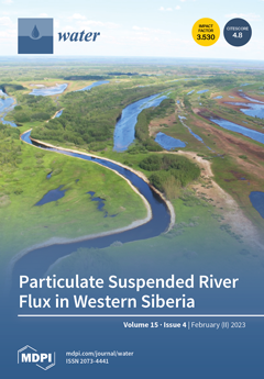
Cover Story (view full-size image): The export of macro- and micro-nutrients from the land to the ocean in high-latitude regions attracts significant research efforts; however, the majority of these studies are devoted to dissolved rather than particulate fraction of the river load. To achieve a better understanding of environmental and seasonal factors controlling mineral and chemical composition of riverine suspended load, we studied, over several hydrological seasons including winter baseflow, the RSM of large boreal river in western Siberia (Ob in its middle course) and its two small tributaries. The obtained results confirm the overwhelming impact of peatlands on element export in suspended form in small rivers of western Siberia, and strong seasonal variations of both mineralogy and chemistry of the RSM in the Ob river’s main stem. View this paper
  • Issues are regarded as officially published after their release is announced to the table of contents alert mailing list.
  • You may sign up for e-mail alerts to receive table of contents of newly released issues.
  • PDF is the official format for papers published in both, html and pdf forms. To view the papers in pdf format, click on the "PDF Full-text" link, and use the free Adobe Reader to open them.
Order results
Result details
Section
Select all
Export citation of selected articles as:
18 pages, 3833 KiB  
Article
Value Engineering Approach to Evaluate the Agricultural Drainage Water Management Strategies
by Walaa Elnashar, Hany F. Abd-Elhamid, Martina Zeleňáková and Ahmed Elyamany
Water 2023, 15(4), 831; https://doi.org/10.3390/w15040831 - 20 Feb 2023
Cited by 3 | Viewed by 2148
Abstract
Excessive irrigating water that has not been adequately drained may cause more water to enter the crop root zone than is necessary. As a result, issues with increasing water table levels, waterlogging, and salinity get worse and cause crop productivity losses. Agricultural drainage [...] Read more.
Excessive irrigating water that has not been adequately drained may cause more water to enter the crop root zone than is necessary. As a result, issues with increasing water table levels, waterlogging, and salinity get worse and cause crop productivity losses. Agricultural drainage water management strategies (ADWMS) can be used to protect the quality of groundwater, guarantee that crops have better moisture conditions, and provide irrigation water by reusing agricultural water drainage and using sub-irrigation practices. In order to decrease the effects of poor drainage, mitigate climate change, conserve the environment, and achieve food security, this study proposes a framework for choosing the most effective ADWMS in Egypt’s Nile Delta as well as the new lands. The value engineering approach is used to ensure the strategy’s functionality and to present some innovation in the process of developing alternative solutions that are financially evaluated using the life cycle cost technique. According to the study results, the most effective strategy (ADWMS-3) prioritizes improving drainage effectiveness, controlling groundwater table rise, and providing another irrigation water source while maintaining environmental protection. This strategy encompasses the use of a control drainage system, timing of fertilizer application, regulating groundwater table variation, and using sub-irrigation practices. ADWMS-3 achieves the highest values for the technical score of 8.06 and the value index of 18.59. This study advances the understanding of the topic by providing policymakers with a tool to (i) evaluate ADWMS and (ii) incorporate the added value and functionality into their policies regarding agricultural drainage water. Full article
(This article belongs to the Special Issue Assessment and Management of Hydrological Risks Due to Climate Change)
Show Figures

Figure 1

16 pages, 4725 KiB  
Article
Study on Genomics of the Bisphenol A-Degrading Bacterium Pseudomonas sp. P1
by Shuaiguo Li, Kejian Tian, Qing Qiu, Yue Yu, Han Li, Menghan Chang, Xuejian Sun, Jinming Gu, Fenglin Zhang, Yibing Wang and Hongliang Huo
Water 2023, 15(4), 830; https://doi.org/10.3390/w15040830 - 20 Feb 2023
Cited by 2 | Viewed by 2214
Abstract
As a widespread pollutant, bisphenol A (BPA) has created a serious threat to ecosystem and human health. Therefore, expanding the available microbial resources used to screen highly efficient BPA-degrading bacteria with BPA as the sole carbon source is very important for the removal [...] Read more.
As a widespread pollutant, bisphenol A (BPA) has created a serious threat to ecosystem and human health. Therefore, expanding the available microbial resources used to screen highly efficient BPA-degrading bacteria with BPA as the sole carbon source is very important for the removal of this pollutant from the environment. In this study, the BPA degradation rate of Pseudomonas sp. P1 to 30 mg/L was 96.89% within 120 h. Whole genome sequencing showed that the genome of strain P1 was composed of a single circular chromosome with a full length of 6.17 Mb, which contained 5636 predicted coding genes. Comparative genomic analysis showed that strain P1 contained 210 functional genes related to BPA degradation. It was confirmed that BPA degradation genes ferredoxin (bisdA), P450 (bisdB), CotA and Lac in strain P1 were highly expressed under the induction of BPA. Combined with the identification of metabolites, the route of BPA degradation by Pseudomonas was proposed. A new metabolite, 4-vinylphenol, was detected for the first time in pathway Ⅰ. In pathway Ⅱ, BPA is directly oxidized to phenol and 4-isopropenyl phenol in the presence of laccase, which is rarely reported in the process of bacterial degradation of BPA. This study confirmed that strain P1 had good tolerance to various environmental factors at the gene level and enriched the degradation mechanism of BPA. Full article
(This article belongs to the Special Issue Functional Microorganisms in Wastewater Treatment)
Show Figures

Figure 1

20 pages, 3215 KiB  
Article
Multifunctional Chitosan/Xylan-Coated Magnetite Nanoparticles for the Simultaneous Adsorption of the Emerging Contaminants Pb(II), Salicylic Acid, and Congo Red Dye
by Hebatullah H. Farghal, Marianne Nebsen and Mayyada M. H. El-Sayed
Water 2023, 15(4), 829; https://doi.org/10.3390/w15040829 - 20 Feb 2023
Cited by 7 | Viewed by 2224
Abstract
In this work, we develop chitosan/xylan-coated magnetite (CsXM) nanoparticles as eco-friendly efficient adsorbents for the facile removal of contaminants from water. Characterization of CsXM using Fourier Transform Infra-Red (FTIR) Spectroscopy, Scanning Electron Microscopy (SEM), X-Ray Diffraction (XRD), Thermogravimetric Analysis (TGA), Transmission Electron Microscopy [...] Read more.
In this work, we develop chitosan/xylan-coated magnetite (CsXM) nanoparticles as eco-friendly efficient adsorbents for the facile removal of contaminants from water. Characterization of CsXM using Fourier Transform Infra-Red (FTIR) Spectroscopy, Scanning Electron Microscopy (SEM), X-Ray Diffraction (XRD), Thermogravimetric Analysis (TGA), Transmission Electron Microscopy (TEM), Zeta potential measurements, and Brunauer-Emmet-Teller (BET) analysis, confirmed the successful preparation of a chitosan/xylan complex coated over magnetite, which is characterized by being mesoporous, thermally stable and of neutral charge. Three contaminants, Pb(II), salicylic acid (SA), and congo red (CR), were chosen as representative pollutants from three major classes of contaminants of emerging concern: heavy metals, pharmaceuticals, and azo dyes. Pb(II), SA, and CR at initial concentrations of 50 ppm were removed by 64.49, 62.90, and 70.35%, respectively, on applying 6 g/L of CsXM. The contaminants were successfully removed in ternary systems, with Pb (II) and SA being more competitive in their adsorption than CR. Adsorption followed the Freundlich isotherm model and the pseudo-second order kinetic model, while the binding was suggested to occur mainly via chemical chelation for Pb(II) and physical interaction for SA and CR, which demonstrates the multifunctional potential of the nanoparticles to capture different contaminants regardless of their charge. Full article
(This article belongs to the Section Wastewater Treatment and Reuse)
Show Figures

Graphical abstract

3 pages, 169 KiB  
Editorial
Surface Water Quality Modelling
by Karl-Erich Lindenschmidt
Water 2023, 15(4), 828; https://doi.org/10.3390/w15040828 - 20 Feb 2023
Viewed by 1809
Abstract
Surface water quality modelling has become an important means of better understanding aquatic and riparian ecosystem processes at all scales, from the micro-scale (e [...] Full article
(This article belongs to the Special Issue Surface Water Quality Modelling)
16 pages, 3699 KiB  
Article
Matching Degree between Agricultural Water and Land Resources in the Xijiang River Basin under Changing Environment
by Shufang Wang and Liping Wang
Water 2023, 15(4), 827; https://doi.org/10.3390/w15040827 - 20 Feb 2023
Cited by 9 | Viewed by 1514
Abstract
The matching degree between agricultural water and land resources directly determines the sustainable development of regional agriculture. Based on climate data corrected by delta statistical downscaling from five global climate models (GCMs) in the Coupled Model Intercomparison Project Phase 6 (CMIP6) and a [...] Read more.
The matching degree between agricultural water and land resources directly determines the sustainable development of regional agriculture. Based on climate data corrected by delta statistical downscaling from five global climate models (GCMs) in the Coupled Model Intercomparison Project Phase 6 (CMIP6) and a multi-model ensemble, this study simulated the runoff used by the Variable Infiltration Capacity (VIC-3L) model under four emission scenarios (SSP1-2.6, SSP2-4.5, SSP3-7.0, and SSP5-8.5) and analyzed the land use changing trend to obtain the matching degree between agricultural water and land resources. The results demonstrate that annual climate factors exhibit an increasing trend, and the average annual runoff was 2128.08–2247.73 × 108 m3, during 2015–2100 under the four scenarios. The area of farmland changed with an increased area of 4201 km2 from 1980 to 2020. The agricultural water and land resources would be well matched under the SSP1-2.6 and SSP2-4.5 scenarios in 2021–2100. However, the risks of mismatch would occur in the 2030–2040 and 2050–2060 periods under the SSP3-7.0 scenario, and the 2030–2040 and 2080–2090 periods under the SSP5-8.5 scenario. This study can provide insight into the scientific decision support for government departments to address the challenges of mismatching risks of agricultural water and land resources. Full article
(This article belongs to the Section Water, Agriculture and Aquaculture)
Show Figures

Figure 1

22 pages, 3823 KiB  
Article
Rainfall Prediction Rate in Saudi Arabia Using Improved Machine Learning Techniques
by Mohammed Baljon and Sunil Kumar Sharma
Water 2023, 15(4), 826; https://doi.org/10.3390/w15040826 - 20 Feb 2023
Cited by 7 | Viewed by 3207
Abstract
Every farmer requires access to rainfall prediction (RP) to continue their exploration of harvest yield. The proper use of water assets, the successful collection of water, and the successful pre-growth of water construction all depend on an accurate assessment of rainfall. The prediction [...] Read more.
Every farmer requires access to rainfall prediction (RP) to continue their exploration of harvest yield. The proper use of water assets, the successful collection of water, and the successful pre-growth of water construction all depend on an accurate assessment of rainfall. The prediction of heavy rain and the provision of information regarding natural catastrophes are two of the most challenging factors in this regard. In the twentieth century, RP was the most methodically and technically complicated issue worldwide. Weather prediction may be used to calculate and analyse the behaviour of weather with unique features and to determine rainfall patterns at an exact locale. To this end, a variety of methodologies have been used to determine the rainfall intensity in Saudi Arabia. The classification methods of data mining (DM) approaches that estimate rainfall both numerically and categorically can be used to achieve RP. This study, which used DM approaches, achieved greater accuracy in RP than conventional statistical methods. This study was conducted to test the efficacy of several machine learning (ML) approaches for forecasting rainfall, utilising southern Saudi Arabia’s historical weather data obtained from the live database that comprises various meteorological data variables. Accurate crop yield predictions are crucial and would undoubtedly assist farmers. While engineers have developed analysis systems whose performance relies on several connected factors, these methods are seldom used despite their potential for precise crop yield forecasts. For this reason, agricultural forecasting should make use of these methods. The impact of drought on crop yield can be difficult to forecast and there is a need for careful preparation regarding crop choice, planting window, harvest motive, and storage space. In this study, the relevant characteristics required to predict precipitation were identified and the ML approach utilised is an innovative classification method that can be used determine whether the predicted rainfall will be regular or heavy. The outcomes of several different methodologies, including accuracy, error, recall, F-measure, RMSE, and MAE, are used to evaluate the performance metrics. Based on this evaluation, it is determined that DT provides the highest level of accuracy. The accuracy of the Function Fitting Artificial Neural Network classifier (FFANN) is 96.1%, which is higher than that of any of the other classifiers currently used in the rainfall database. Full article
Show Figures

Figure 1

18 pages, 3768 KiB  
Article
Troubles Never Come Alone: Outcome of Multiple Pressures on a Temperate Rocky Reef
by Annalisa Azzola, Virginia Picchio, Valentina Asnaghi, Carlo Nike Bianchi, Carla Morri, Alice Oprandi and Monica Montefalcone
Water 2023, 15(4), 825; https://doi.org/10.3390/w15040825 - 20 Feb 2023
Cited by 2 | Viewed by 2083
Abstract
Climate change is affecting rocky reef ecosystems in a multitude of ways at global scale. During summer 2018, the rocky reef communities of Portofino Marine Protected Area (MPA) (NW Mediterranean) were affected by thermal anomalies, a mucilaginous event, and the seasonal expansion of [...] Read more.
Climate change is affecting rocky reef ecosystems in a multitude of ways at global scale. During summer 2018, the rocky reef communities of Portofino Marine Protected Area (MPA) (NW Mediterranean) were affected by thermal anomalies, a mucilaginous event, and the seasonal expansion of Caulerpa cylindracea. Moreover, a severe storm occurred on 29 October. The effects of these pressures on the rocky reef communities were analysed at different depths (10 m, 20 m, 30 m, and 40 m) and at three times (June, October, December) to evaluate change at short temporal scale. Portofino MPA’s communities have significantly changed: thermal anomalies mostly affected the biota living above the summer thermocline (ca 20 m depth); mucilaginoius aggregates first impacted the communities in shallow waters and only later those in deep waters, where they typically fall in late summer; the greatest impact by Caulerpa cylindracea was detected at 20 m depth; the storm directly impacted communities in shallow and intermediate waters by uprooting algal species, while it had indirect effects at greater depths through sediment redistribution. Disentangling the effects of multiple pressures on coastal ecosystems is one of the most pressing goals in marine ecology and biodiversity conservation. This study represents an attempt in this direction as applied to the short-term dynamics of rocky reef communities under a climate change scenario. Full article
(This article belongs to the Special Issue Anthropogenic Impacts on Benthic Marine Ecosystems)
Show Figures

Figure 1

20 pages, 17563 KiB  
Article
Allometric Growth Patterns and Ontogenetic Development during Early Larval Stages of Schizothorax waltoni Regan and Percocypris retrodorslis in Southwest China
by Bin Xu, Dapeng Li, Kaijin Wei, Xiangyun Zhu, Jin Xu and Baoshan Ma
Water 2023, 15(4), 824; https://doi.org/10.3390/w15040824 - 20 Feb 2023
Cited by 2 | Viewed by 3415
Abstract
Due to a sharp decline in resources, Schizothorax waltoni Regan and Percocypris retrodorslis have been listed as wildlife under second-class protection in China. Under culture conditions, the early development and allometric growth patterns of S. waltoni and P. retrodorslis were researched from the [...] Read more.
Due to a sharp decline in resources, Schizothorax waltoni Regan and Percocypris retrodorslis have been listed as wildlife under second-class protection in China. Under culture conditions, the early development and allometric growth patterns of S. waltoni and P. retrodorslis were researched from the hatching stage to 60 DPHs (days post-hatching), and a sampling of ten to fifteen larvae was made every day, followed by measurements with Axio Vision 4.8 software (Carl Zeiss AG, Jena, Germany). Morphological indicators included the anal fin length, the body depth, the body depth at the anus level, the caudal fin length, the dorsal fin length, the eye diameter, the head length, the head depth, the pectoral fin length, the tail length, the trunk length, the snout length, the total length, and the ventral fin length. Based on the morphology development of S. waltoni Regan and P. retrodorslis, four periods of larval growth were identified: pre-flexion larvae at 0–14 DPHs and 0–16 DPHs; flexion larvae at 14–23 DPHs and 16–26 DPHs, post-flexion larvae at 23–50 DPHs and 26–52 DPHs, and the juvenile stage. In newly hatched larvae, most organs and body parts were not differentiated, and they successively developed within 26 DPHs. The depletion of the yolk sac was observed at 23 DPHs and 25 DPHs. Allometric growth mainly occurs in the head and tail regions, indicating that body parts related to feeding and swimming behaviors were more important than the other parts. In addition, the growth pattern shows that the development of organs gives priority to the functions of gill respiration, sensation, exogenous feeding, and swimming. The inflection points of body part growth patterns only appeared before 40 DAH, so future studies should concentrate focus on developing the best feeding from the first feeding to 40 DAH. These outcomes were discussed with regard to the ontogeny of the functional morphology in relation to ecology and aquaculture. It is expected that this research can provide valuable perspectives in species conservation. Full article
(This article belongs to the Special Issue Effect of Aquatic Environment on Fish Ecology)
Show Figures

Figure 1

18 pages, 15927 KiB  
Article
Predicting Groundwater Level Based on Machine Learning: A Case Study of the Hebei Plain
by Zhenjiang Wu, Chuiyu Lu, Qingyan Sun, Wen Lu, Xin He, Tao Qin, Lingjia Yan and Chu Wu
Water 2023, 15(4), 823; https://doi.org/10.3390/w15040823 - 20 Feb 2023
Cited by 9 | Viewed by 3596
Abstract
In recent years, the groundwater level (GWL) and its dynamic changes in the Hebei Plain have gained increasing interest. The GWL serves as a crucial indicator of the health of groundwater resources, and accurately predicting the GWL is vital to prevent its overexploitation [...] Read more.
In recent years, the groundwater level (GWL) and its dynamic changes in the Hebei Plain have gained increasing interest. The GWL serves as a crucial indicator of the health of groundwater resources, and accurately predicting the GWL is vital to prevent its overexploitation and the loss of water quality and land subsidence. Here, we utilized data-driven models, such as the support vector machine, long-short term memory, multi-layer perceptron, and gated recurrent unit models, to predict GWL. Additionally, data from six GWL monitoring stations from 2018 to 2020, covering dynamical fluctuations, increases, and decreases in GWL, were used. Further, the first 70% and remaining 30% of the time-series data were used to train and test the model, respectively. Each model was quantitatively evaluated using the root mean square error (RMSE), coefficient of determination (R2), and Nash–Sutcliffe efficiency (NSE), and they were qualitatively evaluated using time-series line plots, scatter plots, and Taylor diagrams. A comparison of the models revealed that the RMSE, R2, and NSE of the GRU model in the training and testing periods were better than those of the other models at most groundwater monitoring stations. In conclusion, the GRU model performed best and could support dynamic predictions of GWL in the Hebei Plain. Full article
(This article belongs to the Special Issue China Water Forum 2022)
Show Figures

Figure 1

4 pages, 171 KiB  
Editorial
Groundwater Hydrological Model Simulation
by Cristina Di Salvo
Water 2023, 15(4), 822; https://doi.org/10.3390/w15040822 - 20 Feb 2023
Cited by 2 | Viewed by 2026
Abstract
The management of groundwater resources commonly involves challenges and complexities, which are taken on by researchers using a variety of different strategies [...] Full article
(This article belongs to the Special Issue Groundwater Hydrological Model Simulation)
17 pages, 14564 KiB  
Article
Dissolved Methane Transport in the Tatar Strait and the Deepest Basin of the Japan (East) Sea from Its Possible Sources
by Andrei Kholmogorov, Vladimir Ponomarev, Nadezhda Syrbu and Svetlana Shkorba
Water 2023, 15(4), 821; https://doi.org/10.3390/w15040821 - 20 Feb 2023
Cited by 1 | Viewed by 2116
Abstract
Dissolved methane coming from its various sources is an important component of seawater. Finding these probable sources allows for the determination of potential oil and/or gas deposit areas. From an ecological point of view, methane transport studies can reveal probable pollution areas on [...] Read more.
Dissolved methane coming from its various sources is an important component of seawater. Finding these probable sources allows for the determination of potential oil and/or gas deposit areas. From an ecological point of view, methane transport studies can reveal probable pollution areas on the one hand and biological communities, being the lower part of the food chain commercial species, on the other hand. Moreover, the methane transport mechanism can help to obtain a better understanding of the contribution of the World’s oceans to global greenhouse gas emissions. Our research combines gas geochemistry and oceanography. In comparing the research results of both branches, we show the mechanism of methane transport. The features of the dissolved methane on oceanographic sections in the southern part of the Tatar Strait are discussed. The CH4 intake from the bottom sediment and the transport of dissolved methane by the currents in the Tatar Strait are shown. The absolute maximum concentration of CH4 (155.6 nM/L) was observed on the western Sakhalin Island shelf at the near-bottom layer at a depth of 65 m. The local maximum, 84.4 nM/L, was found north of the absolute maximum in the jet current under the seasonal pycnocline. A comparison of the simulated surface seawater origin and dissolved methane in the 4 m depth distribution shows methane transport with the currents in the Tatar Strait. Another studied section is along 134° E in the Japan Basin of the Japan (East) Sea. Here, the East Korean Warm Current close to the Yamato Rise slope and a quasi-stationary mesoscale anticyclonic eddy centered at 41° N intersect. The local maximum methane concentration of 8.2 nM/L is also observed under the seasonal pycnocline. In a mesoscale anticyclonic eddy at 134° E in the deep part of the Japan Basin, a local methane maximum of 5.2 nM/L is detected under the seasonal pycnocline as well. Full article
(This article belongs to the Section Oceans and Coastal Zones)
Show Figures

Figure 1

17 pages, 6467 KiB  
Article
Investigation of Hillslope Vineyard Soil Water Dynamics Using Field Measurements and Numerical Modeling
by Vedran Krevh, Jannis Groh, Lutz Weihermüller, Lana Filipović, Jasmina Defterdarović, Zoran Kovač, Ivan Magdić, Boris Lazarević, Thomas Baumgartl and Vilim Filipović
Water 2023, 15(4), 820; https://doi.org/10.3390/w15040820 - 20 Feb 2023
Cited by 3 | Viewed by 2149
Abstract
Soil heterogeneities can impact hillslope hydropedological processes (e.g., portioning between infiltration and runoff), creating a need for in-depth knowledge of processes governing water dynamics and redistribution. The presented study was conducted at the SUPREHILL Critical Zone Observatory (CZO) (hillslope vineyard) in 2021. A [...] Read more.
Soil heterogeneities can impact hillslope hydropedological processes (e.g., portioning between infiltration and runoff), creating a need for in-depth knowledge of processes governing water dynamics and redistribution. The presented study was conducted at the SUPREHILL Critical Zone Observatory (CZO) (hillslope vineyard) in 2021. A combination of field investigation (soil sampling and monitoring campaign) and numerical modeling with hydrological simulator HYDRUS-1D was used to explore the water dynamics in conjunction with data from a sensor network (soil water content (SWC) and soil-water potential (SWP) sensors), along the hillslope (hilltop, backslope, and footslope). Soil hydraulic properties (SHP) were estimated based on (i) pedotransfer functions (PTFs), (ii) undisturbed soil cores, and (iii) sensor network data, and tested in HYDRUS. Additionally, a model ensemble mean from HYDRUS simulations was calculated with PTFs. The highest agreement of simulated with observed SWC for 40 cm soil depth was found with the combination of laboratory and field data, with the lowest average MAE, RMSE and MAPE (0.02, 0.02, and 5.34%, respectively), and highest average R2 (0.93), while at 80 cm soil depth, PTF model ensemble performed better (MAE = 0.03, RMSE = 0.03, MAPE = 7.55%, R2 = 0.81) than other datasets. Field observations indicated that heterogeneity and spatial variability regarding soil parameters were present at the site. Over the hillslope, SWC acted in a heterogeneous manner, which was most pronounced during soil rewetting. Model results suggested that the incorporation of field data expands model performance and that the PTF model ensemble is a feasible option in the absence of laboratory data. Full article
Show Figures

Graphical abstract

14 pages, 1865 KiB  
Article
A Study on the Dynamics of Landscape Patterns in the Yellow River Delta Region
by Luofan Li, Xinju Li, Beibei Niu and Zixuan Zhang
Water 2023, 15(4), 819; https://doi.org/10.3390/w15040819 - 20 Feb 2023
Cited by 2 | Viewed by 1516
Abstract
The Yellow River Delta region is one of the estuarine deltas with the fastest land building speed, and it is an important region for the study of landscape pattern change due to its diverse variety of landscape types. By analyzing the dynamic degree, [...] Read more.
The Yellow River Delta region is one of the estuarine deltas with the fastest land building speed, and it is an important region for the study of landscape pattern change due to its diverse variety of landscape types. By analyzing the dynamic degree, landscape type transfer matrix, and landscape indices of landscape types in the Yellow River Delta region in 2005, 2012, and 2018, this paper found that the area of construction land, salt fields, and breeding ponds in the Yellow River Delta region has increased to a large extent, with an increase in the aggregation degree and the utilization rate of this landscape type, and the landscape has developed toward the direction of aggregation and unification. The increase in construction land area mainly comes from the transfer of cropland area, part of which is occupied in order to adapt to urban expansion, and the salt fields and breeding ponds mainly come from the transfer of waters and mudflats, which can be seen as the main utilization direction of the water landscape. Moreover, unused land has increased with the degree of dispersion and fragmentation of development and utilization, so the exploitation and utilization of unused land still needs to be optimized. Through the analysis of the dynamic change in landscape pattern, we can explore the direction and extent of the evolution of landscape types, which has certain guiding significance for the sustainable use of land resources and the sustainable development of economy in the Yellow River Delta region. Full article
(This article belongs to the Special Issue Monitoring, Reclamation and Management of Salt-Affected Lands)
Show Figures

Figure 1

17 pages, 5791 KiB  
Article
Recording Permafrost Thaw and Thaw Lake Degradation in Northern Siberia: School Science in Action
by Sergey Kunin, Olga Semenova, Terry V. Callaghan, Olga Shaduyko and Vladimir Bodur
Water 2023, 15(4), 818; https://doi.org/10.3390/w15040818 - 20 Feb 2023
Viewed by 1563
Abstract
Arctic landscapes are changing dramatically in response to climate changes that are regionally four times faster than the global average. However, these vast lands are sparsely populated and ground-based measurements of environmental change impacts on land and lakes are few compared with the [...] Read more.
Arctic landscapes are changing dramatically in response to climate changes that are regionally four times faster than the global average. However, these vast lands are sparsely populated and ground-based measurements of environmental change impacts on land and lakes are few compared with the impacted areas. In the Tazovsky District of the Yamalo-Nenets Autonomous Okrug, school science has been put into practice for over 20 years to determine thermokarst lake changes and their causes. We describe the contributions of school science in recording these lake changes and also their local impacts as a contribution to the Siberian Environmental Change Network. Describing the process and results are particularly relevant to the generation that will experience the greatest environmental change impacts. In contrast to the use of traditional indigenous knowledge, we report on a conventional science methodology used by local people that further empowers a new generation to determine for themselves the changes in their environment and associated implications. Full article
Show Figures

Figure 1

19 pages, 1108 KiB  
Review
Aquatic Productivity under Multiple Stressors
by Donat-P. Häder and Kunshan Gao
Water 2023, 15(4), 817; https://doi.org/10.3390/w15040817 - 20 Feb 2023
Cited by 3 | Viewed by 4097
Abstract
Aquatic ecosystems are responsible for about 50% of global productivity. They mitigate climate change by taking up a substantial fraction of anthropogenically emitted CO2 and sink part of it into the deep ocean. Productivity is controlled by a number of environmental factors, [...] Read more.
Aquatic ecosystems are responsible for about 50% of global productivity. They mitigate climate change by taking up a substantial fraction of anthropogenically emitted CO2 and sink part of it into the deep ocean. Productivity is controlled by a number of environmental factors, such as water temperature, ocean acidification, nutrient availability, deoxygenation and exposure to solar UV radiation. Recent studies have revealed that these factors may interact to yield additive, synergistic or antagonistic effects. While ocean warming and deoxygenation are supposed to affect mitochondrial respiration oppositely, they can act synergistically to influence the migration of plankton and N2-fixation of diazotrophs. Ocean acidification, along with elevated pCO2, exhibits controversial effects on marine primary producers, resulting in negative impacts under high light and limited availability of nutrients. However, the acidic stress has been shown to exacerbate viral attacks on microalgae and to act synergistically with UV radiation to reduce the calcification of algal calcifiers. Elevated pCO2 in surface oceans is known to downregulate the CCMs (CO2 concentrating mechanisms) of phytoplankton, but deoxygenation is proposed to enhance CCMs by suppressing photorespiration. While most of the studies on climate-change drivers have been carried out under controlled conditions, field observations over long periods of time have been scarce. Mechanistic responses of phytoplankton to multiple drivers have been little documented due to the logistic difficulties to manipulate numerous replications for different treatments representative of the drivers. Nevertheless, future studies are expected to explore responses and involved mechanisms to multiple drivers in different regions, considering that regional chemical and physical environmental forcings modulate the effects of ocean global climate changes. Full article
(This article belongs to the Special Issue The Relationship between Phytoplankton Ecology and Marine Pollution)
Show Figures

Figure 1

15 pages, 1347 KiB  
Article
The Multi-Generational Effect of Seawater Acidification on Larval Development, Reproduction, Ingestion Rate, and ATPase Activity of Tigriopus japonicus Mori, 1938
by Fei Li, S. G. Cheung, P. K. S. Shin, Xiaoshou Liu, Yanan Li and Fanghong Mu
Water 2023, 15(4), 816; https://doi.org/10.3390/w15040816 - 20 Feb 2023
Cited by 2 | Viewed by 1484
Abstract
Ocean acidification threatens marine organisms continuously. To ascertain if adaptation of marine species to ocean acidification enhanced over multiple generations, we studied the transgenerational effects of ocean acidification on the development, reproduction, ingestion rate, and ATPase activity of a copepod Tigriopus japonicus Mori, [...] Read more.
Ocean acidification threatens marine organisms continuously. To ascertain if adaptation of marine species to ocean acidification enhanced over multiple generations, we studied the transgenerational effects of ocean acidification on the development, reproduction, ingestion rate, and ATPase activity of a copepod Tigriopus japonicus Mori, 1938. In the first mode, individuals were exposed to either one of the pH levels (8.1 (control), 7.7, 7.3) for five successive generations. In the second mode, each successive generation was exposed to a lower pH level (pH levels: 8.1, 7.9, 7.7, 7.5, 7.3). After prolonged exposure to a constant seawater acidification level, the capacity to adapt to the stress increased. However, when exposed to seawater of descending pH, the detrimental effects gradually increased. Energy allocated to development and reproduction was reduced although the ingestion rate continued to improve in successive generations. Therefore, ongoing ocean acidification might lower the energy transfer of copepods to higher trophic levels. Full article
Show Figures

Figure 1

12 pages, 1671 KiB  
Article
Paleoenvironmental Changes in the Gulf of Gaeta (Central Tyrrhenian Sea, Italy): A Perspective from Benthic Foraminifera after Dam Construction
by Marco Cavaliere, Vittoria Scipioni, Fabio Francescangeli, Luciana Ferraro and Fabrizio Frontalini
Water 2023, 15(4), 815; https://doi.org/10.3390/w15040815 - 20 Feb 2023
Cited by 3 | Viewed by 1986
Abstract
A 300-year paleoenvironmental reconstruction using benthic foraminifera in the Gulf of Gaeta (central Tyrrhenian Sea, Italy) is here presented. The Gulf of Gaeta dynamics are strongly influenced by the fluvial input, particularly the Volturno River and human activities. The sedimentary archive reveals a [...] Read more.
A 300-year paleoenvironmental reconstruction using benthic foraminifera in the Gulf of Gaeta (central Tyrrhenian Sea, Italy) is here presented. The Gulf of Gaeta dynamics are strongly influenced by the fluvial input, particularly the Volturno River and human activities. The sedimentary archive reveals a strong relation between the variations in the composition of the benthic foraminiferal assemblages and human interventions in the Volturno coastal area. According to the statistical analysis, three main temporal phases are identified and supported by the variations in the enhanced benthic foraminifera oxygen index (EBFOI) values over time. We hypothesize that the main environmental modifications might be ascribed to the construction of two dams, Sorgente Capo Volturno (1909–1916) and Ponte Annibale (1953–1958). The dams have probably altered the supply of sediments causing a physical stress related to the variations in grain-size, the organic matter and the oxygen availability. This temporal reconstruction further supports the ability of foraminifera to register paleoenvironmental changes induced by human activities such as the modification of the physical environment within the sedimentary record. Full article
(This article belongs to the Special Issue Research on the Aquatic Species Biodiversity and Morphology)
Show Figures

Figure 1

15 pages, 3610 KiB  
Article
Effect of Pre-Existing Underground Structures on Groundwater Flow and Strata Movement Induced by Dewatering and Excavation
by Tengyun Xue, Xiuli Xue, Sichun Long, Qiunan Chen, Shide Lu and Chaofeng Zeng
Water 2023, 15(4), 814; https://doi.org/10.3390/w15040814 - 20 Feb 2023
Cited by 8 | Viewed by 2054
Abstract
Based on an actual excavation of a metro station in Tianjin, China, a fluid–solid coupling numerical model was developed to study the characteristics of groundwater flow and strata movement induced by dewatering and excavation considering the barrier effect of pre-existing adjacent underground structures. [...] Read more.
Based on an actual excavation of a metro station in Tianjin, China, a fluid–solid coupling numerical model was developed to study the characteristics of groundwater flow and strata movement induced by dewatering and excavation considering the barrier effect of pre-existing adjacent underground structures. Two parameters were selected for the model: the distance between the excavation and the existing underground structure (D), and the buried depth of the adjacent structure (H). By comparing the distribution of groundwater drawdown and deformation modes of the retaining structure and the strata under different working conditions, the influence mechanism of adjacent structures on the movement of groundwater and strata was revealed. The results show that the pile foundations have different effects on the groundwater flow and excavation deformation. Generally, the maximum groundwater drawdown could be enlarged by considering the adjacent underground structure, while the retaining structure deflection would be reduced and the ground settlement could be either enlarged or reduced. Additionally, as D decreases and H increases, a much greater groundwater drawdown and a much smaller retaining structure deflection would appear, which together affect the ground behavior. On the one hand, greater groundwater drawdown would lead to greater ground settlement by soil consolidation, while on the other hand, a smaller retaining structure deflection would lead to smaller ground settlement. Thus, a complex development of ground settlement would appear, and a specific analysis should be performed to assess this in practice, based on a specific H and D. Full article
Show Figures

Figure 1

20 pages, 5553 KiB  
Article
Assessing Climate Change Impact on Water Balance Components Using Integrated Groundwater–Surface Water Models (Case Study: Shazand Plain, Iran)
by Farzaneh Soltani, Saman Javadi, Abbas Roozbahani, Ali Reza Massah Bavani, Golmar Golmohammadi, Ronny Berndtsson, Sami Ghordoyee Milan and Rahimeh Maghsoudi
Water 2023, 15(4), 813; https://doi.org/10.3390/w15040813 - 20 Feb 2023
Cited by 5 | Viewed by 3068
Abstract
Assessing the status of water resources is essential for long-term planning related to water and many other needs of a country. According to climate reports, climate change is on the rise in all parts of the world; however, this phenomenon will have more [...] Read more.
Assessing the status of water resources is essential for long-term planning related to water and many other needs of a country. According to climate reports, climate change is on the rise in all parts of the world; however, this phenomenon will have more consequences in arid and semi-arid regions. The aim of this study is to evaluate the effects of climate change on groundwater, surface water, and their exchanges in Shazand plain in Iran, which has experienced a significant decline in streamflow and groundwater level in recent years. To address this issue, we propose the use of the integrated hydrological model MODFLOW-OWHM to simulate groundwater level, surface water routing, and their interactions; a climate model, NorESM, under scenario SSP2, for climate data prediction; and, finally, the HEC-HMS model to predict future river discharge. The results predict that, under future climate conditions, the river discharges at the hydrometric stations of the region may decrease by 58%, 63%, 75%, and 81%. The average groundwater level in 2060 may decrease significantly by 15.1 m compared to 2010. The results of this study reveal the likely destructive effects of climate change on water resources in this region and highlight the need for sustainable management methods to mitigate these future effects. Full article
(This article belongs to the Section Hydrogeology)
Show Figures

Figure 1

23 pages, 13749 KiB  
Article
Groundwater Vulnerability Assessment to Cemeteries Pollution through GIS-Based DRASTIC Index
by Vanessa Gonçalves, Antonio Albuquerque, Paulo Carvalho, Pedro Almeida and Victor Cavaleiro
Water 2023, 15(4), 812; https://doi.org/10.3390/w15040812 - 19 Feb 2023
Cited by 8 | Viewed by 3516
Abstract
Deposition of corpses in the ground is the most common burial practice, which can allow interactions between polluting compounds and the soil, groundwater, and surface water, which may afterwards lead to negative environmental impacts and risks to public health. The risk of cemeteries [...] Read more.
Deposition of corpses in the ground is the most common burial practice, which can allow interactions between polluting compounds and the soil, groundwater, and surface water, which may afterwards lead to negative environmental impacts and risks to public health. The risk of cemeteries contaminating groundwater is related to their location, the quantity of clothes, metals and adornments buried, and geographical, geological, hydrogeological, and climatic factors. Using the DRASTIC index and geographical information system (GIS) tools, the potential for groundwater contamination was investigated in eight cemeteries located in the Figueira da Foz region (Portugal), which are the main anthropogenic pollution sources in the area. Aquifer vulnerability was assessed through the development of thirteen site characteristic maps, seven thematic maps, and a DRASTIC index vulnerability map, using GIS operation tools. No studies were found on the development of vulnerability maps with this method and digital tools. Cemeteries UC2, UC4, UC5, UC6, UC7, and UC8 are located within the zones susceptible to recharge, with an average recharge rate of 254 mm/year. Cemeteries UC5, UC7, and UC8 are expected to develop a greater water-holding capacity. The water table depth is more vulnerable at UC6, varying between 9.1 m and 15.2 m. However, results show only a high vulnerability associated with the UC4 cemetery with the contributions T,C > R,S > I > A > D, which should be under an environmental monitoring program. The area surrounding UC4 is characterized by a water table depth ranging between 15.2 m to 22.9 m, mainly fine-grained sands in both the vadose zone and the aquifer media, Gleyic Solonchaks at the topsoil, very unfavorable slope (0–2%), and high hydraulic conductivity (>81.5 m/day). The sensitivity analysis shows that the topography, soil media, and aquifer media weights were the most effective in the vulnerability assessment. However, the highest contributions to index variation were made by hydraulic conductivity, net recharge, and soil media. This type of approach not only makes it possible to assess the vulnerability of groundwater to contamination from cemeteries but also allows the definition of environmental monitoring plans as well as provides the entities responsible for its management and surveillance with a methodology and tools for its continuous monitoring. Full article
Show Figures

Figure 1

13 pages, 3514 KiB  
Article
Ultraviolet Radiation-Assisted Preparation of a Novel Biomass Fiber to Remove Cadmium from Wastewater
by Hao Xue, Min Xu, Yueyang Yu, Jiancheng Wan, Chen Liu and Fansheng Meng
Water 2023, 15(4), 811; https://doi.org/10.3390/w15040811 - 19 Feb 2023
Cited by 1 | Viewed by 1080
Abstract
The heavy metal adsorbents developed based on biomass resources have valuable application prospects due to the characteristics of rich sources, renewability and low cost. In the present work, a carboxyl functioned loofah fiber (LF@AA) was synthesized via UV-induced polymerization, and its adsorption capacity [...] Read more.
The heavy metal adsorbents developed based on biomass resources have valuable application prospects due to the characteristics of rich sources, renewability and low cost. In the present work, a carboxyl functioned loofah fiber (LF@AA) was synthesized via UV-induced polymerization, and its adsorption capacity for cadmium (Cd2+) was investigated systematically. This modification resulted in the effective combination of a loofah fiber template and polyacrylic acid (PAA), which promoted its adsorption of Cd2+ to significantly increase to 339.3 mg·g−1, and the applicable pH range was 4.0~7.0. Furthermore, the adsorbability of LF@AA remained stable at a high level after eight consecutive cycles. The adsorption kinetics and isotherm parameters revealed that the adsorption characteristics of cadmium conformed to the Weber–Morris and pseudo-second-order kinetics equations, and the adsorption process of cadmium conformed to Redlich–Peterson and Langmuir models. In addition, consequences of EDS, FTIR, and Zeta potential analysis reflected that the main adsorption mechanism should be ion exchange. Cd2+ was drawn to the adsorbent surface by electrostatic binding, and ion exchange occurred to form a bidentate chelate. This study suggests that it is reasonable and feasible to use natural biomass materials to develop efficient adsorbents to treat heavy metal pollution in wastewater. Full article
(This article belongs to the Special Issue Water Pollution and Bioremediation)
Show Figures

Figure 1

17 pages, 4447 KiB  
Article
Probabilistic Slope Seepage Analysis under Rainfall Considering Spatial Variability of Hydraulic Conductivity and Method Comparison
by Hao Zou, Jing-Sen Cai, E-Chuan Yan, Rui-Xuan Tang, Lin Jia and Kun Song
Water 2023, 15(4), 810; https://doi.org/10.3390/w15040810 - 19 Feb 2023
Viewed by 1664
Abstract
Due to the spatial variability of hydraulic properties, probabilistic slope seepage analysis becomes necessary. This study conducts a probabilistic analysis of slope seepage under rainfall, considering the spatial variability of saturated hydraulic conductivity. Through this, both the commonly used Monte Carlo simulation method [...] Read more.
Due to the spatial variability of hydraulic properties, probabilistic slope seepage analysis becomes necessary. This study conducts a probabilistic analysis of slope seepage under rainfall, considering the spatial variability of saturated hydraulic conductivity. Through this, both the commonly used Monte Carlo simulation method and the proposed first-order stochastic moment approach are tested and compared. The results indicate that the first-order analysis approach is effective and applicable to the study of flow processes in a slope scenario. It is also capable of obtaining statistics such as mean and variance with a high enough accuracy. Using this approach, higher variabilities in the pressure head and the fluctuation of the phreatic surface in the slope are found with a higher value of the correlation length of the saturated hydraulic conductivity. The Monte Carlo simulation is found to be time-consuming: at least 10,000 realizations are required to reach convergence, and the number of realizations needed is sensitive to the grid density. A coarser grid case requires more realizations for convergence. If the number of realizations is not enough, the results are unreliable. Compared with Monte Carlo simulation, the accuracy of the first-order stochastic moment analysis is generally satisfied when the variance and the correlation length of the saturated hydraulic conductivity are not too large. This study highlights the applicability of the proposed first-order stochastic moment analysis approach in the slope scenario. Full article
(This article belongs to the Special Issue Water-Related Geoenvironmental Issues)
Show Figures

Figure 1

15 pages, 2098 KiB  
Article
Distribution and Phylogenetic Position of the Antarctic Ribbon Worm Heteronemertes longifissa (Nemertea, Pilidiophora)
by Alexei V. Chernyshev and Neonila E. Polyakova
Water 2023, 15(4), 809; https://doi.org/10.3390/w15040809 - 19 Feb 2023
Cited by 1 | Viewed by 1846
Abstract
To date, a total of 23 valid species of heteronemerteans belonging to 15 genera have been recorded in Antarctic and Subantarctic waters. The ribbon worm Heteronemertes longifissa (Hubrecht, 1887) is the only heteronemertean species reported to have bipolar distribution, but this statement is [...] Read more.
To date, a total of 23 valid species of heteronemerteans belonging to 15 genera have been recorded in Antarctic and Subantarctic waters. The ribbon worm Heteronemertes longifissa (Hubrecht, 1887) is the only heteronemertean species reported to have bipolar distribution, but this statement is doubtful. The phylogenetic relationships of H. longifissa to other heteronemerteans remain uncertain. A genetic analysis of specimens from Antarctica has shown that the name H. longifissa refers to two sibling species with an uncorrected p-distance of 5.3% in COI. These species differ in body color: one is whitish, and the other is grayish-pink. The species with the whitish body has been reliably identified from off the Norway coast (as Cerebratulus sp. NemBar1383 (BOLD: ACM5920)), i.e., it has a bipolar distribution. A molecular phylogenetic analysis of Lineidae based on five gene markers (COI, 16S, 18S, 28S, and histone H3) has shown the genus Heteronemertes to belong to Lineage D of Clade 2 sensu Kajihara et al., 2022 (crown Lineidae). The phylogenetic positions of four more species of unidentified lineids are currently under discussion. Full article
Show Figures

Figure 1

19 pages, 4379 KiB  
Review
A Review of Bubble Aeration in Biofilter to Reduce Total Ammonia Nitrogen of Recirculating Aquaculture System
by Putu Ayustin Suriasni, Ferry Faizal, Camellia Panatarani, Wawan Hermawan and I Made Joni
Water 2023, 15(4), 808; https://doi.org/10.3390/w15040808 - 19 Feb 2023
Cited by 6 | Viewed by 6240
Abstract
Aeration becomes an essential aspect of biofilter performance to reduce ammonia nitrogen in the Recirculating Aquaculture System (RAS). Efficient aeration introduces air into water media and offers an aerobic environment in the biofilter for microbial degradation of organic matter and ammonia nitrogen. The [...] Read more.
Aeration becomes an essential aspect of biofilter performance to reduce ammonia nitrogen in the Recirculating Aquaculture System (RAS). Efficient aeration introduces air into water media and offers an aerobic environment in the biofilter for microbial degradation of organic matter and ammonia nitrogen. The efficiency of the bubble aeration depends on the size of the bubbles; these include coarse bubble, microbubble, fine bubble, and ultrafine bubble or nanobubble. This review highlights an overview of bubble aeration features in a biofilter to reduce ammonia nitrogen. Moreover, key aspects responsible for the ammonia nitrogen removal efficiencies, such as oxygen transfer, microbial community, and biofilm thickness, are evaluated in this review. In conclusion, the bubble size of aeration affects the microbial community of nitrifying bacteria, consequently determining the growth and thickness of biofilm to improve ammonia removal efficiency. It is emphasized that fine bubble and nanobubble aeration have very positive prospects on improving biofilter performance, though they are currently not widely used in RAS. Full article
Show Figures

Figure 1

26 pages, 12558 KiB  
Article
Floods and Adaptation to Climate Change in Tourist Areas: Management Experiences on the Coast of the Province of Alicante (Spain)
by Esther Sánchez-Almodóvar, Jorge Olcina-Cantos, Javier Martí-Talavera, Antonio Prieto-Cerdán and Ascensión Padilla-Blanco
Water 2023, 15(4), 807; https://doi.org/10.3390/w15040807 - 19 Feb 2023
Cited by 7 | Viewed by 3011
Abstract
One of the principal challenges for cities on the Mediterranean coast is the management of urban runoff after episodes of intense rainfall. This problem is aggravated by the effects of climate change, with the increase in the frequency and intensity of extreme weather [...] Read more.
One of the principal challenges for cities on the Mediterranean coast is the management of urban runoff after episodes of intense rainfall. This problem is aggravated by the effects of climate change, with the increase in the frequency and intensity of extreme weather phenomena in this region. In light of this situation, the local governments, in collaboration with the concessionaire companies providing supply and sewage services, are committed to adopting measures aimed at a more efficient management of non-conventional water resources. Examples of good practice for reducing urban flood risk and adapting to climate change are those actions developed in the tourist municipalities of Alicante, Torrevieja, and Benidorm, where measures have been implemented or have been planned and integrated with green spaces, with a commitment to sustainability, such as sustainable urban drainage systems (SUDS) or Nature-Based Solutions (NBSs). This study analyses these case studies, based on a detailed review of the technical projects that contemplate each of the actions. Furthermore, several field trips were made with technical personnel who are familiar with the measures adopted. The results show that the implementation of these systems contributes to advancing the reduction of urban flood risk and the adaptation to climate change, creating more resilient and safer urban spaces for the citizens residing in them. Full article
Show Figures

Figure 1

13 pages, 3048 KiB  
Article
A Bibliometric Analysis of Groundwater Access and Its Management: Making the Invisible Visible
by Priyanka Lal, Biswaranjan Behera, Malu Ram Yadav, Eshita Sharma, Muhammad Ahsan Altaf, Abhijit Dey, Awadhesh Kumar, Rahul Kumar Tiwari, Milan Kumar Lal and Ravinder Kumar
Water 2023, 15(4), 806; https://doi.org/10.3390/w15040806 - 18 Feb 2023
Cited by 4 | Viewed by 2424
Abstract
The sustainable management of groundwater resources is required to avoid a water crisis. The current study focused on a bibliometric analysis of groundwater access and management to assess research progress. The study was based on data from Dimensions.ai generated using the search terms [...] Read more.
The sustainable management of groundwater resources is required to avoid a water crisis. The current study focused on a bibliometric analysis of groundwater access and management to assess research progress. The study was based on data from Dimensions.ai generated using the search terms “Groundwater”, “access”, and “management” for the period from 1985 to 2022. A total of 534 documents were identified as relevant and retrieved in CSV format. The intellectual structure of the retrieved data was visualized and analyzed using VoS viewer software (version 1.6.18). The analysis showed that the field of earth sciences had the highest number of publications on groundwater access and management (358), followed by the environmental sciences (155). Most of the articles (267) were about Sustainable Development Goal 6, which focuses on ensuring access to clean water and sanitation. The co-authorship analysis for the countries indicated that the United States has the most impact and research, and all other countries have established clusters around it. The citation analysis of the organizations showed that the International Water Management Institute, Charles Sturt University, and Wageningen University and Research were the top three organizations in terms of total citations (825, 611, and 584, respectively), indicating the most effect. The citation analysis for the sources indicated that the “Water” journal had a greater impact on readers with respect to groundwater research. Numerous parties are involved in the groundwater investigation; hence, a broad multidisciplinary approach is required. Therefore, researchers should work together rather than alone to address the problem of sustainable groundwater management. Full article
(This article belongs to the Special Issue Simulation of Groundwater Heads and Flows for Water Resources)
Show Figures

Graphical abstract

19 pages, 16921 KiB  
Article
Multi-Scale Wake Characteristics of the Flow over a Cylinder with Different V-Groove Numbers
by Suyu Jiang, Fei Yan, Jian Zhang and Bo Song
Water 2023, 15(4), 805; https://doi.org/10.3390/w15040805 - 18 Feb 2023
Cited by 2 | Viewed by 1963
Abstract
The near-wake structure resulting from the interaction between the water and the cylinder is researched. The wake characteristics for the smooth cylinder and the cylinder with different numbers of grooves are measured by high-speed particle image velocimetry (PIV) at a Reynolds number of [...] Read more.
The near-wake structure resulting from the interaction between the water and the cylinder is researched. The wake characteristics for the smooth cylinder and the cylinder with different numbers of grooves are measured by high-speed particle image velocimetry (PIV) at a Reynolds number of 7400. From the measured data, it is observed that the v-groove increases the Reynolds shear stress and the turbulent kinetic energy; thus, the formation of the Karman-like vortices is prevented and the recirculation region is reduced. The number of grooves has a limited effect on the wake characteristics. In addition, a one-dimensional orthogonal wavelet decomposes the fluctuation velocities in the cylindrical wake region to study the multi-scale wake characteristics behind the v-groove cylinders. The large-scale structures show that the Karman-like vortices of the grooved cylinder are closer to the trailing edge of the cylinder. The intermediate-scale structures show more vortices behind the 32-groove cylinder. The small-scale structures show that the phase difference between the upper and lower oscillation positions has become smaller. Meanwhile, the large-, intermediate- and small-scale Reynolds shear stress distributions suggest that the shear layer instability in the near-wake region creates vortices, which increase the turbulent kinetic energy and narrow the wake region. Full article
(This article belongs to the Section Hydraulics and Hydrodynamics)
Show Figures

Figure 1

22 pages, 9079 KiB  
Article
Sand Transport with Cohesive Admixtures…—Laboratory Tests and Modeling
by Jerzy Zawisza, Iwona Radosz, Jarosław Biegowski and Leszek M. Kaczmarek
Water 2023, 15(4), 804; https://doi.org/10.3390/w15040804 - 18 Feb 2023
Viewed by 1772
Abstract
The paper presents results of experimental and theoretical studies on transport of water-sand mixtures in steady flow with small amounts of cohesive fractions. The experiments were carried out for sand alone and with cohesive admixtures in the form of clay in the amount [...] Read more.
The paper presents results of experimental and theoretical studies on transport of water-sand mixtures in steady flow with small amounts of cohesive fractions. The experiments were carried out for sand alone and with cohesive admixtures in the form of clay in the amount of 5, 10, 15 and 20% by weight. The amount of sand fractions retained in the trap and along the control area was measured. The experimental results were compared with the calculation results for transport rate of sand fractions. An intended model of the vertical structure of both sand velocity and concentration as well as vertical mixing and sorting is proposed here in order to determine the influence of cohesive admixtures on the transport of sand fractions. Hence the reduction of sand fractions transport due to cohesion forces is included. The agreement of sand transport calculations according to the extended model with measured results and experimental data from literature was achieved within plus/minus a factor of 2. Full article
(This article belongs to the Special Issue Sediment Transport, Budgets and Quality in Riverine Environments)
Show Figures

Figure 1

28 pages, 8791 KiB  
Article
Voices in Shaping Water Governance: Exploring Discourses in the Central Rift Valley, Ethiopia
by Amare Bantider, Bamlaku Tadesse, Adey Nigatu Mersha, Gete Zeleke, Taye Alemayehu, Mohsen Nagheeby and Jaime Amezaga
Water 2023, 15(4), 803; https://doi.org/10.3390/w15040803 - 18 Feb 2023
Cited by 5 | Viewed by 2767
Abstract
As is the case elsewhere in the world, water governance in Ethiopia is a by-product of a complex set of various global and local socio-political, economic, and ecological discourses and narratives. However, the many competitive and often conflicting discourses on shaping water governance [...] Read more.
As is the case elsewhere in the world, water governance in Ethiopia is a by-product of a complex set of various global and local socio-political, economic, and ecological discourses and narratives. However, the many competitive and often conflicting discourses on shaping water governance in the Ethiopian Central Rift Valley (CRV) have not been examined and chronicled. This paper investigates the different discourses, narratives, and debates of water governance and their implications for satisfying the growing demand for water. The study was grounded in political economy and political ecology theoretical frameworks. Data were collected through literature surveys and intensive fieldwork, and were analyzed following a discourse analysis and using narrative analysis techniques. The study found that the dominant competing discourses that have greatly influenced water governance in the CRV focus on decentralization, water-centered development, marketization, land/water degradation, climate change, water scarcity, and weak water governance. We suggest that the analysis and documentation of the diverse narratives and discourses from multiple perspectives could help to unravel the complex nature of water governance in the CRV and lay the foundation for attempts to implement sustainable water resource management in the region. Full article
(This article belongs to the Section Water Resources Management, Policy and Governance)
Show Figures

Figure 1

15 pages, 4235 KiB  
Article
Hydrochemical Characteristics and Risk Assessment of Tongzi River, Guizhou Province, Southwest China
by Jiemei Lü and Yanling An
Water 2023, 15(4), 802; https://doi.org/10.3390/w15040802 - 18 Feb 2023
Cited by 2 | Viewed by 1666
Abstract
This study collected 31 water samples from the Tongzi River, Guizhou Province, Southwest China to conduct a risk assessment to understand the hydrochemical characteristics and major ion sources of irrigation and drinking water quality and their effects on human health. The results showed [...] Read more.
This study collected 31 water samples from the Tongzi River, Guizhou Province, Southwest China to conduct a risk assessment to understand the hydrochemical characteristics and major ion sources of irrigation and drinking water quality and their effects on human health. The results showed that ion abundance in the Tongzi River is Ca2+ (66%) > Mg2+ (24%) > K++Na+ (10%) for cations and HCO3 (75%) > SO42−(21%) > Cl (4%) for anions. Additionally, the hydrochemical type of the water is Ca-Mg-HCO3, controlled by carbonate weathering. Methods including ion ratios, principal component analysis (PCA), and correlation analysis (CA) were used to analyze the source of main ions in the river water. PC1, with the most significant variance (54.9%), decides the hydrochemical characteristics and is affected by the positive loadings of SO42− (0.92), pH (0.85), Ca2+ (0.80), Cl (0.72), Na+(0.66), NO3 (0.65), and K+ (0.57). PC2 explains 19.2% of the total variance, with strong positive loadings of Na+ (0.75), K+ (0.63) and Cl (0.59). Mg2+ (0.84) and HCO3 (0.85) exhibits high loadings in PC3, explaining 9.3% of the variance. The results showed that intensive agricultural activities in the basin were the main source of nitrate NO3, whereas SO42− was mainly derived from mining activities. The lower concentrations of Na+, K+, and Cl were from coal combustion, domestic wastewater discharge, and agricultural fertilizer applications. The study area was mainly affected by carbonate rock weathering; natural processes (mainly the weathering of carbonate rocks) were still the main origin of Ca2+, Mg2+, and HCO3. Moreover, the United States Salinity Laboratory (USSL) diagram and the Wilcox diagram showed that 100% of the samples fell in the C2S1 zones, and the water quality had good suitability for irrigation. The health risk assessment (HRA) results showed that HQNO3 was much larger than HQNH4+ and indicated that nitrate pollution dominated non-health hazards. About 6.5% of the samples in the tributaries represented an unacceptable risk for infants and children, and the HQ value for infants and children was always higher than that for adults. Additionally, the non-carcinogenic health risk of riverine ions for infants and children in the Tongzi River was very noteworthy, especially in the tributaries. Full article
Show Figures

Figure 1

Previous Issue
Next Issue
Back to TopTop