Next Issue
Volume 15, June-1
Previous Issue
Volume 15, May-1


Water, Volume 15, Issue 10 (May-2 2023) – 169 articles

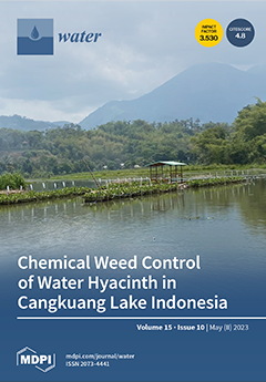
Cover Story (view full-size image): Water hyacinth grows rapidly and has easily invaded Cangkuang lake in Indonesia, thus negatively impacting the aquatic ecosystem. Chemical control using herbicides can be used to manage weeds in aquatic ecosystems to save labor and time and is safe for the environment. The results showed that the herbicide Florpyrauxifen-benzyl 25 g/L, starting at a dose of 15 g a.i/ha, was effective in controlling E. crassipes weeds with a growth reduction percentage up to 100% at 42 DAA. Florpyrauxifen-benzyl 25 g/L herbicide can inhibit the weed growth, number of leaves, number of clumps, relative growth rate and doubling day of water hyacinth weeds. View this paper
  • Issues are regarded as officially published after their release is announced to the table of contents alert mailing list.
  • You may sign up for e-mail alerts to receive table of contents of newly released issues.
  • PDF is the official format for papers published in both, html and pdf forms. To view the papers in pdf format, click on the "PDF Full-text" link, and use the free Adobe Reader to open them.
Order results
Result details
Section
Select all
Export citation of selected articles as:
16 pages, 6325 KiB  
Article
Hydrogeochemical Characteristics and Human Health Risk Assessment of Fluoride Enrichment in Water in Faulted Basins of Qinghai-Tibet Plateau—A Case Study of Sanhe Plain in Guide Basin
by Ruiping Liu, Fei Liu, Youning Xu, Hua Zhu, Jiangang Jiao and Refaey M. El-Wardany
Water 2023, 15(10), 1968; https://doi.org/10.3390/w15101968 - 22 May 2023
Viewed by 1247
Abstract
Fluoride (F) is an essential element of drinking water for human health, especially for bone development and enamel creation. However, if the fluoride content in drinking water is higher than 1.5 mg/L or lower than 0.5 mg/L, it will cause endemic diseases, such [...] Read more.
Fluoride (F) is an essential element of drinking water for human health, especially for bone development and enamel creation. However, if the fluoride content in drinking water is higher than 1.5 mg/L or lower than 0.5 mg/L, it will cause endemic diseases, such as dental fluorosis. There are two main hydrogeological characteristics: the properties of the water-bearing rocks and groundwater conditions controlled the groundwater in guide basin. The geothermal water can be divided into fracture convection and sedimentary basin geothermal water according to its geological environment and heat transfer mode. Inductively coupled plasma spectrometry is a significant tool for groundwater quality analysis. The geochemical factors of fluoride enrichment in confined geothermal water mainly include pH, ion exchange, and mineral saturation. Both groundwater samples are slightly alkaline, while the phreatic water and surface water record pH values of 8.5, 7.78, and 7.8, respectively. The salinity of groundwater water is not high, but for confined geothermal water, phreatic water, and surface water measures 706.0, 430.1 and 285.9 mg/L respectively. The higher the pH of groundwater, the more beneficial it is to the enrichment of fluoride. In contrast, the main cations in phreatic water and surface water are calcium ions and magnesium ions. The anions in groundwater and surface water mainly include SO42− and HCO3, followed by Cl, indicating that the groundwater and surface water here is mainly leaching. Fluoride was shown to be positively correlated with sodium and bicarbonate. Moreover, the results indicate that F enrichment is usually associated with high HCO3 and Na+ concentrations in water, while a high Ca2+ concentration tends to lower the F concentration in water. This means that the ion exchange between calcium ions and sodium ions may lead to fluoride enrichment in natural water. As mentioned above, high-sodium and low-calcium water are favorable for fluoride enrichment. Moreover, saturation indices of fluorite, gypsum, dolomite, and calcite, as well as the saturation index of fluorite, represent a vital method to understand the fluoride enrichment. According to this study, fluoride as a pollutant poses great risks to human health overall, whether lower than or higher than the drinking water limit. Children face higher health risks than adults caused by confined geothermal water drinking intake. This study suggests that groundwater treatment should be conducted to reduce fluoride concentration in drinking water. It is suggested that when confined geothermal water is used as drinking water, it should be mixed with phreatic water and surface water in a certain proportion to make the fluoride in groundwater reach the range of safe drinking water. Full article
(This article belongs to the Special Issue Mine and Water)
Show Figures

Figure 1

19 pages, 4024 KiB  
Article
Benthic Fish Communities Associated with Posidonia oceanica Beds May Reveal the Fishing Impact and Effectiveness of Marine Protected Areas: Two Case Studies in the Southern Tyrrhenian Sea
by Luca Appolloni, Alberto Pagliarani, Adele Cocozza di Montanara, Francesco Rendina, Luigia Donnarumma, Domenico Ciorciaro, Federica Ferrigno, Floriana Di Stefano, Roberto Sandulli and Giovanni Fulvio Russo
Water 2023, 15(10), 1967; https://doi.org/10.3390/w15101967 - 22 May 2023
Cited by 1 | Viewed by 1582
Abstract
The effectiveness of a Marine Protected Area (MPA) is strongly related to its zoning design, management, and surveillance, and fish communities are considered indicators of conservation effects. Posidonia oceanica beds and fish assemblages were studied here to evaluate the fishing impacts and the [...] Read more.
The effectiveness of a Marine Protected Area (MPA) is strongly related to its zoning design, management, and surveillance, and fish communities are considered indicators of conservation effects. Posidonia oceanica beds and fish assemblages were studied here to evaluate the fishing impacts and the effectiveness of the Marine Protected Areas (MPAs) of Santa Maria di Castellabate (SMC) and Costa degli Infreschi e della Masseta (CIM) in the South Tyrrhenian Sea, Italy. P. oceanica characteristics were estimated counting and collecting shoots, while fish communities were investigated by visual census. Multivariate analyses were performed to detect differences in fish assemblages among the MPA protection levels and seagrass characteristics. Significant differences in fish communities were observed between the depth and protection levels. The latter are probably due to the zoning design at SMC, which does not allow a spillover effect, and to fishing activities, as showed by the ABC curve results. Trophic analyses suggested the use of longlines at SMC, due to the dominance of planktivorous fish species, and of trammel nets at CIM, due to the great heterogeneity of the fish trophic groups. Shoot density and leaf length were significantly correlated with fish communities. CCA analyses showed omnivorous species, mostly belonging to the Sparidae family, correlated with the highest shoot densities, with their feeding habits mostly directed to crustaceans, while macro- and microinvertivores, mainly belonging to the Serranidae and Labridae families, correlated with the highest leaf lengths, where they sough shelter and feed. In conclusion, the data suggest that a zoning redesign at SMC and an increase in the surveillance of fishing activities at CIM might enhance the effectiveness of these MPAs, highlighting the role of fish community studies in identifying MPA efficiency issues and providing trustful guidelines for their management. Full article
(This article belongs to the Special Issue Anthropogenic Impacts on Benthic Marine Ecosystems)
Show Figures

Figure 1

17 pages, 1435 KiB  
Article
How Important for Society Is Recreation Provided by Multi-Purpose Water Reservoirs? Welfare Analysis of the Vltava River Reservoir System
by Kateřina Mácová and Zuzana Kozáková
Water 2023, 15(10), 1966; https://doi.org/10.3390/w15101966 - 22 May 2023
Cited by 2 | Viewed by 1456
Abstract
Contrary to the other functions of multi-purpose reservoirs, recreational use is not associated with a tangible social value, which hinders the search for new balances among optimal uses of water that will likely be needed under climate change. The objective of this study [...] Read more.
Contrary to the other functions of multi-purpose reservoirs, recreational use is not associated with a tangible social value, which hinders the search for new balances among optimal uses of water that will likely be needed under climate change. The objective of this study is to analyze visitation behavior and its patterns at a large-scale reservoir system on the Vltava River to quantify the total social benefits associated with recreation in monetary terms and to suggest how the magnitude of estimated recreation welfare relates to hydro-energy benefits, which are in usual practice taken much more into account than recreation in the strategic management of water dams. The elicited average consumer surplus per person and trip is EUR 55.7, which yields a total yearly recreation value of EUR 34 billion (ranging between 22 and 57). When compared to, e.g., the social value of hydro-energy generation, the actual yearly recreation welfare represents 1/3 of this nowadays more prioritized use. The results of the study bring new information for water management bodies that has been missing up to now, and they bring new arguments for reaching socially optimal water use in the strategic and operational management of the cascade of dams. From this perspective, the actual strategic relative prioritization of these two reservoir functions at the pilot site may be viewed as rational. Full article
(This article belongs to the Special Issue Water Governance and Sustainable Water Resources Management)
Show Figures

Figure 1

25 pages, 6644 KiB  
Article
The 100-Year Series of Weather-Related Fatalities in the Czech Republic: Interactions of Climate, Environment, and Society
by Rudolf Brázdil, Kateřina Chromá, Lukáš Dolák, Pavel Zahradníček, Jan Řehoř, Petr Dobrovolný and Ladislava Řezníčková
Water 2023, 15(10), 1965; https://doi.org/10.3390/w15101965 - 22 May 2023
Cited by 1 | Viewed by 1497
Abstract
The paper investigates weather-related fatalities over the territory of the Czech Republic in the 100-year period from 1921 to 2020. The unique database, created from documentary evidence (particularly newspapers), includes, for each deadly event, information about the weather event, the fatality itself, and [...] Read more.
The paper investigates weather-related fatalities over the territory of the Czech Republic in the 100-year period from 1921 to 2020. The unique database, created from documentary evidence (particularly newspapers), includes, for each deadly event, information about the weather event, the fatality itself, and related circumstances. A total of 2729 fatalities were detected during the 100-year period and were associated with various weather categories including frost (38%), convective storms (19%), floods (17%), fog (11%), snow and glaze ice (8%), windstorms (5%), and other inclement weather (2%). A detailed analysis was performed for each individual category. Fatalities occurred throughout the country, with a main maximum in winter (January) and a secondary maximum in summer (July), corresponding to the occurrence of extreme weather. Deaths were mainly interpreted as direct, caused by freezing to death/hypothermia or drowning, and occurred in the afternoon and at night in open countryside or on rivers and water bodies. Males outnumbered females, and adults outnumbered children and the elderly. Hazardous behavior was more frequent than non-hazardous behavior among victims. The information on fatalities and the structure of their characteristics strongly reflects historical milestones of the country, political and socioeconomic changes, as well as changes in lifestyle. Although important weather effects were observed on the deadliest events, the character of the data did not allow for clear evidence of the effects of long-term climate variability. Full article
(This article belongs to the Topic Natural Hazards and Disaster Risks Reduction)
Show Figures

Figure 1

17 pages, 5196 KiB  
Article
Application Research on Risk Assessment of Municipal Pipeline Network Based on Random Forest Machine Learning Algorithm
by Hang Cen, Delong Huang, Qiang Liu, Zhongling Zong and Aiping Tang
Water 2023, 15(10), 1964; https://doi.org/10.3390/w15101964 - 22 May 2023
Cited by 1 | Viewed by 1583
Abstract
Urban municipal water supply is an important part of underground pipelines, and their scale continues to expand. Due to the continuous improvement in the quality and quantity of data available for pipeline systems in recent years, traditional pipeline network risk assessment cannot cope [...] Read more.
Urban municipal water supply is an important part of underground pipelines, and their scale continues to expand. Due to the continuous improvement in the quality and quantity of data available for pipeline systems in recent years, traditional pipeline network risk assessment cannot cope with the improvement of various monitoring methods. Therefore, this paper proposes a machine learning-based risk assessment method for municipal pipe network operation and maintenance and builds a model example based on the data of a pipeline network base in a park in Suzhou. We optimized the random forest learning model, compared it with other centralized learning methods, and finally evaluated the model’s learning effect. Finally, the risk probability associated with each pipe segment sample was obtained, the risk factors affecting the pipe segment’s failure were determined, and their relevance and importance ranking was established. The results showed that the most influential factors are pipe material, soil properties, service life, and the number of past failures. The random forest algorithm demonstrated better prediction accuracy and robustness on the dataset. Full article
Show Figures

Figure 1

18 pages, 6527 KiB  
Article
Fast Prediction of Solitary Wave Forces on Box-Girder Bridges Using Artificial Neural Networks
by Minglong Lu, Shaopeng Li and Teng Wu
Water 2023, 15(10), 1963; https://doi.org/10.3390/w15101963 - 22 May 2023
Viewed by 1138
Abstract
The extreme shallow-water waves during a tropical cyclone are often simplified to solitary waves. Considering the lack of simulation tools to effectively and efficiently forecast wave forces on coastal box-girder bridges during tropical cyclones, this study investigates the impacts of solitary waves on [...] Read more.
The extreme shallow-water waves during a tropical cyclone are often simplified to solitary waves. Considering the lack of simulation tools to effectively and efficiently forecast wave forces on coastal box-girder bridges during tropical cyclones, this study investigates the impacts of solitary waves on box girders and accordingly develops a fast prediction model for solitary wave forces. Computational fluid dynamics (CFD) simulations are used to simulate the hydrodynamic forces on the bridge deck. A total of 368 cases are calculated for the parametric study by varying the submergence coefficients (Cs), relative wave heights (H/h) and deck aspect ratios (W/h). With the CFD simulation results as the training datasets, an artificial neural network (ANN) is trained utilizing the back-propagation algorithm. The maximum wave forces first increase and then decrease with the Cs, while they monotonically increase with H/h. For relatively large H/h and small Cs values, the relationship between the maximum wave forces and W/h presents strong nonlinearities. The observed correlation coefficients between the ANN predictions and the CFD results for the vertical and horizontal wave forces are 98.6% and 98.1%, respectively. The trained ANN-based model shows good prediction accuracy and could be used as an efficient model for the tropical cyclone risk analysis of coastal bridges. Full article
(This article belongs to the Topic Transportation Infrastructure under Hurricane Hazards)
Show Figures

Figure 1

13 pages, 2448 KiB  
Article
Numerical Modelling of a Dam-Regulated River Network for Balancing Water Supply and Ecological Flow Downstream
by Yuxuan Gao, Wei Xiong and Chenhao Wang
Water 2023, 15(10), 1962; https://doi.org/10.3390/w15101962 - 22 May 2023
Cited by 2 | Viewed by 1107
Abstract
Dam operation is regarded as an effective way to increase water, food, and energy security for society. However, with the increasing water demand and frequent extreme droughts, numerous rivers worldwide go through periods of water scarcity and water ecosystem deterioration to varying degrees. [...] Read more.
Dam operation is regarded as an effective way to increase water, food, and energy security for society. However, with the increasing water demand and frequent extreme droughts, numerous rivers worldwide go through periods of water scarcity and water ecosystem deterioration to varying degrees. Balancing the water supply and ecological flow of the dam-regulated river network is essential in the context of river restoration. In this study, we proposed a hydrodynamic and water quality model of a dam-regulated river network balancing water supply and ecological flow using the Environmental Fluid Dynamics Code (EFDC). A section of Jinjiang watershed located in the southwestern of China was chosen as the study area. Firstly, the model was calibrated and validated. By comparing the simulated values with the measured values, the statistical analysis results showed that the relative root mean-squared error (RRMSE) values of water level, COD and NH3-N were 5.5–8.1%, 23.6% and 28.4%, respectively, indicating an adequate degree of agreement between simulation and observation. Based on the established model, dam operation schemes under a dry hydrologic scenario and emergency contamination scenario were formulated to ensure the requirement of ecological water flow and water quality simultaneously. For the dry hydrologic scenario, the ecological water requirement could be satisfied through the dam operation. However, in an emergency contamination scenario, regional water quality requirements cannot be met through dam operation. The dam operation only plays a role in controlling the scope of pollution. This study is expected to provide scientific support for dam-regulated river network management and downstream river ecosystem protection. Full article
(This article belongs to the Special Issue Environment and Ecosystems Research for Natural Waters)
Show Figures

Figure 1

16 pages, 3435 KiB  
Article
Principal Component Analysis and the Water Quality Index—A Powerful Tool for Surface Water Quality Assessment: A Case Study on Struma River Catchment, Bulgaria
by Ivan Benkov, Marian Varbanov, Tony Venelinov and Stefan Tsakovski
Water 2023, 15(10), 1961; https://doi.org/10.3390/w15101961 - 22 May 2023
Cited by 5 | Viewed by 3731
Abstract
The water quality assessment of the surface water bodies (SWBs) is one of the major tasks of environmental authorities dealing with water management. The present study proposes a water quality assessment scheme for the investigation of the surface waters’ physicochemical status changes and [...] Read more.
The water quality assessment of the surface water bodies (SWBs) is one of the major tasks of environmental authorities dealing with water management. The present study proposes a water quality assessment scheme for the investigation of the surface waters’ physicochemical status changes and the identification of significant anthropogenic pressures. It is designed to extract valuable knowledge from the Water Frame Directive (WFD) mandatory monitoring datasets. The water quality assessment scheme is based on the Canadian Council of Ministers of the Environment water quality index (CCME-WQI), trend analysis of estimated WQI values, and Principal Component Analysis (PCA) using calculated excursions during the determination of WQI values. The combination of the abovementioned techniques preserves their benefits and additionally provides important information for water management by revealing the latent factors controlling water quality, taking into account the type of the SWB. The results enable the identification of the anthropogenic impact on SWBs and the type of the corresponding anthropogenic pressure, prioritization and monitoring restoration measures, and optimization of conducted monitoring programs to reflect significant anthropogenic pressures. The proposed simple and reliable assessment scheme is flexible to introducing additional water quality indicators (hydrological, biological, specific pollutants, etc.), which could lead to a more comprehensive surface water quality assessment. Full article
Show Figures

Figure 1

12 pages, 2405 KiB  
Article
Simulation and Dynamic Properties Analysis of the Anaerobic–Anoxic–Oxic Process in a Wastewater Treatment PLANT Based on Koopman Operator and Deep Learning
by Wenchong Tian, Yuting Liu, Jun Xie, Weizhong Huang, Weihao Chen, Tao Tao and Kunlun Xin
Water 2023, 15(10), 1960; https://doi.org/10.3390/w15101960 - 22 May 2023
Cited by 1 | Viewed by 1115
Abstract
The accurate simulation of the dynamics of the anaerobic–anoxic–oxic (A2O) process in the biochemical reactions in wastewater treatment plants (WWTPs) is important for system prediction and optimization. Previous studies have used real-time monitoring data of WWTPs to develop data-driven predictive models, but these [...] Read more.
The accurate simulation of the dynamics of the anaerobic–anoxic–oxic (A2O) process in the biochemical reactions in wastewater treatment plants (WWTPs) is important for system prediction and optimization. Previous studies have used real-time monitoring data of WWTPs to develop data-driven predictive models, but these models cannot be used to provide mathematical analysis of A2O dynamic properties. In this study, we developed a new simulation and analysis method for determining A2O dynamics in biochemical reactions using deep learning and the Koopman operator to address the above problems. This method was validated through data from a real-world WWTP in east China and compared it with the traditional deep learning model. According to the results, the new method achieved high-accuracy prediction. Meanwhile, with the help of the Koopman operator, the new method was able to analyze the asymptotical stability and convergence behavior of the A2O process, which provides a brand-new perspective for the in-depth study of biochemical reactor dynamics. Full article
(This article belongs to the Section Urban Water Management)
Show Figures

Figure 1

17 pages, 2268 KiB  
Review
When Climate Change and Overexploitation Meet in Volcanic Lakes: The Lesson from Lake Bracciano, Rome’s Strategic Reservoir
by Matteo Ventura, Giulio Careddu, Edoardo Calizza, Simona Sporta Caputi, Emmanuelle Argenti, David Rossi, Loreto Rossi and Maria Letizia Costantini
Water 2023, 15(10), 1959; https://doi.org/10.3390/w15101959 - 22 May 2023
Cited by 2 | Viewed by 1802
Abstract
Lakes worldwide have been strongly affected by several types of human-caused alteration, including changes in water level. This also affects deep lakes, including volcanic ones. Volcanic lakes in the Mediterranean area are of great importance for the local economy, but local human activities [...] Read more.
Lakes worldwide have been strongly affected by several types of human-caused alteration, including changes in water level. This also affects deep lakes, including volcanic ones. Volcanic lakes in the Mediterranean area are of great importance for the local economy, but local human activities can threaten their rich biodiversity. As a European biodiversity hotspot and habitat of endemic species, the volcanic Lake Bracciano (Central Italy) is an ecosystem of primary conservation interest threatened by sharply falling water levels, particularly since 2017. It also plays a key role in human wellbeing by providing important ecosystem services including drinking water, fisheries and various recreational opportunities. Although the lake has historically been considered to enjoy good ecological status, various environmental problems, often amplified by water level changes, have arisen during the last two decades. Given this recent rapid evolution, the lake can be considered an example of a valuable ecosystem at risk as a result of increasing anthropogenic pressures. The aim of this review is to examine the changes that have affected the lake in the last 20 years, considerably reducing its capacity to provide ecosystem services, and to review existing and potential threats in order to better inform the management of such resources. Full article
(This article belongs to the Section Water Quality and Contamination)
Show Figures

Figure 1

15 pages, 6196 KiB  
Article
Flood-Triggering Rainfall and Potential Losses—The Copula-Based Approach on the Example of the Upper Nysa Kłodzka River
by Adam Perz, Dariusz Wrzesiński, Waldemar W. Budner and Leszek Sobkowiak
Water 2023, 15(10), 1958; https://doi.org/10.3390/w15101958 - 22 May 2023
Viewed by 4869
Abstract
Floods are natural phenomena, inextricably related to river regimes, which can threaten human health and life, the environment, cultural heritage, economic activity and infrastructure. The aim of the research is to assess the connection between rainfall and river flood risk. The proposed methodology [...] Read more.
Floods are natural phenomena, inextricably related to river regimes, which can threaten human health and life, the environment, cultural heritage, economic activity and infrastructure. The aim of the research is to assess the connection between rainfall and river flood risk. The proposed methodology is presented on the example of the upper Nysa Kłodzka River (NKR) catchment and Kłodzko town located on NKR, which are two of the most flood-prone areas in the Odra River basin. The methodology is based on the well-established methods of potential flood losses (PFL) estimation and the copula-based model, allowing an assessment of connections between rainfall and flood losses in a probabilistic way. The results are presented using the ‘synchronicity’ measure. Seventeen significant summer (rainfall-driven) flood waves were selected, for which PFL were estimated and cumulative rainfall was calculated for 24, 48, 72, 96 and 120 h preceding the flood peak. It was found that the synchronicity of PFL and the 24 h rainfall was the lowest among the analyzed variants, while for the 48 to 120 h rainfall the highest synchronicity was identified at precipitation gauge Podzamek. Full article
(This article belongs to the Special Issue Impacts of Climate Change on Water Resources: Assessment and Modeling)
Show Figures

Figure 1

22 pages, 6659 KiB  
Article
Oil Discharge Trajectory Simulation at Selected Baltic Sea Waterway under Variability of Hydro-Meteorological Conditions
by Ewa Dąbrowska
Water 2023, 15(10), 1957; https://doi.org/10.3390/w15101957 - 22 May 2023
Cited by 3 | Viewed by 1166
Abstract
The paper deals with an important issue related to the identification, modelling, and prediction of environmental pollution in aquatic ecosystems of the Baltic Sea caused by anthropopressure. Water ecosystems are in danger nowadays because of the negative influence of chemical releases in seas, [...] Read more.
The paper deals with an important issue related to the identification, modelling, and prediction of environmental pollution in aquatic ecosystems of the Baltic Sea caused by anthropopressure. Water ecosystems are in danger nowadays because of the negative influence of chemical releases in seas, oceans, or inland waters. The crucial issue is to prevent the oil spills and mitigate their consequences. Thus, there is a need for methods capable of reducing the water pollution and enhancing the effectiveness of port and marine environment preservation. The challenge in implementing actions to remove and prevent horizontal oil discharge lies in accurately determining its shape and direction of oil spreading. The author employed a self-designed software utilizing modified and developed mathematical probabilistic models to forecast the movement and dispersion of an oil spill in diverse hydrological and meteorological conditions. This involved determining the trajectory and movement of a spill domain, which consists of elliptical sub-domains undergoing temporal changes. The research results obtained are the initial results in the oil spill simulation problem. This approach represents an expanded and innovative method for determining the spill domain and tracking its movement, applicable to oceans and seas worldwide. It expands upon the methodologies firstly discussed, thereby broadening the range of available techniques in this field. A simple model of an oil spill trajectory simulation and a surface oil slick as an ellipse is illustrated using a time-series of selected hydro-meteorological factors that change at random times. The author proposes a Monte Carlo simulation method to determine the extent of an oil spill in an aquatic ecosystem, taking into account the influence of varying hydro-meteorological conditions. A semi-Markov model is defined to capture the dynamics of these conditions within the spill area and develop an enhanced algorithm for predicting changes in the shape and movement of the spill domain under changing these conditions. By applying the algorithm, a simulation is conducted to provide short-term prediction of the oil discharge trajectory in a selected Baltic Sea waterway. To enhance the accuracy of predicting the process of changing conditions, uniformly tested joint datasets from the open sea water area were incorporated. Finally, the potential future prospects and directions for further research in this field are discussed. Full article
(This article belongs to the Special Issue Seas under Anthropopressure)
Show Figures

Figure 1

24 pages, 6325 KiB  
Article
Dynamic Response Law and Failure Mechanism of Slope with Weak Interlayer under Combined Action of Reservoir Water and Seismic Force
by Wenpeng Ning and Hua Tang
Water 2023, 15(10), 1956; https://doi.org/10.3390/w15101956 - 21 May 2023
Cited by 1 | Viewed by 1556
Abstract
The southwestern region of China is close to the Eurasian earthquake zone. Many engineering areas in southwestern China are affected by earthquakes and are close to the epicenter of earthquakes that occur in this region. During earthquakes, slopes with weak interlayers are more [...] Read more.
The southwestern region of China is close to the Eurasian earthquake zone. Many engineering areas in southwestern China are affected by earthquakes and are close to the epicenter of earthquakes that occur in this region. During earthquakes, slopes with weak interlayers are more likely to cause large-scale landslides. In response to the low stability of slopes with weak interlayers in reservoir dam areas, the dynamic response law and failure mechanism of weak interlayered slopes under the combined action of reservoir water and seismic forces were studied through shaking table model tests and finite element numerical simulation software. The height of the water level and the size of the seismic waves were changed during these tests. The research results indicate that seismic waves are influenced by weak interlayers and are repeatedly superimposed between the weak interlayers and the slope surface, resulting in an acceleration amplification effect that increases by approximately 1.8 times compared to homogeneous slopes. Vertical earthquakes have a significant impact on the dynamic response of slopes, and their peak acceleration amplification coefficient can reach 0.83 times the horizontal peak acceleration. The stability of weak interlayers during earthquakes is the worst within the range of the direct action of reservoir water. The failure mode of a slope is as follows: earthquake action causes cracking in the upper part of the slope, and as the earthquake increases in intensity, and the infiltration of reservoir water intensifies, the cracks expand. The soft and muddy interlayer in the front section of the slope forms a sliding surface, and ultimately, the sliding failure forms an accumulation body at the foot of the slope. In reservoir dam areas, the stability of a slope is closely related to the engineering safety of the reservoir dam. Therefore, when a strong earthquake and the water level in a reservoir jointly affect a weak-interlayer slope, the slope is in the stage of plastic deformation and instability. The stability of the slope may be overestimated, and the slope is likely vulnerable to sliding instability, which needs to be monitored and treated. Full article
(This article belongs to the Topic Natural Hazards and Disaster Risks Reduction)
Show Figures

Figure 1

12 pages, 2462 KiB  
Article
Phosphorus Removal in VFCWs with Lightweight Aggregates Made of Fly Ash from Sewage-Sludge Thermal Treatment (FASSTT LWA)
by Joanna Rodziewicz, Artur Mielcarek, Wojciech Janczukowicz, Andrzej Białowiec, Jorge Manuel Rodrigues Tavares, Krzysztof Jóźwiakowski and Arthur Thornton
Water 2023, 15(10), 1955; https://doi.org/10.3390/w15101955 - 21 May 2023
Viewed by 1332
Abstract
This study analyzed the effect of lightweight aggregates made of fly ash from sewage-sludge thermal treatment (FASSTT LWA) on the effectiveness of phosphorus removal from wastewater in vertical constructed wetlands (CWs), depending on FASSTT LWA content in the CW filling and hydraulic loading [...] Read more.
This study analyzed the effect of lightweight aggregates made of fly ash from sewage-sludge thermal treatment (FASSTT LWA) on the effectiveness of phosphorus removal from wastewater in vertical constructed wetlands (CWs), depending on FASSTT LWA content in the CW filling and hydraulic loading rate. It was performed over 13 weeks using 15 lysimeters prepared as double-layer systems. An upper layer was made of FASSTT LWA above the gravel layer with different thicknesses of FASSTT LWA (CW 0 cm: only gravel; CW 12 cm, CW 25 cm; CW 50 cm, and CW 100 cm: only FASSTT LWA). Each filling variant was repeated three times. Wastewater with a mean phosphorus concentration of 7.43 mgP/L was fed to the lysimeters once a day. The hydraulic loading rates tested were 3.0, 5.0, and 7.0 mm/d. Both the increased FASSTT LWA content in the CW filling and the decreasing hydraulic loading rate were found to boost the effectiveness of phosphorus removal in the treated wastewater. Constructed wetland filled in 100 % with FASSTT LWA ensured a reduction in phosphorus concentration below 2.0 mg P/L at all hydraulic loading rates tested. Full article
(This article belongs to the Section Wastewater Treatment and Reuse)
Show Figures

Figure 1

19 pages, 2892 KiB  
Article
The Surface-to-Atmosphere GHG Fluxes in Rewetted and Permanently Flooded Former Peat Extraction Areas Compared to Pristine Peatland in Hemiboreal Latvia
by Arta Bārdule, Aldis Butlers, Gints Spalva, Jānis Ivanovs, Raitis Normunds Meļņiks, Ieva Līcīte and Andis Lazdiņš
Water 2023, 15(10), 1954; https://doi.org/10.3390/w15101954 - 21 May 2023
Cited by 1 | Viewed by 1704
Abstract
When it comes to greenhouse gas (GHG) reduction, the role of water tables in former peat extraction areas has received considerable interest in recent decades. This study analysed the carbon dioxide (CO2), methane (CH4) and nitrous oxide (N2 [...] Read more.
When it comes to greenhouse gas (GHG) reduction, the role of water tables in former peat extraction areas has received considerable interest in recent decades. This study analysed the carbon dioxide (CO2), methane (CH4) and nitrous oxide (N2O) surface-to-atmosphere fluxes from a rewetted and permanently flooded former peat extraction areas in comparison to pristine peatland in hemiboreal Latvia. Measurements of GHG fluxes combined gas sampling using a closed-chamber (opaque) method with the gas chromatography detection method. Among the studied land-use types, the highest annualised CO2 fluxes (soil heterotrophic and autotrophic respiration) were recorded in rewetted former peat extraction areas with restored vegetation and in undisturbed peatland (4.10 ± 0.21 and 3.45 ± 0.21 t CO2-C ha−1 yr−1, respectively), with the lowest in flooded former peat extraction areas (0.55 ± 0.05 t CO2-C ha−1 yr−1); temperature and groundwater level were found to be significant influencing factors. The highest annualised CH4 fluxes were recorded in undisturbed peatland (562.4 ± 155.8 kg CH4-C ha−1 yr−1), followed by about two-fold and ~20-fold smaller CH4 fluxes in flooded and rewetted areas, respectively. N2O fluxes were negligible in all the studied land-use types, with the highest N2O fluxes in undisturbed peatland (0.66 ± 0.41 kg N2O-N ha−1 yr−1). Full article
Show Figures

Figure 1

16 pages, 5459 KiB  
Article
Meteoric Water Incursion, Crude Oil Degradation and Calcite Cementation of an Upper Cretaceous Reservoir in the Zagros Foreland Basin (Kurdistan Region of Iraq)
by Howri Mansurbeg, Ibrahim Mohialdeen, Ali Al-Juboury, Namam Salih, Mohammad Alsuwaidi, Salahadin Shahrokhi, Ihsan Al-Aasm, Rebar Mahmmud and Albert Permanyer
Water 2023, 15(10), 1953; https://doi.org/10.3390/w15101953 - 21 May 2023
Viewed by 1794
Abstract
Field observations, together with the results of gas chromatography–mass spectrometry (GC-MS) and stable carbon isotope analysis of bitumen, coupled with fluid inclusion microthermometry and stable isotope analyses of closely associated vug- and fracture-filling columnar calcite in the Upper Cretaceous Bekhme Formation, Kurdistan Region [...] Read more.
Field observations, together with the results of gas chromatography–mass spectrometry (GC-MS) and stable carbon isotope analysis of bitumen, coupled with fluid inclusion microthermometry and stable isotope analyses of closely associated vug- and fracture-filling columnar calcite in the Upper Cretaceous Bekhme Formation, Kurdistan Region of Iraq, suggest that the degradation of crude oil was caused by the regional incursion of meteoric waters. This incursion, which is interpreted to have occurred during tectonic uplift during the Zagros Orogeny, is evidenced by: (i) the depletion of n-alkanes and acyclic isoprenoid alkanes (pristane and phytane) in the bitumen; (ii) low δ13CVPDB values (−8.5‰ to −3.9‰) and δ18OVPDB values (−22.9‰ to −15.0‰), with more radiogenic Sr isotopic ratios (0.70771–0.70772) compared to Cretaceous seawater; and (iii) low salinity and low temperatures (20 to 40 °C) in fluid inclusions of the columnar calcite. This study demonstrates that regional meteoric water incursion into sedimentary basins can be linked to crude oil degradation accompanied by calcite cementation events in carbonate reservoirs. Full article
Show Figures

Figure 1

11 pages, 3420 KiB  
Article
Changes in Climate Factors and Catches of Fisheries in the Republic of Korea over the Three Decades
by Jong-Gyu Kim and Jeong-Gyoo Kim
Water 2023, 15(10), 1952; https://doi.org/10.3390/w15101952 - 21 May 2023
Cited by 1 | Viewed by 1334
Abstract
We investigated the changes of main climate factors and their relationships with the catches of offshore fisheries of the Republic of Korea over the past 30 years (1981 to 2010), using a trend analysis and Pearson’s correlation analysis. This study focused on seven [...] Read more.
We investigated the changes of main climate factors and their relationships with the catches of offshore fisheries of the Republic of Korea over the past 30 years (1981 to 2010), using a trend analysis and Pearson’s correlation analysis. This study focused on seven fish species that have been preferred in Korean cuisine for centuries. Not only the air temperature, but also the sea surface temperature (SST) on the coast of Korea has risen (p < 0.05) in the period. The rise in SST over 30 years is significantly correlated with the rise in temperature (p < 0.01), but not with precipitation. Over the past 30 years, catches of anchovies and squid have increased significantly, while Alaska/walleye pollock has become almost extinct (p < 0.01). The analysis of this study indicates that cold water fish species have decreased or disappeared in Korean fisheries and have been replaced by warm water fish species. Our findings suggest that the fish species caught in Korean offshore fisheries have changed due to climate change, especially global warming. These results also suggest that there may be a threat to the food security of Koreans, so it is necessary to take measures to protect this food resource. Full article
(This article belongs to the Special Issue Aquatic Ecology and Biological Invasions)
Show Figures

Figure 1

20 pages, 8539 KiB  
Article
A Novel Energy Performance Prediction Approach towards Parametric Modeling of a Centrifugal Pump in the Design Process
by Lingbo Nan, Yumeng Wang, Diyi Chen, Weining Huang, Zuchao Zhu and Fusheng Liu
Water 2023, 15(10), 1951; https://doi.org/10.3390/w15101951 - 21 May 2023
Viewed by 1387
Abstract
Traditional centrifugal pump performance prediction (CPPP) employs the semi-theoretical and semi-empirical approaches; however, it can lead to many prediction errors. Considering the superiority of deep learning when applied to nonlinear systems, in this paper, a method combining hydraulic loss and convolutional neural network [...] Read more.
Traditional centrifugal pump performance prediction (CPPP) employs the semi-theoretical and semi-empirical approaches; however, it can lead to many prediction errors. Considering the superiority of deep learning when applied to nonlinear systems, in this paper, a method combining hydraulic loss and convolutional neural network (HLCNN) is applied to CPPP. Head and efficiency were selected as two variables for demonstrating the energy performance of the centrifugal pump in order to reflect the prediction ability of the proposed model. The evaluation results indicate that the predicted head and efficiency are accurate, compared with the experimental results. Furthermore, the HLCNN prediction model was compared against machine learning methods and the computational fluid dynamic method. The proposed HLCNN model obtained a better AREmean, root mean square error, sum of squares due to error, and mean absolute error for centrifugal pump energy performance. The research revealed that the HLCNN model achieves accurate energy performance prediction in the design of centrifugal pumps, reducing the development time and costs. Full article
(This article belongs to the Section Hydraulics and Hydrodynamics)
Show Figures

Figure 1

25 pages, 25292 KiB  
Article
Heavy Metal Dispersion in a Hydrological Sub-Basin as Consequence of Mining Activity in Taxco, Guerrero (Southern Mexico)
by Juan Carlos Ramírez-Javier, Alejandro Hermelindo Ramírez-Guzmán, Giovanni Hernández-Flores, Mario Alberto Hernández Hernández, Oscar Talavera-Mendoza, Sergio Adrián Salgado Souto and Alejandra Cortés-Silva
Water 2023, 15(10), 1950; https://doi.org/10.3390/w15101950 - 21 May 2023
Viewed by 1325
Abstract
The mining industry generates high concentrations of heavy metals (HMs) susceptible to being released into surface and ground water. The objective of this work was to determine the concentration and dispersion of HMs in surface water and ground water in a hydrological sub-basin [...] Read more.
The mining industry generates high concentrations of heavy metals (HMs) susceptible to being released into surface and ground water. The objective of this work was to determine the concentration and dispersion of HMs in surface water and ground water in a hydrological sub-basin located in southwest Mexico. The samples were collected as following: 24 samples from streams, rivers, and one lake, and 15 samples from springs, located along the Taxco-Cocula sub-basin. A total of 78 samples were collected in the dry and rainy seasons. Physicochemical parameters, major ions, and HMs were analyzed. The pH, Eh, electrical conductivity, and total dissolved solids were analyzed in situ, while the concentrations of anions, cations, and HMs were measured in the laboratory. The results were treated with multivariate analysis and PHREEQC simulation. The highest recorded values (in mg/L) were in surface water, where the HMs in the dry season were Al (28.63), As (0.60), Cd (1.78), Cu (1.10), Fe (68.27), Mn (21.47), Pb (0.02), and Zn (208.80). These high concentrations exceed the limits established by national and international regulations for drinking water. The ground water did not indicate pollutants associated to the mining industry. On the other hand, in the rainy season, the surface water showed a decrease in the concentrations of the measured heavy metals. The hypsometric gradient and the hydrogeological and meteorological characteristics of the Taxco-Cocula sub-basin are the factors that contribute to the dilution and dispersion of the HMs along the 60 km of its length. Full article
(This article belongs to the Special Issue Impact of Mining Activities on the Groundwater Resources)
Show Figures

Figure 1

20 pages, 5686 KiB  
Article
In Situ Polyaniline Immobilized ZnO Nanorods for Efficient Adsorptive Detoxification of Cr (VI) from Aquatic System
by Fahad A. Alharthi, Riyadh H. Alshammari and Imran Hasan
Water 2023, 15(10), 1949; https://doi.org/10.3390/w15101949 - 21 May 2023
Cited by 4 | Viewed by 1784
Abstract
The elimination of toxic heavy metal ions from wastewater has been found to be of great importance in human as well marine animal wellbeing. Among various heavy metals, Cr (VI) has been found to be one of the highly toxic and carcinogenic heavy [...] Read more.
The elimination of toxic heavy metal ions from wastewater has been found to be of great importance in human as well marine animal wellbeing. Among various heavy metals, Cr (VI) has been found to be one of the highly toxic and carcinogenic heavy metals which are found to be dissolved in the water stream, the urgent treatment of which needs to be a priority. The present study demonstrates the fabrication of zinc oxide nanorods (ZnO NRs) and an immobilized polyaniline nanorod (ZnO@PAni NR) composite through an in situ free radical polymerization reactions. The material synthesis and purity were verified by X-ray diffractometer (XRD), Fourier transform infrared (FTIR), scanning electron microscope (SEM), energy dispersive spectroscope (EDS), and transmission electron microscope (TEM). Further, ZnO@PAni NRs were applied as an adsorbent for Cr (VI) in the aquatic system and exhibited a tremendous removal efficiency of 98.76%. The impact of operating parameters such as dose effect and pH on adsorption properties were studied. The uptake mechanism of Cr (VI) by ZnO@PAni was best explained by pseudo-second-order reaction, which suggested that the adsorption of Cr (VI) by the synthesized adsorbent material was processed by chemisorption, i.e., through formation of chemical bonds. The adsorption process proved viable and endothermic thermodynamically, and best supported by a Langmuir model, suggesting a monolayer formation of Cr (VI) on the surface of ZnO@PAni NRs. Full article
(This article belongs to the Special Issue Adsorption Technology for Water and Wastewater Treatments)
Show Figures

Figure 1

19 pages, 3122 KiB  
Article
Recent Changes in Composition and Distribution Patterns of Summer Mesozooplankton off the Western Antarctic Peninsula
by Valentina V. Kasyan
Water 2023, 15(10), 1948; https://doi.org/10.3390/w15101948 - 21 May 2023
Cited by 2 | Viewed by 1390
Abstract
The Southern Ocean has undergone significant climate-related changes in recent decades. As a result, pelagic communities inhabiting these waters, particularly mesozooplankton, have adapted to new conditions. The present study considers the patterns of horizontal and vertical (up to 1000 m) distribution, the composition, [...] Read more.
The Southern Ocean has undergone significant climate-related changes in recent decades. As a result, pelagic communities inhabiting these waters, particularly mesozooplankton, have adapted to new conditions. The present study considers the patterns of horizontal and vertical (up to 1000 m) distribution, the composition, abundance, and biomass of mesozooplankton, and the relationships of these parameters to the extreme environmental conditions off the western Antarctic Peninsula throughout the record-warm austral summer season of 2022. Sampling was conducted using the opening/closing Multinet system (0.25 m2 aperture) equipped with five 150-μm mesh nets and a WP-2 net. The mesozooplankton was represented by the three most abundant groups: eggs and larvae of euphausiids such as Euphausia superba, small copepods such as Oithona similis, and large calanoid copepods such as Calanoides acutus, Calanus propinquus, Metridia gerlachei, and Rhincalanus gigas. The composition and quantitative distribution of the mesozooplankton significantly varied: the copepods were abundant in the west, off the Antarctic Peninsula, while eggs and larvae of euphausiids were abundant in the east, off the South Orkney Islands. Most mesozooplankton occurred in the upper 200 m layer, and each taxon showed characteristic depth preference: small copepods, euphausiids larvae, and cirripeds cypris larvae were abundant in the epipelagic layer, while large calanoid copepods, euphausiids eggs, amphipods, pelagic polychaetes, and ostracods were found mostly in the mesopelagic layer. The composition and quantitative distribution of mesozooplankton had clear relationships with environmental factors, particularly with a combination of variables such as water salinity, temperature, and chlorophyll a concentration. Full article
Show Figures

Figure 1

20 pages, 5040 KiB  
Article
Characterisation of the Hydrogeological Properties of the Ntane Sandstone Aquifer Using Co-Seismic and Post-Seismic Groundwater Level Responses to the Mw 6.5 Moiyabana Earthquake, Central Botswana
by Tshepang Mmamorena Marema, Loago Molwalefhe and Elisha M. Shemang
Water 2023, 15(10), 1947; https://doi.org/10.3390/w15101947 - 21 May 2023
Viewed by 1426
Abstract
The 3 April 2017 Mw 6.5 Moiyabana earthquake (Central Botswana) had a significant impact on groundwater levels; a gradual co-seismic increase and a stepwise decline in groundwater levels were observed in response to the earthquake at boreholes MH2 and Z12836, respectively. In this [...] Read more.
The 3 April 2017 Mw 6.5 Moiyabana earthquake (Central Botswana) had a significant impact on groundwater levels; a gradual co-seismic increase and a stepwise decline in groundwater levels were observed in response to the earthquake at boreholes MH2 and Z12836, respectively. In this study, we investigated the response of groundwater levels to Earth tides by computing the amplitude and phase shift of the M2 tidal constituent to estimate the temporal variations of the storativity, transmissivity, and permeability of the Ntane sandstone aquifer (the main aquifer system) prior to and after the earthquake event. The storativity and permeability computed for borehole MH2 showed a decrease in magnitude of 3.17432 × 10⁻⁴ and 1.85 × 10⁻¹³ m2 respectively, indicating that strong ground shaking at borehole MH2 might have consolidated the aquifer material, thus resulting in decreased aquifer permeability. The aquifer coefficient of storativity decreased by 2.85 × 10⁻⁴ while permeability was enhanced by 0.047 × 10⁻¹³ m2 at borehole Z12836. Enhanced permeability might have resulted from increased/enhanced fracturing of the aquifer, fracture clearing and dynamic shaking. Full article
(This article belongs to the Special Issue How Earthquakes Affect Groundwater)
Show Figures

Figure 1

18 pages, 18155 KiB  
Article
Recognition of the Interaction Mechanisms between Water and Land Resources Based on an Improved Distributed Hydrological Model
by Jianwei Wang, Xizhi Lv, Tianling Qin, Yongxin Ni, Li Ma, Qiufen Zhang, Hanjiang Nie, Zhenyu Lv, Chenhao Li, Xin Zhang and Jianming Feng
Water 2023, 15(10), 1946; https://doi.org/10.3390/w15101946 - 21 May 2023
Viewed by 1298
Abstract
Conflicts between humans and land use in the process of using water and conflicts between humans and water resources in the process of using land have led to an imbalance between natural ecosystems and socio-economic systems. It is difficult to understand the impact [...] Read more.
Conflicts between humans and land use in the process of using water and conflicts between humans and water resources in the process of using land have led to an imbalance between natural ecosystems and socio-economic systems. It is difficult to understand the impact of the processes of water production and consumption on land patches and their ecological effects. A grid-type, basin-distributed hydrological model was established in this study, which was based on land-use units and coupled with groundwater modules to simulate the water production and consumption processes in different units. By combining land use and net primary productivity, the runoff coefficient and the water use efficiency (NPP/ET) of different land units were used as indicators to characterize the interaction between water and land resources. The results showed that the average runoff coefficients of cultivated land, forest land and grassland were 0.7, 0.5 and 0.9, respectively. Moreover, the average runoff coefficients of hills, plains and basins were 0.7, 0.7 and 0.8, respectively. The NPP produced by the average unit, evapotranspiration, in cultivated land, forest land and grassland was 7 (gC/(m2•a))/mm, 0.7 (gC/(m2•a))/mm and 0.2 (gC/(m2•a))/mm, respectively. These results provide quantitative scientific and technological support in favor of the comprehensive ecological management of river basins. Full article
(This article belongs to the Topic Hydrology and Water Resources Management)
Show Figures

Figure 1

15 pages, 4221 KiB  
Article
Classification of Water Source in Coal Mine Based on PCA-GA-ET
by Zhenwei Yang, Hang Lv, Xinyi Wang, Hengrui Yan and Zhaofeng Xu
Water 2023, 15(10), 1945; https://doi.org/10.3390/w15101945 - 21 May 2023
Cited by 2 | Viewed by 1306
Abstract
In recent years, inrush water has hampered the regular mining of coal mines, and the proper identification of the source of inrush water is critical to the prevention and management of water hazards in mines. This paper extracts the standard water chemistry discriminating [...] Read more.
In recent years, inrush water has hampered the regular mining of coal mines, and the proper identification of the source of inrush water is critical to the prevention and management of water hazards in mines. This paper extracts the standard water chemistry discriminating ions Na++K+, Ca2+, Mg2+, Cl, SO42−, and HCO3 from observed water samples. An improved water source discrimination model is proposed which combines algorithms from data mining, classification models, and learning reinforcement. According to the Pearson correlation coefficient, Na++K+ has a strong correlation with HCO3. To identify the major metrics, we performed principal component analysis (PCA), and the adaptive differential evolutionary genetic algorithm (GA) was utilized to optimize the depth of the extreme tree (ET) and the number of classifiers. Finally, the model distinguished 25 sets of studied samples from various water sources in the Pingdingshan coalfield. Comparative analysis demonstrated the efficacy of each stage of our work. PCA-GA-ET outperformed the conventional approaches, such as the support vector machine, BP artificial neural network, and random forest. The studies revealed that PCA-GA-ET can eliminate the information overlap between data and simplify the data structure and thereby improve the efficiency and accuracy of water source detection. We discovered that by utilizing the evolutionary algorithm to optimize parameters such as the depth of the extreme trees and the number of decision trees, we could get the model to converge faster and to be more stable and more accurate. The results suggest that PCA-GA-ET has good robustness and accuracy and can meet the needs of water source identification. Full article
(This article belongs to the Special Issue Mine Water Safety and Environment)
Show Figures

Figure 1

13 pages, 9767 KiB  
Article
Real-Time Pyrolysis Dynamics of Thermally Aged Tire Microplastics by TGA-FTIR-GC/MS
by Guangteng Bai, Juyang Fu, Qian Zhou and Xiangliang Pan
Water 2023, 15(10), 1944; https://doi.org/10.3390/w15101944 - 21 May 2023
Cited by 1 | Viewed by 1883
Abstract
Tire wear particles (TWPs), as a type of thermosetting microplastic (MP), accumulate in aquatic environments due to their wide application in road traffic globally. The increase in temperature because of friction heat may cause aging of tire materials, inducing water evaporation, additive volatilization, [...] Read more.
Tire wear particles (TWPs), as a type of thermosetting microplastic (MP), accumulate in aquatic environments due to their wide application in road traffic globally. The increase in temperature because of friction heat may cause aging of tire materials, inducing water evaporation, additive volatilization, polymer decomposition, and may pose serious potential risks to aquatic and terrestrial ecosystems. However, research on real-time pyrolysis dynamics of thermally aged tire MPs is very limited. In this study, a thermogravimetric analyzer coupled with Fourier transform infrared spectrometry and gas chromatography-mass spectrometry (TG-FTIR-GC/MS) was used to investigate pyrolysis behaviors and products of thermally aged tire MPs. FTIR analysis indicated that the main pyrolysis gases included carbon dioxide, carbon monoxide, aliphatic compounds, aromatic compounds and carbonyl compounds. The GC/MS analysis further determined the main pyrolytic products, including methylbenzene, styrene, m-xylene and D-limonene. These data combined with TG analysis revealed that the main pyrolytic products of TWPs were released at 400–600 °C. Moreover, the results showed that the number of aliphatic/aromatic compounds released increased in short-term thermo-oxidative aging but decreased in long-term thermo-oxidative aging. Moreover, the aged TWPs presented higher released amounts of styrene and methylbenzene but lower amounts of D-limonene compared to the original TWPs. These results can provide new insights into the evaluation method of TWP aging and a better understanding on TWP fate in aquatic and terrestrial environments. Full article
(This article belongs to the Special Issue Microplastics Pollution and Solutions)
Show Figures

Figure 1

30 pages, 7463 KiB  
Article
Geospatial-Based Analytical Hierarchy Process (AHP) and Weighted Product Model (WPM) Techniques for Mapping and Assessing Flood Susceptibility in the Wadi Hanifah Drainage Basin, Riyadh Region, Saudi Arabia
by Abdulrahman Mubarark AlAli, Abdelrahim Salih and Abdalhaleem Hassaballa
Water 2023, 15(10), 1943; https://doi.org/10.3390/w15101943 - 20 May 2023
Cited by 4 | Viewed by 3241
Abstract
This paper aimed to map areas prone to flooding in the Wadi Hanifah drainage basin located in the Riyadh region, and identify the most important factors that contribute to flooding through examining the influence of ten topographical, hydrological, and environmental variables affecting flood [...] Read more.
This paper aimed to map areas prone to flooding in the Wadi Hanifah drainage basin located in the Riyadh region, and identify the most important factors that contribute to flooding through examining the influence of ten topographical, hydrological, and environmental variables affecting flood occurrence. Remote sensing data from Landsat-8, Shuttle Radar Topography Mission (SRTM), and other ancillary datasets were used to map relevant variables. Two weighted overlay techniques were used, including: analytical hierarchy process (AHP) and weighted product model (WPM). A correlation matrix and optimum index factor (OIF) were employed to identify the relative importance of each factor. The two derived flood susceptibility maps were assessed through validation by comparing the locations of historical flood events to susceptibility zones. The results confirmed the validity of the WPM map. The results also showed that nearly 50% of the study area was dominated by the “moderate” flood susceptibility zone, while about 33% of the total land area was classified as a “high” flood susceptibility zone. The “slope” factor was found to be the most effective variable for flood occurrence, followed by the “geology” variable, while the “distance to the drainage network” was the least important variable. The results of the OIF indicated that the best combination of factors dictating the variability of all flood susceptibility areas were “geology”, “land use/cover (LULC)”, and “soil type”. The study findings are expected to be useful in understanding the effects of each factor on the spatial variation in flood occurrence and in improving flood control, and can be reapplied to other regions with similar climatic and environmental conditions worldwide. Full article
(This article belongs to the Section Hydrology)
Show Figures

Figure 1

13 pages, 3376 KiB  
Article
Gas Release and Solution as Possible Mechanism of Oscillation Damping in Water Hammer Flow
by Giuseppe Pezzinga
Water 2023, 15(10), 1942; https://doi.org/10.3390/w15101942 - 20 May 2023
Viewed by 989
Abstract
Water hammer flow is examined, putting into evidence that unsteady friction cannot be fully responsible for observed oscillation damping. The measured piezometric head oscillations of water hammer flow experimental tests carried out for very long time (about 70 periods) are presented and compared [...] Read more.
Water hammer flow is examined, putting into evidence that unsteady friction cannot be fully responsible for observed oscillation damping. The measured piezometric head oscillations of water hammer flow experimental tests carried out for very long time (about 70 periods) are presented and compared with the numerical results of a quasi-two-dimensional (2D) flow model. The hypothesis is made that the energy dissipation could be partially due to the process of gas release and solution. An equation for the balance of gas mass is taken into account, already successfully used to improve the comparison between numerical and experimental head oscillations for transient gaseous cavitation. The models are based on a particular implementation of the method of characteristics (MOC-Z). The calibration of the empirical parameters of the models is carried out with a micro-genetic algorithm (micro-GA). The better performance of the proposed model is quantified with comparison of the mean absolute errors for three experimental tests at different Reynolds numbers, ranging from 5300 to 15,400. The corresponding ratios between the mean absolute errors of the models with and without gas release range between 47.3% and 17.7%. It is also shown that different turbulence models give very similar results. The results have some relevance in water hammer research, because sometimes dissipation that is not due to unsteady friction is attributed to it. However, the hypothesized mechanism has to be deepened and validated with further studies. Full article
(This article belongs to the Special Issue About an Important Phenomenon—Water Hammer)
Show Figures

Figure 1

18 pages, 6851 KiB  
Article
Sand Spit Morphology at an Inlet on Phu Quoc Island, Vietnam
by Dinh Van Duy, Tran Van Ty, Tran Nhat Thanh, Huynh Vuong Thu Minh, Cao Van De, Vu Hoang Thai Duong, Trinh Cong Dan, Nguyen Trung Viet and Hitoshi Tanaka
Water 2023, 15(10), 1941; https://doi.org/10.3390/w15101941 - 20 May 2023
Cited by 2 | Viewed by 1682
Abstract
Tidal inlets with attached sand spits are a very common coastal landform. Since the evolution of sand spits along coastlines influence the social-economic development of local coastal areas, sand spits have become the objects of numerous studies. However, previous studies have mainly focused [...] Read more.
Tidal inlets with attached sand spits are a very common coastal landform. Since the evolution of sand spits along coastlines influence the social-economic development of local coastal areas, sand spits have become the objects of numerous studies. However, previous studies have mainly focused on sand spits that are usually in the scale of hundreds of meters in width, whilst knowledge about the evolution of smaller-scale sand spits still remains limited. Therefore, in this study, the morphological change of a small and unexplored sand spit in front of Song Tranh Inlet on the west coast of Phu Quoc Island, Vietnam is investigated. Satellite images are first used to observe the morphological change of the sand spit and calculate the longshore sediment transport rates (LSTR) along the sand spit. Waves and beach sediments are collected at the study site to calculate the longshore sediment transport rate using the CERC formula. It is found that there is a seasonal variation in the evolution of the sand spit at Song Tranh Inlet. The longshore sediment transport rates along the spit calculated by image analysis are 39,000 m3/year, 66,000 m3/year, and 40,000 m3/year, whilst the longshore sediment transport rate calculated by the CERC formula is 72,000 m3/year. This study aims to contribute to the methodology for investigating the evolutions of small sand spits and, specifically, sustainable coastal management for Phu Quoc Island, which is well-known as the Pearl Island of Vietnam. Full article
Show Figures

Figure 1

36 pages, 10462 KiB  
Article
Comparative Laboratory Study of the Geochemical Reactivity of the Marcellus Shale: Rock–Fluid Interaction of Drilled Core Samples vs. Outcrop Specimens
by Kristen Courtney Carpenter, Loic Bethel Dje, Mercy Achang and Mileva Radonjic
Water 2023, 15(10), 1940; https://doi.org/10.3390/w15101940 - 20 May 2023
Viewed by 1190
Abstract
The Marcellus shale is an unconventional reservoir of significant economic potential with Total Organic Carbon (TOC) ranging from 1 to 20%. Hydraulic fracturing is used to extract the shale’s resources, which requires large amounts of water and can result in mineral-rich flowback waters [...] Read more.
The Marcellus shale is an unconventional reservoir of significant economic potential with Total Organic Carbon (TOC) ranging from 1 to 20%. Hydraulic fracturing is used to extract the shale’s resources, which requires large amounts of water and can result in mineral-rich flowback waters containing hazardous contaminants. This study focuses on a geochemical analysis of the flowback waters and an evaluation of the potential environmental impacts on water and soil quality. Drilled core samples from different depths were treated with lab-prepared hydraulic fracturing fluids. Rock samples were analyzed using Energy Dispersive Spectroscopy (EDS), while effluents’ chemical compositions were obtained using Inductively Coupled Plasma Optical Emission Spectroscopy (ICP-OES). A comparison of results from drilled core samples treated with additives for hydraulic fracturing to those treated with deionized (DI) water confirms that, as expected, the major elements present in the effluent were Ca, Ba, and Cl in concentrations greater than 100 µg/L. The most concerning elements in the effluent samples include As, Ca, Cd, Pb, Se, S, K, Na, B, Mo, and Mn, with Cd and Cr values averaging 380 and 320 µg/L, respectively, which are above safe limits. Se concentrations and high levels of Ca pose major safety and scaling concerns, respectively. We also compared Marcellus shale drilled core samples’ geochemical reactivity to samples collected from an outcrop. Full article
(This article belongs to the Special Issue Emerging Contaminants in Water Environment: Sources and Hazards)
Show Figures

Figure 1

16 pages, 6046 KiB  
Article
Performance Analysis of Anaerobic Digestion Coupled with Simultaneous Nitrification and Denitrification Process for Treating Alcohol Precipitation Wastewater of Chinese Patent Medicine
by Xiaofeng Jia, Hanxin Fan, Jiawei Liang, Jihua Dai, Yu Sun and Wenning Mai
Water 2023, 15(10), 1939; https://doi.org/10.3390/w15101939 - 20 May 2023
Cited by 1 | Viewed by 1315
Abstract
The alcohol precipitation wastewater discharged from the production of Chinese patent medicine (CPM) has an extremely high chemical oxygen demand (COD) and poor biodegradability. In this study, the biological treatment method of anaerobic digestion coupled with simultaneous nitrification and denitrification (SND) was adopted [...] Read more.
The alcohol precipitation wastewater discharged from the production of Chinese patent medicine (CPM) has an extremely high chemical oxygen demand (COD) and poor biodegradability. In this study, the biological treatment method of anaerobic digestion coupled with simultaneous nitrification and denitrification (SND) was adopted to investigate its efficiency and to explore the mechanism of pollutant degradation in this process. The results showed that after 220 days of debugging, the coupled process operated stably. The influent COD, total nitrogen (TN), ammonium (NH4+-N), and lignin concentrations were 21,000 mg/L, 400 mg/L, 200 mg/L, and 1800 mg/L, respectively. The removal efficiencies of COD, TN, NH4+-N, and lignin were 97%, 85%, 96%, and 75%, respectively. Spectral detection technology analysis revealed that the wastewater contained alkanes, olefins, phenols, alcohols, unsaturated organics, aromatic compounds, and humic acids. After the treatment by each unit of the process, the three-dimensional fluorescence intensity decreased by 86%; the standard volume of fluorescence area integration declined by 78%; the stretching vibration band of aromatic compounds showed peak splitting; and the molecular weight parameter value in the ultraviolet region increased. These findings demonstrated that the humic acid substances in the wastewater were degraded, and the effect of removal of the macromolecular organic matter was remarkable. Full article
(This article belongs to the Section Wastewater Treatment and Reuse)
Show Figures

Figure 1

Previous Issue
Next Issue
Back to TopTop