Next Issue
Volume 14, May-2
Previous Issue
Volume 14, April-2


Water, Volume 14, Issue 9 (May-1 2022) – 206 articles

Cover Story (view full-size image): 
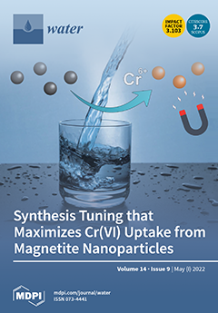
Proper tuning of hydroxyl excess offers multiple options for the implementation of monodisperse magnetically responsive nanoparticles in drinking water technology. Results concerning Cr(VI) uptake indicate that a small increase in hydroxyl excess features synthesized nanoparticles with an uptake capacity of 2.5 mg/g owing to the decrease in particle size and enhancement of the reducing potential. Negative excess values trigger a similar efficiency rise of the obtained aggregates attributed to a possible exchange mechanism between adsorbed sulfates and chromate anions. View this paper
  • Issues are regarded as officially published after their release is announced to the table of contents alert mailing list.
  • You may sign up for e-mail alerts to receive table of contents of newly released issues.
  • PDF is the official format for papers published in both, html and pdf forms. To view the papers in pdf format, click on the "PDF Full-text" link, and use the free Adobe Reader to open them.
Order results
Result details
Section
Select all
Export citation of selected articles as:
14 pages, 1022 KiB  
Article
Changes in the Ecological Status of Rivers Caused by the Functioning of Natural Barriers
by Katarzyna Połeć, Antoni Grzywna, Monika Tarkowska-Kukuryk and Urszula Bronowicka-Mielniczuk
Water 2022, 14(9), 1522; https://doi.org/10.3390/w14091522 - 09 May 2022
Cited by 4 | Viewed by 1681
Abstract
Introducing the European beaver to the catchment area, which adjusts the habitat to its own needs (by building dams), may have a positive impact on the ecology, geology, and hydromorphology of rivers and intensify the water self-purification process. In this study, a comparative [...] Read more.
Introducing the European beaver to the catchment area, which adjusts the habitat to its own needs (by building dams), may have a positive impact on the ecology, geology, and hydromorphology of rivers and intensify the water self-purification process. In this study, a comparative assessment of the ecological status was made between the areas where the species Castor fiber L. occurs (habitat type A) and the areas unaffected by the influence (habitat type B). For this purpose, the Macrophyte River Index (MIR) and the Hydromorphological River Index (HIR) were calculated, along with the floristic indicators of biodiversity: species richness and Margalef, Shannon–Wiener, and Simpson indices. Only 35% of the sites met the standard of good ecological status. The presence of hypertrophic species and anthropogenic modifications of the river bed had a negative impact. The spread of beavers has a significant positive effect on changes in hydromorphological conditions and water levels in the river. The water levels in habitat types A and B were 0.504 and 0.253 m, respectively. There were statistically significant differences in the HIR values between habitat types A and B, which were 0.585 and 0.535, respectively. In habitats of type A, the heterogeneity of the current and bed material as well as the diversity of elements accompanying the tree stands increased. Research has shown greater species richness and greater biodiversity of macrophytes in the habitats of beaver dams. The research confirmed the significant influence of the European beaver on changes in the environment. The activity of beavers intensifies the processes of introducing wetland and rush species to forest areas. Full article
Show Figures

Figure 1

15 pages, 3967 KiB  
Article
Challenges of Spring Protection and Groundwater Development in Urban Subway Construction: A Case Study in the Jinan Karst Area, China
by Wenyang Wang, Yonghui Fan, Kai Li, Xintong Wang and Jintao Kang
Water 2022, 14(9), 1521; https://doi.org/10.3390/w14091521 - 09 May 2022
Cited by 1 | Viewed by 2048
Abstract
In order to improve land-use efficiency and solve traffic congestion, in recent years, many cities in China have focused on developing urban underground space resources and urban rail transit projects. However, there are various hidden risks for the sustainable development of the ecological [...] Read more.
In order to improve land-use efficiency and solve traffic congestion, in recent years, many cities in China have focused on developing urban underground space resources and urban rail transit projects. However, there are various hidden risks for the sustainable development of the ecological environment and water resources. In this paper, a comprehensive investigation and analysis of spring water resources are carried out using the example of the karst area of Jinan, which is known as ‘spring city’. The engineering geological and hydrogeological conditions in Jinan are introduced in detail, and the geological causes of springs are analyzed. In addition, the causes of spring flow attenuation are revealed based on the investigation of the flow dynamics of spring water. Based on the current situation of traffic congestion in Jinan, the necessity and development statuses of rail transit construction are analyzed. Then, according to the different stratigraphic structure, limestone roof depth and karst water head depth, the Jinan spring area is divided into three research regions including the shallow limestone area, concentrated spring water area and deep limestone area. The spring protection problems faced by each region during the construction of urban railways are systematically described. In addition, the countermeasures and suggestions for spring protection are presented. This study aims to reduce the impact of urban rail transit construction on Jinan spring water so as to protect the Jinan spring. It also provides the water resources protection experience for urban rail transit construction in similar karst areas. Full article
(This article belongs to the Special Issue Surface Water Management: Recent Advances and Challenges)
Show Figures

Figure 1

11 pages, 444 KiB  
Article
Assessment of the Effect of Irrigation with Treated Wastewater on Soil Properties and on the Performance of Infiltration Models
by Ammar A. Albalasmeh, Ma’in Z. Alghzawi, Mamoun A. Gharaibeh and Osama Mohawesh
Water 2022, 14(9), 1520; https://doi.org/10.3390/w14091520 - 09 May 2022
Cited by 3 | Viewed by 1791
Abstract
An alternative strategy for saving limited water resources is using treated wastewater (TWW) originating from wastewater treatment plants. However, using TWW can influence soil properties owing to its characteristics compared to conventional water resources. Therefore, assessing the effect of TWW on soil properties [...] Read more.
An alternative strategy for saving limited water resources is using treated wastewater (TWW) originating from wastewater treatment plants. However, using TWW can influence soil properties owing to its characteristics compared to conventional water resources. Therefore, assessing the effect of TWW on soil properties and soil water infiltration is crucial to maintain sustainable use of TWW and to increase the water use efficiency of the precious irrigation water. Moreover, several studies were carried out to assess the performance of infiltration models. However, few studies evaluate infiltration models under the use of treated wastewater. Therefore, this study aims to assess the effect of TWW irrigation on soil properties after 2 and 5 years and to evaluate five classical infiltration models with field data collected from soil irrigated by treated wastewater for their capability in predicting soil water infiltration. This study revealed that using TWW for irrigation affects significantly on soil properties after 2 and 5 years. The soil irrigated with TWW had significantly higher electrical conductivity, organic matter, sodium adsorption ratio, cation exchange capacity, and lower soil bulk density compared to control. The basic infiltration rate and cumulative infiltration decreased significantly compared to control (60.84, 14.04, and 8.42 mm hr−1 and 140 mm, 72 mm, and 62 mm for control, 2, and 5 years’ treatments, respectively). The performance of the infiltration models proposed by Philip, Horton, Kostiakov, Modified Kostiakov, and the Natural Resources Conservation Service was evaluated with consideration of mean error, root mean square error, model efficiency, and Willmott’s index. Horton model had the lowest mean error (0.0008) and Philip model had the lowest root mean square error (0.1700) while Natural Resources Conservation Service had the highest values (0.0433 and 0.5898) for both mean error and root mean square error, respectively. Moreover, Philip model had the highest values of model efficiency and Willmott’s index, 0.9994 and 0.9998, respectively, whereas Horton model had the lowest values for the same indices, 0.9869 and 0.9967, respectively. Philip model followed by Modified Kostiakov model were the most efficient models in predicting cumulative infiltration, while Natural Resources Conservation Service model was the least predictable model. Full article
Show Figures

Figure 1

14 pages, 1491 KiB  
Article
Sustainable Development and Efficiency Analysis of the Major Urban Water Utilities in Spain
by Alicia Robles-Velasco, María Rodríguez-Palero, Jesús Muñuzuri and Luis Onieva
Water 2022, 14(9), 1519; https://doi.org/10.3390/w14091519 - 09 May 2022
Cited by 5 | Viewed by 1862
Abstract
In Spain, the water supply service is a municipal responsibility and in general is a sector without competitors. For this reason, an efficiency analysis attains greater significance. This study uses Data Envelopment Analysis (DEA) to estimate the efficiency of different urban water utilities. [...] Read more.
In Spain, the water supply service is a municipal responsibility and in general is a sector without competitors. For this reason, an efficiency analysis attains greater significance. This study uses Data Envelopment Analysis (DEA) to estimate the efficiency of different urban water utilities. An extensive data search, where several variables such as the capital expenditure, the cost of material, or the labor have been recorded, has allowed evaluating the relative efficiency of the most important Spanish water distribution networks in using their resources. Furthermore, their sustainable efficiency has also been evaluated by including a variable representing the percentage of water losses. Results reveal the weaknesses of inefficient utilities and help to detect potential aspects that these companies should improve. For instance, there is an evident incorrect management of the costs of material by many urban water utilities, which does not happen with the labor. Additionally, the most efficient water utilities regarding the sustainable efficiency help to discover target percentages of water losses for the inefficient ones. Full article
(This article belongs to the Special Issue Increasing the Efficiency of Urban Water Supply)
Show Figures

Figure 1

13 pages, 3113 KiB  
Article
Application of Cosmic-Ray Neutron Sensor Method to Calculate Field Water Use Efficiency
by Xiuhua Chen, Wenlong Song, Yangjun Shi, Weidong Liu, Yizhu Lu, Zhiguo Pang and Xiao Chen
Water 2022, 14(9), 1518; https://doi.org/10.3390/w14091518 - 09 May 2022
Cited by 6 | Viewed by 2254
Abstract
Field water use efficiency is an important parameter for evaluating the quality of field irrigation in irrigated areas, which directly affects the country’s food security and water resource allocation. However, most current studies use point-scale soil moisture (SM) or remote sensing water balance [...] Read more.
Field water use efficiency is an important parameter for evaluating the quality of field irrigation in irrigated areas, which directly affects the country’s food security and water resource allocation. However, most current studies use point-scale soil moisture (SM) or remote sensing water balance models to calculate the field water use coefficient, which cannot avoid errors caused by the spatial heterogeneity of SM and insufficient spatial resolution of remote sensing data. Therefore, in this study, the cosmic-ray neutron sensor (CRNS), Time-Domain Reflectometers (TDR) and Automatic Weather Stations (AWS) were used to monitor the meteorological and hydrological data such as SM, atmospheric pressure, and precipitation in the experimental area of Jinghuiqu Irrigation District for three consecutive years. The scale of the CRNS SM lies between the point and the remote sensing. Based on the CRNS SM, the calculation method for canal head and tail water was used to calculate the field water use efficiency to evaluate the level of agricultural irrigation water use in the experimental irrigation area. The results showed that CRNS could accurately detect the change in SM, and four irrigation events were monitored during the winter wheat growth period from October 2018 to June 2019; the calculation result of field water use efficiency in the experimental area was 0.77. According to the field water use efficiency of the same irrigation area from October 2013 to October 2015 in other studies, the field water use efficiency during the growing period of winter wheat in this area increased from 0.503 to 0.770 in 2013–2019, indicating a significant improvement in the field water use level. In general, this study not only solves the problem of low calculation accuracy of field water use efficiency caused by the mismatch of SM monitoring scales but also explores the application potential of CRNS in agricultural irrigation management and water resource allocation. Full article
Show Figures

Figure 1

12 pages, 1313 KiB  
Article
Multiple Antibiotic Resistance in Escherichia coli Isolates from Fecal and Water Sources in Laguna Lake, Philippines
by Laurice Beatrice Raphaelle O. dela Peña, Mae Ashley G. Nacario, Nicole R. Bolo and Windell L. Rivera
Water 2022, 14(9), 1517; https://doi.org/10.3390/w14091517 - 09 May 2022
Cited by 6 | Viewed by 7887
Abstract
Due to the misuse and overuse of antibiotics, antibiotic residues accumulate in natural environments, leading to the development of antibiotic-resistant bacteria (ARBs). The presence of ARBs in bodies of water poses health hazards to the surrounding community. This study focused on Laguna Lake, [...] Read more.
Due to the misuse and overuse of antibiotics, antibiotic residues accumulate in natural environments, leading to the development of antibiotic-resistant bacteria (ARBs). The presence of ARBs in bodies of water poses health hazards to the surrounding community. This study focused on Laguna Lake, the largest lake in the Philippines, which serves as a water source for agriculture and domestic purposes. We aimed to detect the presence of antibiotic-resistant Escherichia coli from the lake waters and potential reservoirs of resistance as well as determine the multiple antibiotic resistance (MAR) indices of the isolates. E. coli (n = 450) was isolated from fecal-associated samples (chicken, cow, pig, human, sewage) and water samples (sites in Laguna Lake and selected river tributaries). The isolates were subjected to an antibiotic resistance assay using VITEK 2®. Among the 16 antibiotics tested, the isolates exhibited varying resistance to 14, but complete susceptibility to amikacin and tigecycline was observed. Isolates were most frequently resistant to ampicillin (196/450, 43.6%). Among fecal-associated samples, chicken isolates exhibited the highest MAR index (0.174), whereas samples from Pila River exhibited the highest MAR index (0.152) among water samples. The results of this study demonstrate the presence of multidrug-resistant E. coli in samples collected around Laguna Lake and reveal fecal and sewage sources as potential reservoirs of ARBs in the water body. With this information, the public is urged to use antibiotics responsibly to help mitigate the spread of antibiotic resistance. Full article
Show Figures

Graphical abstract

12 pages, 5080 KiB  
Article
Development of a Multiple-Drought Index for Comprehensive Drought Risk Assessment Using a Dynamic Naive Bayesian Classifier
by Hyeok Kim, Dong-Hyeok Park, Jae-Hyun Ahn and Tae-Woong Kim
Water 2022, 14(9), 1516; https://doi.org/10.3390/w14091516 - 09 May 2022
Cited by 2 | Viewed by 1697
Abstract
Korea has made various efforts to reduce drought damage; however, socio-economic damage has increased in recent years due to climate change, which has led to increasing frequency and intensity of drought. In South Korea, because precipitation is concentrated in the summer, drought damage [...] Read more.
Korea has made various efforts to reduce drought damage; however, socio-economic damage has increased in recent years due to climate change, which has led to increasing frequency and intensity of drought. In South Korea, because precipitation is concentrated in the summer, drought damage will be significant in the event of failure of water resources management. Seasonal and regional imbalances in precipitation have contributed to recent extreme droughts in South Korea. In addition, population growth and urbanization have led to increased water use and contributed to water shortage. Drought risk analysis must address multiple contributing factors and comprehensively assess the effects or occurrence of future droughts, which are essential for planning drought mitigation to cope with actual droughts. Drought mitigation depends on the water supply capacity during dry spells. In this study, a dynamic naive Bayesian classifier-based multiple drought index (DNBC-MDI) was developed by combining the strengths of conventional drought indices and water supply capacity. The DNBC-MDI was applied to a bivariate drought frequency analysis to evaluate hydrologic risk of extreme droughts. In addition, future changes of the risk were investigated according to climate change scenarios. As a result, the drought risk had a decreasing trend from the historic period of 1974–2016 to the future period of 2017–2070, then had an increasing trend in the period of 2071–2099. Full article
(This article belongs to the Special Issue The Impacts of Climate Change on Hydrologic Extremes)
Show Figures

Figure 1

23 pages, 7625 KiB  
Article
Potential Risk of Agrochemical Leaching in Areas of Edaphoclimatic Suitability for Coffee Cultivation
by Gleissy Mary Amaral Dino Alves dos Santos, Antônio Augusto Neves, Maria Eliana Lopes Ribeiro de Queiroz, Vagner Tebaldi de Queiroz, Carlos Antonio Alvares Soares Ribeiro, Efraim Lázaro Reis, Ana Carolina Pereira Paiva, José Romário de Carvalho, Samuel Ferreira da Silva, Ronie Silva Juvanhol, Taís Rizzo Moreira, Luciano José Quintão Teixeira, Sérgio Henriques Saraiva, Adilson Vidal Costa, Camila Aparecida da Silva Martins, Fábio Ribeiro Pires, Thuelem Azevedo Curty, Plinio Antonio Guerra Filho, Marcelo Henrique de Souza, Waldir Cintra de Jesus Junior and Alexandre Rosa dos Santosadd Show full author list remove Hide full author list
Water 2022, 14(9), 1515; https://doi.org/10.3390/w14091515 - 09 May 2022
Cited by 2 | Viewed by 2420
Abstract
Studies show that agricultural activities around the world still present a strong dependence on agrochemicals that can leach into the soil profile, causing its contamination, as well as that of water resources. In this context, the present study evaluates the potential risk of [...] Read more.
Studies show that agricultural activities around the world still present a strong dependence on agrochemicals that can leach into the soil profile, causing its contamination, as well as that of water resources. In this context, the present study evaluates the potential risk of pesticide leaching in areas of edaphoclimatic suitability for coffee cultivation in Espírito Santo state, Brazil. As a methodology, the areas of edaphoclimatic suitability for conilon and arabica coffee were defined, and subsequently, the risk of leaching of active agrochemical ingredients in these areas was evaluated using the Groundwater Ubiquity Score (GUS), Leaching Index (LIX) and Attenuation Factor/Retardation Factor (AF/RF) methods. Of the ten active ingredients evaluated, sulfentrazone and thiamethoxam present a potential risk of leaching into the groundwater level. The study allowed us to evaluate the potential risk of agrochemical leaching in tropical soils cultivated with coffee using geographic information system (GIS) techniques. The methodological proposal can be adapted for other agricultural areas and crops. Full article
(This article belongs to the Special Issue Water Quality Modeling and Monitoring)
Show Figures

Graphical abstract

23 pages, 2859 KiB  
Article
Hydrogeological Model of the Forefield Drainage System of Werenskioldbreen, Svalbard
by Katarzyna Stachniak, Sławomir Sitek, Dariusz Ignatiuk and Jacek Jania
Water 2022, 14(9), 1514; https://doi.org/10.3390/w14091514 - 09 May 2022
Cited by 4 | Viewed by 1990
Abstract
The significant recession of Arctic glaciers caused by climate warming is expanding their proglacial zones. Thus, their importance for the hydrology of glacierised basins is growing. In contrast to the surface waters in such areas, the role of groundwater in the hydrological balance [...] Read more.
The significant recession of Arctic glaciers caused by climate warming is expanding their proglacial zones. Thus, their importance for the hydrology of glacierised basins is growing. In contrast to the surface waters in such areas, the role of groundwater in the hydrological balance of Svalbard catchments is poorly known. This paper presents the hydrogeological conditions and groundwater flow within the permafrost active layer in the forefield of the Werenskioldbreen glacier basin (44.1 km2), 61% of which is glacierised. Based on field studies of groundwater in the 2017 ablation season and laboratory analyses of the hydrogeological properties of proglacial sediments, a three-dimensional groundwater flow model (FEFLOW) for part of the glacier forefield (4.8 km2) was developed. The main results show the components and characteristics of the groundwater balance and indicate the preferential groundwater flow paths. The volume of water retained in the sediments of the marginal zone is 1.0073 mln m3. The maximum potential free pore space that could be filled by water is 2.0689 mln m3. The calculated groundwater discharge for average conditions is 6076.9 m3 d−1, which is about 2% of the total seasonal catchment runoff from the main glacial river. The results of the spatial analysis for the groundwater depth and the groundwater flow directions are also presented. There need to be further detailed studies of hydrogeological processes in glacial basins in Svalbard in order to develop existing knowledge. Full article
Show Figures

Figure 1

13 pages, 1892 KiB  
Article
Investigation on the Cavity Backwater of Chute Aerators under Various Atmospheric Pressures
by Yameng Wang, Jun Deng and Wangru Wei
Water 2022, 14(9), 1513; https://doi.org/10.3390/w14091513 - 09 May 2022
Cited by 2 | Viewed by 1399
Abstract
A chute aerator is a device that entrains air into water and protects against cavitation erosion. The state of the jet cavity determines the aerator efficiency under different flow conditions. In the case of a low Froude number and low velocity, backwater is [...] Read more.
A chute aerator is a device that entrains air into water and protects against cavitation erosion. The state of the jet cavity determines the aerator efficiency under different flow conditions. In the case of a low Froude number and low velocity, backwater is generated in the jet cavity. In severe cases, this backwater blocks the air intake holes and affects air intake efficiency. With the development and construction of water conservancy projects, an increasing number of dams have been constructed at altitudes above 3000 m. The influence of cavity backwater depth at reduced atmospheric pressures is unknown and may increase the risk of high-speed aerated flows in high-altitude areas. In this study, the relevant parameters of backwater were measured at various atmospheric pressures, including the jet length, cavity subpressure, backwater depth, and net cavity length. The pressure difference of atmospheric pressure can range from 0 to 94 kPa. The test results indicate that a decrease in atmospheric pressure causes variations in the cavity subpressure. The absolute value of the difference between the inside and outside of the cavity decreases with a decrease in atmospheric pressure. An empirical formula for calculating the subpressure at different atmospheric pressures is proposed for PN < 0.1. The air velocity in the ventilation shaft decreases with a decrease in atmospheric pressure. The effects of variation in the atmospheric pressure on jet length can be ignored because the variation in jet length with different atmospheric pressures was constant. Additionally, the influence of varying atmospheric pressure on the cavity backwater is evident. The backwater depth decreases with a decrease in atmospheric pressure. When the atmospheric pressure decreases from 96 to 6 kPa, the maximum reduction in backwater depth is over 50%. Atmospheric pressure is a parameter that affects cavity backwater. Based on the measured backwater depth data, an empirical formula for calculating the backwater depth at different atmospheric pressures is proposed. This indicates a relationship between the atmospheric pressure and backwater depth under different flow conditions. It was further found that the bottom cavity may require a larger air intake volume at low atmospheric pressures and that it is necessary to optimize the aerator and the ventilation system. Full article
(This article belongs to the Special Issue Advances in Experimental Hydraulics, Coast and Ocean Hydrodynamics)
Show Figures

Figure 1

17 pages, 6045 KiB  
Article
Development of a Deep Learning-Based Prediction Model for Water Consumption at the Household Level
by Jongsung Kim, Haneul Lee, Myungjin Lee, Heechan Han, Donghyun Kim and Hung Soo Kim
Water 2022, 14(9), 1512; https://doi.org/10.3390/w14091512 - 09 May 2022
Cited by 8 | Viewed by 3524
Abstract
The importance of efficient water resource supply has been acknowledged, and it is essential to predict short-term water consumption in the future. Recently, it has become possible to obtain data on water consumption at the household level through smart water meters. The pattern [...] Read more.
The importance of efficient water resource supply has been acknowledged, and it is essential to predict short-term water consumption in the future. Recently, it has become possible to obtain data on water consumption at the household level through smart water meters. The pattern of these data is nonlinear due to various factors related to human activities, such as holidays and weather. However, it is difficult to accurately predict household water consumption with a nonlinear pattern with the autoregressive integrated moving average (ARIMA) model, a traditional time series prediction model. Thus, this study used a deep learning-based long short-term memory (LSTM) approach to develop a water consumption prediction model for each customer. The proposed model considers several variables to learn nonlinear water consumption patterns. We developed an ARIMA model and an LSTM model in the training dataset for customers with four different water-use types (detached houses, apartment, restaurant, and elementary school). The performances of the two models were evaluated using a test dataset that was not used for model learning. The LSTM model outperformed the ARIMA model in all households (correlation coefficient: mean 89% and root mean square error: mean 5.60 m3). Therefore, it is expected that the proposed model can predict customer-specific water consumption at the household level depending on the type of use. Full article
(This article belongs to the Section Urban Water Management)
Show Figures

Figure 1

21 pages, 3842 KiB  
Article
Investigating the Granulometric Distribution of Fluvial Sediments through the Hybrid Technique: Case Study of the Baganza River (Italy)
by Usman Ali Khan and Roberto Valentino
Water 2022, 14(9), 1511; https://doi.org/10.3390/w14091511 - 09 May 2022
Cited by 1 | Viewed by 2684
Abstract
Sediment characterization is a key parameter to understand the geomorphological attributes of a catchment (i.e., assessing the variability of the sediment transport capacity and surface roughness of a hydraulic channel). This assessment can be performed in several ways, for instance, through numerous sampling [...] Read more.
Sediment characterization is a key parameter to understand the geomorphological attributes of a catchment (i.e., assessing the variability of the sediment transport capacity and surface roughness of a hydraulic channel). This assessment can be performed in several ways, for instance, through numerous sampling techniques (i.e., pebble count and zig-zag methods). Sediment sampling using manual sieving inside a laboratory is a hectic process as it requires ample time and physical effort, particularly when the scale of interest is at the catchment level. In order to find the granulometric distribution of some sections of the Baganza streambed (northern Italy), in order to carry out analysis at the catchment scale, a hybrid technique (a combination of the conventional and photogrammetric method) is introduced. Different grain size distribution curves (GSDs) obtained from the image processing technique using Digital Gravelometer software and traditional sediment sieve analysis (sieve-by-weight method) were compared. Sediment sampling was limited to sections of the streambed that were visible during lower flows in the dry summer season. Sediment samples including fine soil fraction, were collected up to a depth of 30 cm, although the exposed areas behaved as gravels and cobble bars. The adopted hybrid technique approach for the characterization of fluvial sediments is desirable in order to accommodate the full range of particle sizes inside the riverbed. Digital photography was performed at ten different cross sections, along the longitudinal profile of the 30 km long reach of the Baganza River, to examine the sediment distribution, grading, and representative particle sizes (D10, D50, D90) at each of the respective cross sections. A comparison of the photogrammetric method and traditional sieve analysis revealed strong agreement in coarser segments of the grain size distributions, but it was deficient in the finer part (<2 mm) due to the shielding effect produced by bigger particles. However, the adopted hybrid technique appears to be quite efficient and promising in determining the GSD by reducing the costs and the sediment sample collection time in the field. Full article
(This article belongs to the Special Issue Research on Soil Erosion and Sediment Transport in Catchment)
Show Figures

Figure 1

14 pages, 712 KiB  
Article
An Assessment of the Water Resources Carrying Capacity in Xinjiang
by Yan Han and Shaofeng Jia
Water 2022, 14(9), 1510; https://doi.org/10.3390/w14091510 - 09 May 2022
Cited by 12 | Viewed by 1941
Abstract
The water resource shortage is a crucial factor in restraining the development of society and the economy in Xinjiang, where there is drought and little rain. The assessment of the water resources carrying capacity (WRCC) is a prerequisite for socioeconomic sustainable development in [...] Read more.
The water resource shortage is a crucial factor in restraining the development of society and the economy in Xinjiang, where there is drought and little rain. The assessment of the water resources carrying capacity (WRCC) is a prerequisite for socioeconomic sustainable development in Xinjiang. In this paper, a convenient and effective model is established for assessing the WRCC under the influence of social welfare and water use efficiency. Meanwhile, a pedigree chart for WRCC is put forward. Then the developed approach is applied to investigate the sustainable utilization of water resources in Xinjiang. The results indicate that the WRCC of Xinjiang is not overloaded in 2018. The status of the WRCC is worse in northern Xinjiang than in southern Xinjiang, especially in Karamay, Shihezi, and Urumchi. The areas with potential water resource exploitation in Xinjiang are mainly located in the Yili Kazak Autonomous Prefecture and Altay Prefecture. The efficiency of agricultural water use is of vital importance to the WRCC in Xinjiang. The WRCC of Xinjiang can be improved by saving agricultural water, water recycling, and optimizing industrial structures. The maximum population carried by the water resources in Xinjiang is predicted to be 33.63 million and 35.80 million in 2035 and 2050, respectively. The assessment of the WRCC provides a valuable reference for the sustainable utilization of water resources in Xinjiang. Full article
(This article belongs to the Section Water Resources Management, Policy and Governance)
Show Figures

Figure 1

16 pages, 2745 KiB  
Article
Ecological Synthesis of CuO Nanoparticles Using Punica granatum L. Peel Extract for the Retention of Methyl Green
by Mongi ben Mosbah, Abdulmohsen Khalaf Dhahi Alsukaibi, Lassaad Mechi, Fathi Alimi and Younes Moussaoui
Water 2022, 14(9), 1509; https://doi.org/10.3390/w14091509 - 08 May 2022
Cited by 8 | Viewed by 2141
Abstract
The aqueous extract from the bark of Punica granatum L. was invested to generate CuO nanoparticles from CuSO4 using a green, economical, ecological, and clean method. The synthesized nanoparticles were characterized and were successfully used as adsorbents for methyl green retention of [...] Read more.
The aqueous extract from the bark of Punica granatum L. was invested to generate CuO nanoparticles from CuSO4 using a green, economical, ecological, and clean method. The synthesized nanoparticles were characterized and were successfully used as adsorbents for methyl green retention of an absorptive capacity amounting to 28.7 mg g−1. Methyl green equilibrium adsorption data were correlated to the Langmuir model following the pseudo-second order kinetics model. This study clearly corroborates that copper nanoparticles exhibit a high potential for use in wastewater treatment. Full article
Show Figures

Figure 1

19 pages, 1602 KiB  
Review
Hypersaline Wastewater Produced from Pickled Mustard Tuber (Chinese Zhacai): Current Treatment Status and Prospects
by Linji Xu, Yunsong Pang, Wenzong Liu, Hongna Chen, Shunjun Huang and Lei Zhu
Water 2022, 14(9), 1508; https://doi.org/10.3390/w14091508 - 08 May 2022
Cited by 9 | Viewed by 2725
Abstract
Pickled mustard tuber, a worldwide condiment, is increasing at a fast growth rate. Its production generates a considerable amount of hypersaline wastewater containing NaCl of 7 wt.%, COD of 30,000 mg L−1, NH3-N of 400 mg L−1, [...] Read more.
Pickled mustard tuber, a worldwide condiment, is increasing at a fast growth rate. Its production generates a considerable amount of hypersaline wastewater containing NaCl of 7 wt.%, COD of 30,000 mg L−1, NH3-N of 400 mg L−1, and TP of 300 mg L−1. Pickled mustard tuber wastewater (PMTW) has severe effects on crops, deterioration of water quality, soil infertility and ecological systems. Due to the technic difficulties and insufficient support from the local governments; however, PMTW has not yet been widely investigated and well summarized. Therefore, this manuscript reviewed the relatively latest advances in PMTW. Physicochemical and biological hybrid processes mainly treat PMTW and the corresponding cost is 6.00 US dollars per ton. In the context of double carbon capture capacity in China and the development of the pickled mustard industry, PMTW sauce and sustainable reuse such as nutrient recovery, acid and alkaline regeneration and renewable energy may be bright prospects. Full article
(This article belongs to the Special Issue Advances of Anaerobic Technologies on Wastewater Treatment)
Show Figures

Figure 1

19 pages, 4478 KiB  
Article
Novel Water-Soluble Poly(terephthalic-co-glycerol-g-fumaric acid) Copolymer Nanoparticles Harnessed as Pore Formers for Polyethersulfone Membrane Modification: Permeability–Selectivity Tradeoff Manipulation
by Khalid T. Rashid, Haiyam M. Alayan, Alyaa E. Mahdi, Mohammad N. AL-Baiati, Hasan Sh. Majdi, Issam K. Salih, Jamal M. Ali and Qusay F. Alsalhy
Water 2022, 14(9), 1507; https://doi.org/10.3390/w14091507 - 08 May 2022
Cited by 9 | Viewed by 2809
Abstract
This work presents poly(terephthalic-co-glycerol-g-fumaric acid) (TGF) as a novel water-soluble polymeric nano-additive for the modification of a polyethersulfone ultrafiltration membrane. The TGF was harnessed as a pore former, aiming to improve the membrane surface porosity and hydrophilicity. Modified membranes [...] Read more.
This work presents poly(terephthalic-co-glycerol-g-fumaric acid) (TGF) as a novel water-soluble polymeric nano-additive for the modification of a polyethersulfone ultrafiltration membrane. The TGF was harnessed as a pore former, aiming to improve the membrane surface porosity and hydrophilicity. Modified membranes were characterized to observe the influence of varying the TGF content on their hydrophilicity, porosity, morphological structure, and composition, as well as their entire performance. The results disclosed that porosity and hydrophilicity of the modified membrane prepared using 4 wt.% TGF content recorded an enhancement by 24% and 38%, respectively. Herein, the lower contact angle was mainly a reflection of the improved porosity, but not of the hydrophilic nature of water-soluble TGF. Furthermore, upon increasing the TGF content in the polymeric matrix, a more porous structure with longer finger-like micropores was formed. Moreover, a sponge-like layer clearly appeared near the bottom surface. Nevertheless, at optimum TGF content (4%), a clear enhancement in the water flux and BSA retention was witnessed by values of 298 LMH and 97%, respectively. These results demonstrate that the obtained permeation and separation behavior of the PES/TGF membrane could stand as a promising choice for water and wastewater treatment applications. Full article
(This article belongs to the Special Issue Membrane Technology for Water Treatment and Desalination)
Show Figures

Figure 1

22 pages, 5491 KiB  
Article
Numerical Analysis of Motion Characteristics of Sliding or Rolling and Saltation of Sediment Particles under Turbulent Flow
by Bangwen Zhang, Anjun Deng, Dangwei Wang, Yang Shi and Xianyong Dong
Water 2022, 14(9), 1506; https://doi.org/10.3390/w14091506 - 07 May 2022
Viewed by 1827
Abstract
The processes of sediment particle movement were studied through numerical simulation using a coupled method with focus on discussing the characteristics of sliding or rolling and saltation sediment particles, respectively. Turbulent flow was simulated using large eddy simulation (LES). The sediment particle was [...] Read more.
The processes of sediment particle movement were studied through numerical simulation using a coupled method with focus on discussing the characteristics of sliding or rolling and saltation sediment particles, respectively. Turbulent flow was simulated using large eddy simulation (LES). The sediment particle was simulated using the combined finite-discrete element method (FDEM). The interaction forces of turbulent flow and sediment particle were calculated using the immersed boundary method (IBM). It indicated that the collisions of saltating particle with low concentration increase the saltation length and flight time. In response, sediment particle velocity also increases. The particle angular velocity is largest at the takeoff moment, and decreases gradually in the saltation progress. The drag and lift forces near the bed are large, and away from the bed decrease and trend to be a stable value, gradually. From the relative magnitudes of the drag and lift forces, the lift force plays a more important role than the drag force in the sediment saltation. The relative magnitudes of drag and lift forces influence the incident and takeoff angles. The sediment transport rate calculated based on the characteristics of saltation sediment particles is overestimated, ignoring the effect of sliding or rolling sediment particles and inter-particle collisions. Full article
Show Figures

Figure 1

12 pages, 1772 KiB  
Article
Electrode Microbial Communities Associated with Electron Donor Source Types in a Bioelectrochemical System Treating Azo-Dye Wastewater
by Zechong Guo, Lu Zhang, Min-Hua Cui and Aijie Wang
Water 2022, 14(9), 1505; https://doi.org/10.3390/w14091505 - 07 May 2022
Cited by 4 | Viewed by 1603
Abstract
Bioelectrochemical systems (BESs) have been acknowledged to be an efficient technology for refractory pollution treatment. An electron donor is as an indispensable element of BES, and domestic wastewater (DW) has been proved as a cost-efficient and accessible alternative option to expensive carbon sources [...] Read more.
Bioelectrochemical systems (BESs) have been acknowledged to be an efficient technology for refractory pollution treatment. An electron donor is as an indispensable element of BES, and domestic wastewater (DW) has been proved as a cost-efficient and accessible alternative option to expensive carbon sources (such as acetate and glucose), yet its effect on microbial community evolution has not been thoroughly revealed. In this study, the electrode microbial communities from BESs treating azo dye wastewater fed by DW (RDW), acetate (RAc), and glucose (RGlu) were systematically revealed based on 16S rRNA Illumina MiSeq sequencing platform. It was found that there were significant differences between three groups in microbial community structures. Desulfovibrio, Acinetobacter, and Klebsiella were identified as the predominant bacterial genera in RDW, RAc, and RGlu, respectively. Methanosaeta, the most enriched methanogen in all reactors, had a relative lower abundance in RDW. Microbial communities in RAc and RGlu were sensitive to electrode polarity while RDW was sensitive to electrode position. Compared with pure substrates, DW increased the diversity of microbial community and, thus, may enhance the stability of electrode biofilm. This study provides an insight into the microbial response mechanism to the electron donors and provides engineering implications for the development of BES. Full article
(This article belongs to the Special Issue The Application of Electrochemical Methods in Water Treatment)
Show Figures

Graphical abstract

17 pages, 3067 KiB  
Article
Hazard Characterization of the Annual Maximum Daily Precipitation in the Southwestern Iberian Peninsula (1851–2021)
by Julia Morales, Leoncio García-Barrón, Mónica Aguilar-Alba and Arturo Sousa
Water 2022, 14(9), 1504; https://doi.org/10.3390/w14091504 - 07 May 2022
Cited by 4 | Viewed by 2053
Abstract
High-intensity rainfall can raise fluvial channel levels, increasing the risk of flooding. Maximum precipitation depths are used to estimate return periods and, thus, calculate the risk of this type of event. To improve these estimates in Southwest Europe, we studied the behavior of [...] Read more.
High-intensity rainfall can raise fluvial channel levels, increasing the risk of flooding. Maximum precipitation depths are used to estimate return periods and, thus, calculate the risk of this type of event. To improve these estimates in Southwest Europe, we studied the behavior of extreme rainfall using the historical records of San Fernando (Cádiz, southwest Spain), obtaining the maximum daily annual rainfall (period 1851–2021). Local risk levels for intense precipitation were established based on the mean values and standard deviation of daily precipitation. In this series, 38% of the years had some type of risk (>53.7 mm), of which 13% of these years had high risk (>73.2 mm) or disaster risk (>92.7 mm). In these risk thresholds, the maximum daily precipitation is mostly concentrated in the autumn months. The SQRT-ETMax model used fits well with the instrumental historical records for return periods of up to 25 years, although it may present appreciable deviations for longer return periods. Using a 170-year secular series, a more precise understanding of extreme periods and precipitation variability was obtained. Full article
Show Figures

Figure 1

17 pages, 5756 KiB  
Article
Comparison of the Performance of IMERG Products and Interpolation-Based Precipitation Estimates in the Middle Reaches of Yellow River Basin
by Jiayong Shi, Zhenxin Bao, Jianyun Zhang, Cuishan Liu, Junliang Jin, Yanli Liu and Guoqing Wang
Water 2022, 14(9), 1503; https://doi.org/10.3390/w14091503 - 07 May 2022
Cited by 4 | Viewed by 1550
Abstract
Accurate spatial precipitation data are of prime importance for hydrological simulations and flood forecasts. Interpolation methods and satellite-based precipitation products (SPPs) are often applied to obtain spatially distributed precipitation over basins. The objective of this study is to investigate whether satellite precipitation data [...] Read more.
Accurate spatial precipitation data are of prime importance for hydrological simulations and flood forecasts. Interpolation methods and satellite-based precipitation products (SPPs) are often applied to obtain spatially distributed precipitation over basins. The objective of this study is to investigate whether satellite precipitation data can yield better estimates than the precipitation information (gauge observations) already available in the basin. In this study, we assessed the performance of three Integrated Multi-satellite Retrievals for Global Precipitation Measurement (IMERG) products against two calculated interpolation data and the ground precipitation observations at a daily scale in the middle reaches of the Yellow River Basin (MRYRB). This research includes two interpolation methods, namely, inverse distance weighting (IDW) and ordinary kriging (OK), and three latest IMERG SPPs, namely, IMERG “Early”, “Late”, and “Final” run SPPs (IMERG-E, IMERG-L, and IMERG-F). The results show that the two interpolation methods (IDW and OK) obtain the best overall performance, followed by IMERG-F, whereas IMERG-E and IMERG-L have inferior performance. Compared with the two interpolation methods, IMERG-F obtains higher CC values and lower FAR scores during the rainy season and presents better correlation with the gauge-based precipitation at the basin boundary. Furthermore, IMERG-F possesses a better capability over IDW and OK in detecting heavy precipitation events (over 20 mm). Nevertheless, the three IMERG SPPs generally provide similarly poor performance in terms of detection metrics and failed to accurately detect winter precipitation. The findings of this study are expected to provide SPP researchers and users with useful feedback on the net utility of satellite products and remind researchers of the importance of interpolated precipitation data in the assessment of satellite precipitation. Full article
(This article belongs to the Section Hydrology)
Show Figures

Figure 1

25 pages, 1985 KiB  
Review
Watershed Ecohydrological Processes in a Changing Environment: Opportunities and Challenges
by Zhe Cao, Shuangtao Wang, Pingping Luo, Danni Xie and Wei Zhu
Water 2022, 14(9), 1502; https://doi.org/10.3390/w14091502 - 07 May 2022
Cited by 25 | Viewed by 7247
Abstract
Basin ecohydrological processes are essential for informing policymaking and social development in response to growing environmental problems. In this paper, we review watershed ecohydrology, focusing on the interaction between watershed ecological and hydrological processes. Climate change and human activities are the most important [...] Read more.
Basin ecohydrological processes are essential for informing policymaking and social development in response to growing environmental problems. In this paper, we review watershed ecohydrology, focusing on the interaction between watershed ecological and hydrological processes. Climate change and human activities are the most important factors influencing water quantity and quality, and there is a need to integrate watershed socioeconomic activities into the paradigm of watershed ecohydrological process studies. Then, we propose a new framework for integrated watershed management. It includes (1) data collection: building an integrated observation network; (2) theoretical basis: attribution analysis; (3) integrated modeling: medium- and long-term prediction of ecohydrological processes by human–nature interactions; and (4) policy orientation. The paper was a potential solution to overcome challenges in the context of frequent climate extremes and rapid land-use change. Full article
(This article belongs to the Special Issue Research Progress on Watershed Ecohydrological Processes)
Show Figures

Figure 1

31 pages, 10242 KiB  
Article
Estimating the Best Exponent and the Best Combination of the Exponent and Topographic Factor of the Modified Universal Soil Loss Equation under the Hydro-Climatic Conditions of Ethiopia
by Manaye Getu Tsige, Andreas Malcherek and Yilma Seleshi
Water 2022, 14(9), 1501; https://doi.org/10.3390/w14091501 - 07 May 2022
Cited by 2 | Viewed by 1624
Abstract
The effect of the topographic factor of the Modified Universal Soil Equation (MUSLE) on soil erosion and sediment yield is not clear. Except for the coefficient, soil erodibility, cover, and conservation practice factors of the MUSLE, an individual effect of the exponents and [...] Read more.
The effect of the topographic factor of the Modified Universal Soil Equation (MUSLE) on soil erosion and sediment yield is not clear. Except for the coefficient, soil erodibility, cover, and conservation practice factors of the MUSLE, an individual effect of the exponents and topographic factors of the MUSLE on soil erosion and sediment yield can be seen by applying the model at different watersheds. A primary objective of this paper is to estimate the best exponents and topographic factors of the MUSLE under the hydro-climatic conditions of Ethiopia. For the sake of the calibration procedure, the main factors of the MUSLE that directly affect the soil erosion process, such as cover, conservation practice, soil erodibility, and topographic factors, are estimated based on past experiences from the literature and comparative approaches, whereas the parameters that do not directly affect the erosion process or that have no direct physical meaning (i.e., coefficient a and exponent b) are estimated through calibration. We verified that the best exponent of the MUSLE is 1 irrespective of the topographic factor, which results in the maximum performance of the MUSLE (i.e., approximately 100%). The best exponent that corresponds to the best equation of the topographic factor is 0.57; in this case, the performance of the model is greater than or equal to 80% for all watersheds under our consideration. We expect the same for other watersheds of Ethiopia, while for other exponents and topographic factors, the performance of the model decreases. Therefore, for the conditions of Ethiopia, the original exponent of the MUSLE is changed from 0.56 to 0.57, and the best equations of the topographic factor are provided in this paper. Full article
(This article belongs to the Special Issue Research on Soil Erosion and Sediment Transport in Catchment)
Show Figures

Figure 1

22 pages, 1553 KiB  
Article
Comprehensive Benefit Evaluation of Pervious Pavement Based on China’s Sponge City Concept
by Xiao-Juan Li, Jun-Xi Deng, Wan-Jun Xie, Chi-Yung Jim, Tai-Bing Wei, Ji-Yu Lai and Cheng-Cheng Liu
Water 2022, 14(9), 1500; https://doi.org/10.3390/w14091500 - 07 May 2022
Cited by 6 | Viewed by 2504
Abstract
Sponge cities provide broad hydrological functions to alleviate urban flooding and other water-related problems in China. Conventional impervious paving cannot meet contemporary sustainable city goals. The permeable paving technology offers primary benefits such as increasing stormwater infiltration, drainage, purification, groundwater recharge, and microclimatic [...] Read more.
Sponge cities provide broad hydrological functions to alleviate urban flooding and other water-related problems in China. Conventional impervious paving cannot meet contemporary sustainable city goals. The permeable paving technology offers primary benefits such as increasing stormwater infiltration, drainage, purification, groundwater recharge, and microclimatic amelioration. Few studies have evaluated the embracive range of benefits and the social functions holistically. This study aimed to develop a comprehensive benefit evaluation system to cover a broad range of indicators. Nineteen indicators were selected based on the literature review, field studies, and research experience. Organized in a three-tiered hierarchical structure, they were divided into environmental, economic, and social benefits. A grey intuitionistic fuzzy comprehensive evaluation model was built by combining intuitionistic fuzzy analysis with a grey comprehensive evaluation. The computational tools could determine the differential weights of indicators and benefit scores. Taking an example of a permeable pavement project in Quanzhou City, the comprehensive benefits were assessed and validated using our evaluation model. The results show that (1) the comprehensive benefits of the project met the economic feasibility criteria with advantages over conventional paving; (2) the environmental benefits were prominently expressed; (3) the social benefits were assessed and confirmed. The results verified the feasibility and applicability of the quantitative-qualitative model. The method could permit the integrated and systematic benefit assessment of permeable paving designs. It also provides guidance and reference to evaluate the performance of permeable pavements and their comprehensive range of benefits. The findings could reference choosing and refining designs, optimizing the benefits, and promoting a science-oriented development of permeable paving. Full article
(This article belongs to the Section Urban Water Management)
Show Figures

Figure 1

19 pages, 6478 KiB  
Article
Availability and Accessibility of Hydrography and Hydrogeology Spatial Data in Europe through INSPIRE
by Danko Markovinović, Vlado Cetl, Sanja Šamanović and Olga Bjelotomić Oršulić
Water 2022, 14(9), 1499; https://doi.org/10.3390/w14091499 - 07 May 2022
Cited by 2 | Viewed by 1862
Abstract
Hydrography and hydrogeology data contain spatial references and as such are part of spatial data infrastructure. On the European level, these data are part of European spatial data infrastructure, well known as INSPIRE. The objective of INSPIRE is to make public spatial data [...] Read more.
Hydrography and hydrogeology data contain spatial references and as such are part of spatial data infrastructure. On the European level, these data are part of European spatial data infrastructure, well known as INSPIRE. The objective of INSPIRE is to make public spatial data available and accessible for a broad range of users in a simple, interoperable, and efficient way. Spatial data play an important role in facilitating data integration, enabling data-driven decision making on where and why things happen and easing communication through intuitive visualizations. Within this paper, we take the opportunity to reflect on the development and implementation of INSPIRE, with the main focus on the availability and accessibility of hydrography and hydrogeology data. By availability, we aim for the existence of metadata describing spatial data, while by accessibility, we aim for the existence of related services for spatial data viewing and downloading. The overall findings, based on the analysis in the INSPIRE Geoportal, shows that the data are still not fully available, although the deadline for INSPIRE implementation has already passed. Data accessibility is also an issue. Data that are even available in the infrastructure are sometimes not accessible. However, technological developments and recent policy initiatives could be drivers for future improvement. Full article
(This article belongs to the Special Issue Inevitable Connection of River Flow Modeling, GIS, and Hydrogeology)
Show Figures

Figure 1

18 pages, 11033 KiB  
Review
Application of Functional Modification of Iron-Based Materials in Advanced Oxidation Processes (AOPs)
by Mengting Liu, Zhenzhen Zhao, Chiquan He, Feifei Wang, Xiaoyan Liu, Xueping Chen, Jialin Liu and Daoyuan Wang
Water 2022, 14(9), 1498; https://doi.org/10.3390/w14091498 - 07 May 2022
Cited by 4 | Viewed by 2154
Abstract
Advanced oxidation processes (AOPs) have become a favored approach in wastewater treatment due to the high efficiency and diverse catalyzed ways. Iron-based materials were the commonly used catalyst due to their environmental friendliness and sustainability in the environment. We collected the published papers [...] Read more.
Advanced oxidation processes (AOPs) have become a favored approach in wastewater treatment due to the high efficiency and diverse catalyzed ways. Iron-based materials were the commonly used catalyst due to their environmental friendliness and sustainability in the environment. We collected the published papers relative to the application of the modified iron-based materials in AOPs between 1999 and 2020 to comprehensively understand the related mechanism of modified materials to improve the catalytic performance of iron-based materials in AOPs. Related data of iron-based materials, modification types, target pollutants, final removal efficiencies, and rate constants were extracted to reveal the critical process of improving the catalytic efficiency of iron-based materials in AOPs. Our results indicated that the modified materials through various mechanisms to enhance the catalytic performance of iron-based materials. The principal aim of iron-based materials modification in AOPs is to increase the content of available Fe2+ and enhance the stability of Fe2+ in the system. The available Fe2+ is elevated by the following mechanisms: (1) modified materials accelerate the electron transfer to promote the Fe3+/Fe2+ reaction cycle in the system; (2) modified materials form chelates with iron ions and bond with iron ions to avoid Fe3+ precipitation. We further analyzed the effect of different modifying materials in improving these two mechanisms. Combining the advantages of different modified materials to develop iron-based materials with composite modification methods can enhance the catalytic performance of iron-based materials in AOPs for further application in wastewater treatment. Full article
(This article belongs to the Section Wastewater Treatment and Reuse)
Show Figures

Graphical abstract

16 pages, 5905 KiB  
Article
Effects of Closing Times and Laws on Water Hammer in a Ball Valve Pipeline
by Yong Han, Weidong Shi, Hong Xu, Jiabin Wang and Ling Zhou
Water 2022, 14(9), 1497; https://doi.org/10.3390/w14091497 - 07 May 2022
Cited by 10 | Viewed by 4061
Abstract
Water hammers seriously endanger the stability and safety of pipeline transportation systems, and its protection mechanism has been a hotspot for research. In order to study the change of water hammer pressure caused by the ball valve under different closing laws, the computational [...] Read more.
Water hammers seriously endanger the stability and safety of pipeline transportation systems, and its protection mechanism has been a hotspot for research. In order to study the change of water hammer pressure caused by the ball valve under different closing laws, the computational fluid dynamics method was used to perform transient numerical simulation of the ball valve under different closing times and closing laws. The results show that the faster the valve closing speed in the early stage, the greater the water hammer pressure. The vortex core motion and pressure vibration were affected by the closing law. Extending the valve closing time can effectively reduce the maximum water hammer pressure. These findings could provide reference for water hammer protection during the closing process of the pipeline system with the ball valve. Full article
(This article belongs to the Special Issue CFD in Fluid Machinery Design and Optimization)
Show Figures

Figure 1

32 pages, 41071 KiB  
Article
Hydrogeochemical and Isotopic Characteristics of the Hot Springs in the Litang Fault Zone, Southeast Qinghai–Tibet Plateau
by Rui Zhou, Xiaocheng Zhou, Ying Li, Miao He, Jingchao Li, Jinyuan Dong, Jiao Tian, Kaiyue Li, Yucong Yan, Shupei Ouyang, Fengli Liu and Zhixin Luo
Water 2022, 14(9), 1496; https://doi.org/10.3390/w14091496 - 06 May 2022
Cited by 9 | Viewed by 2554
Abstract
Based on the observation of the geochemical characteristics of 19 hot springs in the Litang Fault Zone (LFZ) from 2010 to 2019, the major elements, trace elements, and stable isotopes were investigated, and a conceptual model of ground fluid circulation in the LFZ [...] Read more.
Based on the observation of the geochemical characteristics of 19 hot springs in the Litang Fault Zone (LFZ) from 2010 to 2019, the major elements, trace elements, and stable isotopes were investigated, and a conceptual model of ground fluid circulation in the LFZ was established. The main hydrochemical type of hot spring water samples is HCO3-Na+. The δ2H values range from −157.6‰ to −123.4‰ and δ18O values range from −24.5‰ to −15.4‰. The hot spring water in the Litang fault zone is mainly recharged by infiltrating precipitation, with a recharge elevation of 4062~6018 m. Hydrochemical types of Litang hot springs are mainly controlled by the circulation of groundwater in a deep fault system, and are related to the rock lithology of thermal reservoir and water–rock reaction areas. Hot springs in the Litang fault zone attribute to three different heat sources, belonging to three geothermal systems. The flow direction of groundwater in the LFZ is roughly from northwest to southeast along the Litang fault. The deeper the circulation depth of hot spring water on the fault, the higher the thermal reservoir temperature and the stronger the seismic activity of the segment, which is closely related to the increase in pore fluid pressure, rock weakening, and deep fluid upwelling. This study is helpful for further study on regional hydrogeological environments and provides a scientific basis for revealing geothermal fluid movement in fault zones. Full article
(This article belongs to the Special Issue Earthquakes and Groundwater)
Show Figures

Figure 1

21 pages, 4916 KiB  
Article
Prediction of Snowmelt Days Using Binary Logistic Regression in the Umbria-Marche Apennines (Central Italy)
by Matteo Gentilucci and Gilberto Pambianchi
Water 2022, 14(9), 1495; https://doi.org/10.3390/w14091495 - 06 May 2022
Cited by 5 | Viewed by 2020
Abstract
Snow cover in a mountain area is a physical parameter that induces quite rapid changes in the landscape, from a geomorphological point of view. In particular, snowmelt plays a crucial role in the assessment of avalanche risk, so it is essential to know [...] Read more.
Snow cover in a mountain area is a physical parameter that induces quite rapid changes in the landscape, from a geomorphological point of view. In particular, snowmelt plays a crucial role in the assessment of avalanche risk, so it is essential to know the days when snowmelt is expected, in order to prepare operational alert levels. Moreover, melting of the snow cover has a direct effect on the recharge of the water table, as well as on the regulation of the vegetative cycle of mountain plants. Therefore, a study on snowmelt, its persistence on the ground, and the height of the snow cover in the Umbria-Marche Apennines in central Italy is of great interest, since this is an area that is extremely poorly sampled and analysed. This study was conducted on the basis of four mountain weather stations equipped with a recently installed sonar-based snow depth gauge, so that a relatively short period, 2010–2020, was evaluated. A trend analysis revealed non-significant decreases in snow cover height and snow persistence time, in contrast to the significant increasing trend of mean temperature, while parameters such as relative humidity and wind speed did not appear to have a dominant trend. Further analysis showed relationships between snowmelt and the climatic parameters considered, leading to the definition of a mathematical model developed using the binary logistic regression technique, and having a predictive power of 82.6% in the case of days with snowmelt on the ground. The aim of this study was to be a first step towards models aimed at preventing avalanche risk, hydrological risk, and plant species adaptation, as well as providing a more complete definition of the climate of the study area. Full article
Show Figures

Figure 1

16 pages, 4489 KiB  
Article
Evaluation of the Groundwater and Irrigation Quality in the Zhuoshui River Alluvial Fan between Wet and Dry Seasons
by Tawei Chang, Kuoliang Wang, Shengwei Wang, Chinghsuan Hsu and Chialian Hsu
Water 2022, 14(9), 1494; https://doi.org/10.3390/w14091494 - 06 May 2022
Cited by 3 | Viewed by 1860
Abstract
The Zhuoshui River alluvial fan is one of the most important groundwater and agricultural areas in Taiwan. Abundant groundwater resources are the main source of domestic water supply and irrigation water. However, groundwater recharge and groundwater quality have been greatly affected under extreme [...] Read more.
The Zhuoshui River alluvial fan is one of the most important groundwater and agricultural areas in Taiwan. Abundant groundwater resources are the main source of domestic water supply and irrigation water. However, groundwater recharge and groundwater quality have been greatly affected under extreme climate and hydrological conditions. Hence, the quality of groundwater has been a topic of concern to the public. In this study, groundwater level and groundwater quality data of the Zhuoshui River alluvial fan from 2008 to 2020 were used to divide the wet and dry season groups according to the sampling dates. An independent samples t-test was used to evaluate the differences in the mean groundwater level and the mean concentration between the wet and dry seasons. The test results show that there was no statistically significant difference in the mean groundwater level between the wet and dry seasons. This may result from the time lag effects of groundwater recharge. Except for groundwater temperature, bicarbonate, and total organic carbon (TOC), there were no significant differences among the mean concentrations of other groundwater quality parameters in Aquifer 1 and Aquifer 2 between the wet and dry seasons. In terms of the alluvial fan location, although the soil texture, land utilization, cropping systems, and hydrogeology of the proximal, mid-, and distal fan may affect groundwater quality variations, it seems that only Aquifer 1 is affected by surface water infiltration, resulting in significant differences in mean groundwater temperature, mean concentrations of major ions, and nitrate between the wet and dry seasons, whereas Aquifer 2 is less affected. At the same time, owing to the geological conditions and intensive cultivation in the Zhuoshui River alluvial fan, nitrate and arsenic could represent a high risk to the public’s health if groundwater is used as a source for domestic water supply or irrigation water in the distal fan area, whether in the wet season or dry season. Meanwhile, due to global climate change and uneven droughts and floods, the hydrological conditions of the so-called “wet season” and “dry season” are obviously different from those in the past. Compared with precipitation, groundwater level may be a better indicator for understanding variations in groundwater quality. Full article
Show Figures

Figure 1

20 pages, 4851 KiB  
Article
Combining Precision Viticulture Technologies and Economic Indices to Sustainable Water Use Management
by Adele Finco, Deborah Bentivoglio, Giulia Chiaraluce, Matteo Alberi, Enrico Chiarelli, Andrea Maino, Fabio Mantovani, Michele Montuschi, Kassandra Giulia Cristina Raptis, Filippo Semenza, Virginia Strati, Filippo Vurro, Edoardo Marchetti, Manuele Bettelli, Michela Janni, Emiliano Anceschi, Carlo Sportolaro and Giorgia Bucci
Water 2022, 14(9), 1493; https://doi.org/10.3390/w14091493 - 06 May 2022
Cited by 7 | Viewed by 2712
Abstract
The scarcity of water due to climate change is endangering worldwide the production, quality, and economic viability of growing wine grapes. One of the main mitigation measures to be adopted in the viticulture sector will be an adequate irrigation strategy. Irrigation involves an [...] Read more.
The scarcity of water due to climate change is endangering worldwide the production, quality, and economic viability of growing wine grapes. One of the main mitigation measures to be adopted in the viticulture sector will be an adequate irrigation strategy. Irrigation involves an increasing demand for water, a natural limited resource with increasing availability problems for the foreseeable future. Therefore, the development of a precision irrigation system, which is able to manage the efficient use of water and to monitor the crop water stress, is an important research topic for viticulture. This paper, through the analysis of a case study, aims to describe the prototype of a software platform that integrates data coming from different innovative remote and proximal sensors to monitor the hydric stress status of the vineyard. In addition, by using a cost analysis of grape cultivation and implementing economic indices, this study examines the conditions by which irrigation strategies may be economically justified, helping the decision-making process. By combining different sensors, the platform makes it possible to assess the spatial and temporal variability of water in vineyards. In addition, the output data of the platforming, matched with the economic indices, support the decision-making process for winemakers to optimize and schedule water use under water-scarce conditions. Full article
(This article belongs to the Special Issue Applications of Remote Sensing in Agricultural Water Management)
Show Figures

Figure 1

Previous Issue
Next Issue
Back to TopTop