Next Issue
Volume 14, October-2
Previous Issue
Volume 14, September-2


Water, Volume 14, Issue 19 (October-1 2022) – 255 articles

Cover Story (view full-size image): 
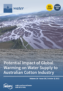
Droughts and long dry spells, interspersed with intense rainfall events, have been characteristic of the northern Murray–Darling Basin, a major Australian agricultural region. A key finding is the prominence of global warming as an attribute, both individually and in combination with climate drivers that include the El Niño-Southern Oscillation, the Southern Annular Mode, the Indian Ocean Dipole, and both local and global sea-surface temperatures. April–May rainfall has decreased significantly since global warming accelerated in the 1990s. This can lead to drought conditions affecting crops such as cotton later in the year if soil moisture is not replenished. On the other hand, La Niña conditions including the period 2021–2022 can lead to floods that destroy cotton crops on the flood plains where they are grown. View this paper
  • Issues are regarded as officially published after their release is announced to the table of contents alert mailing list.
  • You may sign up for e-mail alerts to receive table of contents of newly released issues.
  • PDF is the official format for papers published in both, html and pdf forms. To view the papers in pdf format, click on the "PDF Full-text" link, and use the free Adobe Reader to open them.
Order results
Result details
Section
Select all
Export citation of selected articles as:
15 pages, 3259 KiB  
Article
Ecological Health Status of the Yitong River, China, Assessed with the Planktonic Index of Biotic Integrity
by Ke Zhao, Ang Dong, Shuwei Wang and Xiangfei Yu
Water 2022, 14(19), 3191; https://doi.org/10.3390/w14193191 - 10 Oct 2022
Cited by 3 | Viewed by 1606
Abstract
The Yitong River Basin is the main northern urban river basin in China, and its ecological health has become an important issue of public interest. In 2021, the plankton community and main water quality parameters of the Yitong River were monitored quarterly. An [...] Read more.
The Yitong River Basin is the main northern urban river basin in China, and its ecological health has become an important issue of public interest. In 2021, the plankton community and main water quality parameters of the Yitong River were monitored quarterly. An evaluation system was established based on the Planktonic Index of Biotic Integrity (P–IBI) to assess the spatial and temporal variability in river health. To verify the feasibility of the P–IBI, its assessment results were compared with those of the water quality index (WQI), and the main factors affecting the P–IBI in different seasons were analyzed using correlation analysis between P–IBI metrics and environmental factors. Seasonal comparisons showed that most sampling sites exceeded the “moderate” level in spring and autumn, followed by winter. The worst assessment results occurred in summer. Urban river reaches were more polluted than reaches in rural areas. Regarding driving factors, hydraulic effects on the P–IBI in spring and autumn were significantly stronger than other environmental factors. In summer and winter, special attention should be paid to the input of nitrogen compounds and organic pollutants. Trends based on the P–IBI and the WQI differed in winter, but site patterns were consistent between both indices. The results provide a theoretical basis and data support for the health maintenance of the Yitong River. Full article
(This article belongs to the Section Biodiversity and Functionality of Aquatic Ecosystems)
Show Figures

Figure 1

15 pages, 6880 KiB  
Article
Determination of Pipeline Leaks Based on the Analysis the Hurst Exponent of Acoustic Signals
by Ayrat Zagretdinov, Shamil Ziganshin, Yuri Vankov, Eugenia Izmailova and Alexander Kondratiev
Water 2022, 14(19), 3190; https://doi.org/10.3390/w14193190 - 10 Oct 2022
Cited by 5 | Viewed by 2045
Abstract
Currently, acoustic methods are widely used as a way to detect pipeline leaks. This is due to the fact that the acoustic signal has sufficiently capacious information about the state of the pipeline. The effectiveness of acoustic monitoring depends on the correct extraction [...] Read more.
Currently, acoustic methods are widely used as a way to detect pipeline leaks. This is due to the fact that the acoustic signal has sufficiently capacious information about the state of the pipeline. The effectiveness of acoustic monitoring depends on the correct extraction of this information from the diagnostic signal. Currently, there is a search for new, more effective methods for analyzing acoustic signals. The article proposes to apply the theory of fractals to determine pipeline leaks. One of the most accurate methods for determining the fractal dimension of time series is R/S analysis using the Hurst exponent. An experimental stand has been developed and created, which includes a steel pipeline with water circulating in it. Water leakage from the pipeline was simulated by installing discs with holes of different diameters. The discs were placed in a special fitting on the surface of the pipeline. Acoustic signals recorded from the pipeline surface at different leakages and water pressure were analyzed. A relationship has been established between the size of the leak and the Hurst exponent of acoustic signals. The proposed method is compared with spectral analysis. Empirical experience has proven that R/S analysis can be used to determine pipeline leaks, as well as their classification by size. Full article
(This article belongs to the Special Issue Urban Water Networks Modelling and Monitoring, Volume II)
Show Figures

Figure 1

26 pages, 7746 KiB  
Article
The Optimal Sine Pulse Frequency of Pulse Hydraulic Fracturing for Reservoir Stimulation
by Heng Li, Bingxiang Huang and Hanhua Xu
Water 2022, 14(19), 3189; https://doi.org/10.3390/w14193189 - 10 Oct 2022
Cited by 4 | Viewed by 1590
Abstract
Pulse hydraulic fracturing (PHF) is a key technique for reservoir stimulation. PHF can well accelerate the rupture of rock. However, the supercharging mechanism of PHF is not fully understood. The main reason is that the pressure distribution and its variation, especially the peak [...] Read more.
Pulse hydraulic fracturing (PHF) is a key technique for reservoir stimulation. PHF can well accelerate the rupture of rock. However, the supercharging mechanism of PHF is not fully understood. The main reason is that the pressure distribution and its variation, especially the peak pressure characteristics, are unclear inside the pipe and fissure. The present research focuses on the sine pulse applied at the inlet of a pipe or fracture to reveal the variation regularity of peak pressure with the pulse frequency, amplitude, pipe length, diameter and wave speed. First, the weakly compressible Navier–Stokes equations were developed to simulate the variation of fluid pressure. The computation codes were developed using the MacCormack method validated by the existing experimental data. Then, the sine pulse effect was studied inside the pipe and fissure. Last, a new frequency model was built to describe the relationship between the optimal pulse frequency, wave speed and pipe length. The results show that there is a family of frequencies at which the peak pressure of the endpoint can be significantly enhanced and that these frequencies are the optimal pulse frequency. It is found that the optimal pulse frequency depends on the pipe or fissure length and wave speed. At the optimal pulse frequency, the peak pressure at the endpoint can be increased by 100% or more, and the cavitation phenomenon occurs. However, the peak pressure decreases when with the decrease in the pipe diameter and fissure departure due to the friction drag effect of the wall. These new landmark findings are very important for the PHF technique. In addition, a new universal frequency model is built to predict the optimal sine pulse frequency. The present research shows the variation regularity of the fluid pressure inside the pipe and develops a sine frequency-controlled method, providing a potential guide for reservoir stimulation. Full article
(This article belongs to the Topic Computational Fluid Dynamics (CFD) and Its Applications)
Show Figures

Figure 1

15 pages, 2147 KiB  
Review
Vegetated Roofs as a Means of Sustainable Urban Development: A Scoping Review
by Mohammad A. Rahman, Mohammad A. Alim, Sayka Jahan and Ataur Rahman
Water 2022, 14(19), 3188; https://doi.org/10.3390/w14193188 - 10 Oct 2022
Cited by 1 | Viewed by 2121
Abstract
Urbanisation affects the water cycle and heat balance in a negative way. Vegetated roofs have the potential to minimise the effects of urbanisation. A scoping review is presented here to examine how vegetated roofs are being evolved as an effective tool of sustainable [...] Read more.
Urbanisation affects the water cycle and heat balance in a negative way. Vegetated roofs have the potential to minimise the effects of urbanisation. A scoping review is presented here to examine how vegetated roofs are being evolved as an effective tool of sustainable urban stormwater management and overall urban development. It has been found that research on vegetated roofs has been increasing significantly and it can contribute towards achieving multiple sustainable development goals (SDGs). It has also been found that the uptake of vegetated roofs has been slow. A lack of regulatory acceptance caused by an absence of experimental data and a subsequent knowledge gap establishing the effectiveness of vegetated roofs are major reasons behind this slow uptake. Future research on vegetated roofs and their subsequent evolutions should put a focus on gathering experimental data towards establishing a performance benchmark for detention, retention and water quality in urban settings. Such data can be utilised towards developing a stand-alone guideline and software for green roof design. Full article
(This article belongs to the Special Issue Review Papers of Urban Water Management)
Show Figures

Figure 1

13 pages, 2516 KiB  
Article
Effect of Seawater and Surface-Sediment Variables on Epipelic Diatom Diversity and Abundance in the Coastal Area of Negeri Sembilan, Malaysia
by Ahmed Awadh Sas, Su Nyun Pau Suriyanti, Simon Kumar Das and Zaidi Che Cob
Water 2022, 14(19), 3187; https://doi.org/10.3390/w14193187 - 10 Oct 2022
Cited by 3 | Viewed by 1915
Abstract
Benthic diatoms are important components of marine shallow-water habitats that may affect primary production, stabilize sediment, and produce extracellular polymeric substances. Benthic diatoms are useful for estimating the trophic status of marine ecosystems. In this study, we investigated the diversity and abundance of [...] Read more.
Benthic diatoms are important components of marine shallow-water habitats that may affect primary production, stabilize sediment, and produce extracellular polymeric substances. Benthic diatoms are useful for estimating the trophic status of marine ecosystems. In this study, we investigated the diversity and abundance of benthic diatoms to integrate these data with the physicochemical characteristics of shallow coastal areas in Negeri Sembilan. A total of 39 species of epipelic diatoms were extracted by removing organic matter from sediments that were dominated by pennate diatoms. Results showed that Diploneis crabro, Eunotogramma laevis, Actinoptychus sp., and Cocconeisplacentula were the important species in the area. The abundance varied between 1.85 × 10³ and 3.43 × 10³ cells/g, and the diversity index fluctuated between 2.13 and 2.58. The abundance had significant positive correlations with seawater surface temperature (SST) but had negative correlations with pH and NH3. The diversity on the other end was positively correlated with SST but negatively correlated with total suspended solids and SiO2. Principal component analysis (PCA) demonstrated that the abundance of D. crabro, E. laevis, and Actinoptychus sp. can be attributed to high levels of NO2, NH3, and total dissolved solids. PCA also showed positive correlations of C. placentula with NO3and SiO2 but negative ones with PO43− and pH. The epipelic diatom community showed high diversity with high variations throughout the study area. Full article
(This article belongs to the Section Oceans and Coastal Zones)
Show Figures

Figure 1

20 pages, 4437 KiB  
Article
Effects of a Volcanic-Fluid Cycle System on Water Chemistry of a Deep Caldera Lake: Lake Tazawa, Akita Prefecture, Japan
by Kazuhisa A. Chikita, Kazuhiro Amita, Hideo Oyagi and Jun Okada
Water 2022, 14(19), 3186; https://doi.org/10.3390/w14193186 - 10 Oct 2022
Cited by 1 | Viewed by 2017
Abstract
Lake Tazawa, the deepest lake (423.4 m depth at maximum) in Japan underwent drastically changed water quality in 1940, because volcanic water from two active volcanos was then drawn into the lake for power generation and irrigation. Thereby, the pH of lake water [...] Read more.
Lake Tazawa, the deepest lake (423.4 m depth at maximum) in Japan underwent drastically changed water quality in 1940, because volcanic water from two active volcanos was then drawn into the lake for power generation and irrigation. Thereby, the pH of lake water decreased from 6.7 to 4.2, which exterminated a land-locked type of sockeye salmon, Oncorhynchus nerkakawamurae (locally called Kunimasu trout). Additionally, the mean residence time of lake water changed from 195 years to 8.9 years by rapidly increasing the outflow for power generation and irrigation. In this study, long-term chemical fluxes controlling lake water chemistry were obtained, and a groundwater water cycle system between the lake and the volcano was explored by estimating hydrological and chemical budgets of the lake. In the chemical budget estimate, two ionic species, SO42− and Cl, in volcanic fluids were chosen and each mass conservation equation was yielded. The hydrological budget estimate gave us the net groundwater inflow at −1.36 m3/s on average over three periods in 2020–2021, and then the simultaneous equation coupled with the chemical budget equation allowed us to separate into groundwater inflow and outflow at 6.01 m3/s and 7.37 m3/s, averaged over the three periods, respectively. The evaluated groundwater inflow and outflow were compared with those of the other crater or caldera lakes. The linear relationship between the lake volume and the magnitude of groundwater inflow or outflow suggests that the groundwater cycle scale in such a lake increases with the magnitude of the volcanic eruption to have formed the lake. Full article
(This article belongs to the Special Issue Water Quality Changes of Lakes and Rivers)
Show Figures

Figure 1

21 pages, 5542 KiB  
Article
Developing a Data-Fused Water Quality Index Based on Artificial Intelligence Models to Mitigate Conflicts between GQI and GWQI
by Ata Allah Nadiri, Rahim Barzegar, Sina Sadeghfam and Ali Asghar Rostami
Water 2022, 14(19), 3185; https://doi.org/10.3390/w14193185 - 10 Oct 2022
Cited by 3 | Viewed by 1747
Abstract
The study of groundwater quality is typically conducted using water quality indices such as the Groundwater Quality Index (GQI) or the GroundWater Quality Index (GWQI). The indices are calculated using field data and a scoring system that uses ratios of the constituents to [...] Read more.
The study of groundwater quality is typically conducted using water quality indices such as the Groundwater Quality Index (GQI) or the GroundWater Quality Index (GWQI). The indices are calculated using field data and a scoring system that uses ratios of the constituents to the prescribed standards and weights based on each constituent’s relative importance. The results obtained by this procedure suffer from inherent subjectivity, and consequently may have some conflicts between different water quality indices. An innovative feature drives this research to mitigate the conflicts in the results of GQI and GWQI by using the predictive power of artificial intelligence (AI) models and the integration of multiple water quality indicators into one representative index using the concept of data fusion through the catastrophe theory. This study employed a two-level AI modeling strategy. In Level 1, three indices were calculated: GQI, GWQI, and a data-fusion index based on four pollutants including manganese (Mn), arsenic (As), lead (Pb), and iron (Fe). Further data fusion was applied at Level 2 using supervised learning methods, including Mamdani fuzzy logic (MFL), support vector machine (SVM), artificial neural network (ANN), and random forest (RF), with calculated GQI and GWQI indices at Level 1 as inputs, and data-fused indices target values derived from Level 1 fusion as targets. We applied these methods to the Gulfepe-Zarinabad subbasin in northwest Iran. The results show that all AI models performed reasonably well, and the difference between models was negligible based on the root mean square errors (RMSE), and the coefficient of determination (r2) metrics. RF (r2 = 0.995 and RMSE = 0.006 in the test phase) and MFL (r = 0.921 and RMSE = 0.022 in the test phase) had the best and worst performances, respectively. The results indicate that AI models mitigate the conflicts between GQI and GWQI results. The method presented in this study can also be applied to modeling other aquifers. Full article
Show Figures

Figure 1

10 pages, 1769 KiB  
Article
Laboratory Experiments to Assess the Effect of Chlorella on Turbidity Estimation
by Wenxiang Zhang, Dan Zhang, Benwei Shi, Zhonghao Zhao, Jianxiong Sun, Yujue Wang, Xing Wang, Yang Lv, Yue Li and Youcai Liu
Water 2022, 14(19), 3184; https://doi.org/10.3390/w14193184 - 10 Oct 2022
Cited by 1 | Viewed by 2148
Abstract
Turbidity is an important parameter in monitoring water quality, and thus attracts significant attention. Changes in the various components and constituent elements of water directly affect turbidity measurements. The turbidity of water is generally quantified by measuring the absorbance or scattering characteristics of [...] Read more.
Turbidity is an important parameter in monitoring water quality, and thus attracts significant attention. Changes in the various components and constituent elements of water directly affect turbidity measurements. The turbidity of water is generally quantified by measuring the absorbance or scattering characteristics of substances suspended in it. The complex composition of environmental water bodies complicates the determination of factors influencing their turbidity. Controlled experiments that quantitatively analyze the effect of a single factor on the measurement of turbidity in the laboratory are an important means to improve the accuracy of turbidity assessment. Properties of suspended materials in a water column that may affect its measured turbidity include the concentration of algae, particle size, and the color of soluble substances, etc. The laboratory experiments reported here used Chlorella as an example to investigate the effect of algal concentration on turbidity measurement. The results are as follows. When the turbidity is low (100 NTU), the average relative error between the theoretical and practical absorbance is about 37.52%, which decreases to 19.20% at 100–200 NTU and 5.16% at 200–400 NTU. The characteristic spectral bands sensitive to turbidity (680 nm) and Chlorella (240 nm) were selected, and the theoretical and practical turbidity results were analyzed. The average relative errors of mixed liquids of less than 100, 100–200, and 200–400 NTU are 65.07%, 34.18%, and 3.95%, respectively. Therefore, the concentration of Chlorella significantly affects the measured turbidity, and results in a more complex effect at low turbidity (<100 NTU). Combining the analysis of absorbance peak values and characteristic spectral bands, we can assess the turbidity changes in different components, and through calibration, information regarding the concentration and variation of different components in water bodies can be obtained. The results of this research could improve the accuracy of on-site measurement of the concentrations of different components suspended in water, and also facilitate the development of new turbidity sensors. Full article
Show Figures

Figure 1

12 pages, 1539 KiB  
Article
The Influence of Distinct Seasons on the Succession and Diversity of Bacteria on the Anticorrosive Coatings Surfaces in a Marine Environment
by Shuangwei Li, Jie Liu, Qian Li, Wenfang Li, Xinfeng Xiao and Linlin Zhang
Water 2022, 14(19), 3183; https://doi.org/10.3390/w14193183 - 10 Oct 2022
Cited by 1 | Viewed by 1343
Abstract
Epoxy resin has been frequently used as a coating paint for anticorrosion protection because of its excellent chemical properties. However, the long-term succession of bacteria colonizing coatings surfaces in the different seasons of the year remains uncharacterized. In this work, amplicon-based 16s rDNA [...] Read more.
Epoxy resin has been frequently used as a coating paint for anticorrosion protection because of its excellent chemical properties. However, the long-term succession of bacteria colonizing coatings surfaces in the different seasons of the year remains uncharacterized. In this work, amplicon-based 16s rDNA sequencing was used to characterize the tempol change of bacterial communities growing on the epoxy resin surfaces. The results showed that bacterial diversity indices on spring and autumn immersion samples were higher than that of the samples immersed on summer and winter samples. Proteobacteria was found to be the dominant bacteria of all different seasons and accounted for 57.9% of the total sequence. Gammaproteobacteria and Alphaproteobacteria were the dominant classes in all of the samples, whereas the most abundance bacteria at the genus level had the significant differences with a change of season. Firmicutes also displayed a distinct temporal change pattern in that it was the second abundance in the summer and autumn samples, but had a marked decrease in the other season samples. These results demonstrated that bacterial community composition underwent obvious changes over the distinct seasons of a year. This study will be helpful for the seasonal change of bacterial diversity and development of corrosion-resistant paints. Full article
(This article belongs to the Special Issue In-Depth Understanding of Bacteria in Seawater)
Show Figures

Figure 1

18 pages, 6992 KiB  
Article
Geochemical Characteristics of Geothermal Fluids of a Deep Ancient Buried Hill in the Xiong’an New Area of China
by Mingxiao Yu, Guiling Wang, Feng Ma, Wei Zhang, Wenjing Lin, Xi Zhu and Hanxiong Zhang
Water 2022, 14(19), 3182; https://doi.org/10.3390/w14193182 - 10 Oct 2022
Cited by 2 | Viewed by 1589
Abstract
The Xiong’an New Area is one of the areas with the richest geothermal resources in the east-central part of China. However, the genesis of the geothermal water in Jixianian carbonate reservoirs in this area is still unclear. This study conducted systematical geochemical and [...] Read more.
The Xiong’an New Area is one of the areas with the richest geothermal resources in the east-central part of China. However, the genesis of the geothermal water in Jixianian carbonate reservoirs in this area is still unclear. This study conducted systematical geochemical and isotopic analyses of the geothermal water in the Jixianian carbonate reservoirs in the Rongcheng geothermal field and summed up the genetic mechanisms of geothermal fluids in deep geothermal reservoirs. The results are as follows: the geothermal water in the study area has a hydrochemical type of Cl·HCO3-Na and originates from meteoric water in the Taihang Mountains. The age of the geothermal water increases from 22 ka in the west to 45 ka in the east, and its transport rate is approximately 1.02 m/a. The Sr concentration and 87Sr/86Sr ratio of the geothermal fluids increase along their runoff direction and are related to the dissolution and filtration of minerals such as dolomite and gypsum and the decay of 87Rb in the Earth’s crust. The geothermal water is involved in deep circulation and occurs in a closed system. These results are consistent with those obtained using the PHREEQC inverse model. The reverse hydrogeochemical simulation results exhibited the precipitation of gypsum and halite, the dissolution of anorthite and quartz, and desulfurization. The geothermal reservoir temperatures were estimated to be 92–113 °C using a SiO2 geothermometer, and the thermal groundwater may have undergone deep circulation, with a prolonged retention time. Moreover, the groundwater occurs in a closed environment, strong water-rock interactions occur between the groundwater and related minerals, and the groundwater absorbs the heat from the deep heat source, thus forming geothermal water. Full article
(This article belongs to the Special Issue Hydrochemical Characteristics of Geothermal Water)
Show Figures

Figure 1

15 pages, 3359 KiB  
Article
Characterization of Dissolved Organic Matter of Sediments in Urban Streams Using EEMs–PARAFAC and Absorption Spectroscopy: A Case Study in Wuhan, China
by Hui Zhang, Zufan Liu, Jing Xu, Jun Yang, Xiang Zhang and Shiyong Tao
Water 2022, 14(19), 3181; https://doi.org/10.3390/w14193181 - 10 Oct 2022
Cited by 4 | Viewed by 2014
Abstract
Urbanization has notably changed the characteristics and functions of watershed ecosystems worldwide, influencing the characteristics of chromophoric dissolved organic matter (CDOM) and dissolved organic matter (DOM) of sediments in urban streams. In this study, the biogeochemical characteristics of 42 water samples and the [...] Read more.
Urbanization has notably changed the characteristics and functions of watershed ecosystems worldwide, influencing the characteristics of chromophoric dissolved organic matter (CDOM) and dissolved organic matter (DOM) of sediments in urban streams. In this study, the biogeochemical characteristics of 42 water samples and the optical absorption and excitation–emission matrix spectra (EEMs) of 14 sediment samples collected from 14 urban streams in Wuhan were systematically examined. In addition, five water samples and one sediment sample were collected in Mulan Lake as a reference for non-urban areas. The a254 values of sediments in urban streams ranged widely (25.7–197.6 m−1), and the mean (116.32 ± 60.5 m−1) was significantly higher than the reference (51.52 m−1), indicating clear individual differences and a higher concentration of CDOM. Two humus-like components and one tryptophan-like component were effectively identified by parallel factor analysis (PARAFAC). The fluorescence index (FI)/biological index (BIX) of DOM of sediments in urban streams was mostly within 1.4–1.7/0.8–1.0, indicating a compound of both allochthonous and autochthonous sources. Compared with the reference, lower FI and BIX and higher humification index (HIX) revealed a higher allochthonous input and humification degree of DOM of sediments in urban streams. Spearman’s correlation analysis and redundancy analysis demonstrated that heavy metals and other water quality parameters had a considerable impact on CDOM concentrations and DOM components. This study could support the use of DOM as an effective tool to monitor the water environment and provide insights into future water pollution management strategies. Full article
(This article belongs to the Special Issue China Water Forum 2022)
Show Figures

Figure 1

17 pages, 7033 KiB  
Article
A Simplified Analytical Method to Predict Shallow Landslides Induced by Rainfall in Unsaturated Soils
by Antonello Troncone, Luigi Pugliese and Enrico Conte
Water 2022, 14(19), 3180; https://doi.org/10.3390/w14193180 - 09 Oct 2022
Cited by 4 | Viewed by 1540
Abstract
In order to assess slope stability owing to rainfall, the availability of an effective and simple-to-use methodology, relating directly rain to eventual landslide triggering, is undoubtedly useful. To this purpose, a simplified method aimed to the prediction of rainfall-induced shallow landslides in unsaturated [...] Read more.
In order to assess slope stability owing to rainfall, the availability of an effective and simple-to-use methodology, relating directly rain to eventual landslide triggering, is undoubtedly useful. To this purpose, a simplified method aimed to the prediction of rainfall-induced shallow landslides in unsaturated soils is proposed in the present study. This method takes advantage of some closed-form solutions to evaluate the change in pore pressure due to infiltration of a rainfall characterized by a given intensity and duration, and the simple scheme of infinite slope to calculate a threshold for the change in pore pressure when the slope is under limit conditions. Particularly, using the present approach, a critical curve can be defined to establish the rainfall events that can trigger a failure process at a given depth, where suction before rainfall is known. The proposed method appears promising from an engineering viewpoint, since it is simple to use and requires few parameters as input data. In addition, these parameters can be determined from conventional geotechnical tests. The validity of the proposed approach is corroborated by some comparisons with the results of well-documented case studies. Full article
(This article belongs to the Special Issue Susceptibility Assessment of Rainfall-Induced Landslides)
Show Figures

Figure 1

12 pages, 2423 KiB  
Article
Improvement of the “Triangle Method” for Soil Moisture Retrieval Using ECOSTRESS and Sentinel-2: Results over a Heterogeneous Agricultural Field in Northern India
by Rishabh Singh, Prashant K. Srivastava, George P. Petropoulos, Sudhakar Shukla and Rajendra Prasad
Water 2022, 14(19), 3179; https://doi.org/10.3390/w14193179 - 09 Oct 2022
Cited by 2 | Viewed by 1402
Abstract
For the purpose of deriving spatiotemporal estimates of soil moisture, the triangle method is one of the most widely used approaches today utilizing remote sensing data. Generally, those techniques are based on the physical relationships that exist when a satellite-derived land surface temperature [...] Read more.
For the purpose of deriving spatiotemporal estimates of soil moisture, the triangle method is one of the most widely used approaches today utilizing remote sensing data. Generally, those techniques are based on the physical relationships that exist when a satellite-derived land surface temperature (Ts) is plotted against a spectral vegetation index (VI). The present study proposes an improvement in the triangle method in retrieving soil moisture over heterogeneous areas. In particular, it proposes a new approach in robustly identifying the extreme points required for the technique’s implementation. Those extreme points are then used in calculating fractional vegetation cover (Fr) and scaled Ts. Furthermore, the study proposes a new approach for calculating the coefficients required to develop the relationships between surface soil moisture (SSM) and Fr/Ts, which is implemented using a model and field data. As a case study, an agricultural field in the Varanasi district in India has been used, on which the triangle method is implemented using ECOSTRESS and Sentinel-2 data. The much-improved spatial resolution satellite data of ~70 m from ECOSTRESS allowed deriving more vivid results of SSM spatial variability for the study area. Comparisons between field soil moisture calculated using the proposed method returned an RMSE of 0.03 and R2 value of 0.84, which are considered very satisfactory. The methodology proposed herein and the results obtained are of significant value with regards to the triangle method, contributing to ongoing efforts at present examining its use for operational product development at a global scale. Full article
(This article belongs to the Section Water, Agriculture and Aquaculture)
Show Figures

Figure 1

8 pages, 1390 KiB  
Article
Temperature May Play a More Important Role in Environmental DNA Decay than Ultraviolet Radiation
by Xue Yu, Jiaying Zhou, Jun Wei, Bo Zhang and Xueqiang Lu
Water 2022, 14(19), 3178; https://doi.org/10.3390/w14193178 - 09 Oct 2022
Cited by 4 | Viewed by 1393
Abstract
Environmental DNA (eDNA) preservation is crucial for biological monitoring using eDNA technology. The decay of eDNA over time in natural water bodies and the effects of temperature and ultraviolet (UV) radiation on the decay rate are largely unknown. In this study, the linear [...] Read more.
Environmental DNA (eDNA) preservation is crucial for biological monitoring using eDNA technology. The decay of eDNA over time in natural water bodies and the effects of temperature and ultraviolet (UV) radiation on the decay rate are largely unknown. In this study, the linear and exponential decay models were used to explore the relationship between residual eDNA content and decay time, respectively. It was found that the residual eDNA content treated with a higher temperature decreased by an average of 89.65% at the end of experiment, while those in the 4 °C treatment group remained stable. The higher decision coefficient (R2) of the exponential decay models indicated that they could better reflect the decay of eDNA over time than linear. The difference in the decay rates of the exponential modes was slight between the 20 °C (25.47%) and 20 °C + UV treatment groups (31.64%), but both were much higher than that of the 4 °C group (2.94%). The results suggest that water temperature significantly affected the decay rate of eDNA, while UV radiation had little effect. Full article
Show Figures

Figure 1

16 pages, 5205 KiB  
Article
Study on the Motion Characteristics of Particles Transported by a Horizontal Pipeline in Heterogeneous Flow
by Jiayi Wang, Yitian Li, Zhiqiang Lai, Lianjun Zhao and Zhongmei Wang
Water 2022, 14(19), 3177; https://doi.org/10.3390/w14193177 - 09 Oct 2022
Viewed by 1997
Abstract
The worldwide problem of reservoir sedimentation has perplexed the water conservancy industry. The problem of reservoir sedimentation is particularly serious in sandy rivers in China and directly affects the normal function of reservoirs. Due to its effect on the economy and environmental protection, [...] Read more.
The worldwide problem of reservoir sedimentation has perplexed the water conservancy industry. The problem of reservoir sedimentation is particularly serious in sandy rivers in China and directly affects the normal function of reservoirs. Due to its effect on the economy and environmental protection, the self-priming pipeline dredging and sediment discharge technology has broad application prospects. Nevertheless, there are pressing problems in the transportation of slurry particles in the pipeline system of this new technology. The purpose of this study is to use physical model tests to analyze the influence of the sediment transport rate and pipeline velocity on the motion state of particles (aggregation transport, jump transport, and suspension transport) when a heterogeneous flow with different particle sizes is transported in the pipeline. The results indicate that under the same pipeline velocity and sediment transport rate, the thickness of the static particle accumulation layer decreases with the increase in particle size in the state of aggregation and transportation, and the smaller the particle size, the greater the particle movement speed in the case of aggregation and suspension transportation. During jump transportation, the velocity of particles above the critical inflection point Y’ increases with the decrease in particle size. The opposite is found below the critical inflection point Y’. At the same particle size and sediment transport rate, when the pipeline velocity increases, the particle transport transits from aggregation transport to jump transport and then to suspension transport. The larger the pipeline velocity, the greater the overall movement speed of particles. When gathering and conveying, if the pipeline flow rate increases by 1.5, the maximum movement speed of particles increases by 3.3. The curvature of the vertical velocity curve of the particles during jump transportation is not affected by the pipeline velocity. The particle velocity at the highest point increases with the increase in the pipeline velocity. During suspension transportation, the difference between the maximum and minimum vertical particle distribution velocities is exponentially related to the pipeline velocity. At the same pipe velocity and particle size, the overall particle velocity decreases with the increase in sediment transport rate. Full article
(This article belongs to the Section Hydraulics and Hydrodynamics)
Show Figures

Figure 1

19 pages, 4604 KiB  
Article
The Role of Ports in Tourism: Porto Santo Harbour
by Sérgio Lousada and Rui Alexandre Castanho
Water 2022, 14(19), 3176; https://doi.org/10.3390/w14193176 - 09 Oct 2022
Cited by 3 | Viewed by 3181
Abstract
The island of Porto Santo belongs to the Madeira Archipelago and is often described as an idyllic paradise for its warm waters and its iconic sandy beach, though it faces vulnerabilities such as insularity; a small economy; geographic remoteness; and scarce population, area, [...] Read more.
The island of Porto Santo belongs to the Madeira Archipelago and is often described as an idyllic paradise for its warm waters and its iconic sandy beach, though it faces vulnerabilities such as insularity; a small economy; geographic remoteness; and scarce population, area, and available resources. Nevertheless, these disadvantages have a silver lining because small territories can act as laboratories to test and develop models that can subsequently be implemented at a larger scale. This work provides a case study of the role of ports in tourism development It presents an analysis of air and maritime transport used by tourists to visit the Island of Porto Santo, Madeira Islands, Portugal. The climate changes and strong winds during the year can reduce tourist demand for the inter-island sea travel in the Madeira Archipelago. Porto Santo is a strategic transfer point for tourism, and improving the shipping infrastructures will enable a faster and more diversified maritime transportation system. To capitalise on these developments, Porto Santo needs to improve its reputation as an exclusive beach destination. This will reduce tourism seasonality and improve sustainability. Full article
(This article belongs to the Section Oceans and Coastal Zones)
Show Figures

Figure 1

21 pages, 4923 KiB  
Article
Simulation of the Water Storage Capacity of Siling Co Lake on the Tibetan Plateau and Its Hydrological Response to Climate Change
by Yuanzhi Tang, Junjun Huo, Dejun Zhu and Zhe Yuan
Water 2022, 14(19), 3175; https://doi.org/10.3390/w14193175 - 09 Oct 2022
Cited by 3 | Viewed by 1651
Abstract
Due to their special geographical locations and environments, plateau lakes play a key role in maintaining regional water balance, but lake water storage changes are upsetting this balance. Based on data from lakes on the Tibetan Plateau (TP), this study used the Spatial [...] Read more.
Due to their special geographical locations and environments, plateau lakes play a key role in maintaining regional water balance, but lake water storage changes are upsetting this balance. Based on data from lakes on the Tibetan Plateau (TP), this study used the Spatial Processes in Hydrology (SPHY) model to simulate the runoff process in the Siling Co basin from 2000 to 2016 and estimated the changes in water storage of Siling Co and the contribution of each component of runoff into the lake. The results showed that the water storage capacity of Siling Co has increased by 1.2 billion m3/yr, and the lake area continues to expand; declines in precipitation have significantly reduced baseflow (BF), rainfall runoff (RR), and snow runoff (SR), while temperature increases have raised glacier runoff (GR). The simulated average runoff showed that BF, GF, RR, and SR contribute 24%, 22%, 16%, and 38%, respectively, of the flow into Siling Co. Based on hypothetical climate change scenarios and two Shared Socioeconomic Pathways (SSP1-2.6 and SSP3-7.0) from the MRI-ESM2-0 GCMs, this study estimated that a 10% increase in precipitation could lead to a 28% increase in total runoff, while a 1 °C increase in temperature could lead to a 10% decrease in runoff. The average runoff depth of the basin is expected to increase by 30–39 mm, since the temperature and precipitation may increase significantly from 2020 to 2050. The intensification of glacial melting caused by the increase in temperature continues, posing a greater challenge to many water resources management problems caused by the expansion of lakes. Full article
(This article belongs to the Special Issue Climate Changes and Hydrological Processes)
Show Figures

Figure 1

20 pages, 10939 KiB  
Article
Flash Flood Susceptibility Assessment Based on Morphometric Aspects and Hydrological Approaches in the Pai River Basin, Mae Hong Son, Thailand
by Thapthai Chaithong
Water 2022, 14(19), 3174; https://doi.org/10.3390/w14193174 - 09 Oct 2022
Cited by 2 | Viewed by 2387
Abstract
Flash floods are water-related disasters that cause damage to properties, buildings, and infrastructures in the flow path. Flash floods often occur within a short period of time following intense rainfall in the high, mountainous area of northern Thailand. Therefore, the purpose of this [...] Read more.
Flash floods are water-related disasters that cause damage to properties, buildings, and infrastructures in the flow path. Flash floods often occur within a short period of time following intense rainfall in the high, mountainous area of northern Thailand. Therefore, the purpose of this study is to generate a flash flood susceptibility map using watershed morphometric parameters and hydrological approaches. In this study, the Pai River basin, located in Mae Hong Son in northern Thailand, is divided into 86 subwatersheds, and 23 morphometric parameters of the watershed are extracted from the digital elevation model (DEM). In addition, the soil conservation service curve number (SCS-CN) model is used to estimate the precipitation excess, and Snyder’s synthetic unit hydrograph method is used to estimate the time to peak and time of concentration. With respect to the rainfall dataset, in this study, we combined CHIRPS data (as satellite gridded precipitation data) with rainfall data measured within the study area for the runoff analysis. According to the analysis results, 25 out of 86 subwatersheds are classified as highly susceptible areas to flash floods. The similarities in the morphometric parameters representing watersheds in highly flash flood-susceptible areas indicate that this categorization included areas with high relief, high relief ratios, high ruggedness ratios, high stream frequencies, high texture ratios, high annual runoff, high peak discharge, low elongation ratios, and low lemniscates ratios. Full article
Show Figures

Figure 1

26 pages, 3451 KiB  
Review
Research Trends in Groundwater and Stable Isotopes
by Paúl Carrión-Mero, Néstor Montalván-Burbano, Gricelda Herrera-Franco, Luis Domínguez-Granda, Lady Bravo-Montero and Fernando Morante-Carballo
Water 2022, 14(19), 3173; https://doi.org/10.3390/w14193173 - 09 Oct 2022
Cited by 2 | Viewed by 4261
Abstract
Groundwater is essential in the management of water resources globally. The water quality of aquifers is affected by climate change and population growth, aspects that can be addressed with stable isotope analysis. This study aims to carry out an analysis of the scientific [...] Read more.
Groundwater is essential in the management of water resources globally. The water quality of aquifers is affected by climate change and population growth, aspects that can be addressed with stable isotope analysis. This study aims to carry out an analysis of the scientific information related to groundwater and stable isotopes (GSI) using scientific databases (Scopus and Web of Science) to evaluate the intellectual structure of the subject and the emerging research lines. The methodology includes: (i) topic search selection, (ii) tools in databases processing, (iii) bibliometric analysis, and (iv) review by clustering technique. The results showed that the scientific production of GSI can be addressed through three evolution periods: I (1969–1990), II (1991–2005), and III (2006–2021). Periods I and II did not significantly contribute to publications because, in the past, most of the student’s thesis (M.Sc. and Ph.D) consisted of writing a report that summarizes their works. Therefore, the researcher was not obliged to publish their results in a professional journal. Finally, the third period showed exponential growth, representing 82.34% of the total publications in this theme because, in the last years, institutions require at least one scientific article depending on the country and university, in order to graduate with an M.Sc. and PhD. Finally, the contribution of this study is reflected in the recognition of new research lines and their applicability by the knowledge of recharge sources, environmental aspects, infiltration, knowledge of the aquifer-meteoric water system, and groundwater-superficial water interaction. These aspects offer the possibility of analyzing integrated water resources management at the watershed or river-aquifer systems level. Full article
(This article belongs to the Special Issue Isotope Tracers in Watershed Hydrology)
Show Figures

Figure 1

12 pages, 279 KiB  
Article
Antimicrobial Resistant Bacteria in Shrimp and Shrimp Farms of Bangladesh
by Murshida Khan, Sulav Indra Paul, Md. Mahbubur Rahman and Julie Anderson Lively
Water 2022, 14(19), 3172; https://doi.org/10.3390/w14193172 - 09 Oct 2022
Cited by 5 | Viewed by 3912
Abstract
The purpose of this study was to investigate the presence of pathogenic bacteria, specifically Escherichia coli and Salmonella and Vibrio species, and their antimicrobial resistance in shrimp aquaculture facilities of Bagerhat (Bangladesh). Sediment samples were collected from both Penaeus monodon and Macrobrachium rosenbergii [...] Read more.
The purpose of this study was to investigate the presence of pathogenic bacteria, specifically Escherichia coli and Salmonella and Vibrio species, and their antimicrobial resistance in shrimp aquaculture facilities of Bagerhat (Bangladesh). Sediment samples were collected from both Penaeus monodon and Macrobrachium rosenbergii farms and shrimp samples from the Macrobrachium rosenbergii facility. The abovementioned bacteria were not found, but five Enterobacterales (Proteus penneri, Proteus alimentorum, Morganella morganii, Enterobacter hormaechei subsp. xiangfangensis and Plesiomonas shigelloides) were detected. This is the first documented case of Enterobacter hormaechei subsp. xiangfangensis in a shrimp farm. Nine antibiotics—ampicillin, gentamicin, chloramphenicol, oxytetracycline, nitrofurantoin, levofloxacin, ciprofloxacin, azithromycin, and co-trimoxazole—were selected for antibiotic resistance testing, and the majority (88.9%) had at least one isolate that was resistant. Across sources, 78.0% of isolates were resistant to at least one antimicrobial, and multidrug resistance was also detected in 29.3% of all isolates. Despite the low number of samples analyzed, nine in total, the results of this experiment emphasize that shrimp farms in Bagerhat may have a problem with antimicrobial-resistant bacteria. This could have negative impacts on shrimp quality and consumers’ health. Full article
13 pages, 3856 KiB  
Article
Numerical Research on Fractured Surrounding Rock Deformation and Failure Law Caused by Submarine Mining
by Guang Li, Gang Liu, Fengshan Ma and Jie Guo
Water 2022, 14(19), 3171; https://doi.org/10.3390/w14193171 - 08 Oct 2022
Cited by 1 | Viewed by 1414
Abstract
The existence of cracks has a considerable influence on the deformation failure characteristics and mechanical behavior of the surrounding rock mass. For submarine mining in particular, if a fractured zone in which water is flowing is formed between the goaf and the overlying [...] Read more.
The existence of cracks has a considerable influence on the deformation failure characteristics and mechanical behavior of the surrounding rock mass. For submarine mining in particular, if a fractured zone in which water is flowing is formed between the goaf and the overlying strata, it will result in a devastating disaster in the mine. Therefore, it is of great significance to understand the deformation and failure law of fractured surrounding rock. Based on field investigation and the self-developed Y-Mat finite-discrete element numerical calculation program, submarine mining in the Xinli mine under three different working conditions was simulated. The research results showed that when mining in fractured rock mass, the influence range was large, the surrounding rock deformation was significant, and a discontinuous stress field was generated. Backfill mining can effectively restrain the deformation failure of surrounding rock and reduce the occurrence of penetrating fractures. Moreover, the effect of backfill mining was more obvious in the fractured surrounding rock. The fault had a barrier effect on the penetration of surrounding rock cracks, but its effect was weakened in the fractured surrounding rock. Under the working conditions of the study area, i.e., backfill mining in the fractured rock mass, the primary fractures in the surrounding rock were destroyed first, followed by the intact rock mass between the cracks. It was possible for the fractures to run through the overlying strata. Double subsidence centers developed on the surface and the reflection of deformation on the surface showed obvious hysteresis. These research results can provide a reference for mining stability evaluation and disaster prevention in the study area. Full article
(This article belongs to the Section Hydrogeology)
Show Figures

Figure 1

14 pages, 1589 KiB  
Article
Analysis of the Runoff Component Variation Mechanisms in the Cold Region of Northeastern China under Climate Change
by Shuiqing Liu, Zuhao Zhou, Jiajia Liu, Jia Li, Pengxiang Wang, Cuimei Li, Xinmin Xie, Yangwen Jia and Hao Wang
Water 2022, 14(19), 3170; https://doi.org/10.3390/w14193170 - 08 Oct 2022
Cited by 4 | Viewed by 1223
Abstract
Climate change alters hydrological processes in cold regions. However, the mechanisms of runoff component variation remain obscure. We implemented a WEP-N model to estimate monthly runoff in the Songhua River Basin (SRB) between 1956 and 2018. All flow simulations were accurate (NSE > [...] Read more.
Climate change alters hydrological processes in cold regions. However, the mechanisms of runoff component variation remain obscure. We implemented a WEP-N model to estimate monthly runoff in the Songhua River Basin (SRB) between 1956 and 2018. All flow simulations were accurate (NSE > 0.75 and RE < 5%). The annual runoff was attenuated in 1998, and the hydrological series (1956–2018) was divided into base and change periods in that year. Relative to the BS (base scenario), annual production flow reduction was −28.2% under climate change and water use. A multifactor attribution analysis showed that climate change and water use contributed 77.0% and 23.0% to annual runoff reduction, respectively. Decreases in annual surface and base flow explained 62.1% and 35.7% of annual production flow reduction, respectively. The base flow increased by 8.5% and 6.5% during the freezing and thawing periods, respectively. Relative to the BS, groundwater recharge increased by 9.2% and 4.1% during the freezing and thawing periods, respectively, under climate change conditions. Climate change was the dominant factor attenuating production flow. The change in production flow occurred mainly during the non-freeze-thaw period. The decrease in total production flow in the SRB was caused mainly by the decrease in the surface flow, where the reduction in base flow accounted for a relatively small proportion. Production flow attenuation aggravated water shortages. The utilization rate of groundwater resources is far below the internationally recognized alarm line. Therefore, attention should be directed towards certain areas of the SRB and other regions with minimal groundwater exploitation. Full article
(This article belongs to the Special Issue China Water Forum 2022)
Show Figures

Figure 1

19 pages, 4419 KiB  
Article
Schematization of Converging Groundwater Flow Systems Based on 3D Geostatistics
by Heriberto Morales de Avila, Hugo Enrique Júnez-Ferreira, Julian Gonzalez-Trinidad, María Vicenta Esteller-Alberich, Raúl Ulices Silva-Ávalos, Sandra Davila-Hernandez, Juana Cazares-Escareño and Carlos Francisco Bautista-Capetillo
Water 2022, 14(19), 3169; https://doi.org/10.3390/w14193169 - 08 Oct 2022
Cited by 3 | Viewed by 1476
Abstract
Groundwater is the main source of freshwater available for human beings and is generally extracted through wells. The objective of this work was to schematize the groundwater flow systems within the Calera Aquifer through 3D geostatistical estimations of hydraulic head and physico-chemical parameters [...] Read more.
Groundwater is the main source of freshwater available for human beings and is generally extracted through wells. The objective of this work was to schematize the groundwater flow systems within the Calera Aquifer through 3D geostatistical estimations of hydraulic head and physico-chemical parameters and the integration of hydrogeological features. The evolution of groundwater during its circulation in the subsoil can be done by identifying different types of flow (local, intermediate, regional, or mixed). Two main approaches have been proposed for the identification of flow systems: explaining the evolution of physico-chemical parameters of water through its interaction with the geologic medium, and using cluster analysis; however, these approaches usually do not consider simultaneously the 3D distribution of hydraulic head, water quality parameters, and the geological media that can be useful to delineate converging flow systems with a differentiated origin. In this paper, the determination of groundwater flow systems within the Calera aquifer in Mexico is supported with 3D representations of these hydrogeological variables besides constructive data of the sampled well. For the case study, the convergence of different flow systems that are not identified through a single cluster analysis was actually noticed by the proposal done in this paper. Full article
(This article belongs to the Special Issue Advances in Hydrogeology and Groundwater Management Research)
Show Figures

Figure 1

25 pages, 8020 KiB  
Article
Delineation of Hydrochemical Characteristics and Tracing Nitrate Contamination of Groundwater Based on Hydrochemical Methods and Isotope Techniques in the Northern Huangqihai Basin, China
by Jing Jin, Zihe Wang, Yiping Zhao, Huijun Ding and Jing Zhang
Water 2022, 14(19), 3168; https://doi.org/10.3390/w14193168 - 08 Oct 2022
Cited by 6 | Viewed by 1745
Abstract
Hydrochemical research and identification of nitrate contamination are of great significant for the endorheic basin, and the Northern Huangqihai Basin (a typical endorheic basin) was comprehensively researched. The results showed that the main hydrochemical facies were HCO3–Mg·Ca and HCO3–Ca·Mg. [...] Read more.
Hydrochemical research and identification of nitrate contamination are of great significant for the endorheic basin, and the Northern Huangqihai Basin (a typical endorheic basin) was comprehensively researched. The results showed that the main hydrochemical facies were HCO3–Mg·Ca and HCO3–Ca·Mg. Spatial variation coefficients of most indices were greater than 60%, which was probably caused by human activities. The hydrochemical evolution was mainly affected by rock weathering and also by cation exchange. The D–18O relationship of groundwater was δD = 5.93δ18O − 19.18, and the dexcess range was −1.60–+6.01‰, indicating that groundwater was mainly derived from precipitation and that contaminants were very likely to enter groundwater along with precipitation infiltration. The NO3(N) contents in groundwater exceeded the standard. Hydrochemical analyses indicated that precipitation, industrial activities and synthetic NO3 were unlikely to be the main sources of nitrate contamination in the study area. No obvious denitrification occurred in the transformation process of nitrate. The δ15N(NO3) values ranged from +0.29‰ to +14.39‰, and the δ18O(NO3) values ranged from −6.47‰ to +1.24‰. Based on the δ15N(NO3) – δ18O(NO3) dual isotope technique and hydrochemical methods, manure, sewage and NH4 fertilizers were identified to be the main sources of nitrate contamination. This study highlights the effectiveness of the integration of hydrochemical and isotopic data for nitrate source identification, and is significant for fully understanding groundwater hydrochemistry in endorheic basins and scientifically managing and protecting groundwater. Full article
(This article belongs to the Special Issue Groundwater Quality and Public Health)
Show Figures

Figure 1

17 pages, 48574 KiB  
Article
Study on the Unconventional Water Subsidy Policy in the Arid Area of Northwest China
by Chaomeng Ma, Hongzhen Ni, Yunzhong Jiang and Xichen Lin
Water 2022, 14(19), 3167; https://doi.org/10.3390/w14193167 - 08 Oct 2022
Cited by 4 | Viewed by 1382
Abstract
The arid regions of Northwest China are facing water shortages and ecological fragility. Making full use of unconventional water is one of the effective ways of solving water issues and achieving high-quality regional development. The high cost of unconventional water utilization is the [...] Read more.
The arid regions of Northwest China are facing water shortages and ecological fragility. Making full use of unconventional water is one of the effective ways of solving water issues and achieving high-quality regional development. The high cost of unconventional water utilization is the main obstacle to its utilization and technological development, and the subsidy policy may become a breaking point. Taking Ningdong Energy and Chemical Industry Base (NECI Base) as a case study, the article proposes raising the Yellow River water price to subsidize the utilization of mine water. The development and utilization of mine water can be effectively improved. Considering the optimal allocation of multiple water sources and the substitution relationship between the Yellow river water and mine water, this paper extends the water resources module (WRM) of the Computable General Equilibrium (CGE) model. The model can reflect the substitution of water sources and the linkage between water prices and the economy. Ten different subsidy policy scenarios are simulated through the extended CGE model, and the laws and mechanisms of the subsidy policy on the economy and water usage are summarized. The results show that increasing the price of Yellow River water by 8% to subsidize the mine water will achieve optimal socio-economic output. Under this scenario, the industrial value added (IVA) is basically unaffected, the water-use efficiency (WUE) is significantly improved, and the affordability of the enterprise is satisfied. The Yellow River water usage decreased from 319.03 million (M)m³ to 283.58 Mm³ (11.1% saving), and mine water usage increased from 27.88 Mm³ to 47.15 Mm³ (69.1% increase). Full article
(This article belongs to the Section Water Resources Management, Policy and Governance)
Show Figures

Figure 1

16 pages, 9756 KiB  
Article
Modelling the Effects of Dam Reservoir Backwater Fluctuations on the Hydrodynamics of a Small Mountain Stream
by Maciej Liro, Michael Nones, Paweł Mikuś and Karol Plesiński
Water 2022, 14(19), 3166; https://doi.org/10.3390/w14193166 - 08 Oct 2022
Cited by 9 | Viewed by 1785
Abstract
The water depth and flow velocity of a river may be temporarily disturbed by the water level fluctuations connected with the operation of artificial dam reservoirs located downstream (so-called backwater fluctuations (BF)). In this research, we use the two-dimensional hydrodynamic model iRIC MFlow_02 [...] Read more.
The water depth and flow velocity of a river may be temporarily disturbed by the water level fluctuations connected with the operation of artificial dam reservoirs located downstream (so-called backwater fluctuations (BF)). In this research, we use the two-dimensional hydrodynamic model iRIC MFlow_02 to quantify the effects of BF on the lowermost section (ca. 1.5-km length) of a small (channel width ≤ 20 m) mountain stream, the Smolnik Stream, which flows into the Rożnów Dam Reservoir, in Southern Poland. To reproduce the hydrological conditions generally observed in the stream, six scenarios were simulated, considering three steady flow discharges at the inlet, with recurrence intervals of 1 year (1.8 m3 s−1, small flood), 2 years (24.5 m3 s−1; medium flood), and 20 years (89.5 m3 s−1; large flood), and two reservoir levels at the outlet: 265 m a.s.l. (normal reservoir water level) and 270 m a.s.l. (maximum reservoir water level). In these simulations, sediment transport and morphodynamics are not considered. The average modelled water depth was increased by backwater fluctuation in the channel, from 28% (from 1.62 m vs. 2.07 m) during a small flood, up to 59% (from 3.46 m to 5.50 m) during a large flood. Contrastingly, the average modelled flow velocity was decreased in the channel (from −8% 0.52 m s−1 vs. 0.47 m s−1) during a small flood to −78% (0.49 m s−1 vs. 0.11 m s−1) during a large flood. Our results demonstrate that backwater fluctuations substantially disturb the hydrodynamics of the studied stream, which is interpreted as a triggering factor of the previously documented alterations in its sedimentology, morphology, and riparian vegetation pattern. Full article
(This article belongs to the Section Hydraulics and Hydrodynamics)
Show Figures

Figure 1

9 pages, 2899 KiB  
Article
Low Pressure UV Photolysis of the Pharmaceutical Compounds Acetaminophen, Atenolol, Bezafibrate, Diclofenac and Ibuprofen
by Caroline Pereira Katsumata, Marcela Prado Silva Parizi, Arlen Mabel Lastre-Acosta and Antonio Carlos Silva Costa Teixeira
Water 2022, 14(19), 3165; https://doi.org/10.3390/w14193165 - 08 Oct 2022
Cited by 2 | Viewed by 1709
Abstract
Pharmaceutically active compounds (PhACs) are continuously introduced into the environment by human and livestock excretion, hospital sewage and pharmaceutical effluents. While the performance of UV photolysis regarding PhACs degradation may be limited by low quantum yields, it may be efficient when the contaminants [...] Read more.
Pharmaceutically active compounds (PhACs) are continuously introduced into the environment by human and livestock excretion, hospital sewage and pharmaceutical effluents. While the performance of UV photolysis regarding PhACs degradation may be limited by low quantum yields, it may be efficient when the contaminants significantly absorb UV radiation. In this work, the direct photolysis under 254 nm UVC radiation of acetaminophen (ACT), atenolol (ATL), bezafibrate (BZF), diclofenac (DIC) and ibuprofen (IBU), isolated and in mixture, was investigated. The results showed that PhAC photolysis followed apparent first-order kinetics, with removals ranging from 32% to 99% after 60 min, while all the compounds exhibited lower photolysis rates when mixed in solution. Less than 13% mineralization was achieved. The toxicity of irradiated solutions of Vibrio fischeri remained the same or slightly decreased for ATL, BZF and IBU, increased for ACT, and notably decreased for DIC; nevertheless, the solution of mixed PhACs became very toxic following irradiation, showing the need for oxidant addition for removing residual toxicity. Full article
(This article belongs to the Special Issue Research on Micropollutants in Urban Water)
Show Figures

Figure 1

12 pages, 5037 KiB  
Article
Polygonum criopolitanum Hance Expansion and Its Effects on Overwintering Goose Populations in the Poyang Lake Wetland
by Shiyan Wang, Shilin Zhao, Zhen Han, Xiaobo Liu, Jie Wang, Xu Ma, Yiqian Tan and Wenqi Peng
Water 2022, 14(19), 3164; https://doi.org/10.3390/w14193164 - 08 Oct 2022
Viewed by 1224
Abstract
Since 2003, Poyang Lake has been showing obvious signs of degradation due to its changed “river-lake” relationship with the Yangtze River. The water level of Poyang Lake decreases continuously in autumn. The distribution elevation of wetland beach vegetation is constantly moving down and [...] Read more.
Since 2003, Poyang Lake has been showing obvious signs of degradation due to its changed “river-lake” relationship with the Yangtze River. The water level of Poyang Lake decreases continuously in autumn. The distribution elevation of wetland beach vegetation is constantly moving down and the distribution range is constantly expanding. The Polygonum criopolitanum community expansion at 9–12 m elevation (Yellow Sea elevation, the same below) has resulted in a significant decline in areas of mudflat and shallow water, and a significant change in habitat structure for overwintering migratory birds. Combined with field investigation, controlled experiments and statistical modeling were conducted to simulate Polygonum criopolitanum growth at 9–12 m elevation to establish its growth curve, effective growth time, growth rate, and fast-slow turning point. Polygonum criopolitanum growth rate was fastest in the 12 m elevation zone, and reached a maximum in only 22 days. After that, growth rate slowed down and tended to stagnate. Maximum growth rate of Polygonum criopolitanum in 10 and 11 m elevation zones occurred on the 31st and 46th days, respectively. At the inflection point, the Polygonum criopolitanum biomass accumulation rate was fast, then it gradually slowed down until it stopped. Polygonum criopolitanum growth and development at 9–11 m elevation was highly consistent with the arrival of overwintering migratory geese. Polygonum criopolitanum expansion at 9–11 m elevation created fine habitat conditions and rich food resources for populations of Soybean Goose, White Goose, Swan Goose and Cygnet, which was the fundamental reason for the formation of the Duchang Migratory Bird Reserve after 2003. This study is of scientific significance for studies of wetland vegetation community distribution and the promotion of reserve management. Full article
Show Figures

Figure 1

24 pages, 3305 KiB  
Review
A Recent and Systemic Approach Towards Microbial Biodegradation of Dyes from Textile Industries
by Heli Patel, Virendra Kumar Yadav, Krishna Kumar Yadav, Nisha Choudhary, Haresh Kalasariya, M. Mujahid Alam, Amel Gacem, Mohammed Amanullah, Hala A. Ibrahium, Jae-Woo Park, Sungmin Park and Byong-Hun Jeon
Water 2022, 14(19), 3163; https://doi.org/10.3390/w14193163 - 08 Oct 2022
Cited by 33 | Viewed by 6373
Abstract
The textile industry generated a series of synthetic dyestuffs that threatened environmental protection. Azo dyes, widely utilized in textile, paper, fruit, leathers, cosmeceuticals and pharmaceutical fields, account for most of the dyestuffs made. Since they have colour fastness properties, stability, and susceptibility to [...] Read more.
The textile industry generated a series of synthetic dyestuffs that threatened environmental protection. Azo dyes, widely utilized in textile, paper, fruit, leathers, cosmeceuticals and pharmaceutical fields, account for most of the dyestuffs made. Since they have colour fastness properties, stability, and susceptibility to oxidation, existing effluent treatment methods cannot entirely strip different dyes from effluents. Under certain environmental factors, bacteria decolourize and degrade dyes. The treatment process is cheap, environmentally safe, and can be used on various dyes. However, textile plant wastewater can produce many polluting chemicals and dyes. Environmental legislation is increasingly being enacted to regulate mainly azo-based dyes in the environment. The potential of the microbes for the decolourization of dyes and metabolizing them is long-known knowledge. The toxic components of dyes challenge a potential threat to all the living forms of life. Though both natural and synthetic dyes are used for the colourization of textiles, only synthetic ones are challenging to decolourize. Microbial-based bioremediation of dyes has been studied and reviewed primarily to accelerate dye degradation. The various piece of the literature revealed that the majority of these dye removal microbes belong to mainly white-rot fungi, a consortium of anaerobic bacteria. In addition to this, there are several (genetically engineered microorganisms) GEMs that remediate dyes efficiently. Here in the current review, the authors have tried to bridge the existing gap in the bioremediation of dyestuff. Moreover, the authors have also tried to provide the latest trend in this field. This study will surely benefit the industries and researchers related to dyestuffs by maintaining eco-friendly approaches. Full article
Show Figures

Figure 1

27 pages, 1513 KiB  
Article
Optimization of Cultivation Conditions for Tetraselmis striata and Biomass Quality Evaluation for Fish Feed Production
by Vasiliki Patrinou, Alexandra Daskalaki, Dimitris Kampantais, Dimitris C. Kanakis, Christina N. Economou, Dimitris Bokas, Yannis Kotzamanis, George Aggelis, Dimitris V. Vayenas and Athanasia G. Tekerlekopoulou
Water 2022, 14(19), 3162; https://doi.org/10.3390/w14193162 - 07 Oct 2022
Cited by 7 | Viewed by 3615
Abstract
The marine microalgae Tetraselmis striata was cultivated in drilling waters with different salinities. Growth substrate optimization was performed while the effects of different pH, temperature, photoperiod and CO2 flow rate on biomass productivity and its composition were studied. Results showed that the [...] Read more.
The marine microalgae Tetraselmis striata was cultivated in drilling waters with different salinities. Growth substrate optimization was performed while the effects of different pH, temperature, photoperiod and CO2 flow rate on biomass productivity and its composition were studied. Results showed that the strain grew better in 2.8% drilling waters employing the fertilizer Nutri-Leaf together with ΝaHCO3. A pH value of 8 resulted in high biomass productivity (79.8 mg L−1 d−1) and biomass composition (proteins 51.2% d.w., carbohydrates 14.6% d.w., lipids 27.8% d.w. and total chlorophylls 5.1% d.w.). The optimum cultivation temperature was found to be 25 ± 1 °C which further enhanced biomass productivity (93.7 mg L−1 d−1) and composition (proteins 38.7% d.w., carbohydrates 20.4% d.w., lipids 30.2% d.w., total chlorophylls 5.1% d.w.). Photoperiod experiments showed that continuous illumination was essential for biomass production. A 10 mL min−1 flow rate of CO2 lead to biomass productivity of 87.5 mg L−1 d−1 and high intracellular content (proteins 44.6% d.w., carbohydrates 10.3% d.w., lipids 27.3% d.w., total chlorophylls 5.2% d.w.). Applying the optimum growth conditions, the produced biomass presented high protein content with adequate amino acids and high percentages of eicosapentaenoic acid (EPA), indicating its suitability for incorporation into conventional fish feeds. In addition, this study analyzed how functional parameters may influence the uptake of nutrients by Tetraselmis. Full article
Show Figures

Figure 1

Previous Issue
Back to TopTop