Next Issue
Volume 14, August-2
Previous Issue
Volume 14, July-2


Water, Volume 14, Issue 15 (August-1 2022) – 170 articles

Cover Story (view full-size image): 
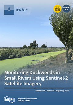
This is an image of the Lis River, located in the centre of Mainland Portugal, taken in the agricultural irrigated area found at the downstream section of the Lis Valley. The green “carpet” is formed by duckweeds (Lemna minor), an aquatic weed that seriously infests this water course, which is the irrigation water source in this area. Duckweeds are widely found in freshwaters all over the world, but whereas this macrophyte provides multiple ecosystems’ functions and services, its excessive proliferation can have negative environmental impacts (including ecological and socio-economic impacts). This work explores the use of remote sensing tools for mapping the dynamics of duckweeds in open watercourses, which could contribute to identifying suitable monitoring programs and integrated management practices. View this paper
  • Issues are regarded as officially published after their release is announced to the table of contents alert mailing list.
  • You may sign up for e-mail alerts to receive table of contents of newly released issues.
  • PDF is the official format for papers published in both, html and pdf forms. To view the papers in pdf format, click on the "PDF Full-text" link, and use the free Adobe Reader to open them.
Order results
Result details
Section
Select all
Export citation of selected articles as:
15 pages, 5522 KiB  
Article
Spatiotemporal Variations in the Water Quality of Qionghai Lake, Yunnan–Guizhou Plateau, China
by Jiao Ran, Rong Xiang, Jie Li, Keyan Xiao and Binghui Zheng
Water 2022, 14(15), 2451; https://doi.org/10.3390/w14152451 - 08 Aug 2022
Cited by 7 | Viewed by 2066
Abstract
Although Qionghai Lake is one of the 11 large and medium-sized lakes (lake area > 25 km2) in the Yunnan–Guizhou Plateau (YGP), there has been little research on its water quality, especially over the long term. Herein, meteorological, hydrologic, trophic, and [...] Read more.
Although Qionghai Lake is one of the 11 large and medium-sized lakes (lake area > 25 km2) in the Yunnan–Guizhou Plateau (YGP), there has been little research on its water quality, especially over the long term. Herein, meteorological, hydrologic, trophic, and biochemical indices were investigated over the 2011–2020 period to explore the spatiotemporal variations in water quality in Qionghai Lake. The results showed that the CCME-WQI value for Qionghai Lake ranked between marginal and fair during 2011–2020, that the water quality of Qionghai Lake before 2017 was worse than after 2017, and that the water quality of the western part of Qionghai Lake was worse than that of the eastern part. Total nitrogen and total phosphorus were 0.39–0.51 and 0.019–0.027 mg/L during 2011–2020, respectively, and were the main pollution factors in Qionghai Lake. In addition, Qionghai Lake was at the mesotrophic level, but the chlorophyll and trophic state levels (TLI) increased year by year, and the levels in the western area were higher than in the eastern area. Increased anthropogenic activities (industrialization, urbanization, agricultural intensification, etc.) were the main reasons for the poor water quality of Qionghai Lake before 2017, while, after 2017, effective government environmental restoration and management measures improved the water quality. Moreover, the difference in land-use types within the watershed was the main reason for the spatial heterogeneity of water quality in Qionghai Lake. Potassium permanganate index (CODMn) and ammonia nitrogen content index (NH3-N) were not very high, but both showed seasonal variations. Water transparency (SD) in Qionghai Lake was reduced by sediment input and increased algal biomass, while dissolved oxygen (DO) decreased due to thermal stratification. This study is expected to provide a theoretical reference for understanding changes in the water quality and water environmental protection of Qionghai Lake and the YGP. Full article
(This article belongs to the Special Issue Water Quality Monitoring, Analysis and Restoration of Lakes)
Show Figures

Graphical abstract

18 pages, 2147 KiB  
Article
Arsenite to Arsenate Oxidation and Water Disinfection via Solar Heterogeneous Photocatalysis: A Kinetic and Statistical Approach
by Felipe de J. Silerio-Vázquez, Cynthia M. Núñez-Núñez, José B. Proal-Nájera and María T. Alarcón-Herrera
Water 2022, 14(15), 2450; https://doi.org/10.3390/w14152450 - 08 Aug 2022
Cited by 1 | Viewed by 1853
Abstract
Arsenic (As) poses a threat to human health. In 2014, more than 200 million people faced arsenic exposure through drinking water, as estimated by the World Health Organization. Additionally, it is estimated that drinking water with proper microbiological quality is unavailable for more [...] Read more.
Arsenic (As) poses a threat to human health. In 2014, more than 200 million people faced arsenic exposure through drinking water, as estimated by the World Health Organization. Additionally, it is estimated that drinking water with proper microbiological quality is unavailable for more than 1 billion people. The present work analyzed a solar heterogeneous photocatalytic (HP) process for arsenite (AsIII) oxidation and coliform disinfection from a real groundwater matrix employing two reactors, a flat plate reactor (FPR) and a compound parabolic collector (CPC), with and without added hydrogen peroxide (H2O2). The pseudo first-order reaction model fitted well to the As oxidation data. The treatments FPR–HP + H2O2 and CPC–HP + H2O2 yielded the best oxidation rates, which were over 90%. These treatments also exhibited the highest reaction rate constants, 6.7 × 10⁻³ min−1 and 6.8 × 10⁻³ min−1, respectively. The arsenic removal rates via chemical precipitation reached 98.6% and 98.7% for these treatments. Additionally, no coliforms were detected at the end of the process. The collector area per order (ACO) for HP treatments was on average 75% more efficient than photooxidation (PO) treatments. The effects of the process independent variables, H2O2 addition, and light irradiation were statistically significant for the AsIII oxidation reaction rate (p < 0.05). Full article
(This article belongs to the Topic Advanced Oxidation Process: Applications and Prospects)
Show Figures

Figure 1

14 pages, 2498 KiB  
Article
A Coevolution Model of the Coupled Society—Water Resources—Environment Systems: An Application in a Case Study in the Yangtze River Economic Belt, China
by Haoyuan Liu, Xiang Zhang, Shiyong Tao, Xi Xiao, Keyi Wu and Jun Xia
Water 2022, 14(15), 2449; https://doi.org/10.3390/w14152449 - 08 Aug 2022
Cited by 1 | Viewed by 1594
Abstract
Interactions among society, water resources, and environment systems have become increasingly prominent with the progressively far-reaching impact of human activities. Therefore, this paper aims to construct a co-evolution model to establish the mutual feedback relationship among society, water resources, and environment from the [...] Read more.
Interactions among society, water resources, and environment systems have become increasingly prominent with the progressively far-reaching impact of human activities. Therefore, this paper aims to construct a co-evolution model to establish the mutual feedback relationship among society, water resources, and environment from the perspective of socio-hydrology. Firstly, social factors such as environmental sensitivity, environmental protection awareness, and technological level are introduced to this model to describe the coevolutionary trajectory of society, water resources and environment subsystems. Then, this model is implemented in 11 provincial administrative regions in the Yangtze River Economic Belt, and the degree of coordination of their coupling is evaluated. Results show that the water-use efficiency of each provincial administrative region in the Yangtze River Economic Belt gradually increases during the forecast period. The coupling-coordinated degree of each provincial administrative region of the Yangtze River Economic Belt has greatly improved during the 14th Five-Year Plan period, reflecting that policy support has played a significant role in the coordinated development of the Yangtze River Economic Belt. The dynamic fluctuation process of environmental sensitivity effectively depicts the co-evolution process of the coupling system, which provides a reference for the subsequent exploration and cognition of the human-water coevolutionary mechanism. Full article
Show Figures

Figure 1

15 pages, 4297 KiB  
Article
An Integrated Bayesian and Machine Learning Approach Application to Identification of Groundwater Contamination Source Parameters
by Yongkai An, Yanxiang Zhang and Xueman Yan
Water 2022, 14(15), 2447; https://doi.org/10.3390/w14152447 - 07 Aug 2022
Cited by 5 | Viewed by 1967
Abstract
The identification of groundwater contamination source parameters is an important prerequisite for the control and risk assessment of groundwater contamination. This study developed an innovative approach for the optimal design of observation well locations and the high-precision identification of groundwater contamination source parameters. [...] Read more.
The identification of groundwater contamination source parameters is an important prerequisite for the control and risk assessment of groundwater contamination. This study developed an innovative approach for the optimal design of observation well locations and the high-precision identification of groundwater contamination source parameters. The approach involves Bayesian theory and integrates Markov Chain Monte Carlo, Bayesian design, information entropy, machine learning, and surrogate modeling. The optimal observation well locations are determined by information entropy, which is adopted to mine valuable information about unknown groundwater contamination source parameters from measurements of contaminant concentration according to Bayesian design. After determining the optimal observation well locations, the identification of groundwater contamination source parameters is implemented through a Bayesian-based Differential Evolution Adaptive Metropolis with Discrete Sampling–Markov Chain Monte Carlo approach. However, the processes of both determination and identification are time-consuming because the original simulation model (that is, the contaminant transport model) needs to be invoked multiple times. To overcome this challenge, a machine learning approach, that is, Multi-layer Perceptron, is used to build a surrogate model for the original simulation model, which can greatly accelerate the determination and identification processes. Finally, two hypothetical numerical case studies involving homogeneous and heterogeneous cases are used to verify the performance of the proposed approach. The results show that the optimal design of observation well locations and high-precision identification of groundwater contamination source parameters can be implemented accurately and effectively by using the proposed approach. In summary, this study highlights that the integrated Bayesian and machine learning approach provides a promising solution for high-precision identification of groundwater contamination source parameters. Full article
(This article belongs to the Special Issue Groundwater Quality and Human Health Risk)
Show Figures

Figure 1

15 pages, 10379 KiB  
Article
Efficient Removal of Organic Matter from Biotreated Coking Wastewater by Coagulation Combined with Sludge-Based Activated Carbon Adsorption
by Yu Xia, Weijia Li, Xuwen He, Dannuo Liu, Yichen Sun, Jie Chang and Jing Liu
Water 2022, 14(15), 2446; https://doi.org/10.3390/w14152446 - 07 Aug 2022
Cited by 4 | Viewed by 1814
Abstract
Coagulation–adsorption can be effective in the removal of the organic matters remaining in biotreated coking wastewater (BTCW), and cheap and efficient adsorbents benefit the widespread application of this technology. In this study, a sludge-based activated carbon (SAC) was prepared using zinc chloride to [...] Read more.
Coagulation–adsorption can be effective in the removal of the organic matters remaining in biotreated coking wastewater (BTCW), and cheap and efficient adsorbents benefit the widespread application of this technology. In this study, a sludge-based activated carbon (SAC) was prepared using zinc chloride to activate sludge pyrolysis carbon for the treatment of BTCW with coagulation as the pretreatment process. According to Brunauer-Emmett-Teller (BET) and the scanning electron microscope (SEM) analysis, the SAC exhibited a specific surface area of 710.175 m2/g and well-developed pore structure. The removal characteristics of the organic matter in BTCW were systematically studied. The results show that 76.79% of the COD in the BTCW was removed by coagulation combined with SAC adsorption, and the effluent COD was below the discharge limit (80 mg/L) (GB16171-2012), with the optimal dosages of polyaluminum chloride and SAC being 150 mg/L and 4 g/L, respectively. Compared with a commercial powdered activated carbon (PAC) (48.26%), the SAC achieved a similar COD removal efficiency (47.74%) at a higher adsorption speed. The removal efficiencies of the hydrophobic components (77.27%) and fluorescent components by SAC adsorption were higher than those by PAC adsorption. The SAC also had an excellent removal effect on complex organic compounds and colored substances in the BTCW, as revealed by UV-vis spectra analyses. Full article
(This article belongs to the Section Wastewater Treatment and Reuse)
Show Figures

Graphical abstract

15 pages, 3642 KiB  
Article
“Sea Anemone”-like CeFe Oxides for High-Efficient Phosphate Removal
by Xiaoying Tan, Pingping Dong, Hongping Min, Jinxue Luo, Wenhai Huang, Xiaodong Wang, Qingqing Li and Qile Fang
Water 2022, 14(15), 2445; https://doi.org/10.3390/w14152445 - 07 Aug 2022
Cited by 1 | Viewed by 1635
Abstract
The excessive release of phosphorus is a prime culprit for eutrophication and algal bloom in the aquatic environment, and there is always an urgent need to develop effective methods to deal with phosphorus pollution. Ce-based oxide is a type of compelling adsorbent for [...] Read more.
The excessive release of phosphorus is a prime culprit for eutrophication and algal bloom in the aquatic environment, and there is always an urgent need to develop effective methods to deal with phosphorus pollution. Ce-based oxide is a type of compelling adsorbent for phosphate removal, and a self-templating strategy is used to construct high-performance Ce-based oxides for phosphate adsorption in this study. A “sea anemone”-like CeFe cyanometallate (CM) with a 3D microstructure is fabricated to provide a precursor for synthesizing CeFe-based oxides (CeFe-CM-T) by high-temperature pyrolysis. The as-prepared CeFe-CM-T maintains the “sea anemone” morphology well and has abundant micropores/mesopores, which render its superior phosphate adsorption capacity 1~2 orders of magnitude higher than that of the commercial CeO2 and Fe3O4 materials. Moreover, CeFe-CM-T shows high selectivity for phosphate removal when it co-exists with other anions and natural organic matter and exhibits excellent recycling performance. It demonstrates that both Ce3+ and Ce4+ are reserved in the oxides, where Ce3+ serves as the main active site for phosphate capture, which forms stable Ce-PO4 compounds via a ligand-exchange mechanism. Thus, the self-templating strategy using CM as a precursor is a potential method for synthesizing porous Ce-based oxides for phosphate removal. Full article
(This article belongs to the Special Issue Carbon Neutrality and Wastewater Treatment)
Show Figures

Figure 1

13 pages, 2589 KiB  
Article
Analysis on the Return Period of “7.20” Rainstorm in the Xiaohua Section of the Yellow River in 2021
by Shuangyan Jin, Shaomeng Guo and Wenbo Huo
Water 2022, 14(15), 2444; https://doi.org/10.3390/w14152444 - 07 Aug 2022
Cited by 5 | Viewed by 1679
Abstract
The “7.20” rainstorm and flood disaster in 2021 occurred in Zhengzhou and adjacent areas of Henan province. According to the Maximum Rainfall Data of Different Periods and the “7.20” rainstorm data of the section from Xiaolangdi to Huayuankou of the Yellow River in [...] Read more.
The “7.20” rainstorm and flood disaster in 2021 occurred in Zhengzhou and adjacent areas of Henan province. According to the Maximum Rainfall Data of Different Periods and the “7.20” rainstorm data of the section from Xiaolangdi to Huayuankou of the Yellow River in 2021, i.e., thirteen kinds of automatic monitoring rainfall data in minutes and six kinds of manual monitoring rainfall data in hours, the rainfall frequency curves of two representative periods of ten reference stations are established using Pearson-III distribution. The return periods of “7.20” rainstorms with maximum 24 h greater than 300 mm and maximum 6 h greater than 100 mm are calculated. The results show that the influence of “7.20” rainstorms on the rainfall return period is obvious. For the ten reference stations, all the maximum 24 h rainfall of “7.20” rainstorms ranked in the first of the series. When establishing the frequency curve, if this value is considered, the largest return period occurs at Sishui station, with a return period of 486 years. Otherwise, the return period of Sishui, Mangling, Minggao, and Xicun stations will exceed 10,000 years. Among ten reference stations, the largest proportion of the maximum 6 h rainfall between “7.20” rainstorms and historical series is Minggao station. Taking Minggao station as an example, the return period is about 200 years when considering the “7.20” value to establish the frequency curve, otherwise it is about 3000 years. The results can provide technical support for the analysis of the rainstorm return period and the flood control operation in the lower Yellow River. Full article
Show Figures

Figure 1

15 pages, 3099 KiB  
Article
Network Subsystems for Robust Design Optimization of Water Distribution Systems
by Assefa Hayelom and Avi Ostfeld
Water 2022, 14(15), 2443; https://doi.org/10.3390/w14152443 - 07 Aug 2022
Cited by 1 | Viewed by 1588
Abstract
The optimal design of WDS has been extensively researched for centuries, but most of these studies have employed deterministic optimization models, which are premised on the assumption that the parameters of the design are perfectly known. Given the inherently uncertain nature of many [...] Read more.
The optimal design of WDS has been extensively researched for centuries, but most of these studies have employed deterministic optimization models, which are premised on the assumption that the parameters of the design are perfectly known. Given the inherently uncertain nature of many of the WDS design parameters, the results derived from such models may be infeasible or suboptimal when they are implemented in reality due to parameter values that differ from those assumed in the model. Consequently, it is necessary to introduce some uncertainty in the design parameters and find more robust solutions. Robust counterpart optimization is one of the methods used to deal with optimization under uncertainty. In this method, a deterministic data set is derived from an uncertain problem, and a solution is computed such that it remains viable for any data realization within the uncertainty bound. This study adopts the newly emerging robust optimization technique to account for the uncertainty associated with nodal demand in designing water distribution systems using the subsystem-based two-stage approach. Two uncertainty data models with ellipsoidal uncertainty set in consumer demand are examined. The first case, referred to as the uncorrelated problem, considers the assumption that demand uncertainty only affects the mass balance constraint, while the second case, referred to as the correlated case, assumes uncertainty in demand and also propagates to the energy balance constraint. Full article
(This article belongs to the Section Urban Water Management)
Show Figures

Figure 1

19 pages, 2187 KiB  
Article
Major, Trace and Rare Earth Element Distribution in Water, Suspended Particulate Matter and Stream Sediments of the Ob River Mouth
by Andrei Soromotin, Dmitriy Moskovchenko, Vitaliy Khoroshavin, Nikolay Prikhodko, Alexander Puzanov, Vladimir Kirillov, Mikhail Koveshnikov, Eugenia Krylova, Aleksander Krasnenko and Aleksander Pechkin
Water 2022, 14(15), 2442; https://doi.org/10.3390/w14152442 - 06 Aug 2022
Cited by 12 | Viewed by 2653
Abstract
Ongoing climatic changes are influencing the volume and composition of the river waters that enter the Arctic Basin. This hydrochemical study was conducted within the mouth of the Ob River, which is one of the world’s largest rivers, providing 15% of the Arctic [...] Read more.
Ongoing climatic changes are influencing the volume and composition of the river waters that enter the Arctic Basin. This hydrochemical study was conducted within the mouth of the Ob River, which is one of the world’s largest rivers, providing 15% of the Arctic Ocean’s total intake. Concentrations of suspended and dissolved elements were determined using ICP–MS and ICP–AES. As compared to the world average values, the Ob river water had higher concentrations of dissolved P, As, Cu, Zn, Pb and Sb, i.e., the elements that form soluble organo-mineral complexes. The composition of suspended matter was characterized by low concentrations of most trace elements (Cd, Cr, Co, Cu, Mo, Al, Ni, Pb, V) due to their low contents in peat soils within the river drainage basin. Concentrations of dissolved forms were many times lower than concentrations of suspended forms in Al, Fe, Mn, Zn, Cr, Co, Ti, Sc, and all rare earth elements. Total concentrations of Ni, Cu, Bi, Pb, W in the river water increased by 2.5 to 4.2 times during the summer. The effects of climate change, which can cause an increase in the discharge of solid particles from thawing permafrost, are likely to lead to an increase in the discharge of certain elements into the Ob River estuary. Full article
(This article belongs to the Special Issue Water Resources under Growing Anthropogenic Loads)
Show Figures

Figure 1

20 pages, 2347 KiB  
Article
Hydro-Geochemistry and Groundwater Quality Assessment of Ouargla Basin, South of Algeria
by Zina Mansouri, Youcef Leghrieb, Saber Kouadri, Nadhir Al-Ansari, Hadee Mohammed Najm, Nuha S. Mashaan, Moutaz Mustafa A. Eldirderi and Khaled Mohamed Khedher
Water 2022, 14(15), 2441; https://doi.org/10.3390/w14152441 - 06 Aug 2022
Cited by 8 | Viewed by 2959
Abstract
This study aims to evaluate the hydro-chemical characteristics of Ouargla, Algeria basin groundwaters harvested from the Mio Pliocene aquifer. The study covered 70 samples; the physical parameters, potential of hydrogen (pH), and electrical conductivity EC μS.cm−1 were determined in situ, using a [...] Read more.
This study aims to evaluate the hydro-chemical characteristics of Ouargla, Algeria basin groundwaters harvested from the Mio Pliocene aquifer. The study covered 70 samples; the physical parameters, potential of hydrogen (pH), and electrical conductivity EC μS.cm−1 were determined in situ, using a multiparameter; the laboratory analysis included dry residuals DR (mg/L), calcium Ca2+ (mg/L), magnesium Mg2+ (mg/L), sodium Na+ (mg/L), potassium K+ (mg/L), bicarbonates HCO3 (mg/L), sulfates SO42− (mg/L), and chloride Cl (mg/L). The piper diagram shows that the Ouargla basin ground waters divided into two facies, sodic chlorinated in 93% and sodic sulphated in 7% of samples. The United States Salinity Laboratory Staff (USSL) diagram was used to detect the suitability of groundwater in irrigation where the results show that the groundwater was classed into two classes, poor water (C4 S4) and bad water (C4 S4). Furthermore, indices such as the Kelly index (KI), sodium adsorption ratio (SAR), sodium solubility percentage (Na%), and magnesium hazards (MH) confirm the negative effect of groundwater on soil permeability in 96%, 80%, 89%, and 53% of samples. The permeability index (PI) shows that the analyzed samples were considered as doubtful (71%) and safe (29%), otherwise there is no risk related to residual sodium carbonate (RSC). The geo-spatial distribution of deferent indices shows that all the study area has poor groundwater for irrigation, except the south-west part, where the groundwaters of this sub-area do not form a problem related to RSC. Full article
Show Figures

Figure 1

23 pages, 5009 KiB  
Article
Prediction of Groundwater Arsenic Hazard Employing Geostatistical Modelling for the Ganga Basin, India
by Sana Dhamija and Himanshu Joshi
Water 2022, 14(15), 2440; https://doi.org/10.3390/w14152440 - 06 Aug 2022
Cited by 5 | Viewed by 2565
Abstract
Elevated arsenic concentrations in groundwater in the Ganga–Brahmaputra–Meghna (GBM) river basin of India has created an alarming situation. Considering that India is one of the largest consumers of groundwater for a variety of uses such as drinking, irrigation, and industry, it is imperative [...] Read more.
Elevated arsenic concentrations in groundwater in the Ganga–Brahmaputra–Meghna (GBM) river basin of India has created an alarming situation. Considering that India is one of the largest consumers of groundwater for a variety of uses such as drinking, irrigation, and industry, it is imperative to determine arsenic occurrence and hazard for sustainable groundwater management. The current study focused on the evaluation of arsenic occurrence and groundwater arsenic hazard for the Ganga basin employing Analytical Hierarchy Process (AHP) and Frequency Ratio (FR) models. Furthermore, arsenic hazard maps were prepared using a Kriging interpolation method and with overlay analysis in the GIS platform based on the available secondary datasets. Both models generated satisfactory results with minimum differences. The highest hazard likelihood has been displayed around and along the Ganges River. Most of the Uttar Pradesh and Bihar; and parts of Rajasthan, Chhattisgarh, Jharkhand, Madhya Pradesh, and eastern and western regions of West Bengal show a high arsenic hazard. More discrete results were rendered by the AHP model. Validation of arsenic hazard maps was performed through evaluating the Area Under Receiver Operating Characteristics metric (AUROC), where AUC values for both models ranged from 0.7 to 0.8. Furthermore, the final output was also validated against the primary arsenic data generated through field sampling for the districts of two states, viz Bihar (2019) and Uttar Pradesh (2021). Both models showed good accuracy in the spatial prediction of arsenic hazard. Full article
Show Figures

Figure 1

24 pages, 1958 KiB  
Review
Research Progress on Integrated Treatment Technologies of Rural Domestic Sewage: A Review
by Peizhen Chen, Wenjie Zhao, Dongkai Chen, Zhiping Huang, Chunxue Zhang and Xiangqun Zheng
Water 2022, 14(15), 2439; https://doi.org/10.3390/w14152439 - 06 Aug 2022
Cited by 21 | Viewed by 6715
Abstract
The improvement of rural living standards in developing countries and the continuous upgrading of the rural industrial economy have prompted the diversification of rural areas and residential forms. Thus, an integrated rural sewage treatment process has gradually become the mainstream technology for rural [...] Read more.
The improvement of rural living standards in developing countries and the continuous upgrading of the rural industrial economy have prompted the diversification of rural areas and residential forms. Thus, an integrated rural sewage treatment process has gradually become the mainstream technology for rural sewage treatment. Numerous studies have reported the effects of ecological wastewater treatment. Meanwhile, the relevant process technologies, evaluations, and operating models of the integrated rural sewage treatment process have yet to be thoroughly summarized. This review aims to fill these gaps. First, the applicability of artificial wetland, soil infiltration, stabilization pond, and integrated rural sewage treatment process technology in rural sewage treatment are outlined and compared. Second, the process flow, technical characteristics, and economic indicators of typical integrated sewage treatment processes (i.e., Anoxic/Oxic (A/O) process, Membrane Bio-Reactor (MBR) process, biological contact oxidation process, Sequencing Batch Reactor Activated Sludge (SBR) process) are introduced. The engineering application effects of the integrated rural sewage treatment process in different countries are also described. Third, the practical and effective evaluation methods of the integrated rural sewage treatment process are introduced. Bearing in mind the current operation and maintenance management modes of the integrated rural sewage treatment process in developed and developing countries, combined with the national conditions of developing countries, the prospect section provides development proposals for further optimization and improvement of the integrated rural sewage treatment process in developing countries. Full article
(This article belongs to the Section Wastewater Treatment and Reuse)
Show Figures

Figure 1

15 pages, 1678 KiB  
Article
Pollutant Removal and Energy Recovery from Swine Wastewater Using Anaerobic Membrane Bioreactor: A Comparative Study with Up-Flow Anaerobic Sludge Blanket
by Yunhui Pu, Jialing Tang, Ting Zeng, Yisong Hu, Jixiang Yang, Xiaochang Wang, Jin Huang and Abdelfatah Abomohra
Water 2022, 14(15), 2438; https://doi.org/10.3390/w14152438 - 06 Aug 2022
Cited by 8 | Viewed by 1987
Abstract
Due to its high content of organics and nutrients, swine wastewater has become one of the main environment pollution sources. Exploring high-efficient technologies for swine wastewater treatment is urgent and becoming a hot topic in the recent years. The present study introduces anaerobic [...] Read more.
Due to its high content of organics and nutrients, swine wastewater has become one of the main environment pollution sources. Exploring high-efficient technologies for swine wastewater treatment is urgent and becoming a hot topic in the recent years. The present study introduces anaerobic membrane bioreactor (AnMBR) for efficient treatment of swine wastewater, compared with up-flow anaerobic sludge blanket (UASB) as a traditional system. Pollutant removal performance, methanogenic properties, and microbial community structures were investigated in both reactors. Results showed that by intercepting particulate organics, AnMBR achieved stable and much higher chemical oxygen demand (COD) removal rate (approximately 90%) than UASB (around 60%). Due to higher methanogenic activity of anaerobic sludge, methane yield of AnMBR (0.23 L/g-COD) was higher than that of UASB. Microbial community structure analysis showed enrichment of functional bacteria that can remove refractory organic matter in the AnMBR, which promoted the organics conversion processes. In addition, obvious accumulation of acetotrophic and hydrotrophic methanogens in AnMBR system was recorded, which could broaden the organic matter degradation pathways and the methanogenesis processes, ensuring a higher methane yield. Through energy balance analysis, results concluded that the net energy recovery efficiency of AnMBR was higher than that of UASB system, indicating that applying AnMBR for livestock wastewater treatment could not only efficiently remove pollutants, but also significantly enhance the energy recovery. Full article
(This article belongs to the Special Issue Advances of Anaerobic Technologies on Wastewater Treatment)
Show Figures

Figure 1

13 pages, 3518 KiB  
Article
Unsteady Friction Modeling Technique for Lagrangian Approaches in Transient Simulations
by Mohamad Zeidan and Avi Ostfeld
Water 2022, 14(15), 2437; https://doi.org/10.3390/w14152437 - 06 Aug 2022
Cited by 2 | Viewed by 1542
Abstract
This study investigates the simulation of celerity attenuation and head damping in transient flows using a Lagrangian approach rather than an Eulerian approach. Typically, the Lagrangian approach requires orders of magnitude fewer calculations, resulting in the rapid solution of very large systems. Additionally, [...] Read more.
This study investigates the simulation of celerity attenuation and head damping in transient flows using a Lagrangian approach rather than an Eulerian approach. Typically, the Lagrangian approach requires orders of magnitude fewer calculations, resulting in the rapid solution of very large systems. Additionally, it is based on a simple physical model. As the method is continuous in both time and space, it is less sensitive to the structure of the network and the length of the simulation process. Most recent studies, however, have focused on the development and improvement of computational routines for modeling in an Eulerian environment. This results in the development of adequate models that are suitable for Eulerian models but not applicable in Lagrangian-based models. As a result of this fixation, a bias was created towards using Eulerian approaches in transient simulations. It also diverts resources from further development of Lagrangian models. Consequently, it is necessary to develop a friction model that is more accurate and compatible with Lagrangian methods without compromising their performance. To the authors’ knowledge, such a model is yet to be published in the literature. This study presents a new friction modeling technique that compensates for both the local and convective acceleration terms for the Lagrangian transient modeling approach without compromising the computational time. Full article
(This article belongs to the Section Urban Water Management)
Show Figures

Figure 1

40 pages, 11600 KiB  
Review
Nanomaterial-Based Sensors for the Detection of Glyphosate
by Karem Zúñiga, Georgette Rebollar, Mayra Avelar, José Campos-Terán and Eduardo Torres
Water 2022, 14(15), 2436; https://doi.org/10.3390/w14152436 - 06 Aug 2022
Cited by 11 | Viewed by 3646
Abstract
Due to its chemical properties, glyphosate [N-(phosphonomethyl)glycine] is one of the most commonly used agricultural herbicides globally. Due to risks associated with human exposure to glyphosate and its potential harmfulness, the need to develop specific, accurate, online, and sensitive methods is imperative. In [...] Read more.
Due to its chemical properties, glyphosate [N-(phosphonomethyl)glycine] is one of the most commonly used agricultural herbicides globally. Due to risks associated with human exposure to glyphosate and its potential harmfulness, the need to develop specific, accurate, online, and sensitive methods is imperative. In accordance with this, the present review is focused on recent advances in developing nanomaterial-based sensors for glyphosate detection. Reported data from the literature concerning glyphosate detection in the different matrices using analytical methods (mostly chromatographic techniques) are presented; however, they are expensive and time-consuming. In this sense, nanosensors’ potential applications are explained to establish their advantages over traditional glyphosate detection methods. Zero-dimensional (0D), one-dimensional (1D), two-dimensional (2D), and three- dimensional (3D) materials are reviewed, from biomolecules to metallic compounds. Bionanomaterials have generated research interest due to their selectivity with respect to using enzymes, DNA, or antibodies. On the other hand, Quantum Dots also are becoming relevant for their vast surface area and good limit of detection values (in the range of pM). This review presents all the characteristics and potential applications of different nanomaterials for sensor development, bearing in mind the necessity of a glyphosate detection method with high sensitivity, selectivity, and portability. Full article
Show Figures

Figure 1

26 pages, 14310 KiB  
Article
Mapping Prospective Areas of Water Resources and Monitoring Land Use/Land Cover Changes in an Arid Region Using Remote Sensing and GIS Techniques
by Tong Sun, Wuqun Cheng, Mohamed Abdelkareem and Nasir Al-Arifi
Water 2022, 14(15), 2435; https://doi.org/10.3390/w14152435 - 06 Aug 2022
Cited by 12 | Viewed by 3947
Abstract
Groundwater is a vital water resource for economic, agricultural, and domestic purposes in arid regions. To reduce water scarcity in arid regions, recently, remote sensing and GIS techniques have been successfully applied to predict areas with prospective water resources. Thus, this study attempted [...] Read more.
Groundwater is a vital water resource for economic, agricultural, and domestic purposes in arid regions. To reduce water scarcity in arid regions, recently, remote sensing and GIS techniques have been successfully applied to predict areas with prospective water resources. Thus, this study attempted to spatially reveal groundwater potential zones (GWPZs) and to conduct change detection on the desert fringes of Wadi Asyuti, a defunct tributary of Egypt’s Nile basin in eastern Sahara. Eleven influential groundwater factors generated from remote sensing imagery, and geological, hydrological, and climatic conditions were combined after giving a weight to each factor through a GIS-based Analytical Hierarchy Process (AHP) coupled with the weighted overlay technique (WOT). The results revealed six distinctive zones with scores ranging from very low (10.59%) to excellent (3.03%). Thirty-three productive groundwater wells, Interferometry Synthetic Aperture Radar (InSAR) coherence change detection (CCD), a land use map derived from Sentinel-2, and the delineated flooding zone derived from Landsat-8 data were used to validate the delineated zones. The GWPZs indicated that 48% of the collected wells can be classified as consistent to excellent. The Normalized Difference Vegetation Index (NDVI) and image classification were applied to the multi-temporal Landsat series and Sentinel-2 along with the InSAR CCD data derived from Sentinel-1 images to reveal dramatic changes in land use/land cover (LU/LC) in terms of agricultural and other anthropogenic activities in the structurally downstream area, which is the most promising area for future developments. Overall, the integration of radar and multispectral data through the GIS technique has the ability to provide valuable information about water resources in arid regions. Thus, the tested model is a promising technique, and such information is extremely significant for the guidance of planners and decision makers in the area of sustainable development. Full article
Show Figures

Figure 1

17 pages, 4452 KiB  
Article
Flash Flood Susceptibility Mapping in Sinai, Egypt Using Hydromorphic Data, Principal Component Analysis and Logistic Regression
by Mustafa El-Rawy, Wael M. Elsadek and Florimond De Smedt
Water 2022, 14(15), 2434; https://doi.org/10.3390/w14152434 - 06 Aug 2022
Cited by 16 | Viewed by 2371
Abstract
Flash floods in the Sinai often cause significant damage to infrastructure and even loss of life. In this study, the susceptibility to flash flooding is determined using hydro-morphometric characteristics of the catchments. Basins and their hydro-morphometric features are derived from a digital elevation [...] Read more.
Flash floods in the Sinai often cause significant damage to infrastructure and even loss of life. In this study, the susceptibility to flash flooding is determined using hydro-morphometric characteristics of the catchments. Basins and their hydro-morphometric features are derived from a digital elevation model from NASA Earthdata. Principal component analysis is used to identify principal components with a clear physical meaning that explains most of the variation in the data. The probability of flash flooding is estimated by logistic regression using the principal components as predictors and by fitting the model to flash flood observations. The model prediction results are cross validated. The logistic model is used to classify Sinai basins into four classes: low, moderate, high and very high susceptibility to flash flooding. The map indicating the susceptibility to flash flooding in Sinai shows that the large basins in the mountain ranges of the southern Sinai have a very high susceptibility for flash flooding, several basins in the southwest Sinai have a high or moderate susceptibility to flash flooding, some sub-basins of wadi El-Arish in the center have a high susceptibility to flash flooding, while smaller to medium-sized basins in flatter areas in the center and north usually have a moderate or low susceptibility to flash flooding. These results are consistent with observations of flash floods that occurred in different regions of the Sinai and with the findings or predictions of other studies. Full article
(This article belongs to the Special Issue Flash Floods: Forecasting, Monitoring and Mitigation Strategies)
Show Figures

Figure 1

17 pages, 8225 KiB  
Article
Developing a Novel Alum Sludge-Based Floating Treatment Wetland for Natural Water Restoration
by Xinlong He, Xiaohong Zhao, Wenshan Zhang, Baiming Ren and Yaqian Zhao
Water 2022, 14(15), 2433; https://doi.org/10.3390/w14152433 - 05 Aug 2022
Cited by 5 | Viewed by 1957
Abstract
Novel alum sludge-based floating treatment wetland (FTW) was developed to enhance the purification performances of natural water bodies, i.e., rivers, lakes, and ponds. Polyurethane was applied to foam the lightweight alum sludge based-substrate (PU-AL) of FTW through the response surface method. Three FTWs [...] Read more.
Novel alum sludge-based floating treatment wetland (FTW) was developed to enhance the purification performances of natural water bodies, i.e., rivers, lakes, and ponds. Polyurethane was applied to foam the lightweight alum sludge based-substrate (PU-AL) of FTW through the response surface method. Three FTWs configurations were created for a half-year lab-scale operation, and the PU-AL FTW presents the greatest purification performance in the removal rate of chemical oxygen demand (COD) of 62.58 ± 6.65%, total nitrogen (TN) of 53.31 ± 4.65%, and total phosphorus (TP) of 45.39 ± 4.69%. PU-AL substrate could enhance the nutrient removal performance of existing FTW by providing a proper media for microbial and plants’ growth. This study provides a good solution and showcase not only from a natural water restoration point of view but also from the waterworks sludge management view for a better understanding of FTWs and good applications in engineering practice. Full article
(This article belongs to the Section Water Quality and Contamination)
Show Figures

Graphical abstract

18 pages, 3110 KiB  
Article
Evaluation of TIGGE Precipitation Forecast and Its Applicability in Streamflow Predictions over a Mountain River Basin, China
by Yiheng Xiang, Tao Peng, Qi Gao, Tieyuan Shen and Haixia Qi
Water 2022, 14(15), 2432; https://doi.org/10.3390/w14152432 - 05 Aug 2022
Cited by 4 | Viewed by 1450
Abstract
The number of numerical weather prediction (NWP) models is on the rise, and they are commonly used for ensemble precipitation forecast (EPF) and ensemble streamflow prediction (ESP). This study evaluated the reliabilities of two well-behaved NWP centers in the Observing System Research and [...] Read more.
The number of numerical weather prediction (NWP) models is on the rise, and they are commonly used for ensemble precipitation forecast (EPF) and ensemble streamflow prediction (ESP). This study evaluated the reliabilities of two well-behaved NWP centers in the Observing System Research and Predictability Experiment (THORPEX) Interactive Grand Global Ensemble (TIGGE), the European Centre for Medium-Range Weather Forecasts (ECMWF) and the National Centers for Environmental Prediction (NCEP), in EPF and ESP over a mountain river basin in China. This evaluation was carried out based on both deterministic and probabilistic metrics at a daily temporal scale. The effectiveness of two postprocessing methods, the Generator-based Postprocessing (GPP) method, and the Bayesian Model Averaging (BMA) method were also investigated for EPF and ESP. Results showed that: (1) The ECMWF shows better performances than NCEP in both EPF and ESP in terms of evaluation indexes and representation of the hydrograph. (2) The GPP method performs better than BMA in improving both EPF and ESP performances, and the improvements are more significant for the NCEP with worse raw performances. (3) Both ECMWF and NCEP have good potential for both EPF and ESP. By using the GPP method, there are desirable EPF performances for both ECMWF and NCEP at all 7 lead days, as well as highly skillful ECMWF ESP for 1~5 lead days and average moderate skillful NCEP ESP for all 7 lead days. The results of this study can provide a reference for the applications of TIGGE over mountain river basins. Full article
Show Figures

Figure 1

15 pages, 3500 KiB  
Article
What Is the Suitable Sampling Frequency for Water Quality Monitoring in Full-Scale Constructed Wetlands Treating Tail Water?
by Siyuan Song, Sheng Sheng, Jianqiang Xu and Dehua Zhao
Water 2022, 14(15), 2431; https://doi.org/10.3390/w14152431 - 05 Aug 2022
Cited by 2 | Viewed by 1685
Abstract
Three years of hourly COD and NH4+-N measurements for two full-scale integrated constructed wetlands (CWs) treating secondary effluents from sewage treatment plants (STPs) were used to quantify the proper sampling frequency (SF). The modified coefficient of variation (CVm) [...] Read more.
Three years of hourly COD and NH4+-N measurements for two full-scale integrated constructed wetlands (CWs) treating secondary effluents from sewage treatment plants (STPs) were used to quantify the proper sampling frequency (SF). The modified coefficient of variation (CVm) and average variation rate (VRa) were calculated to monitor the dynamics and annual average performance, respectively. It was found that (1) under CVm 5%, VRa 5%, and VRm 5%, the sampling intervals (SI) of COD can be set as 1.19 h, 526.5 h, and 110.1 h, respectively, and the SI of NH4+-N should be 4.51 h, 66.3 h, and 26.8 h, respectively; (2) under CVm 10%, VRa 10%, and VRm 10%, the monitoring intervals of COD can be set as 11.92 h, 1401.7 h, and 233.5 h, respectively, and the monitoring intervals of NH4+-N should be 30.73 h, 139.3 h, and 50.5 h, respectively. Therefore, to meet the need of monitoring the dynamic changes in data, hourly and 4 h SIs were recommended for COD and NH4+-N evaluation, respectively, when it is necessary to consider the operation and maintenance costs at the same time, 11 h and 30 h SIs were proper for COD and NH4+-N evaluation, respectively. The methods proposed in this study could provide reference to improve the management and evaluation level of full-scale CWs. Full article
Show Figures

Figure 1

23 pages, 4927 KiB  
Article
Comparison of Urbanization, Climate Change, and Drainage Design Impacts on Urban Flashfloods in an Arid Region: Case Study, New Cairo, Egypt
by Bassma Taher Hassan, Mohamad Yassine and Doaa Amin
Water 2022, 14(15), 2430; https://doi.org/10.3390/w14152430 - 05 Aug 2022
Cited by 14 | Viewed by 4526
Abstract
Urban flooding is considered one of the hazardous disasters in metropolitan areas, especially for those located in arid regions. Due to the associated risks of climate change in increasing the frequency of extreme rainfall events, climate-induced migration to urban areas leads to the [...] Read more.
Urban flooding is considered one of the hazardous disasters in metropolitan areas, especially for those located in arid regions. Due to the associated risks of climate change in increasing the frequency of extreme rainfall events, climate-induced migration to urban areas leads to the intensification of urban settlements in arid regions as well as an increase in urban expansion towards arid land outskirts. This not only stresses the available infrastructure but also produces substantial social instability due to unplanned urban growth. Therefore, this study sheds light on the main factors that are increasing the flood risk, through examining the consequences of rapid urban growth and the performance of drainage networks on urban flood volumes and comparing it with the effects induced by climate change on the surface runoff. The effect of urbanization is assessed through land use maps showing the historical urbanization conditions for the past 30 years, while considering the role of urban planning and its effect on exacerbating surface runoff. Six climate projection scenarios adopted from three Global Climate Models under two Representative Concentration Pathways (4.5 and 8.5) during the period (2006–2020) were compared to ground observed rainfall data to identify which climate scenario we are likely following and then evaluate its effects on the current rainfall trends up to the year 2050. The significance of the drainage design in the mitigation or increase of surface runoff is evaluated through capacity-load balance during regular and extreme storms. It is found that using impervious surfaces coupled with poor planning causing the blockage of natural flood plains led to an increase in the total runoff of about 180%, which is three times more than the effect induced by climate change for the same analysis period. Climate change decreased the intensities of 2- and 5-year rainfall events by 6% while increasing the intensities of extreme events corresponds to 100-year by 17%. Finally, the urban drainage had a distinguished role in increasing surface runoff, as 70% of the network performed poorly during the smallest rainfall event of 2-year return period. The study emphasizes the urgency to re-evaluate the existing and future urban drainage design approach: although urban development and climate change have inevitable effects on the increase in urban flood volumes, it could be alleviated through improved infrastructures. Full article
(This article belongs to the Special Issue Urban Floods in a Changing Climate)
Show Figures

Figure 1

18 pages, 5421 KiB  
Article
Spatiotemporal Evaluation of Blue and Green Water in Xinjiang River Basin Based on SWAT Model
by Xudong Zhang, Cong Jiang, Junzhe Huang, Zhenyu Ni, Jizhou Sun, Zuzhong Li and Tianfu Wen
Water 2022, 14(15), 2429; https://doi.org/10.3390/w14152429 - 05 Aug 2022
Cited by 2 | Viewed by 1818
Abstract
Poyang Lake is the largest freshwater lake in China. As an important tributary of Poyang Lake, Xinjiang River has an important influence on the water ecology and water resources of the Poyang Lake basin. Based on the hydrological simulation of the SWAT (Soil [...] Read more.
Poyang Lake is the largest freshwater lake in China. As an important tributary of Poyang Lake, Xinjiang River has an important influence on the water ecology and water resources of the Poyang Lake basin. Based on the hydrological simulation of the SWAT (Soil and Water Assessment Tool) model, the spatiotemporal distribution and evaluation of the blue and green water during the period (1982–2016) in the basin were explored by the Mann–Kendall test, precipitation anomaly percentage, and scenario simulation. It is found that the SWAT model presents a satisfactory performance in runoff simulation of the basin. The multi-year average blue water in the Xinjiang River basin is 1138 mm, and the green water is 829 mm, with a green water coefficient of 0.42. The amount of blue water in wet years is about 1.5 times that in normal years and 2.4 times that in dry years. Compared with the green water, the blue water of the basin is more sensitive to the variations in precipitation. In spatial distribution, the blue and green water in the middle of the basin is obviously more than those in other parts of the basin. During the study period, the blue water in the basin shows a slight decreasing trend, and the green water shows a significant decreasing trend. It is also found that climatic factors have a greater influence on the trend of blue and green water than land use, and the decrease in precipitation is the dominant cause for the trend of blue and green water. Full article
(This article belongs to the Section Water Quality and Contamination)
Show Figures

Figure 1

13 pages, 1742 KiB  
Article
Dew Evaporation Amount and Its Influencing Factors in an Urban Ecosystem in Northeastern China
by Yingying Xu, Chenzhuo Jia and Hongzhao Liu
Water 2022, 14(15), 2428; https://doi.org/10.3390/w14152428 - 05 Aug 2022
Cited by 3 | Viewed by 1807
Abstract
Dew is an important water input and promotes plant growth. Dew condenses on plant leaves at night, and a portion of this dew returns to the atmosphere through evaporation. The amount of dew that evaporates is not equal to the amount of condensation; [...] Read more.
Dew is an important water input and promotes plant growth. Dew condenses on plant leaves at night, and a portion of this dew returns to the atmosphere through evaporation. The amount of dew that evaporates is not equal to the amount of condensation; however, the dew evaporation process has not received enough attention. By monitoring the dew condensation and evaporation processes associated with four typical shrubs (Syringa, Hemiptelea, Buxus, and Cornus) in northeast China, we found that dew condensation started approximately 30 min after sunset, finished approximately 30 min before sunrise, and then turned to the evaporation phase. Dew had completely depleted approximately 4 h after sunrise. The dew evaporation period was negatively correlated with the wind speed (p < 0.01) and positively correlated with temperature, solar radiation, and relative humidity (RH) (p < 0.01). The average evaporation periods of Syringa, Buxus, Cornus, and Hemiptelea were 282 ± 21 min, 255 ± 26 min, 242 ± 22 min, and 229 ± 17 min, respectively. The daily evaporation amounts in May and September reached the minimum and maximum values, respectively, and the evaporation intensity of dew was positively correlated with RH (p < 0.01). There was no significant difference in the daily evaporation amounts of Syringa, Hemiptelea, Buxus, or Cornus (p > 0.05), and the annual evaporation amounts of these four plants were 17.05 mm/y, 16.38 mm/y, 21.94 mm/y, and 16.15 mm/y, respectively. The microstructure of leaves affected both the rate and amount of evaporation. Dew evaporated faster on hydrophilic leaves, and leaves with high trichome and stomatal densities had lower proportions of the dew evaporation amount to the condensation amount. The proportions of the dew evaporation amount to the condensation amount derived for Syringa, Hemiptelea, Buxus, and Cornus were 60.38%, 46.07%, 57.24%, and 52.81%, respectively. This study supplements our understanding of dew evaporation amounts, providing information that was missing in the near-surface hydrological cycle and aiding in the assessment of the ecological significance of dew to plants. Full article
(This article belongs to the Section Ecohydrology)
Show Figures

Figure 1

16 pages, 6107 KiB  
Article
Conceptual and Methodological Foundations for the Articulation of Geospatial Data on Water Resources in South America’s Cross-Border Hydrographic Basins
by Valdir Adilson Steinke, Gabriella Emilly Pessoa, Romero Gomes Pereira da Silva and Carlos Hiroo Saito
Water 2022, 14(15), 2427; https://doi.org/10.3390/w14152427 - 05 Aug 2022
Viewed by 1802
Abstract
When observing transboundary waters through the lens of Integrated Water Resources Management (IWRM), it is essential to emphasize the principle of watershed unicity, which must overcome geopolitical interests while being supported by technical criteria. This paper used a multilevel and multiscale approach for [...] Read more.
When observing transboundary waters through the lens of Integrated Water Resources Management (IWRM), it is essential to emphasize the principle of watershed unicity, which must overcome geopolitical interests while being supported by technical criteria. This paper used a multilevel and multiscale approach for integrated management of transboundary water resources in two South American transboundary river basins: the Javari River Basin (between Brazil and Peru) and the Quaraí River Basin (between Brazil and Uruguay). The Food and Agriculture Organization (FAO) provided spatialized data for South American watersheds. Our research focused on several broad issues concerning regional transboundary water management: (a) Because only Peru and Brazil use the Otto–Pfafstetter method, a uniform method within a regional agreement about methodological differences for delimiting hydrographic basins in each country is required; (b) It is necessary to organize accurate databases to avoid problems of mismatched borders by overlapping national databases or mismatches due to scale problems; (c) It is also necessary to establish a coordinating body capable of working with each country’s representatives. In this case, building integrated and collaborative cartographic database becomes critical; (d) Because river meanders can change, historical data of a river’s morphology is required. In this sense, this research provides guidelines to make water management in transboundary rivers feasible in South America. Full article
(This article belongs to the Section Water Resources Management, Policy and Governance)
Show Figures

Graphical abstract

19 pages, 3051 KiB  
Article
The Setpoint Curve as a Tool for the Energy and Cost Optimization of Pumping Systems in Water Networks
by Christian F. León-Celi, Pedro L. Iglesias-Rey, Francisco Javier Martínez-Solano and Daniel Mora-Melia
Water 2022, 14(15), 2426; https://doi.org/10.3390/w14152426 - 05 Aug 2022
Cited by 2 | Viewed by 1609
Abstract
In water distribution networks, the adjustment of the driving curves of pumping systems to the setpoint curves allows for determining the minimum energy cost that can be achieved in terms of pumping. This paper presents the methodology for calculating the optimal setpoint curves [...] Read more.
In water distribution networks, the adjustment of the driving curves of pumping systems to the setpoint curves allows for determining the minimum energy cost that can be achieved in terms of pumping. This paper presents the methodology for calculating the optimal setpoint curves in water networks with multiple pumping systems, pressure dependent and independent consumption, with and without storage capacity. In addition, the energy and cost implications of the setpoint curve are analyzed. Three objective functions have been formulated depending on the case study, one of minimum energy and two of costs that depend on whether or not the presence of storage tanks is considered. For the optimization process, two algorithms have been used, Hooke and Jeeves and differential evolution. There are two study networks: TF and Richmond. The results show savings of close to 10% in the case of the Richmond network. Full article
(This article belongs to the Section Urban Water Management)
Show Figures

Figure 1

23 pages, 7070 KiB  
Article
Sanitary Sewerage Master Plan for the Sustainable Use of Wastewater on a University Campus
by Bethy Merchán-Sanmartín, Paul Carrión-Mero, Sebastián Suárez-Zamora, Maribel Aguilar-Aguilar, Omar Cruz-Cabrera, Katherine Hidalgo-Calva and Fernando Morante-Carballo
Water 2022, 14(15), 2425; https://doi.org/10.3390/w14152425 - 05 Aug 2022
Cited by 5 | Viewed by 3150
Abstract
Wastewater collection, transport, and treatment systems are essential to ensure human and environmental well-being. The Escuela Superior Politécnica del Litoral (ESPOL), has been implementing various sanitary sewerage systems; however, population growth has given rise to discussion on the installed capacity versus the necessary [...] Read more.
Wastewater collection, transport, and treatment systems are essential to ensure human and environmental well-being. The Escuela Superior Politécnica del Litoral (ESPOL), has been implementing various sanitary sewerage systems; however, population growth has given rise to discussion on the installed capacity versus the necessary capacity for the future population in the sustainable management of water resources. Therefore, this study aimed to develop a sanitary sewerage master plan by analysing the existing situation and applying technical criteria for the sustainable use of wastewater on a university campus. The methodology consisted of (i) evaluation and diagnosis of the area studied through data collection and processing, (ii) design of the sanitary sewerage system considering area-expansion zones, and (iii) SWOT analysis of a proposal to enhance wastewater transport and treatment systems. The proposal contemplates designing a sanitary sewer system that will manage the collection, transport, and treatment of wastewater over 15 years for 5667 inhabitants located in three expansion zones with occupation periods of 5, 10, and 15 years. The sewerage system comprises a pipe network 1.19 km long and 200 mm in diameter, transporting 12.37 L/s of wastewater generated to two treatment systems that guarantee efficient depuration and subsequent reuse. This design was complemented by a SWOT analysis of the existing sanitation system developed by experts in the area, which included optimising existing treatment systems and reusing wastewater for irrigation of green areas as tertiary treatment within the circular economy. The methodology used in the study allows us to offer a tool for efficiently managing wastewater on a university campus, guaranteeing human well-being, and promoting the circular economy of water. Full article
(This article belongs to the Special Issue Water Management: New Paradigms for Water Treatment and Reuse)
Show Figures

Figure 1

11 pages, 1077 KiB  
Article
Drinking Bottled and Tap Water for Healthier Living in Volcanic Areas: Are All Waters the Same?
by Diana Linhares, Diogo Gaspar, Patrícia Garcia and Armindo Rodrigues
Water 2022, 14(15), 2424; https://doi.org/10.3390/w14152424 - 05 Aug 2022
Viewed by 3452
Abstract
In most volcanic areas, the population considers the use of bottled waters as a healthier and safer option. This study aimed to (i) assess the fluoride concentrations in tap and bottled water consumed on São Miguel Island, (ii) confirm the accuracy of the [...] Read more.
In most volcanic areas, the population considers the use of bottled waters as a healthier and safer option. This study aimed to (i) assess the fluoride concentrations in tap and bottled water consumed on São Miguel Island, (ii) confirm the accuracy of the labeling of fluoride levels on bottled water, and (iii) assess the fluoride daily intake and risk exposure and discuss the possible health effects in adults and children. Fluoride concentrations were measured in tap water (49 samples) and bottled water (23 samples) with a fluoride ion-selective electrode. The fluoride concentration was above the recommended limit in tap water from Sete Cidades (1.71 mg/L), in bottled waters nº 5 and 7 from category C (2.05 ± 0.04 mg/L and 2.36 ± 0.14 mg/L, respectively), and in bottled water nº 5 from category D (1.92 ± 0.03 mg/L). Fluoride daily intake in children reached a maximum value in gasified water nº 7 (0.059 mg F/day/kg). The risk assessment evidenced that all the brands with over 1.2 mgF/L might be a concern for potential non-cancer health effects, especially in adults. The most recognized brands of gasified and gasified flavored waters represent a higher risk of exceeding fluoride daily intake when compared to tap and mineral bottled waters. Full article
(This article belongs to the Section Water and One Health)
Show Figures

Figure 1

14 pages, 3090 KiB  
Article
Prediction and Interpretation of Water Quality Recovery after a Disturbance in a Water Treatment System Using Artificial Intelligence
by Jungsu Park, Juahn Ahn, Junhyun Kim, Younghan Yoon and Jaehyeoung Park
Water 2022, 14(15), 2423; https://doi.org/10.3390/w14152423 - 05 Aug 2022
Cited by 4 | Viewed by 1842
Abstract
In this study, an ensemble machine learning model was developed to predict the recovery rate of water quality in a water treatment plant after a disturbance. XGBoost, one of the most popular ensemble machine learning models, was used as the main framework of [...] Read more.
In this study, an ensemble machine learning model was developed to predict the recovery rate of water quality in a water treatment plant after a disturbance. XGBoost, one of the most popular ensemble machine learning models, was used as the main framework of the model. Water quality and operational data observed in a pilot plant were used to train and test the model. Disturbance was determined when the observed turbidity was higher than the given turbidity criteria. Therefore, the recovery rate of water quality at a time t was defined during the falling limb of the turbidity recovery period. It was considered as a relative ratio of the differences between the peak and observed turbidities at time t to the difference between the peak turbidity and turbidity criteria. The root mean square error–observation standard deviation ratio of the XGBoost model improved from 0.730 to 0.373 by pretreatment, removing the observation for the rising limb of the disturbance from the training data. Moreover, Shapley value analysis, a novel explainable artificial intelligence method, was used to provide a reasonable interpretation of the model’s performance. Full article
(This article belongs to the Section Water Quality and Contamination)
Show Figures

Graphical abstract

12 pages, 1878 KiB  
Article
Effects of Polyester Microfibers on the Growth and Toxicity Production of Bloom-Forming Cyanobacterium Microcystis aeruginosa
by Yufan Lu, Ruohan Huang, Jialin Wang, Liqing Wang and Wei Zhang
Water 2022, 14(15), 2422; https://doi.org/10.3390/w14152422 - 04 Aug 2022
Cited by 4 | Viewed by 1850
Abstract
The global pollution of microplastics (MPs) has attracted wide attention, and many studies have been conducted on the effects of MP qualities or types and particle sizes on aquatic organisms. However, few studies on the impact of polyethylene terephthalate microplastic (mPET) with different [...] Read more.
The global pollution of microplastics (MPs) has attracted wide attention, and many studies have been conducted on the effects of MP qualities or types and particle sizes on aquatic organisms. However, few studies on the impact of polyethylene terephthalate microplastic (mPET) with different colors on phytoplankton in aquatic ecosystems have been carried out. In this study, mPET of three common colors (green, black, and white) in different concentrations (0, 10, 50, 100, and 200 mg/L) were selected to explore effects on a bloom-forming cyanobacterium Microcystis aeruginosa. The growth, photosynthesis, the number and size of colony, and MC-LR production of M. aeruginosa were studied within a 25-days exposure experiment. The results showed that colors of mPET had significant effects on the growth and photosynthesis of this species but the concentration of mPET had no significant effect. The low concentration of green mPET group promoted algal growth, photosynthesis, and the M. aeruginosa exposed to it was easier to agglomerate into colonies. Moreover, both mPET colors and concentrations have a significant impact on the microcystin production of M. aeruginosa. The low concentration of the green mPET group significantly inhibited the production throughout the experiment, while the white and black mPET significantly increased the concentration of extracellular microcystin (MC-LR). Our results provided new insights into the effects of MPs with different colors and concentrations on the growth and physiology of cyanobacteria and provide basic data for the ecological risk assessment and pollution prevention of MPs. Full article
(This article belongs to the Section Biodiversity and Functionality of Aquatic Ecosystems)
Show Figures

Figure 1

10 pages, 430 KiB  
Article
Order Out of Chaos in Soil–Water Retention Curves
by Lucas Parreira de Faria Borges, André Luís Brasil Cavalcante and Luan Carlos de Sena Monteiro Ozelim
Water 2022, 14(15), 2421; https://doi.org/10.3390/w14152421 - 04 Aug 2022
Cited by 1 | Viewed by 1445
Abstract
Water flow in porous media is one of many phenomena in nature that can demonstrate both simple and complex behaviors. A soil–water retention curve (SWRC) is needed to characterize this flow properly. This curve relates the soil water content and the matric potential [...] Read more.
Water flow in porous media is one of many phenomena in nature that can demonstrate both simple and complex behaviors. A soil–water retention curve (SWRC) is needed to characterize this flow properly. This curve relates the soil water content and the matric potential (or porepressure), being fundamental for simulating unsaturated soil behaviors. This article proposes a new model based on simple assumptions regarding the saturated and unsaturated branches of soil–water retention curves. Despite its simplicity, the modeling capability of the proposed SWRC is shown for two types of soil. This new SWRC is obtained as a logistic function after solving an ordinary differential equation (ODE). This ODE can also be solved numerically using the Finite Difference Method (FDM), which indicates that the discrete version of the SWRC can be represented as the logistic map for specific parameters. On the other hand, this discrete representation is known to encompass chaotic and fractal behaviors. This link is used to investigate the stability and convergence of the FDM scheme, indicating that for values pre-bifurcation, both the FDM and the analytical solution of the ODE represent the new SWRC. This way, the present paper is the first step to better understating how a chaotic framework could be related to SWRCs and geotechnics in general. Full article
Show Figures

Figure 1

Previous Issue
Next Issue
Back to TopTop