Next Issue
Volume 11, August
Previous Issue
Volume 11, June


Water, Volume 11, Issue 7 (July 2019) – 210 articles

Cover Story (view full-size image): 
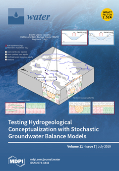
Conceptual uncertainty is considered one of the major sources of uncertainty in groundwater flow modelling. In this regard, hypothesis testing is essential to increase system understanding by refuting alternative hydrogeological conceptual models. Often a stepwise approach to the groundwater modelling workflow, with respect to complexity, is promoted, but hypothesis testing of simple groundwater models is rarely applied. We present an approach to model-based Bayesian hypothesis testing in a simple groundwater balance model, which involves optimization of a model in function of both parameter values and conceptual model through trans-dimensional sampling. View this paper.
  • Issues are regarded as officially published after their release is announced to the table of contents alert mailing list.
  • You may sign up for e-mail alerts to receive table of contents of newly released issues.
  • PDF is the official format for papers published in both, html and pdf forms. To view the papers in pdf format, click on the "PDF Full-text" link, and use the free Adobe Reader to open them.
Order results
Result details
Section
Select all
Export citation of selected articles as:
12 pages, 628 KiB  
Technical Note
Exploring Compatibility of Sherwood-Gilland NAPL Dissolution Models with Micro-Scale Physics Using an Alternative Volume Averaging Approach
by Scott K. Hansen
Water 2019, 11(7), 1525; https://doi.org/10.3390/w11071525 - 23 Jul 2019
Cited by 1 | Viewed by 2449
Abstract
The dynamics of NAPL dissolution into saturated porous media are typically modeled by the inclusion of a reaction term in the advection-dispersion-reaction equation (ADRE) with the reaction rate defined by a Sherwood-Gilland empirical model. This stipulates, among other things, that the dissolution rate [...] Read more.
The dynamics of NAPL dissolution into saturated porous media are typically modeled by the inclusion of a reaction term in the advection-dispersion-reaction equation (ADRE) with the reaction rate defined by a Sherwood-Gilland empirical model. This stipulates, among other things, that the dissolution rate is proportional to a power of the NAPL volume fraction, and also to the difference between the local average aqueous concentration of the NAPL species and its thermodynamic saturation concentration. Solute source models of these sorts are ad hoc and empirically calibrated but have come to see widespread use in contaminant hydrogeology. In parallel, a number of authors have employed the method of volume averaging to derive upscaled transport equations describing the same dissolution and transport phenomena. However, these solutions typically yield forms of equations that are seemingly incompatible with Sherwood-Gilland source models. In this paper, we revisit the compatibility of the two approaches using a radically simplified alternative volume averaging analysis. We begin from a classic micro-scale formulation of the NAPL dissolution problem but develop some new simplification approaches (including a physics-preserving transformation of the domain and a new geometric lemma) which allow us to avoid solving traditional closure boundary value problems. We arrive at a general, volume-averaged governing equation that does not reduce to the ADRE with a Sherwood-Gilland source but find that the two approaches do align under straightforward advection-dominated conditions. Full article
(This article belongs to the Special Issue Water Flow, Solute and Heat Transfer in Groundwater)
Show Figures

Figure 1

14 pages, 2419 KiB  
Article
A Framework for Improving Reliability of Water Distribution Systems Based on a Segment-Based Minimum Cut-Set Approach
by Seokhyeon Kim, Hwan Don Jun, Do Guen Yoo and Joong Hoon Kim
Water 2019, 11(7), 1524; https://doi.org/10.3390/w11071524 - 23 Jul 2019
Cited by 8 | Viewed by 5549
Abstract
A framework is presented to effectively improve the water distribution system (WDS) reliability. The proposed framework first classifies pipes in a WDS into three reinforcement types through topological analyses and hydraulic simulations over the WDS; type 1: no reinforcement, type 2: increasing pipe [...] Read more.
A framework is presented to effectively improve the water distribution system (WDS) reliability. The proposed framework first classifies pipes in a WDS into three reinforcement types through topological analyses and hydraulic simulations over the WDS; type 1: no reinforcement, type 2: increasing pipe durability, and type 3: installing valve(s) at both ends. Then two rules, rules 1 and 2, are implemented, in which rule 1 first reinforces the pipe with the lowest reliability but rule 2 preferentially reduces damage size by pipe failures represented as the expected number of customers out of service (EN). The proposed method was applied to Cherry Hill network, and considerably improved the WDS reliability from 0.137 to 0.483. Both approaches showed notable differences in changes of the EN at each step of reinforcement, where rule 2 showed a better capability to reduce the EN and detect vulnerable areas in the WDS than rule 1. In addition, a practical approach, maximizing valve installations and minimizing pipe replacements according to the reinforcement types in the system, provided an improved WDS reliability (0.423) close to that of the rule-based approach (0.483) using only 21% of the construction cost by the rule-based approach. The proposed framework can be guidelines for improving the WDS reliability under restricted budget and site conditions. Full article
Show Figures

Graphical abstract

17 pages, 4472 KiB  
Article
Fine Sediment Modeling During Storm-Based Events in the River Bandon, Ireland
by Juan T. García and Joseph R. Harrington
Water 2019, 11(7), 1523; https://doi.org/10.3390/w11071523 - 23 Jul 2019
Cited by 2 | Viewed by 2896
Abstract
The River Bandon located in County Cork (Ireland) has been time-continuously monitored by turbidity probes, as well as automatic and manual suspended sediment sampling. The current work evaluates three different models used to estimate the fine sediment concentration during storm-based events over a [...] Read more.
The River Bandon located in County Cork (Ireland) has been time-continuously monitored by turbidity probes, as well as automatic and manual suspended sediment sampling. The current work evaluates three different models used to estimate the fine sediment concentration during storm-based events over a period of one year. The modeled suspended sediment concentration is compared with that measured at an event scale. Uncertainty indices are calculated and compared with those presented in the bibliography. An empirically-based model was used as a reference, as this model has been previously applied to evaluate sediment behavior over the same time period in the River Bandon. Three other models have been applied to the gathered data. First is an empirically-based storm events model, based on an exponential function for calculation of the sediment output from the bed. A statistically-based approach first developed for sewers was also evaluated. The third model evaluated was a shear stress erosion-based model based on one parameter. The importance of considering the fine sediment volume stored in the bed and its consolidation to predict the suspended sediment concentration during storm events is clearly evident. Taking into account dry weather periods and the bed erosion in previous events, knowledge on the eroded volume for each storm event is necessary to adjust the parameters for each model. Full article
(This article belongs to the Section Hydraulics and Hydrodynamics)
Show Figures

Figure 1

17 pages, 2348 KiB  
Article
Removal of Platinum and Palladium from Wastewater by Means of Biosorption on Fungi Aspergillus sp. and Yeast Saccharomyces sp.
by Beata Godlewska-Żyłkiewicz, Sylwia Sawicka and Joanna Karpińska
Water 2019, 11(7), 1522; https://doi.org/10.3390/w11071522 - 23 Jul 2019
Cited by 39 | Viewed by 6138
Abstract
The emission of platinum group metals from different sources has caused elevated concentrations of platinum and palladium in samples of airborne particulate matter, soil, surface waters and sewage sludge. The ability of biomass of Aspergillus sp. and yeast Saccharomyces sp. for removal of [...] Read more.
The emission of platinum group metals from different sources has caused elevated concentrations of platinum and palladium in samples of airborne particulate matter, soil, surface waters and sewage sludge. The ability of biomass of Aspergillus sp. and yeast Saccharomyces sp. for removal of Pt(IV) and Pd(II) from environmental samples was studied in this work. The pH of the solution, the mass of biosorbent, and contact time were optimized. The Langmuir and Freundlich adsorption isotherms and kinetic results were used for interpretation of the process equilibrium of Pt(IV) and Pd(II) on both microorganisms. The maximal efficiency of retention of Pt(IV) on yeast and fungi was obtained at acidic solutions (pH 2.0 for Pt(IV) and pH 2.5–3.5 for Pd(II)). The equilibrium of the biosorption process was attained within 45 min. The best interpretation for the experimental data was given by the Langmuir isotherm. Kinetics of the Pt and Pd adsorption process suit well the pseudo-second-order kinetics model. Fungi Aspergillus sp. shows higher adsorption capacity for both metals than yeast Saccharomyces sp. The maximum adsorption capacity of fungi was 5.49 mg g−1 for Pt(IV) and 4.28 mg g−1 for Pd(II). The fungi possess the ability for efficient removal of studied ions from different wastewater samples (sewage and road run-off water). It was also demonstrated, that quantitative recovery of Pd from industrial wastes could be obtained by biosorption using Aspergillus sp. Full article
(This article belongs to the Special Issue Removal of Organic Pollution in Water Environment)
Show Figures

Figure 1

11 pages, 2129 KiB  
Article
Design and Bench-Scale Hydrodynamic Testing of Thin-Layer Wavy Photobioreactors
by Monica Moroni, Simona Lorino, Agnese Cicci and Marco Bravi
Water 2019, 11(7), 1521; https://doi.org/10.3390/w11071521 - 23 Jul 2019
Cited by 8 | Viewed by 3404
Abstract
In a thin-volume photobioreactor where a concentrated suspension of microalgae is circulated throughout the established spatial irradiance gradient, microalgal cells experience a time-variable irradiance. Deploying this feature is the most convenient way of obtaining the so-called “flashing light” effect, improving biomass production in [...] Read more.
In a thin-volume photobioreactor where a concentrated suspension of microalgae is circulated throughout the established spatial irradiance gradient, microalgal cells experience a time-variable irradiance. Deploying this feature is the most convenient way of obtaining the so-called “flashing light” effect, improving biomass production in high irradiance. This work investigates the light flashing features of sloping wavy photobioreactors, a recently proposed type, by introducing and validating a computational fluid dynamics (CFD) model. Two characteristic flow zones (straight top-to-bottom stream and local recirculation stream), both effective toward light flashing, have been found and characterized: a recirculation-induced frequency of 3.7 Hz and straight flow-induced frequency of 5.6 Hz were estimated. If the channel slope is increased, the recirculation area becomes less stable while the recirculation frequency is nearly constant with flow rate. The validated CFD model is a mighty tool that could be reliably used to further increase the flashing frequency by optimizing the design, dimensions, installation, and operational parameters of the sloping wavy photobioreactor. Full article
(This article belongs to the Special Issue Integration of Microalgal Based Processes in Wastewater Treatment)
Show Figures

Graphical abstract

19 pages, 4447 KiB  
Article
Parameters Estimation and Prediction of Water Movement and Solute Transport in Layered, Variably Saturated Soils Using the Ensemble Kalman Filter
by Zheng Jiang, Quanzhong Huang, Gendong Li and Guangyong Li
Water 2019, 11(7), 1520; https://doi.org/10.3390/w11071520 - 22 Jul 2019
Cited by 7 | Viewed by 3465
Abstract
The parameters of water movement and solute transport models are essential for the accurate simulation of soil moisture and salinity, particularly for layered soils in field conditions. Parameter estimation can be achieved using the inverse modeling method. However, this type of method cannot [...] Read more.
The parameters of water movement and solute transport models are essential for the accurate simulation of soil moisture and salinity, particularly for layered soils in field conditions. Parameter estimation can be achieved using the inverse modeling method. However, this type of method cannot fully consider the uncertainties of measurements, boundary conditions, and parameters, resulting in inaccurate estimations of parameters and predictions of state variables. The ensemble Kalman filter (EnKF) is well-suited to data assimilation and parameter prediction in Situations with large numbers of variables and uncertainties. Thus, in this study, the EnKF was used to estimate the parameters of water movement and solute transport in layered, variably saturated soils. Our results indicate that when used in conjunction with the HYDRUS-1D software (University of California Riverside, California, CA, USA) the EnKF effectively estimates parameters and predicts state variables for layered, variably saturated soils. The assimilation of factors such as the initial perturbation and ensemble size significantly affected in the simulated results. A proposed ensemble size range of 50–100 was used when applying the EnKF to the highly nonlinear hydrological models of the present study. Although the simulation results for moisture did not exhibit substantial improvement with the assimilation, the simulation of the salinity was significantly improved through the assimilation of the salinity and relative solutetransport parameters. Reducing the uncertainties in measured data can improve the goodness-of-fit in the application of the EnKF method. Sparse field condition observation data also benefited from the accurate measurement of state variables in the case of EnKF assimilation. However, the application of the EnKF algorithm for layered, variably saturated soils with hydrological models requires further study, because it is a challenging and highly nonlinear problem. Full article
(This article belongs to the Section Hydrology)
Show Figures

Figure 1

14 pages, 2910 KiB  
Article
Quantitative Assessment of the Influences of Three Gorges Dam on the Water Level of Poyang Lake, China
by Dan Wang, Shuanghu Zhang, Guoli Wang, Qiaoqian Han, Guoxian Huang, Hao Wang, Yin Liu and Yanping Zhang
Water 2019, 11(7), 1519; https://doi.org/10.3390/w11071519 - 22 Jul 2019
Cited by 26 | Viewed by 4231
Abstract
Lakes are important for global ecological balance and provide rich biological and social resources. However, lake systems are sensitive to climate change and anthropogenic activities. Poyang Lake is an important wetland in the middle reach of the Yangtze River, China and has a [...] Read more.
Lakes are important for global ecological balance and provide rich biological and social resources. However, lake systems are sensitive to climate change and anthropogenic activities. Poyang Lake is an important wetland in the middle reach of the Yangtze River, China and has a complicated interaction with the Yangtze River. In recent years, the water level of Poyang Lake was altered dramatically, in particular showing a significant downward trend after the operation of the Three Gorges Dam (TGD) in 2003, thus seriously affecting the lake wetland ecosystem. The operation of the TGD changed both the hydrological regime and the deeper channel in the middle reach of the Yangtze River, and affected the river–lake system between the Yangtze River and Poyang Lake. This study analyzed the change in the water level of Poyang Lake and quantified the contributions of the TGD operation, from the perspectives of water storage and erosion of the deeper channel in the middle reach of the Yangtze River, through hydrodynamic model simulation. The erosion of the deeper channel indicated a significant decrease in annual water level. However, due to the water storage of the TGD in September and October, the discharge in the Yangtze River sharply decreased and the water level of Poyang Lake was largely affected. Especially in late September, early October, and mid-October, the contributions of water storage of the TGD to the decline in the water level of Poyang Lake respectively reached 68.85%, 59.04%, and 54.88%, indicating that the water storage of the TGD was the main factor in the decrease in water level. The erosion of the deeper channel accelerated the decline of the water level of Poyang Lake and led to about 10% to 20% of the decline of water level in September and October. Due to the combined operation of the TGD and more reservoirs under construction in the upper TGD, the long-term and irreversible influence of the TGD on Poyang Lake should be further explored in the future. Full article
(This article belongs to the Special Issue Environmental Hydraulics Research)
Show Figures

Figure 1

19 pages, 441 KiB  
Review
The Elusive Quest for Valuation of Coastal and Marine Ecosystem Services
by J. Walter Milon and Sergio Alvarez
Water 2019, 11(7), 1518; https://doi.org/10.3390/w11071518 - 22 Jul 2019
Cited by 17 | Viewed by 4294
Abstract
Coastal and marine ecosystem (CME) services provide benefits to people through direct goods and services that may be harvested or enjoyed in situ and indirect services that regulate and support biological and geophysical processes now and in the future. In the past two [...] Read more.
Coastal and marine ecosystem (CME) services provide benefits to people through direct goods and services that may be harvested or enjoyed in situ and indirect services that regulate and support biological and geophysical processes now and in the future. In the past two decades, there has been an increase in the number of studies and journal articles designed to measure the economic value of the world’s CME services, although there is significantly less published research than for terrestrial ecosystems. This article provides a review of the literature on valuation of CME services along with a discussion of the theoretical and practical challenges that must be overcome to utilize valuation results in CME policy and planning at local, regional, and global scales. The review reveals that significant gaps exist in research and understanding of the broad range of CME services and their economic values. It also raises questions about the validity of aggregating ecosystem services as independent components to determine the value of a biome when there is little understanding of the relationships and feedbacks between ecosystems and the services they produce. Finally, the review indicates that economic valuation of CME services has had a negligible impact on the policy process in four main regions around the world. An alternative direction for CME services research would focus on valuing the world’s CME services in a wealth accounting framework. Full article
(This article belongs to the Special Issue Coastal Resources Economics and Ecosystem Valuation)
17 pages, 5980 KiB  
Article
Integral Flow Modelling Approach for Surface Water-Groundwater Interactions along a Rippled Streambed
by Tabea Broecker, Katharina Teuber, Vahid Sobhi Gollo, Gunnar Nützmann, Jörg Lewandowski and Reinhard Hinkelmann
Water 2019, 11(7), 1517; https://doi.org/10.3390/w11071517 - 22 Jul 2019
Cited by 16 | Viewed by 5039
Abstract
Exchange processes of surface and groundwater are important for the management of water quantity and quality as well as for the ecological functioning. In contrast to most numerical simulations using coupled models to investigate these processes, we present a novel integral formulation for [...] Read more.
Exchange processes of surface and groundwater are important for the management of water quantity and quality as well as for the ecological functioning. In contrast to most numerical simulations using coupled models to investigate these processes, we present a novel integral formulation for the sediment-water-interface. The computational fluid dynamics (CFD) model OpenFOAM was used to solve an extended version of the three-dimensional Navier–Stokes equations which is also applicable in non-Darcy-flow layers. Simulations were conducted to determine the influence of ripple morphologies and surface hydraulics on the flow processes within the hyporheic zone for a sandy and for a gravel sediment. In- and outflowing exchange fluxes along a ripple were determined for each case. The results indicate that larger grain size diameters, as well as ripple distances, increased hyporheic exchange fluxes significantly. For higher ripple dimensions, no clear relationship to hyporheic exchange was found. Larger ripple lengths decreased the hyporheic exchange fluxes due to less turbulence between the ripples. For all cases with sand, non-Darcy-flow was observed at an upper layer of the ripple, whereas for gravel non-Darcy-flow was recognized nearly down to the bottom boundary. Moreover, the sediment grain sizes influenced also the surface water flow significantly. Full article
(This article belongs to the Special Issue Groundwater-Surface Water Interactions)
Show Figures

Figure 1

15 pages, 1665 KiB  
Article
Rice Cultivation without Synthetic Fertilizers and Performance of Microbial Fuel Cells (MFCs) under Continuous Irrigation with Treated Wastewater
by Dong Duy Pham, Kei Cai, Luc Duc Phung, Nobuo Kaku, Atsushi Sasaki, Yuka Sasaki, Kenichi Horiguchi, Dung Viet Pham and Toru Watanabe
Water 2019, 11(7), 1516; https://doi.org/10.3390/w11071516 - 22 Jul 2019
Cited by 11 | Viewed by 4865
Abstract
To obtain a high rice yield and quality for animal feed without synthetic fertilizers, an experiment with bench-scale apparatus was conducted by applying continuous irrigation with treated municipal wastewater (TWW). Uniform rice seedlings of a high-yield variety (Oryza sativa L., cv. Bekoaoba) [...] Read more.
To obtain a high rice yield and quality for animal feed without synthetic fertilizers, an experiment with bench-scale apparatus was conducted by applying continuous irrigation with treated municipal wastewater (TWW). Uniform rice seedlings of a high-yield variety (Oryza sativa L., cv. Bekoaoba) were transplanted in five treatments to examine different TWW irrigation directions (“bottom-to-top” and “top-to-top” irrigation) and fertilization practices (with and without P-synthetic fertilizers) as well as one control that simulated the irrigation and fertilization management of normal paddy fields. The highest rice yield (14.1 t ha−1), shoot dry mass (12.9 t ha−1), and protein content in brown rice (14.6%) were achieved using bottom-to-top irrigation, although synthetic fertilizers were not applied. In addition, this subsurface irrigation system could contribute to environmental protection by removing 85–90% of nitrogen from TWW more effectively than the top-to-top irrigation, which showed a removal efficiency of approximately 63%. No accumulation of heavy metals (Fe, Mn, Cu, Zn, Cd, Ni, Pb, Cr, and As) in the paddy soils was observed after TWW irrigation for five months, and the contents of these metals in the harvested brown rice were lower than the permissible limits recommended by international standards. A microbial fuel cell system (MFC) was installed in the cultivation system using graphite-felt electrodes to test the capacity of electricity generation; however, the electricity output was much lower than that reported in normal paddy fields. Bottom-to-top irrigation with TWW can be considered a potential practice to meet both water and nutrient demand for rice cultivation in order to achieve a very high yield and nutritional quality of cultivated rice without necessitating the application of synthetic fertilizers. Full article
(This article belongs to the Special Issue Insights on the Water–Energy–Food Nexus)
Show Figures

Figure 1

19 pages, 8206 KiB  
Article
Experimental Investigation of Local Scour Protection for Cylindrical Bridge Piers Using Anti-Scour Collars
by Shunyi Wang, Kai Wei, Zhonghui Shen and Qiqi Xiang
Water 2019, 11(7), 1515; https://doi.org/10.3390/w11071515 - 21 Jul 2019
Cited by 55 | Viewed by 6401
Abstract
Local scour of bridge piers is one of the main threats responsible for bridge damage. Adopting scour countermeasures to protect bridge foundations from scour has become an important issue for the design and maintenance of bridges located in erodible sediment beds. This paper [...] Read more.
Local scour of bridge piers is one of the main threats responsible for bridge damage. Adopting scour countermeasures to protect bridge foundations from scour has become an important issue for the design and maintenance of bridges located in erodible sediment beds. This paper focuses on the protective effect of one active countermeasure named an “anti-scour collar” on local scour around the commonly used cylindrical bridge pier. A cylindrical pier model was set up in a current flume. River sand with a median particle size of 0.324 mm was selected and used as the sediment in the basin. A live-bed scour experimental program was carried out to study the protective effect of an anti-scour collar by comparing the local scour at a cylindrical bridge pier model with and without collar. The effects of three design parameters including collar installation height, collar external diameter and collar protection range, on the scour depth and scour development were investigated parametrically. According to the experimental results, it can be concluded that: the application of an anti-scour collar alleviates the local scour at the pier effectively; and the protection effect decreases with an increase in the collar installation height, but increases with an increase in the collar external diameter and the protection range. Design suggestions for improving the scour protective effect of the anti-scour collar are summarized and of great practical guiding significance to the development of anti-scour collars for bridge piers. Full article
(This article belongs to the Special Issue Experimental, Numerical and Field Approaches to Scour Research)
Show Figures

Figure 1

11 pages, 1349 KiB  
Article
Raindrop Energy Impact on the Distribution Characteristics of Splash Aggregates of Cultivated Dark Loessial Cores
by Yu Fu, Guanglu Li, Dong Wang, Tenghui Zheng and Mingxi Yang
Water 2019, 11(7), 1514; https://doi.org/10.3390/w11071514 - 21 Jul 2019
Cited by 14 | Viewed by 3529
Abstract
To determine the effect of different rainfall energy levels on the breakdown of soil aggregates, this study analyzed the soil splash erosion amounts and the distribution of particle sizes under six rainfall conditions (rainfall energy: 2.41 × 10⁻⁵–22.4 × 10⁻⁵ [...] Read more.
To determine the effect of different rainfall energy levels on the breakdown of soil aggregates, this study analyzed the soil splash erosion amounts and the distribution of particle sizes under six rainfall conditions (rainfall energy: 2.41 × 10⁻⁵–22.4 × 10⁻⁵ J m−2 s−1 and 1.29 × 10⁻⁴ J m−2 s−1) at five splash distances (from 0–10 cm to 40–50 cm). Cores of the size 10 × 20 cm of undisturbed cultivated dark loessial soil were selected in tree replicates as the research subject. The results indicated that splashed aggregates were distributed mainly at splash distances of 0–20 cm, which accounted for 66%–90% of the total splash erosion amount. The splash erosion amount significantly decreased exponentially with increasing splash distance for the same rainfall energy (p < 0.01). The splash erosion amount significantly increased in the power function relationship with increasing rainfall energy at the same splash distance (p < 0.05). A model was obtained to predict the splash erosion amount for rainfall energy and splash distance. The fractal dimension (D) of the aggregates showed a downward opening parabolic relationship with raindrop energy. The maximal value of the rainfall energy was 1.286 × 10⁻⁴ J m−2 s−1, which broke the aggregates to the largest degree. Enrichment ratio (ER) values for fragments >2 mm were close to 0. A particle size of 0.25 mm was the critical particle level for splash erosion. Full article
(This article belongs to the Special Issue Rainfall Erosivity in Soil Erosion Processes)
Show Figures

Figure 1

9 pages, 1390 KiB  
Article
Cold Plasma Treatment for Efficient Control over Algal Bloom Products in Surface Water
by Hee-Jun Kim, Gui-Sook Nam, Jung-Seok Jang, Chan-Hee Won and Hyun-Woo Kim
Water 2019, 11(7), 1513; https://doi.org/10.3390/w11071513 - 21 Jul 2019
Cited by 20 | Viewed by 6119
Abstract
Algal bloom significantly alters the physicochemical properties of water due to drastic pH change, dissolved oxygen depletion/super-saturation, and toxicity, which lead to ecosystem destruction. To prevent this, this study evaluated the reduction performance of algal biomass by applying a non-thermal or cold plasma [...] Read more.
Algal bloom significantly alters the physicochemical properties of water due to drastic pH change, dissolved oxygen depletion/super-saturation, and toxicity, which lead to ecosystem destruction. To prevent this, this study evaluated the reduction performance of algal biomass by applying a non-thermal or cold plasma process. We used chlorophyll-a (chl-a), suspended solids (SS), and turbidity as indicators of the biomass. Results demonstrated that their removal efficiencies were in the ranges 88–98%, 70%–90%, and 53%–91%, respectively. Field emission scanning electron microscopy indicated how the cell wall of microalgae was destroyed by cold plasma. Also, the removal kinetics of cold plasma confirmed the enhanced removal rate constants. The estimated required times for 99% removal were 0.4–1.2 d (chl-a), 1.3–3.4 d (SS), and 1.6–6.2 d (turbidity), respectively. Overall, cold plasma could be a useful option to effectively treat pollution associated with algal bloom in surface water. Full article
(This article belongs to the Section Wastewater Treatment and Reuse)
Show Figures

Figure 1

11 pages, 1372 KiB  
Article
Effects of Artificial LED Light on the Growth of Three Submerged Macrophyte Species during the Low-Growth Winter Season: Implications for Macrophyte Restoration in Small Eutrophic Lakes
by Chao Xu, Hai-Jun Wang, Qing Yu, Hong-Zhu Wang, Xiao-Min Liang, Miao Liu and Erik Jeppesen
Water 2019, 11(7), 1512; https://doi.org/10.3390/w11071512 - 21 Jul 2019
Cited by 14 | Viewed by 3407 | Correction
Abstract
Eutrophication of lakes is becoming a global environmental problem, leading to, among other things, rapid reproduction of phytoplankton, increased turbidity, loss of submerged macrophytes, and the recovery of these plants following nutrient loading reduction is often delayed. Artificial light supplement could potentially be [...] Read more.
Eutrophication of lakes is becoming a global environmental problem, leading to, among other things, rapid reproduction of phytoplankton, increased turbidity, loss of submerged macrophytes, and the recovery of these plants following nutrient loading reduction is often delayed. Artificial light supplement could potentially be a useful method to help speeding up recovery. In this study, three common species of submerged macrophytes, Vallisneria natans, Myriophyllum spicatum and Ceratophyllum demersum, were exposed to three LED light treatments (blue, red and white) and shaded (control) for 100 days (from 10 November 2016 to 18 January 2017) in 12 tanks holding 800 L of water. All the three LED light treatments promoted growth of the three macrophyte species in terms of shoot number, length and dry mass. The three light treatments differed in their effects on the growth of the plants; generally, the red light had the strongest promoting effects, followed by blue and white. The differences in light effects may be caused by the different photosynthetic photon flux density (PPFD) of the lights, as indicated by an observed relationship of PPFD with the growth variables. The three species also responded differently to the light treatments, V. natans and C. demersum showing higher growth than M. spicatum. Our findings demonstrate that artificial light supplement in the low-growth winter season can promote growth and recovery of submerged macrophytes and hence potentially enhance their competitiveness against phytoplankton in the following spring. More studies, however, are needed to elucidate if LED light treatment is a potential restoration method in small lakes, when the growth of submerged macrophytes are delayed following a sufficiently large external nutrient loading reduction for a shift to a clear macrophyte state to have a potential to occur. Our results may also be of relevance when elucidating the role of artificial light from cities on the ecosystem functioning of lakes in urban areas. Full article
(This article belongs to the Section Water Quality and Contamination)
Show Figures

Graphical abstract

13 pages, 1298 KiB  
Article
Assessing Reclaimed Urban Wastewater for Reuse in Agriculture: Technical and Economic Concerns for Mediterranean Regions
by Giacomo Giannoccaro, Stefania Arborea, Bernardo C. de Gennaro, Vito Iacobellis and A. Ferruccio Piccinni
Water 2019, 11(7), 1511; https://doi.org/10.3390/w11071511 - 21 Jul 2019
Cited by 24 | Viewed by 3670
Abstract
Direct reuse of treated wastewater can offer a realistic supply alternative for irrigation in Mediterranean areas. In this study, we conducted a spatial cost-benefit analysis to quantify and locate the volume of technically and economically feasible and readily available reclaimed urban wastewater. We [...] Read more.
Direct reuse of treated wastewater can offer a realistic supply alternative for irrigation in Mediterranean areas. In this study, we conducted a spatial cost-benefit analysis to quantify and locate the volume of technically and economically feasible and readily available reclaimed urban wastewater. We considered the case of Puglia (Italy) and the results are discussed in terms of the implications for policy-making and pointing out future research needs. The results showed that the main technical barrier is the shortness of the irrigation season. On the other hand, the main economic concern is related to filtration followed by lack of conveyance systems. While our results are based on estimates, future research should try to include practical experiments based on actual data. Further research should also address the issue of transaction costs by establishing the obligations of wastewater treatment plants to deliver reclaimed water to farmers. Full article
Show Figures

Figure 1

23 pages, 919 KiB  
Article
Development of a Contaminant Distribution Model for Water Supply Systems
by Oluwaseye S. Adedoja, Yskandar Hamam, Baset Khalaf and Rotimi Sadiku
Water 2019, 11(7), 1510; https://doi.org/10.3390/w11071510 - 21 Jul 2019
Cited by 4 | Viewed by 2829
Abstract
Water contamination can result in serious health complications and gross socioeconomic implications. Therefore, identifying the source of contamination is of great concern to researchers and water operators, particularly, to avert the unfavorable consequences that can ensue from consuming contaminated water. As part of [...] Read more.
Water contamination can result in serious health complications and gross socioeconomic implications. Therefore, identifying the source of contamination is of great concern to researchers and water operators, particularly, to avert the unfavorable consequences that can ensue from consuming contaminated water. As part of the effort to address this challenge, this present study proposes a novel contaminant distribution model for water supply systems. The concept of superimposing the contaminant over the hydraulic analysis was used to develop the proposed model. Four water sample networks were used to test the performance of the proposed model. The results obtained displayed the contaminant distributions across the water network at a limited computational time. Apart from being the first in this domain, the significant reduction of computational time achieved by the proposed model is a major contribution to the field. Full article
(This article belongs to the Section Water Quality and Contamination)
Show Figures

Figure 1

17 pages, 1776 KiB  
Article
Net Fisheries’ Métiers in the Eastern Mediterranean: Insights for Small-Scale Fishery Management on Kalymnos Island
by Kyriakoula Roditi and Dimitris Vafidis
Water 2019, 11(7), 1509; https://doi.org/10.3390/w11071509 - 21 Jul 2019
Cited by 9 | Viewed by 3672
Abstract
Small-scale fisheries constitute an important component of coastal human societies. The present study describes the small-scale net fisheries on Kalymnos Island (south-east Aegean Sea) that harbors the largest small-scale fleet in the eastern Mediterranean Sea. In addition, this study aims to evaluate their [...] Read more.
Small-scale fisheries constitute an important component of coastal human societies. The present study describes the small-scale net fisheries on Kalymnos Island (south-east Aegean Sea) that harbors the largest small-scale fleet in the eastern Mediterranean Sea. In addition, this study aims to evaluate their characteristics and economics. Relevant métiers were identified through a multivariate analysis by inputting the main resources and fishing gear data that were recorded during landings. Four main practices were observed being used as fishing gears, gillnets and trammel nets, targeting the species Mullus barbatus, Boops boops, Mullus surmuletus, Scorpaena porcus, and Sepia officinalis. Further analysis, which incorporated data concerning the type of the gear used, revealed 11 distinct métiers. Most of these métiers are practiced by other Mediterranean small-scale fisheries as well, in terms of target species, gear and seasonality. However, the métier that had its target species as B.boops is not practiced in other Mediterranean small-scale fisheries. The seasonal rotation of métiers was determined by the availability of different species rather than their market price. The results revealed the difference in fishing practice used by the fishermen in the study area compared to other fishing practices in the Mediterranean Sea. In particular, the fishermen of this study area targeted more species (B.boops) with a very low market price. They also provided essential information for the development and implementation of management plans aiming at the sustainability of small-scale fisheries. Full article
(This article belongs to the Special Issue Selected Papers from HydroMediT 2018)
Show Figures

Figure 1

11 pages, 3119 KiB  
Article
Middleware to Operate Smart Photovoltaic Irrigation Systems in Real Time
by Rafael González Perea, Aida Mérida García, Irene Fernández García, Emilio Camacho Poyato, Pilar Montesinos and Juan Antonio Rodríguez Díaz
Water 2019, 11(7), 1508; https://doi.org/10.3390/w11071508 - 21 Jul 2019
Cited by 7 | Viewed by 3654
Abstract
Climate change, water scarcity and higher energy requirements and electric tariff compromises the continuity of the irrigated agriculture. Precision agriculture (PA) or renewable energy sources which are based on communication and information technologies and a large amount of data are key to ensuring [...] Read more.
Climate change, water scarcity and higher energy requirements and electric tariff compromises the continuity of the irrigated agriculture. Precision agriculture (PA) or renewable energy sources which are based on communication and information technologies and a large amount of data are key to ensuring this economic activity and guaranteeing food security at the global level. Several works which are based on the use of PA and renewable energy sources have been developed in order to optimize different variables of irrigated agriculture such as irrigation scheduling. However, the large amount of technologies and sensors that these models need to be implemented are still far from being easily accessible and usable by farmers. In this way, a middleware called Real time Smart Solar Irrigation Manager (RESSIM) has been developed in this work and implemented in MATLABTM with the aim to provide to farmers a user-friendly tool for the daily making decision process of irrigation scheduling using a smart photovoltaic irrigation management module. RESSIM middleware was successfully tested in a real field during a full irrigation season of olive trees using a real smart photovoltaic irrigation system. Full article
(This article belongs to the Special Issue Optimization of Irrigation Scheduling: Challenges and Perspectives)
Show Figures

Figure 1

19 pages, 5337 KiB  
Article
Low-End Probabilistic Sea-Level Projections
by Gonéri Le Cozannet, Rémi Thiéblemont, Jeremy Rohmer, Déborah Idier, Jean-Charles Manceau and Robin Quique
Water 2019, 11(7), 1507; https://doi.org/10.3390/w11071507 - 20 Jul 2019
Cited by 16 | Viewed by 5880
Abstract
In the area of sea-level rise, recent research has focused on assessing either likely or high end future sea levels, but less attention has been given to “low-end” sea-level projections, exploring best-case potential sea-level changes and providing the basis for estimating minimum adaptation [...] Read more.
In the area of sea-level rise, recent research has focused on assessing either likely or high end future sea levels, but less attention has been given to “low-end” sea-level projections, exploring best-case potential sea-level changes and providing the basis for estimating minimum adaptation needs. Here, we provide global and regional probabilistic sea-level projections using conservative projections of glaciers and ice-sheets melting and a selection of models from the Coupled Model Intercomparison Project phase 5 (CMIP5) delivering moderate thermal expansion. Our low-end sea-level projections are higher than previously estimated because they rely on modeling outcomes only, and do not add any expert judgement, aiming essentially at delivering more realistic upper tails. While there are good reasons to believe that our projections are excessively optimistic, they can be used as low-end sea-level projections in order to inform users with low aversion to uncertainty. Our low-end sea-level projection exceeds 0.5 m along most inhabited coasts by 2100 for business as usual greenhouse gas emissions (RCP8.5), which is relevant for adaptation practitioners as long as efficient climate change mitigation policies are not implemented. This means that without efficient climate mitigation, an acceleration of sea-level rise can hardly be avoided during the 21st century. Full article
(This article belongs to the Special Issue Past, Present and Future Trends in Sea Level Change)
Show Figures

Figure 1

18 pages, 11610 KiB  
Article
Identifying a Suitable Model for Low-Flow Simulation in Watersheds of South-Central Chile: A Study Based on a Sensitivity Analysis
by Víctor Parra, Jose Luis Arumí and Enrique Muñoz
Water 2019, 11(7), 1506; https://doi.org/10.3390/w11071506 - 20 Jul 2019
Cited by 14 | Viewed by 4585
Abstract
Choosing a model that suitably represents the characteristics of a watershed to simulate low flows is crucial, especially in watersheds whose main source of baseflow generation depends on groundwater storage and release. The goal of this investigation is to study the performance and [...] Read more.
Choosing a model that suitably represents the characteristics of a watershed to simulate low flows is crucial, especially in watersheds whose main source of baseflow generation depends on groundwater storage and release. The goal of this investigation is to study the performance and representativeness of storage-release process modeling, considering aspects such as the topography and geology of the modeled watershed through regional sensitivity analysis, in order to improve low-flow prediction. To this end, four groundwater storage-release structures in various watersheds with different geological (fractured and sedimentary rock) and topographic domains (steep and gentle slopes) were analyzed. The results suggest that the two-reservoir structure with three runoff responses is suitable (better) for simulating low flows in watersheds with fractured geological characteristics and rugged or steep topography. The results also indicate that a one-reservoir model can be adequate for predicting low flows in watersheds with a sedimentary influence or flat topography. Full article
(This article belongs to the Special Issue Hydrologic Modelling for Water Resources and River Basin Management)
Show Figures

Figure 1

18 pages, 983 KiB  
Article
Assessing the Self-Purification Capacity of Surface Waters in Lake Baikal Watershed
by Mikhail Yu. Semenov, Yuri M. Semenov, Anton V. Silaev and Larisa A. Begunova
Water 2019, 11(7), 1505; https://doi.org/10.3390/w11071505 - 20 Jul 2019
Cited by 17 | Viewed by 7269
Abstract
The removal of trace metals (TM), dissolved organic carbon (DOC), mineral nitrogen (Nmin.), and polycyclic aromatic hydrocarbons (PAHs) from the water of Lake Baikal and its tributaries was evaluated. The contaminant removal rate (CRR) and the contaminant removal capacity (CRC) were [...] Read more.
The removal of trace metals (TM), dissolved organic carbon (DOC), mineral nitrogen (Nmin.), and polycyclic aromatic hydrocarbons (PAHs) from the water of Lake Baikal and its tributaries was evaluated. The contaminant removal rate (CRR) and the contaminant removal capacity (CRC) were used as water self-purification parameters. The CRR was calculated as the difference between contaminant mass flow rates at downstream and upstream gauging stations. The CRC was calculated as the quotient of the CRR and the change in water discharge between downstream and upstream gauging stations. Whether the CRR and CRC have positive or negative values depends on whether contaminant release or removal occurs in the water body. The CRR depends on the size of the water body. The lowest and the highest CRRs observed for Baikal were equal to −15 mg/s (PAHs) to −7327 g/s (DOC), whereas the highest PAH and DOC removal rates observed for Selenga River (the major Baikal tributary) in summer were equal to −9 mg/s and −3190 g/s correspondingly. The highest PAH and DOC removal rates observed for small tributaries were equal to 0.0004 mg/s and −0.7 g/s respectively. The amplitude of annual CRR oscillations depends on contaminant abundance. The highest amplitude was typical for most abundant contaminants such as Nmin. and DOC. In unpolluted sections of the Selenga River the highest rates of N and C removal (−85 g/s and −3190 g/s, respectively) were observed in summer and the lowest rates (4 g/s and 3869 g/s, respectively) were observed in the spring. The lowest amplitude was typical for PAHs and some low-abundance TM such as V and Ni. The highest summer rates of V and Ni removal were equal to −378 mg/s and −155 mg/s respectively, whereas lowest spring rates are equal to 296 mg/s and 220 mg/s. The intermediate CRR amplitudes were typical for most abundant TM such as Sr, Al, and Fe. The spatial CRR variability depends on water chemistry and the presence of pollution sources. The lowest (up to 38 g/s) rates of Nmin. removal was observed for polluted lower Selenga sections characterized by low water mineralization and high DOC concentrations. The highest rates (−85 g/s) were observed for unpolluted upper sections. Seepage loss from the river to groundwater was also recognized as an important means of contaminant removal. The CRC values depend mostly on water residence time. The DOC removing capacity value of Baikal (−26 g/m3) were lower than those of Selenga in summer (−35 g/m3) but higher than the CRCs of all tributaries during the other seasons (from 30 mg/m3 to −10 g/m3). Full article
Show Figures

Figure 1

12 pages, 3039 KiB  
Article
Effect of Water Column Stability on Surface Chlorophyll and Time Lags under Different Nutrient Backgrounds in a Deep Reservoir
by Min Zhang, Zhipan Niu, Qinghua Cai, Yaoyang Xu and Xiaodong Qu
Water 2019, 11(7), 1504; https://doi.org/10.3390/w11071504 - 20 Jul 2019
Cited by 11 | Viewed by 3440
Abstract
Hydrodynamic conditions are considered to be very important in the control of algal blooms. Weekly or daily measurements may miss some important events in the hydrodynamic process, resulting in inaccurate evaluations of the impacts of hydrodynamics on phytoplankton. In this study, high-frequency (15-min [...] Read more.
Hydrodynamic conditions are considered to be very important in the control of algal blooms. Weekly or daily measurements may miss some important events in the hydrodynamic process, resulting in inaccurate evaluations of the impacts of hydrodynamics on phytoplankton. In this study, high-frequency (15-min interval) measurements were used to analyze the effect of water column stability on surface chlorophyll a (Chl a) and lag time under different nutrient backgrounds during a cyanobacterial bloom in the Three Gorges Reservoir, China. Cross-correlation analysis between the relative water column stability (RWCS) and Chl a was performed at different stages. The results showed that the RWCS above the euphotic depth influenced the surface Chl a concentration most significantly. A lower RWCS (<20) limited the increase in the Chl a concentration, and a higher RWCS caused a significant increase in Chl a only when nutrients were not limited (TN/TP < 29) and light and temperature conditions were suitable. It took a short time for a higher RWCS to significantly increase the surface Chl a concentration compared with a lower RWCS. When the waterbody had a very low Chl a concentration (almost 0), approximately 2 days were needed to significantly increase the Chl a concentration, while approximately only half an hour was needed when the background concentration of Chl a was slightly higher. During the bloom period, a decline in the RWCS significantly decreased the Chl a in a very short time (approximately half an hour). Reducing the water column stability could be a good approach to control cyanobacterial blooms. Full article
(This article belongs to the Section Water Quality and Contamination)
Show Figures

Figure 1

13 pages, 1289 KiB  
Article
Improving Yield and Quality of Processing Tomato (Lycopersicon esculentum Miller) Using Alternate Partial Root-Zone Drip Irrigation in Arid Northwest China
by Di Zhao, Zhenhua Wang, Jinzhu Zhang, Wenhao Li and Bo Zhou
Water 2019, 11(7), 1503; https://doi.org/10.3390/w11071503 - 20 Jul 2019
Cited by 8 | Viewed by 3756
Abstract
Processing tomato is one of the most important economic crops in Xinjiang, China, which was constrained with severe water shortage and extreme arid climate. Alternate partial root-zone irrigation (APRI) may provide an effective way to increase irrigation water use efficiency (iWUE) without yield [...] Read more.
Processing tomato is one of the most important economic crops in Xinjiang, China, which was constrained with severe water shortage and extreme arid climate. Alternate partial root-zone irrigation (APRI) may provide an effective way to increase irrigation water use efficiency (iWUE) without yield reduction. However, limited studies concerned about applying APRI in processing tomato plantation have been done, especially combined with drip irrigation to further control the irrigation and improve iWUE. Therefore, the two-year pot experiments were conducted to study the effects of different irrigation treatments, including three APRI treatments (irrigation quota of 67.5, 51.6, and 43.7 mm, respectively), fixed partial root-zoon drip irrigation (FPRI, 67.5 mm) and conventional drip irrigation (CDI, 67.5 mm). The results indicated that APRI was an appropriate irrigation method in processing tomato plantation in arid desert area such as Xinjiang, as high irrigation quota of APRI (APRIH) significantly improved its yield without fruit quality reduction in comparison with those of CDI. However, the yield without fruit quality of FPRI significantly decreased. Even if the irrigation quota of APRI decreased to the medium level (APRIM, 51.6 mm), iWUE by increased 31.8–32.7% on the contrary, as irrigation water was saved by 23.6%; while keeping the yield and fruit quality. Therefore, APRIM is recommended for processing tomato plantation in arid northwest China, to increase plant growth, fruit quality, yield, and iWUE synergistically. Full article
(This article belongs to the Section Water Resources Management, Policy and Governance)
Show Figures

Figure 1

15 pages, 3346 KiB  
Article
Modelling Actual and Future Seawater Intrusion in the Variconi Coastal Wetland (Italy) Due to Climate and Landscape Changes
by Micòl Mastrocicco, Gianluigi Busico, Nicolò Colombani, Marco Vigliotti and Daniela Ruberti
Water 2019, 11(7), 1502; https://doi.org/10.3390/w11071502 - 19 Jul 2019
Cited by 49 | Viewed by 5128
Abstract
Coastal freshwater resources are commonly under high risk of being contaminated from seawater. The main processes that affect seawater intrusion are groundwater overexploitation, land use change, and climate change effects. In this context coastal lagoons represent the more sensitive environments prone to seawater [...] Read more.
Coastal freshwater resources are commonly under high risk of being contaminated from seawater. The main processes that affect seawater intrusion are groundwater overexploitation, land use change, and climate change effects. In this context coastal lagoons represent the more sensitive environments prone to seawater intrusion. Numerical modelling is a useful tool to understand and predict seawater intrusion. In this study, a three-dimensional SEAWAT model is employed to simulate the seawater intrusion to coastal aquifers of Variconi Oasis (Italy). The present simulation was divided into a calibration and a validation model, then the model was used to predict the salinization trend up to 2050. Results show the role of the sea in salinizing the beach front, while the retrodunal environment is characterized by transitional environments. Future seawater intrusion scenarios considering only climate data showed no significative differences in respect to the actual situation. The same happens considering also a low sea level rise prediction. On the contrary, the worst scenario (high sea level rise prediction), depicts a quite different situation, with a saline intrusion in the Variconi oasis that will severely affect the fragile transitional ecosystem. This modelling framework can be used to quantify the effects of climate changes in similar coastal environments. Full article
(This article belongs to the Special Issue Salinization of Water Resources: Ongoing and Future Trends)
Show Figures

Graphical abstract

17 pages, 757 KiB  
Article
Pluvial Flooding in Utrecht: On Its Way to a Flood-Proof City
by Romy C. Brockhoff, Steven H. A. Koop and Karin A. W. Snel
Water 2019, 11(7), 1501; https://doi.org/10.3390/w11071501 - 19 Jul 2019
Cited by 9 | Viewed by 6884
Abstract
Downpours are increasing in frequency and severity due to climate change. Cities are particularly susceptible to flooding from downpours because of their large share of impervious surfaces. Minimising pluvial flood risk requires all involved stakeholders to collaborate and overcome various barriers. Although an [...] Read more.
Downpours are increasing in frequency and severity due to climate change. Cities are particularly susceptible to flooding from downpours because of their large share of impervious surfaces. Minimising pluvial flood risk requires all involved stakeholders to collaborate and overcome various barriers. Although an increase in citizen engagement in climate adaptation is generally preferred, experiences with inclusive decision-making are often limited. The aim of this paper is to obtain a deeper understanding of how the capacity to govern pluvial flood risk can be developed through citizen engagement. We scrutinised the capacity of local actors to govern pluvial flood risk in the city of Utrecht, the Netherlands. For the analysis of Utrecht’s problem-solving capacity, the Governance Capacity Framework provided a consistent assessment of the key governance components. The results indicate that Utrecht’s capacity to govern pluvial flooding is relatively well-developed. Collaboration between public authorities is advanced, sufficient financial resources are available, and smart monitoring enables high levels of evaluation and learning. However, citizen awareness and engagement in policy making is rather low. Accordingly, citizens’ willingness to pay for flood adaptation is limited. Stimulating flood risk awareness by combining financial incentives with more advanced arrangements for active citizen engagement is key for Utrecht and other cities. Full article
(This article belongs to the Special Issue Flood Risk Governance for More Resilience)
Show Figures

Figure 1

20 pages, 2270 KiB  
Article
Data-Driven Approach for Leak Localization in Water Distribution Networks Using Pressure Sensors and Spatial Interpolation
by Adrià Soldevila, Joaquim Blesa, Rosa M. Fernandez-Canti, Sebastian Tornil-Sin and Vicenç Puig
Water 2019, 11(7), 1500; https://doi.org/10.3390/w11071500 - 19 Jul 2019
Cited by 23 | Viewed by 4611
Abstract
This paper presents a new data-driven method for leak localization in water distribution networks. The proposed method relies on the use of available pressure measurements in some selected internal network nodes and on the estimation of the pressure at the remaining nodes using [...] Read more.
This paper presents a new data-driven method for leak localization in water distribution networks. The proposed method relies on the use of available pressure measurements in some selected internal network nodes and on the estimation of the pressure at the remaining nodes using Kriging spatial interpolation. Online leak localization is attained by comparing current pressure values with their reference values. Supported by Kriging; this comparison can be performed for all the network nodes, not only for those equipped with pressure sensors. On the one hand, reference pressure values in all nodes are obtained by applying Kriging to measurement data previously recorded under network operation without leaks. On the other hand, current pressure values at all nodes are obtained by applying Kriging to the current measured pressure values. The node that presents the maximum difference (residual) between current and reference pressure values is proposed as a leaky node candidate. Thereafter, a time horizon computation based on Bayesian reasoning is applied to consider the residual time evolution, resulting in an improved leak localization accuracy. As a data-driven approach, the proposed method does not need a hydraulic model; only historical data from normal operation is required. This is an advantage with respect to most data-driven methods that need historical data for the considered leak scenarios. Since, in practice, the obtained leak localization results will strongly depend on the number of available pressure measurements and their location, an optimal sensor placement procedure is also proposed in the paper. Three different case studies illustrate the performance of the proposed methodologies. Full article
(This article belongs to the Section Urban Water Management)
Show Figures

Figure 1

16 pages, 4702 KiB  
Article
Seepage Comprehensive Evaluation of Concrete Dam Based on Grey Cluster Analysis
by Junjie Li, Xudong Chen, Chongshi Gu and Zhongyan Huo
Water 2019, 11(7), 1499; https://doi.org/10.3390/w11071499 - 19 Jul 2019
Cited by 10 | Viewed by 4004
Abstract
Most concrete dams have seepage problems to some degree, so it is a common strategy to maintain ongoing monitoring and take timely repair measures. In order to grasp the real operation state of dam seepage, it is vital to analyze the measured data [...] Read more.
Most concrete dams have seepage problems to some degree, so it is a common strategy to maintain ongoing monitoring and take timely repair measures. In order to grasp the real operation state of dam seepage, it is vital to analyze the measured data of each monitoring indicator and establish an appropriate prediction equation. However, dam seepage states under the load and environmental influences are very complicated, involving various monitoring indicators and multiple monitoring points of each indicator. For the purpose of maintaining the temporal continuity and spatial correlation of monitoring objects, this paper used a multi-indicator grey clustering analysis model to explore the grey correlation among various indicators, and realized a comprehensive evaluation of a dam seepage state by computation of the clustering coefficient. The case study shows that the proposed method can be successfully applied to the health monitoring of concrete dam seepage. Full article
(This article belongs to the Special Issue Machine Learning Applied to Hydraulic and Hydrological Modelling)
Show Figures

Figure 1

22 pages, 5940 KiB  
Article
Analysis of Long-Term Trends of Annual and Seasonal Rainfall in the Awash River Basin, Ethiopia
by Solomon Mulugeta, Clifford Fedler and Mekonen Ayana
Water 2019, 11(7), 1498; https://doi.org/10.3390/w11071498 - 19 Jul 2019
Cited by 31 | Viewed by 6216
Abstract
With climate change prevailing around the world, understanding the changes in long-term annual and seasonal rainfall at local scales is very important in planning for required adaptation measures. This is especially true for areas such as the Awash River basin where there is [...] Read more.
With climate change prevailing around the world, understanding the changes in long-term annual and seasonal rainfall at local scales is very important in planning for required adaptation measures. This is especially true for areas such as the Awash River basin where there is very high dependence on rain- fed agriculture characterized by frequent droughts and subsequent famines. The aim of the study is to analyze long-term trends of annual and seasonal rainfall in the Awash River Basin, Ethiopia. Monthly rainfall data extracted from Climatic Research Unit (CRU 4.01) dataset for 54 grid points representing the entire basin were aggregated to find the respective areal annual and seasonal rainfall time series for the entire basin and its seven sub-basins. The Mann-Kendall (MK) test and Sen Slope estimator were applied to the time series for detecting the trends and for estimating the rate of change, respectively. The Statistical software package R version 3.5.2 was used for data extraction, data analyses, and plotting. Geographic information system (GIS) package was also used for grid making, site selection, and mapping. The results showed that no significant trend (at α = 0.05) was identified in annual rainfall in all sub-basins and over the entire basin in the period (1902 to 2016). However, the results for seasonal rainfall are mixed across the study areas. The summer rainfall (June through September) showed significant decreasing trend (at α ≤ 0.1) over five of the seven sub-basins at a rate varying from 4 to 7.4 mm per decade but it showed no trend over the two sub-basins. The autumn rainfall (October through January) showed no significant trends over four of the seven sub-basins but showed increasing trends over three sub-basins at a rate varying from 2 to 5 mm per decade. The winter rainfall (February through May) showed no significant trends over four sub-basins but showed significant increasing trends (at α ≤ 0.1) over three sub-basins at a rate varying from 0.6 to 2.7 mm per decade. At the basin level, the summer rainfall showed a significant decreasing trend (at α = 0.05) while the autumn and winter rainfall showed no significant trends. In addition, shift in some amount of summer rainfall to winter and autumn season was noticed. It is evident that climate change has shown pronounced effects on the trends and patterns of seasonal rainfall. Thus, the study contribute to better understanding of climate change in the basin and the information from the study can be used in planning for adaptation measures against a changing climate. Full article
(This article belongs to the Section Hydrology)
Show Figures

Figure 1

18 pages, 2879 KiB  
Article
Sources and Mechanisms of Low-Flow River Phosphorus Elevations: A Repeated Synoptic Survey Approach
by Sara E. Vero, Karen Daly, Noeleen T. McDonald, Simon Leach, Sophie C. Sherriff and Per-Erik Mellander
Water 2019, 11(7), 1497; https://doi.org/10.3390/w11071497 - 18 Jul 2019
Cited by 8 | Viewed by 4205
Abstract
High-resolution water quality monitoring indicates recurring elevation of stream phosphorus concentrations during low-flow periods. These increased concentrations may exceed Water Framework Directive (WFD) environmental quality standards during ecologically sensitive periods. The objective of this research was to identify source, mobilization, and pathway factors [...] Read more.
High-resolution water quality monitoring indicates recurring elevation of stream phosphorus concentrations during low-flow periods. These increased concentrations may exceed Water Framework Directive (WFD) environmental quality standards during ecologically sensitive periods. The objective of this research was to identify source, mobilization, and pathway factors controlling in-stream total reactive phosphorus (TRP) concentrations during low-flow periods. Synoptic surveys were conducted in three agricultural catchments during spring, summer, and autumn. Up to 50 water samples were obtained across each watercourse per sampling round. Samples were analysed for TRP and total phosphorus (TP), along with supplementary parameters (temperature, conductivity, dissolved oxygen, and oxidation reduction potential). Bed sediment was analysed at a subset of locations for Mehlich P, Al, Ca, and Fe. The greatest percentages of water sampling points exceeding WFD threshold of 0.035 mg L−1 TRP occurred during summer (57%, 11%, and 71% for well-drained, well-drained arable, and poorly drained grassland catchments, respectively). These percentages declined during autumn but did not return to spring concentrations, as winter flushing had not yet occurred. Different controls were elucidated for each catchment: diffuse transport through groundwater and lack of dilution in the well-drained grassland, in-stream mobilization in the well-drained arable, and a combination of point sources and cumulative loading in the poorly drained grassland. Diversity in controlling factors necessitates investigative protocols beyond low-spatial and temporal resolution water sampling and must incorporate both repeated survey and complementary understanding of sediment chemistry and anthropogenic phosphorus sources. Despite similarities in elevation of P at low-flow, catchments will require custom solutions depending on their typology, and both legislative deadlines and target baselines standards must acknowledge these inherent differences. Full article
Show Figures

Figure 1

29 pages, 4001 KiB  
Article
Built-Up Growth Impacts on Digital Elevation Model and Flood Risk Susceptibility Prediction in Muaeng District, Nakhon Ratchasima (Thailand)
by Patiwat Littidej and Nutchanat Buasri
Water 2019, 11(7), 1496; https://doi.org/10.3390/w11071496 - 18 Jul 2019
Cited by 8 | Viewed by 5291
Abstract
The transformation of land-use and land cover in Nakhon Ratchasima province, Thailand has rapidly changed over the last few years. The major factors affecting the growth in the province arise from the huge expansion of developing areas, according to the government’s development plans [...] Read more.
The transformation of land-use and land cover in Nakhon Ratchasima province, Thailand has rapidly changed over the last few years. The major factors affecting the growth in the province arise from the huge expansion of developing areas, according to the government’s development plans that aim to promote the province as a central business-hub in the region. This development expansion has eventually intruded upon and interfered with sub-basin areas, which has led to environmental problems in the region. The scope of this study comprises three objectives, i.e., (i) to optimize the Cellular Automata (CA) model for predicting the expansion of built-up sites by 2022; (ii) to model a linear regression method for deriving the transition of the digital elevation model (DEM); and (iii) to apply Geographic Weighted Regression (GWR) for analyzing the risk of the stativity of flood areas in the province. The results of this study show that the optimized CA demonstrates accurate prediction of the expansion of built-up areas in 2022 using Land use (LU) data of 2-year intervals. In addition, the predicting model is generalized and converged at the iteration no. 4. The prediction outcomes, including spatial locations and ground-water touch points of the construction, are used to estimate and model the DEM to extract independent hydrology variables that are used in the determination of Flood Risk Susceptibility (FRS). In GWR in the research called FRS-GWR, this integration of quantitative GIS and the spatial model is anticipated to produce promising results in predicting the growth and expansion of built-up areas and land-use change that lead to an effective analysis of the impacts on spatial change in water sub-basin areas. This research may be beneficial in the process of urban planning with respect to the study of environmental impacts. In addition, it can indicate and impose important directions for development plans in cities to avoid and minimize flood area problems. Full article
(This article belongs to the Special Issue Recent Advances in the Assessment of Flood Risk in Urban Areas)
Show Figures

Figure 1

Previous Issue
Next Issue
Back to TopTop