Next Issue
Volume 11, February
Previous Issue
Volume 10, December


Water, Volume 11, Issue 1 (January 2019) – 181 articles

Cover Story (view full-size image): 
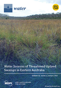
Temperate Highland Peat Swamps on Sandstone (THPSS) are Groundwater Dependent Terrestrial Ecosystems that occur in headwaters stream on low relief plateaus. They provide base flow to downstream catchments in the water supply area of Australia’s largest city, Sydney. These swamps are subject to aquifer interference from mining and groundwater extraction and are threatened by urbanization and climate change. Hydrogen (δ2H) and oxygen (δ18O) isotopes, and Radon (222Rn) were used to determine whether the swamps are dominantly rainwater or groundwater fed. The swamps are dominantly rainwater fed, but up to 30% of water can be sourced from the surrounding bedrock aquifer, making these swamps sensitive to both aquifer interference activities and a changing climate. View this paper.
  • Issues are regarded as officially published after their release is announced to the table of contents alert mailing list.
  • You may sign up for e-mail alerts to receive table of contents of newly released issues.
  • PDF is the official format for papers published in both, html and pdf forms. To view the papers in pdf format, click on the "PDF Full-text" link, and use the free Adobe Reader to open them.
Order results
Result details
Section
Select all
Export citation of selected articles as:
11 pages, 4214 KiB  
Article
Uptake of Sb(V) by Nano Fe3O4-Decorated Iron Oxy-Hydroxides
by Konstantinos Simeonidis, Kyriaki Kalaitzidou, Efthimia Kaprara, Georgia Mitraka, Theopoula Asimakidou, Lluis Balcells and Manassis Mitrakas
Water 2019, 11(1), 181; https://doi.org/10.3390/w11010181 - 21 Jan 2019
Cited by 14 | Viewed by 5637
Abstract
The presence of antimony in water remains a major problem for drinking water technology, defined by the difficulty of available adsorbents to comply with the very low regulation limit of 5 μg/L for the dominant Sb(V) form. This study attempts to develop a [...] Read more.
The presence of antimony in water remains a major problem for drinking water technology, defined by the difficulty of available adsorbents to comply with the very low regulation limit of 5 μg/L for the dominant Sb(V) form. This study attempts to develop a new class of water adsorbents based on the combination of amorphous iron oxy-hydroxide with Fe3O4 nanoparticles and optimized to the sufficient uptake of Sb(V). Such a Fe3O4/FeOOH nanocomposite is synthesized by a two-step aqueous precipitation route from iron salts under different oxidizing and acidity conditions. A series of materials with various contents of Fe3O4 nanoparticles in the range 0–100 wt % were prepared and tested for their composition, and structural and morphological features. In order to evaluate the performance of prepared adsorbents, the corresponding adsorption isotherms, in the low concentration range for both Sb(III) and Sb(V), were obtained using natural-like water. The presence of a reducing agent such as Fe3O4 results in the improvement of Sb(V) uptake capacity, which is found around 0.5 mg/g at a residual concentration of 5 μg/L. The intermediate reduction of Sb(V) to Sb(III) followed by Sb(III) adsorption onto FeOOH is the possible mechanism that explains experimental findings. Full article
(This article belongs to the Special Issue Technologies Developing in Heavy Metals' Removal from Water)
Show Figures

Figure 1

17 pages, 1885 KiB  
Article
Modeling of Pollutants Removal in Subsurface Vertical Flow and Horizontal Flow Constructed Wetlands
by Wojciech Dąbrowski, Beata Karolinczak, Paweł Malinowski and Dariusz Boruszko
Water 2019, 11(1), 180; https://doi.org/10.3390/w11010180 - 21 Jan 2019
Cited by 16 | Viewed by 5166
Abstract
Reject water is a by-product of every municipal and agro-industrial wastewater treatment plant (WWTP) applying sewage sludge stabilization. It is usually returned without pre-treatment to the biological part of WWTP, having a negative impact on the nitrogen removal process. The current models of [...] Read more.
Reject water is a by-product of every municipal and agro-industrial wastewater treatment plant (WWTP) applying sewage sludge stabilization. It is usually returned without pre-treatment to the biological part of WWTP, having a negative impact on the nitrogen removal process. The current models of pollutants removal in constructed wetlands concern municipal and industrial wastewater, whereas there is no such model for reject water. In the presented study, the results of treatment of reject water from dairy WWTP in subsurface vertical flow (SS VF) and subsurface horizontal flow (SS HF) beds were presented. During a one-year research period, SS VF bed reached 50.7% efficiency of TN removal and 73.8% of NH4+-N, while SS HF bed effectiveness was at 41.4% and 62.0%, respectively. In the case of BOD5 (biochemical oxygen demand), COD (chemical oxygen demand), NH4+-N, and TN (total nitrogen), the P-k-C* model was applied. Multi-model nonlinear segmented regression analysis was performed. Final mathematical models with estimates of parameters determining the treatment effectiveness were obtained. Treatment efficiency increased up to the specific temperature, then it was constant. The results obtained in this work suggest that it may be possible to describe pollutant removal behavior using simplified models. In the case of TP (total phosphorus) removal, distribution tests along with a t-test were performed. All models predict better treatment efficiency in SS VF bed, except for TP. Full article
(This article belongs to the Section Wastewater Treatment and Reuse)
Show Figures

Figure 1

19 pages, 2189 KiB  
Article
Effect of Aluminium Salt Dosing on Activated Sludge Settleability Indicators: A New Settleability Model Development
by Peter Ojo and Augustine Osamor Ifelebuegu
Water 2019, 11(1), 179; https://doi.org/10.3390/w11010179 - 21 Jan 2019
Cited by 5 | Viewed by 5147
Abstract
There has been a significant rise in the use of aluminium salts (Al3+) for the chemical precipitation of phosphates in wastewater treatment plants due to growing stricter regulatory requirements for wastewater effluent release to the environment. The modelling of the settleability [...] Read more.
There has been a significant rise in the use of aluminium salts (Al3+) for the chemical precipitation of phosphates in wastewater treatment plants due to growing stricter regulatory requirements for wastewater effluent release to the environment. The modelling of the settleability of the resultant Al3+ sludge in present engineering practice for design and optimisation are still based on conventional sludge settleability models. This paper describes a novel activated sludge settleability model which is designed to analyse the effects of Al3+ dosing on activated sludge settleability indicators, zone settling velocity (ZSV), and stirred specific volume index (SSVI). The impact of Al3+ dosing concentrations on ZSV and SSVI of full scale activated sludge plant were analysed in the laboratory over a three years’ period and the exponential form of the Vesilind equation was optimised and validated to include alum chemical dosing parameters. The proposed model equation was found to effectively describe the settleability of Al3+ dosed sludge for dosing concentrations range of 0 to 100 mg/L. Full article
Show Figures

Figure 1

17 pages, 3292 KiB  
Article
CMADS-Driven Simulation and Analysis of Reservoir Impacts on the Streamflow with a Simple Statistical Approach
by Ningpeng Dong, Mingxiang Yang, Xianyong Meng, Xuan Liu, Zhaokai Wang, Hao Wang and Chuanguo Yang
Water 2019, 11(1), 178; https://doi.org/10.3390/w11010178 - 21 Jan 2019
Cited by 12 | Viewed by 3840
Abstract
The reservoir operation is a notable source of uncertainty in the natural streamflow and it should be represented in hydrological modelling to quantify the reservoir impact for more effective hydrological forecasting. While many researches focused on the effect of large reservoirs only, this [...] Read more.
The reservoir operation is a notable source of uncertainty in the natural streamflow and it should be represented in hydrological modelling to quantify the reservoir impact for more effective hydrological forecasting. While many researches focused on the effect of large reservoirs only, this study developed an online reservoir module where the small reservoirs were aggregated into one representative reservoir by employing a statistical approach. The module was then integrated into the coupled Noah Land Surface Model and Hydrologic Model System (Noah LSM-HMS) for a quantitative assessment of the impact of both large and small reservoirs on the streamflow in the upper Gan river basin, China. The Noah LSM-HMS was driven by the China Meteorological Assimilation Driving Datasets for the Soil and Water Assessment Tool (SWAT) model (CMADS) with a very good performance and a Nash-Sutcliffe coefficient of efficiency (NSE) of 0.89, which proved to be more effective than the reanalysis data from the National Centers for Environmental Prediction (NCEP) over China. The simulation results of the integrated model indicate that the proposed reservoir module can acceptably depict the temporal variation in the water storage of both large and small reservoirs. Simulation results indicate that streamflow is increased in dry seasons and decreased in wet seasons, and large and small reservoirs can have equally large effects on the streamflow. With the integration of the reservoir module, the performance of the original model is improved at a significant level of 5%. Full article
Show Figures

Figure 1

16 pages, 1147 KiB  
Article
Scientific Coverage in Water Governance: Systematic Analysis
by Amador Durán-Sánchez, María de la Cruz del Río-Rama, José Álvarez-García and Francisco Javier Castellano-Álvarez
Water 2019, 11(1), 177; https://doi.org/10.3390/w11010177 - 21 Jan 2019
Cited by 7 | Viewed by 3624
Abstract
In this article, the results of the bibliometric analysis applied to research on “Water Governance” are presented in order to observe behavior patterns in the key areas of this field of knowledge (progression, most productive authors, etc.). This research is complemented with a [...] Read more.
In this article, the results of the bibliometric analysis applied to research on “Water Governance” are presented in order to observe behavior patterns in the key areas of this field of knowledge (progression, most productive authors, etc.). This research is complemented with a co-citation analysis. When considering two databases, a comparative study is carried out between both databases through coverage, overlap, dispersion, or concentration indicators. The results indicate that this area of knowledge has evolved rapidly and has gained popularity and importance among researchers, especially since 2009, when the real boom of the discipline took place, with about two-thirds of the papers being published in the last five years. The main authors, the most relevant articles based on the citation criterion, the institutions, and countries with the highest number of investigations and the journals where this topic is published are also identified. Scopus is the database that performs better coverage by collecting a higher number of articles and obtaining a greater number of citations. Full article
(This article belongs to the Section Water Resources Management, Policy and Governance)
Show Figures

Figure 1

14 pages, 5721 KiB  
Article
Characterization of Hydraulic Heterogeneity of Alluvial Aquifer Using Natural Stimuli: A Field Experience of Northern Italy
by Marco D’Oria and Andrea Zanini
Water 2019, 11(1), 176; https://doi.org/10.3390/w11010176 - 20 Jan 2019
Cited by 9 | Viewed by 4525
Abstract
This study investigates the hydraulic heterogeneity of the alluvial aquifer underneath the dam and the stilling basin of a flood protection structure in Northern Italy. The knowledge of the interactions between the water in the reservoir upstream of the dam and the groundwater [...] Read more.
This study investigates the hydraulic heterogeneity of the alluvial aquifer underneath the dam and the stilling basin of a flood protection structure in Northern Italy. The knowledge of the interactions between the water in the reservoir upstream of the dam and the groundwater levels is relevant for the stability of the structure. A Bayesian Geostatistical Approach (BGA) combined with a groundwater flow model developed in MODFLOW 2005 has been used to estimate the hydraulic conductivity (HK) field in a context of a highly parameterized inversion. The transient hydraulic heads collected in 14 monitoring points represent the calibration dataset; these observations are the results of the hydraulic stresses induced by the variations of the lake stage upstream of the dam (natural stimuli). The geostatistical inversion was performed by means of a computer code, bgaPEST, developed according to the free PEST software concept. The results of the inversion show a moderate degree of heterogeneity of the estimated HK field, consistent with the alluvial nature of the aquifer and the other information available. The calibrated groundwater model is useful for simulating the interactions between the reservoir and the studied aquifer under different flood scenarios and for forecasting the hydraulic head levels due to strong flood events. The use of natural stimuli is useful for obtaining information for aquifer heterogeneity characterization. Full article
(This article belongs to the Special Issue Heterogeneous Aquifer Modeling: Closing the Gap)
Show Figures

Figure 1

19 pages, 6990 KiB  
Article
Relationship between Soil Salinization and Groundwater Hydration in Yaoba Oasis, Northwest China
by Guoqing Cui, Yudong Lu, Ce Zheng, Zhiheng Liu and Jiamei Sai
Water 2019, 11(1), 175; https://doi.org/10.3390/w11010175 - 20 Jan 2019
Cited by 36 | Viewed by 4899
Abstract
Precipitation is scarce and evaporation is intense in desert areas. Groundwater is used as the main water source to develop agriculture in the oases. However, the effects of using groundwater on the ecological environment elicit widespread public concern. This study investigated the relationship [...] Read more.
Precipitation is scarce and evaporation is intense in desert areas. Groundwater is used as the main water source to develop agriculture in the oases. However, the effects of using groundwater on the ecological environment elicit widespread public concern. This study investigated the relationship between soil salinity and groundwater characteristics in Yaoba Oasis through in situ experiments. The relationship of the mineral content, pH, and main ion content of groundwater with soil salt was quantitatively evaluated through a gray relational analysis. Four main results were obtained. First, the fresh water area with low total dissolved solid (TDS) was usually HCO3 or SO42− type water, and salt water was mostly Cl and SO42−. The spatial distribution of main ions in groundwater during winter irrigation in November was basically consistent with that during spring irrigation in June. However, the spatial distribution of TDS differed in the two seasons. Second, soil salinization in the study area was severe, and the salinization rate reached 72.7%. In this work, the spatial variability of soil salinization had a relatively large value, and the values in spring were greater than those in autumn. Third, the soil in the irrigated area had a high salt content, and the salt ion content of surface soil was higher than that of subsoil. A piper trilinear diagram revealed that Ca2+ and K+ + Na+ were the main cations. SO42−, Cl, and HCO3 were the main anions, and salinization soil mainly contained SO42−. Fourth, the changes in soil salt and ion contents in the 0–10 cm soil layer were approximately similar to those of irrigation water quality, both of which showed an increasing trend. The correlation of surface soil salinity with the salinity of groundwater and its chemical components was high. In summary, this study identified the progress of irrigation water quality in soil salinization and provided a scientific basis for improving the oasis ecosystem, maintaining the healthy development of agriculture, managing oasis water resources, and policy development. Our findings can serve as a reference for other, similar oasis research. Full article
(This article belongs to the Section Water Quality and Contamination)
Show Figures

Figure 1

34 pages, 7697 KiB  
Article
Demand for Stream Mitigation in Colorado, USA
by Jason P. Julian and Russell C. Weaver
Water 2019, 11(1), 174; https://doi.org/10.3390/w11010174 - 19 Jan 2019
Cited by 4 | Viewed by 7165
Abstract
Colorado, the headwaters for much of the United States, is one of the fastest growing states in terms of both population and land development. These land use changes are impacting jurisdictional streams, and thus require compensatory stream mitigation via environmental restoration. In this [...] Read more.
Colorado, the headwaters for much of the United States, is one of the fastest growing states in terms of both population and land development. These land use changes are impacting jurisdictional streams, and thus require compensatory stream mitigation via environmental restoration. In this article, we first characterize current demand and supply for stream mitigation for the entire state of Colorado. Second, we assess future demand by forecasting and mapping the lengths of streams that will likely be impacted by specific development and land use changes. Third, based on our interviews with experts, stakeholders, resource managers, and regulators, we provide insight on how regulatory climate, challenges, and water resource developments may influence demand for stream mitigation. From geospatial analyses of permit data, we found that there is currently demand for compensatory stream mitigation in 13 of the 89 HUC-8 watersheds across Colorado. Permanent riverine impacts from 2012–2017 requiring compensatory mitigation totaled 38,292 linear feet (LF). The supply of stream mitigation credits falls well short of this demand. There has only been one approved stream mitigation bank in Colorado, supplying only 2539 LF credits. Based on our analyses of future growth and development in Colorado, there will be relatively high demand for stream mitigation credits in the next 5–10 years. While most of these impacts will be around the Denver metropolitan area, we identified some new areas of the state that will experience high demand for stream mitigation. Given regulatory agencies’ stated preference for mitigation banks, the high demand for stream mitigation credits, and the short supply of stream credits, there should be an active market for stream mitigation banks in Colorado. However, there are some key obstacles preventing this market from moving forward, with permanent water rights’ acquisitions at the top of the list. Ensuring stream mitigation compliance is essential for restoring and maintaining the chemical, physical, and biological integrity of stream systems in Colorado and beyond. Full article
(This article belongs to the Collection Water Policy Collection)
Show Figures

Graphical abstract

17 pages, 8648 KiB  
Article
The Impact of Recreational Activities on Aquatic Vegetation in Alpine Lakes
by Piotr Dynowski, Adam Senetra, Anna Źróbek-Sokolnik and Jacek Kozłowski
Water 2019, 11(1), 173; https://doi.org/10.3390/w11010173 - 18 Jan 2019
Cited by 20 | Viewed by 4897
Abstract
Tourism pressure on protected areas with attractive landscapes leads to environmental modifications. Eutrophication poses the main threat to the quality of water in alpine lakes. Even small inflows of biogenic elements can disrupt the ecological balance of these ecosystems. The aim of this [...] Read more.
Tourism pressure on protected areas with attractive landscapes leads to environmental modifications. Eutrophication poses the main threat to the quality of water in alpine lakes. Even small inflows of biogenic elements can disrupt the ecological balance of these ecosystems. The aim of this study was to verify the hypothesis that recreational activities and easy access to alpine lakes contribute to changes in their ecological status. This hypothesis was verified by analyzing the presence of hydromacrophytes in two lakes of the Tatra National Park (Poland). The analysis was carried out along segments of hiking trails which were evaluated for accessibility to the studied lakes. Underwater surveys were carried out during scuba diving expeditions in 2012–2016. Submerged vegetation was evaluated in both lakes. This is the first study in Poland and one of the few projects in the world to have relied on such extensive support from scuba divers to generate highly accurate measurements. The study demonstrated that lake bottoms were extensively covered by Potamogeton friesii in the vicinity of trail segments with easy access to lakes. Our results show that tourism pressure contributes to the growth of aquatic vegetation in some areas of alpine lakes. We relied on our findings to propose several modifications to the routes of the evaluated tourist trails to minimize the impact of anthropogenic pressure on the studied lakes. Full article
(This article belongs to the Section Water Quality and Contamination)
Show Figures

Figure 1

19 pages, 2121 KiB  
Article
The Evaluation of Regional Water-Saving Irrigation Development Level in Humid Regions of Southern China
by Lu Zhao, Lili Zhang, Ningbo Cui, Chuan Liang and Yi Feng
Water 2019, 11(1), 172; https://doi.org/10.3390/w11010172 - 18 Jan 2019
Cited by 6 | Viewed by 3661
Abstract
Water-saving irrigation development level (WIDL) refers to reasonably and accurately judging a water-saving area based on the analysis of all factors affecting the water-saving irrigation development. The evaluation of regional WIDL is the premise of scientific planning guidance to irrigation work. How to [...] Read more.
Water-saving irrigation development level (WIDL) refers to reasonably and accurately judging a water-saving area based on the analysis of all factors affecting the water-saving irrigation development. The evaluation of regional WIDL is the premise of scientific planning guidance to irrigation work. How to select reasonable evaluation indexes and build a scientific and comprehensive model to evaluate WIDL is of great significance. In this study, the comprehensive evaluation index system of WIDL in 21 cities (states) of the Sichuan province in China (a typical humid region in southern China) was constructed, and the TOPSIS (Technique for Order Preference by Similarity to an Ideal Solution) method was improved to evaluate WIDL. Results showed that the overall development level of water-saving irrigation was “poor” in Sichuan province. The water-saving irrigation level turned out to be “good” in three regions with advantageous geographical conditions and developed economies, “general” in four regions with good economic levels where agronomy water saving has been popularized, and “poor” in fourteen regions of mountainous and hilly areas, especially Ganzi, Aba, and Liangshan, located in the Northwest plateau of Sichuan province, with poor natural resources and insufficient economies. The evaluation results were in good agreement with the actual situation, and in this area, there is enormous potential for the development of water-saving irrigation strategies. This study provides an important technical approach for the evaluation of water-saving irrigation development in humid regions of Southern China. Full article
(This article belongs to the Special Issue Advances in Hydraulics and Hydroinformatics)
Show Figures

Figure 1

21 pages, 4190 KiB  
Article
Parameter Estimation and Uncertainty Analysis: A Comparison between Continuous and Event-Based Modeling of Streamflow Based on the Hydrological Simulation Program–Fortran (HSPF) Model
by Hui Xie, Zhenyao Shen, Lei Chen, Xijun Lai, Jiali Qiu, Guoyuan Wei, Jianwei Dong, Yexuan Peng and Xinquan Chen
Water 2019, 11(1), 171; https://doi.org/10.3390/w11010171 - 18 Jan 2019
Cited by 16 | Viewed by 5240
Abstract
Hydrologic modeling is usually applied to two scenarios: continuous and event-based modeling, between which hydrologists often neglect the significant differences in model application. In this study, a comparison-based procedure concerning parameter estimation and uncertainty analysis is presented based on the Hydrological Simulation Program–Fortran [...] Read more.
Hydrologic modeling is usually applied to two scenarios: continuous and event-based modeling, between which hydrologists often neglect the significant differences in model application. In this study, a comparison-based procedure concerning parameter estimation and uncertainty analysis is presented based on the Hydrological Simulation Program–Fortran (HSPF) model. Calibrated parameters related to base flow and moisture distribution showed marked differences between the continuous and event-based modeling. Results of the regionalized sensitivity analysis identified event-dependent parameters and showed that gravity drainage and storage outflow were the primary runoff generation processes for both scenarios. The overall performance of the event-based simulation was better than that of the daily simulation for streamflow based on the generalized likelihood uncertainty estimation (GLUE). The GLUE analysis also indicated that the performance of the continuous model was limited by several extreme events and low flows. In the event-based scenario, the HSPF model performances decreased as the precipitation became intense in the event-based modeling. The structure error of the HSFP model was recognized at the initial phase of the rainfall-event period. This study presents a valuable opportunity to understand dominant controls in different hydrologic scenario and guide the application of the HSPF model. Full article
(This article belongs to the Section Hydrology)
Show Figures

Figure 1

17 pages, 3669 KiB  
Article
Using a Hydrologic Model to Assess the Performance of Regional Climate Models in a Semi-Arid Watershed in Brazil
by Carlos A. S. Santos, Felizardo. A. Rocha, Tiago B. Ramos, Lincoln M. Alves, Marcos Mateus, Rodrigo Proença de Oliveira and Ramiro Neves
Water 2019, 11(1), 170; https://doi.org/10.3390/w11010170 - 18 Jan 2019
Cited by 19 | Viewed by 5424
Abstract
This study assessed the impact of climate change on the hydrological regime of the Paraguaçu river basin, northeastern Brazil. Hydrological impact simulations were conducted using the Soil and Water Assessment Tool (SWAT) for 2020–2040. Precipitation and surface air temperature projections from two Regional [...] Read more.
This study assessed the impact of climate change on the hydrological regime of the Paraguaçu river basin, northeastern Brazil. Hydrological impact simulations were conducted using the Soil and Water Assessment Tool (SWAT) for 2020–2040. Precipitation and surface air temperature projections from two Regional Climate Models (Eta-HadGEM2-ES and Eta-MIROC5) based on IPCC5—RCP 4.5 and 8.5 scenarios were used as inputs after first applying two bias correction methods (linear scaling—LS and distribution mapping—DM). The analysis of the impact of climate change on streamflow was done by comparing the maximum, average and reference (Q90) flows of the simulated and observed streamflow records. This study found that both methods were able to correct the climate projection bias, but the DM method showed larger distortion when applied to future scenarios. Climate projections from the Eta-HadGEM2-ES (LS) model showed significant reductions of mean monthly streamflow for all time periods under both RCP 4.5 and 8.5. The Eta-MIROC5 (LS) model showed a lower reduction of the simulated mean monthly streamflow under RCP 4.5 and a decrease of streamflow under RCP 8.5, similar to the Eta-HadGEM2-ES model results. The results of this study provide information for guiding future water resource management in the Paraguaçu River Basin and show that the bias correction algorithm also plays a significant role when assessing climate model estimates and their applicability to hydrological modelling. Full article
(This article belongs to the Special Issue Evaluating Hydrological Responses to Climate Change)
Show Figures

Figure 1

17 pages, 12490 KiB  
Case Report
Contribution of Excessive Supply of Solid Material to a Runoff-Generated Debris Flow during Its Routing Along a Gully and Its Impact on the Downstream Village with Blockage Effects
by Ming-liang Chen, Xing-nian Liu, Xie-kang Wang, Tao Zhao and Jia-wen Zhou
Water 2019, 11(1), 169; https://doi.org/10.3390/w11010169 - 18 Jan 2019
Cited by 19 | Viewed by 4022
Abstract
On 8 August 2017, a runoff-generated debris flow occurred in the Puge County, Sichuan Province of southwestern China and caused huge property damage and casualties (25 people died and 5 people were injured). Emergency field investigations found that paddy fields, dry land, residential [...] Read more.
On 8 August 2017, a runoff-generated debris flow occurred in the Puge County, Sichuan Province of southwestern China and caused huge property damage and casualties (25 people died and 5 people were injured). Emergency field investigations found that paddy fields, dry land, residential buildings and roads suffered different degrees of impact from the debris flow. This paper reveals the formation process of the debris flow by analyzing the characteristics of rainfall precipitation and sediment supply conditions in the study area and it approaches the practical application of hazard prevention and mitigation constructions. Doppler weather radar analysis indicates that a very high intensity rainfall occurred in the middle and upper zones of the basin, illustrating the importance of enhancing rainfall monitoring in high-altitude areas. The abundant supply of deposits in gully channels is among the significant causes of a transformation from mountain floods to large-scale debris flows. It was also found that the two culverts played an important role in the movement affecting the processes of debris flows which has substantially aggravated the destructive outcome. The excessive supply of solid material and local blockage with outburst along a gully must receive significant attention for the prediction of future debris flows, hazard prevention and mitigation measures. Full article
(This article belongs to the Special Issue Water Related Disaster and Water Environment Management)
Show Figures

Figure 1

21 pages, 726 KiB  
Article
Comparison of Methods to Estimate Lake-Surface-Water Temperature Using Landsat 7 ETM+ and MODIS Imagery: Case Study of a Large Shallow Subtropical Lake in Southern Brazil
by Matheus Henrique Tavares, Augusto Hugo Farias Cunha, David Motta-Marques, Anderson Luís Ruhoff, J. Rafael Cavalcanti, Carlos Ruberto Fragoso, Jr., Juan Martín Bravo, Andrés Mauricio Munar, Fernando Mainardi Fan and Lucia Helena Ribeiro Rodrigues
Water 2019, 11(1), 168; https://doi.org/10.3390/w11010168 - 18 Jan 2019
Cited by 31 | Viewed by 6472
Abstract
Water temperature regulates many processes in lakes; therefore, evaluating it is essential to understand its ecological status and functioning, and to comprehend the impact of climate change. Although few studies assessed the accuracy of individual sensors in estimating lake-surface-water temperature (LSWT), comparative analysis [...] Read more.
Water temperature regulates many processes in lakes; therefore, evaluating it is essential to understand its ecological status and functioning, and to comprehend the impact of climate change. Although few studies assessed the accuracy of individual sensors in estimating lake-surface-water temperature (LSWT), comparative analysis considering different sensors is still needed. This study evaluated the performance of two thermal sensors, MODIS and Landsat 7 ETM+, and used Landsat methods to estimate the SWT of a large subtropical lake. MODIS products MOD11 LST and MOD28 SST were used for comparison. For the Landsat images, the radiative transfer equation (RTE), using NASA’s Atmospheric Correction Parameter Calculator (AtmCorr) parameters, was compared with the single-channel algorithm in different approaches. Our results showed that MOD11 obtained the highest accuracy (RMSE of 1.05 ° C), and is the recommended product for LSWT studies. For Landsat-derived SWT, AtmCorr obtained the highest accuracy (RMSE of 1.07 ° C) and is the recommended method for small lakes. Sensitivity analysis showed that Landsat-derived LSWT using the RTE is very sensitive to atmospheric parameters and emissivity. A discussion of the main error sources was conducted. We recommend that similar tests be applied for Landsat imagery on different lakes, further studies on algorithms to correct the cool-skin effect in inland waters, and tests of different emissivity values to verify if it can compensate for this effect, in an effort to improve the accuracy of these estimates. Full article
(This article belongs to the Section Water Quality and Contamination)
Show Figures

Figure 1

9 pages, 1098 KiB  
Article
The Contribution of Coniferous Canopy to the Molecular Diversity of Dissolved Organic Matter in Rainfall
by Jun’ichiro Ide, Naoki Makita, Seonghun Jeong, Keitaro Yamase and Mizue Ohashi
Water 2019, 11(1), 167; https://doi.org/10.3390/w11010167 - 18 Jan 2019
Cited by 4 | Viewed by 3417
Abstract
Rainwater interacts with tree canopies in forest ecosystems, which greatly influence its quality. However, little information is available regarding how tree canopies influence dissolved organic matter (DOM) in rainwater. To examine this, we collected bulk deposition (rainfall) and throughfall in a conifer ( [...] Read more.
Rainwater interacts with tree canopies in forest ecosystems, which greatly influence its quality. However, little information is available regarding how tree canopies influence dissolved organic matter (DOM) in rainwater. To examine this, we collected bulk deposition (rainfall) and throughfall in a conifer (Chamaecyparis obtusa) plantation, western Japan, during a rain event, and analyzed their DOM molecular compositions using ultrahigh-resolution Fourier transform ion cyclotron resonance mass spectrometry. The dissolved organic carbon flux and the number of DOM molecular species detected were approximately seven times and three times higher in throughfall than in rainfall, respectively. We found that the average proportion of molecular species shared between five sample replicates was larger in throughfall (69%) than in rainfall (50%). Nonmetric multidimensional scaling revealed that the molecular species were significantly differentiated between throughfall and rainfall, and the dissimilarity among the replicates was much smaller in throughfall. This indicates that the quality of DOM in rainwater became spatially homogeneous due to contact with tree canopies. The number of lignin-like molecules was larger than those of any other biomolecular compounds in throughfall and seven times larger than in rainfall, suggesting that many of plant-derived DOM molecules were dissolved into rainwater. Full article
(This article belongs to the Section Water Quality and Contamination)
Show Figures

Figure 1

17 pages, 5777 KiB  
Article
Temporal Variation and Reduction Strategy of Nutrient Loads from an Urban River Catchment into a Eutrophic Lake, China
by Chengxin Qin, Zhiyi Li, Pengcheng Xie, Qianting Hao, Xuejun Tang, Yihui Wu and Pengfei Du
Water 2019, 11(1), 166; https://doi.org/10.3390/w11010166 - 17 Jan 2019
Cited by 8 | Viewed by 4019
Abstract
Excessive nutrient input from urban areas increases the occurrence of eutrophication. Control of nutrient loads is perceived as the primary restoration method. Quantifying temporal variation of nutrient loads is essential to understand the dynamic relationships of nutrient source-impacts in the urban water system [...] Read more.
Excessive nutrient input from urban areas increases the occurrence of eutrophication. Control of nutrient loads is perceived as the primary restoration method. Quantifying temporal variation of nutrient loads is essential to understand the dynamic relationships of nutrient source-impacts in the urban water system and investigate the operational efficiency of treatment facilities for eutrophication control. Here, a holistic approach was developed to estimate nutrient loads from different sources and evaluate nutrient impacts on the urban water environment. An integrated catchment model of nutrient loads was built and applied to calculate river nutrient loads from untreated rainfall runoff, untreated sewage, and treated recharge into the eutrophic Dianchi Lake from an urban river catchment with limited infrastructure. Nutrient impacts on the lake were evaluated and a load reduction strategy was given a hint to reduce nutrient impacts of urban rivers. During the study period 2014–2016, nutrient loads from the urban river generally decreased except during heavy winter rainfall events and high-intensity pollution events associated with rainfall runoff. The average contribution of annual nutrient loads to the lake capacity indicated the underestimation of nutrient impacts of urban rivers. This approach provides new insights into urban water management and underscores the importance of sewage infrastructure. Full article
(This article belongs to the Section Urban Water Management)
Show Figures

Figure 1

11 pages, 2343 KiB  
Article
Method for the Calculation of the Underwater Effective Wake Field for Propeller Optimization
by Jianing Li, Dagang Zhao, Chao Wang, Shuai Sun and Liyu Ye
Water 2019, 11(1), 165; https://doi.org/10.3390/w11010165 - 17 Jan 2019
Cited by 2 | Viewed by 3930
Abstract
A quasi-steady prediction model of propeller hydrodynamic performance was established here using the surface panel method to determine the effective wake field of a propeller. The apparent wake field was accurately determined in advance by CFD (Computational Fluid Dynamics). The average of the [...] Read more.
A quasi-steady prediction model of propeller hydrodynamic performance was established here using the surface panel method to determine the effective wake field of a propeller. The apparent wake field was accurately determined in advance by CFD (Computational Fluid Dynamics). The average of the induced velocity near the front of the propeller was determined by coupling the steady calculation and the unsteady forecast to render the induced velocity field more consistent with the actual situation when the propeller works in a non-uniform flow field. By superimposing the induced velocity near the front of the propeller with the apparent wake field, the effective wake field was able to be determined. Then the induced velocity field was calculated again to determine the new effective wake. An iterative calculation method was used until the hydrodynamic performance converged. The case described here shows that the effective wake obtained by this method can better predict the hydrodynamic performance of the propeller, and it can provide a basis for the design and optimization of the propeller. It was found that the results of the prediction were consistent with the experimental values. Full article
Show Figures

Figure 1

14 pages, 4357 KiB  
Article
Integration of GIS and a Lagrangian Particle-Tracking Model for Harmful Algal Bloom Trajectories Prediction
by Rufu Qin and Liangzhao Lin
Water 2019, 11(1), 164; https://doi.org/10.3390/w11010164 - 17 Jan 2019
Cited by 7 | Viewed by 4150
Abstract
Harmful algal bloom (HAB) is a major environmental problem in coastal waters around the world. The technologies and approaches for short-term forecasting of the HABs trajectories have obtained increasing attention from researchers. In this paper, we present a straightforward physical-based model based on [...] Read more.
Harmful algal bloom (HAB) is a major environmental problem in coastal waters around the world. The technologies and approaches for short-term forecasting of the HABs trajectories have obtained increasing attention from researchers. In this paper, we present a straightforward physical-based model based on a non-Fickian Lagrangian particle-tracking scheme for understanding the movement of detected HABs. The model adopts the fractional Brownian motion (fBm) technology, and is coupled with the Delft3D and WRF models and GIS. The fBm based Lagrangian particle-tracking model can flexibly control the scale of the particle clouds diffusion through Hurst value, which can be used to account for uncertainties and adjust for better representing the trajectories of HABs. Simulation results demonstrate that the presented model can successfully predict the trends and the main features of red tide drifting. The developed simulation tool enables users to create the model configuration, manage data inputs, run the model, and generate model maps and animations within a GIS environment. It is believed that the model and the tool outlined herein can be very useful for rapidly evaluating potential areas at risk from the HABs events. Full article
(This article belongs to the Section Water Quality and Contamination)
Show Figures

Figure 1

17 pages, 3944 KiB  
Article
Improved Curve Number Estimation in SWAT by Reflecting the Effect of Rainfall Intensity on Runoff Generation
by Dejian Zhang, Qiaoyin Lin, Xingwei Chen and Tian Chai
Water 2019, 11(1), 163; https://doi.org/10.3390/w11010163 - 17 Jan 2019
Cited by 23 | Viewed by 6063
Abstract
Determining the amount of rainfall that will eventually become runoff and its pathway is a crucial process in hydrological modelling. We proposed a method to better estimate curve number by adding an additional component (AC) to better account for the effects of daily [...] Read more.
Determining the amount of rainfall that will eventually become runoff and its pathway is a crucial process in hydrological modelling. We proposed a method to better estimate curve number by adding an additional component (AC) to better account for the effects of daily rainfall intensity on rainfall-runoff generation. This AC is determined by a regression equation developed from the relationship between the AC series derived from fine-tuned calibration processes and observed rainfall series. When incorporated into the Soil and Water Assessment Tool and tested in the Anxi Watershed, it is found, overall, the modified SWAT (SWAT-ICN) outperformed the original SWAT (SWAT-CN) in terms of stream flow, base flow, and annual extreme flow simulation. These models were further evaluated with the data sets of two adjacent watersheds. Similar results were achieved, indicating the ability of the proposed method to better estimate curve number. Full article
(This article belongs to the Section Hydrology)
Show Figures

Figure 1

17 pages, 1937 KiB  
Article
A Practical Protocol for the Experimental Design of Comparative Studies on Water Treatment
by Long Ho, Olivier Thas, Wout Van Echelpoel and Peter Goethals
Water 2019, 11(1), 162; https://doi.org/10.3390/w11010162 - 17 Jan 2019
Cited by 5 | Viewed by 9448
Abstract
The design and execution of effective and informative experiments in comparative studies on water treatment is challenging due to their complexity and multidisciplinarity. Often, environmental engineers and researchers carefully set up their experiments based on literature information, available equipment and time, analytical methods [...] Read more.
The design and execution of effective and informative experiments in comparative studies on water treatment is challenging due to their complexity and multidisciplinarity. Often, environmental engineers and researchers carefully set up their experiments based on literature information, available equipment and time, analytical methods and experimental operations. However, because of time constraints but mainly missing insight, they overlook the value of preliminary experiments, as well as statistical and modeling techniques in experimental design. In this paper, the crucial roles of these overlooked techniques are highlighted in a practical protocol with a focus on comparative studies on water treatment optimization. By integrating a detailed experimental design, lab experiment execution, and advanced data analysis, more relevant conclusions and recommendations are likely to be delivered, hence, we can maximize the outputs of these precious and numerous experiments. The protocol underlines the crucial role of three key steps, including preliminary study, predictive modeling, and statistical analysis, which are strongly recommended to avoid suboptimal designs and even the failure of experiments, leading to wasted resources and disappointing results. The applicability and relevance of this protocol is demonstrated in a case study comparing the performance of conventional activated sludge and waste stabilization ponds in a shock load scenario. From that, it is advised that in the experimental design, the aim is to make best possible use of the statistical and modeling tools but not lose sight of a scientific understanding of the water treatment processes and practical feasibility. Full article
(This article belongs to the Section Wastewater Treatment and Reuse)
Show Figures

Graphical abstract

12 pages, 4021 KiB  
Article
Analysis of the Recent Trends of Two Climate Parameters over Two Eco-Regions of Ethiopia
by Mohammed Gedefaw, Denghua Yan, Hao Wang, Tianling Qin and Kun Wang
Water 2019, 11(1), 161; https://doi.org/10.3390/w11010161 - 17 Jan 2019
Cited by 18 | Viewed by 4173
Abstract
The changes in climatic variables in Ethiopia are not entirely understood. This paper investigated the recent trends of precipitation and temperature on two eco-regions of Ethiopia. This study used the observed historical meteorological data from 1980 to 2016 to analyze the trends. Trend [...] Read more.
The changes in climatic variables in Ethiopia are not entirely understood. This paper investigated the recent trends of precipitation and temperature on two eco-regions of Ethiopia. This study used the observed historical meteorological data from 1980 to 2016 to analyze the trends. Trend detection was done by using the non-parametric Mann-Kendall (MK), Sen’s slope estimator test, and Innovative Trend Analysis Method (ITAM). The results showed that a significant increasing trend was observed in the Gondar, Bahir Dar, Gewane, Dembi-Dolo, and Negele stations. However, a slightly decreasing trend was observed in the Sekoru, Degahabur, and Maichew stations regarding precipitation trends. As far as the trend of temperature was concerned, an increasing trend was detected in the Gondar, Bahir Dar, Gewane, Degahabur, Negele, Dembi-Dolo, and Maichew stations. However, the temperature trend in Sekoru station showed a sharp decreasing trend. The effects of precipitation and temperature changes on water resources are significant after 1998. The consistency in the precipitation and temperature trends over the two eco-regions confirms the robustness of the changes. The findings of this study will serve as a reference for climate researchers, policy and decision makers. Full article
Show Figures

Figure 1

16 pages, 2098 KiB  
Article
The Performance and Microbial Community Identification in Mesophilic and Atmospheric Anaerobic Membrane Bioreactor for Municipal Wastewater Treatment Associated with Different Hydraulic Retention Times
by Yi Ding, Zhenlin Liang, Zhansheng Guo, Zhipeng Li, Xuguang Hou and Chao Jin
Water 2019, 11(1), 160; https://doi.org/10.3390/w11010160 - 17 Jan 2019
Cited by 21 | Viewed by 4466
Abstract
The anaerobic membrane bioreactors (AnMBR) with ring membrane module were operated under mesophilic temperature (M-AnMBR) and atmospheric temperature (A-AnMBR). Compared to the M-AnMBR, the removal efficiency of the A-AnMBR was found to be lower and the faster membrane fouling occurred in the A-AnMBR [...] Read more.
The anaerobic membrane bioreactors (AnMBR) with ring membrane module were operated under mesophilic temperature (M-AnMBR) and atmospheric temperature (A-AnMBR). Compared to the M-AnMBR, the removal efficiency of the A-AnMBR was found to be lower and the faster membrane fouling occurred in the A-AnMBR under corresponding hydraulic retention time (HRT). The MiSeq high-throughput sequencing was applied to analyze the microbial community structure. The HRT change had different effects on the community richness and diversity of the cake and bulk sludge. The abundance of phylum Proteobacteria in the M-AnMBR was higher than that in the A-AnMBR, which should account for the higher removal of nutrients in the M-AnMBR. The faster membrane fouling would occur in the A-AnMBR due to the relatively high abundance of Bacteroidetes in the bulk sludge and cake sludge. Moreover, specific comparison down to the genus level showed that the dominant abundant bacterial genera were Candidate division OP8 norank and Anaerolineaceae uncultured in the cake sludge for M-AnMBR, and were VadinHA17 norank, WCHB1-69 norank, VadinBC27 wastewater-sludge group, and Synergistaceae uncultured in the cake sludge for A-AnMBR The different representative genera with the variation of the HRTs for the two bioreactors might indicate the different performance between the two AnMBRs. Full article
(This article belongs to the Special Issue Enhancement of Anaerobic Digestion for Energy and Resource Recovery)
Show Figures

Graphical abstract

19 pages, 5134 KiB  
Article
Influence of Landscape Structures on Water Quality at Multiple Temporal and Spatial Scales: A Case Study of Wujiang River Watershed in Guizhou
by Guoyu Xu, Xiaodong Ren, Zhenhua Yang, Haifei Long and Jie Xiao
Water 2019, 11(1), 159; https://doi.org/10.3390/w11010159 - 17 Jan 2019
Cited by 38 | Viewed by 4981
Abstract
Water quality is highly influenced by the composition and configuration of landscape structure, and regulated by various spatiotemporal factors. Using the Wujiang river watershed as a case study, this research assesses the influence of landscape metrics—including composition and spatial configuration—on river water quality. [...] Read more.
Water quality is highly influenced by the composition and configuration of landscape structure, and regulated by various spatiotemporal factors. Using the Wujiang river watershed as a case study, this research assesses the influence of landscape metrics—including composition and spatial configuration—on river water quality. An understanding of the relationship between landscape metrics and water quality can be used to improve water contamination predictability and provide restoration and management strategies. For this study, eight water quality variables were collected from 32 sampling sites from 2014 through 2017. Water quality variables included nutrient pollutant indicators ammoniacal nitrogen (NH3-N), nitrogen (NO3), and total phosphate (TP), as well as oxygen-consuming organic matter indicators COD (chemical oxygen demand), biochemical oxygen demand (BOD5), dissolved oxygen (DO), and potassium permanganate index (CODMn). Partial least squares (PLS) regression was used to quantitatively analyze the influence of landscape metrics on water quality at five buffer zone scales (extending 3, 6, 9, 12, and 15 km from the sample site) in the Wujiang river watershed. Results revealed that water quality is affected by landscape composition, landscape configuration, and precipitation. During the dry season, landscape metrics at both landscape and class levels predicted organic matter at the five buffer zone scales. During the wet season, only class-level landscape metrics predicted water contaminants, including organic matter and nutrients, at the middle three of five buffer scales. We identified the following important indicators of water quality degradation: percent of landscape, edge density, and aggregation index for built-up land; aggregation index for water; CONTAGION; COHESION; and landscape shape index. These results suggest that pollution can be mitigated by reducing natural landscape composition fragmentation, increasing the connectedness of region rivers, and minimizing human disturbance of landscape structures in the watershed area. Full article
(This article belongs to the Section Water Quality and Contamination)
Show Figures

Figure 1

19 pages, 9584 KiB  
Article
Improving the Performance of Vegetable Leaf Wetness Duration Models in Greenhouses Using Decision Tree Learning
by Hui Wang, Jorge Antonio Sanchez-Molina, Ming Li and Francisco Rodríguez Díaz
Water 2019, 11(1), 158; https://doi.org/10.3390/w11010158 - 17 Jan 2019
Cited by 22 | Viewed by 4913
Abstract
Leaf wetness duration (LWD) is a key driving variable for peat and disease control in greenhouse management, and depends upon irrigation, rainfall, and dewfall. However, LWD measurement is often replaced by its estimation from other meteorological variables, with associated uncertainty due to the [...] Read more.
Leaf wetness duration (LWD) is a key driving variable for peat and disease control in greenhouse management, and depends upon irrigation, rainfall, and dewfall. However, LWD measurement is often replaced by its estimation from other meteorological variables, with associated uncertainty due to the modelling approach used and its calibration. This study uses the decision learning tree method (DLT) for calibrating four LWD models—RH threshold model (RHM), the dew parameterization model (DPM), the classification and regression tree model (CART) and the neural network model (NNM)—whose performances in reproducing measured data are assessed using a large dataset. The relative importance of input variables in contributing to LWD estimation is also computed for the models tested. The LWD models were evaluated at two different greenhouse locations: in a Chinese (CN) greenhouse over three planting seasons (April 2014–October 2015) and in a Spanish (ES) greenhouse over four planting seasons (April 2016–February 2018). Based on multi-evaluation indicators, the models were given a ranking for their assessment capabilities during calibration (in the Spanish greenhouse from April 2016 to December 2016 and in the Chinese greenhouse from April 2014 to November 2014). The models were then evaluated on an independent set of data, and the obtained areas under the receiver operating characteristic curve (AUC) of the LWD models were over 0.73. Therein, the best LWD model in this case was the NNM, with positive predict values (PPVs) of 0.82 (SP) and 0.90 (CN), and mean absolute errors (MAEs) of 1.85 h (SP) and 1.30 h (CN). Consequently, the DLT can decrease LWD estimation error by calibrating the model threshold and choosing black box model input variables. Full article
(This article belongs to the Section Water Resources Management, Policy and Governance)
Show Figures

Figure 1

14 pages, 3578 KiB  
Article
Microorganisms Collected from the Surface of Freshwater Lakes Using a Drone Water Sampling System (DOWSE)
by James Benson, Regina Hanlon, Teresa M. Seifried, Philipp Baloh, Craig W. Powers, Hinrich Grothe and David G. Schmale
Water 2019, 11(1), 157; https://doi.org/10.3390/w11010157 - 16 Jan 2019
Cited by 23 | Viewed by 10860
Abstract
New tools and technology are needed to study microorganisms in freshwater environments. Little is known about spatial distribution and ice nucleation activity (INA) of microorganisms in freshwater lakes. We developed a system to collect water samples from the surface of lakes using a [...] Read more.
New tools and technology are needed to study microorganisms in freshwater environments. Little is known about spatial distribution and ice nucleation activity (INA) of microorganisms in freshwater lakes. We developed a system to collect water samples from the surface of lakes using a 3D-printed sampling device tethered to a drone (DOWSE, DrOne Water Sampling SystEm). The DOWSE was used to collect surface water samples at different distances from the shore (1, 25, and 50 m) at eight different freshwater lakes in Austria in June 2018. Water samples were filtered, and microorganisms were cultured on two different media types, TSA (a general growth medium) and KBC (a medium semi-selective for bacteria in the genus Pseudomonas). Mean concentrations (colony forming units per mL, or CFU/mL) of bacteria cultured on TSA ranged from 19,800 (Wörthersee) to 210,500 (Gosaulacke) CFU/mL, and mean concentrations of bacteria cultured on KBC ranged from 2590 (Ossiachersee) to 11,000 (Vorderer Gosausee) CFU/mL. There was no significant difference in sampling distance from the shore for concentrations of microbes cultured on TSA (p = 0.28). A wireless bathymetry sensor was tethered to the drone to map temperature and depth across the sampling domain of each of the lakes. At the 50 m distance from the shore, temperature ranged from 17 (Hinterer Gosausee, and Gosaulacke) to 26 °C (Wörthersee), and depth ranged from 2.8 (Gosaulacke) to 11.1 m (Grundlsee). Contour maps of concentrations of culturable bacteria across the drone sampling domain revealed areas of high concentrations (hot spots) in some of the lakes. The percentage of ice-nucleation active (ice+) bacteria cultured on KBC ranged from 0% (0/64) (Wörthersee) to 58% (42/72) (Vorderer Gosausee), with a mean of 28% (153/544) for the entire sample set. Future work aims to elucidate the structure and function of entire microbial assemblages within and among the Austrian lakes. Full article
(This article belongs to the Section Water Quality and Contamination)
Show Figures

Graphical abstract

15 pages, 23274 KiB  
Article
Hydrology of the Sirba River: Updating and Analysis of Discharge Time Series
by Paolo Tamagnone, Giovanni Massazza, Alessandro Pezzoli and Maurizio Rosso
Water 2019, 11(1), 156; https://doi.org/10.3390/w11010156 - 16 Jan 2019
Cited by 20 | Viewed by 5906
Abstract
The Sahelian regions are affected by an increasing number of catastrophic floods in recent years as a consequence of climate and land use/land cover changes. River flow data is key to understanding river behavior and develop flood mitigation and prevention strategies. The present [...] Read more.
The Sahelian regions are affected by an increasing number of catastrophic floods in recent years as a consequence of climate and land use/land cover changes. River flow data is key to understanding river behavior and develop flood mitigation and prevention strategies. The present study provides a revision and an update of the existing discharge dataset of the Sirba River with the aim of enhancing the reliability of these data. The revision also includes the recalibration of the Garbey Kourou rating curves. The analysis of the revised discharge time series strengthens the previous findings, evidencing a positive trend in flood frequency and intensity over the entire analyzed period of 1956–2018. This positive trend is more pronounced for the last 40 years due to a significant underestimation of the rating curves used. A relevant finding is a new changepoint in the time series, detected for 2008, which represents the beginning of the period in which the highest flood magnitudes were registered. The effect of land use/land cover changes and climate changes on the water resource is depicted using flow duration curves. This research produces a revised and more reliable discharge time series that will be a new starting point for future hydrological analyses. Full article
(This article belongs to the Special Issue Hydrological Impacts of Climate Change and Land Use/Land Cover Change)
Show Figures

Figure 1

13 pages, 3386 KiB  
Article
Numerical Analysis of the Impact Factors on the Flow Fields in a Large Shallow Lake
by Haifei Liu, Zhexian Zhu, Jingling Liu and Qiang Liu
Water 2019, 11(1), 155; https://doi.org/10.3390/w11010155 - 16 Jan 2019
Cited by 6 | Viewed by 3732
Abstract
Wetland acts as an important part of climatic regulation, water purification, and biodiversity maintenance. As an integral part of wetlands, large shallow lakes play an essential role in protecting ecosystem diversity and providing water sources. Baihe Lake in the Momoge Wetland is one [...] Read more.
Wetland acts as an important part of climatic regulation, water purification, and biodiversity maintenance. As an integral part of wetlands, large shallow lakes play an essential role in protecting ecosystem diversity and providing water sources. Baihe Lake in the Momoge Wetland is one such example, so it is necessary to study the flow pattern characteristics of this lake under different conditions. A new model, based on the lattice Boltzmann method, was used to investigate the effects of different impact factors on flow fields, such as water discharge from surrounding farmland, rainfall, wind speed, and aquatic vegetation. Importantly, this study provides a hydrodynamic basis for local ecological protection and restoration work. Full article
(This article belongs to the Special Issue Advances in Hydraulics and Hydroinformatics)
Show Figures

Figure 1

17 pages, 1849 KiB  
Article
Unraveling Flooding Dynamics and Nutrients’ Controls upon Phytoplankton Functional Dynamics in Amazonian Floodplain Lakes
by Cleber Nunes Kraus, Marie-Paule Bonnet, Ina de Souza Nogueira, Maria Tereza Morais Pereira Souza Lobo, David da Motta Marques, Jérémie Garnier and Ludgero Cardoso Galli Vieira
Water 2019, 11(1), 154; https://doi.org/10.3390/w11010154 - 16 Jan 2019
Cited by 22 | Viewed by 5149
Abstract
The processes in tropical floodplain lakes enable maintaining phytoplankton nutrient requirements over a hydrological year. The nutrients such as nitrogen, phosphorus and carbon compounds play an essential role in phytoplankton growth. However, the way that nutrients and phytoplankton interact and how this relationship [...] Read more.
The processes in tropical floodplain lakes enable maintaining phytoplankton nutrient requirements over a hydrological year. The nutrients such as nitrogen, phosphorus and carbon compounds play an essential role in phytoplankton growth. However, the way that nutrients and phytoplankton interact and how this relationship varies seasonally in tropical freshwater ecosystems is not clear. In this study, we evaluate the relationship between phytoplankton–nutrients over the hydrological cycle in Amazonian floodplain lakes and verify if this relationship influences the biomass of cyanobacteria. We also check what factors linked to nutrients act in structuring phytoplankton community. Using the phytoplankton functional approach, we verified how their ability to respond to hydrological and environmental variations reflects the ecological conditions and investigated how these interactions work. The results show that the Amazonian floodplain lakes could maintain long-term nutrient enrichment status. The nutrients input conduces to cyanobacteria dominance, that allied to other factors, play an essential role in supporting the stability of the phytoplankton–nutrients relationship over the hydrological cycle. Full article
(This article belongs to the Section Water Quality and Contamination)
Show Figures

Figure 1

26 pages, 7448 KiB  
Article
Poseidon—Decision Support Tool for Water Reuse
by Emmanuel Oertlé, Christoph Hugi, Thomas Wintgens and Christos A. Karavitis
Water 2019, 11(1), 153; https://doi.org/10.3390/w11010153 - 16 Jan 2019
Cited by 17 | Viewed by 5846
Abstract
In an era when many water systems worldwide are experiencing water stress regarding water quantity and quality, water reuse has received growing attention as one of the most promising integrated mitigating solutions. Nevertheless, the plethora of technologies and their combinations available, as well [...] Read more.
In an era when many water systems worldwide are experiencing water stress regarding water quantity and quality, water reuse has received growing attention as one of the most promising integrated mitigating solutions. Nevertheless, the plethora of technologies and their combinations available, as well as social, economic, and environmental constraints, often make it complex for stakeholders and especially decision makers to elicit relevant information. The scope of the current study is to develop a decision support tool that supports pre-feasibility studies and aims at promoting water reuse and building capacities in the field. The tool developed currently encompasses 37 unit processes combined into 70 benchmark treatment trains. It also contains information on water quality standards and typical wastewater qualities. It estimates the removal performances for 12 parameters and the lifecycle costs including distribution. The tool and all underlying data are open access and under continuous development. The underlying systemic approach of the tool makes it intuitive also for users with limited prior knowledge in the field to identify most adequate solutions based on a multi-criteria assessment. This should help to promote water reuse and spearhead initiates for more detailed feasibility and design commissioning for implementation of water reuse schemes. Full article
(This article belongs to the Section Wastewater Treatment and Reuse)
Show Figures

Graphical abstract

13 pages, 400 KiB  
Article
Feed Spacer Geometries and Permeability Coefficients. Effect on the Performance in BWRO Spriral-Wound Membrane Modules
by Alejandro Ruiz-García and Ignacio de la Nuez Pestana
Water 2019, 11(1), 152; https://doi.org/10.3390/w11010152 - 16 Jan 2019
Cited by 46 | Viewed by 5291
Abstract
Reverse osmosis (RO) is the most widely used technology to desalinate brackish water and seawater. Significant efforts have been made in recent decades to improve RO efficiency. Feed spacer geometry design is a very important factor in RO membrane performance. In this work, [...] Read more.
Reverse osmosis (RO) is the most widely used technology to desalinate brackish water and seawater. Significant efforts have been made in recent decades to improve RO efficiency. Feed spacer geometry design is a very important factor in RO membrane performance. In this work, correlations based on computational fluid dynamics and experimental work were applied in an algorithm to simulate the effect of different feed spacer geometries in full-scale brackish water reverse osmosis (BWRO) membranes with different permeability coefficients. The aim of this work was to evaluate the impact of feed spacers in conjunction with the permeability coefficients on membrane performance. The results showed a greater impact of feed spacer geometries in the membrane with the highest water permeability coefficient (A). Studying only one single element in a series, variations due to feed spacer geometries were observed in specific energy consumption ( S E C ) and permeate concentration ( C p ) of about 6.83% and 10.42%, respectively. Allowing the rolling of commercial membranes with different feed spacer geometries depending on the operating conditions could optimize the RO process. Full article
(This article belongs to the Special Issue Advances in Water and Wastewater Monitoring and Treatment Technology)
Show Figures

Figure 1

Previous Issue
Next Issue
Back to TopTop