Next Issue
Volume 10, May
Previous Issue
Volume 10, March


Water, Volume 10, Issue 4 (April 2018) – 188 articles

Cover Story (view full-size image): 
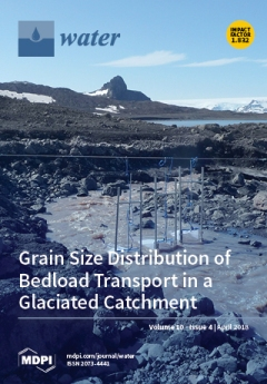
In order to identify regularities in the development of the 2 proglacial troughs located on the forefield of Baranowski Glacier (King George Island), filed observations and analysis of grain size distribution (GSD) were carried out. The main finding was that the method based on the GSD parameters can be successfully used for the assessment of the stage of development of riverbeds relative to that of other riverbeds in polar regions. View this paper
  • Issues are regarded as officially published after their release is announced to the table of contents alert mailing list.
  • You may sign up for e-mail alerts to receive table of contents of newly released issues.
  • PDF is the official format for papers published in both, html and pdf forms. To view the papers in pdf format, click on the "PDF Full-text" link, and use the free Adobe Reader to open them.
Order results
Result details
Section
Select all
Export citation of selected articles as:
46 pages, 18468 KiB  
Article
Analysis of Anthropogenic, Climatological, and Morphological Influences on Dissolved Organic Matter in Rocky Mountain Streams
by Nicolás Rodríguez-Jeangros, Amanda S. Hering and John E. McCray
Water 2018, 10(4), 534; https://doi.org/10.3390/w10040534 - 23 Apr 2018
Cited by 2 | Viewed by 5685
Abstract
In recent decades, the Rocky Mountains (RM) have undergone significant changes associated with anthropogenic activities and natural disturbances. These changes have the potential to alter primary productivity and biomass carbon storage. In particular, dissolved organic carbon (DOC) in RM streams can affect heterotrophic [...] Read more.
In recent decades, the Rocky Mountains (RM) have undergone significant changes associated with anthropogenic activities and natural disturbances. These changes have the potential to alter primary productivity and biomass carbon storage. In particular, dissolved organic carbon (DOC) in RM streams can affect heterotrophic processes, act as a source for the nutrient cycle, absorb sunlight radiation, alter metal transport, and can promote the production of carcinogenic byproducts during water treatment. Recent studies have focused on the relationship between bark beetle infestations and stream organic matter but have reached conflicting conclusions. Consequently, here we compile and process multiple datasets representing features of the RM for the period 1983–2012 with the purpose of assessing their relative influence on stream DOC concentrations using spatial statistical modeling. Features representing climate, land cover, forest disturbances, topography, soil types, and anthropogenic activities are included. We focus on DOC during base-flow conditions in RM streams because base-flow concentrations are more representative of the longer-term (annual to decadal) impacts and are less dependent on episodic, short-term storm and runoff/erosion events. To predict DOC throughout the network, we use a stream network model in a 56,550 km2 area to address the intrinsic connectivity and hydrologic directionality of the stream network. Natural forest disturbances are positively correlated with increased DOC concentrations; however, the effect of urbanization is far greater. Similarly, higher maximum temperatures, which can be exacerbated by climate change, are also associated with elevated DOC concentrations. Overall, DOC concentrations present an increasing trend over time in the RM region. Full article
Show Figures

Figure 1

13 pages, 37337 KiB  
Article
An Efficient Method for Mapping High-Resolution Global River Discharge Based on the Algorithms of Drainage Network Extraction
by Jiaye Li, Tiejian Li, Suning Liu and Haiyun Shi
Water 2018, 10(4), 533; https://doi.org/10.3390/w10040533 - 23 Apr 2018
Cited by 8 | Viewed by 6485
Abstract
River discharge, which represents the accumulation of surface water flowing into rivers and ultimately into the ocean or other water bodies, may have great impacts on water quality and the living organisms in rivers. However, the global knowledge of river discharge is still [...] Read more.
River discharge, which represents the accumulation of surface water flowing into rivers and ultimately into the ocean or other water bodies, may have great impacts on water quality and the living organisms in rivers. However, the global knowledge of river discharge is still poor and worth exploring. This study proposes an efficient method for mapping high-resolution global river discharge based on the algorithms of drainage network extraction. Using the existing global runoff map and digital elevation model (DEM) data as inputs, this method consists of three steps. First, the pixels of the runoff map and the DEM data are resampled into the same resolution (i.e., 0.01-degree). Second, the flow direction of each pixel of the DEM data (identified by the optimal flow path method used in drainage network extraction) is determined and then applied to the corresponding pixel of the runoff map. Third, the river discharge of each pixel of the runoff map is calculated by summing the runoffs of all the pixels in the upstream of this pixel, similar to the upslope area accumulation step in drainage network extraction. Finally, a 0.01-degree global map of the mean annual river discharge is obtained. Moreover, a 0.5-degree global map of the mean annual river discharge is produced to display the results with a more intuitive perception. Compared against the existing global river discharge databases, the 0.01-degree map is of a generally high accuracy for the selected river basins, especially for the Amazon River basin with the lowest relative error (RE) of 0.3% and the Yangtze River basin within the RE range of ±6.0%. However, it is noted that the results of the Congo and Zambezi River basins are not satisfactory, with RE values over 90%, and it is inferred that there may be some accuracy problems with the runoff map in these river basins. Full article
(This article belongs to the Special Issue Applications of Remote Sensing and GIS in Hydrology)
Show Figures

Graphical abstract

12 pages, 2239 KiB  
Article
Adsorption of Isothiazolone Biocides in Textile Reverse Osmosis Concentrate by Powdered Activated Carbon
by Bing-Tian Li, Zhuo Chen, Wen-Long Wang, Ying-Xue Sun, Tian-Hui Zhou, Ang Li, Qian-Yuan Wu and Hong-Ying Hu
Water 2018, 10(4), 532; https://doi.org/10.3390/w10040532 - 23 Apr 2018
Cited by 9 | Viewed by 3960
Abstract
Isothiazolones have been widely applied as non-oxidizing biocides to prevent biofouling of reverse osmosis (RO) membranes. However, few studies have investigated suitable RO concentrate treatments to remove these biocides. This study evaluated the adsorption behavior of four isothiazolone biocides, 2-methyl-4-isothiazolin-3-one (MIT), 5-chloro-2-methyl-4-isothiazolin-3-one (CMIT), [...] Read more.
Isothiazolones have been widely applied as non-oxidizing biocides to prevent biofouling of reverse osmosis (RO) membranes. However, few studies have investigated suitable RO concentrate treatments to remove these biocides. This study evaluated the adsorption behavior of four isothiazolone biocides, 2-methyl-4-isothiazolin-3-one (MIT), 5-chloro-2-methyl-4-isothiazolin-3-one (CMIT), 1,2-benzisothiazol-3(2H)-one (BIT), and 2-n-octyl-4-isothiazolin-3-one (OIT), by powdered activated carbon (PAC). Isothiazolones adsorption was found to obey pseudo second-order kinetics. Langmuir adsorption isotherms were more suitable to simulation of the adsorption effects than Freundlich isotherms. The adsorption amount followed the order OIT > BIT > CMIT > MIT, in accordance with the isothiazolones octanol/water partition coefficients (Kow), indicating that hydrophobicity is the main factor for influencing adsorption amounts. Following normalization with Kow, the amounts of isothiazolones adsorbed at equilibrium and normalized aqueous concentrations showed a linear relationship in a log-linear form. 1,2-benzisothiazol-3(2H)-one is anionic at high pH, and difficult to adsorb, while neutral BIT is more likely to be adsorbed. Textile reverse osmosis concentrate had an adverse effect on MIT, CMIT and BIT adsorption, but little effect on adsorption of OIT, which has a high log Kow value. There was competition between organics and isothiazolones for PAC adsorption sites, which influenced the adsorption efficiency. Full article
(This article belongs to the Section Wastewater Treatment and Reuse)
Show Figures

Figure 1

25 pages, 11499 KiB  
Review
Freshwater Ecosystem Services in Mining Regions: Modelling Options for Policy Development Support
by Daniel Mercado-Garcia, Guido Wyseure and Peter Goethals
Water 2018, 10(4), 531; https://doi.org/10.3390/w10040531 - 23 Apr 2018
Cited by 17 | Viewed by 6523
Abstract
The ecosystem services (ES) approach offers an integrated perspective of social-ecological systems, suitable for holistic assessments of mining impacts. Yet for ES models to be policy-relevant, methodological consensus in mining contexts is needed. We review articles assessing ES in mining areas focusing on [...] Read more.
The ecosystem services (ES) approach offers an integrated perspective of social-ecological systems, suitable for holistic assessments of mining impacts. Yet for ES models to be policy-relevant, methodological consensus in mining contexts is needed. We review articles assessing ES in mining areas focusing on freshwater components and policy support potential. Twenty-six articles were analysed concerning (i) methodological complexity (data types, number of parameters, processes and ecosystem–human integration level) and (ii) potential applicability for policy development (communication of uncertainties, scenario simulation, stakeholder participation and management recommendations). Articles illustrate mining impacts on ES through valuation exercises mostly. However, the lack of ground- and surface-water measurements, as well as insufficient representation of the connectivity among soil, water and humans, leave room for improvements. Inclusion of mining-specific environmental stressors models, increasing resolution of topographies, determination of baseline ES patterns and inclusion of multi-stakeholder perspectives are advantageous for policy support. We argue that achieving more holistic assessments exhorts practitioners to aim for high social-ecological connectivity using mechanistic models where possible and using inductive methods only where necessary. Due to data constraints, cause–effect networks might be the most feasible and best solution. Thus, a policy-oriented framework is proposed, in which data science is directed to environmental modelling for analysis of mining impacts on water ES. Full article
Show Figures

Graphical abstract

17 pages, 5268 KiB  
Article
Inundation Analysis of Reservoir Flood Based on Computer Aided Design (CAD) and Digital Elevation Model (DEM)
by Jiqing Li, Jianchang Li and Kaiwen Yao
Water 2018, 10(4), 530; https://doi.org/10.3390/w10040530 - 23 Apr 2018
Cited by 5 | Viewed by 5114
Abstract
GIS (Geographic Information System) can be used to combine multiple hydrologic data and geographic data for FIA (Flood Impact Assessment). For a developing country like China, a lot of geographic data is in the CAD (Computer Aided Design) format. The commonly used method [...] Read more.
GIS (Geographic Information System) can be used to combine multiple hydrologic data and geographic data for FIA (Flood Impact Assessment). For a developing country like China, a lot of geographic data is in the CAD (Computer Aided Design) format. The commonly used method for converting CAD into DEM may result in data loss. This paper introduces a solution for the conversion between CAD data and DEM data. The method has been applied to the FIA based on the topographic map of CAD in Hanjiang River. When compared with the other method, the new method solves the data loss problem. Besides, the paper use GIS to simulate the inundation range, area, and the depth distribution of flood backwater. Based on the analysis, the author concludes: (1) the differences of the inundation areas between the flood of HQ100 and the flood of HQ50 are small. (2) The inundation depth shows a decreasing trend along the upstream of the river. (3) The inundation area less than 4 m in flood of HQ50 is larger than that in flood of HQ100, the result is opposite when the inundation depth is greater than 4 m. (4) The flood loss is 392.32 million RMB for flood of HQ50 and 610.02 million RMB for flood of HQ100. The method can be applied to FIA. Full article
(This article belongs to the Special Issue Applications of Remote Sensing and GIS in Hydrology)
Show Figures

Figure 1

17 pages, 7816 KiB  
Article
PATs Operating in Water Networks under Unsteady Flow Conditions: Control Valve Manoeuvre and Overspeed Effect
by Modesto Pérez-Sánchez, P. Amparo López-Jiménez and Helena M. Ramos
Water 2018, 10(4), 529; https://doi.org/10.3390/w10040529 - 23 Apr 2018
Cited by 13 | Viewed by 4542
Abstract
The knowledge of transient conditions in water pressurized networks equipped with pump as turbines (PATs) is of the utmost importance and necessary for the design and correct implementation of these new renewable solutions. This research characterizes the water hammer phenomenon in the design [...] Read more.
The knowledge of transient conditions in water pressurized networks equipped with pump as turbines (PATs) is of the utmost importance and necessary for the design and correct implementation of these new renewable solutions. This research characterizes the water hammer phenomenon in the design of PAT systems, emphasizing the transient events that can occur during a normal operation. This is based on project concerns towards a stable and efficient operation associated with the normal dynamic behaviour of flow control valve closure or by the induced overspeed effect. Basic concepts of mathematical modelling, characterization of control valve behaviour, damping effects in the wave propagation and runaway conditions of PATs are currently related to an inadequate design. The precise evaluation of basic operating rules depends upon the system and component type, as well as the required safety level during each operation. Full article
(This article belongs to the Special Issue Advances in Water Distribution Networks)
Show Figures

Figure 1

19 pages, 9951 KiB  
Article
Using SWAT-LUD Model to Estimate the Influence of Water Exchange and Shallow Aquifer Denitrification on Water and Nitrate Flux
by Xiaoling Sun, Léonard Bernard-Jannin, Youen Grusson, Sabine Sauvage, Jeffrey Arnold, Raghavan Srinivasan and José Miguel Sánchez Pérez
Water 2018, 10(4), 528; https://doi.org/10.3390/w10040528 - 23 Apr 2018
Cited by 7 | Viewed by 4496
Abstract
Numerous studies have pointed out the importance of groundwater and surface water interaction (SW–GW) in a river system. However; those functions have rarely been considered in large scale hydrological models. The SWAT-LUD model has been developed based on the Soil and Water Assessment [...] Read more.
Numerous studies have pointed out the importance of groundwater and surface water interaction (SW–GW) in a river system. However; those functions have rarely been considered in large scale hydrological models. The SWAT-LUD model has been developed based on the Soil and Water Assessment Tool (SWAT) model; and it integrates a new type of subbasin; which is called subbasin-LU (SL); to represent the floodplain area. New modules representing SW–GW exchanges and shallow aquifer denitrification are developed in the SWAT-LUD model. In this study; the SWAT-LUD model was applied to the middle floodplain area of the Garonne catchment in France. The results showed that the SWAT-LUD model could represent the SW–GW exchange and shallow aquifer denitrification appropriately. An annual 44.1 × 10⁷ m3 of water flowed into the river from the study area; but the annual exchanged water volume was 6.4 × 10⁷ m3; which represented just 1% of the river discharge. A total of 384 tons of N-NO3 (0.023 t·ha−1) was consumed by denitrification in the floodplain shallow aquifer annually. The nitrate concentration (N-NO3) decrease in the channel was 0.12 mg·L−1; but in the shallow aquifer it reached 11.40 mg·L−1; 8.05 mg·L−1; and 5.41 mg·L−1 in LU1; LU2; and LU3; respectively. Our study reveals that; in the Garonne floodplain; denitrification plays a significant role in the attenuation of nitrate associated with groundwater; but the impacts of denitrification on nitrate associated with river water is much less significant. Full article
(This article belongs to the Section Water Quality and Contamination)
Show Figures

Figure 1

13 pages, 2002 KiB  
Article
Nitrogen Removal in Greywater Living Walls: Insights into the Governing Mechanisms
by Harsha S. Fowdar, Ana Deletic, Belinda E. Hatt and Perran L. M. Cook
Water 2018, 10(4), 527; https://doi.org/10.3390/w10040527 - 23 Apr 2018
Cited by 20 | Viewed by 4922
Abstract
Nitrogen is a pollutant of great concern when present in excess in surface waters. Living wall biofiltration systems that employ ornamentals and climbing plants are an emerging green technology that has recently demonstrated significant potential to reduce nitrogen concentrations from greywater before outdoor [...] Read more.
Nitrogen is a pollutant of great concern when present in excess in surface waters. Living wall biofiltration systems that employ ornamentals and climbing plants are an emerging green technology that has recently demonstrated significant potential to reduce nitrogen concentrations from greywater before outdoor domestic re-use. However, there still exists a paucity of knowledge around the mechanisms governing this removal, particularly in regards to the fate of dissolved organic nitrogen (DON) within these systems. Understanding the fate of nitrogen in living wall treatment systems is imperative both to optimise designs and to predict the long-term viability of these systems, more so given the growing interest in adopting green infrastructure within urban cities. A laboratory study was undertaken to investigate the transformation and fate of nitrogen in biofilters planted with different climbing plants and ornamental species. An isotropic tracer (15N-urea) was applied to quantify the amount removed through coupled nitrification-denitrification. The results found that nitrification-denitrification formed a minor removal pathway in planted systems, comprising only 0–15% of added 15N. DON and ammonium were effectively reduced by all biofilter designs, indicating effective mineralisation and nitrification rates. However, in designs with poor nitrogen removal, the effluent was enriched with nitrate, suggesting limited denitrification rates. Given the likely dominance of plant assimilation in removal, this indicates that plant selection is a critical design parameter, as is maintaining healthy plant growth for optimal nitrogen removal in greywater living wall biofilters in their early years of operation. Full article
(This article belongs to the Section Water Quality and Contamination)
Show Figures

Figure 1

12 pages, 4119 KiB  
Article
Effects of Partial Root-Zone Irrigation on the Water Use Efficiency and Root Water and Nitrate Uptake of Corn
by Rahman Barideh, Sina Besharat, Mohamad Morteza and Vahid Rezaverdinejad
Water 2018, 10(4), 526; https://doi.org/10.3390/w10040526 - 23 Apr 2018
Cited by 13 | Viewed by 4038
Abstract
Due to water shortages and the increasing need for food in recent years, the optimization of water consumption parameters, fertilizers, and food production are essential and a priority. The aim of this study is to investigate the effect of partial root-zone irrigation (PRI) [...] Read more.
Due to water shortages and the increasing need for food in recent years, the optimization of water consumption parameters, fertilizers, and food production are essential and a priority. The aim of this study is to investigate the effect of partial root-zone irrigation (PRI) methods on corn plant characteristics. The study also tried to measure the water use efficiency (WUE) of corn in pot cultivation and provide the best method of management in the fields of irrigation and fertigation. For this purpose, three irrigation methods, including alternate partial root-zone irrigation (APRI), fixed partial root-zone irrigation (FPRI), and conventional irrigation (CI) were studied in pots, and completely randomized blocks with eight replications were carried out. Each pot was evenly separated with plastic sheets into two sub-parts of equal volume, between which no water exchange occurred. The water content of the field capacity was calculated by the weighting method. The water requirement was provided daily, equal to 95% of the field capacity water content. Parameters including shoot and root dry weight, nitrate (N) uptake, the remaining nitrate in the soil, leaf area index, and WUE during the growing season were measured and compared. According to the results, the amount of saved water using the FPRI and APRI methods compared to the CI method were 28% and 32%, respectively. The highest and lowest WUE were observed as equal to 4.88 and 3.82 g/L using the APRI and CI methods, respectively, among which the CI method had the highest yield according to the amount of utilized water. Given the statistical examinations, there was no significant difference in the nitrate level of plants between CI and APRI, and the lowest uptake was observed in FPRI. Finally, considering indicators of yield production and WUE simultaneously, the APRI method was selected as the best method of management. Full article
(This article belongs to the Special Issue Advances in Agriculture Water Efficiency)
Show Figures

Figure 1

8 pages, 572 KiB  
Communication
Individual Local Farmers’ Perceptions of Environmental Change in Tanzania
by Lina Röschel, Frieder Graef, Ottfried Dietrich, Meike Pendo Schäfer and Dagmar Haase
Water 2018, 10(4), 525; https://doi.org/10.3390/w10040525 - 22 Apr 2018
Cited by 11 | Viewed by 4005
Abstract
Climatic and environmental changes are expected to affect in particular those regions where the economy is primarily based on the agricultural sector and where the dependency on water availability is high. This study examines how smallholder farmers in rural Tanzania perceived climatic and [...] Read more.
Climatic and environmental changes are expected to affect in particular those regions where the economy is primarily based on the agricultural sector and where the dependency on water availability is high. This study examines how smallholder farmers in rural Tanzania perceived climatic and environmental changes over the past 20 years and the resulting effects on water availability and food security. The study is based on a household survey of 899 farmers in a semi-arid and a sub-humid region in Tanzania. It was found that (a) significant differences in perceptions of the environment by farmers can be attributed to agro-climatic location, while the distance to a water source has less impact on individual perception; (b) differently perceived changes affect individual water availability and food security; and (c) the farm level adaptation methods applied are linked to vulnerability to changes and the household dependence on the immediate environment. The authors conclude that the specific environmental surroundings paired with socio-economic factors can severely compound the negative effects of water scarcity on rural farmers. Full article
(This article belongs to the Special Issue Soil Water Conservation: Dynamics and Impact)
Show Figures

Figure 1

29 pages, 17196 KiB  
Article
A Novel Multislope MUSCL Scheme for Solving 2D Shallow Water Equations on Unstructured Grids
by Haiyong Xu, Xingnian Liu, Fujian Li, Sheng Huang and Chao Liu
Water 2018, 10(4), 524; https://doi.org/10.3390/w10040524 - 21 Apr 2018
Cited by 2 | Viewed by 5225
Abstract
Within the framework of the two-dimensional cell-centered Godunov-type finite volume (CCFV) method, this paper presents a novel multislope scheme on the basis of the monotone upstream scheme for conservation law (MUSCL) for numerically solving nonlinear shallow water equations on two-dimensional triangular grids. The [...] Read more.
Within the framework of the two-dimensional cell-centered Godunov-type finite volume (CCFV) method, this paper presents a novel multislope scheme on the basis of the monotone upstream scheme for conservation law (MUSCL) for numerically solving nonlinear shallow water equations on two-dimensional triangular grids. The Riemann states of the considered edge are calculated by an edge-based reconstructing procedure, where a limited scalar slope is employed to prevent potential numerical oscillations. The novel aspect of the new scheme is that it takes advantage of the geometrical characteristics of triangular grids in the reconstructing and limiting procedures, which effectively reduces the cost of computation and provides higher resolution and accuracy compared with classical MUSCL schemes. Seven tests are adopted to verify the scheme, and the results indicate that this scheme is efficient, accurate, robust, and high-resolution, and can be an ideal alternative for solving shallow water problems over uneven and frictional topography. Full article
Show Figures

Figure 1

14 pages, 5298 KiB  
Article
Comparison of Pressure-Driven Formulations for WDN Simulation
by Carlo Ciaponi and Enrico Creaco
Water 2018, 10(4), 523; https://doi.org/10.3390/w10040523 - 21 Apr 2018
Cited by 19 | Viewed by 3723
Abstract
This paper presents the comparison of five pressure-driven formulations in the context of water distribution network (WDN) modelling. These formulations, which relate nodal outflow q to users to demands d and nodal pressure heads h, were implemented inside the global gradient algorithm [...] Read more.
This paper presents the comparison of five pressure-driven formulations in the context of water distribution network (WDN) modelling. These formulations, which relate nodal outflow q to users to demands d and nodal pressure heads h, were implemented inside the global gradient algorithm for the snapshot solution of the equations concerning mass and energy conservation at WDN nodes and pipes, respectively. The modelling of leakage nodal outflows as a function of pressure was also considered. The applications concerned two case studies, in which nodal demands were suitably amplified to lower service pressure below the desired values. This was done to stress the effects of the pressure-driven dependence q(h) in the WDN. The results showed that the formulations tend to behave similarly in terms of nodal outflows. Compared to a widely used formulation, which features a q(h) relationship with derivative discontinuities, the other four formulations analyzed tend to guarantee faster algorithm convergence, above all for simple and poorly interconnected WDNs, due to their smooth q(h) relationship. The results in terms of nodal pressure heads can be very different, above all for low values of h. Full article
(This article belongs to the Special Issue Advances in Water Distribution Networks)
Show Figures

Figure 1

20 pages, 6898 KiB  
Article
Some Aspects of Turbulent Mixing of Jets in the Marine Environment
by Michele Mossa and Peter A. Davies
Water 2018, 10(4), 522; https://doi.org/10.3390/w10040522 - 21 Apr 2018
Cited by 15 | Viewed by 5926
Abstract
Prominent among environmental problems is the pollution of the coastal marine zone as a result of anthropogenic activities. On this point, while studies of jets in still water and in crossflows have been developed in many research centres, studies on jets interacting with [...] Read more.
Prominent among environmental problems is the pollution of the coastal marine zone as a result of anthropogenic activities. On this point, while studies of jets in still water and in crossflows have been developed in many research centres, studies on jets interacting with waves are still rare. The present study analyses turbulent, non-buoyant water jets issued into a wave environment. A comparison of the time-averaged and phase-averaged velocity components has been carried out, in order to highlight the flow patterns in the two configurations. The experimental data have also been compared with others in the literature, such as the relationship between the dimensionless, longitudinal, time-averaged velocities of the jet mean axis and the distance from the source. Such comparisons reveal a good agreement. Furthermore, using the analogy between the equation of the turbulent transport of a solute concentration and the equation of the turbulent kinetic energy, the paper presents also estimates of the turbulence diffusion coefficients and advection terms of jets in a wave environment. The experimental results are compared with jets in still water. With the presence of waves, the turbulence length-scales in the streamwise direction vary, contributing to an increase in streamwise turbulent diffusion, relative to the condition of the same jet in still water. The analysis of the jet streamwise advection term reveals that it increases in the case of jets in a wave environment, as compared to no-wave conditions. Full article
(This article belongs to the Special Issue Turbulence in River and Maritime Hydraulics)
Show Figures

Figure 1

19 pages, 26803 KiB  
Article
Cover Crops for Managing Stream Water Quantity and Improving Stream Water Quality of Non-Tile Drained Paired Watersheds
by Gurbir Singh, Jon E. Schoonover and Karl W. J. Williard
Water 2018, 10(4), 521; https://doi.org/10.3390/w10040521 - 21 Apr 2018
Cited by 27 | Viewed by 5418
Abstract
In the Midwestern United States, cover crops are being promoted as a best management practice for managing nutrient and sediment losses from agricultural fields through surface and subsurface water movement. To date, the water quality benefits of cover crops have been inferred primarily [...] Read more.
In the Midwestern United States, cover crops are being promoted as a best management practice for managing nutrient and sediment losses from agricultural fields through surface and subsurface water movement. To date, the water quality benefits of cover crops have been inferred primarily from plot scale studies. This project is one of the first to analyze the impacts of cover crops on stream water quality at the watershed scale. The objective of this research was to evaluate nitrogen, phosphorus, and sediment loss in stream water from a no-till corn-soybean rotation planted with winter cover crops cereal rye (Secale cereale) and hairy vetch (Vicia villosa) in non-tile drained paired watersheds in Illinois, USA. The paired watersheds are under mixed land use (agriculture, forest, and pasture). The control watershed had 27 ha of row-crop agriculture, and the treatment watershed had 42 ha of row crop agriculture with cover crop treatment (CC-treatment). During a 4-year calibration period, 42 storm events were collected and Event Mean Concentrations (EMCs) for each storm event were calculated for total suspended solids (TSS), nitrate-N (NO3-N), ammonia-N (NH4-N), dissolved reactive phosphorus (DRP), and total discharge. Predictive regression equations developed from the calibration period were used for calculating TSS, NO3-N, NH4-N, and DRP losses of surface runoff for the CC-treatment watershed. The treatment period consisted of total 18 storm events, seven of which were collected during the cereal rye, eight in the hairy vetch cover crop season and three during cash crop season. Cover crops reduced TSS and discharge by 33% and 34%, respectively in the CC-treatment watershed during the treatment period. However, surprisingly, EMCs for NO3-N, NH4-N, and DRP did not decrease. Stream discharge from the paired-watersheds will continue to be monitored to determine if the current water quality results hold or new patterns emerge. Full article
(This article belongs to the Section Water Quality and Contamination)
Show Figures

Figure 1

16 pages, 4749 KiB  
Article
Seasonal and Interannual Variability in Coastal Circulations in the Northern South China Sea
by Jin Liu, Juanjuan Dai, Dongfeng Xu, Jun Wang and Yeping Yuan
Water 2018, 10(4), 520; https://doi.org/10.3390/w10040520 - 21 Apr 2018
Cited by 12 | Viewed by 3919
Abstract
Seasonal cycle and interannual variability in coastal circulations in the northern South China Sea (NSCS) are investigated using satellite altimeter data from March 1993 to September 2016. Altimeter-derived velocity anomalies are in good agreement with acoustic Doppler current profilers (ADCP) observations at an [...] Read more.
Seasonal cycle and interannual variability in coastal circulations in the northern South China Sea (NSCS) are investigated using satellite altimeter data from March 1993 to September 2016. Altimeter-derived velocity anomalies are in good agreement with acoustic Doppler current profilers (ADCP) observations at an adjacent location. Along-shelf volume transport anomalies in the NSCS indicate northeastward transports from mid-spring to summer and southwestward transports from mid-autumn to winter, which are consistent with previous studies in this region. According to convergence and divergence in the target control volumes, cross-shelf volume transports are estimated as the differences between two neighboring along-shelf volume transport anomalies, with the assumption that long-term mean along-shelf volume transports at each cross-sections are identical. The results show onshore transports in mid-autumn and offshore transports in early summer. The comparison between altimeter-derived and ADCP-estimated cross-shelf volume transports is encouraging, especially when the region has relatively low mesoscale activities and a low freshwater input. Reconstructed cross-shelf volume transports through multiple linear regression reveal that seasonal harmonics is the primary force in driving cross-shelf volume transports in the NSCS, while wind and El Niño have secondary effects on controlling cross-shelf volume transports in different regions. The present study helps to quantify the long-term coastal circulations, especially cross-shelf volume transports, based on altimeter data, which has important implications on the dynamics in coastal regions where observational data is limited. Full article
(This article belongs to the Section Hydrology)
Show Figures

Figure 1

19 pages, 4557 KiB  
Article
The Mediterranean Moisture Contribution to Climatological and Extreme Monthly Continental Precipitation
by Danica Ciric, Raquel Nieto, Lucia Losada, Anita Drumond and Luis Gimeno
Water 2018, 10(4), 519; https://doi.org/10.3390/w10040519 - 21 Apr 2018
Cited by 20 | Viewed by 6870
Abstract
Moisture transport from its sources to surrounding continents is one of the most relevant topics in hydrology, and its role in extreme events is crucial for understanding several processes such as intense precipitation and flooding. In this study, we considered the Mediterranean Sea [...] Read more.
Moisture transport from its sources to surrounding continents is one of the most relevant topics in hydrology, and its role in extreme events is crucial for understanding several processes such as intense precipitation and flooding. In this study, we considered the Mediterranean Sea as the main water source and estimated its contribution to the monthly climatological and extreme precipitation events over the surrounding continental areas. To assess the effect of the Mediterranean Sea on precipitation, we used the Multi-Source Weighted-Ensemble Precipitation (MSWEP) database to characterize precipitation. The Lagrangian dispersion model known as FLEXPART was used to estimate the moisture contribution of this source. This contribution was estimated by tracking particles that leave the Mediterranean basin monthly and then calculating water loss (E − P < 0) over the continental region, which was modelled by FLEXPART. The analysis was conducted using data from 1980 to 2015 with a spatial resolution of 0.25°. The results showed that, in general, the spatial pattern of the Mediterranean source’s contribution to precipitation, unlike climatology, is similar during extreme precipitation years in the regions under study. However, while the Mediterranean Sea is usually not an important source of climatological precipitation for some European regions, it is a significant source during extreme precipitation years. Full article
Show Figures

Figure 1

26 pages, 5116 KiB  
Article
Comparing the Sensitivity of Bank Retreat to Changes in Biophysical Conditions between Two Contrasting River Reaches Using a Coupled Morphodynamic Model
by Yannick Y. Rousseau, Pascale M. Biron and Marco J. Van de Wiel
Water 2018, 10(4), 518; https://doi.org/10.3390/w10040518 - 20 Apr 2018
Cited by 3 | Viewed by 4355
Abstract
Morphodynamic models of river meandering patterns and dynamics are based on the premise that the integration of biophysical processes matching those operating in natural rivers should result in a better fit with observations. Only a few morphodynamic models have been applied to natural [...] Read more.
Morphodynamic models of river meandering patterns and dynamics are based on the premise that the integration of biophysical processes matching those operating in natural rivers should result in a better fit with observations. Only a few morphodynamic models have been applied to natural rivers, typically along short reaches, and the relative importance of biophysical parameters remains largely unknown in these cases. Here, a series of numerical simulations were run using the hydrodynamic solver TELEMAC-2D, coupled to an advanced physics-based geotechnical module, to verify if sensitivity to key biophysical conditions differs substantially between two natural meandering reaches of different scale and geomorphological context. The model was calibrated against observed measurements of bank retreat for a 1.5 km semi-alluvial meandering reach incised into glacial till (Medway Creek, Ontario, Canada) and an 8.6 km long sinuous alluvial reach of the St. François River (Quebec, Canada). The two river reaches have contrasting bed and bank composition, and they differ in width by one order of magnitude. Calibration was performed to quantify and contrast the contribution of key geotechnical parameters, such as bank cohesion, to bank retreat. Results indicate that the sensitivity to key geotechnical parameters is dependent on the biophysical context and highly variable at the sub-reach scale. The homogeneous sand-bed St. François River is less sensitive to cohesion and friction angle than the more complex Medway Creek, flowing through glacial-till deposits. The latter highlights the limits of physics-based models for practical purposes, as the amount and spatial resolution of biophysical parameters required to improve the agreement between simulation results and observations may justify the use of a reduced complexity modelling approach. Full article
(This article belongs to the Special Issue Streambank Erosion: Monitoring, Modeling and Management)
Show Figures

Figure 1

16 pages, 5349 KiB  
Article
Transmission of Water Waves under Multiple Vertical Thin Plates
by Yifei Yu, Zhiqun Guo and Qingwei Ma
Water 2018, 10(4), 517; https://doi.org/10.3390/w10040517 - 20 Apr 2018
Cited by 2 | Viewed by 4403
Abstract
The transmission of water waves under vertical thin plates, e.g., offshore floating breakwaters, oscillating water column wave energy converters, and so on, is a crucial feature that dominates the hydrodynamic performance of marine devices. In this paper, the analytical solution to the transmission [...] Read more.
The transmission of water waves under vertical thin plates, e.g., offshore floating breakwaters, oscillating water column wave energy converters, and so on, is a crucial feature that dominates the hydrodynamic performance of marine devices. In this paper, the analytical solution to the transmission of water waves under multiple 2D vertical thin plates is firstly derived based on the linear potential theory. The influences of relevant parameters on the wave transmission are discussed, which include the number of plates, the draft of plates, the distance between plates and the water depth. The analytical results suggest that the transmission of progressive waves gradually weakens with the growth of the number and draft of plates, and under the conditions of given number and draft of plates, the distribution of plates has significant influence on the transmission of progressive waves. The results of this paper contribute to the understanding of the transmission of water waves under multiple vertical thin plates, as well as the suggestion on optimal design of complex marine devices, such as a floating breakwater with multiple plates. Full article
(This article belongs to the Section Hydraulics and Hydrodynamics)
Show Figures

Figure 1

13 pages, 3848 KiB  
Communication
Occurrence and Removal of Copper and Aluminum in a Stream Confluence Affected by Acid Mine Drainage
by Carolina Rodríguez, Enzo Leiva-Aravena, Jennyfer Serrano and Eduardo Leiva
Water 2018, 10(4), 516; https://doi.org/10.3390/w10040516 - 20 Apr 2018
Cited by 12 | Viewed by 5019
Abstract
Acid mine drainage (AMD) is an environmental concern characterized by low pH and high concentrations of dissolved metals and sulfate. Yerba Loca Creek in Santiago, Chile, is an AMD-affected water stream that originates in a glacier and, therefore, has a season-dependent flow. This [...] Read more.
Acid mine drainage (AMD) is an environmental concern characterized by low pH and high concentrations of dissolved metals and sulfate. Yerba Loca Creek in Santiago, Chile, is an AMD-affected water stream that originates in a glacier and, therefore, has a season-dependent flow. This water course is characterized by low pH (3.75 ± 0.13) and high concentrations of aluminum (2.2–2.6 mg/L) and copper (4.8–6.5 mg/L). A field campaign was carried out to study the geochemical behavior around the confluence of the Yerba Loca Creek with the San Francisco River, which has a neutral pH and low concentration of dissolved metals. The results show that the geochemical parameters after the confluence are very similar to those registered for the Yerba Loca Creek, due to its great flow in relation to the San Francisco River. The pH after the mixing zone was controlled by the geochemical conditions and flow of the Yerba Loca Creek; however, the turbidity decreases and stabilizes downstream. We found that, despite the low impact of pH on the precipitation of aluminum and copper phases due to poor neutralization, the dissolved aluminum and copper concentrations are slightly decreased after the mixing zone by natural microscale removal processes or suspended solids formation. Scanning electron microscopy–energy-dispersive X-ray spectroscopy (SEM–EDX) analysis of suspended solids indicates the presence of various oxides, hydroxy-sulfates and aluminosilicates, which have a great affinity for adsorption and co-precipitation with dissolved metals (i.e., Al and Cu). A pH-neutralization would favor the formation of more minerals and, therefore, the immobilization of the heavy metals found in these waters. These results contribute to a better understanding of the effect of the confluence of water courses related to pollution by AMD. It is possible that the seasonal variation of the flows has an impact on the composition of water and minerals formed. Full article
(This article belongs to the Section Wastewater Treatment and Reuse)
Show Figures

Figure 1

25 pages, 11312 KiB  
Article
WCSPH with Limiting Viscosity for Modeling Landslide Hazard at the Slopes of Artificial Reservoir
by Sauro Manenti, Andrea Amicarelli and Sara Todeschini
Water 2018, 10(4), 515; https://doi.org/10.3390/w10040515 - 20 Apr 2018
Cited by 30 | Viewed by 4436
Abstract
This work illustrated an application of the FOSS code SPHERA v.8.0 (RSE SpA, Milano, Italy) to the simulation of landslide hazard at the slope of a water basin. SPHERA is based on the weakly compressible SPH method (WCSPH) and holds a mixture model, [...] Read more.
This work illustrated an application of the FOSS code SPHERA v.8.0 (RSE SpA, Milano, Italy) to the simulation of landslide hazard at the slope of a water basin. SPHERA is based on the weakly compressible SPH method (WCSPH) and holds a mixture model, consistent with the packing limit of the Kinetic Theory of Granular Flow (KTGF), which was previously tested for simulating two-phase free-surface rapid flows involving water-sediment interaction. In this study a limiting viscosity parameter was implemented in the previous formulation of the mixture model to limit the growth of the apparent viscosity, thus saving computational time while preserving the solution accuracy. This approach is consistent with the experimental behavior of high polymer solutions for which an almost constant value of viscosity may be approached at very low deformation rates near the transition zone of elastic–plastic regime. In this application, the limiting viscosity was used as a numerical parameter for optimization of the computation. Some preliminary tests were performed by simulating a 2D erosional dam break, proving that a proper selection of the limiting viscosity leads to a considerable drop of the computational time without altering significantly the numerical solution. SPHERA was then validated by simulating a 2D scale experiment reproducing the early phase of the Vajont landslide when a tsunami wave was generated that climbed the opposite mountain side with a maximum run-up of about 270 m. The obtained maximum run-up was very close to the experimental result. Influence of saturation of the landslide material below the still water level was also accounted, showing that the landslide dynamics can be better represented and the wave run-up can be properly estimated. Full article
(This article belongs to the Special Issue Water-Induced Landslides: Prediction and Control)
Show Figures

Figure 1

17 pages, 7012 KiB  
Article
Comparing Transient and Steady-State Analysis of Single-Ring Infiltrometer Data for an Abandoned Field Affected by Fire in Eastern Spain
by Simone Di Prima, Laurent Lassabatere, Jesús Rodrigo-Comino, Roberto Marrosu, Manuel Pulido, Rafael Angulo-Jaramillo, Xavier Úbeda, Saskia Keesstra, Artemi Cerdà and Mario Pirastru
Water 2018, 10(4), 514; https://doi.org/10.3390/w10040514 - 20 Apr 2018
Cited by 23 | Viewed by 4612
Abstract
This study aimed at determining the field-saturated soil hydraulic conductivity, Kfs, of an unmanaged field affected by fire by means of single-ring infiltrometer runs and the use of transient and steady-state data analysis procedures. Sampling and measurements were carried out in [...] Read more.
This study aimed at determining the field-saturated soil hydraulic conductivity, Kfs, of an unmanaged field affected by fire by means of single-ring infiltrometer runs and the use of transient and steady-state data analysis procedures. Sampling and measurements were carried out in 2012 and 2017 in a fire-affected field (burnt site) and in a neighboring non-affected site (control site). The predictive potential of different data analysis procedures (i.e., transient and steady-state) to yield proper Kfs estimates was investigated. In particular, the transient WU1 method and the BB, WU2 and OPD methods were compared. The cumulative linearization (CL) method was used to apply the WU1 method. Values of Kfs ranging from 0.87 to 4.21 mm·h−1 were obtained, depending on the considered data analysis method. The WU1 method did not yield significantly different Kfs estimates between the sampled sites throughout the five-year period, due to the generally poor performance of the CL method, which spoiled the soil hydraulic characterization. In particular, good fits were only obtained in 23% of the cases. The BB, WU2 and the OPD methods, with a characterization based exclusively on a stabilized infiltration process, yielded an appreciably lower variability of the Kfs data as compared with the WU1 method. It was concluded that steady-state methods were more appropriate for detecting slight changes of Kfs in post-fire soil hydraulic characterizations. Our results showed a certain degree of soil degradation at the burnt site with an immediate reduction of the soil organic matter and a progressive increase of the soil bulk density during the five years following the fire. This general impoverishment resulted in a slight but significant decrease in the field-saturated soil hydraulic conductivity. Full article
(This article belongs to the Special Issue Soil Water Conservation: Dynamics and Impact)
Show Figures

Figure 1

18 pages, 3460 KiB  
Article
Evaluation and Hydrological Simulation of CMADS and CFSR Reanalysis Datasets in the Qinghai-Tibet Plateau
by Jun Liu, Donghui Shanguan, Shiyin Liu and Yongjian Ding
Water 2018, 10(4), 513; https://doi.org/10.3390/w10040513 - 20 Apr 2018
Cited by 49 | Viewed by 5542
Abstract
Multisource reanalysis datasets provide an effective way to help us understand hydrological processes in inland alpine regions with sparsely distributed weather stations. The accuracy and quality of two widely used datasets, the China Meteorological Assimilation Driving Datasets to force the SWAT model (CMADS), [...] Read more.
Multisource reanalysis datasets provide an effective way to help us understand hydrological processes in inland alpine regions with sparsely distributed weather stations. The accuracy and quality of two widely used datasets, the China Meteorological Assimilation Driving Datasets to force the SWAT model (CMADS), and the Climate Forecast System Reanalysis (CFSR) in the Qinghai-Tibet Plateau (TP), were evaluated in this paper. The accuracy of daily precipitation, max/min temperature, relative humidity and wind speed from CMADS and CFSR are firstly evaluated by comparing them with results obtained from 131 meteorological stations in the TP. Statistical results show that most elements of CMADS are superior to those of CFSR. The average correlation coefficient (R) between the maximum temperature and the minimum temperature of CMADS and CFSR ranged from 0.93 to 0.97. The root mean square error (RMSE) for CMADS and CFSR ranged from 3.16 to 3.18 °C, and ranged from 5.19 °C to 8.14 °C respectively. The average R of precipitation, relative humidity, and wind speed for CMADS are 0.46; 0.88 and 0.64 respectively, while they are 0.43, 0.52, and 0.37 for CFSR. Gridded observation data is obtained using the professional interpolation software, ANUSPLIN. Meteorological elements from three gridded data have a similar overall distribution but have a different partial distribution. The Soil and Water Assessment Tool (SWAT) is used to simulate hydrological processes in the Yellow River Source Basin of the TP. The Nash Sutcliffe coefficients (NSE) of CMADS+SWAT in calibration and validation period are 0.78 and 0.68 for the monthly scale respectively, which are better than those of CFSR+SWAT and OBS+SWAT in the Yellow River Source Basin. The relationship between snowmelt and other variables is measured by GeoDetector. Air temperature, soil moisture, and soil temperature at 1.038 m has a greater influence on snowmelt than others. Full article
Show Figures

Figure 1

12 pages, 3653 KiB  
Article
Bioturbation Effects of Chironomid Larvae on Nitrogen Release and Ammonia-Oxidizing Bacteria Abundance in Sediments
by Xigang Xing, Ling Liu, Wenming Yan, Tingfeng Wu, Liping Zhao and Xixi Wang
Water 2018, 10(4), 512; https://doi.org/10.3390/w10040512 - 20 Apr 2018
Cited by 6 | Viewed by 4431
Abstract
The purpose of this work was to reveal the Chironomid larvae bioturbation impact on N release and to find the mechanism of bioturbation to N conversion at the SWI (sediment–water interface). Sampling at four points during a 35-day incubation experiment was conducted. Two [...] Read more.
The purpose of this work was to reveal the Chironomid larvae bioturbation impact on N release and to find the mechanism of bioturbation to N conversion at the SWI (sediment–water interface). Sampling at four points during a 35-day incubation experiment was conducted. Two in situ techniques (microelectrode and Peeper) were used to capture more realistic and accurate microenvironment information around U-shaped corridors. The results demonstrate that the concentrations of ammonia nitrogen (NH4+) and nitrate nitrogen (NO3) decreased by 21.26% and 19.50% in sediment and increased by 8.65% and 49.82% in the overlying water compared to the control treatment, respectively. An inverse relationship was observed between NH4+ and NO3 concentrations in pore water in Chironomid larvae treatment, and they were significantly negatively/positively correlated with AOB (ammonia-oxidizing bacteria) abundance, respectively. This study confirmed that the Chironomid larvae bioturbation promoted the N (NH4+ and NO3) release from sediment by in situ techniques, and a part of NH4+ converted into NO3 during their flow into the overlying water through the nitrification affected by AOB. Furthermore, the main depth of bioturbation influence is approximately 12 cm below the SWI and the most significant bioturbation effect was observed from days 15 to 25. Full article
(This article belongs to the Special Issue Eutrophication of Waterways: An Old Problem with Modern Consequences)
Show Figures

Figure 1

12 pages, 9478 KiB  
Article
Corn Straw as a Solid Carbon Source for the Treatment of Agricultural Drainage Water in Horizontal Subsurface Flow Constructed Wetlands
by Yuanyuan Li, Sen Wang, Yue Li, Fanlong Kong, Houye Xi and Yanan Liu
Water 2018, 10(4), 511; https://doi.org/10.3390/w10040511 - 20 Apr 2018
Cited by 18 | Viewed by 4194
Abstract
Agricultural drainage water with a low C/N ratio restricts the nitrogen and phosphorus removal efficiencies of constructed wetlands. Thus, there is a need to add external carbon sources to drive the nitrogen and phosphorus removal. In this study, the effects of the addition [...] Read more.
Agricultural drainage water with a low C/N ratio restricts the nitrogen and phosphorus removal efficiencies of constructed wetlands. Thus, there is a need to add external carbon sources to drive the nitrogen and phosphorus removal. In this study, the effects of the addition of corn straw pretreated with different methods (acid treatment, alkali treatment, and comminution) on treating agricultural drainage water with a low C/N ratio were investigated in constructed wetlands. The results showed that soaking the corn straw in an alkaline solution was the most suitable pretreatment method according to the release rule of chemical oxygen demand (COD) and the dissolution of total nitrogen (TN) and total phosphorus (TP). The average removal efficiency of TN and TP in constructed wetlands increased respectively by 37.2% and 30.5% after adding corn straw, and by 17.1% and 11.7% after adding sodium acetate when the hydraulic retention time (HRT) was 3 days. As an external carbon source, straw was cheap, renewable, and available. In contrast, the sodium acetate demanded high costs in a long-term operation. Therefore, corn straw had a great advantage in treatment effect and cost, which improved the treatment efficiency of agricultural drainage water using a byproduct of agricultural production as a slow-release carbon source. Full article
(This article belongs to the Special Issue Wetlands for the Treatment of Agricultural Drainage Water)
Show Figures

Figure 1

15 pages, 7647 KiB  
Article
Surface Water Quality Evaluation Based on a Game Theory-Based Cloud Model
by Bing Yang, Chengguang Lai, Xiaohong Chen, Xiaoqing Wu and Yanhu He
Water 2018, 10(4), 510; https://doi.org/10.3390/w10040510 - 20 Apr 2018
Cited by 20 | Viewed by 6677
Abstract
Water quality evaluation is an essential measure to analyze water quality. However, excessive randomness and fuzziness affect the process of evaluation, thus reducing the accuracy of evaluation. Therefore, this study proposed a cloud model for evaluating the water quality to alleviate this problem. [...] Read more.
Water quality evaluation is an essential measure to analyze water quality. However, excessive randomness and fuzziness affect the process of evaluation, thus reducing the accuracy of evaluation. Therefore, this study proposed a cloud model for evaluating the water quality to alleviate this problem. Analytic hierarchy process and entropy theory were used to calculate the subjective weight and objective weight, respectively, and then they were coupled as a combination weight (CW) via game theory. The proposed game theory-based cloud model (GCM) was then applied to the Qixinggang section of the Beijiang River. The results show that the CW ranks fecal coliform as the most important factor, followed by total nitrogen and total phosphorus, while biochemical oxygen demand and fluoride were considered least important. There were 19 months (31.67%) at grade I, 39 months (65.00%) at grade II, and one month at grade IV and grade V during 2010–2014. A total of 52 months (86.6%) of GCM were identical to the comprehensive evaluation result (CER). The obtained water quality grades of GCM are close to the grades of the analytic hierarchy process weight (AHPW) due to the weight coefficient of AHPW set to 0.7487. Generally, one or two grade gaps exist among the results of the three groups of weights, suggesting that the index weight is not particularly sensitive to the cloud model. The evaluated accuracy of water quality can be improved by modifying the quantitative boundaries. This study could provide a reference for water quality evaluation, prevention, and improvement of water quality assessment and other applications. Full article
(This article belongs to the Special Issue Water Quality: A Component of the Water-Energy-Food Nexus)
Show Figures

Figure 1

24 pages, 25598 KiB  
Article
Water Pricing and Implementation Strategies for the Sustainability of an Irrigation System: A Case Study within the Command Area of the Rakh Branch Canal
by Muhammad Uzair Qamar, Muhammad Azmat, Azhar Abbas, Muhammad Usman, Muhammad Adnan Shahid and Zahid Mahmood Khan
Water 2018, 10(4), 509; https://doi.org/10.3390/w10040509 - 19 Apr 2018
Cited by 12 | Viewed by 8900
Abstract
The command area of the Rakh branch canal grows wheat, sugarcane, and rice crops in abundance. The canal water, which is trivial for irrigating these crops, is conveyed to the farms through the network of canals and distributaries. For the maintenance of this [...] Read more.
The command area of the Rakh branch canal grows wheat, sugarcane, and rice crops in abundance. The canal water, which is trivial for irrigating these crops, is conveyed to the farms through the network of canals and distributaries. For the maintenance of this vast infrastructure; the end users are charged on a seasonal basis. The present water charges are severely criticized for not being adequate to properly manage the entire infrastructure. We use the residual value to determine the value of the irrigation water and then based on the quantity of irrigation water supplied to farm land coupled with the infrastructure maintenance cost, full cost recovery figures are executed for the study area, and policy recommendations are made for the implementation of the full cost recovery system. The approach is unique in the sense that the pricings are based on the actual quantity of water conveyed to the field for irrigating crops. The results of our analysis showed that the canal water is severely under charged in the culturable command area of selected distributaries, thus negating the plan of having a self-sustainable irrigation system. Full article
(This article belongs to the Section Water Resources Management, Policy and Governance)
Show Figures

Figure 1

23 pages, 10741 KiB  
Article
Modeling Streambank and Artificial Gravel Deposit Erosion for Sediment Replenishment
by Lukas Vonwiller, David F. Vetsch and Robert M. Boes
Water 2018, 10(4), 508; https://doi.org/10.3390/w10040508 - 19 Apr 2018
Cited by 9 | Viewed by 4510
Abstract
Sediment replenishment by artificial gravel deposits is a measure to increase sediment supply in gravel-bed rivers. Thereby, streambank erosion is the dominant process for gravel entrainment. In this contribution, we quantitatively validate a numerical morphodynamic 2D model and the relevant model approaches to [...] Read more.
Sediment replenishment by artificial gravel deposits is a measure to increase sediment supply in gravel-bed rivers. Thereby, streambank erosion is the dominant process for gravel entrainment. In this contribution, we quantitatively validate a numerical morphodynamic 2D model and the relevant model approaches to reproduce non-cohesive streambank erosion. Therefore, a calibration and a sensitivity analysis of the relevant model approaches and parameters are carried out based on a reference laboratory experiment on streambank erosion in a straight channel from the literature. The relevant model approaches identified to successfully reproduce lateral streambank erosion are the gravitational bank collapse, the lateral bed slope effect on the bed load transport direction and the local bed slope effect on the critical Shields stress. Based on these findings, the numerical model was compared against data from laboratory experiments on gravel deposit erosion. Thereby, the focus was on the influence of the hydraulic discharge, the grain size distribution of the sediment and the geometrical quantities of the gravel deposits, such as the width, height and length of the deposit. It is shown that the dynamics of the erosion process were well reproduced by the numerical model using non-uniform sediment. Furthermore, the erosion rates were in good agreement with the laboratory experiments, except for the initial phase of the experiments, where the erosion rates were highest and settling of the gravel deposit was observed in the laboratory experiments. Overall, the numerical model proved to be a suitable tool to predict the erosion process of artificial gravel deposits, and hence, can be recommended for the design of sediment replenishment measures. Full article
(This article belongs to the Special Issue Streambank Erosion: Monitoring, Modeling and Management)
Show Figures

Figure 1

13 pages, 8395 KiB  
Article
Application of CityDrain3 in Flood Simulation of Sponge Polders: A Case Study of Kunshan, China
by Dingbing Wei, Christian Urich, Shuci Liu and Sheng Gu
Water 2018, 10(4), 507; https://doi.org/10.3390/w10040507 - 19 Apr 2018
Cited by 8 | Viewed by 6086
Abstract
The selection of sponge city facilities (e.g., pump, storage tank, wetland, or bioretention pond) to mitigate urban floods has been a crucial issue in China. This study aims to develop a conceptual flood-simulation model, which can take into account the effects of such [...] Read more.
The selection of sponge city facilities (e.g., pump, storage tank, wetland, or bioretention pond) to mitigate urban floods has been a crucial issue in China. This study aims to develop a conceptual flood-simulation model, which can take into account the effects of such facilities of a sponge city. Taking Jiangpu polder in Kunshan City as a case study, CityDrain3 was implemented to develop a baseline model and another three sponge polder models (pump only, storage tank only, pump, and storage tank). A sensitivity analysis was carried out to guarantee the robustness of the newly developed model. In the model application part, firstly, one-hour rainfall scenarios with different return periods (2a, 5a, 10a, 20a, 50a, 100a, with ‘a’ referring to a year) were employed as inputs to the conceptual baseline model. The growing trend of flood depth (from 12.69 mm to 17.16 mm) simulated by the baseline model under increased return periods (from 3a to 100a) demonstrated the feasibility of polder flood simulations using CityDrain3. Secondly, a one-hour rainfall scenario with a 10-year return period was employed on the baseline model and the three sponge polder models. The results showed that the effect rankings of the control strategies on the total flood volume, peak flow, flood yielding time, and the peak-flow occurrence time were comparable—combined strategies (pump and storage tank) > storage tank only > pump only. The conceptual, and hydrological model developed in this study can serve as a simulation tool for implementing a real-time urban storm water drainage control system in the Jiangpu polder. Full article
(This article belongs to the Special Issue Sponge Cities: Emerging Approaches, Challenges and Opportunities)
Show Figures

Figure 1

21 pages, 2364 KiB  
Review
A Review of Rainwater Harvesting in Malaysia: Prospects and Challenges
by Nor Hafizi Md Lani, Zulkifli Yusop and Achmad Syafiuddin
Water 2018, 10(4), 506; https://doi.org/10.3390/w10040506 - 19 Apr 2018
Cited by 90 | Viewed by 22499
Abstract
The mismatch between freshwater demand and its availability is a major problem that causes global water scarcity. The exploration and utilization of rainwater seem to be viable options for minimizing the aforementioned issue. This manuscript reviews the prospects and challenges of the rainwater [...] Read more.
The mismatch between freshwater demand and its availability is a major problem that causes global water scarcity. The exploration and utilization of rainwater seem to be viable options for minimizing the aforementioned issue. This manuscript reviews the prospects and challenges of the rainwater harvesting system (RWHS) in Malaysia. Malaysia can be categorized as a country that has high annual rainfall, as well as high domestic water consumption. Thus, Malaysia is well positioned to harvest rainwater for both potable and non-potable uses. Although the RWH guidelines were issued in Malaysia in 1999, the implementation of RWHS as an alternative water resource is still very limited due to its long return on investment and poor public acceptance. Major future challenges on the implementation of RWHS in Malaysia are to achieve competitive cost, the wide application of commercial buildings, a cost effective treatment system, effective policy implementation, the application of green materials, public perception improvement, and reliable first flush technology. Some recommendations such as providing appropriate subsidies and limiting the use of piped water are necessary for implementing RWHS at wider scales. Full article
Show Figures

Figure 1

16 pages, 807 KiB  
Article
Water Poverty in Rural Communities of Arid Areas in China
by Wenxin Liu, Minjuan Zhao and Tao Xu
Water 2018, 10(4), 505; https://doi.org/10.3390/w10040505 - 19 Apr 2018
Cited by 19 | Viewed by 7474
Abstract
For developing countries, an adequate domestic water supply is conventionally assessed based on the proportion of communities that are covered by improved water sources. However, it is difficult to evaluate water poverty accurately, as it is multidimensional. For this reason, this paper used [...] Read more.
For developing countries, an adequate domestic water supply is conventionally assessed based on the proportion of communities that are covered by improved water sources. However, it is difficult to evaluate water poverty accurately, as it is multidimensional. For this reason, this paper used the Water Poverty Index (WPI) to measure water poverty in rural communities of arid areas in China. This study also uses the Least Square Error (LSE) model to analyze the influencing factors of water poverty. Based on the WPI and LSE, the results showed that the rural communities of Sheshu, Fanyao, Dongcao, Qiaodi, and Gouershang (listed in order of priority of need for intervention) are in a water poverty situation. In rural communities with high water poverty, the suggested priority order for the study was environment, capacity, use, resources, and access, with the environmental factor needing to be improved. The results are useful for prioritizing areas and identifying the extent of the need for policy intervention on different scales. The research findings are intended to complement the evaluation of water poverty and to provide a strategy for regional water resources management to relieve water poverty. Full article
(This article belongs to the Section Water Resources Management, Policy and Governance)
Show Figures

Figure 1

Previous Issue
Next Issue
Back to TopTop