Next Issue
Volume 9, March
Previous Issue
Volume 9, January


Atmosphere, Volume 9, Issue 2 (February 2018) – 44 articles

Cover Story (view full-size image): 
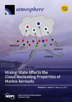
In coastal California, the chemical mixing state and ability of aerosol particles to nucleate cloud droplets were strongly associated with air mass origin and local onshore/offshore winds. The observed water uptake properties of marine aerosols were significantly reduced when compared to values predicted by models, which highlights the need to update model parameterizations in coastal environments. View this paper
  • Issues are regarded as officially published after their release is announced to the table of contents alert mailing list.
  • You may sign up for e-mail alerts to receive table of contents of newly released issues.
  • PDF is the official format for papers published in both, html and pdf forms. To view the papers in pdf format, click on the "PDF Full-text" link, and use the free Adobe Reader to open them.
Order results
Result details
Section
Select all
Export citation of selected articles as:
20 pages, 10886 KiB  
Article
Spatiotemporal Distribution of Satellite-Retrieved Ground-Level PM2.5 and Near Real-Time Daily Retrieval Algorithm Development in Sichuan Basin, China
by Chao Gao, Xuelei Zhang, Wenyong Wang, Aijun Xiu, Daniel Q. Tong and Weiwei Chen
Atmosphere 2018, 9(2), 78; https://doi.org/10.3390/atmos9020078 - 22 Feb 2018
Cited by 10 | Viewed by 5552
Abstract
Satellite-based monitoring can retrieve ground-level PM2.5 concentrations with higher-resolution and continuous spatial coverage to assist in making management strategies and estimating health exposures. The Sichuan Basin has a complex terrain and several city clusters that differ from other regions in China: it [...] Read more.
Satellite-based monitoring can retrieve ground-level PM2.5 concentrations with higher-resolution and continuous spatial coverage to assist in making management strategies and estimating health exposures. The Sichuan Basin has a complex terrain and several city clusters that differ from other regions in China: it has an enclosed air basin with a unique planetary boundary layer dynamic which accumulates air pollution. The spatiotemporal distribution of 1-km resolution Aerosol Optical Depth (AOD) in the Sichuan Basin was retrieved using the improved dark pixel method and Moderate Resolution Imaging Spectroradiometer (MODIS) data in this study. The retrieved seasonal AOD reached its highest values in spring and had the lowest values in autumn. The higher correlation (r = 0.84, N = 171) between the ground-based Lidar AOD and 1-km resolution MODIS AOD indicated that the high-resolution MODIS AOD could be used to retrieve the ground-level PM2.5 concentration. The Lidar-measured annual average extinction coefficient increased linearly with the Planetary Boundary Layer Height (PBLH) in the range of 100~670 m, but exponentially decreased between the heights of 670~1800 m. Both the correlation and the variation tendency of simulated PBLH from the Weather Research and Forecasting (WRF) model & Shin-Hong (SHIN)/California Meteorological (CALMET) model (WRF_SHIN/CALMET) were closer to the Lidar observation than that of three other Planetary Boundary Layer (PBL) schemes (the Grenier-Bretherton-McCaa (GBM) scheme, the Total Energy-Mass Flux (TEMF) scheme and the University of Washington (UW) scheme), which suggested that the simulated the Planetary Boundary Layer Height (PBLH) could be used in the vertical correction of retrieval PM2.5. Four seasonal fitting functions were also obtained for further humidity correction. The correlation coefficient between the aerosol extinction coefficient and the fitted surface-level PM2.5 concentration at the benchmark station of Southwest Jiao-tong University was enhanced significantly from 0.62 to 0.76 after vertical and humidity corrections during a whole year. During the evaluation of the retrieved ground-level PM2.5 with observed values from three cities, Yibin (YB), Dazhou (DZ), and Deyang (DY), our algorithm performed well, resulting in higher correlation coefficients of 0.78 (N = 177), 0.77 (N = 178), and 0.81 (N = 181), respectively. Full article
(This article belongs to the Section Air Quality)
Show Figures

Graphical abstract

18 pages, 2960 KiB  
Article
Innovative Hybrid Modeling of Wind Speed Prediction Involving Time-Series Models and Artificial Neural Networks
by Henrique Do Nascimento Camelo, Paulo Sérgio Lucio, João Bosco Verçosa Leal Junior, Daniel Von Glehn dos Santos and Paulo Cesar Marques de Carvalho
Atmosphere 2018, 9(2), 77; https://doi.org/10.3390/atmos9020077 - 21 Feb 2018
Cited by 8 | Viewed by 4106
Abstract
This work proposes hybrid models combining time-series models (using linear functions) and artificial intelligence (using a nonlinear function) that can be used to provide monthly mean wind speed predictions for the Brazilian northeast region. These might be useful for wind power generation; for [...] Read more.
This work proposes hybrid models combining time-series models (using linear functions) and artificial intelligence (using a nonlinear function) that can be used to provide monthly mean wind speed predictions for the Brazilian northeast region. These might be useful for wind power generation; for example, they could acquire important information on how the local wind potential can be usable for a possible wind power plant through understanding future wind speed values. To create the proposed hybrid models, it was necessary to set the wind speed variable as a dependent variable of exogenous variables (i.e., pressure, temperature, and precipitation). Thus, it was possible to consider the meteorological characteristics of the study regions. It is possible to verify the hybrid models’ efficiency in providing perfect adjustments to the observed data. This statement is based on the low values found in the error statistical analysis, i.e., an error of approximately 5.0% and a Nash–Sutcliffe coefficient near to 0.96. These results were certainly important in predicting the wind speed time-series, which was similar to the observed wind speed time-series profile. Great similarities of maximums and minimums between the series were evident and showed the capacity of the models to represent the seasonality characteristics. Full article
(This article belongs to the Section Meteorology)
Show Figures

Figure 1

18 pages, 1150 KiB  
Review
Recent Advances in Atmospheric Chemistry of Mercury
by Lin Si and Parisa A. Ariya
Atmosphere 2018, 9(2), 76; https://doi.org/10.3390/atmos9020076 - 21 Feb 2018
Cited by 37 | Viewed by 11601 | Correction
Abstract
Mercury is one of the most toxic metals and has global importance due to the biomagnification and bioaccumulation of organomercury via the aquatic food web. The physical and chemical transformations of various mercury species in the atmosphere strongly influence their composition, phase, transport [...] Read more.
Mercury is one of the most toxic metals and has global importance due to the biomagnification and bioaccumulation of organomercury via the aquatic food web. The physical and chemical transformations of various mercury species in the atmosphere strongly influence their composition, phase, transport characteristics and deposition rate to the ground. Modeling efforts to evaluate the mercury cycling in the environment require an accurate understanding of atmospheric mercury chemistry. We focus this article on recent studies (since 2015) on improving our understanding of the atmospheric chemistry of mercury. We discuss recent advances in (i) determining the dominant atmospheric oxidant of elemental mercury (Hg0); (ii) understanding the oxidation reactions of Hg0 by halogen atoms and by nitrate radical (NO3); (iii) the aqueous reduction of oxidized mercury compounds (HgII); and (iv) the heterogeneous reactions of Hg on atmospherically-relevant surfaces. The need for future research to improve understanding of the fate and transformation of mercury in the atmosphere is also discussed. Full article
(This article belongs to the Special Issue Atmospheric Metal Pollution)
Show Figures

Graphical abstract

14 pages, 3156 KiB  
Article
Indoor Air Quality and Thermal Conditions in a Primary School with a Green Roof System
by Nikolaos Barmparesos, Margarita Niki Assimakopoulos, Vasiliki D. Assimakopoulos, Nikolaos Loumos, Maria Aliki Sotiriou and Athanasios Koukoumtzis
Atmosphere 2018, 9(2), 75; https://doi.org/10.3390/atmos9020075 - 20 Feb 2018
Cited by 17 | Viewed by 4885 | Correction
Abstract
This paper presents experimental results from a typical school building in Athens, equipped partly with a green roof system (GRS). Environmental monitoring took place in six classrooms located both under the concrete roof and the GRS sectors as well as in the immediate [...] Read more.
This paper presents experimental results from a typical school building in Athens, equipped partly with a green roof system (GRS). Environmental monitoring took place in six classrooms located both under the concrete roof and the GRS sectors as well as in the immediate external environment during the warm and cold periods of a school year. Daily measurements of pollutants CO2, TVOCs (Total Volatile Organic Compound), PM1, PM2.5, and PM10 were performed in selected classes. Moreover, indoor ambient temperature (T) and relative humidity (RH) measurements were implemented in order to estimate the absolute humidity (AH) and assess the indoor environmental conditions. The results highlight that during summer, the GRS reduces temperature in a classroom on the top floor by about 2.8 °C, in comparison with the respective classroom under the concrete roof and that AH remained relatively stable for both classrooms. Amid winter, a reverse behavior occurs only for temperature. Moreover, air exchange rates (AER) were calculated by using the CO2 decay method for all of the classrooms. The results demonstrated insufficient ventilation for all experimental sights. Finally, concentrations of PM1, PM2.5 and PM10, were found to be relatively decreased, with average values of 0.79, 3.39, and 27.80 μg m−3. Levels of CO2 and TVOCs were elevated during class hours ranging from 469 to 779 ppm and from 6.63 ppm to 13.33 ppm, respectively, but generally within the respective limits of exposure. The examination of the indoor/outdoor (I/O) ratio of air pollutants, demonstrated that the outdoor meteorology affects only PM1 and PM2.5, as PM10 and TVOCs are strongly affected by internal sources and the activities of pupils. Full article
(This article belongs to the Special Issue Advances in Atmospheric Physics: Selected Papers from CEST2017)
Show Figures

Figure 1

16 pages, 3925 KiB  
Article
Spatiotemporal Characteristics of Air Pollutants (PM10, PM2.5, SO2, NO2, O3, and CO) in the Inland Basin City of Chengdu, Southwest China
by Kuang Xiao, Yuku Wang, Guang Wu, Bin Fu and Yuanyuan Zhu
Atmosphere 2018, 9(2), 74; https://doi.org/10.3390/atmos9020074 - 16 Feb 2018
Cited by 89 | Viewed by 9204
Abstract
Most cities in China are experiencing severe air pollution due to rapid economic development and accelerated urbanization. Long-term air pollution data with high temporal and spatial resolutions are needed to support research into physical and chemical processes that affect air quality, and the [...] Read more.
Most cities in China are experiencing severe air pollution due to rapid economic development and accelerated urbanization. Long-term air pollution data with high temporal and spatial resolutions are needed to support research into physical and chemical processes that affect air quality, and the corresponding health risks. For the first time, data on PM10, PM2.5, SO2, NO2, O3 and CO concentrations in 23 ambient air quality automatic monitoring stations and routine meteorological were collected between January 2014 and December 2016 to determine the spatial and temporal variation in these pollutants and influencing factors in Chengdu. The annual mean concentrations of PM2.5 and PM10 exceeded the standard of Chinese Ambient Air Quality and World Health Organization guidelines standards at all of the stations. The concentrations of PM10, PM2.5, SO2 and CO decreased from 2014 to 2016, and the NO2 level was stable, whereas the O3 level increased markedly during this period. The air pollution characteristics in Chengdu showed simultaneously high PM concentrations and O3. High PM concentrations were mainly observed in the middle region of Chengdu and may have been due to the joint effects of industrial and vehicle emissions. Ozone pollution was mainly due to vehicle emissions in the downtown area, and industry had a more important effect on O3 in the northern area with fewer vehicles. The concentrations of PM10, PM2.5, NO2 and CO were highest in winter and lowest in summer; the highest SO2 concentration was also observed in winter and was lowest in autumn, whereas the O3 concentration peaked in summer. Haze pollution can easily form under the weather conditions of static wind, low temperature and relative humidity, and high surface pressure inside Chengdu. In contrast, severe ozone pollution is often associated with high temperature. Full article
(This article belongs to the Section Air Quality)
Show Figures

Graphical abstract

13 pages, 1860 KiB  
Article
Comparative Evaluation of the Third-Generation Reanalysis Data for Wind Resource Assessment of the Southwestern Offshore in South Korea
by Hyun-Goo Kim, Jin-Young Kim and Yong-Heack Kang
Atmosphere 2018, 9(2), 73; https://doi.org/10.3390/atmos9020073 - 16 Feb 2018
Cited by 34 | Viewed by 5159
Abstract
This study evaluated the applicability of long-term datasets among third-generation reanalysis data CFSR, ERA-Interim, MERRA, and MERRA-2 to determine which dataset is more suitable when performing wind resource assessment for the ‘Southwest 2.5 GW Offshore Wind Power Project’, which is currently underway strategically [...] Read more.
This study evaluated the applicability of long-term datasets among third-generation reanalysis data CFSR, ERA-Interim, MERRA, and MERRA-2 to determine which dataset is more suitable when performing wind resource assessment for the ‘Southwest 2.5 GW Offshore Wind Power Project’, which is currently underway strategically in South Korea. The evaluation was performed by comparing the reanalyses with offshore, onshore, and island meteorological tower measurements obtained in and around the southwest offshore. In the pre-processing of the measurement data, the shading sectors due to a meteorological tower were excluded from all observation data, and the measurement heights at the offshore meteorological towers were corrected considering the sea level change caused by tidal difference. To reflect the orographic forcing by terrain features, the reanalysis data were transformed by using WindSim, a flow model based on computational fluid dynamics and statistical-dynamic downscaling. The comparison of the reanalyses with the measurement data showed the fitness in the following order in terms of coefficient of determination: MERRA-2 > CFSR = MERRA > ERA-Interim. Since the measurement data at the onshore meteorological towers strongly revealed a local wind system such as sea-land breeze, it is judged to be inappropriate for use as supplementary data for offshore wind resource assessment. Full article
(This article belongs to the Special Issue Energy Meteorology)
Show Figures

Figure 1

9 pages, 11629 KiB  
Article
2004–2016 Wintertime Atmospheric Blocking Events over Western Siberia and Their Effect on Surface Temperature Anomalies
by Olga Yu. Antokhina, Pavel N. Antokhin, Elena V. Devyatova and Yuliya V. Martynova
Atmosphere 2018, 9(2), 72; https://doi.org/10.3390/atmos9020072 - 16 Feb 2018
Cited by 4 | Viewed by 2952
Abstract
Western Siberia is a large area in Northern Eurasia, which lies between the Urals and the Yenisei River. The atmospheric blocking events are not a frequent phenomenon in this region. Nevertheless, they noticeably affect the weather and living conditions of people there. We [...] Read more.
Western Siberia is a large area in Northern Eurasia, which lies between the Urals and the Yenisei River. The atmospheric blocking events are not a frequent phenomenon in this region. Nevertheless, they noticeably affect the weather and living conditions of people there. We have investigated 14 winter blocking events, identified over Western Siberia, over 2004–2016, and have studied their effect on the surface temperature in this region. We have compared each of the 14 blocking events to the corresponding surface temperature anomalies in the north and in the south of Western Siberia. As a result, the temperature anomalies were separated into two groups: (1) dipole, with a positive surface temperature anomaly (or close to the norm) in the north, and with a negative anomaly (or close to the norm) in the south, and (2) non-dipole. Ten events were attributed to Group 1, four events were referred to Group 2. Analyzing the potential temperature on the dynamic tropopause (advection characteristic) showed that the Group 1 events feature strong advection over the investigated territory. In the non-dipole situations from Group 2 Western Siberia are away from strong blocking events. Full article
Show Figures

Figure 1

24 pages, 4412 KiB  
Article
Analysis of the Influence of Rainfall Spatial Uncertainty on Hydrological Simulations Using the Bootstrap Method
by Ang Zhang, Haiyun Shi, Tiejian Li and Xudong Fu
Atmosphere 2018, 9(2), 71; https://doi.org/10.3390/atmos9020071 - 15 Feb 2018
Cited by 18 | Viewed by 5158
Abstract
Rainfall stations of a certain number and spatial distribution supply sampling records of rainfall processes in a river basin. Uncertainty may be introduced when the station records are spatially interpolated for the purpose of hydrological simulations. This study adopts a bootstrap method to [...] Read more.
Rainfall stations of a certain number and spatial distribution supply sampling records of rainfall processes in a river basin. Uncertainty may be introduced when the station records are spatially interpolated for the purpose of hydrological simulations. This study adopts a bootstrap method to quantitatively estimate the uncertainty of areal rainfall estimates and its effects on hydrological simulations. The observed rainfall records are first analyzed using clustering and correlation methods and possible average basin rainfall amounts are calculated with a bootstrap method using various combinations of rainfall station subsets. Then, the uncertainty of simulated runoff, which is propagated through a hydrological model from the spatial uncertainty of rainfall estimates, is analyzed with the bootstrapped rainfall inputs. By comparing the uncertainties of rainfall and runoff, the responses of the hydrological simulation to the rainfall spatial uncertainty are discussed. Analyses are primarily performed for three rainfall events in the upstream of the Qingjian River basin, a sub-basin of the middle Yellow River; moreover, one rainfall event in the Longxi River basin is selected for the analysis of the areal representation of rainfall stations. Using the Digital Yellow River Integrated Model, the results show that the uncertainty of rainfall estimates derived from rainfall station network has a direct influence on model simulation, which can be conducive to better understand of rainfall spatial characteristic. The proposed method can be a guide to quantify an approximate range of simulated error caused by the spatial uncertainty of rainfall input and the quantified relationship between rainfall input and simulation performance can provide useful information about rainfall station network management in river basins. Full article
Show Figures

Figure 1

21 pages, 1486 KiB  
Article
Evaluation of Analysis by Cross-Validation, Part II: Diagnostic and Optimization of Analysis Error Covariance
by Richard Ménard and Martin Deshaies-Jacques
Atmosphere 2018, 9(2), 70; https://doi.org/10.3390/atmos9020070 - 15 Feb 2018
Cited by 11 | Viewed by 3841
Abstract
We present a general theory of estimation of analysis error covariances based on cross-validation as well as a geometric interpretation of the method. In particular, we use the variance of passive observation-minus-analysis residuals and show that the true analysis error variance can be [...] Read more.
We present a general theory of estimation of analysis error covariances based on cross-validation as well as a geometric interpretation of the method. In particular, we use the variance of passive observation-minus-analysis residuals and show that the true analysis error variance can be estimated, without relying on the optimality assumption. This approach is used to obtain near optimal analyses that are then used to evaluate the air quality analysis error using several different methods at active and passive observation sites. We compare the estimates according to the method of Hollingsworth-Lönnberg, Desroziers et al., a new diagnostic we developed, and the perceived analysis error computed from the analysis scheme, to conclude that, as long as the analysis is near optimal, all estimates agree within a certain error margin. Full article
(This article belongs to the Special Issue Air Quality Monitoring and Forecasting)
Show Figures

Figure 1

13 pages, 5307 KiB  
Article
The 30–50-Day Intraseasonal Oscillation of SST and Precipitation in the South Tropical Indian Ocean
by Yun Liang, Yan Du, Lianyi Zhang, Xiaotong Zheng and Shuang Qiu
Atmosphere 2018, 9(2), 69; https://doi.org/10.3390/atmos9020069 - 15 Feb 2018
Cited by 4 | Viewed by 4137
Abstract
The Sea Surface Temperature (SST) in the South Tropical Indian Ocean (STIO) displays significant intraseasonal oscillation (ISO) in two regions. A striking 30–50-day ISO found over the east of thermocline ridge (Region A, 80–90° E, 6–12° S), as identified by the Empirical Mode [...] Read more.
The Sea Surface Temperature (SST) in the South Tropical Indian Ocean (STIO) displays significant intraseasonal oscillation (ISO) in two regions. A striking 30–50-day ISO found over the east of thermocline ridge (Region A, 80–90° E, 6–12° S), as identified by the Empirical Mode Decomposition (EMD) method, is distinguished from the SST signature over the thermocline ridge (Region B, 52.5–65° E, 6–13° S). The 30–50-day ISO of SST in the Region A is active in March–May (MAM) and suppressed in September–November (SON). Meanwhile, a 30–50-day ISO of precipitation correlates with the SST over the Region A. SST leads precipitation by 10 days, implying a pronounced ocean–atmosphere interaction at the intraseasonal timescale, especially the oceanic feedback to the atmosphere during Madden–Julian Oscillation (MJO) events. Analysis on mechanism of the ISO manifests heat fluxes are critical to the development of the intraseasonal SST variability. The local thermocline in Region A, as the shallowest in MAM and the thickest in SON, is likely to modulate the strength of ISO and contribute to its sustainability. It suggests that thermocline plays a more important role in Region A than in Region B, leading to the difference between the two regions. Full article
(This article belongs to the Special Issue Madden-Julian Oscillation)
Show Figures

Figure 1

17 pages, 3093 KiB  
Article
Observing Actual Evapotranspiration from Flux Tower Eddy Covariance Measurements within a Hilly Watershed: Case Study of the Kamech Site, Cap Bon Peninsula, Tunisia
by Rim Zitouna-Chebbi, Laurent Prévot, Amal Chakhar, Manel Marniche-Ben Abdallah and Frederic Jacob
Atmosphere 2018, 9(2), 68; https://doi.org/10.3390/atmos9020068 - 15 Feb 2018
Cited by 22 | Viewed by 4945
Abstract
There is a strong need for long term observations of land surface fluxes such as actual evapotranspiration (ETa). Eddy covariance (EC) method is widely used to provide ETa measurements, and several gap-filling methods have been proposed to complete inherent missing data. However, implementing [...] Read more.
There is a strong need for long term observations of land surface fluxes such as actual evapotranspiration (ETa). Eddy covariance (EC) method is widely used to provide ETa measurements, and several gap-filling methods have been proposed to complete inherent missing data. However, implementing gap-filling methods is questionable for EC time series collected within hilly agricultural areas at the watershed extent. Indeed, changes in wind direction induce changes in airflow inclination and footprint, and therefore possibly induce changes in the relationships on which rely gap-filling methods. This study aimed to obtain continuous ETa time series by adapting gap-filling methods to the particular conditions abovementioned. The experiment took place within an agricultural watershed in north-eastern Tunisia. A 9.6-m-high EC flux tower has been operating close to the watershed center since 2010. The sensible and latent heat fluxes data collected from 2010 to 2013 were quality controlled, and the REddyProc software was used to fill gaps at the hourly timescale. Adapting REddyProc method consisted of splitting the dataset according to wind direction, which improved the flux data at the hourly timescale, but not at the daily and monthly timescales. Finally, complete time series permitted to analyze seasonal and inter-annual variability of ETa. Full article
Show Figures

Figure 1

14 pages, 15809 KiB  
Article
Activity Characteristics of the East Asian Trough in CMIP5 Models
by Xiong Chen, Xing Liu, Xin Li, Mingyang Liu and Minghao Yang
Atmosphere 2018, 9(2), 67; https://doi.org/10.3390/atmos9020067 - 14 Feb 2018
Cited by 4 | Viewed by 4148
Abstract
In this paper, the performances of 12 CMIP5 (Coupled Model Intercomparison Project phase 5) models for simulating the climatology and interannual variability of the East Asian trough (EAT) are assessed using the National Centers for Environmental Prediction (NCEP) reanalysis data and the outputs [...] Read more.
In this paper, the performances of 12 CMIP5 (Coupled Model Intercomparison Project phase 5) models for simulating the climatology and interannual variability of the East Asian trough (EAT) are assessed using the National Centers for Environmental Prediction (NCEP) reanalysis data and the outputs of the CMIP5 models. The multimodel ensemble (MME) successfully reproduces the spatial pattern and spatial variations in the climatology and interannual variability of the EAT but the intensity and interannual variability of EAT are weaker than in the observations. The biases in intensity (interannual variability) are larger over the southern (northern) part of the EAT than over the northern (southern) part. The intermodel spreads are small for the EAT intensity but are large for its location in terms of both latitude and longitude. The simulated EAT in the MME is about 3° E and 1.5° S of that observed. All 12 CMIP5 models reproduce the first empirical orthogonal function (EOF) mode of EAT activity; however, its intensity and location are only successfully captured in half of the models and its linear weakening trend is simulated in ten models. The second EOF mode of EAT activity and its linear strengthening trend are successfully reproduced in eight models. Full article
(This article belongs to the Special Issue Monsoons)
Show Figures

Figure 1

17 pages, 10096 KiB  
Article
Effect of Teleconnection Patterns on Changes in Water Temperature in Polish Lakes
by Mariusz Ptak, Arkadiusz M. Tomczyk and Dariusz Wrzesiński
Atmosphere 2018, 9(2), 66; https://doi.org/10.3390/atmos9020066 - 14 Feb 2018
Cited by 28 | Viewed by 3229
Abstract
The objective of the paper was the determination of the effect of teleconnection patterns (North Atlantic Oscillation (NAO), Arctic Oscillation (AO), East Atlantic pattern (EA), East Atlantic/Western Russia (EAWR), and Scandinavian pattern (SCAND)) on changes in air and water temperature in Polish lakes. [...] Read more.
The objective of the paper was the determination of the effect of teleconnection patterns (North Atlantic Oscillation (NAO), Arctic Oscillation (AO), East Atlantic pattern (EA), East Atlantic/Western Russia (EAWR), and Scandinavian pattern (SCAND)) on changes in air and water temperature in Polish lakes. Correlations of circulation indices with air and lake water temperature were analysed in the monthly cycle. Deviations of values of such components in different phases of the analysed atmospheric circulations types from mean average from the years 1971 to 2015 were also determined. The research showed a variable effect of the atmospheric circulations types. The strongest effect on water temperature was observed in winter, when AO and NAO circulation showed particularly evident influence. Deviations of water temperature from mean values from the analysed multi-annual period generally oscillated around 1.0 °C, reaching a maximum value of 1.4 °C. The presented research shows the complexity of processes determining changes in lake water temperature, the course of which depends on many factors with both regional (e.g., ice cover on lakes) and local range (conditions of water exchange, human pressure). Full article
(This article belongs to the Section Biosphere/Hydrosphere/Land–Atmosphere Interactions)
Show Figures

Figure 1

27 pages, 28890 KiB  
Article
Ventilation and Air Quality in City Blocks Using Large-Eddy Simulation—Urban Planning Perspective
by Mona Kurppa, Antti Hellsten, Mikko Auvinen, Siegfried Raasch, Timo Vesala and Leena Järvi
Atmosphere 2018, 9(2), 65; https://doi.org/10.3390/atmos9020065 - 13 Feb 2018
Cited by 70 | Viewed by 8382
Abstract
Buildings and vegetation alter the wind and pollutant transport in urban environments. This comparative study investigates the role of orientation and shape of perimeter blocks on the dispersion and ventilation of traffic-related air pollutants, and the street-level concentrations along a planned city boulevard. [...] Read more.
Buildings and vegetation alter the wind and pollutant transport in urban environments. This comparative study investigates the role of orientation and shape of perimeter blocks on the dispersion and ventilation of traffic-related air pollutants, and the street-level concentrations along a planned city boulevard. A large-eddy simulation (LES) model PALM is employed over a highly detailed representation of the urban domain including street trees and forested areas. Air pollutants are represented by massless and passive particles (non-reactive gases), which are released with traffic-related emission rates. High-resolution simulations for four different city-block-structures are conducted over a 8.2 km 2 domain under two contrasting inflow conditions with neutral and stable atmospheric stratification corresponding the general and wintry meteorological conditions. Variation in building height together with multiple cross streets along the boulevard improves ventilation, resulting in 7–9% lower mean concentrations at pedestrian level. The impact of smaller scale variability in building shape was negligible. Street trees further complicate the flow and dispersion. Notwithstanding the surface roughness, atmospheric stability controls the concentration levels with higher values under stably stratified inflow. Little traffic emissions are transported to courtyards. The results provide urban planners direct information to reduce air pollution by proper structural layout of perimeter blocks. Full article
(This article belongs to the Special Issue Recent Advances in Urban Ventilation Assessment and Flow Modelling)
Show Figures

Graphical abstract

14 pages, 267 KiB  
Article
Electrostatic Dust Cloth: A Passive Screening Method to Assess Occupational Exposure to Organic Dust in Bakeries
by Carla Viegas, Ana Monteiro, Liliana Aranha Caetano, Tiago Faria, Elisabete Carolino and Susana Viegas
Atmosphere 2018, 9(2), 64; https://doi.org/10.3390/atmos9020064 - 12 Feb 2018
Cited by 35 | Viewed by 4663
Abstract
Organic dust is widespread in the environment including occupational settings, such as bakeries. Recently, a new collection device—the electrostatic dust cloth (EDC)—has been described for the assessment of occupational exposures. The aim of this study was to investigate the suitability of EDC for [...] Read more.
Organic dust is widespread in the environment including occupational settings, such as bakeries. Recently, a new collection device—the electrostatic dust cloth (EDC)—has been described for the assessment of occupational exposures. The aim of this study was to investigate the suitability of EDC for identifying the distribution patterns and exposure concentrations of particulate matter and microbial contaminants such as fungi and bacteria in bakeries. Twelve bakeries were selected, and dust was allowed to settle for 13 to 16 days on EDCs (a total of 33 samples). Particle counts and size distribution (0.3 µm, 0.5 µm, 1 µm, 2.5 µm, 5 µm and 10 µm) were measured with direct-reading equipment. Higher EDC mass was significantly correlated (p values < 0.05) with higher fungal load on dichloran glycerol (DG18) and with particle size distribution in the 0.3 µm, 0.5 µm, 1.0 µm and 10.0 µm range. Fungal levels on malt extract agar (MEA) ranged from 0 to 2886 CFU/m2 EDC in the warehouse setting, 0 to 500 CFU/m2 EDC in the production setting, and 0 to 3135 CFU/m2 EDC in the store. Penicillium sp. (42.56%) was the most frequent fungi. Total bacterial load ranged from 0 to 18,859 CFU/m2 EDC in the warehouse, 0 to 71,656 CFU/m2 EDC in production, and 0 to 21,746 CFU/m2 EDC in the store. EDC assessment provided a longer-term integrated sample of organic dust, useful for identifying critical worksites in which particulate matter and bio-burden exposures are elevated. These findings suggest that EDC can be applied as a screening method for particulate matter-exposure assessment and as a complementary method to quantify exposures in occupational environments. Full article
(This article belongs to the Special Issue Indoor Air Pollution)
9 pages, 910 KiB  
Article
Seasonal Variations and Sources of Airborne Polycyclic Aromatic Hydrocarbons (PAHs) in Chengdu, China
by Ju Yang, Wenlai Xu and Huiyu Cheng
Atmosphere 2018, 9(2), 63; https://doi.org/10.3390/atmos9020063 - 11 Feb 2018
Cited by 28 | Viewed by 4390
Abstract
The concentrations of polycyclic aromatic hydrocarbons (PAHs) in the air of Chengdu, a southwest city of China, were determined from March 2015 to February 2016. Here, two diagnostic ratios (DR) were determined and a principal component analysis/multiple linear regression (PCA/MLR) analysis was performed [...] Read more.
The concentrations of polycyclic aromatic hydrocarbons (PAHs) in the air of Chengdu, a southwest city of China, were determined from March 2015 to February 2016. Here, two diagnostic ratios (DR) were determined and a principal component analysis/multiple linear regression (PCA/MLR) analysis was performed to identify the sources of PAHs during the four seasons. The gaseous and particle phase samples were analyzed separately. The sampled air had a gas-to particle ratio of 4.21, and between 18.7% and 31.3% of the total detected PAHs were found in the particulate phase. The total concentration of all 16-PAHs combined (gas + particles) varied from 176.94 in summer to 458.95 ng·m−3 in winter, with a mean of 300.35 ± 176.6 ng·m−3. In the gas phase, phenanthrene(Phe) was found at the highest concentrations in all four seasons, while benzo[b]fluoranthene(BbF) and (in winter) chrysene(Chr) were the highest in the particle phase. The DR of Fluroanthene (Flua)/(Flua + Pyrene (Pyr)) was higher in the gas phase than in the particle phase, while the Indeno[1,2,3-cd]pyrene(IcdP)/(IcdP + Benzo[ghi]perylene (BghiP)) ratio was more variable in the gas than that in the particle phase. The main sources for both phases were a mixture of liquid fossil fuel combustion and the burning of biomass and coal, with clear seasonal variation. Principal Component Analysis/Multiple Linear Regression (PCA/MLR) analysis identified the main PAH sources as coal burning (52%) with motor vehicle exhaust and coke (48%) in spring; coal (52%), coke (21%), and motor vehicle exhaust (27%) in summer; coal (47%), vehicle exhaust (34%), and coke (19%) in autumn; and coal (58%) and vehicle exhaust (42%) in winter. Full article
(This article belongs to the Special Issue Formation and Transformation of Organic Aerosol)
Show Figures

Figure 1

13 pages, 2041 KiB  
Article
Day-Night Differences, Seasonal Variations and Source Apportionment of PM10-Bound PAHs over Xi’an, Northwest China
by Xin Wang, Zhenxing Shen, Yaling Zeng, Fobang Liu, Qian Zhang, Yali Lei, Hongmei Xu, Junji Cao and Liu Yang
Atmosphere 2018, 9(2), 62; https://doi.org/10.3390/atmos9020062 - 11 Feb 2018
Cited by 16 | Viewed by 4226
Abstract
Day-night PM10-bound PAHs were studied at an urban site of Xi’an from 20 December 2006 to 28 October 2007. The annual mean concentration of nighttime PAHs (285.0 ng m−3) was higher than that in daytime (239.4 ng m−3 [...] Read more.
Day-night PM10-bound PAHs were studied at an urban site of Xi’an from 20 December 2006 to 28 October 2007. The annual mean concentration of nighttime PAHs (285.0 ng m−3) was higher than that in daytime (239.4 ng m−3). A significant difference of PAH concentrations between daytime and nighttime was found in autumn with a coefficient of divergence (CD) of 0.23 (significant level 0.2). However, no distinct difference was observed in other seasons (with CD values < 0.2), although the difference of PAHs partition capacity in PM10 between daytime and nighttime was significant in the four seasons. Remarkable seasonal variations were observed in the total PAH levels, with a highest mean concentration of 344.6 ng m−3 in winter and a lowest mean concentration of 177 ng m−3 in summer. Positive matrix factorization results revealed that residential emission for heating is the major contributor of the elevated PAH levels in winter, accounting for 49% of the total PAH levels. The coal combustion including industrial and residential usage, contributed over 40% of the PAH emissions in PM10 of Xi’an during the one-year sampling period. These results can provide guidance for taking measures in reducing PAHs levels in the air. Full article
(This article belongs to the Section Aerosols)
Show Figures

Figure 1

10 pages, 4387 KiB  
Article
Vortex Motion State of the Dry Atmosphere with Nonzero Velocity Divergence
by Robert Zakinyan, Arthur Zakinyan, Roman Ryzhkov and Julia Semenova
Atmosphere 2018, 9(2), 61; https://doi.org/10.3390/atmos9020061 - 10 Feb 2018
Viewed by 3202
Abstract
In the present work, an analytical model of the vortex motion basic state of the dry atmosphere with nonzero air velocity divergence is constructed. It is shown that the air parcel moves along the open curve trajectory of spiral geometry. It is found [...] Read more.
In the present work, an analytical model of the vortex motion basic state of the dry atmosphere with nonzero air velocity divergence is constructed. It is shown that the air parcel moves along the open curve trajectory of spiral geometry. It is found that for the case of nonzero velocity divergence, the atmospheric basic state presents an unlimited sequence of vortex cells transiting from one to another. On the other hand, at zero divergence, the basic state presents a pair of connected vortices, and the trajectory is a closed curve. If in some cells the air parcel moves upward, then in the adjacent cells, it will move downward, and vice versa. Upon reaching the cell’s middle height, the parcel reverses the direction of rotation. When the parcel moves upward, the motion is of anticyclonic type in the lower part of the vortex cell and of cyclonic type in the upper part. When the parcel moves downward, the motion is of anticyclonic type in the upper part of the vortex cell and of cyclonic type in the lower part. Full article
Show Figures

Figure 1

19 pages, 5878 KiB  
Article
Effect of Wind Speed on Moderate Resolution Imaging Spectroradiometer (MODIS) Aerosol Optical Depth over the North Pacific
by Lena Merkulova, Eyal Freud, E. Monica Mårtensson, E. Douglas Nilsson and Paul Glantz
Atmosphere 2018, 9(2), 60; https://doi.org/10.3390/atmos9020060 - 09 Feb 2018
Cited by 9 | Viewed by 4923
Abstract
The surface-wind speed influences on aerosol optical depth (AOD), derived from the Moderate Resolution Imaging Spectroradiometer (MODIS) Aqua daily observations over the central North Pacific during the period 2003–2016, have been investigated in this study. The cloud coverage is relatively low over the [...] Read more.
The surface-wind speed influences on aerosol optical depth (AOD), derived from the Moderate Resolution Imaging Spectroradiometer (MODIS) Aqua daily observations over the central North Pacific during the period 2003–2016, have been investigated in this study. The cloud coverage is relatively low over the present investigation area compared to other marine areas, which favors AOD derived from passive remote sensing from space. In this study, we have combined MODIS AOD with 2 m wind speed (U2m) on a satellite-pixel basis, which has been interpolated from National Centers for Environmental Prediction (NCEP) reanalysis. In addition, daily averaged AOD derived from Aerosol Robotic Network (AERONET) measurements in the free-troposphere at the Mauna Loa Observatory (3397 m above sea level), Hawaii, was subtracted from the MODIS column AOD values. The latter was to reduce the contribution of aerosols above the planetary boundary layer. This study shows relatively strong power-law relationships between MODIS mean AOD and surface-wind speed for marine background conditions in summer, fall and winter of the current period. However, previous established relationships between AOD and surface-wind speed deviate substantially. Even so, for similar marine conditions the present relationship agrees reasonable well with a power-law relationship derived for north-east Atlantic conditions. The present MODIS retrievals of AOD in the marine atmosphere agree reasonably well with ground-based remote sensing of AOD. Full article
(This article belongs to the Special Issue Ocean Contributions to the Marine Boundary Layer Aerosol Budget)
Show Figures

Figure 1

18 pages, 4401 KiB  
Article
Influential Factors and Dry Deposition of Polychlorinated Biphenyls (PCBs) in Atmospheric Particles at an Isolated Island (Pingtan Island) in Fujian Province, China
by Qibin Lao, Liping Jiao, Fajin Chen, Liqi Chen and Xia Sun
Atmosphere 2018, 9(2), 59; https://doi.org/10.3390/atmos9020059 - 09 Feb 2018
Cited by 12 | Viewed by 4191
Abstract
To explore the polychlorinated biphenyl (PCB) pollution characteristics of atmospheric particles, influential factors, and dry deposition fluxes, 28 PCB congeners were examined over a 2-year period in the environment of an isolated island in Fujian Province. In 2006 and 2007, PCB concentrations ranged [...] Read more.
To explore the polychlorinated biphenyl (PCB) pollution characteristics of atmospheric particles, influential factors, and dry deposition fluxes, 28 PCB congeners were examined over a 2-year period in the environment of an isolated island in Fujian Province. In 2006 and 2007, PCB concentrations ranged from 1.12 to 87.32 pg m−3 and ND (not detected) to 44.93 pg m−3, respectively, and were predominantly highly-chlorinated PCBs. The levels were much lower than those from industrial, urban, and rural areas, but slightly higher than those found in coastal areas of Europe and in the ocean. Obvious seasonal variations were found in the PCB levels, with high levels appearing in the winter, whereas low levels appeared in the summer, which indicated a significant positive correlation with the atmospheric particle mass level. The distribution pattern of the PCB concentration was largely affected by the meteorological conditions and total organic carbon (TOC) levels. Moreover, air mass originating from Northern China may be responsible for the higher PCB levels over Pingtan Island during the winter, and tracing the source of atmospheric particles by the stable carbon isotope suggested that the PBC levels may be influenced by coal combustion during the “heating season” of Northern China. The total dry deposition flux of the 28 PCBs on Pingtan Island was 3.94 ng m−2 d−1 and 2.94 ng m−2 d−1 in 2006 and 2007, respectively, and the average yearly input to the adjacent waters was 7531.2 g y−1. Full article
(This article belongs to the Special Issue Air Quality in China: Past, Present and Future)
Show Figures

Graphical abstract

15 pages, 1009 KiB  
Article
Heavy Metals Size Distribution in PM10 and Environmental-Sanitary Risk Analysis in Acerra (Italy)
by Paola Di Vaio, Elisa Magli, Giuseppe Caliendo, Angela Corvino, Ferdinando Fiorino, Francesco Frecentese, Irene Saccone, Vincenzo Santagada, Beatrice Severino, Giuseppe Onorati, Giuseppina D’Onofrio Freda, Cosimo Manzo and Elisa Perissutti
Atmosphere 2018, 9(2), 58; https://doi.org/10.3390/atmos9020058 - 09 Feb 2018
Cited by 38 | Viewed by 5153
Abstract
The present research has been focused on the evaluation of seasonal changes in mass concentrations and compositions of heavy metals in Particular Matters (PM)10 collected from a typical urban-industrial site in Acerra, a city located in an area called “triangle of [...] Read more.
The present research has been focused on the evaluation of seasonal changes in mass concentrations and compositions of heavy metals in Particular Matters (PM)10 collected from a typical urban-industrial site in Acerra, a city located in an area called “triangle of death”. No significant (p < 0.05) seasonal variation was evidenced for the PM10 concentration, but in all the seasons (except for autumn) exceedances of daily concentrations (50 μg m−3) were observed. Airborne PM was analyzed for these heavy metals: Al, As, Cd, Co, Cr, Cu, Fe, Mn, Ni, Pb, Sb, V and Zn, which represented about 8% of the PM10 concentrations. None of the metals classified by IARC as carcinogenic in humans (group 1) exceeded on average the annual EU’s and Italy’s limit. For the mentioned heavy metals the enrichment factors (EnFs) were analyzed and highlighted high enrichment for Cd, Sb, Pb, As, Cu and Zn. Principal component analysis (PCA) for the heavy metals in PM10 identified oil combustion, vehicle and industrial emissions as major sources. To assess the health risk related to the inhalation to airborne PM10 metals, we applied the Cancer Risk (CR) and Target Hazard Quotient (THQ). The results showed that the CR was similar for a child and an adult, while the THQ proved to be higher for a child than for an adult. The low PM metals risk in the urban industrial site was in agreement with the ongoing lowering trend of metals in Italy and Europe. Full article
(This article belongs to the Section Aerosols)
Show Figures

Graphical abstract

14 pages, 4552 KiB  
Article
Personal Exposure to PM2.5 in the Megacity of Mexico: A Multi-Mode Transport Study
by Iván Y. Hernández-Paniagua, Gema L. Andraca-Ayala, Ulises Diego-Ayala, Luis G. Ruiz-Suarez, Juan C. Zavala-Reyes, Silvia Cid-Juárez, Luis Torre-Bouscoulet, Laura Gochicoa-Rangel, Irma Rosas-Pérez and Arón Jazcilevich
Atmosphere 2018, 9(2), 57; https://doi.org/10.3390/atmos9020057 - 09 Feb 2018
Cited by 13 | Viewed by 4310
Abstract
Recurrent personal exposure to ambient PM2.5 is associated with adverse human health effects, in particular on the respiratory and cardiovascular systems. Here, we present an assessment of personal exposure and inhalation of PM2.5 for five modes of transport (walking, cycling, public [...] Read more.
Recurrent personal exposure to ambient PM2.5 is associated with adverse human health effects, in particular on the respiratory and cardiovascular systems. Here, we present an assessment of personal exposure and inhalation of PM2.5 for five modes of transport (walking, cycling, public bus (trolleybus and diesel bus), conventional car (CC) and hybrid-electric car (HEC)) and two routes of similar distance, along a major road in the Mexico City metropolitan area (MCMA). Arithmetic average exposure concentrations ranged from 16.5 ± 6.5 µg m−3 for walking to 81.7 ± 9.1 µg m−3 for cycling (henceforth shown as average ±1 SD), with no significant differences with geometric averages. The maximum exposure concentration of 110.9 µg m−3 was observed for the conventional car. The highest exposure concentrations depended on route and the mode of transport, being observed for cycling and walking. The PM2.5 measurements showed large spatial heterogeneity in the exposure levels for walking and cycling, while public buses and private transport showed less spatial heterogeneity. The greatest peaks in PM2.5 coincided with 4-way intersections for all modes of transport, being positively influenced by traffic density. The mass of PM2.5 inhaled depended mostly on the mode of transport, and ranged between 1.0 ± 0.3 and 30.1 ± 14.2 µg km−1 for the HEC and bicycle, respectively. Local area PM2.5 increments identified as ‘residuals’ after subtraction of data recorded at the closest fixed monitoring site from exposure concentrations along the studied road suggested that inhalation for bicycle and diesel buses is strongly influenced by vehicular emissions. Residuals estimated for the trolleybus, CC and HEC confirmed a lower inhalation than for the other modes of transport evaluated due to protection by the cabin. Full article
(This article belongs to the Special Issue Impacts of Air Pollution on Human Health)
Show Figures

Figure 1

16 pages, 5265 KiB  
Article
Ship-Based Measurements of Atmospheric Mercury Concentrations over the Baltic Sea
by Hanna Hoglind, Sofia Eriksson and Katarina Gardfeldt
Atmosphere 2018, 9(2), 56; https://doi.org/10.3390/atmos9020056 - 09 Feb 2018
Cited by 5 | Viewed by 4295
Abstract
Mercury is a toxic pollutant emitted from both natural sources and through human activities. A global interest in atmospheric mercury has risen ever since the discovery of the Minamata disease in 1956. Properties of gaseous elemental mercury enable long range transport, which can [...] Read more.
Mercury is a toxic pollutant emitted from both natural sources and through human activities. A global interest in atmospheric mercury has risen ever since the discovery of the Minamata disease in 1956. Properties of gaseous elemental mercury enable long range transport, which can cause pollution even in pristine environments. Gaseous elemental mercury (GEM) was measured from winter 2016 to spring 2017 over the Baltic Sea. A Tekran 2357A mercury analyser was installed aboard the research and icebreaking vessel Oden for the purpose of continuous measurements of gaseous mercury in ambient air. Measurements were performed during a campaign along the Swedish east coast and in the Bothnian Bay near Lulea during the icebreaking season. Data was evaluated from Gothenburg using plotting software, and back trajectories for air masses were calculated. The GEM average of 1.36 ± 0.054 ng/m3 during winter and 1.29 ± 0.140 ng/m3 during spring was calculated as well as a total average of 1.36 ± 0.16 ng/m3. Back trajectories showed a possible correlation of anthropogenic sources elevating the mercury background level in some areas. There were also indications of depleted air, i.e., air with lower concentrations than average, being transported from the Arctic to northern Sweden, resulting in a drop in GEM levels. Full article
(This article belongs to the Special Issue Atmospheric Metal Pollution)
Show Figures

Figure 1

14 pages, 3937 KiB  
Article
Immersion Freezing of Total Ambient Aerosols and Ice Residuals
by Gourihar Kulkarni
Atmosphere 2018, 9(2), 55; https://doi.org/10.3390/atmos9020055 - 09 Feb 2018
Cited by 5 | Viewed by 3971
Abstract
This laboratory study evaluates an experimental set-up to study the immersion freezing properties of ice residuals (IRs) at a temperature ranging from −26 to −34 °C using two continuous-flow diffusion chamber-style ice nucleation chambers coupled with a virtual impactor and heat exchanger. Ice [...] Read more.
This laboratory study evaluates an experimental set-up to study the immersion freezing properties of ice residuals (IRs) at a temperature ranging from −26 to −34 °C using two continuous-flow diffusion chamber-style ice nucleation chambers coupled with a virtual impactor and heat exchanger. Ice was nucleated on the total ambient aerosol through an immersion freezing mechanism in an ice nucleation chamber (chamber 1). The larger ice crystals formed in chamber 1 were separated and sublimated to obtain IRs, and the frozen fraction of these IRs was investigated in a second ice nucleation chamber (chamber 2). The ambient aerosol was sampled from a sampling site located in the Columbia Plateau region, WA, USA, which is subjected to frequent windblown dust events, and only particles less than 1.5 μm in diameter were investigated. Single-particle elemental composition analyses of the total ambient aerosols showed that the majority of the particles are dust particles coated with organic matter. This study demonstrated a capability to investigate the ice nucleation properties of IRs to better understand the nature of Ice Nucleating Particles (INPs) in the ambient atmosphere. Full article
(This article belongs to the Special Issue Morphology and Internal Mixing of Atmospheric Particles)
Show Figures

Figure 1

18 pages, 5318 KiB  
Article
Influence of Common Assumptions Regarding Aerosol Composition and Mixing State on Predicted CCN Concentration
by Manasi Mahish, Anne Jefferson and Don R. Collins
Atmosphere 2018, 9(2), 54; https://doi.org/10.3390/atmos9020054 - 08 Feb 2018
Cited by 8 | Viewed by 4151
Abstract
A 4-year record of aerosol size and hygroscopic growth factor distributions measured at the Department of Energy’s Southern Great Plains (SGP) site in Oklahoma, U.S. were used to estimate supersaturation (S)-dependent cloud condensation nuclei concentrations (NCCN). Baseline or reference NCCN [...] Read more.
A 4-year record of aerosol size and hygroscopic growth factor distributions measured at the Department of Energy’s Southern Great Plains (SGP) site in Oklahoma, U.S. were used to estimate supersaturation (S)-dependent cloud condensation nuclei concentrations (NCCN). Baseline or reference NCCN(S) spectra were estimated using κ-Köhler Theory without any averaging of the measured distributions by creating matrices of size- and hygroscopicity-dependent number concentration (N) and then integrating for S > critical supersaturation (Sc) calculated for the same size and hygroscopicity pairs. Those estimates were first compared with directly measured NCCN at the same site. Subsequently, NCCN was calculated using the same dataset but with an array of simplified treatments in which the aerosol was assumed to be either an internal or an external mixture and the hygroscopicity either assumed or based on averages derived from the growth factor distributions. The CCN spectra calculated using the simplified treatments were compared with those calculated using the baseline approach to evaluate the error introduced with commonly used approximations. Full article
(This article belongs to the Special Issue Morphology and Internal Mixing of Atmospheric Particles)
Show Figures

Figure 1

21 pages, 2245 KiB  
Article
Assembling Typical Meteorological Year Data Sets for Building Energy Performance Using Reanalysis and Satellite-Based Data
by Thomas Huld, Elena Paietta, Paolo Zangheri and Irene Pinedo Pascua
Atmosphere 2018, 9(2), 53; https://doi.org/10.3390/atmos9020053 - 06 Feb 2018
Cited by 42 | Viewed by 6199
Abstract
We present a method to generate Typical Meteorological Year (TMY) data sets for use in calculations of the energy performance of buildings, based on satellite derived solar radiation data and other meteorological parameters obtained from reanalysis products. The great advantage of this method [...] Read more.
We present a method to generate Typical Meteorological Year (TMY) data sets for use in calculations of the energy performance of buildings, based on satellite derived solar radiation data and other meteorological parameters obtained from reanalysis products. The great advantage of this method is the availability of data over large geographical regions, giving global coverage for the reanalysis and continental-scale coverage for the solar radiation data, making it possible to generate TMY data for nearly any location, independent of the availability of meteorological measurement stations in the area. The TMY data generated with this method have been validated against 487 meteorological stations in Europe, by calculating heating and cooling degree days, and by running building energy performance simulations using EnergyPlus. Results show that the generated data sets using a long time series perform better than the TMY data generated from station measurements for building heating calculations and nearly as well for cooling calculations, with relative standard deviations remaining below 6% for heating calculations. TMY data constructed using the proposed method yield somewhat larger deviations compared to TMY data constructed from station data. We outline a number of possibilities for further improvement using data sets that will become available in the near future. Full article
(This article belongs to the Special Issue Energy Meteorology)
Show Figures

Figure 1

16 pages, 8124 KiB  
Article
The Cloud Nucleating Properties and Mixing State of Marine Aerosols Sampled along the Southern California Coast
by Cassandra J. Gaston, John F. Cahill, Douglas B. Collins, Kaitlyn J. Suski, Jimmy Y. Ge, Anne E. Barkley and Kimberly A. Prather
Atmosphere 2018, 9(2), 52; https://doi.org/10.3390/atmos9020052 - 06 Feb 2018
Cited by 14 | Viewed by 4501
Abstract
Marine aerosols are a globally significant contributor to aerosol-cloud-climate interactions; however, the impact that different sources of pollution and natural emissions from the ocean have on the water uptake properties of marine aerosols remains largely underexplored. Here we present measurements of the cloud [...] Read more.
Marine aerosols are a globally significant contributor to aerosol-cloud-climate interactions; however, the impact that different sources of pollution and natural emissions from the ocean have on the water uptake properties of marine aerosols remains largely underexplored. Here we present measurements of the cloud condensation nuclei (CCN) activation of marine aerosols taken in a coastal, marine environment impacted by sea spray aerosol and different sources of pollution. The hygroscopicity parameter, κ, was found to range from <0.1 up to 1.4 with a campaign-average value of 0.22 ± 0.12. Smaller particles were less hygroscopic than larger ones, and κ varied diurnally and temporally as a function of air mass transport conditions. Measurements made using aerosol time-of-flight mass spectrometry (ATOFMS) revealed that heterogeneous reactions, sulfates, and temporal differences in the observed particle types had the largest impacts on the observed κ values. The aerosol mixing-state was also found to affect κ. Temporal differences between freshly-emitted soot and aged soot internally mixed with sulfates, likely emitted from ships, had the largest impact on diurnal variations in κ. Our results further demonstrate the significant impact that pollution and the aerosol mixing-state have on aerosol-cloud interactions in the marine boundary layer. Full article
(This article belongs to the Special Issue Atmospheric Aerosol Composition and its Impact on Clouds)
Show Figures

Figure 1

12 pages, 5316 KiB  
Article
Numerical Study on the Effect of Air–Sea–Land Interaction on the Atmospheric Boundary Layer in Coastal Area
by Zixuan Yang, Antoni Calderer, Sida He, Fotis Sotiropoulos, James D. Doyle, David D. Flagg, Jamie MacMahan, Qing Wang, Brian K. Haus, Hans C. Graber and Lian Shen
Atmosphere 2018, 9(2), 51; https://doi.org/10.3390/atmos9020051 - 05 Feb 2018
Cited by 10 | Viewed by 4713
Abstract
We have performed large-eddy simulations (LES) to study the effect of complex land topography on the atmospheric boundary layer (ABL) in coastal areas. The areas under investigation are located at three beaches in Monterey Bay, CA, USA. The sharp-interface immersed boundary method is [...] Read more.
We have performed large-eddy simulations (LES) to study the effect of complex land topography on the atmospheric boundary layer (ABL) in coastal areas. The areas under investigation are located at three beaches in Monterey Bay, CA, USA. The sharp-interface immersed boundary method is employed to resolve the land topography down to grid scale. We have considered real-time and what-if cases. In the real-time cases, measurement data and realistic land topographies are directly incorporated. In the what-if cases, the effects of different scenarios of wind speed, wind direction, and terrain pattern on the momentum flux at the beach are studied. The LES results are compared with simulations using the Coupled Ocean/Atmosphere Mesoscale Prediction System (COAMPS) and field measurement data. We find that the land topography imposes a critical influence on the ABL in the coastal area. The momentum fluxes obtained from our LES agree with measurement data. Our results indicate the importance of capturing the effects of land topographies in simulations. Full article
(This article belongs to the Special Issue Air-Sea Coupling)
Show Figures

Figure 1

24 pages, 24318 KiB  
Article
Megacity-Induced Mesoclimatic Effects in the Lower Atmosphere: A Modeling Study for Multiple Summers over Moscow, Russia
by Mikhail Varentsov, Hendrik Wouters, Vladimir Platonov and Pavel Konstantinov
Atmosphere 2018, 9(2), 50; https://doi.org/10.3390/atmos9020050 - 04 Feb 2018
Cited by 68 | Viewed by 6987
Abstract
Urbanization leads to distinct meteorological features of urban environments, and one the best-known is the urban heat island (UHI) effect. For megacities, these features become mesoscale phenomena (scale ≥ 10 km) that are amplified by the tropospheric feedbacks, and have substantial implications on [...] Read more.
Urbanization leads to distinct meteorological features of urban environments, and one the best-known is the urban heat island (UHI) effect. For megacities, these features become mesoscale phenomena (scale ≥ 10 km) that are amplified by the tropospheric feedbacks, and have substantial implications on human well-being. For the first time, a three-dimensional statistical description of the megacity-induced meteorological effects extending towards the lower troposphere for summer is acquired on a quasi-climatological timescale (a decade) based on high-resolution (1 km) simulations for Moscow with the COSMO-CLM model with and without its urban canopy model TERRA_URB. Our results confirm the features from previous observational and modeling studies, including the UHI itself, the cooling effect above established by the cross-over effect, the urban dry/moist islands and the urban breeze circulation. Particularly, the UHI shows a strong diurnal variation in terms of intensity and vertical extent between daytime (≈0.5 K/≈1.5 km) and nighttime (>3 K/≈150 m). We have discovered a systematic veering in the downwind shift of the UHI spatial pattern established by the Coriolis effect, and an enhanced stable stratification of the rural surroundings established by the urban plumes further downwind. Finally, extending the analysis to multiple summers demonstrates a substantial increase in summer precipitation (up to +25%) over the city center and its leeward side. These urban-caused mesoclimatic effects need to be taken into account in weather and climate services, including the design of future megacities. Full article
(This article belongs to the Special Issue Atmospheric Effects on Humans—EMS 2017 Session)
Show Figures

Figure 1

17 pages, 5581 KiB  
Article
Development and Evaluation of a Comprehensive Atmospheric Emission Inventory for Air Quality Modeling in the Megacity of Bogotá
by Jorge E. Pachón, Boris Galvis, Oscar Lombana, Luis Gabriel Carmona, Sandra Fajardo, Alexander Rincón, Sandra Meneses, Rafael Chaparro, Robert Nedbor-Gross and Barron Henderson
Atmosphere 2018, 9(2), 49; https://doi.org/10.3390/atmos9020049 - 03 Feb 2018
Cited by 35 | Viewed by 8793
Abstract
We built an emission inventory (EI) for the megacity of Bogotá, Colombia for 2012, which for the first time augments traditional industrial and mobile sources by including commercial sources, biogenic sources, and resuspended dust. We characterized the methodologies for estimating each source annually, [...] Read more.
We built an emission inventory (EI) for the megacity of Bogotá, Colombia for 2012, which for the first time augments traditional industrial and mobile sources by including commercial sources, biogenic sources, and resuspended dust. We characterized the methodologies for estimating each source annually, and allocated the sources to hourly and 1 km2 spatial resolution for use as inputs for air quality modeling purposes. A resuspended particulate matter (RPM) emission estimate was developed using the first measurements of road dust loadings and silt content for the city. Results show that mobile sources dominate emissions of CO2 (80%), CO (99%), VOC (68%), NOx (95%), and SO2 (85%). However, the newly estimated RPM comprises 90% of total PM10 emissions, which are at least onefold larger than the PM10 emissions from combustion processes. The 2012 EI was implemented in a chemical transport model (CTM) in order to understand the pollutants’ fate and transport. Model evaluation was conducted against observations from the city’s air quality monitoring network in two different periods. Modeling results for O3 concentrations showed a good agreement, with mean fractional bias (MFB) of +11%, and a mean fractional error (MFE) of +35% with observations, but simulated PM10 concentrations were strongly biased high (MFB +57%, MFE +68%), which was likely due to RPM emissions being overestimated. NOx, CO, and SO2 were also biased high by the model, which was probably due to emissions not reflecting current fleet conditions. Future work aims to revise emission factors for mobile sources, which are the main sources of pollutants to the atmosphere. Full article
(This article belongs to the Special Issue Regional Scale Air Quality Modelling)
Show Figures

Figure 1

Previous Issue
Next Issue
Back to TopTop