Next Issue
Volume 9, February
Previous Issue
Volume 8, December


Atmosphere, Volume 9, Issue 1 (January 2018) – 34 articles

Cover Story (view full-size image): 
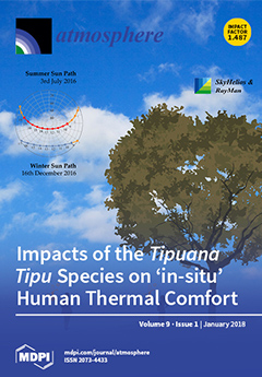
Being one of Lisbon’s most common shading tree species, the influences of Tipuana tipu are determined in order to evaluate its impacts on human thermal stress within different locations within canyons with dissimilar morphological compositions. Such a study is conducted both during the winter and summer to present the ‘in-situ’ influences resulting from the presence and absence of Tipuana tipu. View this paper.
  • Issues are regarded as officially published after their release is announced to the table of contents alert mailing list.
  • You may sign up for e-mail alerts to receive table of contents of newly released issues.
  • PDF is the official format for papers published in both, html and pdf forms. To view the papers in pdf format, click on the "PDF Full-text" link, and use the free Adobe Reader to open them.
Order results
Result details
Section
Select all
Export citation of selected articles as:
15 pages, 10316 KiB  
Article
Observations of Local Meteorological Variability under Large-Scale Circulation Patterns over Athens, Greece
by Christos H. Halios, Helena A. Flocas, Costas G. Helmis, Dimosthenis N. Asimakopoulos and Panagiotis G. Mouschouras
Atmosphere 2018, 9(1), 25; https://doi.org/10.3390/atmos9010025 - 23 Jan 2018
Cited by 4 | Viewed by 3159
Abstract
Linking synoptic circulation patterns to specific environmental problems is of significance in the Eastern Mediterranean region, which is characterized by increased seasonal climatic variability and a wealth of distinct weather patterns. This study aims to discuss the links between synoptic scale circulation, intra-day [...] Read more.
Linking synoptic circulation patterns to specific environmental problems is of significance in the Eastern Mediterranean region, which is characterized by increased seasonal climatic variability and a wealth of distinct weather patterns. This study aims to discuss the links between synoptic scale circulation, intra-day variability and sub-hourly temperature changes over Athens. Diurnal cycles of surface atmospheric variability were examined by applying Principal Component Analysis and Integral Quantities Analysis to a four months data set with surface meteorological elements. Sub-hourly temperature changes were identified by applying a simple linear technique. Principal Components, Integral Quantities and temperature change rates (geometric structures) were related with synoptic circulation categories. It was found that the presence of a Closed Low over the area results in intense along-mountain flows, whilst, after the passage of a trough, when a strong northwesterly flow is established over the area, surface recirculation flows develop. On 64% of the days, geometric structures were observed in the hourly temperature time-series, and they were found to occur across all synoptic situations. Cliff—ramps was the most common geometric structure, and step changes were found to be related with recirculation flows. Full article
(This article belongs to the Special Issue Advances in Atmospheric Physics: Selected Papers from CEST2017)
Show Figures

Figure 1

14 pages, 3476 KiB  
Article
Estimate of Hurricane Wind Speed from AMSR-E Low-Frequency Channel Brightness Temperature Data
by Lei Zhang, Xiao-bin Yin, Han-qing Shi and Ming-yuan He
Atmosphere 2018, 9(1), 34; https://doi.org/10.3390/atmos9010034 - 22 Jan 2018
Cited by 20 | Viewed by 5591
Abstract
Two new parameters (W6H and W6V) were defined that represent brightness temperature increments for different low-frequency channels due to ocean wind. We developed a new wind speed retrieval model inside hurricanes based on W6H and W6V using brightness temperature data from AMSR-E. The [...] Read more.
Two new parameters (W6H and W6V) were defined that represent brightness temperature increments for different low-frequency channels due to ocean wind. We developed a new wind speed retrieval model inside hurricanes based on W6H and W6V using brightness temperature data from AMSR-E. The AMSR-E observations of 12 category 3–5 hurricanes from 2003 to 2011 and corresponding data from the H*wind analysis system were used to develop and validate the AMSR-E wind speed retrieval model. The results show that the mean bias and the overall root-mean-square (RMS) difference of the AMSR-E retrieved wind speeds with respect to H*wind (HRD Real-time Hurricane Wind Analysis System) analysis data were −0.01 m/s and 2.66 m/s, respectively. One case study showed that W6H and W6V were less sensitive to rain than the observed AMSR-E C-band and X-band brightness temperature data. The AMSR-E retrieval model was further validated by comparing the retrieved wind speeds against stepped-frequency microwave radiometer (SFMR) measurements. The comparison showed an RMS difference of 3.41 m/s and a mean bias of 0.49 m/s. Full article
(This article belongs to the Special Issue Tropical Cyclones and Their Impacts)
Show Figures

Figure 1

18 pages, 6810 KiB  
Article
The Dynamical Linkage of Atmospheric Blocking to Drought, Heatwave and Urban Heat Island in Southeastern US: A Multi-Scale Case Study
by Li Dong, Chandana Mitra, Seth Greer and Ethan Burt
Atmosphere 2018, 9(1), 33; https://doi.org/10.3390/atmos9010033 - 22 Jan 2018
Cited by 31 | Viewed by 6084
Abstract
Atmospheric blocking is a long standing structure stalled in the mid-troposphere which is often associated with extreme weather events such as droughts, heatwaves, flood and cold air outbreak. A striking atmospheric blocking is identified to persist over the US during 13–17 August 2007, [...] Read more.
Atmospheric blocking is a long standing structure stalled in the mid-troposphere which is often associated with extreme weather events such as droughts, heatwaves, flood and cold air outbreak. A striking atmospheric blocking is identified to persist over the US during 13–17 August 2007, exacerbating the existing drought over the Southeastern US. This pronounced blocking event not only intensified the concurrent drought conditions, but also led to a record-breaking heatwave over the Southeast of the US. The excessive heat observed during this heatwave is attributable to the subsidence-associated adiabatic warming as well as the dry-and-warm air advection over Alabama and the neighboring states. At the local scale, we choose Birmingham, AL, as the study area for exploring the blocking influence on urban heat island. Based on the remote sensing data, the surface (skin) urban heat island is found to be 8 C in this area on the block-onset day. This provides partial evidences that the surface urban heat island intensity is likely amplified by the blocking-induced heat waves. The present work provides a unique case study in which blocking, drought, heatwave and urban heat island all occur concurrently, and interplay across a spectrum of spatial scales. We conclude that atmospheric blocking is capable of reinforcing droughts, initiating heatwaves, and probably amplifying the urban heat island intensity during the concurrent period. Full article
(This article belongs to the Special Issue Temperature Extremes and Heat/Cold Waves)
Show Figures

Figure 1

17 pages, 228 KiB  
Article
Decision Science Perspectives on Hurricane Vulnerability: Evidence from the 2010–2012 Atlantic Hurricane Seasons
by Kerry Milch, Kenneth Broad, Ben Orlove and Robert Meyer
Atmosphere 2018, 9(1), 32; https://doi.org/10.3390/atmos9010032 - 20 Jan 2018
Cited by 10 | Viewed by 5464
Abstract
Although the field has seen great advances in hurricane prediction and response, the economic toll from hurricanes on U.S. communities continues to rise. We present data from Hurricanes Earl (2010), Irene (2011), Isaac (2012), and Sandy (2012) to show that individual and household [...] Read more.
Although the field has seen great advances in hurricane prediction and response, the economic toll from hurricanes on U.S. communities continues to rise. We present data from Hurricanes Earl (2010), Irene (2011), Isaac (2012), and Sandy (2012) to show that individual and household decisions contribute to this vulnerability. From phone surveys of residents in communities threatened by impending hurricanes, we identify five decision biases or obstacles that interfere with residents’ ability to protect themselves and minimize property damage: (1) temporal and spatial myopia, (2) poor mental models of storm risk, (3) gaps between objective and subjective probability estimates, (4) prior storm experience, and (5) social factors. We then discuss ways to encourage better decision making and reduce the economic and emotional impacts of hurricanes, using tools such as decision defaults (requiring residents to opt out of precautions rather than opt in) and tailoring internet-based forecast information so that it is local, specific, and emphasizes impacts rather than probability. Full article
(This article belongs to the Special Issue Tropical Cyclones and Their Impacts)
25 pages, 9461 KiB  
Article
Improvement in the Modeled Representation of North American Monsoon Precipitation Using a Modified Kain–Fritsch Convective Parameterization Scheme
by Thang M. Luong, Christopher L. Castro, Truong M. Nguyen, William W. Cassell and Hsin-I Chang
Atmosphere 2018, 9(1), 31; https://doi.org/10.3390/atmos9010031 - 19 Jan 2018
Cited by 14 | Viewed by 4757
Abstract
A commonly noted problem in the simulation of warm season convection in the North American monsoon region has been the inability of atmospheric models at the meso-β scales (10 s to 100 s of kilometers) to simulate organized convection, principally mesoscale convective systems. [...] Read more.
A commonly noted problem in the simulation of warm season convection in the North American monsoon region has been the inability of atmospheric models at the meso-β scales (10 s to 100 s of kilometers) to simulate organized convection, principally mesoscale convective systems. With the use of convective parameterization, high precipitation biases in model simulations are typically observed over the peaks of mountain ranges. To address this issue, the Kain–Fritsch (KF) cumulus parameterization scheme has been modified with new diagnostic equations to compute the updraft velocity, the convective available potential energy closure assumption, and the convective trigger function. The scheme has been adapted for use in the Weather Research and Forecasting (WRF). A numerical weather prediction-type simulation is conducted for the North American Monsoon Experiment Intensive Observing Period 2 and a regional climate simulation is performed, by dynamically downscaling. In both of these applications, there are notable improvements in the WRF model-simulated precipitation due to the better representation of organized, propagating convection. The use of the modified KF scheme for atmospheric model simulations may provide a more computationally economical alternative to improve the representation of organized convection, as compared to convective-permitting simulations at the kilometer scale or a super-parameterization approach. Full article
(This article belongs to the Special Issue WRF Simulations at the Mesoscale: From the Microscale to Macroscale)
Show Figures

Figure 1

10 pages, 2930 KiB  
Article
A Two-Year Study on Mercury Fluxes from the Soil under Different Vegetation Cover in a Subtropical Region, South China
by Ming Ma, Tao Sun, Hongxia Du and Dingyong Wang
Atmosphere 2018, 9(1), 30; https://doi.org/10.3390/atmos9010030 - 19 Jan 2018
Cited by 11 | Viewed by 3653
Abstract
In order to reveal the mercury (Hg) emission and exchange characteristics at the soil–air interface under different vegetation cover types, the evergreen broad-leaf forest, shrub forest, grass, and bare lands of Simian Mountain National Nature Reserve were selected as the sampling sites. The [...] Read more.
In order to reveal the mercury (Hg) emission and exchange characteristics at the soil–air interface under different vegetation cover types, the evergreen broad-leaf forest, shrub forest, grass, and bare lands of Simian Mountain National Nature Reserve were selected as the sampling sites. The gaseous elementary mercury (GEM) fluxes at the soil–air interface under the four vegetation covers were continuously monitored for two years, and the effect of temperature and solar radiation on GEM fluxes were also investigated. Results showed that the GEM fluxes at the soil–air interface under different vegetation cover types had significant difference (p < 0.05). The bare land had the maximum GEM flux (15.32 ± 10.44 ng·m−2·h−1), followed by grass land (14.73 ± 18.84 ng·m−2·h−1), and shrub forest (12.83 ± 10.22 ng·m−2·h−1), and the evergreen broad-leaf forest had the lowest value (11.23 ± 11.13 ng·m−2·h−1). The GEM fluxes at the soil–air interface under different vegetation cover types showed similar regularity in seasonal variation, which mean that the GEM fluxes in summer were higher than that in winter. In addition, the GEM fluxes at the soil–air interface under the four vegetation covers in Mt. Simian had obvious diurnal variations. Full article
(This article belongs to the Special Issue Atmospheric Metal Pollution)
Show Figures

Figure 1

20 pages, 4247 KiB  
Article
Spatial Patterns and Temporal Changes in Atmospheric-Mercury Deposition for the Midwestern USA, 2001–2016
by Martin R. Risch and Donna M. Kenski
Atmosphere 2018, 9(1), 29; https://doi.org/10.3390/atmos9010029 - 18 Jan 2018
Cited by 9 | Viewed by 3829
Abstract
Spatial patterns and temporal changes in atmospheric-mercury (Hg) deposition were examined in a five-state study area in the Midwestern USA where 32% of the stationary sources of anthropogenic Hg emissions in the continental USA were located. An extensive monitoring record for wet and [...] Read more.
Spatial patterns and temporal changes in atmospheric-mercury (Hg) deposition were examined in a five-state study area in the Midwestern USA where 32% of the stationary sources of anthropogenic Hg emissions in the continental USA were located. An extensive monitoring record for wet and dry Hg deposition was compiled for 2001–2016, including 4666 weekly precipitation samples at 13 sites and 27 annual litterfall-Hg samples at 7 sites. This study is the first to examine these Hg data for the Midwestern USA. The median annual precipitation-Hg deposition at the study sites was 10.4 micrograms per square meter per year (µg/m2/year) and ranged from 5.8 µg/m2/year to 15.0 µg/m2/year. The median annual Hg concentration was 9.4 ng/L. Annual litterfall-Hg deposition had a median of 16.1 µg/m2/year and ranged from 9.7 to 23.4 µg/m2/year. Isopleth maps of annual precipitation-Hg deposition indicated a recurring spatial pattern similar to one revealed by statistical analysis of weekly precipitation-Hg deposition. In that pattern, high Hg deposition in southeastern Indiana was present each year, frequently extending to southern Illinois. Most of central Indiana and central Illinois had similar Hg deposition. Areas with comparatively lower annual Hg deposition were observed in Michigan and Ohio for many years and frequently included part of northern Indiana. The area in southern Indiana where high Hg deposition predominated had the highest number of extreme episodes of weekly Hg deposition delivering up to 15% of the annual Hg load from precipitation in a single week. Modeled 48-h back trajectories indicated air masses for these episodes often arrived from the south and southwest, crossing numerous stationary sources of Hg emissions releasing from 23 to more than 300 kg Hg per year. This analysis suggests that local and regional, rather than exclusively continental or global Hg emissions were likely contributing to the extreme episodes and at least in part, to the spatial patterns of precipitation-Hg deposition in the study area. Statistically significant temporal decreases in weekly precipitation-Hg concentrations in the study area between the periods 2001–2013 and 2014–2016 were observed, coinciding with reported reductions in Hg emissions in the USA required by implementation of national Hg emissions-control rules. These decreases in atmospheric-Hg concentrations are believed to have resulted in the reduced atmospheric-Hg deposition recorded because precipitation depths between the two periods were not significantly different. The Hg-monitoring data for the study area identified an atmospheric deposition response to decreased local and regional Hg emissions. Full article
(This article belongs to the Special Issue Atmospheric Metal Pollution)
Show Figures

Figure 1

18 pages, 2564 KiB  
Article
An Analysis of Dynamic Instability on TC-Like Vortex Using the Regularization-Based Eigenmode Linear Superposition Method
by Shuang Liu, Wei Zhong, Yudi Liu and Jie Xiang
Atmosphere 2018, 9(1), 26; https://doi.org/10.3390/atmos9010026 - 18 Jan 2018
Cited by 2 | Viewed by 3191
Abstract
In this paper, the eigenmode linear superposition (ELS) method based on the regularization is used to discuss the distributions of all eigenmodes and the role of their instability to the intensity and structure change in TC-like vortex. Results show that the regularization approach [...] Read more.
In this paper, the eigenmode linear superposition (ELS) method based on the regularization is used to discuss the distributions of all eigenmodes and the role of their instability to the intensity and structure change in TC-like vortex. Results show that the regularization approach can overcome the ill-posed problem occurring in solving mode weight coefficients as the ELS method are applied to analyze the impacts of dynamic instability on the intensity and structure change of TC-like vortex. The Generalized Cross-validation (GCV) method and the L curve method are used to determine the regularization parameters, and the results of the two approaches are compared. It is found that the results based on the GCV method are closer to the given initial condition in the solution of the inverse problem of the vortex system. Then, the instability characteristic of the hollow vortex as the basic state are examined based on the linear barotropic shallow water equations. It is shown that the wavenumber distribution of system instability obtained from the ELS method is well consistent with that of the numerical analysis based on the norm mode. On the other hand, the evolution of the hollow vortex are discussed using the product of each eigenmode and its corresponding weight coefficient. Results show that the intensity and structure change of the system are mainly affected by the dynamic instability in the early stage of disturbance development, and the most unstable mode has a dominant role in the growth rate and the horizontal distribution of intense disturbance in the near-core region. Moreover, the wave structure of the most unstable mode possesses typical characteristics of mixed vortex Rossby-inertio-gravity waves (VRIGWs). Full article
(This article belongs to the Section Meteorology)
Show Figures

Figure 1

21 pages, 3728 KiB  
Article
New Setup of the UAS ALADINA for Measuring Boundary Layer Properties, Atmospheric Particles and Solar Radiation
by Konrad Bärfuss, Falk Pätzold, Barbara Altstädter, Endres Kathe, Stefan Nowak, Lutz Bretschneider, Ulf Bestmann and Astrid Lampert
Atmosphere 2018, 9(1), 28; https://doi.org/10.3390/atmos9010028 - 17 Jan 2018
Cited by 39 | Viewed by 6454 | Correction
Abstract
The unmanned research aircraft ALADINA (Application of Light-weight Aircraft for Detecting in situ Aerosols) has been established as an important tool for boundary layer research. For simplified integration of additional sensor payload, a flexible and reliable data acquisition system was developed at the [...] Read more.
The unmanned research aircraft ALADINA (Application of Light-weight Aircraft for Detecting in situ Aerosols) has been established as an important tool for boundary layer research. For simplified integration of additional sensor payload, a flexible and reliable data acquisition system was developed at the Institute of Flight Guidance, Technische Universität (TU) Braunschweig. The instrumentation consists of sensors for temperature, humidity, three-dimensional wind vector, position, black carbon, irradiance and atmospheric particles in the diameter range of ultra-fine particles up to the accumulation mode. The modular concept allows for straightforward integration and exchange of sensors. So far, more than 200 measurement flights have been performed with the robustly-engineered system ALADINA at different locations. The obtained datasets are unique in the field of atmospheric boundary layer research. In this study, a new data processing method for deriving parameters with fast resolution and to provide reliable accuracies is presented. Based on tests in the field and in the laboratory, the limitations and verifiability of integrated sensors are discussed. Full article
(This article belongs to the Special Issue Atmospheric Measurements with Unmanned Aerial Systems (UAS))
Show Figures

Figure 1

13 pages, 2044 KiB  
Article
The Dynamic Character of Northern Hemisphere Flow Regimes in a Near-Term Climate Change Projection
by Andrew D. Jensen, Mirseid G. Akperov, Igor I. Mokhov, Anthony R. Lupo and Fengpeng Sun
Atmosphere 2018, 9(1), 27; https://doi.org/10.3390/atmos9010027 - 16 Jan 2018
Cited by 12 | Viewed by 7860
Abstract
The dynamic character of an enstrophy-based diagnostic, previously used in the study of atmospheric blocking, is examined here, in near-term future simulations from the Institut Pierre Simon Laplace Climate Model version 4 (IPSL-CM4) and version 5 (IPSL-CM5) climate models of the Northern Hemisphere [...] Read more.
The dynamic character of an enstrophy-based diagnostic, previously used in the study of atmospheric blocking, is examined here, in near-term future simulations from the Institut Pierre Simon Laplace Climate Model version 4 (IPSL-CM4) and version 5 (IPSL-CM5) climate models of the Northern Hemisphere flow for moderate climate change scenarios. Previous research has shown that integrated regional enstrophy (IE) increases during blocking onset and decay, which is a reflection of planetary-scale instability. In addition, IE has been shown previously to increase during flow regime transitions in general, even those not associated with blocking events. Here, a 31-year IE diagnostic time series is examined for changes in short term (5–40 days) planetary-scale variability that may correspond flow regime changes in an increased carbon dioxide environment. The time-series analysis herein indicates that the IE diagnostic provides evidence for approximately 30–35 atmospheric flow regime transitions per year in a warmer climate, which is similar to that of the control run and the latest 30-year observed climate, as derived from re-analyses. This result has implications regarding the predictability of weather in a warmer world. Full article
(This article belongs to the Section Meteorology)
Show Figures

Figure 1

23 pages, 9802 KiB  
Article
Spatiotemporal Variations of Extreme Precipitation under a Changing Climate in the Three Gorges Reservoir Area (TGRA)
by Mingquan Lü, Yi Jiang, Xunlai Chen, Jilong Chen, Shengjun Wu and Jun Liu
Atmosphere 2018, 9(1), 24; https://doi.org/10.3390/atmos9010024 - 16 Jan 2018
Cited by 16 | Viewed by 4403
Abstract
The Three Gorges Dam (TGD) is one of the largest hydroelectric projects in the world. Monitoring the spatiotemporal distribution of extreme precipitation offers valuable information for adaptation and mitigation strategies and reservoir management schemes. This study examined variations in extreme precipitation over the [...] Read more.
The Three Gorges Dam (TGD) is one of the largest hydroelectric projects in the world. Monitoring the spatiotemporal distribution of extreme precipitation offers valuable information for adaptation and mitigation strategies and reservoir management schemes. This study examined variations in extreme precipitation over the Three Gorges Reservoir area (TGRA) in China to investigate the potential role of climate warming and Three Gorges Reservoir (TGR). The trends in extreme precipitation over the TGRA were investigated using the iterative-based Mann–Kendall (MK) test and Sen’s slope estimator, based on weather station daily data series and TRMM (Tropical Rainfall Measuring Mission) data series. The mean and density distribution of extreme precipitation indices between pre-dam and post-dam, pre-1985 and post-1985, and near and distant reservoir area were assessed by the Mann–Whitney test and the Kolmogorov–Smirnov test. The ratio of extreme precipitation to non-extreme precipitation became larger. The precipitation was characterized by increases in heavy precipitation as well as decreases in light and moderate rain. Comparing extreme precipitation indices between pre-1985 (cooling) and post-1985 (warming) indicated extreme precipitation has changed to become heavier. Under climate warming, the precipitation amount corresponding to more than the 95th percentile increased at the rate of 6.48%/°C. Results from comparing extreme precipitation for the pre- and post-dam, near reservoir area (NRA) and away from the reservoir area (ARA) imply an insignificant role of the TGR on rainfall extremes over the TGRA. Moreover, the impoundment of TGR did not exert detectable impacts on the surface relative humidity (RH) and water vapor pressure (WP). Full article
(This article belongs to the Section Meteorology)
Show Figures

Figure 1

16 pages, 10732 KiB  
Article
Assessing the Impact of Surface and Upper-Air Observations on the Forecast Skill of the ACCESS Numerical Weather Prediction Model over Australia
by Sergei Soldatenko, Chris Tingwell, Peter Steinle and Boris A. Kelly-Gerreyn
Atmosphere 2018, 9(1), 23; https://doi.org/10.3390/atmos9010023 - 16 Jan 2018
Cited by 10 | Viewed by 4598
Abstract
The impact of the Australian Bureau of Meteorology’s in situ observations (land and sea surface observations, upper air observations by radiosondes, pilot balloons, wind profilers, and aircraft observations) on the short-term forecast skill provided by the ACCESS (Australian Community Climate and Earth-System Simulator) [...] Read more.
The impact of the Australian Bureau of Meteorology’s in situ observations (land and sea surface observations, upper air observations by radiosondes, pilot balloons, wind profilers, and aircraft observations) on the short-term forecast skill provided by the ACCESS (Australian Community Climate and Earth-System Simulator) global numerical weather prediction (NWP) system is evaluated using an adjoint-based method. This technique makes use of the adjoint perturbation forecast model utilized within the 4D-Var assimilation system, and is able to calculate the individual impact of each assimilated observation in a cycling NWP system. The results obtained show that synoptic observations account for about 60% of the 24-h forecast error reduction, with the remainder accounted for by aircraft (12.8%), radiosondes (10.5%), wind profilers (3.9%), pilot balloons (2.8%), buoys (1.7%) and ships (1.2%). In contrast, the largest impact per observation is from buoys and aircraft. Overall, all observation types have a positive impact on the 24-h forecast skill. Such results help to support the decision-making process regarding the evolution of the observing network, particularly at the national level. Consequently, this 4D-Var-based approach has great potential as a tool to assist the design and running of an efficient and effective observing network. Full article
(This article belongs to the Special Issue Efficient Formulation and Implementation of Data Assimilation Methods)
Show Figures

Figure 1

15 pages, 6462 KiB  
Technical Note
Web Strategy to Convey Marine Biogeochemical Feedback Concepts to the Policy Community: Aerosol and Sea Ice
by Zachary M. Menzo
Atmosphere 2018, 9(1), 22; https://doi.org/10.3390/atmos9010022 - 16 Jan 2018
Cited by 2 | Viewed by 3473
Abstract
Limited understanding of the climate system imposes upon policy makers an intimate reliance on results from Earth System Models (ESMs). However, climate simulations are necessarily incomplete since many strong channels through planetary scale biology and geochemistry remain too complex or poorly comprehended to [...] Read more.
Limited understanding of the climate system imposes upon policy makers an intimate reliance on results from Earth System Models (ESMs). However, climate simulations are necessarily incomplete since many strong channels through planetary scale biology and geochemistry remain too complex or poorly comprehended to include. This paper presents and describes an interactive, public domain website detailing the role of two marine biogeochemical (mBGC) feedback loops currently excluded from many ESMs (www.marinefeedbacks.com). Every page on the website includes images or videos to foster engagement with its technically challenging content. Simultaneously, fundamentals of the natural science involved are reinforced. The site includes subsections of the following nature; background information, executive summaries for each feedback type, detailed descriptions of the chemical mechanisms, climate change impact, and recommendations for future research. The information provided is firmly grounded in the technical literature but is designed specifically for accessibility to non-scientists. Particular targets for the material are the next-generation of decision makers and those framing the international climate agenda. It is hoped that a site with tailored pedagogical value may contribute to well informed policy formulation and legislation. Full article
(This article belongs to the Special Issue Ocean Contributions to the Marine Boundary Layer Aerosol Budget)
Show Figures

Figure 1

12 pages, 5782 KiB  
Article
Exposure to Black Carbon during Bicycle Commuting–Alternative Route Selection
by Borut Jereb, Tanja Batkovič, Luka Herman, Gregor Šipek, Špela Kovše, Asta Gregorič and Griša Močnik
Atmosphere 2018, 9(1), 21; https://doi.org/10.3390/atmos9010021 - 15 Jan 2018
Cited by 38 | Viewed by 6828
Abstract
Traffic air pollution significantly influences cyclists using cycling routes near main roads. We analyze the dependency of black carbon (BC) concentrations in relation to the proximity to their traffic sources. We performed static and mobile measurements of BC using aethalometers at chosen sites [...] Read more.
Traffic air pollution significantly influences cyclists using cycling routes near main roads. We analyze the dependency of black carbon (BC) concentrations in relation to the proximity to their traffic sources. We performed static and mobile measurements of BC using aethalometers at chosen sites and cycling routes in Celje, Slovenia—static measurements at two road-side sites and an urban background site. Mobile measurements were performed simultaneously at an existing cycling route and an alternative route away from the busy roads. BC concentration apportioned to traffic decreases with the distance from the sources on the main road. The exposure of cyclists to BC can be greatly reduced by moving the cycling route away from busy roads, hence we propose an alternative route and show that traffic planning and management should include all modes of transport. Results imply that street intersections along the cycling routes influence the cyclists’ exposure and should be as few as possible when planning cycling routes in urban areas. Full article
(This article belongs to the Special Issue Carbonaceous Aerosols in Atmosphere)
Show Figures

Figure 1

13 pages, 2310 KiB  
Article
X-ray Observations at Gaisberg Tower
by Pasan Hettiarachchi, Vernon Cooray, Gerhard Diendorfer, Hannes Pichler, Joseph Dwyer and Mahbubur Rahman
Atmosphere 2018, 9(1), 20; https://doi.org/10.3390/atmos9010020 - 13 Jan 2018
Cited by 8 | Viewed by 4844
Abstract
We report the occurrence of X-rays at ground level due to cloud-to-ground flashes of upward-initiated lightning from Gaisberg Tower, in Austria, which is located at an altitude of 1300 m. This is the first observation of X-ray emissions from upward lightning from a [...] Read more.
We report the occurrence of X-rays at ground level due to cloud-to-ground flashes of upward-initiated lightning from Gaisberg Tower, in Austria, which is located at an altitude of 1300 m. This is the first observation of X-ray emissions from upward lightning from a tower top located at high altitude. Measurements were carried out using scintillation detectors installed close to the tower top in two phases from 2011 to 2015. X-rays were recorded in three subsequent strokes of three flashes out of the total of 108 flashes recorded in the system during both phases. In contrast to the observations from downward natural or triggered lightning, X-rays were observed only within 10 µs before the subsequent return stroke. This shows that X-rays were emitted when the dart leader was in the vicinity of the tower top, hence during the most intense phase of the dart leader. Both the detected energy and the fluence of X-rays are far lower compared to X-rays from downward natural or rocket-triggered lightning. In addition to the above 108 flashes, an interesting observation of X-rays produced by a nearby downward flash is also presented. The shorter length of dart-leader channels in Gaisberg is suggested as a possible cause of this apparently weaker X-ray production. Full article
Show Figures

Figure 1

14 pages, 1765 KiB  
Technical Note
Overview of Model Inter-Comparison in Japan’s Study for Reference Air Quality Modeling (J-STREAM)
by Satoru Chatani, Kazuyo Yamaji, Tatsuya Sakurai, Syuichi Itahashi, Hikari Shimadera, Kyo Kitayama and Hiroshi Hayami
Atmosphere 2018, 9(1), 19; https://doi.org/10.3390/atmos9010019 - 11 Jan 2018
Cited by 32 | Viewed by 8172
Abstract
The inter-comparison of regional air quality models is an effective way to understand uncertainty in ambient pollutant concentrations simulated using various model configurations, as well as to find ways to improve model performance. Based on the outcomes and experiences of Japanese projects thus [...] Read more.
The inter-comparison of regional air quality models is an effective way to understand uncertainty in ambient pollutant concentrations simulated using various model configurations, as well as to find ways to improve model performance. Based on the outcomes and experiences of Japanese projects thus far, a new model inter-comparison project called Japan’s study for reference air quality modeling (J-STREAM) has begun. The objective of J-STREAM is to establish reference air quality modeling for source apportionment and effective strategy making to suppress secondary air pollutants including PM2.5 and photochemical ozone in Japan through model inter-comparison. The first phase focuses on understanding the ranges and limitations in ambient PM2.5 and ozone concentrations simulated by participants using common input datasets. The second phase focuses on issues revealed in previous studies in simulating secondary inorganic aerosols, as well as on the three-dimensional characteristics of photochemical ozone as a new target. The third phase focuses on comparing source apportionments and sensitivities under heavy air pollution episodes simulated by participating models. Detailed understanding of model performance, uncertainty, and possible improvements to urban-scale air pollution involving secondary pollutants, as well as detailed sector-wise source apportionments over megacities in Japan are expected. Full article
(This article belongs to the Special Issue Regional Scale Air Quality Modelling)
Show Figures

Figure 1

20 pages, 13448 KiB  
Article
Atmospheric Moisture Content over Europe and the Northern Atlantic
by Agnieszka Wypych, Bogdan Bochenek and Michał Różycki
Atmosphere 2018, 9(1), 18; https://doi.org/10.3390/atmos9010018 - 11 Jan 2018
Cited by 28 | Viewed by 6988
Abstract
Water vapor plays a major role in the process of radiation, cloud formation, energy exchange within a system, and remains a key component of the Earth’s atmosphere. The purpose of this study is to examine the water vapor content of the troposphere over [...] Read more.
Water vapor plays a major role in the process of radiation, cloud formation, energy exchange within a system, and remains a key component of the Earth’s atmosphere. The purpose of this study is to examine the water vapor content of the troposphere over Europe and the Northern Atlantic. Both temporal and spatial differences were examined for total column water vapor (TCWV) and vertically integrated water vapor flux (IWVF) based on ERA-Interim reanalysis data. The statistical relationship between circulation patterns, as expressed by empirical orthogonal function (EOF) modes, and TCWV were examined, as were statistical relationships between distinguished advection types and TCWV and IWVF. The study confirmed the significance of atmospheric circulation in the formation of moisture content in the winter season (i.e., January) and its markedly lower impact in other seasons. The relationships noted in the study are characterized by statistically significant spatial differentiation. Spatial pattern analysis was used to identify six regions with different moisture content over the course of the year. The boundaries of the regions confirm the significant role of local factors impacting moisture content. Full article
(This article belongs to the Special Issue Water Vapor in the Atmosphere)
Show Figures

Figure 1

17 pages, 5794 KiB  
Article
Quantifying Impacts of Aerosol Mixing State on Nucleation-Scavenging of Black Carbon Aerosol Particles
by Joseph Ching, Matthew West and Nicole Riemer
Atmosphere 2018, 9(1), 17; https://doi.org/10.3390/atmos9010017 - 11 Jan 2018
Cited by 17 | Viewed by 5715
Abstract
Recent observational studies suggest that nucleation-scavenging is the principal path to removing black carbon-containing aerosol from the atmosphere, thus affecting black carbon’s lifetime and radiative forcing. Modeling the process of nucleation-scavenging is challenging, since black carbon (BC) forms complex internal mixtures with other [...] Read more.
Recent observational studies suggest that nucleation-scavenging is the principal path to removing black carbon-containing aerosol from the atmosphere, thus affecting black carbon’s lifetime and radiative forcing. Modeling the process of nucleation-scavenging is challenging, since black carbon (BC) forms complex internal mixtures with other aerosol species. Here, we examined the impacts of black carbon mixing state on nucleation scavenging using the particle-resolved aerosol model PartMC-MOSAIC. This modeling approach has the unique advantage that complex aerosol mixing states can be represented on a per-particle level. For a scenario library that comprised hundreds of diverse aerosol populations, we quantified nucleation-scavenged BC mass fractions. Consistent with measurements, these vary widely, depending on the amount of BC, the amount of coating and coating material, as well as the environmental supersaturation. We quantified the error in the nucleation-scavenged black carbon mass fraction introduced when assuming an internally mixed distribution, and determined its bounds depending on environmental supersaturation and on the aerosol mixing state index χ . For a given χ value, the error decreased at higher supersaturations. For more externally mixed populations ( χ < 20 %), the nucleation-scavenged BC mass fraction could be overestimated by more than 1000% at supersaturations of 0.1%, while for more internally mixed populations ( χ > 75 %), the error was below 100% for the range of supersaturations (from 0.02% to 1%) investigated here. Accounting for black carbon mixing state and knowledge of the supersaturation of the environment are crucial when determining the amount of black carbon that can be incorporated into clouds. Full article
(This article belongs to the Special Issue Morphology and Internal Mixing of Atmospheric Particles)
Show Figures

Figure 1

10 pages, 208 KiB  
Editorial
Acknowledgement to Reviewers of Atmosphere in 2017
by Atmosphere Editorial Office
Atmosphere 2018, 9(1), 16; https://doi.org/10.3390/atmos9010016 - 09 Jan 2018
Viewed by 3153
Abstract
Peer review is an essential part in the publication process, ensuring that Atmosphere maintains high quality standards for its published papers.[...] Full article
18 pages, 3630 KiB  
Article
Machine Learning to Predict the Global Distribution of Aerosol Mixing State Metrics
by Michael Hughes, John K. Kodros, Jeffrey R. Pierce, Matthew West and Nicole Riemer
Atmosphere 2018, 9(1), 15; https://doi.org/10.3390/atmos9010015 - 09 Jan 2018
Cited by 23 | Viewed by 6906
Abstract
Atmospheric aerosols are evolving mixtures of chemical species. In global climate models (GCMs), this “aerosol mixing state” is represented in a highly simplified manner. This can introduce errors in the estimates of climate-relevant aerosol properties, such as the concentration of cloud condensation nuclei. [...] Read more.
Atmospheric aerosols are evolving mixtures of chemical species. In global climate models (GCMs), this “aerosol mixing state” is represented in a highly simplified manner. This can introduce errors in the estimates of climate-relevant aerosol properties, such as the concentration of cloud condensation nuclei. The goal for this study is to determine a global spatial distribution of aerosol mixing state with respect to hygroscopicity, as quantified by the mixing state metric χ . In this way, areas can be identified where the external or internal mixture assumption is more appropriate. We used the output of a large ensemble of particle-resolved box model simulations in conjunction with machine learning techniques to train a model of the mixing state metric χ . This lower-order model for χ uses as inputs only variables known to GCMs, enabling us to create a global map of χ based on GCM data. We found that χ varied between 20% and nearly 100%, and we quantified how this depended on particle diameter, location, and time of the year. This framework demonstrates how machine learning can be applied to bridge the gap between detailed process modeling and a large-scale climate model. Full article
(This article belongs to the Special Issue Morphology and Internal Mixing of Atmospheric Particles)
Show Figures

Graphical abstract

12 pages, 6376 KiB  
Article
Estimating the Biogenic Non-Methane Hydrocarbon Emissions over Greece
by Ermioni Dimitropoulou, Vasiliki D. Assimakopoulos, Kyriaki M. Fameli, Helena A. Flocas, Panagiotis Kosmopoulos, Stelios Kazadzis, Kostas Lagouvardos and Elizabeth Bossioli
Atmosphere 2018, 9(1), 14; https://doi.org/10.3390/atmos9010014 - 09 Jan 2018
Cited by 2 | Viewed by 4069
Abstract
Biogenic emissions affect the urban air quality as they are ozone and secondary organic aerosol (SOA) precursors and should be taken into account when applying photochemical pollution models. The present study presents an estimation of the magnitude of non-methane volatile organic compounds (BNMVOCs) [...] Read more.
Biogenic emissions affect the urban air quality as they are ozone and secondary organic aerosol (SOA) precursors and should be taken into account when applying photochemical pollution models. The present study presents an estimation of the magnitude of non-methane volatile organic compounds (BNMVOCs) emitted by vegetation over Greece. The methodology is based on computation developed with the aid of a Geographic Information System (GIS) and theoretical equations in order to produce an emission inventory on a 6 × 6 km2 spatial resolution, in a temporal resolution of 1 h covering one year (2016). For this purpose, a variety of input data was used: updated satellite land-use data, land-use specific emission potentials, foliar biomass densities, temperature, and solar radiation data. Hourly, daily, and annual isoprene, monoterpenes, and other volatile organic compounds (OVOCs) were estimated. In the area under study, the annual biogenic emissions were estimated up to 472 kt, consisting of 46.6% isoprene, 28% monoterpenes, and 25.4% OVOCs. Results delineate an annual cycle with increasing values from March to April, while maximum emissions were observed from May to September, followed by a decrease from October to January. Full article
(This article belongs to the Special Issue Advances in Atmospheric Physics: Selected Papers from CEST2017)
Show Figures

Figure 1

22 pages, 15099 KiB  
Article
Impact of Drizzle-Sized Cloud Particles on Production of Precipitation in Hailstorms: A Sensitivity Study
by Nemanja Kovačević and Katarina Veljovic
Atmosphere 2018, 9(1), 13; https://doi.org/10.3390/atmos9010013 - 09 Jan 2018
Cited by 2 | Viewed by 3601
Abstract
This sensitivity study examined the impact of drizzle on hailstorm characteristics and precipitation on the ground. A cloud-resolving mesoscale model with a two-moment bulk microphysical scheme is modified by introducing mixing ratio and number concentration of drizzle. Therefore, the cloud model integrates the [...] Read more.
This sensitivity study examined the impact of drizzle on hailstorm characteristics and precipitation on the ground. A cloud-resolving mesoscale model with a two-moment bulk microphysical scheme is modified by introducing mixing ratio and number concentration of drizzle. Therefore, the cloud model integrates the mixing ratio and number concentration of the eight microphysical particles: cloud droplets, drizzle, raindrops, cloud ice, snowflakes, graupel, frozen raindrops and hailstones. We compared two microphysical schemes depending on whether drizzle particles are present or not. It can be noted that the presence of drizzle category slows the development of the rain in the hailstorm and its appearance on the ground. The increased values of radar reflectivity factor in simulations with drizzle are a result of significantly higher values of raindrop number concentration rather than their sizes and indicate the presence of hail as well. There are prominent decreases of the radar reflectivity factor in simulations with drizzle. The occurrence of heavy showers does not exist in results without drizzle. The absence of drizzle category leads to greater accumulations of rain and a wider area of downdrafts. The alternate case produces both weaker downdrafts and smaller area of downdraft cells due to a slower autoconversion of drizzle to rain and a smaller rain evaporation. A smaller amount of surface hail is expected in the non-drizzle case. Full article
(This article belongs to the Section Meteorology)
Show Figures

Figure 1

13 pages, 1960 KiB  
Article
Health Impact Assessment Associated with Exposure to PM10 and Dust Storms in Kuwait
by Ali Al-Hemoud, Ali Al-Dousari, Ahmad Al-Shatti, Ahmed Al-Khayat, Weam Behbehani and Mariam Malak
Atmosphere 2018, 9(1), 6; https://doi.org/10.3390/atmos9010006 - 08 Jan 2018
Cited by 81 | Viewed by 9561
Abstract
Little information is available on the assessment of health impact concerning the Middle Eastern dust storms and PM10 concentration levels despite the aridity of the region and frequent dust storms occurring in this part of the world. A prospective study was conducted [...] Read more.
Little information is available on the assessment of health impact concerning the Middle Eastern dust storms and PM10 concentration levels despite the aridity of the region and frequent dust storms occurring in this part of the world. A prospective study was conducted to determine the association between dust particles and morbidity and mortality rates for respiratory and cardiovascular diseases in Kuwait. Spearman and Pearson’s correlations were used to identify such associations. Results revealed a significant correlation between dust storms, suspended dust and rising dust (p < 0.01). Correlation between the occurrence of respiratory and cardiovascular diseases and dust storms showed that PM10 concentrations were significantly correlated with bronchial asthma at the 0.05 level (Pearson r = 0.292). Significant correlations at the 0.01 level were shown between bronchial asthma and both acute lower respiratory tract infection (r = 0.737) and acute upper respiratory tract infection (r = 0.839). Respiratory and cardiovascular mortality rates were both equal to 0.62 per 10,000 persons, each corresponding to 8.7% proportionate mortality rate. This study provides a good evidence of the consistent relationship between dust storm events, PM10 concentration levels, and respiratory diseases. Full article
Show Figures

Figure 1

28 pages, 7921 KiB  
Article
The Impact of Tipuana tipu Species on Local Human Thermal Comfort Thresholds in Different Urban Canyon Cases in Mediterranean Climates: Lisbon, Portugal
by Andre Santos Nouri, Dominik Fröhlich, Maria Matos Silva and Andreas Matzarakis
Atmosphere 2018, 9(1), 12; https://doi.org/10.3390/atmos9010012 - 07 Jan 2018
Cited by 26 | Viewed by 5536
Abstract
Based upon the case of Lisbon, this article examined the in-situ effects of vegetation upon pedestrian thermal comfort levels. Focussing specifically upon the historic quarter that often witnesses the highest Tamb values and Urban Heat Island (UHI) intensities during the summer, the [...] Read more.
Based upon the case of Lisbon, this article examined the in-situ effects of vegetation upon pedestrian thermal comfort levels. Focussing specifically upon the historic quarter that often witnesses the highest Tamb values and Urban Heat Island (UHI) intensities during the summer, the most common urban canyon cases (UCCs) were modelled, along with one of the most commonly used vegetative semi-deciduous species found in the city, Tipuana tipu. Based upon a reference point (RP) system, the assessments were undertaken through the use of a new version of the SkyHelios model, local obtained Grad values, and the modified physiologically equivalent temperature (mPET) index calculated through the human-biometeorological model RayMan. The study identified the in-situ thermo-physiological influences of Tipuana tipu during different periods of the year: (1) during the summer, which revealed considerable reductions of PET/mPET of up to 15.6 °C/11.6 °C during a very hot day (where daily maximum Tamb surpassed 35 °C); and (2) during the winter, which revealed the risks of oversharing as a result of the species keeping its foliage during the winter with reductions of PET/mPET of up to 2.7 °C/2.6 °C. Furthermore, the study utilised the climate tourism/transfer information scheme (CTIS) to categorise and facilitate the interpretation of the results. Full article
(This article belongs to the Special Issue Urban Design and City Microclimates)
Show Figures

Figure 1

15 pages, 16162 KiB  
Article
Thermal Conditions in the City of Poznań (Poland) during Selected Heat Waves
by Marek Półrolniczak, Arkadiusz M. Tomczyk and Leszek Kolendowicz
Atmosphere 2018, 9(1), 11; https://doi.org/10.3390/atmos9010011 - 07 Jan 2018
Cited by 17 | Viewed by 3902
Abstract
The aim of the study was to characterise the occurrence of hot days and heat waves in Poznań in the 1966–2015 period, as well as to describe the thermal conditions in the city during selected heat waves between 2008 and 2015. The basis [...] Read more.
The aim of the study was to characterise the occurrence of hot days and heat waves in Poznań in the 1966–2015 period, as well as to describe the thermal conditions in the city during selected heat waves between 2008 and 2015. The basis of the study was the daily maximum and minimum air temperature values for Poznań–Ławica station from 1966–2015 and the daily values of air temperature from eight measuring points located in the city in various land types from 2008 to 2015. A hot day was defined as a day with Tmax above the 95th annual percentile (from 1966 to 2015), while a heat wave was assumed to be at least five consecutive hot days. The research study conducted shows the increase of Tmax, number of hot days and frequency of heat waves in Poznań over the last 50 years. Across the area of the city (differentiation of urban area types according to Urban Atlas 2012), there was a great diversity of thermal conditions during the heat waves analysed. Full article
(This article belongs to the Special Issue Impacts of Climate Change on Human Health)
Show Figures

Figure 1

14 pages, 9628 KiB  
Article
Diagnosing Changes of Winter NAO in Response to Different Climate Forcings in a Set of Atmosphere-Only Timeslice Experiments
by Yu Huang, Hong-Li Ren, Robin Chadwick, Zhigang Cheng and Quanliang Chen
Atmosphere 2018, 9(1), 10; https://doi.org/10.3390/atmos9010010 - 04 Jan 2018
Cited by 3 | Viewed by 3738
Abstract
Changes of the winter North Atlantic Oscillation (NAO) variability in response to different climate forcings, and their possible causes, are decomposed and investigated using a set of atmosphere-only timeslice experiments forced by sea surface temperature (SST) from coupled runs. The results indicate that [...] Read more.
Changes of the winter North Atlantic Oscillation (NAO) variability in response to different climate forcings, and their possible causes, are decomposed and investigated using a set of atmosphere-only timeslice experiments forced by sea surface temperature (SST) from coupled runs. The results indicate that the effects of uniform SST warming and direct CO2 radiative forcing could enhance NAO variability, while SST pattern change could lead to large inter-model difference for model simulations. For the influences of uniform SST warming and the direct CO2 radiative effect, the most significant air temperature increases occur at mid-low latitudes instead of northern polar regions, which produces a greater meridional temperature gradient at mid-high latitudes, thus leading to enhanced westerly winds according to the thermal wind theory. The effects of uniform SST warming and CO2 direct radiative forcing could lead to intensification of winter NAO variability, although this result does not consider ocean-atmosphere coupling. The meridional temperature gradient decreases in most areas of the northern Atlantic under the forcing of SST pattern change, but with a larger inter-model uncertainty, which makes the change of winter NAO variability in response to SST pattern change an open issue. Full article
(This article belongs to the Section Meteorology)
Show Figures

Figure 1

14 pages, 9603 KiB  
Article
On the Attribution of Changing Reference Evapotranspiration in a Coastal Area of China
by Renying Gu, Dan Zhang, Anhua Liao, Huayu Shen, Xiaotong Zhao and Jingru Pan
Atmosphere 2018, 9(1), 9; https://doi.org/10.3390/atmos9010009 - 01 Jan 2018
Cited by 4 | Viewed by 3127
Abstract
Reference evapotranspiration (ET0) is a crucial parameter for hydrological modeling, land-atmospheric interaction investigations and agricultural irrigation management. This study investigated changes in ET0 and attributed those changes to climate variations in a coastal area (Zhejiang province) of China by [...] Read more.
Reference evapotranspiration (ET0) is a crucial parameter for hydrological modeling, land-atmospheric interaction investigations and agricultural irrigation management. This study investigated changes in ET0 and attributed those changes to climate variations in a coastal area (Zhejiang province) of China by a numerical experiment method. The results indicated that annual ET0 increased significantly (p < 0.05) at a rate of 1.58 mm·year−1 from 1973 to 2013, which was mainly caused by an obvious increase in ET0 in spring. Air temperature and water vapor pressure deficits increased significantly (p < 0.05) at rates of 0.04 °C·year−1 and 0.005 kPa·year−1, respectively, at an annual time scale during the study period, while wind speed and solar radiation decreased significantly (p < 0.05) at rates of −0.01 m/s·year−1 and −3.94 MJ·m−2·day−1·year−1, respectively. The contributions of changes in air temperature, wind speed, water vapor pressure deficits and solar radiation to increases in ET0 were 0.39, −0.56, 2.62 and −0.61 mm·year−1, respectively. The decrease in wind speed and solar radiation negatively affected the increase in ET0, which was offset by the positive effects of the air temperature and water vapor pressure deficits increase, where the water vapor pressure deficits was the dominant factor in increasing ET0 in the coastal area. Moreover, the impact of topography on ET0 was further discussed. ET0 changes at plain stations were approximately 5.4 times those at hill stations, which may be due to the impact of a large water body and the augment of surface roughness from intense human activities in the well-developed plain area. The results are helpful for investigating spatial and temporal changes in the evaporative demand for well-developed regions under energy-limited conditions. Full article
(This article belongs to the Section Meteorology)
Show Figures

Figure 1

19 pages, 7393 KiB  
Article
Source Apportionment and Data Assimilation in Urban Air Quality Modelling for NO2: The Lyon Case Study
by Chi Vuong Nguyen, Lionel Soulhac and Pietro Salizzoni
Atmosphere 2018, 9(1), 8; https://doi.org/10.3390/atmos9010008 - 01 Jan 2018
Cited by 18 | Viewed by 5436
Abstract
Developing effective strategies for reducing the atmospheric pollutant concentrations below regulatory threshold levels requires identifying the main origins/sources of air pollution. This can be achieved by implementing so called source apportionment methods in atmospheric dispersion models. This study presents the results of a [...] Read more.
Developing effective strategies for reducing the atmospheric pollutant concentrations below regulatory threshold levels requires identifying the main origins/sources of air pollution. This can be achieved by implementing so called source apportionment methods in atmospheric dispersion models. This study presents the results of a source apportionment module implemented in the SIRANE urban air-quality model. This module uses the tagged species approach and includes two methods, named SA-NO and SA-NOX, in order to evaluate the sources’ contributions to the NO 2 concentrations in air. We also present results of a data assimilation method, named SALS, that uses the source apportionment estimates to improve the accuracy of the SIRANE model results. The source apportionment module and the assimilation method have been tested on a real case study (the urban agglomeration of Lyon, France, for the year 2008) focusing on the NO 2 emissions and concentrations. Results of the source apportionment with the SA-NO and SA-NOX models are similar. Both models show that traffic is the main cause of NO 2 air pollution in the studied area. Results of the SALS data assimilation method highlights its ability in improving the predictions of an urban atmospheric models. Full article
(This article belongs to the Special Issue Recent Advances in Urban Ventilation Assessment and Flow Modelling)
Show Figures

Figure 1

14 pages, 4703 KiB  
Article
Analysis of the Spatio-Temporal Patterns of Dry and Wet Conditions in Central Asia
by Zhijie Ta, Ruide Yu, Xi Chen, Guijin Mu and Yanfei Guo
Atmosphere 2018, 9(1), 7; https://doi.org/10.3390/atmos9010007 - 01 Jan 2018
Cited by 35 | Viewed by 4616
Abstract
Drought has become an important threat to industrial and agricultural production and human activities in Central Asia. Using the Standardized Precipitation Evapotranspiration Index (SPEI), we explored the spatial and temporal patterns of dry and wet changes in Central Asia from 1930–2014. The Mann-Kendall [...] Read more.
Drought has become an important threat to industrial and agricultural production and human activities in Central Asia. Using the Standardized Precipitation Evapotranspiration Index (SPEI), we explored the spatial and temporal patterns of dry and wet changes in Central Asia from 1930–2014. The Mann-Kendall trend test and empirical orthogonal function analysis were used to analyze the characteristics of drought in the interannual and seasonal scales. The results showed that the interannual SPEI index in Central Asia presented a distinct phased feature, in the late 1930s, 1970s and 1990s, three consecutive periods of drought occurred. Seasonal SPEI presented different characteristics, with no obvious drying trends in spring and summer. Autumn and winter showed a wet trend. While an obviously wetting tendency has been detected for the winter season, it started in the mid-1950s. Spatially, drought frequency is 42.87% over the entire region of Central Asia from 1930 to 2014. Kyrgyzstan and Tajikistan are wet relative to other countries in Central Asia, with the frequency of drought occurring at 41.6% and 41.9%, respectively; lower than the average frequency of drought in Central Asia. The average frequency of drought in Kazakhstan is 43.1%. Droughts frequently occur in the central and southern parts of Kazakhstan, with the frequency of drought reaching 46.76%. Droughts hardly occur in eastern of Kazakhstan, as well as in the northeastern region. Turkmenistan and Uzbekistan are the two driest countries in Central Asia, especially in the desert region. The frequency of drought was 50.68% and 47.64% respectively. Full article
(This article belongs to the Section Meteorology)
Show Figures

Figure 1

24 pages, 16522 KiB  
Article
Spatiotemporal Variations in Satellite-Based Formaldehyde (HCHO) in the Beijing-Tianjin-Hebei Region in China from 2005 to 2015
by Songyan Zhu, Xiaoying Li, Chao Yu, Hongmei Wang, Yapeng Wang and Jing Miao
Atmosphere 2018, 9(1), 5; https://doi.org/10.3390/atmos9010005 - 01 Jan 2018
Cited by 25 | Viewed by 5154
Abstract
The widespread distribution and strong seasonal pattern of highly concentrated summertime formaldehyde (HCHO) were observed using data from the Ozone Monitoring Instrument (OMI) onboard Aura satellite from 2005 to 2015 in Beijing-Tianjin-Hebei, China. The large-scale HCHO concentrations and its close connection with the [...] Read more.
The widespread distribution and strong seasonal pattern of highly concentrated summertime formaldehyde (HCHO) were observed using data from the Ozone Monitoring Instrument (OMI) onboard Aura satellite from 2005 to 2015 in Beijing-Tianjin-Hebei, China. The large-scale HCHO concentrations and its close connection with the surface O3 pollution made the study of summertime HCHO patterns and its major contributors necessary. Accordingly, time series decomposition, Moran’s I and Pearson correlation coefficient (PCC) were adopted to investigate the spatiotemporal variations of HCHO. We found that the HCHO columns regionally increased from 2005 to 2010 and decreased in the north (e.g., Chengde) from 2010 to 2015. Additionally, HCHO Vertical Column Densities (VCDs) exhibited higher values in urban areas. Despite the strong possibilities of major biogenic contributions, anthropogenic sources represented larger spatial PCCs and larger total emission rates. Industrial sources exhibited a large increasing emission amount, and the most similar distribution to HCHO was found in residential sources. By comparison, power-based emissions accounted for a relatively small fraction, and transportation emissions declined rapidly. In conclusion, anthropogenic VOCs might contribute to the summertime HCHO concentrations as well as isoprene, and controls on VOCs and HCHO would be greatly assisted by the satellite-based observations. Full article
(This article belongs to the Section Air Quality)
Show Figures

Figure 1

Previous Issue
Next Issue
Back to TopTop