Next Issue
Volume 11, May
Previous Issue
Volume 11, March


Atmosphere, Volume 11, Issue 4 (April 2020) – 121 articles

Cover Story (view full-size image): 
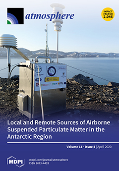
Suspended particulate matter plays a crucial role in the global climate system and can negatively disturb remote places, such as in the Antarctic region. Aerosol measurements were recorded using a low-volume sampler on Deception Island (Gabriel de Castilla Spanish base, South Shetlands Islands, Antarctic region). Inductively coupled plasma-mass spectrometry (ICP-MS) and inductively coupled plasma-atomic emission spectroscopy (ICP-AES) were used to chemically characterize Antarctic atmospheric aerosols. Then, air mass backward trajectory models, together with polar contour maps and statistical tools, were implemented to better understand the potential remote and local sources of these atmospheric elements. View this paper.
  • Issues are regarded as officially published after their release is announced to the table of contents alert mailing list.
  • You may sign up for e-mail alerts to receive table of contents of newly released issues.
  • PDF is the official format for papers published in both, html and pdf forms. To view the papers in pdf format, click on the "PDF Full-text" link, and use the free Adobe Reader to open them.
Order results
Result details
Section
Select all
Export citation of selected articles as:
16 pages, 11083 KiB  
Article
Characteristics of Decaying Convective Boundary Layers Revealed by Large-Eddy Simulations
by Seung-Bu Park and Jong-Jin Baik
Atmosphere 2020, 11(4), 434; https://doi.org/10.3390/atmos11040434 - 24 Apr 2020
Cited by 7 | Viewed by 2877
Abstract
The decay of the Convective Boundary Layer (CBL) is studied using large-eddy simulations of free and advective CBLs, in which surface heat supply is suddenly cut off. After the cutoff, coherent convective circulations last about one convective time scale and then fade away. [...] Read more.
The decay of the Convective Boundary Layer (CBL) is studied using large-eddy simulations of free and advective CBLs, in which surface heat supply is suddenly cut off. After the cutoff, coherent convective circulations last about one convective time scale and then fade away. In the mixed layer, the decay time scale increases with height, indicating that nonlocal eddies decay slower than near-surface local eddies. The slower decay of turbulence in the middle of CBL than near-surface turbulence is reconfirmed from the analysis of pattern correlations of perturbations of vertical velocity. Perturbations of potential temperature and scalar concentration decay faster and slower than vertical velocity perturbations, respectively. A downward propagation of negative heat flux and its oscillation are found and a quadrant analysis reveals that warmer air sinking events are responsible for the downward propagation. The fourth quadrant events seem to be induced by demixing of air parcels, entrained from above the CBL. The advective CBL simulation with geostrophic wind illustrates that near-surface eddies are mechanically generated and they decelerate flow from the bottom up in the CBL/residual layer. The two-dimensional spectra show the height- and scale-dependent characteristics of decaying convective turbulence again in the free and advective boundary layer simulations. Full article
Show Figures

Figure 1

15 pages, 5931 KiB  
Article
NOx Emission Reduction and Recovery during COVID-19 in East China
by Ruixiong Zhang, Yuzhong Zhang, Haipeng Lin, Xu Feng, Tzung-May Fu and Yuhang Wang
Atmosphere 2020, 11(4), 433; https://doi.org/10.3390/atmos11040433 - 24 Apr 2020
Cited by 184 | Viewed by 23487
Abstract
Since its first confirmed case at the end of 2019, COVID-19 has become a global pandemic in three months with more than 1.4 million confirmed cases worldwide, as of early April 2020. Quantifying the changes of pollutant emissions due to COVID-19 and associated [...] Read more.
Since its first confirmed case at the end of 2019, COVID-19 has become a global pandemic in three months with more than 1.4 million confirmed cases worldwide, as of early April 2020. Quantifying the changes of pollutant emissions due to COVID-19 and associated governmental control measures is crucial to understand its impacts on economy, air pollution, and society. We used the WRF-GC model and the tropospheric NO2 column observations retrieved by the TROPOMI instrument to derive the top-down NOx emission change estimation between the three periods: P1 (January 1st to January 22nd, 2020), P2 (January 23rd, Wuhan lockdown, to February 9th, 2020), and P3 (February 10th, back-to-work day, to March 12th, 2020). We found that NOx emissions in East China averaged during P2 decreased by 50% compared to those averaged during P1. The NOx emissions averaged during P3 increased by 26% compared to those during P2. Most provinces in East China gradually regained some of their NOx emissions after February 10, the official back-to-work day, but NOx emissions in most provinces have not yet to return to their previous levels in early January. NOx emissions in Wuhan, the first epicenter of COVID-19, had no sign of emission recovering by March 12. A few provinces, such as Zhejiang and Shanxi, have recovered fast, with their averaged NOx emissions during P3 almost back to pre-lockdown levels. Full article
(This article belongs to the Special Issue Asian/Pacific Air Pollution and Environment)
Show Figures

Graphical abstract

27 pages, 10820 KiB  
Article
Effects of Model Coupling on Typhoon Kalmaegi (2014) Simulation in the South China Sea
by Kenny T.C. Lim Kam Sian, Changming Dong, Hailong Liu, Renhao Wu and Han Zhang
Atmosphere 2020, 11(4), 432; https://doi.org/10.3390/atmos11040432 - 24 Apr 2020
Cited by 12 | Viewed by 3851
Abstract
Typhoon Kalmaegi (2014) in the South China Sea (SCS) is simulated using a fully coupled atmosphere–ocean–wave model (COAWST). A set of sensitivity experiments are conducted to investigate the effects of different model coupling combinations on the typhoon simulation. Model results are validated by [...] Read more.
Typhoon Kalmaegi (2014) in the South China Sea (SCS) is simulated using a fully coupled atmosphere–ocean–wave model (COAWST). A set of sensitivity experiments are conducted to investigate the effects of different model coupling combinations on the typhoon simulation. Model results are validated by employing in-situ data at four locations in the SCS, and best-track and satellite data. Correlation and root-mean-square difference are used to assess the simulation quality. A skill score system is defined from these two statistical criteria to evaluate the performance of model experiments relative to a baseline. Atmosphere–ocean feedback is crucial for accurate simulations. Our baseline experiment successfully reconstructs the atmospheric and oceanic conditions during Typhoon Kalmaegi. Typhoon-induced sea surface cooling that weakens the system due to less heat and moisture availability is captured best in a Regional Ocean Modeling System (ROMS)-coupled run. The Simulated Wave Nearshore (SWAN)-coupled run has demonstrated the ability to estimate sea surface roughness better. Intense winds lead to a larger surface roughness where more heat and momentum are exchanged, while the rougher surface causes more friction, slowing down surface winds. From our experiments, we show that these intricate interactions require a fully coupled Weather Research and Forecasting (WRF)–ROMS–SWAN model to best reproduce the environment during a typhoon. Full article
(This article belongs to the Section Meteorology)
Show Figures

Figure 1

16 pages, 18097 KiB  
Article
A Numerical Study of Windstorms in the Lee of the Taebaek Mountains, South Korea: Characteristics and Generation Mechanisms
by Joohyun Lee, Jaemyeong Mango Seo, Jong-Jin Baik, Seung-Bu Park and Beom-Soon Han
Atmosphere 2020, 11(4), 431; https://doi.org/10.3390/atmos11040431 - 24 Apr 2020
Cited by 7 | Viewed by 3030
Abstract
The Yeongdong region, located east of the Taebaek Mountains, South Korea, often experiences severe windstorms in spring, causing a lot of damages, especially when forest fires spread out rapidly by strong winds. Here, the characteristics and generation mechanisms of the windstorms in the [...] Read more.
The Yeongdong region, located east of the Taebaek Mountains, South Korea, often experiences severe windstorms in spring, causing a lot of damages, especially when forest fires spread out rapidly by strong winds. Here, the characteristics and generation mechanisms of the windstorms in the Yeongdong region on 8 April 2012 are examined through a high-resolution Weather Research and Forecasting (WRF) model simulation. In the Yangyang area, the steep descent of the isentropes on the lee slope of the mountain and their recovery farther leeward are seen. Inversion layers and incoming flow in hydraulic jump regime suggest that the hydraulic jump is responsible for the downslope windstorm. In the Jangjeon area, the plume-shaped wind pattern extending seaward from the gap exit is seen when the sea-level pressure difference between the gap inside and the gap exit, being responsible for the gap winds, is large. In the Uljin area, downslope windstorms pass over the region with weak wind, low Richardson number, and deep planetary boundary layer (PBL), making banded pattern in the wind and PBL height fields. This study demonstrates that the characteristics of the windstorms in the lee of the Taebaek Mountains and their generation mechanisms differ depending on local topographic features. Full article
(This article belongs to the Special Issue Advancements in Mesoscale Weather Analysis and Prediction)
Show Figures

Figure 1

17 pages, 2922 KiB  
Article
A Sensitivity Analysis with COSMO-LM at 1 km Resolution over South Italy
by Edoardo Bucchignani, Antigoni Voudouri and Paola Mercogliano
Atmosphere 2020, 11(4), 430; https://doi.org/10.3390/atmos11040430 - 23 Apr 2020
Cited by 5 | Viewed by 2877
Abstract
The results of a sensitivity analysis based on COSMO-LM (COnsortium for Small-Scale MOdeling—Lokal Model) simulations driven by ECMWF-IFS (European Centre for Medium-Range Weather Forecasts—Integrated Forecasting System). global data over a domain located in southern Italy are presented. Simulations have been performed at very [...] Read more.
The results of a sensitivity analysis based on COSMO-LM (COnsortium for Small-Scale MOdeling—Lokal Model) simulations driven by ECMWF-IFS (European Centre for Medium-Range Weather Forecasts—Integrated Forecasting System). global data over a domain located in southern Italy are presented. Simulations have been performed at very high resolution (about 1 km). The main aim of this study is to individuate the most sensitive physical and numerical parameters of the model configuration, comparing a set of 18 simulations in terms of temperature and precipitation against ground observations. The parameters that result in having more influence for a proper representation of temperature and precipitation fields are the heat resistance length of laminar layer (which accounts for the high complexity of the interaction of the atmosphere with the underlying surface) and the minimal diffusion coefficient for heat. Temperature values are strongly influenced also by the vertical variation of critical relative humidity. An optimized tuning of these parameters allows COSMO-LM to improve the representation of simulated main features of this area, with significant bias reductions. Full article
(This article belongs to the Section Meteorology)
Show Figures

Figure 1

17 pages, 6149 KiB  
Article
Improving Air Quality in the Po Valley, Italy: Some Results by the LIFE-IP-PREPAIR Project
by Katia Raffaelli, Marco Deserti, Michele Stortini, Roberta Amorati, Matteo Vasconi and Giulia Giovannini
Atmosphere 2020, 11(4), 429; https://doi.org/10.3390/atmos11040429 - 23 Apr 2020
Cited by 35 | Viewed by 7151
Abstract
The Po Valley (Northern Italy) represents an important exceedance zone of the air-quality limit values for PM (particulate matter), NO2 (nitrogen dioxide) and O3 (ozone). This area covers the territory of most Italian northern regions and includes several urban agglomerates, such [...] Read more.
The Po Valley (Northern Italy) represents an important exceedance zone of the air-quality limit values for PM (particulate matter), NO2 (nitrogen dioxide) and O3 (ozone). This area covers the territory of most Italian northern regions and includes several urban agglomerates, such as Milan, Turin, Venice and Bologna. The area is densely populated and heavily industrialized. The paper summarizes the assessment of the impact of the current (2013) and future (2025) emissions and of the meteorological conditions on the air quality of the Po Valley. This study is one of the first outcomes of the EU LIFE-IP Clean Air Program Po Regions Engaged to Policies of Air (PREPAIR) project. The project, involving administrations and environmental agencies of eight regions and three municipalities in Northern Italy and Slovenia, started in 2017 and will end in 2024. Future emission scenarios consider the emissions reduction due to the air-quality action plans of the regions involved, of the agreements between the national authorities and regional administrations and of the PREPAIR project itself, in the overall context of the application of the current legislation of the European Union. The combination of these measures will lead to the reduction of direct emissions of PM10 in the Po Valley and of the main precursors emitted in the area (NOx, nitrogen oxides and NH3, and ammonia) by 38% for PM10, 39% for NOx and 22% for NH3, respectively. This lowering corresponds to a reduction of about 30.000 tons of primary PM10, 150.000 tons of NOx, 54.000 tons of NH3 and 1700 tons of SO2. The results show that these expected reductions should allow us to achieve the EU PM10 limit value in the Po Valley by the year 2025. Full article
(This article belongs to the Special Issue Recent Advances of Air Pollution Studies in Italy)
Show Figures

Figure 1

12 pages, 1737 KiB  
Article
Scale-Dependent Turbulent Dynamics and Phase-Space Behavior of the Stable Atmospheric Boundary Layer
by Francesco Carbone, Tommaso Alberti, Luca Sorriso-Valvo, Daniele Telloni, Francesca Sprovieri and Nicola Pirrone
Atmosphere 2020, 11(4), 428; https://doi.org/10.3390/atmos11040428 - 23 Apr 2020
Cited by 4 | Viewed by 2540
Abstract
The structure of turbulent dynamics in a stable atmospheric boundary layer was studied by means of a phase-space description. Data from the CASES-99 experiment, decomposed in local modes (with increasing time scale) using empirical mode decomposition, were analyzed in order to extract the [...] Read more.
The structure of turbulent dynamics in a stable atmospheric boundary layer was studied by means of a phase-space description. Data from the CASES-99 experiment, decomposed in local modes (with increasing time scale) using empirical mode decomposition, were analyzed in order to extract the proper time lag and the embedding dimension of the phase-space manifold, and subsequently to estimate their scale-dependent correlation dimension. Results show that the dynamics are low-dimensional and anisotropic for a large scale, where the flow is dominated by the bulk motion. Then, they become progressively more high-dimensional while transiting into the inertial sub-range. Finally, they reach three-dimensionality in the range of scales compatible with the center of the inertial sub-range, where the phase-space-filling turbulent fluctuations dominate the dynamics. Full article
Show Figures

Figure 1

13 pages, 3433 KiB  
Article
Aridity Trends in Central America: A Spatial Correlation Analysis
by Marcela Alfaro-Córdoba, Hugo G. Hidalgo and Eric J. Alfaro
Atmosphere 2020, 11(4), 427; https://doi.org/10.3390/atmos11040427 - 23 Apr 2020
Cited by 15 | Viewed by 3551
Abstract
Trend analyses are common in several types of climate change studies. In many cases, finding evidence that the trends are different from zero in hydroclimate variables is of particular interest. However, when estimating the confidence interval of a set of hydroclimate stations or [...] Read more.
Trend analyses are common in several types of climate change studies. In many cases, finding evidence that the trends are different from zero in hydroclimate variables is of particular interest. However, when estimating the confidence interval of a set of hydroclimate stations or gridded data the spatial correlation between can affect the significance assessment using for example traditional non-parametric and parametric methods. For this reason, Monte Carlo simulations are needed in order to generate maps of corrected trend significance. In this article, we determined the significance of trends in aridity, modeled runoff using the Variable Infiltration Capacity Macroscale Hydrological model, Hagreaves potential evapotranspiration (PET) and near-surface temperature in Central America. Linear-regression models were fitted considering that the predictor variable is the time variable (years from 1970 to 1999) and predictand variable corresponds to each of the previously mentioned hydroclimate variables. In order to establish if the temporal trends were significantly different from zero, a Mann Kendall and a Monte Carlo test were used. The spatial correlation was calculated first to correct the variance of each trend. It was assumed in this case that the trends form a spatial stochastic process that can be modeled as such. Results show that the analysis considering the spatial correlation proposed here can be used for identifying those extreme trends. However, a set of variables with strong spatial correlation such as temperature can have robust and widespread significant trends assuming independence, but the vast majority of the stations can still fail the Monte Carlo test. We must be vigilant of the statistically robust changes in key primary parameters such as temperature and precipitation, which are the driving sources of hydrological alterations that may affect social and environmental systems in the future. Full article
(This article belongs to the Special Issue Central America and Caribbean Hydrometeorology and Hydroclimate)
Show Figures

Graphical abstract

21 pages, 2213 KiB  
Article
Definition and Application of a Protocol for Electronic Nose Field Performance Testing: Example of Odor Monitoring from a Tire Storage Area
by Carmen Bax, Selena Sironi and Laura Capelli
Atmosphere 2020, 11(4), 426; https://doi.org/10.3390/atmos11040426 - 23 Apr 2020
Cited by 10 | Viewed by 3253
Abstract
Odor pollution is nowadays recognized as a serious environmental concern. Italy still lacks a national regulation about odors, but several regions issued specific guidelines and regulations regarding odor emissions management, which combine olfactometric measurements with dispersion modeling for assessing odor impacts and verifying [...] Read more.
Odor pollution is nowadays recognized as a serious environmental concern. Italy still lacks a national regulation about odors, but several regions issued specific guidelines and regulations regarding odor emissions management, which combine olfactometric measurements with dispersion modeling for assessing odor impacts and verifying compliance with acceptability criteria. However, in cases of variable or diffuse sources, this approach is sometimes hardly applicable, because odor emission rates can hardly be estimated. In such cases, electronic noses, or more generally, Instrumental Odor Monitoring Systems (IOMS), represent a suitable solution for direct odor measurement. Accordingly, IOMS are explicitly mentioned in the most recent regional regulations as advanced tools for odor impact assessment. In Italy, data from instrumental odor monitoring have started to have regulatory value; thus the need arises to have specific quality programs to ensure and verify the reliability of IOMS outcomes. This paper describes the monitoring by a commercial electronic nose (EOS507F) of odors from an area dedicated to tire storage, a diffuse source with variable emissions over time, for which dispersion modeling is not applicable. The paper proposes also a protocol for IOMS performance testing in the field, to provide experimental data to support technical groups working on standardization both on the national and European level. Full article
(This article belongs to the Special Issue Recent Advances of Air Pollution Studies in Italy)
Show Figures

Figure 1

20 pages, 1880 KiB  
Article
A Budget-Based Turbulence Length Scale Diagnostic
by Ivan Bašták Ďurán, Juerg Schmidli and Ritthik Bhattacharya
Atmosphere 2020, 11(4), 425; https://doi.org/10.3390/atmos11040425 - 22 Apr 2020
Cited by 10 | Viewed by 3169
Abstract
The most frequently used boundary-layer turbulence parameterization in numerical weather prediction (NWP) models are turbulence kinetic energy (TKE) based-based schemes. However, these parameterizations suffer from a potential weakness, namely the strong dependence on an ad-hoc quantity, the so-called turbulence length scale. The physical [...] Read more.
The most frequently used boundary-layer turbulence parameterization in numerical weather prediction (NWP) models are turbulence kinetic energy (TKE) based-based schemes. However, these parameterizations suffer from a potential weakness, namely the strong dependence on an ad-hoc quantity, the so-called turbulence length scale. The physical interpretation of the turbulence length scale is difficult and hence it cannot be directly related to measurements or large eddy simulation (LES) data. Consequently, formulations for the turbulence length scale in basically all TKE schemes are based on simplified assumptions and are model-dependent. A good reference for the independent evaluation of the turbulence length scale expression for NWP modeling is missing. Here we propose a new turbulence length scale diagnostic which can be used in the gray zone of turbulence without modifying the underlying TKE turbulence scheme. The new diagnostic is based on the TKE budget: The core idea is to encapsulate the sum of the molecular dissipation and the cross-scale TKE transfer into an effective dissipation, and associate it with the new turbulence length scale. This effective dissipation can then be calculated as a residuum in the TKE budget equation (for horizontal sub-domains of different sizes) using LES data. Estimation of the scale dependence of the diagnosed turbulence length scale using this novel method is presented for several idealized cases. Full article
Show Figures

Figure 1

21 pages, 8439 KiB  
Article
Projecting Changes in Temperature Extremes in the Han River Basin of China Using Downscaled CMIP5 Multi-Model Ensembles
by Weiwei Xiao, Bin Wang, De Li Liu and Puyu Feng
Atmosphere 2020, 11(4), 424; https://doi.org/10.3390/atmos11040424 - 22 Apr 2020
Cited by 7 | Viewed by 2452
Abstract
Estimating the changes in the spatial–temporal characteristics of extreme temperature events under future climate scenarios is critical to provide reference information to help mitigate climate change. In this study, we analyzed 16 extreme temperature indices calculated based on downscaled data from 28 Global [...] Read more.
Estimating the changes in the spatial–temporal characteristics of extreme temperature events under future climate scenarios is critical to provide reference information to help mitigate climate change. In this study, we analyzed 16 extreme temperature indices calculated based on downscaled data from 28 Global Climate Models (GCMs) that were obtained from Coupled Model Intercomparison Project Phase 5 (CMIP5) under Representative Concentration Pathway (RCP) 4.5 and 8.5 scenarios in the Han River Basin (HRB). The results indicate that the downscaled data from 28 GCMs reproduced a consistent sign of recent trends for all extreme temperature indices except the DTR for the historical period (1961–2013). We found significantly increasing trends for the warm extreme indices (i.e., TXx, TNx, TX90p, TN90p, SU, TR, and WSDI) and considerably decreasing trends for the cold extreme indices (i.e., TX10p, TN10p, CSDI, FD, ID) under both the RCP4.5 and 8.5 scenarios for 2021–2100. Spatially, great changes in warm extremes will occur in the west and southeast of the HRB in the future. The projected changes in extreme temperatures will impact the eco-environment and agricultural production. Our findings will help regional managers adopt countermeasures and strategies to adapt to future climate change, especially extreme weather events. Full article
(This article belongs to the Section Meteorology)
Show Figures

Figure 1

22 pages, 3521 KiB  
Article
Estimating Tropical Cyclone Intensity in the South China Sea Using the XGBoost Model and FengYun Satellite Images
by Qingwen Jin, Xiangtao Fan, Jian Liu, Zhuxin Xue and Hongdeng Jian
Atmosphere 2020, 11(4), 423; https://doi.org/10.3390/atmos11040423 - 22 Apr 2020
Cited by 16 | Viewed by 3254
Abstract
Conventional numerical methods have made significant advances in forecasting tropical cyclone (TC) tracks, using remote sensing data with high spatial and temporal resolutions. However, over the past two decades, no significant improvements have been made with regard to the accuracy of TC intensity [...] Read more.
Conventional numerical methods have made significant advances in forecasting tropical cyclone (TC) tracks, using remote sensing data with high spatial and temporal resolutions. However, over the past two decades, no significant improvements have been made with regard to the accuracy of TC intensity prediction, which remains challenging, as the internal convection and formation mechanisms of such storms are not fully understood. This study investigated the relationship between remote sensing data and TC intensity to improve the accuracy of TC intensity prediction. An intensity forecast model for the South China Sea was built using the eXtreme Gradient Boosting (XGBoost) model and FengYun-2 (FY-2) satellite data, environmental data, and best track datasets from 2006 to 2017. First, correlation analysis algorithms were used to extract the TC regions in which the satellite data were best correlated, with TC intensity at lead times of 6, 12, 18, and 24 h. Then, satellite, best track, and environmental data were used as source data to develop three different XGBoost models for predicting TC intensity: model A1 (climatology and persistence predictors + environmental predictors), model A2 (A1 + satellite-based predictors extracted as mean values), and model A3 (A1 + satellite-based predictors extracted by our method). Finally, we analyzed the impact of the FY-2 satellite data on the accuracy of TC intensity prediction using the forecast skill parameter. The results revealed that the equivalent blackbody temperature (TBB) of the FY-2 data has a strong correlation with TC intensity at 6, 12, 18, and 24 h lead times. The mean absolute error (MAE) of model A3 was reduced by 0.47%, 1.79%, 1.91%, and 5.04% in 6, 12, 18, and 24 h forecasts, respectively, relative to those of model A2, respectively, and by 2.73%, 7.58%, 7.64%, and 5.04% in 6, 12, 18, and 24 h forecasts, respectively, relative to those of model A1. Furthermore, the accuracy of TC intensity prediction is improved by FY-2 satellite images, and our extraction method was found to significantly improve upon the traditional extraction method. Full article
(This article belongs to the Special Issue Modeling and Data Assimilation for Tropical Cyclone Forecasts)
Show Figures

Figure 1

21 pages, 3695 KiB  
Article
Modelling Cyclists’ Multi-Exposure to Air and Noise Pollution with Low-Cost Sensors—The Case of Paris
by Jérémy Gelb and Philippe Apparicio
Atmosphere 2020, 11(4), 422; https://doi.org/10.3390/atmos11040422 - 22 Apr 2020
Cited by 12 | Viewed by 5542
Abstract
Cyclists are particularly exposed to air and noise pollution because of their higher ventilation rate and their proximity to traffic. However, few studies have investigated their multi-exposure and have taken into account its real complexity in building statistical models (nonlinearity, pseudo replication, autocorrelation, [...] Read more.
Cyclists are particularly exposed to air and noise pollution because of their higher ventilation rate and their proximity to traffic. However, few studies have investigated their multi-exposure and have taken into account its real complexity in building statistical models (nonlinearity, pseudo replication, autocorrelation, etc.). We propose here to model cyclists’ exposure to air and noise pollution simultaneously in Paris (France). Specifically, the purpose of this study is to develop a methodology based on an extensive mobile data collection using low-cost sensors to determine which factors of the urban micro-scale environment contribute to cyclists’ multi-exposure and to what extent. To this end, we developed a conceptual framework to define cyclists’ multi-exposure and applied it to a multivariate generalized additive model with mixed effects and temporal autocorrelation. The results show that it is possible to reduce cyclists’ multi-exposure by adapting the planning and development practices of cycling infrastructure, and that this reduction can be substantial for noise exposure. Full article
(This article belongs to the Special Issue Air Pollution and Environment in France)
Show Figures

Graphical abstract

26 pages, 11617 KiB  
Article
Morphology of the Wavenumber 1 and Wavenumber 2 Stratospheric Kelvin Waves Using the Long-Term Era-Interim Reanalysis Dataset
by Chen-Jeih Pan, Shih-Sian Yang, Uma Das and Wei-Sheng Chen
Atmosphere 2020, 11(4), 421; https://doi.org/10.3390/atmos11040421 - 22 Apr 2020
Cited by 2 | Viewed by 2362
Abstract
The atmospheric Kelvin wave has been widely studied due to its importance in atmospheric dynamics. Since a long-term climatological study is absent in the literature, we have employed the two-dimensional fast Fourier transform (2D-FFT) method for the 40-year long-term reanalysis of the dataset, [...] Read more.
The atmospheric Kelvin wave has been widely studied due to its importance in atmospheric dynamics. Since a long-term climatological study is absent in the literature, we have employed the two-dimensional fast Fourier transform (2D-FFT) method for the 40-year long-term reanalysis of the dataset, ERA-Interim, to investigate the properties of Kelvin waves with wavenumbers 1 (E1) and 2 (E2) at 6–24 days wave periods over the equatorial region of ±10° latitude between a 15 and 45 km altitude during the period 1979–2019. The spatio-temporal variations of the E1 and E2 wave amplitudes were compared to the information of stratospheric quasi-biennial oscillation (QBO), and the wave amplitudes were found to have an inter-QBO cycle variation that was related to sea surface temperature and convections, as well as an intra-QBO cycle variation that was caused by interactions between the waves and stratospheric mean flows. Also, the E1 waves with 6–10 day periods and the E2 waves with 6 days period were observed to penetrate the westerly regime of QBO, which has a thickness less than the vertical wavelengths of those waves, and the waves could further propagate upward to higher altitudes. In a case study of the period 2006–2013, the wave amplitudes showed a good correlation with the Niño 3.4 index, outgoing longwave radiation (OLR), and precipitation during 2006–2013, though this was not the case for the full time series. The present paper is the first report on the 40-year climatology of Kelvin waves, and the morphology of Kelvin waves will help us diagnose the anomalies of wave activity and QBO in the future. Full article
(This article belongs to the Special Issue Gravity Waves in the Atmosphere)
Show Figures

Figure 1

29 pages, 7165 KiB  
Article
Partitioning Waves and Eddies in Stably Stratified Turbulence
by Henri Lam, Alexandre Delache and Fabien S Godeferd
Atmosphere 2020, 11(4), 420; https://doi.org/10.3390/atmos11040420 - 22 Apr 2020
Cited by 6 | Viewed by 3247
Abstract
We consider the separation of motion related to internal gravity waves and eddy dynamics in stably stratified flows obtained by direct numerical simulations. The waves’ dispersion relation links their angle of propagation to the vertical θ , to their frequency ω , so [...] Read more.
We consider the separation of motion related to internal gravity waves and eddy dynamics in stably stratified flows obtained by direct numerical simulations. The waves’ dispersion relation links their angle of propagation to the vertical θ , to their frequency ω , so that two methods are used for characterizing wave-related motion: (a) the concentration of kinetic energy density in the ( θ , ω ) map along the dispersion relation curve; and (b) a direct computation of two-point two-time velocity correlations via a four-dimensional Fourier transform, permitting to extract wave-related space-time coherence. The second method is more computationally demanding than the first. In canonical flows with linear kinematics produced by space-localized harmonic forcing, we observe the pattern of the waves in physical space and the corresponding concentration curve of energy in the ( θ , ω ) plane. We show from a simple laminar flow that the curve characterizing the presence of waves is distorted differently in the presence of a background convective mean velocity, either uniform or varying in space, and also when the forcing source is moving. By generalizing the observation from laminar flow to turbulent flow, this permits categorizing the energy concentration pattern of the waves in complex flows, thus enabling the identification of wave-related motion in a general turbulent flow with stable stratification. The advanced method (b) is finally used to compute the wave-eddy partition in the velocity–buoyancy fields of direct numerical simulations of stably stratified turbulence. In particular, we use this splitting in statistics as varied as horizontal and vertical kinetic energy, as well as two-point velocity and buoyancy spectra. Full article
Show Figures

Figure 1

16 pages, 4964 KiB  
Article
Hourly Elemental Composition and Source Identification by Positive Matrix Factorization (PMF) of Fine and Coarse Particulate Matter in the High Polluted Industrial Area of Taranto (Italy)
by Franco Lucarelli, Giulia Calzolai, Massimo Chiari, Fabio Giardi, Caroline Czelusniak and Silvia Nava
Atmosphere 2020, 11(4), 419; https://doi.org/10.3390/atmos11040419 - 21 Apr 2020
Cited by 17 | Viewed by 2697
Abstract
In the framework of an extensive environmental investigation, promoted by the Italian Health Ministry, the ISPESL (Istituto Superiore per la Prevenzione e la Sicurezza del Lavoro) and the CNR (Consiglio Nazionale della Ricerca), aerosol samples were collected in Taranto (one of the most [...] Read more.
In the framework of an extensive environmental investigation, promoted by the Italian Health Ministry, the ISPESL (Istituto Superiore per la Prevenzione e la Sicurezza del Lavoro) and the CNR (Consiglio Nazionale della Ricerca), aerosol samples were collected in Taranto (one of the most industrialized towns in southern Italy) with high time resolution and analyzed by PIXE. The samples were collected in two periods (February–March and June 2004) and in two different sites: an urban district close to the industrial area and a small town 7 km N-NW of Taranto. The use of ‘‘streaker’’ samplers (by PIXE International Corporation) allowed for the simultaneous collection of the fine (<2.5 μm) and coarse (2.5–10 μm) fractions of particulate matter. PIXE analyses were performed with a 3 MeV proton beam from the 3 MV Tandetron accelerator of the INFN-LABEC laboratory. Particulate emissions as well as their atmospheric transport and dilution processes change within a few hours, but most of the results in literature are limited to daily time resolution of the input samples that are not suitable for tracking these rapid changes. Furthermore, since source apportionment receptor models need a series of samples containing material from the same set of sources in different proportions, a higher variability between samples can be obtained by increasing the temporal resolution rather than with samples integrated over a longer time. In this study, the high time resolution of the adopted approach allowed us to follow in detail the changes in the aerosol elemental composition due to both the time evolution of the industrial emissions and the time changes in meteorological conditions, and thus, transport pathways. Moreover, the location of the sampling sites, along the prevalent wind direction and in opposite positions with respect to the industrial site, allowed us to follow the impact of the industrial plume as a function of wind direction. Positive matrix factorization (PMF) analysis on the elemental hourly concentrations identified eight sources in the fine fraction and six sources in the coarse one. Full article
(This article belongs to the Special Issue Recent Advances of Air Pollution Studies in Italy)
Show Figures

Figure 1

21 pages, 8394 KiB  
Article
Aircraft Takeoff Performance in a Changing Climate for Canadian Airports
by Yijie Zhao and Laxmi Sushama
Atmosphere 2020, 11(4), 418; https://doi.org/10.3390/atmos11040418 - 21 Apr 2020
Cited by 8 | Viewed by 5472
Abstract
Temperature and wind are major meteorological factors that affect the takeoff and landing performance of aircraft. Warmer temperatures and the associated decrease in air density in future climate, and changes to crosswind and tailwind, can potentially impact aircraft performance. This study evaluates projected [...] Read more.
Temperature and wind are major meteorological factors that affect the takeoff and landing performance of aircraft. Warmer temperatures and the associated decrease in air density in future climate, and changes to crosswind and tailwind, can potentially impact aircraft performance. This study evaluates projected changes to aircraft takeoff performance, in terms of weight restriction days and strong tailwind and crosswind occurrences, for 13 major airports across Canada, for three categories of aircraft used for long-, medium- and short-haul flights. To this end, two five-member ensembles of transient climate change simulations performed with a regional climate model, for Representative Concentration Pathway (RCP) 4.5 and 8.5 scenarios, respectively, are analyzed. Results suggest that the projected increases in weight restriction days associated with the increases in daily maximum temperatures vary with aircraft category and airfield location, with larger increases noted for airfields in the south central regions of Canada. Although avoiding takeoff during the warmest period of the day could be a potential solution, analysis focused on the warmest and coolest periods of the day suggests more weight restriction hours even during the coolest period of the day, for these airfields. Though RCP8.5 in general suggests larger changes to weight restriction hours compared to RCP4.5, the differences between the two scenarios are more prominent for the coolest part of the day, as projected changes to daily minimum temperatures occur at a much faster rate for RCP8.5 compared to RCP4.5, and also due to the higher increases in daily minimum temperatures compared to maximum temperatures. Both increases and decreases to crosswind and tailwind are projected, which suggest the need for detailed case studies, especially for those airfields that suggest increases. This study provides useful preliminary insights related to aircraft performance in a warmer climate, which will be beneficial to the aviation sector in developing additional analysis and to support climate change adaptation-related decision-making. Full article
(This article belongs to the Section Meteorology)
Show Figures

Figure 1

19 pages, 5210 KiB  
Article
Partitioning of Large-Scale and Local-Scale Precipitation Events by Means of Spatio-Temporal Precipitation Regimes on Corsica
by Isabel Knerr, Katja Trachte, Emilie Garel, Frédéric Huneau, Sébastien Santoni and Jörg Bendix
Atmosphere 2020, 11(4), 417; https://doi.org/10.3390/atmos11040417 - 21 Apr 2020
Cited by 13 | Viewed by 3279
Abstract
The island of Corsica in the western Mediterranean is characterized by a pronounced topography in which local breeze systems develop in the diurnal cycle. In interaction with the large-scale synoptic situation, various precipitation events occur, which are classified in this study with regard [...] Read more.
The island of Corsica in the western Mediterranean is characterized by a pronounced topography in which local breeze systems develop in the diurnal cycle. In interaction with the large-scale synoptic situation, various precipitation events occur, which are classified in this study with regard to their duration and intensity. For this purpose, the island was grouped into five precipitation regimes using a cluster analysis, namely the western coastal area, the central mountainous region, the southern coastal area, the northeast coastal area, and the eastern coastal area. Based on principal component analysis using mean sea level pressure (mslp) obtained from ERA5 reanalysis (the fifth generation of the European Centre for Medium-Range Weather Forecasts, ECMWF), six spatial patterns were identified which explain 98% of the large-scale synoptic situation, while the diurnal breeze systems within the regimes characterize local drivers. It is shown that on radiation days with weak large-scale pressure gradients, pronounced local circulations in mountainous regions are coupled with sea breezes, leading to a higher number of short and intense precipitation events. Meridional circulation patterns lead to more intensive precipitation events on the eastern part of the island (30% intensive events with meridional patterns on the east side compared to 11% on the west side). On the west side of Corsica, however, coastal precipitation events are seldom and less intense than further inland, which can be attributed to the influence of the topography in frontal passages. Full article
(This article belongs to the Special Issue Climatological and Hydrological Processes in Mountain Regions)
Show Figures

Figure 1

25 pages, 7618 KiB  
Article
Unmanned Aerial Systems for Investigating the Polar Atmospheric Boundary Layer—Technical Challenges and Examples of Applications
by Astrid Lampert, Barbara Altstädter, Konrad Bärfuss, Lutz Bretschneider, Jesper Sandgaard, Janosch Michaelis, Lennart Lobitz, Magnus Asmussen, Ellen Damm, Ralf Käthner, Thomas Krüger, Christof Lüpkes, Stefan Nowak, Alexander Peuker, Thomas Rausch, Fabian Reiser, Andreas Scholtz, Denis Sotomayor Zakharov, Dominik Gaus, Stephan Bansmer, Birgit Wehner and Falk Pätzoldadd Show full author list remove Hide full author list
Atmosphere 2020, 11(4), 416; https://doi.org/10.3390/atmos11040416 - 21 Apr 2020
Cited by 27 | Viewed by 4711
Abstract
Unmanned aerial systems (UAS) fill a gap in high-resolution observations of meteorological parameters on small scales in the atmospheric boundary layer (ABL). Especially in the remote polar areas, there is a strong need for such detailed observations with different research foci. In this [...] Read more.
Unmanned aerial systems (UAS) fill a gap in high-resolution observations of meteorological parameters on small scales in the atmospheric boundary layer (ABL). Especially in the remote polar areas, there is a strong need for such detailed observations with different research foci. In this study, three systems are presented which have been adapted to the particular needs for operating in harsh polar environments: The fixed-wing aircraft M 2 AV with a mass of 6 kg, the quadrocopter ALICE with a mass of 19 kg, and the fixed-wing aircraft ALADINA with a mass of almost 25 kg. For all three systems, their particular modifications for polar operations are documented, in particular the insulation and heating requirements for low temperatures. Each system has completed meteorological observations under challenging conditions, including take-off and landing on the ice surface, low temperatures (down to −28 C), icing, and, for the quadrocopter, under the impact of the rotor downwash. The influence on the measured parameters is addressed here in the form of numerical simulations and spectral data analysis. Furthermore, results from several case studies are discussed: With the M 2 AV, low-level flights above leads in Antarctic sea ice were performed to study the impact of areas of open water within ice surfaces on the ABL, and a comparison with simulations was performed. ALICE was used to study the small-scale structure and short-term variability of the ABL during a cruise of RV Polarstern to the 79 N glacier in Greenland. With ALADINA, aerosol measurements of different size classes were performed in Ny-Ålesund, Svalbard, in highly complex terrain. In particular, very small, freshly formed particles are difficult to monitor and require the active control of temperature inside the instruments. The main aim of the article is to demonstrate the potential of UAS for ABL studies in polar environments, and to provide practical advice for future research activities with similar systems. Full article
Show Figures

Figure 1

14 pages, 2365 KiB  
Article
PM2.5 in Indoor Air of a Bakery: Chemical Characterization and Size Distribution
by Pierina Ielpo, Claudia Marcella Placentino, Alessandra Genga, Valeria Ancona, Vito Felice Uricchio and Paola Fermo
Atmosphere 2020, 11(4), 415; https://doi.org/10.3390/atmos11040415 - 21 Apr 2020
Cited by 5 | Viewed by 2787
Abstract
In current literature, studies on indoor air quality mostly concern environments such as hospitals, schools and homes, and less so on spaces producing food, such as bakeries. However, small- and medium-sized bakeries are typical and very common food production spaces, mostly in Southern [...] Read more.
In current literature, studies on indoor air quality mostly concern environments such as hospitals, schools and homes, and less so on spaces producing food, such as bakeries. However, small- and medium-sized bakeries are typical and very common food production spaces, mostly in Southern Italy. Considering this, the present study investigated size trends of the aerosol particles during bakery working activities and the indoor particulate matter PM2.5 chemical speciation at the same time, in order to characterize the aerosol particulate matter emissions. In particular, indoor air monitoring was performed using a silent sequential sampler and an optical particle counter monitor during 7–19 April 2013. For each daily sampling, four PM2.5 samples were collected. In each sample, OC (organic carbon), EC (elemental carbon), LG (levoglucosan) Cl (chloride), NO2 (nitrite), NO3 (nitrate), SO42− (sulfate), C2O42− (oxalate), Na+ (sodium), NH4+ (ammonium), K+ (potassium), Mg2+ (magnesium) and Ca2+ (calcium) concentrations were determined. The main sources of particles were wood burning, the cleaning of ovens (ash removal) and the baking of bread. While levoglucosan was associated with the source wood burning, potassium in this case can be considered as a marker of the contribution of the bakery activities. This work represents the second part of indoor research activities performed in the bakery. The first part was published in Ielpo et al. (2018). Full article
(This article belongs to the Special Issue Recent Advances of Air Pollution Studies in Italy)
Show Figures

Figure 1

16 pages, 1975 KiB  
Article
Ultrafine Particle Features Associated with Pro-Inflammatory and Oxidative Responses: Implications for Health Studies
by Francesca Costabile, Maurizio Gualtieri, Carla Ancona, Silvia Canepari and Stefano Decesari
Atmosphere 2020, 11(4), 414; https://doi.org/10.3390/atmos11040414 - 21 Apr 2020
Cited by 12 | Viewed by 2882
Abstract
Suspected detrimental health effects associated with ultrafine particles (UFPs) are impressive. However, epidemiological evidence is still limited. This is potentially due to challenges related to UFP exposure assessment and the lack of consensus on a standard methodology for UFPs. It is imperative to [...] Read more.
Suspected detrimental health effects associated with ultrafine particles (UFPs) are impressive. However, epidemiological evidence is still limited. This is potentially due to challenges related to UFP exposure assessment and the lack of consensus on a standard methodology for UFPs. It is imperative to focus future health studies on those UFP metrics more likely to represent health effects. This is the purpose of this paper, where we extend the results obtained during the CARE (“Carbonaceous Aerosol in Rome and Environs”) experiment started in 2017 in Rome. The major purpose is to investigate features of airborne UFPs associated with pro-inflammatory and oxidative responses. Aerosol chemical, microphysical, and optical properties were measured, together with the oxidative potential, at temporal scales relevant for UFPs (minutes to hours). The biological responses were obtained using both in-vivo and in-vitro tests carried out directly under environmental conditions. Findings indicate that caution should be taken when assessing health-relevant exposure to UFPs through the conventional metrics like total particle number concentration and PM2.5 and Black Carbon (BC) mass concentration. Conversely, we recommend adding to these, a UFP source apportionment analysis and indicators for both ultrafine black carbon and the size of particles providing most of the total surface area to available toxic molecules. Full article
(This article belongs to the Special Issue 10th Anniversary of Atmosphere: Air Quality)
Show Figures

Figure 1

13 pages, 5035 KiB  
Article
The Microphysical Properties of a Sea-Fog Event along the West Coast of the Yellow Sea in Spring
by Shengkai Wang, Li Yi, Suping Zhang, Xiaomeng Shi and Xianyao Chen
Atmosphere 2020, 11(4), 413; https://doi.org/10.3390/atmos11040413 - 20 Apr 2020
Cited by 6 | Viewed by 2622
Abstract
The microphysics and visibility of a sea-fog event were measured at the Qingdao Meteorological Station (QDMS) (120°19′ E, 36°04′ N) from 5 April to 8 April 2017. The two foggy periods with low visibility (<200 m) lasted 31 h together. The mean value [...] Read more.
The microphysics and visibility of a sea-fog event were measured at the Qingdao Meteorological Station (QDMS) (120°19′ E, 36°04′ N) from 5 April to 8 April 2017. The two foggy periods with low visibility (<200 m) lasted 31 h together. The mean value of the average liquid water content (LWC) was 0.057 g m−3, and the mean value of the number concentration (NUM) was 64.4 cm−3. We found that although large droplets only constituted a small portion of the total number of the concentration; they contributed the majority of the LWC and therefore determined ~76% of total extinction of the visibility. The observed droplet-size distribution (DSD) exhibited a new bimodal Gaussian (G-exponential) distribution function, rather than the well-accepted Gamma distribution. This work suggests a new distribution function to describe fog DSD, which may help to improve the microphysical parameterization for the Yellow Sea fog numerical forecasting. Full article
(This article belongs to the Special Issue Observation, Simulation and Predictability of Fog )
Show Figures

Figure 1

17 pages, 974 KiB  
Article
An Inter-Comparison of the Holiday Climate Index (HCI:Beach) and the Tourism Climate Index (TCI) to Explain Canadian Tourism Arrivals to the Caribbean
by Michelle Rutty, Daniel Scott, Lindsay Matthews, Ravidya Burrowes, Adrian Trotman, Roché Mahon and Amanda Charles
Atmosphere 2020, 11(4), 412; https://doi.org/10.3390/atmos11040412 - 20 Apr 2020
Cited by 62 | Viewed by 6386
Abstract
Through an empirical investigation of the historical relationship between the destination climate and tourist arrivals in the Caribbean, this study presents the first revealed preference evaluation of a climate index informed by tourists’ stated climatic preferences for coastal-beach tourism (i.e., a sun-sand-surf or [...] Read more.
Through an empirical investigation of the historical relationship between the destination climate and tourist arrivals in the Caribbean, this study presents the first revealed preference evaluation of a climate index informed by tourists’ stated climatic preferences for coastal-beach tourism (i.e., a sun-sand-surf or 3S travel market). The goal of this multi-organization collaboration was to examine the potential application of a newly designed climate index—the Holiday Climate Index (HCI):Beach—for three Caribbean destinations (Antigua and Barbuda, Barbados, Saint Lucia). This paper provides an overview of the evolution of climate indices, including the development of the (HCI):Beach. To test the validity of climate indices for a beach travel market, daily climate ratings based on outputs from the Tourism Climate Index and the HCI were correlated with monthly arrivals data from Canada (a key source market) at an island destination scale. The results underscore the strength of the new index, with each destination scoring consistently higher using the HCI:Beach, including a stronger relationship (R2) between index scores and tourist arrivals. These findings demonstrate the value of combining stated and revealed preference methodologies to predict tourism demand and highlight opportunities for future research. Full article
Show Figures

Figure 1

17 pages, 6904 KiB  
Article
Sensitivity of the Intensity and Structure of Tropical Cyclones to Tropospheric Stability Conditions
by Tetsuya Takemi and Shota Yamasaki
Atmosphere 2020, 11(4), 411; https://doi.org/10.3390/atmos11040411 - 20 Apr 2020
Cited by 6 | Viewed by 3048
Abstract
The intensity of tropical cyclones (TCs) is controlled by their environmental conditions. In addition to the sea surface temperature, tropospheric temperature lapse rate and tropopause height are highly variable. This study investigates the sensitivity of the intensity and structure of TCs to environmental [...] Read more.
The intensity of tropical cyclones (TCs) is controlled by their environmental conditions. In addition to the sea surface temperature, tropospheric temperature lapse rate and tropopause height are highly variable. This study investigates the sensitivity of the intensity and structure of TCs to environmental static stability with a fixed sea surface temperature by conducting a large ensemble of axisymmetric numerical experiments in which tropopause height and tropospheric temperature lapse rate are systematically changed based on the observed environmental properties for TCs that occurred in the western North Pacific. The results indicate that the intensity of the simulated TCs changes more sharply with the increase in the temperature lapse rate than with the increase in the tropopause height. The increases in the intensity of TCs are 1.3–1.9 m s−1 per 1% change of the lapse rate and 0.1–0.5 m s−1 per 1% change of the tropopause height. With the increase in the intensity of TCs, supergradient wind at low levels and double warm core structures are evident. Specifically, the formation of the warm core at the lower levels is closely tied with the intensification of TCs, and the temperature excess of the lower warm core becomes larger in higher lapse rate cases. Full article
(This article belongs to the Special Issue Modeling and Data Assimilation for Tropical Cyclone Forecasts)
Show Figures

Graphical abstract

16 pages, 5735 KiB  
Article
Mobility Infrastructures in Cities and Climate Change: An Analysis Through the Superblocks in Barcelona
by Iván López, Jordi Ortega and Mercedes Pardo
Atmosphere 2020, 11(4), 410; https://doi.org/10.3390/atmos11040410 - 20 Apr 2020
Cited by 19 | Viewed by 16806
Abstract
Cities are key actors in the fight against climate change since they are major sources of greenhouse gas (GHG) emissions while at the same time they experience the negative impact of this phenomenon. Mitigating and adapting to climate change requires fundamental changes in [...] Read more.
Cities are key actors in the fight against climate change since they are major sources of greenhouse gas (GHG) emissions while at the same time they experience the negative impact of this phenomenon. Mitigating and adapting to climate change requires fundamental changes in urbanism and city automobile traffic. Superblocks, a grid of blocks and basic roads forming a polygon, approximately 400 by 400 m, are one of the instruments for such changes. These type of city Superblocks represent a new model of mobility that restructures the typical urban road network, thereby substantially reducing automobile traffic, and accordingly GHG emissions, while increasing green space in the city and improving the health and quality of life of its inhabitants. Furthermore, the Superblocks do not require investment in hard infrastructures, nor do they involve demolishing buildings or undertaking massive development; they are in fact very low-tech urbanism. The city of Barcelona has been implementing Superblocks as one of the measures to combat climate change with very positive results. The paper analyzes the concept of the Superblock and its relation with climate change in cities. Along these lines, it analyzes the pioneer experience of Barcelona in the development and implementation of the Superblocks, as a radical plan aimed at taking back the streets from cars. The role of political power and institutional leadership has been key in societal acceptance and the achievement of tangible results. But there are also obstacles and drawbacks in the development of these types of Superblocks, such as the necessity to redesign the collective transport network so that car traffic can truly be reduced in cities, the possible negative influence on traffic going in and out of the city, the lack of visible advantages if they are not implemented in the entire city, the risk of gentrification in the areas with Superblocks, public opposition, and opposition from certain sectors of the business community. Full article
(This article belongs to the Section Climatology)
Show Figures

Figure 1

18 pages, 3730 KiB  
Article
Turbulence in a Coronal Loop Excited by Photospheric Motions
by Giuseppina Nigro, Francesco Malara, Antonio Vecchio, Leonardo Primavera, Francesca Di Mare, Vincenzo Carbone and Pierluigi Veltri
Atmosphere 2020, 11(4), 409; https://doi.org/10.3390/atmos11040409 - 20 Apr 2020
Cited by 1 | Viewed by 2431
Abstract
Photospheric motions are believed to be the source of coronal heating and of velocity fluctuations detected in the solar corona. A numerical model, based on the shell technique applied on reduced magnetohydrodynamics equations, is used to represent energy injection due to footpoint motions, [...] Read more.
Photospheric motions are believed to be the source of coronal heating and of velocity fluctuations detected in the solar corona. A numerical model, based on the shell technique applied on reduced magnetohydrodynamics equations, is used to represent energy injection due to footpoint motions, storage and dissipation of energy in a coronal loop. Motions at the loop bases are simulated by random signals whose frequency-wavenumber spectrum reproduces features of photospheric motions: the p-mode peak and the low-frequency continuum. Results indicate that a turbulent state develops, dominated by magnetic energy, where dissipation takes place in an intermittent fashion. The nonlinear cascade is mainly controlled by velocity fluctuations, where resonant modes are dominant at high frequencies. Low frequency fluctuations present a power-law spectra and a bump at p-mode frequency; similar features are observed in velocity spectra detected in the corona. For typical loop parameters the energy input flux is comparable with that necessary to heat the quiet-Sun corona. Full article
Show Figures

Figure 1

15 pages, 12788 KiB  
Article
Climate Change Impacts on Sugarcane Production in Thailand
by Siwabhorn Pipitpukdee, Witsanu Attavanich and Somskaow Bejranonda
Atmosphere 2020, 11(4), 408; https://doi.org/10.3390/atmos11040408 - 19 Apr 2020
Cited by 39 | Viewed by 11724
Abstract
This study investigated the impact of climate change on yield, harvested area, and production of sugarcane in Thailand using spatial regression together with an instrumental variable approach to address the possible selection bias. The data were comprised of new fine-scale weather outcomes merged [...] Read more.
This study investigated the impact of climate change on yield, harvested area, and production of sugarcane in Thailand using spatial regression together with an instrumental variable approach to address the possible selection bias. The data were comprised of new fine-scale weather outcomes merged together with a provincial-level panel of crops that spanned all provinces in Thailand from 1989–2016. We found that in general climate variables, both mean and variability, statistically determined the yield and harvested area of sugarcane. Increased population density reduced the harvested area for non-agricultural use. Considering simultaneous changes in climate and demand of land for non-agricultural development, we reveal that the future sugarcane yield, harvested area, and production are projected to decrease by 23.95–33.26%, 1.29–2.49%, and 24.94–34.93% during 2046–2055 from the baseline, respectively. Sugarcane production is projected to have the largest drop in the eastern and lower section of the central regions. Given the role of Thailand as a global exporter of sugar and the importance of sugarcane production in Thai agriculture, the projected declines in the production could adversely affect the well-being of one million sugarcane growers and the stability of sugar price in the world market. Full article
(This article belongs to the Special Issue Plant Adaptation to Global Climate Change)
Show Figures

Figure 1

13 pages, 1592 KiB  
Article
Investigating the Atmospheric Sources and Sinks of Perfluorooctanoic Acid Using a Global Chemistry Transport Model
by Rayne Holland, M. Anwar H. Khan, Rabi Chhantyal-Pun, Andrew J. Orr-Ewing, Carl J. Percival, Craig A. Taatjes and Dudley E. Shallcross
Atmosphere 2020, 11(4), 407; https://doi.org/10.3390/atmos11040407 - 19 Apr 2020
Cited by 7 | Viewed by 3515
Abstract
Perfluorooctanoic acid, PFOA, is one of the many concerning pollutants in our atmosphere; it is highly resistant to environmental degradation processes, which enables it to accumulate biologically. With direct routes of this chemical to the environment decreasing, as a consequence of the industrial [...] Read more.
Perfluorooctanoic acid, PFOA, is one of the many concerning pollutants in our atmosphere; it is highly resistant to environmental degradation processes, which enables it to accumulate biologically. With direct routes of this chemical to the environment decreasing, as a consequence of the industrial phase out of PFOA, it has become more important to accurately model the effects of indirect production routes, such as environmental degradation of precursors; e.g., fluorotelomer alcohols (FTOHs). The study reported here investigates the chemistry, physical loss and transport of PFOA and its precursors, FTOHs, throughout the troposphere using a 3D global chemical transport model, STOCHEM-CRI. Moreover, this investigation includes an important loss process of PFOA in the atmosphere via the addition of the stabilised Criegee intermediates, hereby referred to as the “Criegee Field.” Whilst reaction with Criegee intermediates is a significant atmospheric loss process of PFOA, it does not result in its permanent removal from the atmosphere. The atmospheric fate of the resultant hydroperoxide product from the reaction of PFOA and Criegee intermediates resulted in a ≈0.04 Gg year−1 increase in the production flux of PFOA. Furthermore, the physical loss of the hydroperoxide product from the atmosphere (i.e., deposition), whilst decreasing the atmospheric concentration, is also likely to result in the reformation of PFOA in environmental aqueous phases, such as clouds, precipitation, oceans and lakes. As such, removal facilitated by the “Criegee Field” is likely to simply result in the acceleration of PFOA transfer to the surface (with an expected decrease in PFOA atmospheric lifetime of ≈10 h, on average from ca. 80 h without Criegee loss to 70 h with Criegee loss). Full article
(This article belongs to the Special Issue Atmospheric Modeling Study)
Show Figures

Figure 1

15 pages, 1706 KiB  
Article
Emissions from the Open Laboratory Combustion of Cheatgrass (Bromus Tectorum)
by Megan Rennie, Vera Samburova, Deep Sengupta, Chiranjivi Bhattarai, W. Patrick Arnott, Andrey Khlystov and Hans Moosmüller
Atmosphere 2020, 11(4), 406; https://doi.org/10.3390/atmos11040406 - 19 Apr 2020
Cited by 3 | Viewed by 3200
Abstract
Cheatgrass (Bromus Tectorum) is a highly invasive species in the Great Basin of the Western USA that is increasing the frequency and intensity of wildland fires. Though cheatgrass plays a significant role in the fire ecology of the Great Basin, very [...] Read more.
Cheatgrass (Bromus Tectorum) is a highly invasive species in the Great Basin of the Western USA that is increasing the frequency and intensity of wildland fires. Though cheatgrass plays a significant role in the fire ecology of the Great Basin, very little is known about its combustion emissions. The fresh smoke from 16 open laboratory burns of cheatgrass was analyzed using real-time measurements and filter analysis. We presented measured intensive optical properties of the emitted smoke, including absorption Ångström exponent (AAE), scattering Ångström exponent (SAE), single scattering albedo (SSA), and other combustion properties, such as modified combustion efficiency (MCE) and fuel-based emission factors (EFs). In addition, we gave a detailed chemical analysis of polar organic species in cheatgrass combustion emissions. We presented EFs that showed a large variation between fuels and demonstrated that analysis of combustion emissions for specific fuels was important for studying and modeling the chemistry of biomass-burning emissions. Full article
Show Figures

Figure 1

12 pages, 2200 KiB  
Article
The Influence of Meteorological Conditions on the Yellow Fever Epidemic in Cádiz (Southern Spain) in 1800: A Historical Scientific Controversy
by Fernando S. Rodrigo
Atmosphere 2020, 11(4), 405; https://doi.org/10.3390/atmos11040405 - 18 Apr 2020
Cited by 4 | Viewed by 2696
Abstract
A yellow fever epidemic occurred in Cádiz and other areas of southern Spain during the last months of 1800. An anonymous author attributed this disease to the contrast between the cold and rainy winter and spring, and the subsequent very hot summer. However, [...] Read more.
A yellow fever epidemic occurred in Cádiz and other areas of southern Spain during the last months of 1800. An anonymous author attributed this disease to the contrast between the cold and rainy winter and spring, and the subsequent very hot summer. However, the physician J.M. Aréjula published a report in 1806 where he refuted this conclusion after a detailed analysis of the meteorological conditions in the area. This controversy is a good example of the discussion about the relationships between meteorological conditions and public health. In this work, this “scientific” controversy is studied. Although the arguments of both authors were inspired by the neo-Hippocratic medical paradigm, the anonymous author put forth a simple cause–effect hypothesis, while Aréjula recognized the complexity of the problem, introducing the concept of “concause” to explain the confluence of environmental and contagious effects. Full article
Show Figures

Figure 1

Previous Issue
Next Issue
Back to TopTop