Next Issue
Volume 12, September-1
Previous Issue
Volume 12, August-1
 
 
remotesensing-logo

Journal Browser

Journal Browser

Remote Sens., Volume 12, Issue 16 (August-2 2020) – 158 articles

Cover Story (view full-size image): 
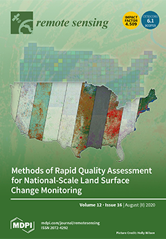
The Land Change Monitoring, Assessment, and Projection (LCMAP) project has released a suite of 10 annual land cover and land surface change datasets between 1985 and 2017 across the United States at a 30-m spatial resolution. This paper presents a method for automatically evaluating LCMAP results during the production phase based on 14 indices to quickly find and flag erroneous tiles (150 km × 150 km). The algorithm focused on using the local outlier factor analysis to find erroneous tiles through comparison with surrounding tiles. Our analysis showed that all local outlier scores for the published LCMAP tiles are below the outlier threshold. The overall agreement between LCMAP and the National Land Cover Database land cover products on a tile basis is above 71.5% and has an average of 89.1% across the 422 tiles in the conterminous United States. View this paper
  • Issues are regarded as officially published after their release is announced to the table of contents alert mailing list.
  • You may sign up for e-mail alerts to receive table of contents of newly released issues.
  • PDF is the official format for papers published in both, html and pdf forms. To view the papers in pdf format, click on the "PDF Full-text" link, and use the free Adobe Reader to open them.
Order results
Result details
Section
Select all
Export citation of selected articles as:
19 pages, 8927 KiB  
Article
Mapping Sea Surface Height Using New Concepts of Kinematic GNSS Instruments
by Clémence Chupin, Valérie Ballu, Laurent Testut, Yann-Treden Tranchant, Michel Calzas, Etienne Poirier, Thibault Coulombier, Olivier Laurain, Pascal Bonnefond and Team FOAM Project
Remote Sens. 2020, 12(16), 2656; https://doi.org/10.3390/rs12162656 - 19 Aug 2020
Cited by 19 | Viewed by 4908
Abstract
For over 25 years, satellite altimetry observations have provided invaluable information about sea-level variations, from Global Mean Sea-Level to regional meso-scale variability. However, this information remains difficult to extract in coastal areas, where the proximity to land and complex dynamics create complications that [...] Read more.
For over 25 years, satellite altimetry observations have provided invaluable information about sea-level variations, from Global Mean Sea-Level to regional meso-scale variability. However, this information remains difficult to extract in coastal areas, where the proximity to land and complex dynamics create complications that are not sufficiently accounted for in current models. Detailed knowledge of local hydrodynamics, as well as reliable sea-surface height measurements, is required to improve and validate altimetry measurements. New kinematic systems based on Global Navigation Satellite Systems (GNSS) have been developed to map the sea surface height in motion. We demonstrate the capacity of two of these systems, designed to measure the height at a centimetric level: (1) A GNSS floating carpet towed by boat (named CalNaGeo); and (2) a combination of GNSS antenna and acoustic altimeter (named Cyclopée) mounted on an unmanned surface vehicle (USV). We show that, at a fixed point, these instruments provide comparable accuracy to the best available tide gauge systems. When moving at up to 7 knots, the instrument velocity does not affect the sea surface height accuracy, and the two instruments agree at a cm-level. Full article
(This article belongs to the Special Issue Calibration and Validation of Satellite Altimetry)
Show Figures

Graphical abstract

24 pages, 25578 KiB  
Article
Bayesian Calibration of the Aquacrop-OS Model for Durum Wheat by Assimilation of Canopy Cover Retrieved from VENµS Satellite Data
by Deepak Upreti, Stefano Pignatti, Simone Pascucci, Massimo Tolomio, Wenjiang Huang and Raffaele Casa
Remote Sens. 2020, 12(16), 2666; https://doi.org/10.3390/rs12162666 - 18 Aug 2020
Cited by 21 | Viewed by 5434
Abstract
Crop growth models play an important role in agriculture management, allowing, for example, the spatialized estimation of crop yield information. However, crop model parameter calibration is a mandatory step for their application. The present work focused on the regional calibration of the Aquacrop-OS [...] Read more.
Crop growth models play an important role in agriculture management, allowing, for example, the spatialized estimation of crop yield information. However, crop model parameter calibration is a mandatory step for their application. The present work focused on the regional calibration of the Aquacrop-OS model for durum wheat by assimilating high spatial and temporal resolution canopy cover data retrieved from VENµS satellite images. The assimilation procedure was implemented using the Bayesian approach with the recent implementation of the Markov chain Monte Carlo (MCMC)-based Differential Evolution Adaptive Metropolis (DREAM) algorithm DREAM(KZS). The fraction of vegetation cover (fvc) was retrieved from the VENµS satellite images for two years, during the durum wheat growing seasons of 2018 and 2019 in Central Italy. The retrieval was based on a hybrid method using PROSAIL Radiative Transfer Model (RTM) simulations for training a Gaussian Process Regression (GPR) algorithm, combined with Active Learning to reduce the computational cost. The Aquacrop-OS model was calibrated with the fvc data of 2017–2018 for the Maccarese farm in Central Italy and validated with the 2018–2019 data. The retrieval accuracy of the fvc from the VENµS images were the Coefficient of Determination (R2) = 0.76, Root Mean Square Error (RMSE) = 0.09, and Relative Root Mean Square Error (RRMSE) = 11.6%, when compared with the ground-measured fvc. The MCMC results are presented in terms of Gelman–Rubin R statistics and MR statistics, Markov chains, and marginal posterior distribution functions, which are summarized with the mean values for the most sensitive crop parameters of the Aquacrop-OS model subjected to calibration. When validating for the fvc, the R2 of the model for year (2018–2019) ranged from 0.69 to 0.86. The RMSE, Relative Error (RE), Relative Variability (α), and Relative Bias (β) ranged from 0.15 to 0.44, 0.19 to 2.79, 0.84 to 1.45, and 0.91 to 1.95, respectively. The present work shows the importance of the calibration of the Aquacrop-OS (AOS) crop water productivity model for durum wheat by assimilating remote sensing information from VENµS satellite data. Full article
(This article belongs to the Special Issue VENµS Image Processing Techniques and Applications)
Show Figures

Graphical abstract

19 pages, 2360 KiB  
Article
Estimates of Conservation Tillage Practices Using Landsat Archive
by Peter C. Beeson, Craig S.T. Daughtry and Steven A. Wallander
Remote Sens. 2020, 12(16), 2665; https://doi.org/10.3390/rs12162665 - 18 Aug 2020
Cited by 15 | Viewed by 4732
Abstract
The USDA Environmental Quality Incentives Program (EQIP) provides financial assistance to encourage producers to adopt conservation practices. Historically, one of the most common practices is conservation tillage, primarily the use of no-till planting. The objectives of this research were to determine crop residue [...] Read more.
The USDA Environmental Quality Incentives Program (EQIP) provides financial assistance to encourage producers to adopt conservation practices. Historically, one of the most common practices is conservation tillage, primarily the use of no-till planting. The objectives of this research were to determine crop residue using remote sensing, an indicator of tillage intensity, without using training data and examine its performance at the field level. The Landsat Thematic Mapper Series platforms can provide global temporal and spatial coverage beginning in the mid-1980s. In this study, we used the Normalized Difference Tillage Index (NDTI), which has proved to be robust and accurate in studies built upon training datasets. We completed 10 years of residue maps for the 150,000 km2 study area in South Dakota, North Dakota, and Minnesota and validated the results against field-level survey data. The overall accuracy was between 64% and 78% with additional improvement when survey points with suspect geolocation and satellite tillage estimates with fewer than four dates of Landsat images were excluded. This study demonstrates that, with Landsat Archive available at no cost, researchers can implement retrospective, untrained estimates of conservation tillage with sufficient accuracy for some applications. Full article
(This article belongs to the Special Issue Remote Sensing of Crop Residue and Non-photosynthetic Vegetation)
Show Figures

Graphical abstract

17 pages, 4551 KiB  
Article
Shoreline Extraction from WorldView2 Satellite Data in the Presence of Foam Pixels Using Multispectral Classification Method
by Audrey Minghelli, Jérôme Spagnoli, Manchun Lei, Malik Chami and Sabine Charmasson
Remote Sens. 2020, 12(16), 2664; https://doi.org/10.3390/rs12162664 - 18 Aug 2020
Cited by 11 | Viewed by 3685
Abstract
Foam is often present in satellite images of coastal areas and can lead to serious errors in the detection of shorelines especially when processing high spatial resolution images (<20 m). This study focuses on shoreline extraction and shoreline evolution using high spatial resolution [...] Read more.
Foam is often present in satellite images of coastal areas and can lead to serious errors in the detection of shorelines especially when processing high spatial resolution images (<20 m). This study focuses on shoreline extraction and shoreline evolution using high spatial resolution satellite images in the presence of foam. A multispectral supervised classification technique is selected, namely the Support Vector Machine (SVM) and applied with three classes which are land, foam and water. The merging of water and foam classes followed by a segmentation procedure enables the separation of land and ocean pixels. The performance of the method is evaluated using a validation dataset acquired on two study areas (south and north of the bay of Sendaï—Japan). On each site, WorldView-2 multispectral images (eight bands, 2 m resolution) were acquired before and after the Fukushima tsunami generated by the Tohoku earthquake in 2011. The consideration of the foam class enables the false negative error to be reduced by a factor of three. The SVM method is also compared with four other classification methods, namely Euclidian Distance, Spectral Angle Mapper, Maximum Likelihood, and Neuronal Network. The SVM method appears to be the most efficient to determine the erosion and the accretion resulting from the tsunami, which are societal issues for littoral management purposes. Full article
Show Figures

Graphical abstract

17 pages, 5894 KiB  
Article
Susceptibility Analysis of the Mt. Umyeon Landslide Area Using a Physical Slope Model and Probabilistic Method
by Sunmin Lee, Jungyoon Jang, Yunjee Kim, Namwook Cho and Moung-Jin Lee
Remote Sens. 2020, 12(16), 2663; https://doi.org/10.3390/rs12162663 - 18 Aug 2020
Cited by 11 | Viewed by 3165
Abstract
Every year, many countries carry out landslide susceptibility analyses to establish and manage countermeasures and reduce the damage caused by landslides. Because increases in the areas of landslides lead to new landslides, there is a growing need for landslide prediction to reduce such [...] Read more.
Every year, many countries carry out landslide susceptibility analyses to establish and manage countermeasures and reduce the damage caused by landslides. Because increases in the areas of landslides lead to new landslides, there is a growing need for landslide prediction to reduce such damage. Among the various methods for landslide susceptibility analysis, statistical methods require information about the landslide occurrence point. Meanwhile, analysis based on physical slope models can estimate stability by considering the slope characteristics, which can be applied based on information about the locations of landslides. Therefore, in this study, a probabilistic method based on a physical slope model was developed to analyze landslide susceptibility. To this end, an infinite slope model was used as the physical slope model, and Monte Carlo simulation was applied based on landslide inventory including landslide locations, elevation, slope gradient, specific catchment area (SCA), soil thickness, unit weight, cohesion, friction angle, hydraulic conductivity, and rainfall intensity; deterministic analysis was also performed for the comparison. The Mt. Umyeon area, a representative case for urban landslides in South Korea where large scale human damage occurred in 2011, was selected for a case study. The landslide prediction rate and receiver operating characteristic (ROC) curve were used to estimate the prediction accuracy so that we could compare our approach to the deterministic analysis. The landslide prediction rate of the deterministic analysis was 81.55%; in the case of the Monte Carlo simulation, when the failure probabilities were set to 1%, 5%, and 10%, the landslide prediction rates were 95.15%, 91.26%, and 90.29%, respectively, which were higher than the rate of the deterministic analysis. Finally, according to the area under the curve of the ROC curve, the prediction accuracy of the probabilistic model was 73.32%, likely due to the variability and uncertainty in the input variables. Full article
Show Figures

Graphical abstract

21 pages, 5311 KiB  
Article
Seasonal Cycles of Phytoplankton Expressed by Sine Equations Using the Daily Climatology from Satellite-Retrieved Chlorophyll-a Concentration (1997–2019) Over Global Ocean
by Zexi Mao, Zhihua Mao, Cédric Jamet, Marc Linderman, Yuntao Wang and Xiaoyan Chen
Remote Sens. 2020, 12(16), 2662; https://doi.org/10.3390/rs12162662 - 18 Aug 2020
Cited by 8 | Viewed by 2785
Abstract
The global coverage of Chlorophyll-a concentration (Chl-a) has been continuously available from ocean color satellite sensors since September 1997 and the Chl-a data (1997–2019) were used to produce a climatological dataset by averaging Chl-a values at same locations and same day of year. [...] Read more.
The global coverage of Chlorophyll-a concentration (Chl-a) has been continuously available from ocean color satellite sensors since September 1997 and the Chl-a data (1997–2019) were used to produce a climatological dataset by averaging Chl-a values at same locations and same day of year. The constructed climatology can remarkably reduce the variability of satellite data and clearly exhibit the seasonal cycles, demonstrating that the growth and decay of phytoplankton recurs with similarly seasonal cycles year after year. As the shapes of time series of the climatology exhibit strong periodical change, we wonder whether the seasonality of Chl-a can be expressed by a mathematic equation. Our results show that sinusoid functions are suitable to describe cyclical variations of data in time series and patterns of the daily climatology can be matched by sine equations with parameters of mean, amplitude, phase, and frequency. Three types of sine equations were used to match the climatological Chl-a with Mean Relative Differences (MRD) of 7.1%, 4.5%, and 3.3%, respectively. The sine equation with four sinusoids can modulate the shapes of the fitted values to match various patterns of climatology with small MRD values (less than 5%) in about 90% of global oceans. The fitted values can reflect an overall pattern of seasonal cycles of Chl-a which can be taken as a time series of biomass baseline for describing the state of seasonal variations of phytoplankton. The amplitude images, the spatial patterns of seasonal variations of phytoplankton, can be used to identify the transition zone chlorophyll fronts. The timing of phytoplankton blooms is identified by the biggest peak of the fitted values and used to classify oceans as different bloom seasons, indicating that blooms occur in all four seasons with regional features. In global oceans within latitude domains (48°N–48°S), blooms occupy approximately half of the ocean (50.6%) during boreal winter (December–February) in the northern hemisphere and more than half (58.0%) during austral winter (June–August) in the southern hemisphere. Therefore, the sine equation can be used to match the daily Chl-a climatology and the fitted values can reflect the seasonal cycles of phytoplankton, which can be used to investigate the underlying phenological characteristics. Full article
(This article belongs to the Section Biogeosciences Remote Sensing)
Show Figures

Graphical abstract

21 pages, 3423 KiB  
Article
Primary Evaluation of the GCOM-C Aerosol Products at 380 nm Using Ground-Based Sky Radiometer Observations
by Hossain Mohammed Syedul Hoque, Hitoshi Irie, Alessandro Damiani and Masahiro Momoi
Remote Sens. 2020, 12(16), 2661; https://doi.org/10.3390/rs12162661 - 18 Aug 2020
Cited by 4 | Viewed by 2859
Abstract
The Global Change Observation Mission-Climate (GCOM-C) is currently the only satellite sensor providing aerosol optical thickness (AOT) in the ultraviolet (UV) region during the morning overpass time. The observations in the UV region are important to detect the presence of absorbing aerosols in [...] Read more.
The Global Change Observation Mission-Climate (GCOM-C) is currently the only satellite sensor providing aerosol optical thickness (AOT) in the ultraviolet (UV) region during the morning overpass time. The observations in the UV region are important to detect the presence of absorbing aerosols in the atmosphere. The recently available GCOM-C dataset of AOT at 380 nm for January to September 2019 were evaluated using ground-based SKYNET sky radiometer measurements at Chiba, Japan (35.62° N, 140.10° E) and Phimai, central Thailand (15.18° N, 102.56° E), representing urban and rural sites, respectively. AOT retrieved from sky radiometer observations in Chiba and Phimai was compared with coincident AERONET and multi-axis differential optical absorption spectroscopy (MAX-DOAS) AOT values, respectively. Under clear sky conditions, the datasets showed good agreement. The sky radiometer and GCOM-C AOT values showed a positive correlation (R) of ~0.73 for both sites, and agreement between the datasets was mostly within ±0.2 (the number of coincident points at both sites was less than 50 for the coincidence criterion of ≤30 km). At Chiba, greater differences in the AOT values were primarily related to cloud screening in the datasets. The mean bias error (MBE) (GCOM-C – sky radiometer) for the Chiba site was −0.02 for a coincidence criterion of ≤10 km. For a similar coincidence criterion, the MBE values were higher for observations at the Phimai site. This difference was potentially related to the strong influence of biomass burning during the dry season (Jan–Apr). The diurnal variations in AOT, inferred from the combination of GCOM-C and ozone monitoring instrument (OMI) observations, showed good agreement with the sky radiometer data, despite the differences in the absolute AOT values. Over Phimai, the AOT diurnal variations from the satellite and sky radiometer observations were different, likely due to the large differences in the AOT values during the dry season. Full article
(This article belongs to the Section Atmospheric Remote Sensing)
Show Figures

Graphical abstract

22 pages, 32595 KiB  
Article
Utilization of Multi-Temporal Microwave Remote Sensing Data within a Geostatistical Regionalization Approach for the Derivation of Soil Texture
by Philip Marzahn and Swen Meyer
Remote Sens. 2020, 12(16), 2660; https://doi.org/10.3390/rs12162660 - 18 Aug 2020
Cited by 9 | Viewed by 3091
Abstract
Land Surface Models (LSM) have become indispensable tools to quantify water and nutrient fluxes in support of land management strategies or the prediction of climate change impacts. However, the utilization of LSM requires soil and vegetation parameters, which are seldom available in high [...] Read more.
Land Surface Models (LSM) have become indispensable tools to quantify water and nutrient fluxes in support of land management strategies or the prediction of climate change impacts. However, the utilization of LSM requires soil and vegetation parameters, which are seldom available in high spatial distribution or in an appropriate temporal frequency. As shown in recent studies, the quality of these model input parameters, especially the spatial heterogeneity and temporal variability of soil parameters, has a strong effect on LSM simulations. This paper assesses the potential of microwave remote sensing data for retrieving soil physical properties such as soil texture. Microwave remote sensing is able to penetrate in an imaged media (soil, vegetation), thus being capable of retrieving information beneath such a surface. In this study, airborne remote sensing data acquired at 1.3 GHz and in different polarization is utilized in conjunction with geostatistics to retrieve information about soil texture. The developed approach is validated with in-situ data from different field campaigns carried out over the TERENO test-site “North-Eastern German Lowland Observatorium”. With the proposed approach a high accuracy of the retrieved soil texture with a mean RMSE of 2.42 (Mass-%) could be achieved outperforming classical deterministic and geostatistical approaches. Full article
Show Figures

Graphical abstract

40 pages, 3131 KiB  
Review
Recent Advances of Hyperspectral Imaging Technology and Applications in Agriculture
by Bing Lu, Phuong D. Dao, Jiangui Liu, Yuhong He and Jiali Shang
Remote Sens. 2020, 12(16), 2659; https://doi.org/10.3390/rs12162659 - 18 Aug 2020
Cited by 388 | Viewed by 29593
Abstract
Remote sensing is a useful tool for monitoring spatio-temporal variations of crop morphological and physiological status and supporting practices in precision farming. In comparison with multispectral imaging, hyperspectral imaging is a more advanced technique that is capable of acquiring a detailed spectral response [...] Read more.
Remote sensing is a useful tool for monitoring spatio-temporal variations of crop morphological and physiological status and supporting practices in precision farming. In comparison with multispectral imaging, hyperspectral imaging is a more advanced technique that is capable of acquiring a detailed spectral response of target features. Due to limited accessibility outside of the scientific community, hyperspectral images have not been widely used in precision agriculture. In recent years, different mini-sized and low-cost airborne hyperspectral sensors (e.g., Headwall Micro-Hyperspec, Cubert UHD 185-Firefly) have been developed, and advanced spaceborne hyperspectral sensors have also been or will be launched (e.g., PRISMA, DESIS, EnMAP, HyspIRI). Hyperspectral imaging is becoming more widely available to agricultural applications. Meanwhile, the acquisition, processing, and analysis of hyperspectral imagery still remain a challenging research topic (e.g., large data volume, high data dimensionality, and complex information analysis). It is hence beneficial to conduct a thorough and in-depth review of the hyperspectral imaging technology (e.g., different platforms and sensors), methods available for processing and analyzing hyperspectral information, and recent advances of hyperspectral imaging in agricultural applications. Publications over the past 30 years in hyperspectral imaging technology and applications in agriculture were thus reviewed. The imaging platforms and sensors, together with analytic methods used in the literature, were discussed. Performances of hyperspectral imaging for different applications (e.g., crop biophysical and biochemical properties’ mapping, soil characteristics, and crop classification) were also evaluated. This review is intended to assist agricultural researchers and practitioners to better understand the strengths and limitations of hyperspectral imaging to agricultural applications and promote the adoption of this valuable technology. Recommendations for future hyperspectral imaging research for precision agriculture are also presented. Full article
(This article belongs to the Special Issue Hyperspectral Remote Sensing of Agriculture and Vegetation)
Show Figures

Figure 1

15 pages, 9224 KiB  
Article
Efficient Location and Extraction of the Iceberg Calved Areas of the Antarctic Ice Shelves
by Mengzhen Qi, Yan Liu, Yijing Lin, Fengming Hui, Teng Li and Xiao Cheng
Remote Sens. 2020, 12(16), 2658; https://doi.org/10.3390/rs12162658 - 18 Aug 2020
Cited by 6 | Viewed by 2725
Abstract
Continuous, rapid, and precise monitoring of calving events contributes to an in-depth understanding of calving mechanisms, which have the potential to cause significant mass loss from the Antarctic ice sheet. The difficulties in the precise monitoring of iceberg calving lie with the coexistence [...] Read more.
Continuous, rapid, and precise monitoring of calving events contributes to an in-depth understanding of calving mechanisms, which have the potential to cause significant mass loss from the Antarctic ice sheet. The difficulties in the precise monitoring of iceberg calving lie with the coexistence of ice shelf advances and calving. The manual location of iceberg calving is time-consuming and painstaking, while achieving precise extraction has mostly relied on the surface textural characteristics of the ice shelves and the quality of the images. Here, we propose a new and efficient method of separating the expansion and calving processes of ice shelves. We visualized the extension process by simulating a new coastline, based on the ice velocity, and detected the calved area using the simulated coastline and single-temporal post-calving images. We extensively tested the validity of this method by extracting four annual calving datasets (from August 2015 to August 2019) from the Sentinel-1 synthetic aperture radar mosaic of the Antarctic coastline. A total of 2032 annual Antarctic calving events were detected, with areas ranging from 0.05 km2 to 6141.0 km2, occurring on almost every Antarctic ice shelf. The extraction accuracy of the calved area depends on the positioning accuracy of the simulated coastline and the spatial resolution of the images. The positioning error of the simulated coastline is less than one pixel, and the determined minimum valid extraction area is 0.05 km2, when based on 75 m resolution images. Our method effectively avoids repetition and omission errors during the calved area extraction process. Furthermore, its efficiency is not affected by the surface textural characteristics of the calving fronts and the various changes in the frontal edge velocity, which makes it fully applicable to the rapid and accurate extraction of different calving types. Full article
(This article belongs to the Special Issue Polar Sea Ice: Detection, Monitoring and Modeling)
Show Figures

Graphical abstract

23 pages, 20393 KiB  
Article
ALS-Based Detection of Past Human Activities in the Białowieża Forest—New Evidence of Unknown Remains of Past Agricultural Systems
by Krzysztof Stereńczak, Rafał Zapłata, Jarosław Wójcik, Bartłomiej Kraszewski, Miłosz Mielcarek, Krzysztof Mitelsztedt, Małgorzata Białczak, Grzegorz Krok, Łukasz Kuberski, Anna Markiewicz, Aneta Modzelewska, Karolina Parkitna, Żaneta Piasecka, Kamil Pilch, Karol Rzeczycki, Rafał Sadkowski, Martyna Wietecha, Piotr Rysiak, Klaus von Gadow and Chris J. Cieszewski
Remote Sens. 2020, 12(16), 2657; https://doi.org/10.3390/rs12162657 - 18 Aug 2020
Cited by 14 | Viewed by 5865
Abstract
The Białowieża Forest (BF), a unique ecosystem of historical significance in central Europe, has a long history of assumed human settlement, with at least 200 known archaeological sites (until 2016). This study uncovers new evidence of the cultural heritage of this unique forest [...] Read more.
The Białowieża Forest (BF), a unique ecosystem of historical significance in central Europe, has a long history of assumed human settlement, with at least 200 known archaeological sites (until 2016). This study uncovers new evidence of the cultural heritage of this unique forest area using Airborne Laser Scanning (ALS) technology combined with traditional archaeological field assessment methods to verify the ALS data interpretations and to provide additional evidence about the function and origin of the newly detected archaeological sites. The results of this study include (1) a scientific approach for an improved identification of archaeological resources in forest areas; (2) new evidence about the history of the human use of the BF based on ALS data, covering the entire Polish part of the BF; and (3) an improved remote sensing infrastructure, supporting existing GIS (Geographic Information System) systems for the BF, a famous UNESCO Heritage site. Our study identified numerous locations with evidence of past human agricultural activities known in the literature as “field systems”, “lynchets” and “Celtic fields”. The initial identification included more than 300 km of possible field boundaries and plough headlands, many of which we have verified on the ground. Various past human activities creating those boundaries have existed since the (pre-) Roman Period up to the 13th century AD. The results of this study demonstrate that past human activities in the Polish part of the Białowieża Forest had been more prevalent than previously believed. As a practical result of the described activities, a geodatabase was created; this has practical applications for the system of monument protection in Poland, as well as for local communities and the BF’s management and conservation. The more widely achieved results are in line with the implementation of the concept of a cultural heritage inventory in forested and protected areas—the actions taken specify (built globally) the forms of protection and management of cultural and environmental goods. Full article
(This article belongs to the Special Issue Remote Sensing of Archaeology)
Show Figures

Graphical abstract

25 pages, 13188 KiB  
Article
Rice Crop Detection Using LSTM, Bi-LSTM, and Machine Learning Models from Sentinel-1 Time Series
by Hugo Crisóstomo de Castro Filho, Osmar Abílio de Carvalho Júnior, Osmar Luiz Ferreira de Carvalho, Pablo Pozzobon de Bem, Rebeca dos Santos de Moura, Anesmar Olino de Albuquerque, Cristiano Rosa Silva, Pedro Henrique Guimarães Ferreira, Renato Fontes Guimarães and Roberto Arnaldo Trancoso Gomes
Remote Sens. 2020, 12(16), 2655; https://doi.org/10.3390/rs12162655 - 18 Aug 2020
Cited by 95 | Viewed by 8661
Abstract
The Synthetic Aperture Radar (SAR) time series allows describing the rice phenological cycle by the backscattering time signature. Therefore, the advent of the Copernicus Sentinel-1 program expands studies of radar data (C-band) for rice monitoring at regional scales, due to the high temporal [...] Read more.
The Synthetic Aperture Radar (SAR) time series allows describing the rice phenological cycle by the backscattering time signature. Therefore, the advent of the Copernicus Sentinel-1 program expands studies of radar data (C-band) for rice monitoring at regional scales, due to the high temporal resolution and free data distribution. Recurrent Neural Network (RNN) model has reached state-of-the-art in the pattern recognition of time-sequenced data, obtaining a significant advantage at crop classification on the remote sensing images. One of the most used approaches in the RNN model is the Long Short-Term Memory (LSTM) model and its improvements, such as Bidirectional LSTM (Bi-LSTM). Bi-LSTM models are more effective as their output depends on the previous and the next segment, in contrast to the unidirectional LSTM models. The present research aims to map rice crops from Sentinel-1 time series (band C) using LSTM and Bi-LSTM models in West Rio Grande do Sul (Brazil). We compared the results with traditional Machine Learning techniques: Support Vector Machines (SVM), Random Forest (RF), k-Nearest Neighbors (k-NN), and Normal Bayes (NB). The developed methodology can be subdivided into the following steps: (a) acquisition of the Sentinel time series over two years; (b) data pre-processing and minimizing noise from 3D spatial-temporal filters and smoothing with Savitzky-Golay filter; (c) time series classification procedures; (d) accuracy analysis and comparison among the methods. The results show high overall accuracy and Kappa (>97% for all methods and metrics). Bi-LSTM was the best model, presenting statistical differences in the McNemar test with a significance of 0.05. However, LSTM and Traditional Machine Learning models also achieved high accuracy values. The study establishes an adequate methodology for mapping the rice crops in West Rio Grande do Sul. Full article
Show Figures

Graphical abstract

25 pages, 8135 KiB  
Article
Performances of Vegetation Indices on Paddy Rice at Elevated Air Temperature, Heat Stress, and Herbicide Damage
by Jae-Hyun Ryu, Hoejeong Jeong and Jaeil Cho
Remote Sens. 2020, 12(16), 2654; https://doi.org/10.3390/rs12162654 - 18 Aug 2020
Cited by 28 | Viewed by 3963
Abstract
Spectral reflectance-based vegetation indices have sensitive characteristics to crop growth and health conditions. The performance of each vegetation index to a certain condition is different and needs to be interpreted, correspondingly. This study aimed to assess the most suitable vegetation index to identify [...] Read more.
Spectral reflectance-based vegetation indices have sensitive characteristics to crop growth and health conditions. The performance of each vegetation index to a certain condition is different and needs to be interpreted, correspondingly. This study aimed to assess the most suitable vegetation index to identify the crop response against elevated air temperatures, heat stress, and herbicide damage. The spectral reflectance, yield components, and growth parameters such as plant height, leaf area index (LAI), and above-ground dry matter of paddy rice, which was cultivated in a temperature gradient field chamber to simulate global warming conditions, were observed from 2016 to 2018. The relationships between the vegetation indices and the crop parameters were assessed considering stress conditions. The normalized difference vegetation index (NDVI) represented the changes in plant height (R-square = 0.93) and the LAI (R-square = 0.901) before the heading stage. Furthermore, the NDVI and the cumulative growing degree days had a Sigmoid curve and an R-square value of 0.937 under the normal growth case, but it decreased significantly in the herbicide damage case. This characteristic was useful for detecting the damaged crop growth condition. Additionally, to estimate the grain yield of paddy rice, the medium resolution imaging spectrometer (MERIS) terrestrial chlorophyll index was better: R-square = 0.912; root mean square error = 95.69 g/m2. Photochemical reflectance index was sensitive to physiological stress caused by the heatwave, and it decreased in response to extremely high air temperatures. These results will contribute towards determining vegetation indices under stress conditions and how to effectively utilize them. Full article
(This article belongs to the Special Issue Remote Sensing for Agrometeorology)
Show Figures

Graphical abstract

21 pages, 1227 KiB  
Article
Effective Training of Deep Convolutional Neural Networks for Hyperspectral Image Classification through Artificial Labeling
by Wojciech Masarczyk, Przemysław Głomb, Bartosz Grabowski and Mateusz Ostaszewski
Remote Sens. 2020, 12(16), 2653; https://doi.org/10.3390/rs12162653 - 17 Aug 2020
Cited by 17 | Viewed by 4703
Abstract
Hyperspectral imaging is a rich source of data, allowing for a multitude of effective applications. However, such imaging remains challenging because of large data dimension and, typically, a small pool of available training examples. While deep learning approaches have been shown to be [...] Read more.
Hyperspectral imaging is a rich source of data, allowing for a multitude of effective applications. However, such imaging remains challenging because of large data dimension and, typically, a small pool of available training examples. While deep learning approaches have been shown to be successful in providing effective classification solutions, especially for high dimensional problems, unfortunately they work best with a lot of labelled examples available. The transfer learning approach can be used to alleviate the second requirement for a particular dataset: first the network is pre-trained on some dataset with large amount of training labels available, then the actual dataset is used to fine-tune the network. This strategy is not straightforward to apply with hyperspectral images, as it is often the case that only one particular image of some type or characteristic is available. In this paper, we propose and investigate a simple and effective strategy of transfer learning that uses unsupervised pre-training step without label information. This approach can be applied to many of the hyperspectral classification problems. The performed experiments show that it is very effective at improving the classification accuracy without being restricted to a particular image type or neural network architecture. The experiments were carried out on several deep neural network architectures and various sizes of labeled training sets. The greatest improvement in overall accuracy on the Indian Pines and Pavia University datasets is over 21 and 13 percentage points, respectively. An additional advantage of the proposed approach is the unsupervised nature of the pre-training step, which can be done immediately after image acquisition, without the need of the potentially costly expert’s time. Full article
(This article belongs to the Special Issue Computer Vision and Deep Learning for Remote Sensing Applications)
Show Figures

Graphical abstract

21 pages, 3359 KiB  
Article
The Sentinel-3 OLCI Terrestrial Chlorophyll Index (OTCI): Algorithm Improvements, Spatiotemporal Consistency and Continuity with the MERIS Archive
by J. Pastor-Guzman, L. Brown, H. Morris, L. Bourg, P. Goryl, S. Dransfeld and J. Dash
Remote Sens. 2020, 12(16), 2652; https://doi.org/10.3390/rs12162652 - 17 Aug 2020
Cited by 16 | Viewed by 5827
Abstract
The Ocean and Land Colour Instrument (OLCI) on-board Sentinel-3 (2016–present) was designed with similar mechanical and optical characteristics to the Envisat Medium Resolution Imaging Spectrometer (MERIS) (2002–2012) to ensure continuity with a number of land and marine biophysical products. The Sentinel-3 OLCI Terrestrial [...] Read more.
The Ocean and Land Colour Instrument (OLCI) on-board Sentinel-3 (2016–present) was designed with similar mechanical and optical characteristics to the Envisat Medium Resolution Imaging Spectrometer (MERIS) (2002–2012) to ensure continuity with a number of land and marine biophysical products. The Sentinel-3 OLCI Terrestrial Chlorophyll Index (OTCI) is an indicator of canopy chlorophyll content and is intended to continue the legacy of the Envisat MERIS Terrestrial Chlorophyll Index (MTCI). Despite spectral similarities, validation and verification of consistency is essential to inform the user community about the product’s accuracy, uncertainty, and fitness for purpose. This paper aims to: (i) describe the theoretical basis of the Sentinel-3 OTCI and (ii) evaluate the spatiotemporal consistency between the Sentinel-3 OTCI and the Envisat MTCI. Two approaches were used to conduct the evaluation. Firstly, agreement between the Sentinel-3 OTCI and the Envisat MTCI archive was assessed over the Committee for Earth Observation Satellites (CEOS) Land Product Validation (LPV) core validation sites, enabling the temporal consistency of the two products to be investigated. Secondly, intercomparison of monthly Level-3 Sentinel-3 OTCI and Envisat MTCI composites was carried out to evaluate the spatial distribution of differences across the globe. In both cases, the agreement was quantified with statistical metrics (R2, NRMSD, bias) using an Envisat MTCI climatology based on the MERIS archive as the reference. Our results demonstrate strong agreement between the products. Specifically, high 1:1 correspondence (R2 >0.88), low global mean percentage difference (−1.86 to 0.61), low absolute bias (<0.1), and minimal error (NRMSD ~0.1) are observed. The temporal profiles reveal consistency in the expected range of values, amplitudes, and seasonal trajectories. Biases and discrepancies may be attributed to changes in land management practices, land cover change, and extreme climatic events occurred during the time gap between the missions; however, this requires further investigation. This research confirms that Sentinel-3 OTCI dataset can be used along with the Envisat MTCI to provide a data coverage over the last 20 years. Full article
Show Figures

Graphical abstract

20 pages, 4509 KiB  
Article
Dynamics and Drivers of the Alpine Timberline on Gongga Mountain of Tibetan Plateau-Adopted from the Otsu Method on Google Earth Engine
by Wen He, Chongchong Ye, Jian Sun, Junnan Xiong, Jinniu Wang and Tiancai Zhou
Remote Sens. 2020, 12(16), 2651; https://doi.org/10.3390/rs12162651 - 17 Aug 2020
Cited by 14 | Viewed by 3412
Abstract
The alpine timberline, an ecosystem ecotone, indicates climatic change and is tending to shift toward higher altitudes because of an increase in global warming. However, spatiotemporal variations of the alpine timberline are not consistent on a global scale. The abundant and highest alpine [...] Read more.
The alpine timberline, an ecosystem ecotone, indicates climatic change and is tending to shift toward higher altitudes because of an increase in global warming. However, spatiotemporal variations of the alpine timberline are not consistent on a global scale. The abundant and highest alpine timberline, located on the Tibetan Plateau, is less subject to human activity and disturbance. Although many studies have investigated the alpine timberline on the Tibetan Plateau, large-scale monitoring of spatial-temporal dynamics and driving mechanisms of the alpine timberline remain uncertain and inaccurate. Hence, the Gongga Mountain on the southeastern Tibetan Plateau was chosen as the study area because of the most complete natural altitudinal zonation. We used the Otsu method on Google Earth Engine to extract the alpine timberline from 1987–2019 based on the normalized difference vegetation index (NDVI). Then, the alpine timberline spatiotemporal patterns and the effect of topography on alpine timberline distribution were explored. Four hillsides on the western Gongga Mountain were selected to examine the hillside differences and drivers of the alpine timberline based on principal component analysis (PCA) and multiple linear regression (MLR). The results indicated that the elevation range of alpine timberline was 3203–4889 m, and the vegetation coverage increased significantly (p < 0.01) near the alpine timberline ecotone on Gongga Mountain. Moreover, there was spatial heterogeneity in dynamics of alpine timberline, and some regions showed no regular trend in variations. The spatial pattern of the alpine timberline was generally high in the west, low in the east, and primarily distributed on 15–55° slopes. Besides, the drivers of the alpine timberline have the hillside differences, and the sunny and shady slopes possessed different driving factors. Thus, our results highlight the effects of topography and climate on the alpine timberline on different hillsides. These findings could provide a better approach to study the dynamics and formation of alpine timberlines. Full article
Show Figures

Graphical abstract

20 pages, 3703 KiB  
Article
Dynamic Influence Elimination and Chlorophyll Content Diagnosis of Maize Using UAV Spectral Imagery
by Lang Qiao, Dehua Gao, Junyi Zhang, Minzan Li, Hong Sun and Junyong Ma
Remote Sens. 2020, 12(16), 2650; https://doi.org/10.3390/rs12162650 - 17 Aug 2020
Cited by 34 | Viewed by 3768
Abstract
In order to improve the diagnosis accuracy of chlorophyll content in maize canopy, the remote sensing image of maize canopy with multiple growth stages was acquired by using an unmanned aerial vehicle (UAV) equipped with a spectral camera. The dynamic influencing factors of [...] Read more.
In order to improve the diagnosis accuracy of chlorophyll content in maize canopy, the remote sensing image of maize canopy with multiple growth stages was acquired by using an unmanned aerial vehicle (UAV) equipped with a spectral camera. The dynamic influencing factors of the canopy multispectral images of maize were removed by using different image segmentation methods. The chlorophyll content of maize in the field was diagnosed. The crop canopy spectral reflectance, coverage, and texture information are combined to discuss the different segmentation methods. A full-grown maize canopy chlorophyll content diagnostic model was created on the basis of the different segmentation methods. Results showed that different segmentation methods have variations in the extraction of maize canopy parameters. The wavelet segmentation method demonstrated better advantages than threshold and ExG index segmentation methods. This method segments the soil background, reduces the texture complexity of the image, and achieves satisfactory results. The maize canopy multispectral band reflectance and vegetation index were extracted on the basis of the different segmentation methods. A partial least square regression algorithm was used to construct a full-grown maize canopy chlorophyll content diagnostic model. The result showed that the model accuracy was low when the image background was not removed (Rc2 (the determination coefficient of calibration set) = 0.5431, RMSEF (the root mean squared error of forecast) = 4.2184, MAE (the mean absolute error) = 3.24; Rv2 (the determination coefficient of validation set) = 0.5894, RMSEP (the root mean squared error of prediction) = 4.6947, and MAE = 3.36). The diagnostic accuracy of the chlorophyll content could be improved by extracting the maize canopy through the segmentation method, which was based on the wavelet segmentation method. The maize canopy chlorophyll content diagnostic model had the highest accuracy (Rc2 = 0.6638, RMSEF = 3.6211, MAE = 2.89; Rv2 = 0.6923, RMSEP = 3.9067, and MAE = 3.19). The research can provide a feasible method for crop growth and nutrition monitoring on the basis of the UAV platform and has a guiding significance for crop cultivation management. Full article
(This article belongs to the Special Issue UAVs for Vegetation Monitoring)
Show Figures

Figure 1

20 pages, 2303 KiB  
Article
Remote Sensing of Agricultural Greenhouses and Plastic-Mulched Farmland: An Analysis of Worldwide Research
by Rafael Jiménez-Lao, Fernando J. Aguilar, Abderrahim Nemmaoui and Manuel A. Aguilar
Remote Sens. 2020, 12(16), 2649; https://doi.org/10.3390/rs12162649 - 17 Aug 2020
Cited by 38 | Viewed by 5004
Abstract
The total area of plastic-covered crops of 3019 million hectares has been increasing steadily around the world, particularly in the form of crops maintained under plastic-covered greenhouses to control their environmental conditions and their growth, thereby increasing production. This work analyzes the worldwide [...] Read more.
The total area of plastic-covered crops of 3019 million hectares has been increasing steadily around the world, particularly in the form of crops maintained under plastic-covered greenhouses to control their environmental conditions and their growth, thereby increasing production. This work analyzes the worldwide research dynamics on remote sensing-based mapping of agricultural greenhouses and plastic-mulched crops throughout the 21st century. In this way, a bibliometric analysis was carried out on a total of 107 publications based on the Scopus database. Different aspects of these publications were studied, such as type of publication, characteristics, categories and journal/conference name, countries, authors, and keywords. The results showed that “articles” were the type of document mostly found, while the number of published documents has exponentially increased over the last four years, growing from only one document published in 2001 to 22 in 2019. The main Scopus categories relating to the topic analyzed were Earth and Planetary Sciences (53%), Computer Science (30%), and Agricultural and Biological Sciences (28%). The most productive journal in this field was “Remote Sensing”, with 22 documents published, while China, Italy, Spain, USA, and Turkey were the five countries with the most publications. Among the main research institutions belonging to these five most productive countries, there were eight institutions from China, four from Italy, one from Spain, two from Turkey, and one from the USA. In conclusion, the evolution of the number of publications on Remote Sensing of Agricultural Greenhouses and Plastic-Mulched Farmland found throughout the period 2000–2019 allows us to classify the subject studied as an emerging research topic that is attracting an increasing level of interest worldwide, although its relative significance is still very limited within the remote sensing discipline. However, the growing demand for information on the arrangement and spatio-temporal dynamics of this increasingly important model of intensive agriculture is likely to drive this line of research in the coming years. Full article
Show Figures

Graphical abstract

19 pages, 7114 KiB  
Article
Investigating Detection of Floating Plastic Litter from Space Using Sentinel-2 Imagery
by Kyriacos Themistocleous, Christiana Papoutsa, Silas Michaelides and Diofantos Hadjimitsis
Remote Sens. 2020, 12(16), 2648; https://doi.org/10.3390/rs12162648 - 17 Aug 2020
Cited by 87 | Viewed by 12653
Abstract
Plastic litter floating in the ocean is a significant problem on a global scale. This study examines whether Sentinel-2 satellite images can be used to identify plastic litter on the sea surface for monitoring, collection and disposal. A pilot study was conducted to [...] Read more.
Plastic litter floating in the ocean is a significant problem on a global scale. This study examines whether Sentinel-2 satellite images can be used to identify plastic litter on the sea surface for monitoring, collection and disposal. A pilot study was conducted to determine if plastic targets on the sea surface can be detected using remote sensing techniques with Sentinel-2 data. A target made up of plastic water bottles with a surface measuring 3 m × 10 m was created, which was subsequently placed in the sea near the Old Port in Limassol, Cyprus. An unmanned aerial vehicle (UAV) was used to acquire multispectral aerial images of the area of interest during the same time as the Sentinel-2 satellite overpass. Spectral signatures of the water and the plastic litter after it was placed in the water were taken with an SVC HR1024 spectroradiometer. The study found that the plastic litter target was easiest to detect in the NIR wavelengths. Seven established indices for satellite image processing were examined to determine whether they can identify plastic litter in the water. Further, the authors examined two new indices, the Plastics Index (PI) and the Reversed Normalized Difference Vegetation Index (RNDVI) to be used in the processing of the satellite image. The newly developed Plastic Index (PI) was able to identify plastic objects floating on the water surface and was the most effective index in identifying the plastic litter target in the sea. Full article
(This article belongs to the Special Issue Remote Sensing in Applications of Geoinformation)
Show Figures

Figure 1

18 pages, 2517 KiB  
Article
Evaluation of BDS-3 Orbit Determination Strategies Using Ground-Tracking and Inter-Satellite Link Observation
by Yifei Lv, Tao Geng, Qile Zhao, Xin Xie, Feng Zhang and Xing Wang
Remote Sens. 2020, 12(16), 2647; https://doi.org/10.3390/rs12162647 - 17 Aug 2020
Cited by 12 | Viewed by 3050
Abstract
Dual one-way inter-satellite link (ISL) pseudoranges of BDS-3 satellites can be introduced as an additional measurement along with L-band pseudoranges and phases to improve the accuracy of precise orbit determination (POD). In the existing research, although the clock-free or geometry-free ISL observables are [...] Read more.
Dual one-way inter-satellite link (ISL) pseudoranges of BDS-3 satellites can be introduced as an additional measurement along with L-band pseudoranges and phases to improve the accuracy of precise orbit determination (POD). In the existing research, although the clock-free or geometry-free ISL observables are derived from the raw two one-way pseudoranges, only the clock-free observables are adopted for the ISL joint POD (Joint 1 POD) without considering the geometric-free observables. An improved joint (Joint 2 POD) strategy making full use of the clock-free and geometry-free observables is applied in this contribution. The orbits of ground-only POD, ISL-only POD, Joint 1 POD, and Joint 2 POD are comprehensively compared by the orbit overlapping differences, the Satellite Laser Ranging (SLR) residuals, and the characteristics of the satellite clock offsets estimated simultaneously. The comparisons prove that the performance of the Joint 2 POD strategy is better than that of the other three POD strategies regardless of the types of satellites. Moreover, this paper discusses ISL’s contribution to the station selection strategy in terms of the number and distribution. The experimental results show that, when there are more than 20 stations, each additional 10 stations contributes to a maximum of 7.5%, 3.9%, and 2.8% improvement on MEO, IGSO, and GEO satellites 3D accuracy, respectively. When the number of stations reaches 50, the precise orbits achieve similar accuracy to the results using 80 stations. In addition, after adding ISL data, the orbits estimated using 10 regional stations and 10 global stations are greatly improved, and the accuracy between them is only 0.9 cm in 3D errors. Full article
Show Figures

Graphical abstract

18 pages, 4024 KiB  
Article
Object Tracking in Unmanned Aerial Vehicle Videos via Multifeature Discrimination and Instance-Aware Attention Network
by Shiyu Zhang, Li Zhuo, Hui Zhang and Jiafeng Li
Remote Sens. 2020, 12(16), 2646; https://doi.org/10.3390/rs12162646 - 17 Aug 2020
Cited by 16 | Viewed by 3639
Abstract
Visual object tracking in unmanned aerial vehicle (UAV) videos plays an important role in a variety of fields, such as traffic data collection, traffic monitoring, as well as film and television shooting. However, it is still challenging to track the target robustly in [...] Read more.
Visual object tracking in unmanned aerial vehicle (UAV) videos plays an important role in a variety of fields, such as traffic data collection, traffic monitoring, as well as film and television shooting. However, it is still challenging to track the target robustly in UAV vision task due to several factors such as appearance variation, background clutter, and severe occlusion. In this paper, we propose a novel two-stage UAV tracking framework, which includes a target detection stage based on multifeature discrimination and a bounding-box estimation stage based on the instance-aware attention network. In the target detection stage, we explore a feature representation scheme for a small target that integrates handcrafted features, low-level deep features, and high-level deep features. Then, the correlation filter is used to roughly predict target location. In the bounding-box estimation stage, an instance-aware intersection over union (IoU)-Net is integrated together with an instance-aware attention network to estimate the target size based on the bounding-box proposals generated in the target detection stage. Extensive experimental results on the UAV123 and UAVDT datasets show that our tracker, running at over 25 frames per second (FPS), has superior performance as compared with state-of-the-art UAV visual tracking approaches. Full article
Show Figures

Graphical abstract

22 pages, 6074 KiB  
Article
On the Radiative Transfer Model for Soil Moisture across Space, Time and Hydro-Climates
by Maheshwari Neelam and Binayak P. Mohanty
Remote Sens. 2020, 12(16), 2645; https://doi.org/10.3390/rs12162645 - 17 Aug 2020
Cited by 2 | Viewed by 3394
Abstract
A framework is proposed for understanding the efficacy of the microwave radiative transfer model (RTM) of soil moisture with different support scales, seasonality (time), hydroclimates, and aggregation (scaling) methods. In this paper, the sensitivity of brightness temperature TB (H- and V-polarization) to [...] Read more.
A framework is proposed for understanding the efficacy of the microwave radiative transfer model (RTM) of soil moisture with different support scales, seasonality (time), hydroclimates, and aggregation (scaling) methods. In this paper, the sensitivity of brightness temperature TB (H- and V-polarization) to physical variables (soil moisture, soil texture, surface roughness, surface temperature, and vegetation characteristics) is studied. Our results indicate that the sensitivity of brightness temperature (V- or H-polarization) is determined by the upscaling method and heterogeneity observed in the physical variables. Under higher heterogeneity, the TB sensitivity to vegetation and roughness followed a logarithmic function with an increasing support scale, while an exponential function is followed under lower heterogeneity. Surface temperature always followed an exponential function under all conditions. The sensitivity of TB at H- or V- polarization to soil and vegetation characteristics varied with the spatial scale (extent and support) and the amount of biomass observed. Thus, choosing an H- or V-polarization algorithm for soil moisture retrieval is a tradeoff between support scales, and land surface heterogeneity. For largely undisturbed natural environments such as SGP’97 and SMEX04, the sensitivity of TB to variables remains nearly uniform and is not influenced by extent, support scales, or an upscaling method. On the contrary, for anthropogenically-manipulated environments such as SMEX02 and SMAPVEX12, the sensitivity to variables is highly influenced by the distribution of land surface heterogeneity and upscaling methods. Full article
(This article belongs to the Special Issue Remote Sensing and Modeling of the Terrestrial Water Cycle)
Show Figures

Figure 1

19 pages, 7304 KiB  
Article
Novel Pole Photogrammetric System for Low-Cost Documentation of Archaeological Sites: The Case Study of “Cueva Pintada”
by Susana Del Pozo, Pablo Rodríguez-Gonzálvez, David Hernández-López, Jorge Onrubia-Pintado, Diego Guerrero-Sevilla and Diego González-Aguilera
Remote Sens. 2020, 12(16), 2644; https://doi.org/10.3390/rs12162644 - 17 Aug 2020
Cited by 5 | Viewed by 3343
Abstract
Close-range photogrammetry is a powerful and widely used technique for 3D reconstruction of archaeological environments, specifically when a high-level detail is required. This paper presents an innovative low-cost system that allows high quality and detailed reconstructions of indoor complex scenarios with unfavorable lighting [...] Read more.
Close-range photogrammetry is a powerful and widely used technique for 3D reconstruction of archaeological environments, specifically when a high-level detail is required. This paper presents an innovative low-cost system that allows high quality and detailed reconstructions of indoor complex scenarios with unfavorable lighting conditions by means of close-range nadir and oblique images as an alternative to drone acquisitions for those places where the use of drones is limited or discouraged: (i) indoor scenarios in which both loss of GNSS signal and need of long exposure times occur, (ii) scenarios with risk of raising dust in suspension due to the proximity to the ground and (iii) complex scenarios with variability in the presence of nooks and vertical elements of different heights. The low-altitude aerial view reached with this system allows high-quality 3D documentation of complex scenarios helped by its ergonomic design, self-stability, lightness, and flexibility of handling. In addition, its interchangeable and remote-control support allows to board different sensors and perform both acquisitions that follow the ideal photogrammetric epipolar geometry but also acquisitions with geometry variations that favor a more complete and reliable reconstruction by avoiding occlusions. This versatile pole photogrammetry system has been successfully used to 3D reconstruct and document the “Cueva Pintada” archaeological site located in Gran Canaria (Spain), of approximately 5400 m2 with a Canon EOS 5D MARK II SLR digital camera. As final products: (i) a great quality photorealistic 3D model of 1.47 mm resolution and ±8.4 mm accuracy, (ii) detailed orthophotos of the main assets of the archaeological remains and (iii) a visor 3D with associated information on the structures, materials and plans of the site were obtained. Full article
(This article belongs to the Special Issue Sensors & Methods in Cultural Heritage)
Show Figures

Graphical abstract

14 pages, 5020 KiB  
Article
Determination of Cloud Motion Applying the Lucas-Kanade Method to Sky Cam Imagery
by Román Mondragón, Joaquín Alonso-Montesinos, David Riveros-Rosas and Roberto Bonifaz
Remote Sens. 2020, 12(16), 2643; https://doi.org/10.3390/rs12162643 - 16 Aug 2020
Cited by 11 | Viewed by 3581
Abstract
The atmospheric conditions existing where concentrated solar power plants (CSP) are installed need to be carefully studied. A very important reason for this is because the presence of clouds causes drops in electricity generated from solar energy. Therefore, forecasting the cloud displacement trajectory [...] Read more.
The atmospheric conditions existing where concentrated solar power plants (CSP) are installed need to be carefully studied. A very important reason for this is because the presence of clouds causes drops in electricity generated from solar energy. Therefore, forecasting the cloud displacement trajectory in real time is one of the functions and tools that CSP operators must develop for plant optimization, and to anticipate drops in solar irradiance. For short forecast of cloud movement (10 min) is enough with describe the cloud advection while for longer forecast (over 15 min), it is necessary to predict both advection and cloud changes. In this paper, we present a model that predict only the cloud advection displacement trajectory for different sky conditions and cloud types at the pixel level, using images obtained from a sky camera, as well as mathematical methods and the Lucas-Kanade method to measure optical flow. In the short term, up to 10 min the future position of the cloud front is predicted with 92% certainty while for 25–30 min, the best predicted precision was 82%. Full article
Show Figures

Figure 1

39 pages, 17832 KiB  
Article
The ESA Permanent Facility for Altimetry Calibration: Monitoring Performance of Radar Altimeters for Sentinel-3A, Sentinel-3B and Jason-3 Using Transponder and Sea-Surface Calibrations with FRM Standards
by Stelios Mertikas, Achilleas Tripolitsiotis, Craig Donlon, Constantin Mavrocordatos, Pierre Féménias, Franck Borde, Xenophon Frantzis, Costas Kokolakis, Thierry Guinle, George Vergos, Ilias N. Tziavos and Robert Cullen
Remote Sens. 2020, 12(16), 2642; https://doi.org/10.3390/rs12162642 - 16 Aug 2020
Cited by 20 | Viewed by 4742
Abstract
This work presents the latest calibration results for the Copernicus Sentinel-3A and -3B and the Jason-3 radar altimeters as determined by the Permanent Facility for Altimetry Calibration (PFAC) in west Crete, Greece. Radar altimeters are used to provide operational measurements for sea surface [...] Read more.
This work presents the latest calibration results for the Copernicus Sentinel-3A and -3B and the Jason-3 radar altimeters as determined by the Permanent Facility for Altimetry Calibration (PFAC) in west Crete, Greece. Radar altimeters are used to provide operational measurements for sea surface height, significant wave height and wind speed over oceans. To maintain Fiducial Reference Measurement (FRM) status, the stability and quality of altimetry products need to be continuously monitored throughout the operational phase of each altimeter. External and independent calibration and validation facilities provide an objective assessment of the altimeter’s performance by comparing satellite observations with ground-truth and in-situ measurements and infrastructures. Three independent methods are employed in the PFAC: Range calibration using a transponder, sea-surface calibration relying upon sea-surface Cal/Val sites, and crossover analysis. Procedures to determine FRM uncertainties for Cal/Val results have been demonstrated for each calibration. Biases for Sentinel-3A Passes No. 14, 278 and 335, Sentinel-3B Passes No. 14, 71 and 335, as well as for Jason-3 Passes No. 18 and No. 109 are given. Diverse calibration results by various techniques, infrastructure and settings are presented. Finally, upgrades to the PFAC in support of the Copernicus Sentinel-6 ‘Michael Freilich’, due to launch in November 2020, are summarized. Full article
(This article belongs to the Special Issue Calibration and Validation of Satellite Altimetry)
Show Figures

Graphical abstract

18 pages, 3944 KiB  
Article
CIST: An Improved ISAR Imaging Method Using Convolution Neural Network
by Shunjun Wei, Jiadian Liang, Mou Wang, Xiangfeng Zeng, Jun Shi and Xiaoling Zhang
Remote Sens. 2020, 12(16), 2641; https://doi.org/10.3390/rs12162641 - 16 Aug 2020
Cited by 24 | Viewed by 3678
Abstract
Compressive sensing (CS) has been widely utilized in inverse synthetic aperture radar (ISAR) imaging, since ISAR measured data are generally non-completed in cross-range direction, and CS-based imaging methods can obtain high-quality imaging results using under-sampled data. However, the traditional CS-based methods need to [...] Read more.
Compressive sensing (CS) has been widely utilized in inverse synthetic aperture radar (ISAR) imaging, since ISAR measured data are generally non-completed in cross-range direction, and CS-based imaging methods can obtain high-quality imaging results using under-sampled data. However, the traditional CS-based methods need to pre-define parameters and sparse transforms, which are tough to be hand-crafted. Besides, these methods usually require heavy computational cost with large matrices operation. In this paper, inspired by the adaptive parameter learning and rapidly reconstruction of convolution neural network (CNN), a novel imaging method, called convolution iterative shrinkage-thresholding (CIST) network, is proposed for ISAR efficient sparse imaging. CIST is capable of learning optimal parameters and sparse transforms throughout the CNN training process, instead of being manually defined. Specifically, CIST replaces the linear sparse transform with non-linear convolution operations. This new transform and essential parameters are learnable end-to-end across the iterations, which increases the flexibility and robustness of CIST. When compared with the traditional state-of-the-art CS imaging methods, both simulation and experimental results demonstrate that the proposed CIST-based ISAR imaging method can obtain imaging results of high quality, while maintaining high computational efficiency. CIST-based ISAR imaging is tens of times faster than other methods. Full article
Show Figures

Graphical abstract

24 pages, 6677 KiB  
Article
Delineation of Crop Field Areas and Boundaries from UAS Imagery Using PBIA and GEOBIA with Random Forest Classification
by Odysseas Vlachopoulos, Brigitte Leblon, Jinfei Wang, Ataollah Haddadi, Armand LaRocque and Greg Patterson
Remote Sens. 2020, 12(16), 2640; https://doi.org/10.3390/rs12162640 - 16 Aug 2020
Cited by 8 | Viewed by 2810
Abstract
Unmanned aircraft systems (UAS) have been proven cost- and time-effective remote-sensing platforms for precision agriculture applications. This study presents a method for automatic delineation of field areas and boundaries that uses UAS multispectral orthomosaics acquired over 7 vegetated fields having a variety of [...] Read more.
Unmanned aircraft systems (UAS) have been proven cost- and time-effective remote-sensing platforms for precision agriculture applications. This study presents a method for automatic delineation of field areas and boundaries that uses UAS multispectral orthomosaics acquired over 7 vegetated fields having a variety of crops in Prince Edward Island (PEI). This information is needed by crop insurance agencies and growers for an accurate determination of crop insurance premiums. The field areas and boundaries were delineated by applying both a pixel-based and an object-based supervised random forest (RF) classifier applied to reflectance and vegetation index images, followed by a vectorization pipeline. Both methodologies performed exceptionally well, resulting in a mean area goodness of fit (AGoF) for the field areas greater than 98% and a mean boundary mean positional error (BMPE) lower than 0.8 m for the seven surveyed fields. Full article
(This article belongs to the Special Issue Environmental Mapping Using Remote Sensing)
Show Figures

Graphical abstract

15 pages, 4106 KiB  
Article
Population Characteristics of Loess Gully System in the Loess Plateau of China
by Jiaming Na, Xin Yang, Guoan Tang, Weiqin Dang and Josef Strobl
Remote Sens. 2020, 12(16), 2639; https://doi.org/10.3390/rs12162639 - 15 Aug 2020
Cited by 19 | Viewed by 3444
Abstract
Gullies in the Loess Plateau of China vary in developmental stages and morphologic sizes. In this case study, in Linjialian watershed in the loess hilly region, we introduced some perspectives from population ecology to explore the population characteristics of the loess gully system. [...] Read more.
Gullies in the Loess Plateau of China vary in developmental stages and morphologic sizes. In this case study, in Linjialian watershed in the loess hilly region, we introduced some perspectives from population ecology to explore the population characteristics of the loess gully system. Different types of gullies were extracted based on the digital elevation model and imagery data. Population analysis was then carried out from three aspects, namely, quantity, structure, and distribution. Results showed that in terms of the quantity, hillslope ephemeral gullies (187 numbers/km2 in number density) and bank gullies (8.3 km/km2 in length density) are the most active gullies in this area with an exponential growth trend, and the hillslope ephemeral gully is the dominant type. Along with age structure analysis, the pyramid-shaped age structure indicated that the gully system is at its early or middle stages of development. The spatial distribution of hillslope ephemeral gullies has a clear aspect asymmetry pattern, and the bank gully distribution is symmetrical. A hierarchical structure (hillslope ephemeral gully–bank gully–valley gully in upslope–shoulder line–bottom area) in an elevation distribution is presented. These preliminary results are helpful for further understanding the organized, systematic development, and evolution of the gully system. Full article
Show Figures

Graphical abstract

24 pages, 8558 KiB  
Article
A Multi-Sensor Unoccupied Aerial System Improves Characterization of Vegetation Composition and Canopy Properties in the Arctic Tundra
by Dedi Yang, Ran Meng, Bailey D. Morrison, Andrew McMahon, Wouter Hantson, Daniel J. Hayes, Amy L. Breen, Verity G. Salmon and Shawn P. Serbin
Remote Sens. 2020, 12(16), 2638; https://doi.org/10.3390/rs12162638 - 15 Aug 2020
Cited by 30 | Viewed by 5788
Abstract
Changes in vegetation distribution, structure, and function can modify the canopy properties of terrestrial ecosystems, with potential consequences for regional and global climate feedbacks. In the Arctic, climate is warming twice as fast as compared to the global average (known as ‘Arctic amplification’), [...] Read more.
Changes in vegetation distribution, structure, and function can modify the canopy properties of terrestrial ecosystems, with potential consequences for regional and global climate feedbacks. In the Arctic, climate is warming twice as fast as compared to the global average (known as ‘Arctic amplification’), likely having stronger impacts on arctic tundra vegetation. In order to quantify these changes and assess their impacts on ecosystem structure and function, methods are needed to accurately characterize the canopy properties of tundra vegetation types. However, commonly used ground-based measurements are limited in spatial and temporal coverage, and differentiating low-lying tundra plant species is challenging with coarse-resolution satellite remote sensing. The collection and processing of multi-sensor data from unoccupied aerial systems (UASs) has the potential to fill the gap between ground-based and satellite observations. To address the critical need for such data in the Arctic, we developed a cost-effective multi-sensor UAS (the ‘Osprey’) using off-the-shelf instrumentation. The Osprey simultaneously produces high-resolution optical, thermal, and structural images, as well as collecting point-based hyperspectral measurements, over vegetation canopies. In this paper, we describe the setup and deployment of the Osprey system in the Arctic to a tundra study site located in the Seward Peninsula, Alaska. We present a case study demonstrating the processing and application of Osprey data products for characterizing the key biophysical properties of tundra vegetation canopies. In this study, plant functional types (PFTs) representative of arctic tundra ecosystems were mapped with an overall accuracy of 87.4%. The Osprey image products identified significant differences in canopy-scale greenness, canopy height, and surface temperature among PFTs, with deciduous low to tall shrubs having the lowest canopy temperatures while non-vascular lichens had the warmest. The analysis of our hyperspectral data showed that variation in the fractional cover of deciduous low to tall shrubs was effectively characterized by Osprey reflectance measurements across the range of visible to near-infrared wavelengths. Therefore, the development and deployment of the Osprey UAS, as a state-of-the-art methodology, has the potential to be widely used for characterizing tundra vegetation composition and canopy properties to improve our understanding of ecosystem dynamics in the Arctic, and to address scale issues between ground-based and airborne/satellite observations. Full article
Show Figures

Graphical abstract

24 pages, 23389 KiB  
Article
Detection of Thermal Changes Related to the 2011 Shinmoedake Volcano Activity, Japan: Spatiotemporal Variation of Singularity of MODIS Data after Discriminating False Changes Due to Cloud
by Rika Tsutsumi, Katsumi Hattori, Chie Yoshino and Nicola Genzano
Remote Sens. 2020, 12(16), 2637; https://doi.org/10.3390/rs12162637 - 15 Aug 2020
Cited by 1 | Viewed by 2703
Abstract
We proposed a cloud discrimination method applicable in Japan using MODIS nighttime data, monitored the singularity of the spatiotemporal correlation of surface temperature anomalies and investigated the possibility of detecting and monitoring lava activity in Shinmoedake. With the aim to detect lava eruption [...] Read more.
We proposed a cloud discrimination method applicable in Japan using MODIS nighttime data, monitored the singularity of the spatiotemporal correlation of surface temperature anomalies and investigated the possibility of detecting and monitoring lava activity in Shinmoedake. With the aim to detect lava eruption activity in 2011, nine years of data from 2003 to 2011 were analyzed. As a result, the first anomalous singularity in brightness temperature was detected on 26 January 2011. Moreover, the maximum value was detected on 30 January 2011. The values showed larger ones until early February 2011. When an anomalous singularity appeared, it was the only period with the magma-related volcanic activity for Shinmoedake over the analyzed period of nine years. The above facts indicate the effectiveness of the proposed singularity method to monitor the lava activity for Shinmoedake. Therefore, it is concluded that if cloud discrimination is realized with high accuracy, no spurious changes will come to arise, and no false detection of hotspots will be given. Full article
(This article belongs to the Special Issue Satellite Remote Sensing of High-Temperature Thermal Anomalies)
Show Figures

Graphical abstract

Previous Issue
Back to TopTop